Download Agreement, Release, and Acknowledgement of Risk:
You (the person requesting this file download) fully understand mountain climbing ("Activity") involves risks and dangers of serious bodily injury, including permanent disability, paralysis, and death ("Risks") and you fully accept and assume all such risks and all responsibility for losses, costs, and damages you incur as a result of your participation in this Activity.
You acknowledge that information in the file you have chosen to download may not be accurate and may contain errors. You agree to assume all risks when using this information and agree to release and discharge 14ers.com, 14ers Inc. and the author(s) of such information (collectively, the "Released Parties").
You hereby discharge the Released Parties from all damages, actions, claims and liabilities of any nature, specifically including, but not limited to, damages, actions, claims and liabilities arising from or related to the negligence of the Released Parties. You further agree to indemnify, hold harmless and defend 14ers.com, 14ers Inc. and each of the other Released Parties from and against any loss, damage, liability and expense, including costs and attorney fees, incurred by 14ers.com, 14ers Inc. or any of the other Released Parties as a result of you using information provided on the 14ers.com or 14ers Inc. websites.
You have read this agreement, fully understand its terms and intend it to be a complete and unconditional release of all liability to the greatest extent allowed by law and agree that if any portion of this agreement is held to be invalid the balance, notwithstanding, shall continue in full force and effect.
By clicking "OK" you agree to these terms. If you DO NOT agree, click "Cancel"...
Days of Thunder Thunder Pyramid(13,932')
10.5 miles, 4450' Gain Route: White Gully (standard) to South Ridge Variation Climbing Team: Sarah (sstratta) & Matt (I Man) Start: 7:30am End: 7:30pm
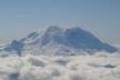
The Bells seen from the Trailhead
I have had my eyes set on Thunder Pyramid for some time now, but after twice making plans, I had yet to attempt it. I had told myself I would not be going after any of the harder Centennials once fall really set in, but with a good forecast in Aspen for Sunday and successfully securing a partner, all bets were off.
After (sort of) attending the Winter Welcomer on Quandry, I met up with Sarah in East Vail and we made the drive to the Bells Park. We arrived around 10pm to a desolate parking lot. We slept in the car and planned to wake at 6am.
Having spoken to many friends who had done Thunder in various conditions, I was really unsure what to expect. With last year's accident and Roach's description, it is clear that one must approach this peak with respect and humility. However, several of my friends had said the peak was fairly easy and nothing worse than Pyramid. I decided that given the fall conditions and its reputation that I was in for a tough day. Sarah made fun of me on several occasions as I sounded "very pessimistic" about our chances.
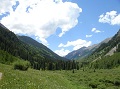
We woke up around 6am and drifted in and out for a while before getting up and heading out around 7:30am. Having been to the Park twice during the peak season recently, the isolation and snow was a welcome change. As usual, the approach hike seemed to take longer than expected. We were pleasantly surprised to find the trail completely boot packed though.
Sarah shortly after the Crater Lake Turnoff. The Bells display their glory.
The initial approach on a well packed trail
Thunder has a reputation for being hard to pick out, and besides the one time on top of Pyramid, I hadn't ever picked out the summit. As we passed Crater Lake we enjoyed guessing which was our summit, and where the "standard route" lie. Sarah had done a ton of research and her route-finding proved to be the key to our success. We crossed the stream shortly after the South Maroon turnoff and easily located the cairn about 100 yards past the crossing.
Cairn marking the turn off for Thunder - approx. 100 yards past the stream crossing
Looking down the key gully to access the upper slopes below Thunder's West Face. We climbed the right side on Class 3 cli
West Face of Thunder Pyramid
From this point, things get interesting. With the snow, the boulder hopping and side slope-ing proved pretty tedious. On more than one occasion I was pulling on vegetation to avoid sliding down the hill. The entrance to the first gully is very obvious and puts you above the cliff bands. We stayed on the left side and climbed 20-30ft of Class 3 rock instead of going up the loose gully. While going up the gully certainly would have been an option, we chose to warm up and take the "more fun" route. There are a few cairns here and there and the route is fairly obvious as you connect gullies to reach a large talus field below the West face of Thunder Pyramid.
Lower access to the West Face
Walking along the ridge before the "fun" began
After following Sarah through a small jungle, we came onto the large open talus field. There are many small gullies on Thunder's lower West face, all of which cliff out at the bottom. We accessed the lowest portion of the White Gully via some broken ledges to the right of it. I believe this is the standard route and went very smoothly. Once in the gully, it was clear that this climb was going to take a while. Fresh, loose powder on top of horribly loose rock made the route selection very easy; we would try and link rock ribs and stay out of the gullies. Through the early goings this worked out well and we experienced plenty of 2+ scampering with the occasional Class 3 or 4 cliff band. Progress went at a moderate pace as Sarah picked the best lines. As we gained altitude, we spread out a bit more and had fun go at "Choose Your Own Adventure."
The Lower White Gully
Climbing one of the many exposed Class 4 cliff bands
Half-way up, the route becomes more obvious. There is a large prominent saddle to the North of Thunder, and due to a mistake made by one of Sarah's frequent partners, we knew that, while enticing, this route would lead to the more difficult North Ridge. As we continued up, we were ever mindful of not falling into that trap. We continued our rock rib ascent and the climbing gradually became more committing. At this point I took the lead.
Taking a break around 12,250 ft
We climbed about 40ft of loose and near vertical class 4 rock before finding ourselves above a 100ft cliff to our left. We knew we wanted to get into that gully, and without a rope, rappelling was not an option. The thought of down climbing the Class 4 head wall did not really excite me, so I made the decision to push the route upwards in the hopes that it would link up with the gully. A few moves later and I let out a sigh of relief as I saw the way.
The secret exit that we found after thinking we had clibmed into a trap
At this point the rest of the route became clear, though we were still almost 1,000 feet below the summit. The views around us were outstanding. The Bells displayed their full glory and we each took some moments to enjoy this rarely seen view. The face is steep and unrelenting. It seemed as if we were never gaining any altitude. Slowly but surely, the ridge grew nearer. Roughly 400ft below the ridge, we agreed that we would push a line directly up and intersect the ridge, and then head left and approach the summit. Our progress was very slow, but eventually we topped out on the ridge.
Just after topping out on the ridge - fianlly off of the face
Sarah climbing on one of the Cliff Bands on the rock rib
Sarah 4th Classin' it in boots and glvoes!
Just after climbing off of the face and onto the ridge
More tough climbing
And more climbing
Looking into Len Shoemaker basin, gives a general diea of the slope of the face
Okay - so I have heard from multiple sources that the ridge isn't that bad, and I guess I fell into the trap of expecting something easy. I was floored. I was not fully prepared for what we were about to experience. It turns out we gained the ridge about 100ft further South than we had planned, and the initial traverse required 4th class ledge traverses. The ledges were covered in snow, the hand holds were rotten and the climbing was slightly overhung above fatal exposure. It took a minute to calm my nerves, but I started the sequence. We were at 13,900ft and we still had yet to see the summit. After traversing for 100ft or so, I climbed directly up some steep 4th class and topped out on what I was hoping would be the summit. No dice -we still had some ridge to work with.
Sufferfest - final face climb
The climbing got progressively worse and I took my time. Sarah followed behind me and I called out to make sure she was still on the mountain on more than one occasion. The ridge was heavily corniced to the East and the exposure was very, very real. Within 20ft of the summit I came to a narrow crossing...the worst I've ever seen. Heavily corniced on the East over the worst exposure of the day, and sloping steeply down to the west, I was dumbfounded. I seriously considered bailing as I was not sure that we could safely make the summit. Sometimes the mountain says no - but today was not going to be that day.
Hiking along the South Ridge
One of the sketchiest moves I've ever made
Sarah on Class 2+ terrain during the ascent
After some internal coaching, I stepped gingerly onto the loose rock on the West face and willed myself across the notch. I was now within striking distance of the summit of Thunder Pyramid. I traversed around to the West face and made a 10ft 5th class sequence before collapsing on the summit. Sarah soon followed. We had made the summit, but the toughest part of the day still lie ahead.
Sarah makes the final approach to the summit of Thunder Pyramid
Sarah on the Summit...Way to go, congrats!!!!
The Bells as seen from high on Thunder
I spent one of the most nervous summits of my short climbing career and dozed off for a few minutes. I came to and turned to Sarah "I don't know how we are getting down off this summit - I'm mentally drained from leading - care to take control?" She thanked me for my efforts on the final 1500 feet of the climb and happily took the lead for the descent. It was a tremendous relief to find the down climbs not as bad as we were expecting and within 30 minutes we were casually descending 2+ terrain. We entered a snow filled gully around 500ft below the summit and were able to plunge step and glissade by linking gullies for 2,000 feet or so.
Sarah confidently leads us off of the exposed summit block
Plunge Stepping on the Descent
The final exit off the face took some route finding and scrambling, but 3 hours after leaving the summit we found ourselves on the trail. We arrived back at the car in the pitch dark, 12 hours after leaving.
Descending the first gully
This climb tested every skill in my alpine tool box. Without Sarah's support, I am certain that this summit would not have yielded itself. Of the 55 Centennials I have climbed, this was by far the most challenging. Thanks again to Sarah for being a stellar partner and letting me hear all about her international adventures!
Thumbnails for uploaded photos (click to open slideshow):
Great write-up, Matt!! You forgot to warn people about the killer bird that lives up in the trees by Maroon Lake and makes strange noises before the sun comes up...haha
Nice job you two. Seems like you had a great day and congrats on getting the summit of Thunder in the shoulder season. The views of the Bells and Pyramid are something else!
Hell of a productive weekend, Matt, way to get after it.
Way to persevere man. Like I told ya, these early winter conditions are the toughest kind of conditions out there and will test the heartiest of mountaineers! Well done!
I enjoyed the TR. Yes, the conditions look miserable between the loose rock and sketchy snow, and I'm glad I didn't go with you, but hells yeah, I respect you both for summiting that junk!!
Nice job, Matt and Sarah! I hope you played a little ACDC for some pregame warmup, Matt. Snow always spices things up in the Elks for sure. Glad my TR going up the wrong fork on the White Gully was of some use. :shock:
Nice climb in sketchy conditions, but more importantly, I now hold you in higher esteem for the Days of Thunder reference. Most of that movie was filmed in beautiful, iconic North Carolina, homeland of all things awesome. I'M DROPPIN' THE HAMMER!
"The climbing got progressively worse..." 11/2/2012 3:16pm
Sometimes I wonder why we do this to ourselves. :roll:
Way to keep your head on and get the goal in tough conditions.
Nice avatar, btw. :wink:
Caution: The information contained in this report may not be accurate and should not be the only resource used in preparation for your climb. Failure to have the necessary experience, physical conditioning, supplies or equipment can result in injury or death. 14ers.com and the author(s) of this report provide no warranties, either express or implied, that the information provided is accurate or reliable. By using the information provided, you agree to indemnify and hold harmless 14ers.com and the report author(s) with respect to any claims and demands against them, including any attorney fees and expenses. Please read the 14ers.com Safety and Disclaimer pages for more information.
Please respect private property: 14ers.com supports the rights of private landowners to determine how and by whom their land will be used. In Colorado, it is your responsibility to determine if land is private and to obtain the appropriate permission before entering the property.


 Sarah shortly after the Crater Lake Turnoff. The Bells display their glory.")
 The Bells seen from the Trailhead")
 Just after climbing off of the face and onto the ridge")
 The initial approach on a well packed trail")
 Taking a break around 12,250 ft")
 Sufferfest - final face climb")
 Looking down the key gully to access the upper slopes below Thunder's West Face. We climbed the right side on Class 3 cli")
 The Lower White Gully")
 Climbing one of the many exposed Class 4 cliff bands")
 Walking along the ridge before the")
 Descending the first gully")
 More tough climbing")
 And more climbing")
")
 Hiking along the South Ridge")
 One of the sketchiest moves I've ever made")
 Plunge Stepping on the Descent")
 Sarah climbing on one of the Cliff Bands on the rock rib")
 Sarah 4th Classin' it in boots and glvoes!")
 Sarah confidently leads us off of the exposed summit block")
 Sarah makes the final approach to the summit of Thunder Pyramid")
 Sarah on Class 2+ terrain during the ascent")
 Sarah on the Summit...Way to go, congrats!!!!")
 Looking into Len Shoemaker basin, gives a general diea of the slope of the face")
 The Bells as seen from high on Thunder")
 Cairn marking the turn off for Thunder - approx. 100 yards past the stream crossing")
 West Face of Thunder Pyramid")
 Just after topping out on the ridge - fianlly off of the face")
 The secret exit that we found after thinking we had clibmed into a trap")
 Lower access to the West Face")