Download Agreement, Release, and Acknowledgement of Risk:
You (the person requesting this file download) fully understand mountain climbing ("Activity") involves risks and dangers of serious bodily injury, including permanent disability, paralysis, and death ("Risks") and you fully accept and assume all such risks and all responsibility for losses, costs, and damages you incur as a result of your participation in this Activity.
You acknowledge that information in the file you have chosen to download may not be accurate and may contain errors. You agree to assume all risks when using this information and agree to release and discharge 14ers.com, 14ers Inc. and the author(s) of such information (collectively, the "Released Parties").
You hereby discharge the Released Parties from all damages, actions, claims and liabilities of any nature, specifically including, but not limited to, damages, actions, claims and liabilities arising from or related to the negligence of the Released Parties. You further agree to indemnify, hold harmless and defend 14ers.com, 14ers Inc. and each of the other Released Parties from and against any loss, damage, liability and expense, including costs and attorney fees, incurred by 14ers.com, 14ers Inc. or any of the other Released Parties as a result of you using information provided on the 14ers.com or 14ers Inc. websites.
You have read this agreement, fully understand its terms and intend it to be a complete and unconditional release of all liability to the greatest extent allowed by law and agree that if any portion of this agreement is held to be invalid the balance, notwithstanding, shall continue in full force and effect.
By clicking "OK" you agree to these terms. If you DO NOT agree, click "Cancel"...
Trailhead: Yule Creek/Bible Camp (roughly a mile down road of trailhead)
Mileage: 17
Elevation Gain: 7,032'
Time: 12:38
Beta: SarahT's 14erworld TR (From Paradise Divide TH: 10.7mi & 4900') and Craig's (giarcd) knowledge of the area
I had originally planned for the Treasure combo from the trailhead, but Craig said that the mining road that accessed the Treasure ridge from the north, would be a better ascent route than what I was planning. It added mileage and elevation gain, but at the time I didn't know how much. My plan was for ~14miles and ~6.6K. But talking around the fire, Craig got Scott and me interested in this other option. We would have to go through the Bible Camp to get to the mining road. I was just happy that there was someone else interested in these peaks!
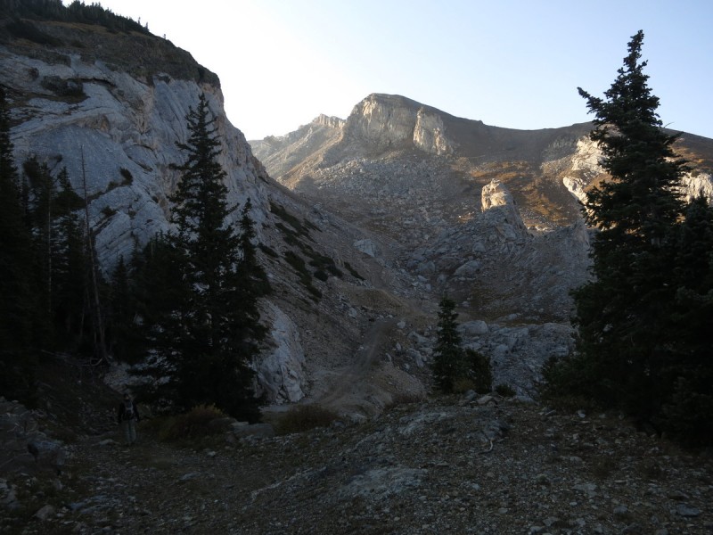
So the next morning, we took the short ~10min drive from the campsite to our makeshift trailhead at the Bible Camp, and walked through it (with "permission" from Craig). We found the mining road and followed it. But it petered out, and so we must have found a spur accidentally. So we briefly bushwhacked uphill till we found the switchbacking road. A GPS was quite handy here in the dark, as otherwise it can be hard to spot where to go. The road doesn't exactly correspond to what was on my GPS map, but it was good enough to find our way.
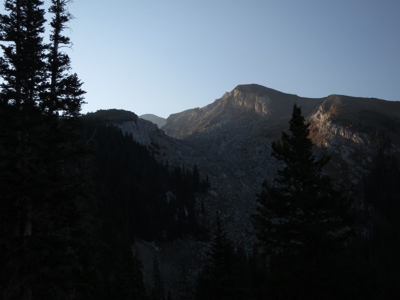
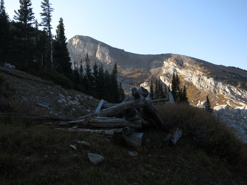
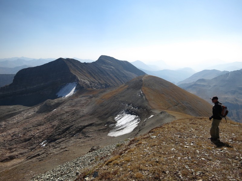
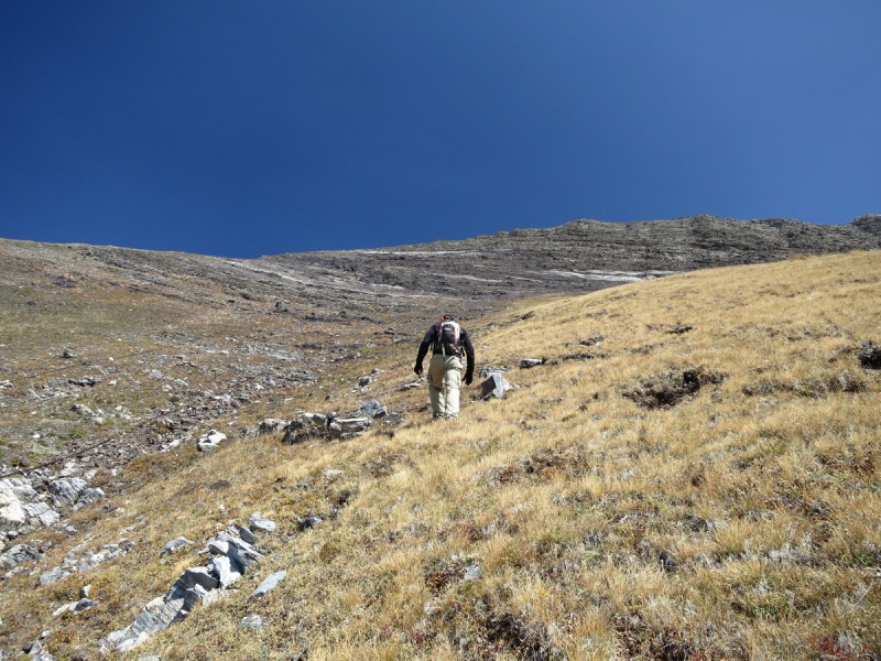
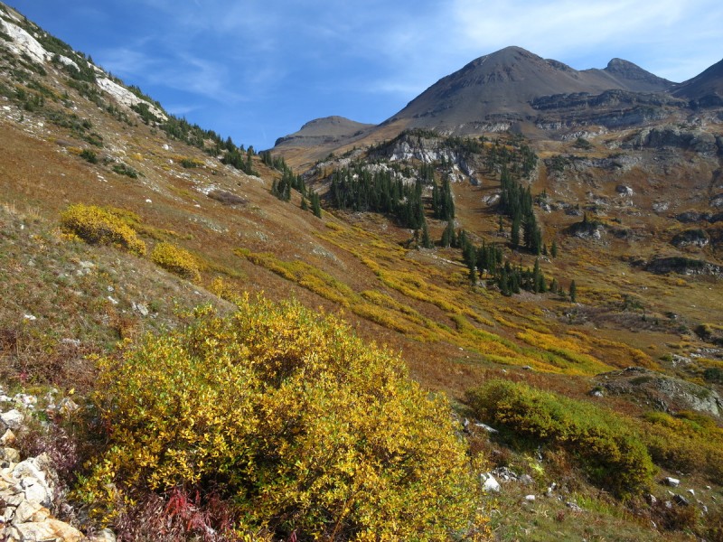
So up we walked on this mining road, through the aspens that unfortunately it was a bit too dark to really photograph. We made quick progress up to the saddle with Whitehouse Mountain, where we got our first hazy views of the rest of the Elks. From here we continued along the mining road as it went through the quarry and on up to the grassy ridge above. I was amazed how high the road went. Afterwards, there was some evidence of a faint trail as it continued towards the summit.
The Rageds through the Aspens Top of the quarry/road An old mining building Following the mining road as it switchbacked up to the saddle in the distance Capitol and Snowmass Some cliffs on the east face of Treasure
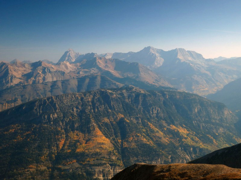
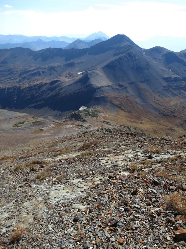
We took a little bit of a break on the summit as we gazed around us. The fires up in Montana, Utah and Wyoming really hindered some good photos of the surrounding peaks, but at least I was able to get a good view of Sunday's peak, 13,062 B.
Capitol and Snowmass, again Pt 13,062 B
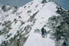
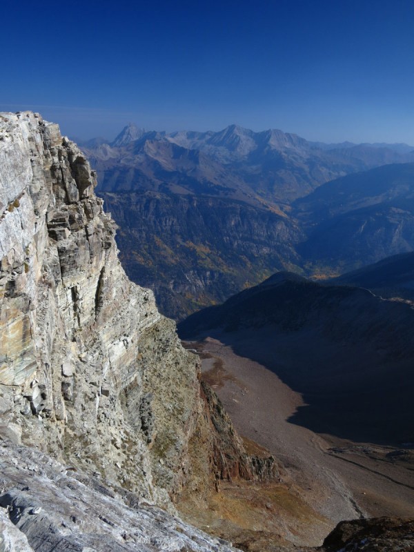
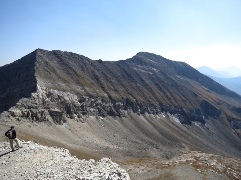
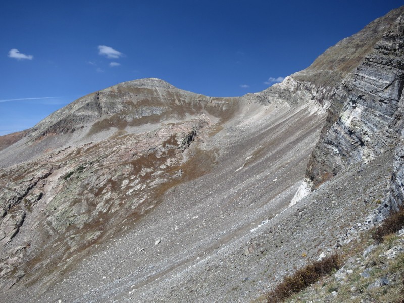
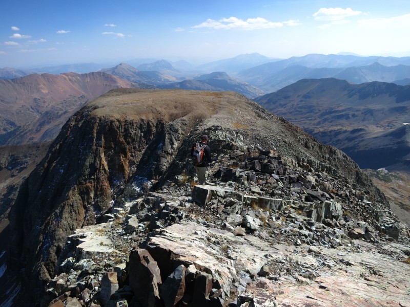
We followed the long ridge of Treasure all the way to the base of the the ridge crux, which looks to be highly exposed and goes class 5 for the white rock part of the cliff. I didn't bring gear, so it was time to spot the weakness in the cliff band a thousand or more feet down. SarahT did this route in reverse, so I knew what I was looking for, as well as that there would be a cable to take almost all the way to the next summit.
So down we descended, and traversed and scree skied and such. It wasn't all that bad, just a few areas of tricky sliding rocks. But we also found hidden gems in this talus mess. Gold. Or at least that's what it looks like (see last photo - upper left). I need to remember my Geology classes from college. I know it could be Pyrite or Chalcopyrite, but there wasn't a cubic or tetragonal crystal habit to be seen. So I need to do a hardness test and a streak test for one thing. Or I just need my mining geology friend, moon stalker to take a look at it.
From Treasure to Treasury Scott contemplating the route ahead Looking for the weakness in the cliff band The Ridge crux Class 5 ridge crux Looking back at the saddle with Treasure
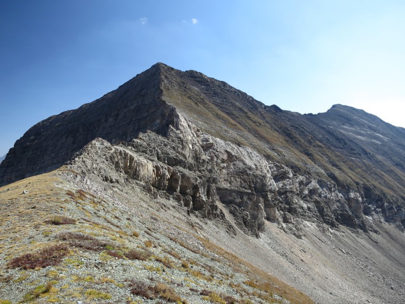
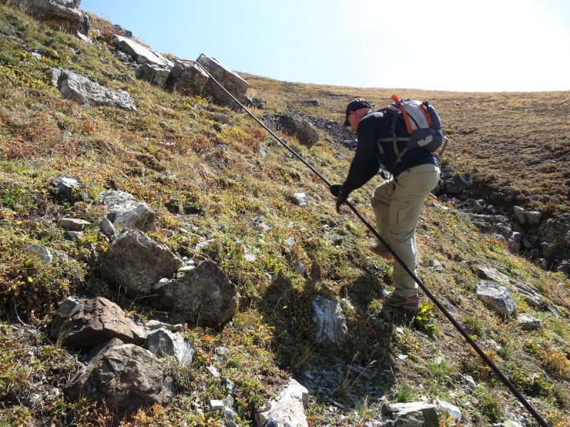
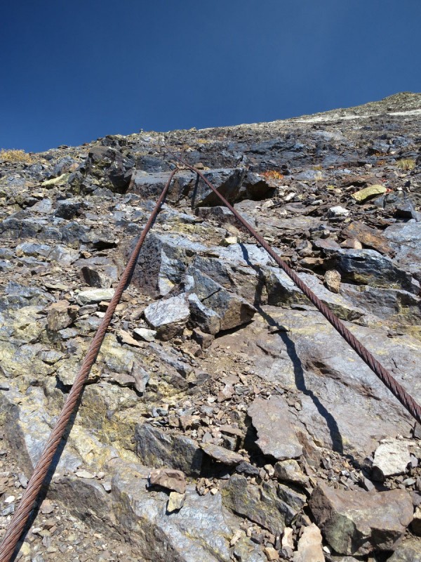
At the traversing point up to the slight ridge feature we would follow up Treasury, we found the cable that SarahT mentioned. So we used it for a little bit, until it went over a rough rock section. So up the nice grassy slope we went. Above that, Scott went back to the cable and I went over to the ridge proper for a while. But eventually the ridge proper went from stable grass to scree. So I decided to traverse over to the cable again.
Scott utilizing the cable Up the grassy slope
On the traverse over to the cable, I got distracted by the the most awesome boulder ever! It was a giant rock with tons of geodes in it! So I had to take a bunch of photos of the rock I want in my back yard!
Once back at the cable, it was very useful to have one hand on the cable as we both struggled up the slope. It was steep and loose, and having the stable hand hold was nice. Of course, being a mine and a slope that isn't heavily travelled has its advantages. I found tons of interesting minerals and crystals along the way. It was so tough to not go slowly and look at everything! (See last rock photo) My pockets were bulging and still there was more awesome stuff left behind. But Scott was waiting up at the top of the cable, so I kept going.
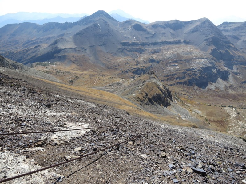
The cable Looking down the cable from half-way Time to use the cable to get up the steep scree Where the cable ends
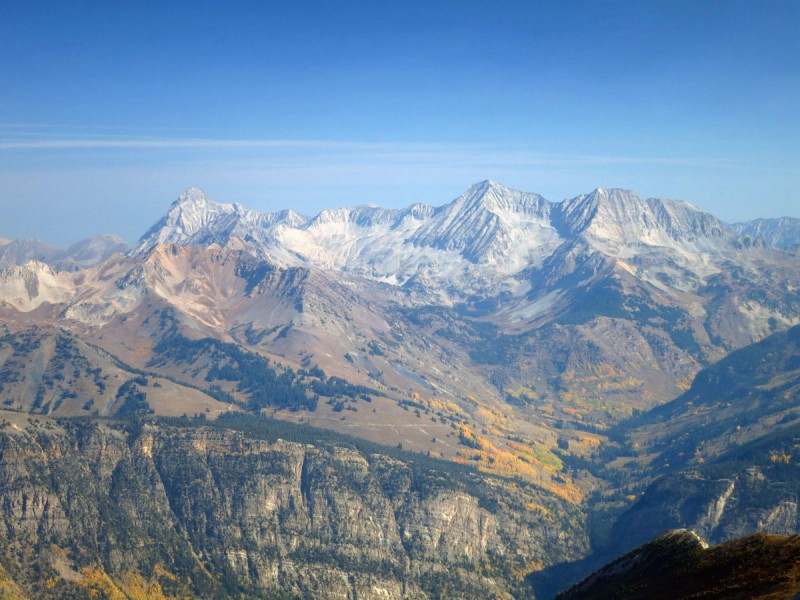
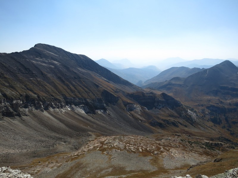
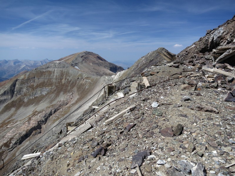
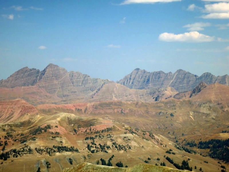
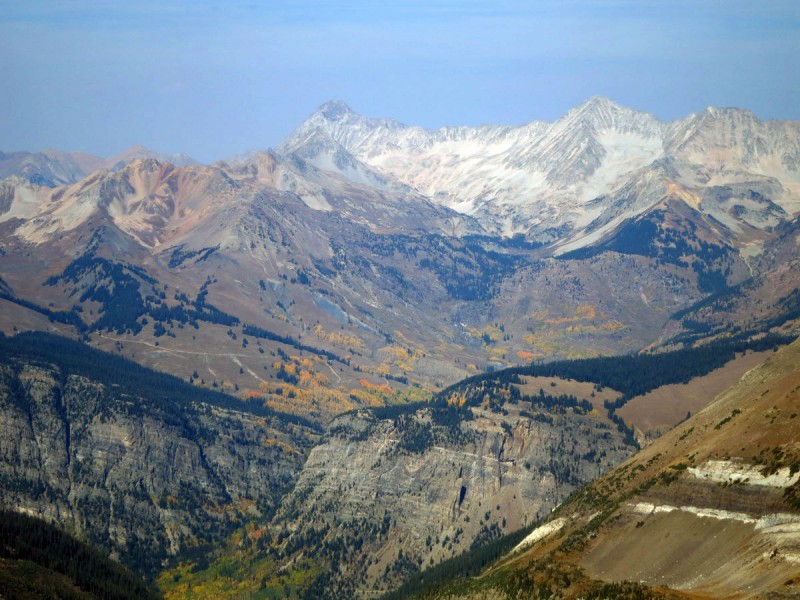
Getting to the last summit was a nice feeling, I knew we had a long way left to go, but it was mostly downhill from here. The views were spectacular in the afternoon light.
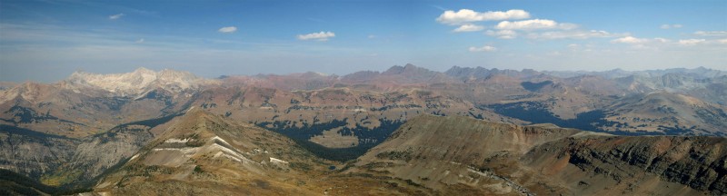
The Bells and Pyramid Capitol and Snowmass Elk 14er pano
Descending down Treasury's slope to Yule Pass was quicker than expected, as plenty of scree skiing was to be had. I don't think I would enjoy ascending this way, but going down was pretty easy.
Descending down Treasury's south ridge What the west ridge of Treasury looks like - scree skiing!
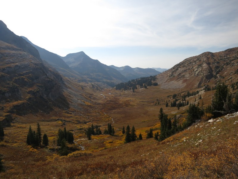
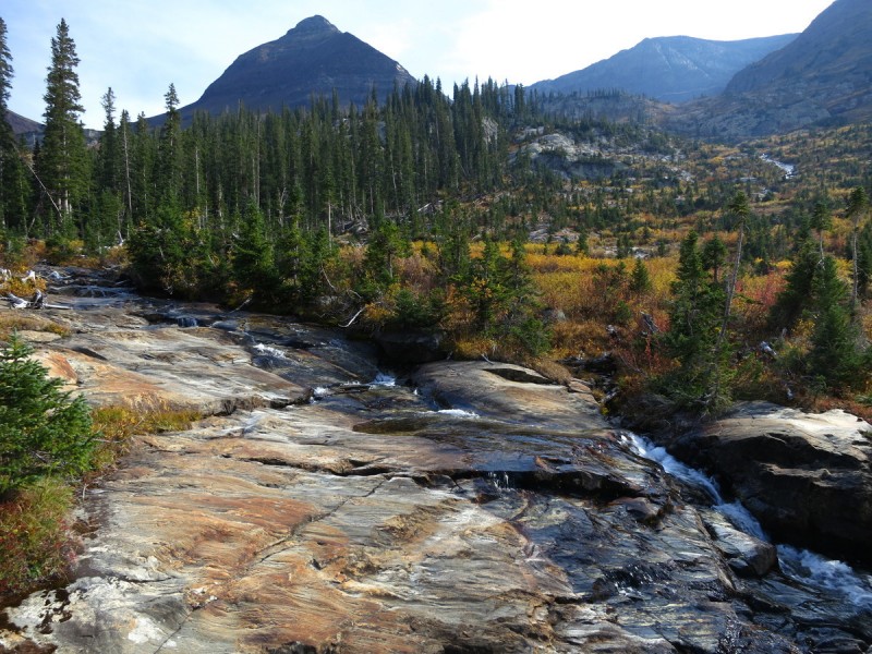
Once at the pass, we had a really nice trail all the way down the valley. There even appeared to be a trail that went up to the area between Treasure and Treasury, maybe to the cable? We did lose the trail in the willows a few times, but always got back to it. There are two trails that go back to the road. One that I can imagine that is the preferred way, and then the old one which peters out to about nothing (an older defunct trail), with just some game trails. Scott and I were talking a bit too much and managed to miss the turn for the preferred path, and found ourselves in a stream valley, with a steep ridge/cliff between us and the other trail. Not wanting to backtrack, we made due and bushwhacked and found game trails to follow.
The long valley home Colorful willows Almost like a stream chute to slide down
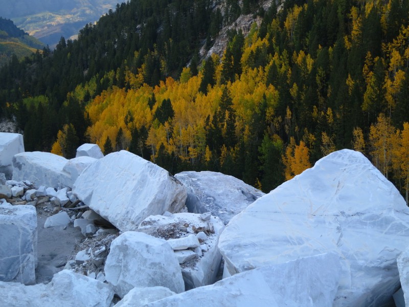
Eventually we found the Marble mine. No way around it, we had to walk through it. It was pretty awesome sight to see. Since not only were we tired of walking/bushwhacking but the the immensity of the mine was breath taking. This is the mine that supplied the blocks for the Lincoln Memorial and the Tomb of the Unknown Soldiers.
Marble Mine Marble and Colorado Gold
Rocks... and pretty sparkly crystals. What more does a 13er girl want?
That last mile down the road was pretty painful, it seems I have found my limit for mileage and elevation gain/loss in a day. But overall it was an amazing day spent with great company!
My GPS Tracks on Google Maps (made from a .GPX file upload):
what an interesting hike. if i could have made the Gathering I definitely would have done this trek. but this TR just confirmed these two peaks on my short list for next summer. I'd love to see that marble mine!
That ”cable route” :shock: ! The big rock and the last few photographs are really cool. I don't know if I will ever make it up there, but I would like to try at some point now that I have seen your report (and am interested in the other beta reports you list). Mileage: 17 and Elevation Gain: 7,032', along with that cable route.....that is a ways off for me at the moment. Nice work!
I forgot to mention that there is a shorter, easier way to do these peaks. (I just edited) ”From Crested Butte take the road to Gothic, continue to Schofield Pass, then take a well-signed left and drive 2 miles to Paradise Divide”. Then it is only 10.7mi and 4.9K. I would have gone this way, but we were camping in Marble for the Gathering.
You certainly took the long way around for that adventure. I didn't realize the marble mine was up there. I did see some of your cool rocks during the campout, which makes the trip seem worthwhile all on its own.
Anyway, it was nice meeting you this past weekend! Thanks for the report on these peaks.
This one is goin on the list, and when I mean list, I don't mean that as a generic comment for a peak i'll probably never get around to. I literally might climb this next month.
I was just looking at this trip report again nearly 3 years later as I wanted to see the pics again. It reminded me of what a great report you posted Otina––thanks for preserving it so well. We had such a great day out there and then the time with everyone at the Gathering. A memorable weekend!
Article on the mine's history, 1879 to 1950 9/7/2018 12:00pm
There is an article here on the history of the mine and the cables.
"By 1950, a 2,200-foot, $100,000 aerial tram had been constructed from the Eureka to a bulldozed road below. Simpson took 50 loads of ore in two Dodge Power Wagons over Yule Pass and down the Slate River to the D&RG Railroad in Crested Butte."
Caution: The information contained in this report may not be accurate and should not be the only resource used in preparation for your climb. Failure to have the necessary experience, physical conditioning, supplies or equipment can result in injury or death. 14ers.com and the author(s) of this report provide no warranties, either express or implied, that the information provided is accurate or reliable. By using the information provided, you agree to indemnify and hold harmless 14ers.com and the report author(s) with respect to any claims and demands against them, including any attorney fees and expenses. Please read the 14ers.com Safety and Disclaimer pages for more information.
Please respect private property: 14ers.com supports the rights of private landowners to determine how and by whom their land will be used. In Colorado, it is your responsibility to determine if land is private and to obtain the appropriate permission before entering the property.


 The Rageds through the Aspens")
 Top of the quarry/road")
 An old mining building")
 Following the mining road as it switchbacked up to the saddle in the distance")
 Capitol and Snowmass")
 Some cliffs on the east face of Treasure")
 Capitol and Snowmass, again")
 Pt 13,062 B")
 From Treasure to Treasury")
 Scott contemplating the route ahead")
 Looking for the weakness in the cliff band")
 The Ridge crux")
 Class 5 ridge crux")
 Looking back at the saddle with Treasure")
 Scott utilizing the cable")
 Up the grassy slope")
 The cable")
 Looking down the cable from half-way")
 Time to use the cable to get up the steep scree")
 Where the cable ends")
 The Bells and Pyramid")
 Capitol and Snowmass")
 Elk 14er pano")
 Descending down Treasury's south ridge")
 What the west ridge of Treasury looks like - scree skiing!")
 The long valley home")
 Colorful willows")
 Almost like a stream chute to slide down")
 Marble Mine")
 Marble and Colorado Gold")