Download Agreement, Release, and Acknowledgement of Risk:
You (the person requesting this file download) fully understand mountain climbing ("Activity") involves risks and dangers of serious bodily injury, including permanent disability, paralysis, and death ("Risks") and you fully accept and assume all such risks and all responsibility for losses, costs, and damages you incur as a result of your participation in this Activity.
You acknowledge that information in the file you have chosen to download may not be accurate and may contain errors. You agree to assume all risks when using this information and agree to release and discharge 14ers.com, 14ers Inc. and the author(s) of such information (collectively, the "Released Parties").
You hereby discharge the Released Parties from all damages, actions, claims and liabilities of any nature, specifically including, but not limited to, damages, actions, claims and liabilities arising from or related to the negligence of the Released Parties. You further agree to indemnify, hold harmless and defend 14ers.com, 14ers Inc. and each of the other Released Parties from and against any loss, damage, liability and expense, including costs and attorney fees, incurred by 14ers.com, 14ers Inc. or any of the other Released Parties as a result of you using information provided on the 14ers.com or 14ers Inc. websites.
You have read this agreement, fully understand its terms and intend it to be a complete and unconditional release of all liability to the greatest extent allowed by law and agree that if any portion of this agreement is held to be invalid the balance, notwithstanding, shall continue in full force and effect.
By clicking "OK" you agree to these terms. If you DO NOT agree, click "Cancel"...
Day 1: Pt 13111, Pt 13020 D (unranked), "Baldy Lejos", Pt 13034
Mileage: 12.6
Elevation Gain: 4,000'
Time: 7:15
Trailhead: West Willow Creek
Partner: Solo
After hiking the Emma Burr group, I make the long drive down to Creede and up to the trailhead. I followed the directions from Bill's iPhone app, and when I arrived, I had to check my GPS to make sure I was where I thought I was. The trailhead says it's "at the end of the road", but a tough 4x4 road takes off up a hill from it, so the road technically continues. Thankfully the trail is marked and was on my map, so I knew I had made it then. So I set up my grill and made dinner, and settled down for a very long ridge run in the morning.
My alarm goes off pretty early, but yet I still sleep in. I kinda dislike hiking in the dark alone. I'll just have to hike faster! As I was getting ready, two more trucks show up and two guys get out asking about if this was the trailhead to San Luis. We chat for a short bit and I tell them about the trail split that I had spied out the afternoon before, and then speed off on my way to San Luis Pass along the Colorado Trail.
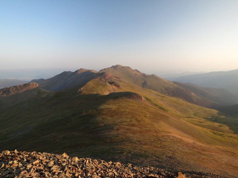
Once on the beautiful CT, I make speedy progress up to the first summit of the day PT 13,111. I arrive just after the nice sunrise over San Luis Peak.
Sunrise behind San Luis' south ridge View to the south The ridge ahead to 13020 D and "Baldy Lejos" The ridge to 13034
From there, I head north and try to bypass as many of the bumps on the ridge that I can. There are some game trails and possibly some human emphasized game trails to follow if you look for them. On the way up to the unranked 13,020 D, there were 3 sheep on the summit. As I looked over to "Baldy Lejos", a sizable herd of Elk noticed my presence and raced up the slope as I followed quickly after them.
"Baldy Lejos" from 13020 D
Elk running up "Baldy Lejos"
I spend a short while on the summit, the sun and haze makes seeing anything to the east difficult. But one thing I do note, is that my planned ridge run for tomorrow is going to be a lot more complicated than I had planned for. Now to walk all the way back to the first summit...
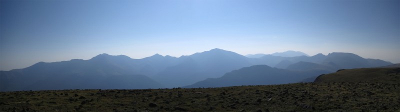
San Luis pano
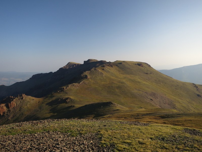
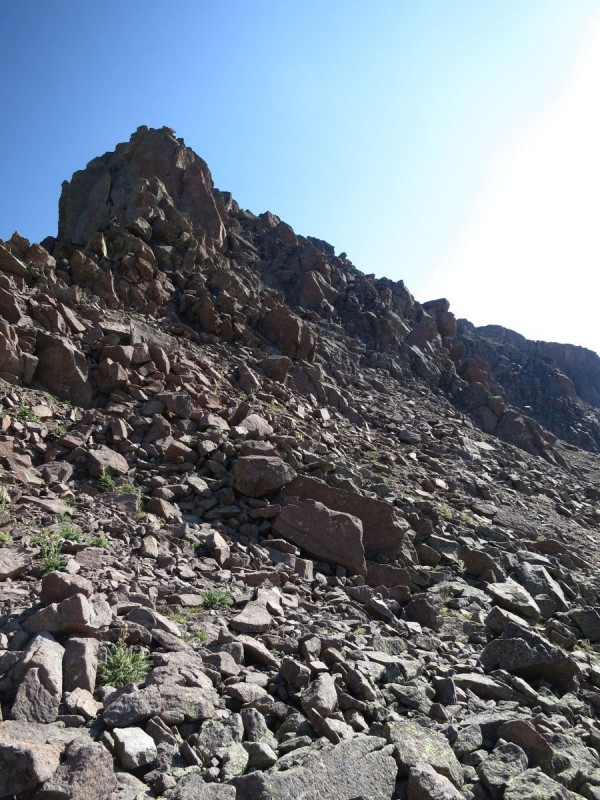
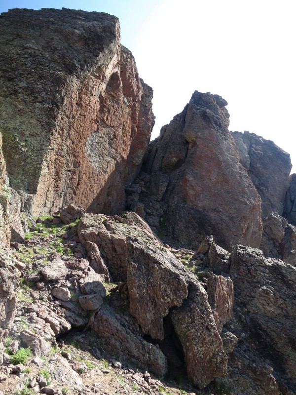
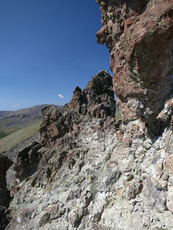
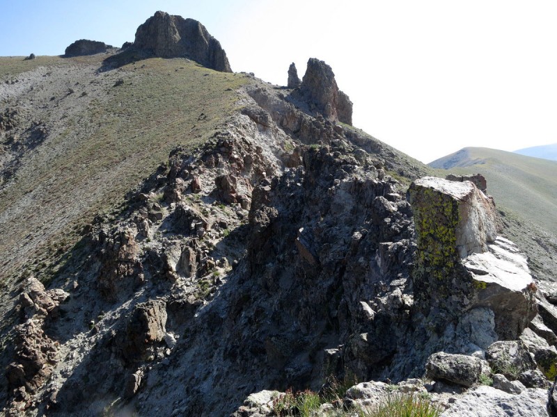
I spied a game/human trail to the west of Pt 13,111 that would save me the elevation gain of going to the east along the CT, but there was some annoying side hilling to be done my way. Once back up on the ridge it was a fairly simple walk over to the last peak of the day. As I got closer, it was starting to become apparent that it wasn't going to be a simple walk up. From a distance, the ridge looked like it wouldn't go. Contouring around to the eastern scree slope looked horrendous, so I kept that as a last resort!
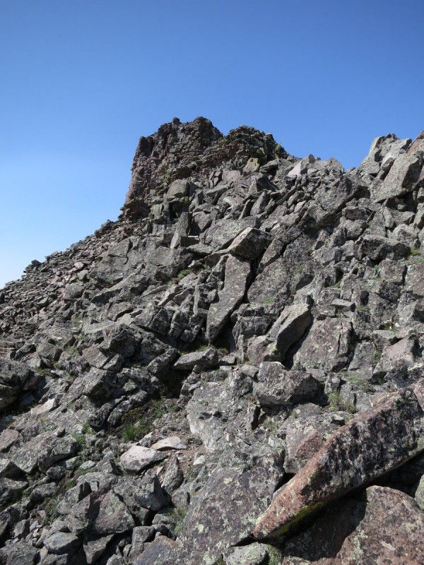
Thankfully, what looks impossible from far away, becomes possible once you get closer. I stayed as ridge proper as possible on the way up and the difficulty was only class 3 in spots.
Approaching 13034 The summit ridge of 13034
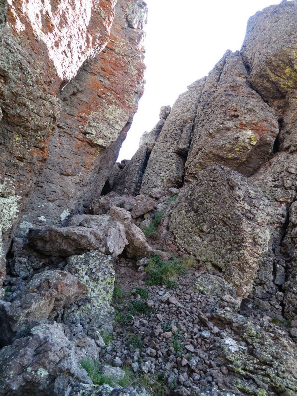
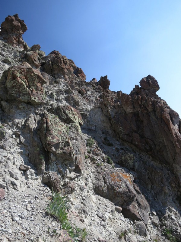
After the first class 3 section, there is a ridge feature which looks like nicely stacked dinner plates. You can climb over this section, but it doesn't gain you anything, so I went around to the left.
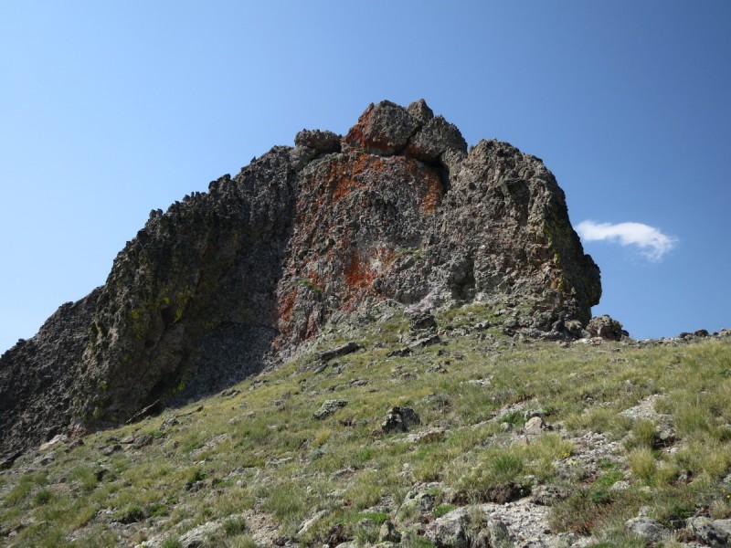
After that, I stay as close to the ridge proper as possible, as the slope is loose dinner plates trending towards a steep cliff further down. Once past the red rock feature on the ridge, you can regain the ridge proper and go to the summit. After all that scrambling, I expected the summit to be on one of those rocky features, but no, it was a grassy bump. Approaching from the other direction (SW) looks like a pretty gentle grass slope.
The ridge up after the first class 3 section Bypassing some ridge difficulties to the left on way up View on the way down of the ridge bypass - Stay as high as possible!
View of 130134 from the return to the trailhead
A pretty purple flower blowing in the breeze.
Back at the trailhead, I cook my dinner, relax and read a book. Not a bad life! Though as the hours pass by, I start to worry about those 2 guys I met this morning, their vehicles are still there. It's getting close to dusk, and I'm starting to think about when it would be appropriate to go get help. In the morning if they don't return? Or late tonight? Or do I stop by the sheriff's office on my way back down Sunday afternoon after I do my loop tomorrow which doubles up the San Luis route on the return. Thankfully, the 2 guys come slowly down the trail before I worry too much longer, a bit trail and foot weary, but ok. Apparently they went off-route to sneak up on a herd of elk.
Day 2: Pt 13285, Pt 13180 (unranked), Pt 13155
Mileage: 9
Elevation Gain: 3,426'
Time: 6:40
Trailhead: West Willow Creek
Partner: Solo
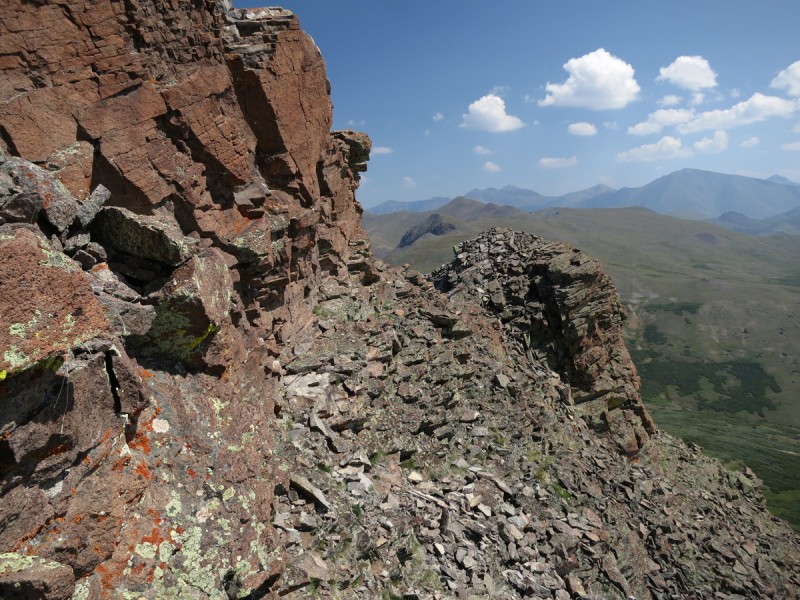
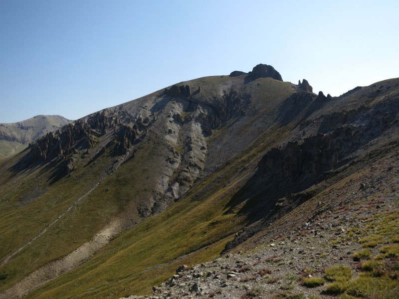
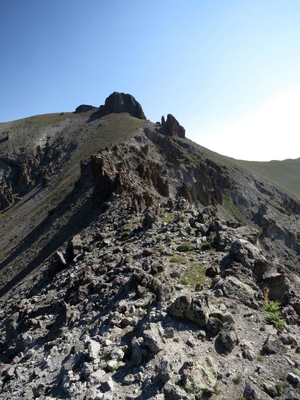
Knowing that after the first summit of the day would entail some serious class 3 scrambling, I got to sleep in till first light. No sense getting to the first summit until you can see what you need to climb! So I followed the San Luis route up to the first pass, and then head up the grassy ridge to Pt 13,285. Along the way I get the first close up view of the ridge traverse... spicy!
A very frosty morning
The Ridge from yesterday between 13,020 D and "Baldy Lejos" View of the start of the ridge traverse
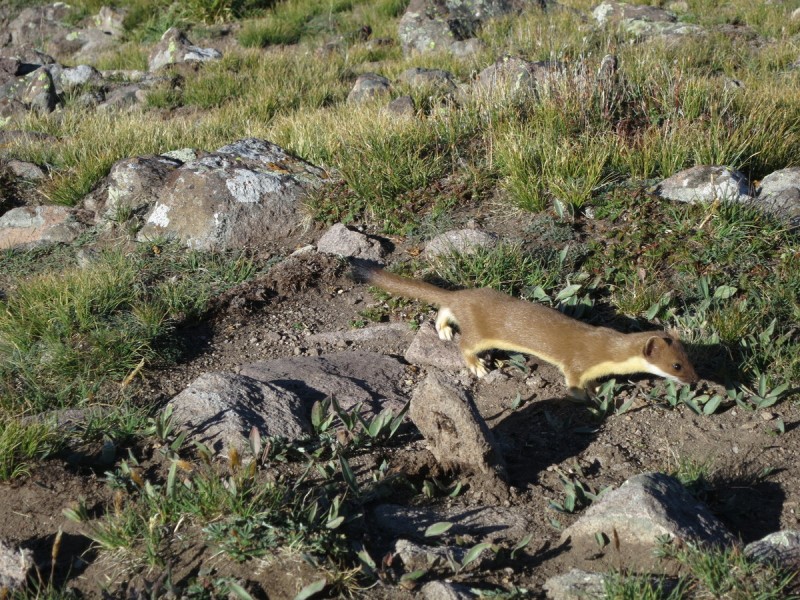
On the true summit (not where the cairn is), I tighten my boots and get ready for a route finding challenge. A "Roach class 3" always has me concerned it may actually be class 4! While I rest, a cute little weasel comes up to investigate. Thankfully my camera is handy, but not set up to catch the quick motion of the weasel. But one photo turned out!
Looking at San Luis from the summit of 13285 Wow, what an amazing viewing of a rare mountain creature!
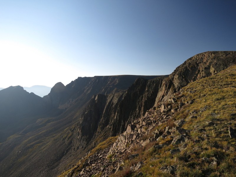
I start down the ridge proper, until it becomes clear that the ridge will NOT go, and I descend onto a seriously nasty loose steep slope. After the traverse comes a steep scree gully, which according to how I interpreted the Roach route, I was supposed to drop all the way down to, and then traverse low around Pt 12,295 to regain the saddle with 13,180. That way looked like craptastic nastyness, and a lot of elevation loss. I had already impaled both my pointer fingers on both hands on those nasty pricker plants trying to save a fall on that nasty gully slope. Plus I was a trundling fool, nothing to be done about that! At that point I wanted my ice axe!
Looking down the start of the ridge - nope it doesn't go View along ridge after dropping down to the right (south)
So once around the slope on 13,285 I spied a possible way to traverse around 12,295 at roughly about halfway. The rock on the 13,285 side was solid after the loose rock an scree jungle from the descent, so I was willing to scout a way to avoid that slope if I could. Even if it meant returning to it, if I got cliffed out. Once past the first section, the rock got much looser again, and it turned into rocks precariously perched on one another. I was careful to pick my way around, where there was less stacked rocks high above me. I think I ended up having to traverse higher in elevation as I went around, to avoid the steeper slopes lower down.
Once back to the ridge on the Pt 13,180 side of 12,295, I was pleased to find a way down to the saddle that didn't involve cliffs! Once there, I then started to route find my way up 13,180. I figured staying ridge proper or as close as possible would be a good option. From far away it looked like the first ridge weakness to the right would go. So I aimed for it
View of remaining ridge after traversing around Pt 12295 View back of the first part of the ridge
View of 13285 and 12295 and the loose traverse
View up ridge of difficulties ahead on 13180
Once I got to the major ridge weakness in the blocky summit area, I was pleased to find a V-notch feature and not a more exposed dihedral. I'm ok doing class 5 if there isn't too much exposure. A fall in this section would hurt, but I wouldn't die! So I walk up to the crack on the right with a boulder stuck in there, and mantle up it. No real place for my feet, so it was all arms on this one.
A V-notch in the ridge! I may actually be able to get up this thing! Hmm not class 3 or 4... Oh well, I can do it!
A view from above the class 5 mantle move
Once above the V-Notch, it was a very short stroll to the summit of the unranked peak. Not sure I've ever done this much work for an unranked before! The last move made it all worth it!
View from just above the V-Notch feature
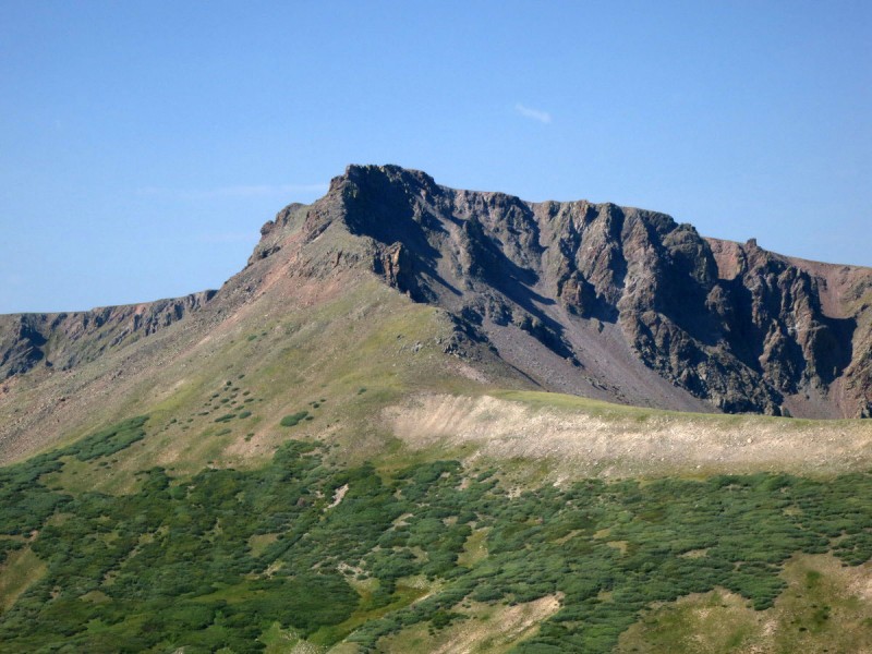
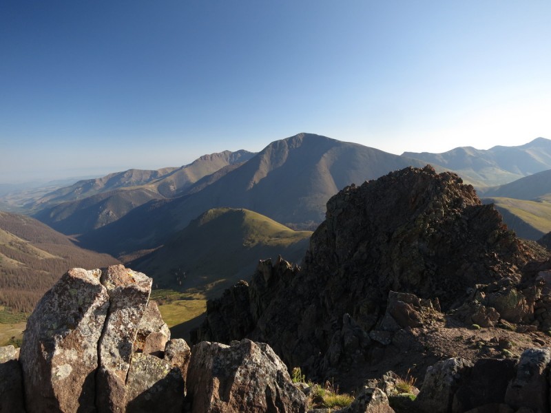
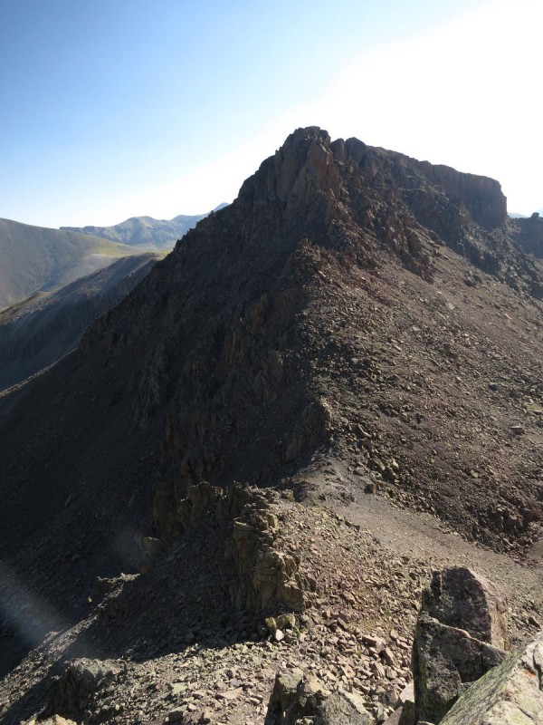
On the summit of 13,180 I get a bit of a respite of scrambling until near the summit of 13,155 where more "ridge features" look rather spicy. At least the walk over to the difficulties went quickly!
View of San Luis and the ridge to 13,155 13,155 and it's hoodoo's
Once at the volcanic hoodoo's, you skirt around the pointy rocks as close to the ridge as you can. The slopes around appear solid and steep, but the holds will break if not careful. I had a few hand and foot hold break out, so don't be fooled here. The last ridge feature I dropped down and around to the left (north) on steep hardpan.
Hoodoo ridge... View back along hoodoo's View ahead and up hoodoo's Last ridge feature to avoid to the north
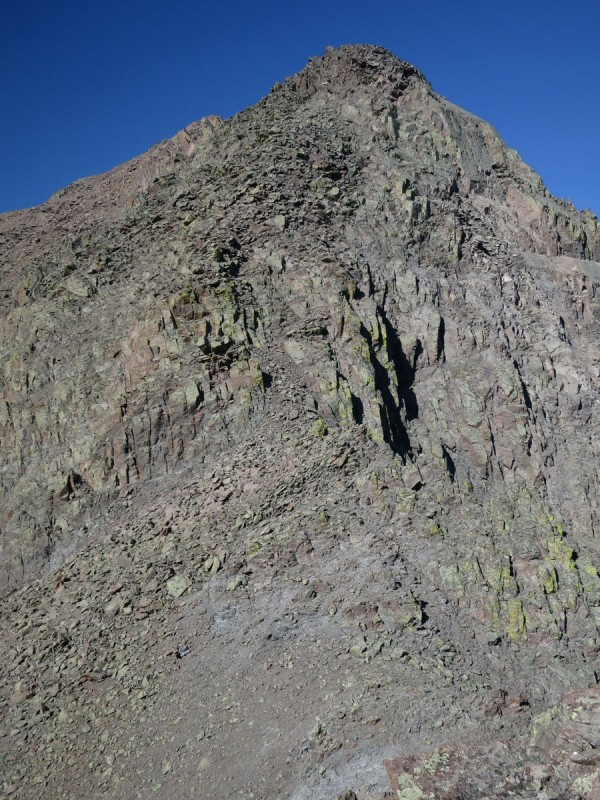
The Roach description say to approach the summit block from the north, as every other side looks class 5 and overhanging! The first part is class 3, but once you get up onto the boulders it turns into class 4. So much for "Roach's solid class 3 scramble to the summit"! It was quite exposed up on those boulders, and I even had a foot hold break loose, but after all the incredibly loose scrambling, this was as solid as it got in comparison!
The final summit pitch of 13,155 class 3 followed by class 4 over the precariously perched boulders
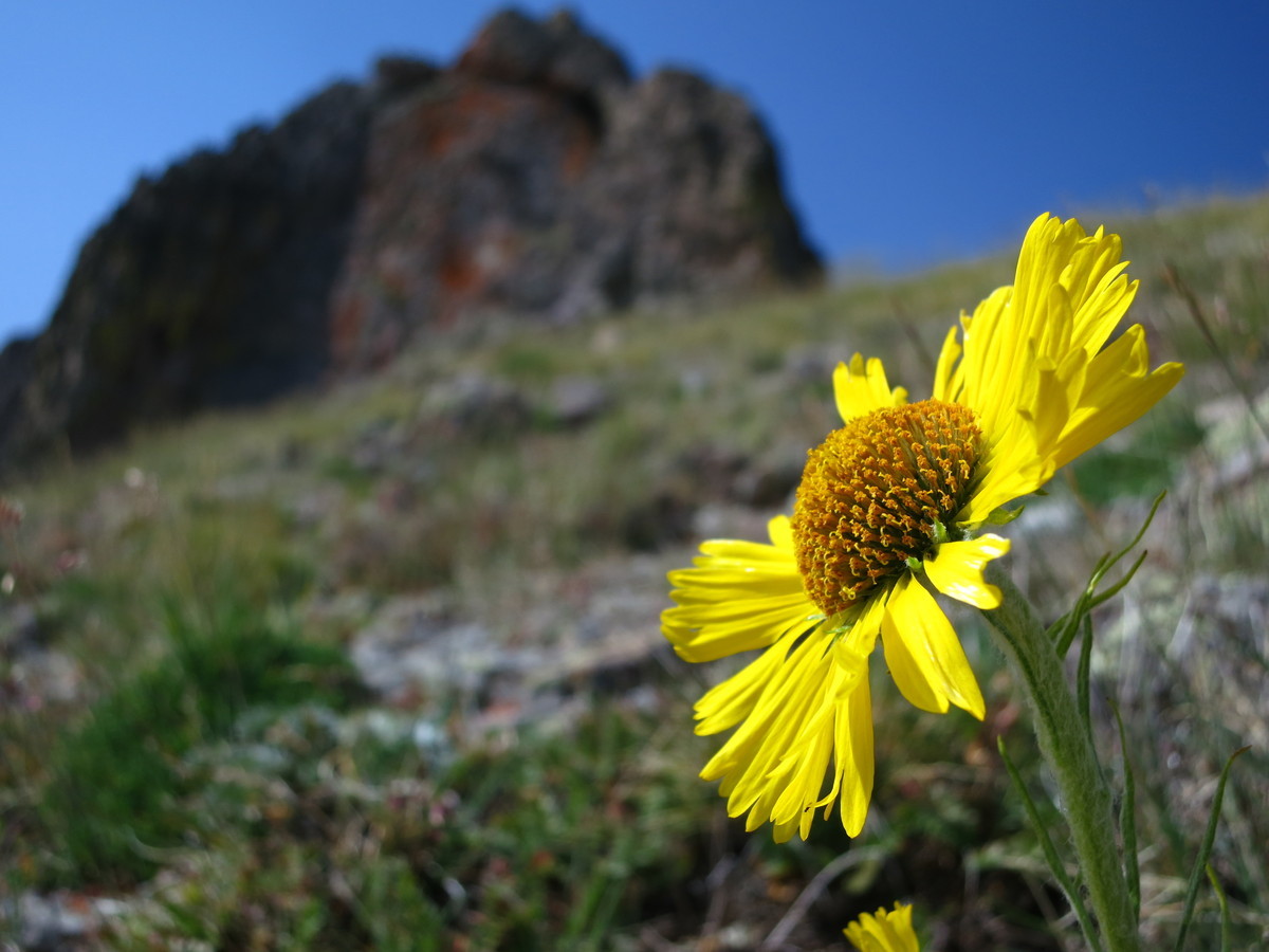
After all the difficult route finding, scrambling, traversing and climbing, I sat down with a pretty flower for a few minutes. Usually I find these yellow flowers pretty beaten up by the wind, but this one looked fresh!
Once back on the Colorado Trail, I made quick work of the return to the pass, and even got a nice view of the ridge traverse I had just done
And what would a trip to Creede be without some touristy shots of the mining ruins!
My GPS Tracks on Google Maps (made from a .GPX file upload):
8) I remember that we saw a huge herd of elk way above treeline (just like yours) when we were doing some 13ers over by San Luis one summer. They seem to like that region. Frost already ... we saw some this past weekend ... getting a bit nippy in the morning. Thanks for posting. Happy trails! :D
Sarah - I could hardly believe it when that little guy ran up to within a few feet of me and posed. He was just too quick to get many photos of. I wish I had my camera in shutter burst mode at the time!
Presto - I always see more elk than people on 13ers in the San Juans!
SuperPolok & Jay521 - It's a great view from there, enjoy!
SurfNTurf - Maybe I'll have to check that concert out... :wink: Sure you can't make the party?
Caution: The information contained in this report may not be accurate and should not be the only resource used in preparation for your climb. Failure to have the necessary experience, physical conditioning, supplies or equipment can result in injury or death. 14ers.com and the author(s) of this report provide no warranties, either express or implied, that the information provided is accurate or reliable. By using the information provided, you agree to indemnify and hold harmless 14ers.com and the report author(s) with respect to any claims and demands against them, including any attorney fees and expenses. Please read the 14ers.com Safety and Disclaimer pages for more information.
Please respect private property: 14ers.com supports the rights of private landowners to determine how and by whom their land will be used. In Colorado, it is your responsibility to determine if land is private and to obtain the appropriate permission before entering the property.