Download Agreement, Release, and Acknowledgement of Risk:
You (the person requesting this file download) fully understand mountain climbing ("Activity") involves risks and dangers of serious bodily injury, including permanent disability, paralysis, and death ("Risks") and you fully accept and assume all such risks and all responsibility for losses, costs, and damages you incur as a result of your participation in this Activity.
You acknowledge that information in the file you have chosen to download may not be accurate and may contain errors. You agree to assume all risks when using this information and agree to release and discharge 14ers.com, 14ers Inc. and the author(s) of such information (collectively, the "Released Parties").
You hereby discharge the Released Parties from all damages, actions, claims and liabilities of any nature, specifically including, but not limited to, damages, actions, claims and liabilities arising from or related to the negligence of the Released Parties. You further agree to indemnify, hold harmless and defend 14ers.com, 14ers Inc. and each of the other Released Parties from and against any loss, damage, liability and expense, including costs and attorney fees, incurred by 14ers.com, 14ers Inc. or any of the other Released Parties as a result of you using information provided on the 14ers.com or 14ers Inc. websites.
You have read this agreement, fully understand its terms and intend it to be a complete and unconditional release of all liability to the greatest extent allowed by law and agree that if any portion of this agreement is held to be invalid the balance, notwithstanding, shall continue in full force and effect.
By clicking "OK" you agree to these terms. If you DO NOT agree, click "Cancel"...
Trailhead: Rock Creek
Mileage: 12.3
Elevation Gain: 4,265'
It was almost 4 years to the day of my first trip to the Gores. It was high time to get back into this range that I have been saving for Darrin's scramble and exposure happy feet. Finally the stars aligned and we got a trip planned into this amazing range. Now, I doubt we'll leave it anytime soon. But that's how it goes when you fall in love, right?
We crashed out at a very full trailhead Friday night (road turnoff is not 9 miles from I-70 like SP says) for a semi early wake-up call the next day. For once the weather forecast wasn't predicting the punishing monsoon storms we've been seeing for the past month. So we knew we had time to take it easy.
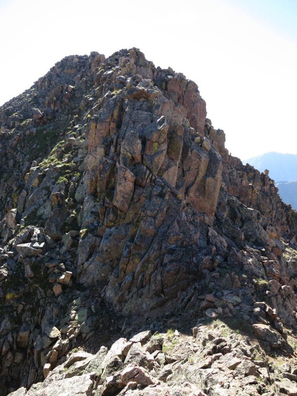
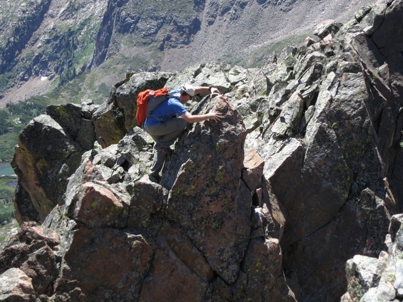
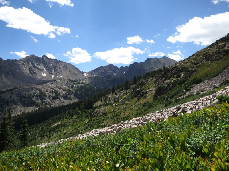
The first few miles fled by, as the trail is like a super highway. Though once at the mine , the trails spray out in many directions. After "locating our return trail", we make our way up our intended direction, the east ridge. From there it was a fairly simple amble up the ridge to the start of the talus. Then the fun began! Plenty of opportunities to scramble if you chose, or dodge around if you like. There's only one spot where you do need to do some class 3 scrambling, but it's up a rather nice stair-step.
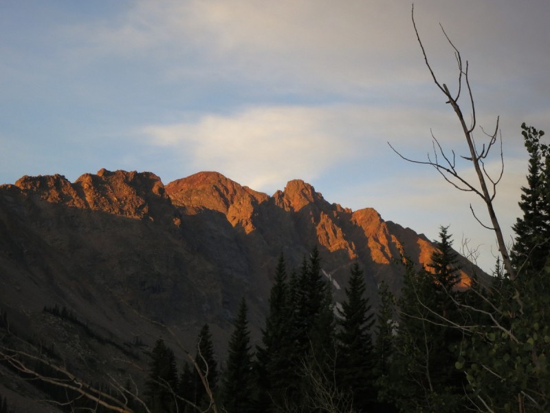
Sunrise Moonset behind the ridge
All the while, the views around were amazing. I was kicking myself for forgetting my polarizing filter in another climbing bag. But I made do, trying to take photos and keep up with Darrin as he had fun on the ridge.
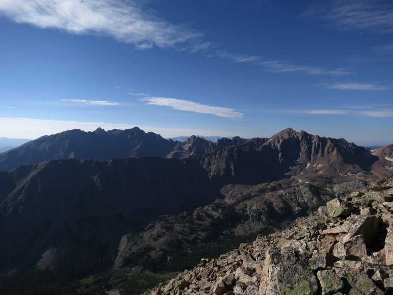
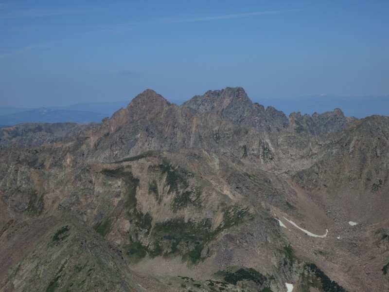
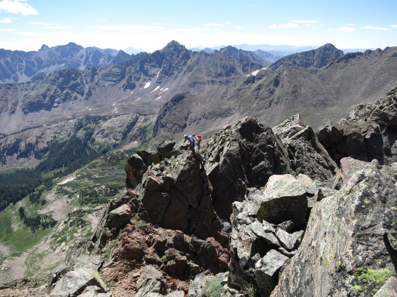
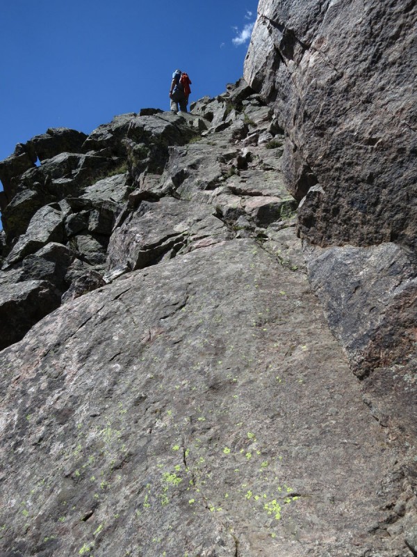
Southern Gore Pano from the ridge up Keller The Grand Traverse Valhalla, I am coming! Blocky ridge walking A ridge scramble, if you will Darrin having some fun Like walking up stairs as a toddler The white tower
After a while, the ridge obstructions were getting a bit much, so we dropped to the south and just skirted them. After that, it was a simple walk over to the summit.
We lounged on the summit for a while, drinking in the views. Darrin was already making a list of all the peaks he wanted to climb next. Too bad it wasn't the start of summer! Oh well, not like they're going anywhere.
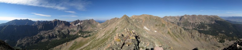
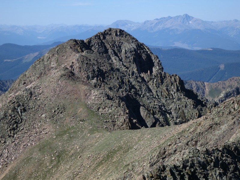
Knobbly What's that? Is it ranked? Doubtful Let's go over there anyway! (Holy Cross in background) Summit Gore pano
We had originally planned to go back down via the Southwest face, but that bump farther SW on the ridge was calling our name. It didn't look ranked, but it looked like it may be interesting getting over there. So with a beautiful day continuing, we decided to alter plans and go explore another ridge.
The Ridge to 13,055
Well, the ridge wasn't all that difficult, and we then knew it wasn't ranked. But we got a better view and some of the more northern peaks that were hiding behind a ridge, popped into view. So not terrible. From here we decided to continue along the ridge, till the saddle with "North Traverse Peak".
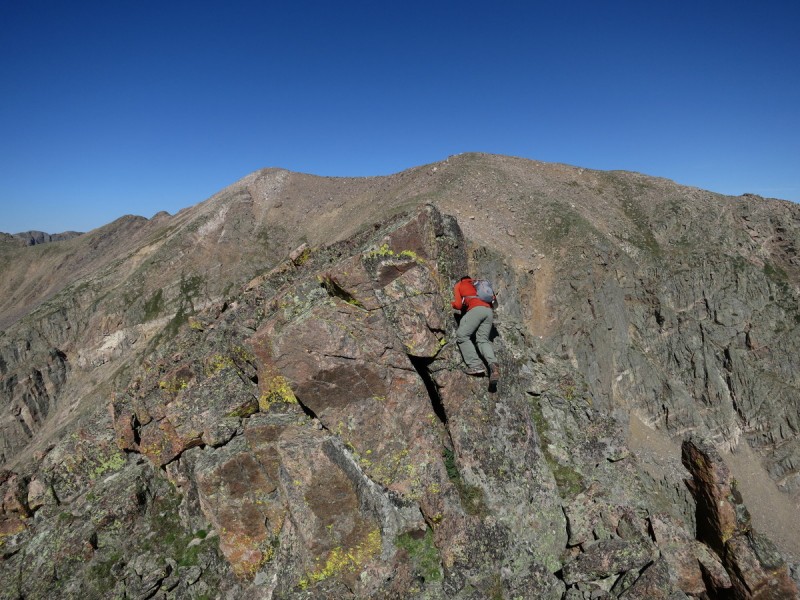
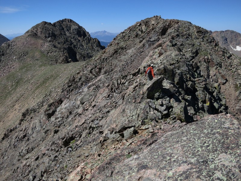
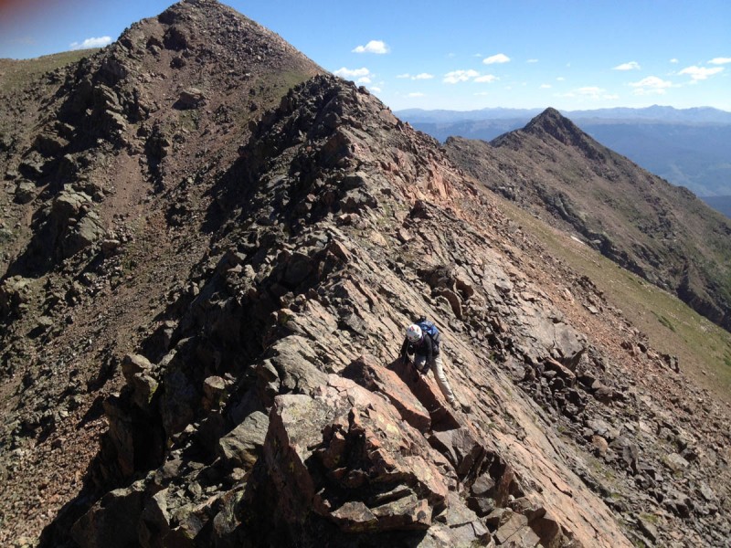
The ridge proper is quite exciting! Though SP lists the route as C2, I bet they dropped off the ridge to the east to accomplish that. So keep that in mind as you view the next few photos of some fun on the ridge proper.
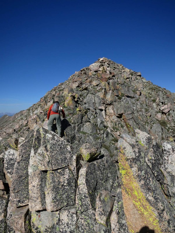
Darrin finding some exposure scrambling Some perspective on the last shot I think I'll take the less exposed class 4 slab Starting to get real interesting... Some slabby exposure Me traversing, hoping my slightly worn out boots can grip the narrow edge
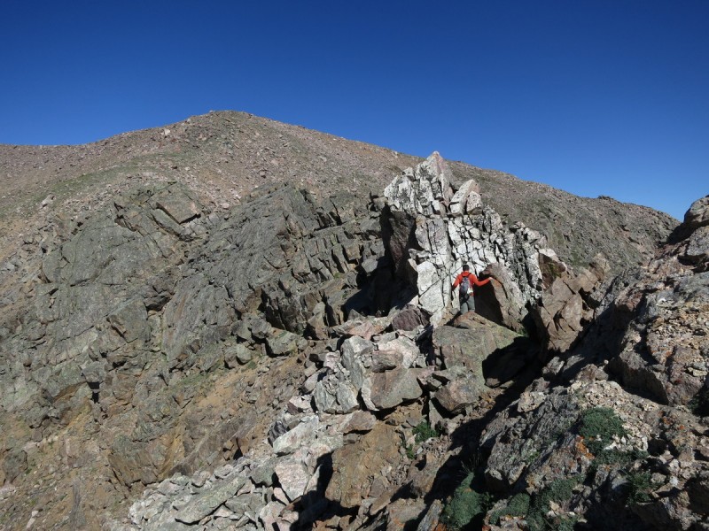
Once beyond the fun on the ridge, the drop down to the saddle went smoothly. We had been eying a way to get from the saddle to the "trail" of the SW slopes from the view above. I figured if we contoured high and left in the valley, we would meet up with the trail as it dropped down further into the valley.
Dropping from the saddle A lovely tarn
Hmm we thought, as we got to where the trail should be. Where the heck is it? So we contoured farther over, and more or less followed where the line on the SP map said the trail would be. Nada. So then we just started down into the valley. Followed a talus slope for a while, until it dead-ended in willows. Now the bushwack began! Climbing over talus with willows is not a great way to go, nor is it safe for shins. After some time exploring our hate of willows, we exited and found another open talus slope. At the base of it was a cairn. A cairn? Yay! That trail was short lived, as it went due south, and not in our preferred direction. So we left that area and just headed in the direction of the mine. After a short bit a narrow dirt track appeared. So we followed it. Neither of us said anything, for fear of jinxing it, and therefore losing the track. But after a few minutes, it remained. Hurray! We found the trail! Not that it was a great trail, but it was a trail. A trail that seemingly kept going uphill, a lot. Oh well. we found it, and as soon as we hit the mining trail, it was off to the races, despite our sore feet. I doubt I'll ever leave the Gore without sore feet. Seems to be a theme...
How soft your fields so green, can whisper tales of gore
My GPS Tracks on Google Maps (made from a .GPX file upload):
Great views, interesting scrambles and great weather window. Glad you guys got hooked. And don't worry about forgetting your polarizer, Gores are aesthetic as is.
This peak was a great way to view the majority of the range, Red was just too far on the edge to completely hook me.
Monster5 - Those traverses would be of interest, if we can get the timing to work out! Hey, I'm just glad Darrin got the camera (ie his iPhone) out of his pocket and actually took 7 photos. There was a better version of the thumb one (without the thumb), but he held the phone at an awkward angle, on purpose... tilted pic
lordhelmut - Hooked... I'm just glad Darrin is excited about mountains again! I figured we had lost him after K 49...
Caroline - You should start with this peak then. After all, it would be USAKeller on Keller Mtn!
SolarAlex - Glad to inspire a trip!
Caution: The information contained in this report may not be accurate and should not be the only resource used in preparation for your climb. Failure to have the necessary experience, physical conditioning, supplies or equipment can result in injury or death. 14ers.com and the author(s) of this report provide no warranties, either express or implied, that the information provided is accurate or reliable. By using the information provided, you agree to indemnify and hold harmless 14ers.com and the report author(s) with respect to any claims and demands against them, including any attorney fees and expenses. Please read the 14ers.com Safety and Disclaimer pages for more information.
Please respect private property: 14ers.com supports the rights of private landowners to determine how and by whom their land will be used. In Colorado, it is your responsibility to determine if land is private and to obtain the appropriate permission before entering the property.


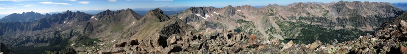


 Gore Pano north")
 Sunrise")
 Moonset behind the ridge")
 Southern Gore")
 Pano from the ridge up Keller")
 The Grand Traverse")
 Valhalla, I am coming!")
 Blocky ridge walking")
 A ridge scramble, if you will")
 Darrin having some fun")
 Like walking up stairs as a toddler")
 The white tower")
 Knobbly")
 What's that? Is it ranked? Doubtful Let's go over there anyway! (Holy Cross in background)")
 Summit Gore pano")
 The Ridge to 13,055")
 Darrin finding some exposure scrambling")
 Some perspective on the last shot")
 I think I'll take the less exposed class 4 slab")
 Starting to get real interesting...")
 Some slabby exposure")
 Me traversing, hoping my slightly worn out boots can grip the narrow edge")
 Dropping from the saddle")
 A lovely tarn")
 How soft your fields so green, can whisper tales of gore")


