Download Agreement, Release, and Acknowledgement of Risk:
You (the person requesting this file download) fully understand mountain climbing ("Activity") involves risks and dangers of serious bodily injury, including permanent disability, paralysis, and death ("Risks") and you fully accept and assume all such risks and all responsibility for losses, costs, and damages you incur as a result of your participation in this Activity.
You acknowledge that information in the file you have chosen to download may not be accurate and may contain errors. You agree to assume all risks when using this information and agree to release and discharge 14ers.com, 14ers Inc. and the author(s) of such information (collectively, the "Released Parties").
You hereby discharge the Released Parties from all damages, actions, claims and liabilities of any nature, specifically including, but not limited to, damages, actions, claims and liabilities arising from or related to the negligence of the Released Parties. You further agree to indemnify, hold harmless and defend 14ers.com, 14ers Inc. and each of the other Released Parties from and against any loss, damage, liability and expense, including costs and attorney fees, incurred by 14ers.com, 14ers Inc. or any of the other Released Parties as a result of you using information provided on the 14ers.com or 14ers Inc. websites.
You have read this agreement, fully understand its terms and intend it to be a complete and unconditional release of all liability to the greatest extent allowed by law and agree that if any portion of this agreement is held to be invalid the balance, notwithstanding, shall continue in full force and effect.
By clicking "OK" you agree to these terms. If you DO NOT agree, click "Cancel"...
Trailhead: North Halfmoon
Mileage: 11.4
Elevation Gain: 5,159'
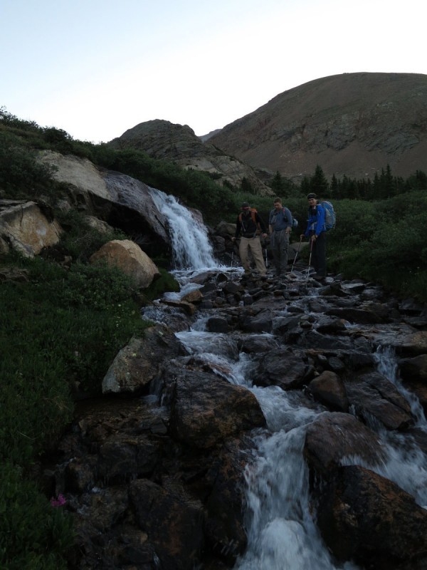
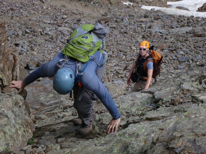
Traipsers through the rocks and flowers: Darrin, Caroline, Bob & Kate
Searching for a 13er loop for a group can be like sorting through porridge for Goldilocks. Not too long, not too short, not too far, not too close, not too much elevation gain, not too little. Gauge the weather and the group. Then hope for some previous beta.
After some back-and-forth we came up with this 3 peak loop. Some scrambling, some "bump-humping", some route finding. A good mix, hopefully for a good weather day. Plus I was going to take my very first photos with my new camera, Canon S100. My S90 took an unplanned 4' drop onto some rocks. My fool-proof lanyard system was outwitted by a fool. The camera complains when it opens the lens. I don't like complaining cameras, it makes me nervous.
We bounce into the trail head a little after dark, to already find the Finns in their vehicle sleeping. 2 others would show up after us, before we went off to sleep, a rather short sleep.
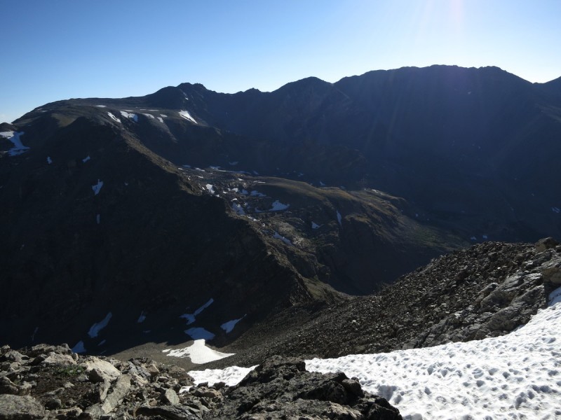
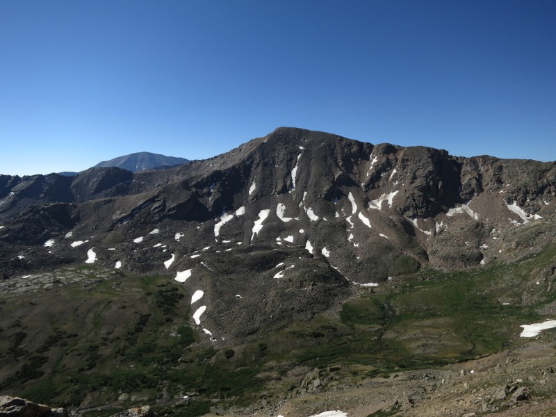
At O-dark 4:15am we were on the trail ready to tackle a pretty tough day. The conversation was lively and continuous as we followed the trail for the SW slopes route of Massive. We make the turn for the lake trail and follow it, finding the first waterfall of the day. I know the regular route diverts from somewhere below treeline, but we follow the trail till we get above, and then contour over to the SE slopes of Mt Oklahoma. We only lost a little bit of elevation along the detour, so not too terrible. Plus we got to see 2 more waterfalls along our path than we would have otherwise.
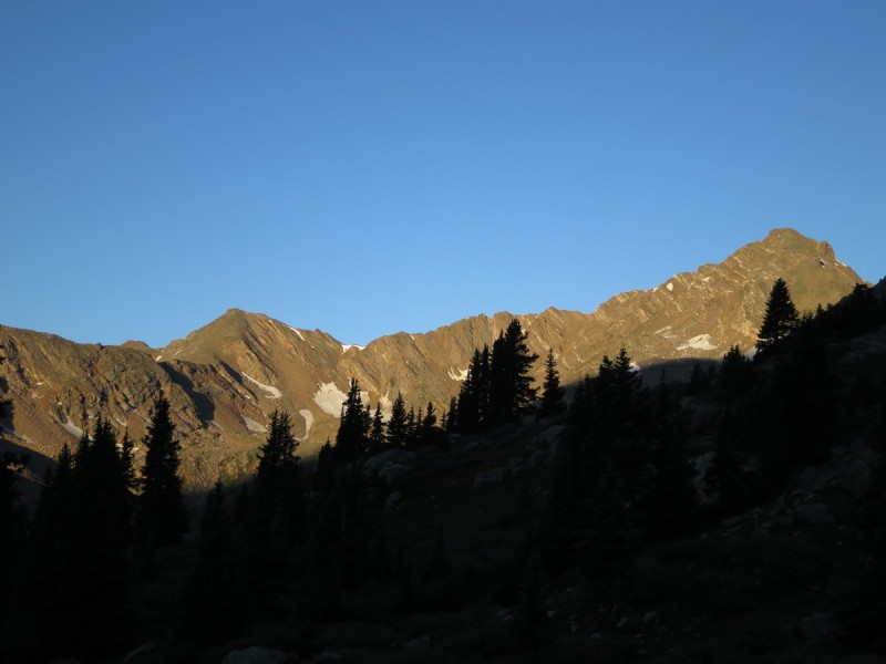
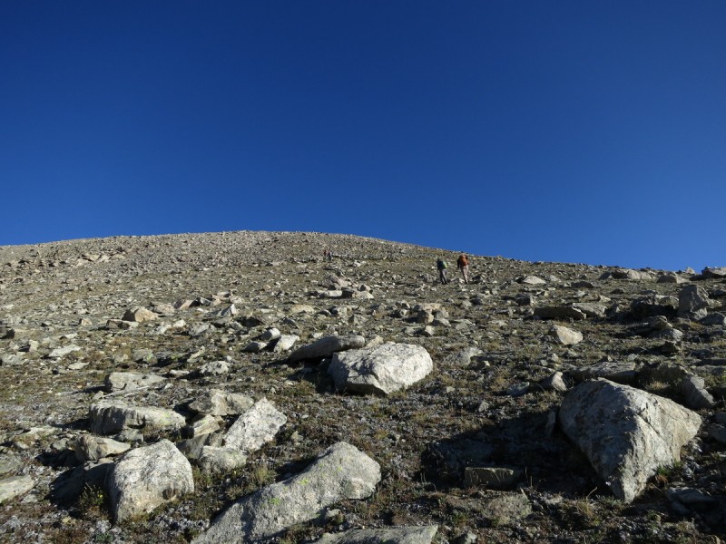
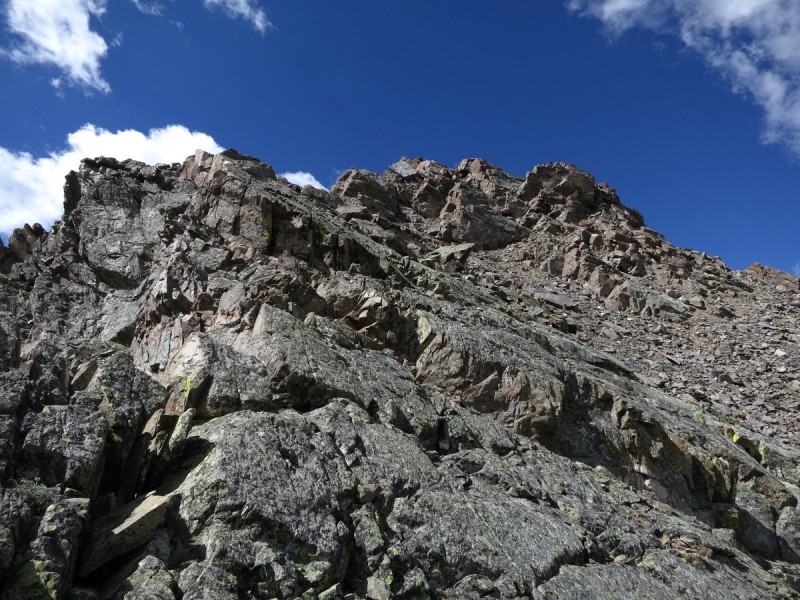
As we make our way up the ridge to the SE slopes, the sun rises and warms up the otherwise chilly day. The steep slope leads up to the gentle summit slope is as irksome as it looks. But this too shall pass, and soon you will find yourself on the summit.
Waterfall with Mt Oklahoma behind Pretty waterfall #2
Waterfall #3 K 49 and Deer in first light Caroline wtih K 49 - descent started near where her hat is.
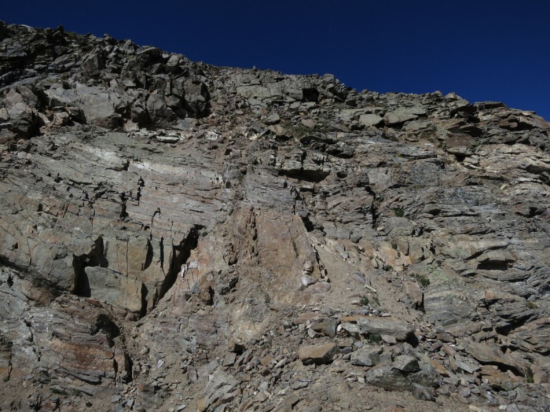
Steep slope of suckage - Photo Credit: Bob
More sucky slope - Photo Credit: Bob The gentle final slopes up Oklahoma
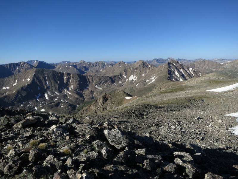
Once on the summit we take a pretty considerable break to discuss very important topics that shall be left on the mountain. That and eat breakfast. The important things in life.
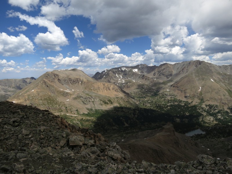
Mt Massive is massive Viewing the loop for the day
Everyone's happy summit face!!! Oh wait... hmmm - Photo Credit: Bob
Caroline's most awesome fisheye photo
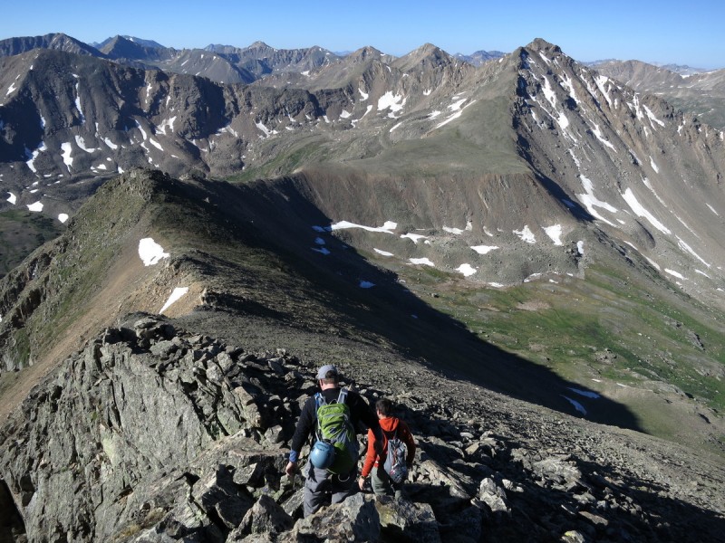
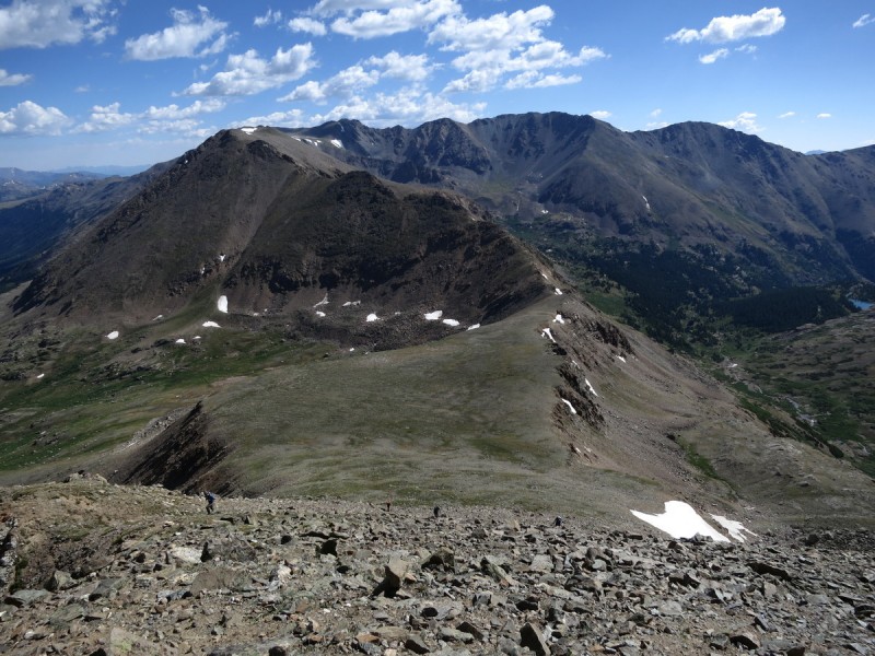
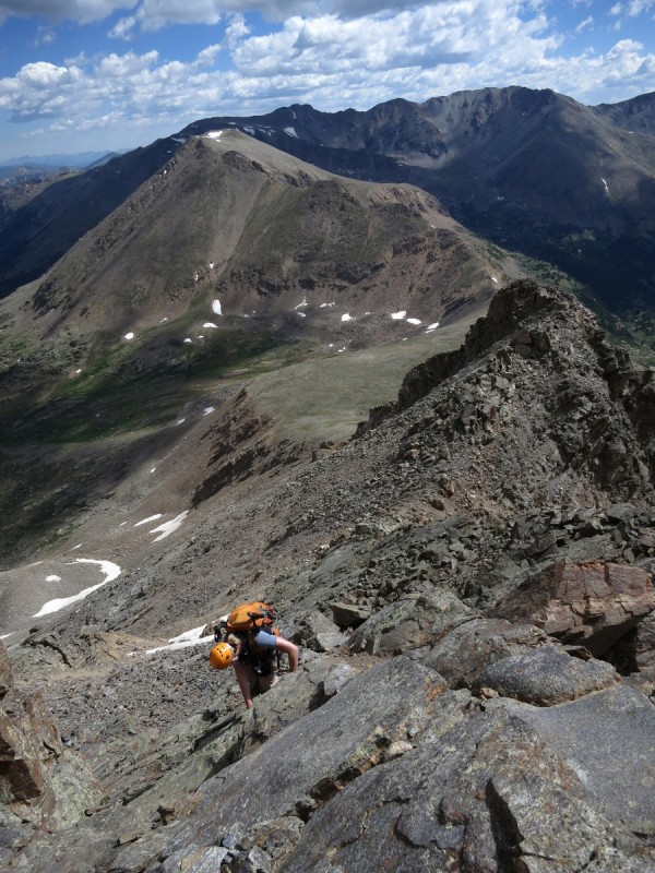
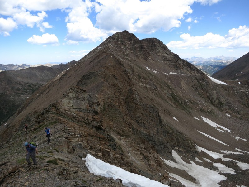
The ridge over to Deer is long, and so we make our way along the C2+ ridge. The more ridge proper, the higher the C rating, the lower you go, the easier. But also the looser.
Descending Oklahoma
Some flowers amongst the rocks - Photo Credit: Bob Looking back at the descent from Oklahoma Ridge over to Deer Mtn K 49
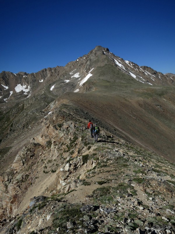
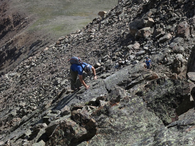
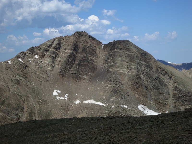
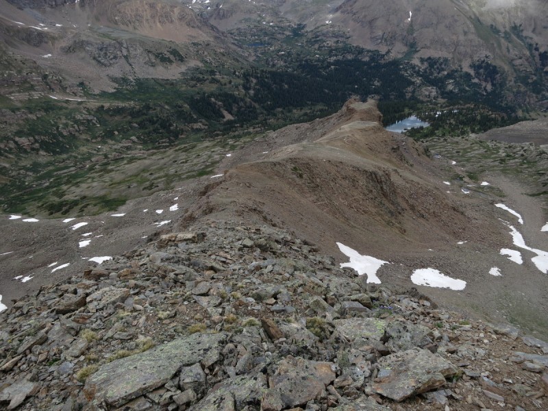
At the base of Deer Mtn, the very first wisps of puffy clouds have started. Ok we have T-1.5 to 2 hours before we want to be off the ridge. Hmmm 20% storms, and we're seeing puffies this early? Crap, time to move or go home. So I start up the next peak without much of a break, just put on my helmet and go. I figure I can route find the class 3 section above, as well as spreading out on the loose ridge section would also be a good idea. Since the ridge up to the false summit is super loose.
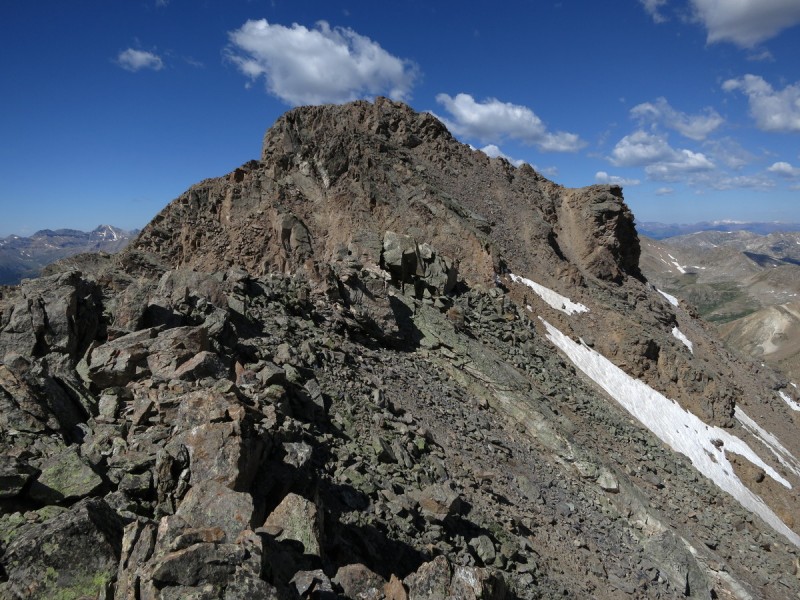
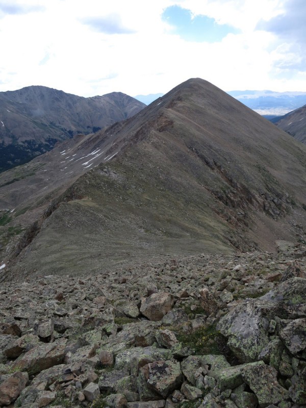
Deer Mountain
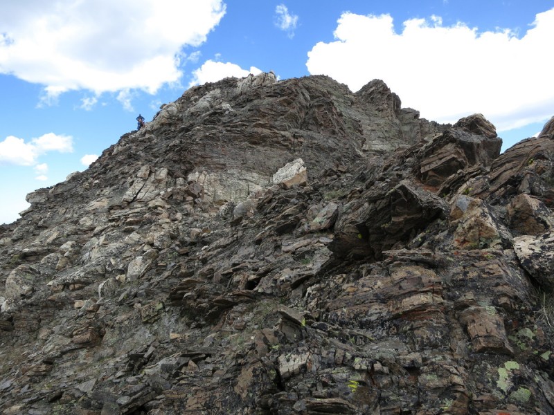
Zoom of the first crux section - Photo Credit: Bob Approaching the class 3 section The loose C3 up to the false summit Looking back at Oklahoma On the false summit, looking at the real Looking back at the false summit
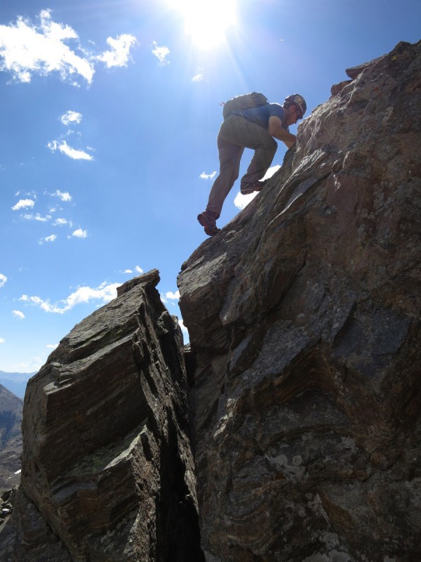
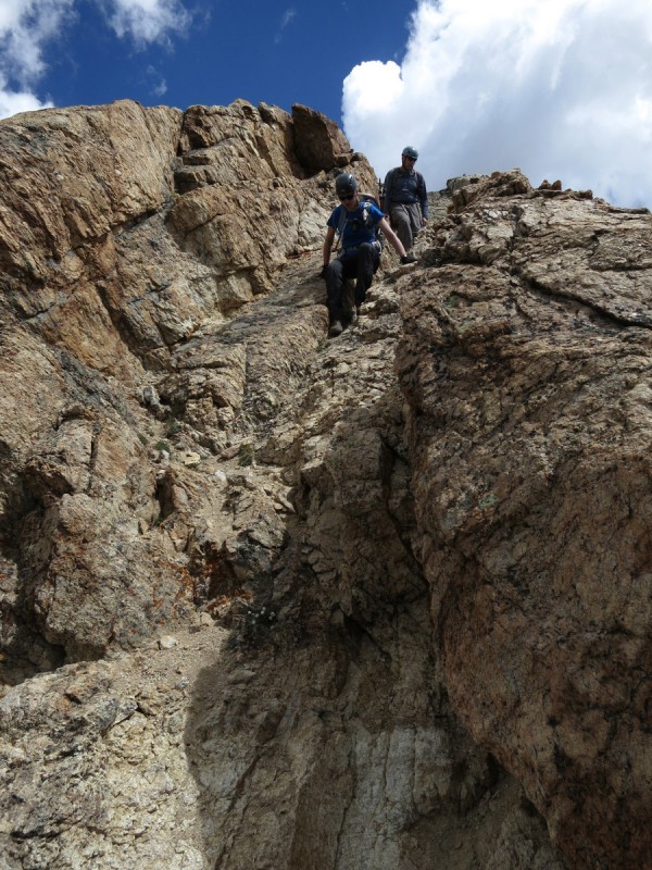
Once beyond the false summit, the rock gets a bit more solid, but yet not really. There are plenty of options for the summit pitch crux. I tried one and eventually had to back off, as it was about a mid C5 move I didn't like without a rope. So when Darrin caught up, he found another way. Quite a bit more exposed and still a low C5 move required. We figured we could get up higher and help the others find a simpler way up, which Kate did by going further to the right (north). It turns out you probably could bypass all of this C4 by contouring right further on crappy steep loose slopes over to a scree gully. But that's not very elegant!
Slabby scrambling followed by a challenging wall Darrin coming up the slabs
My first attempt at the crux (slab chosen by rest, to far right)- Photo Credit: Darrin Darrin and my choice to go up the crux to the summit
Me going up the crux - Photo Credit: Bob
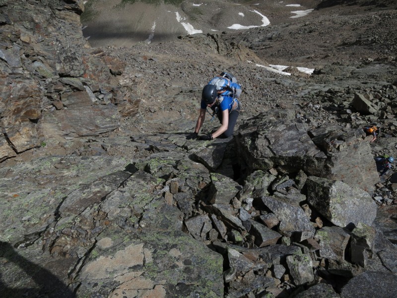
Trying not to let loose any rocks, the other two C5 routes below me - Photo Credit: Bob Kate finding an easier slabby way Bob making his way up Caroline on the slabs, with some perspective behind
We spent only a few minutes on Deer. Not sure anyone took photos. It was go time, so just a quick refuel, rest and go. The descent to the south of Deer was much easier than our way up, and was mainly C3. It still allowed some fun route finding, which is always appreciated!
Descending Deer Mtn
The airy ridge off of Deer - Photo Credit: Bob An interesting feature Deer is a very pretty peak!
We dodged as much around that unranked point on the ridge as possible to get our first good view of the ridge to "K 49" and a possible ditch route off it's SE slopes down to the 4WD road below. The clouds had been growing, but not building to the level of terrifying thunderstorms over us, or to the west. So we figured the 30-40 minutes to the summit and our planned descent was best. We would have just enough time to make the summit. Then take a good break there too, as the clouds still held. Better to hurry first, then break later, when the clouds held.
"K 49" looks, umm well, more boring than what we have already done Oklahoma & Massive Pretty Deer! Bob and Kate keep a tradition alive, while Darrin eats potato chips
Eventually we had to start to make our way down. We knew the clouds would likely let loose on us at some point. But thankfully they held off till we were scree-skiing the final slope into the valley, then we got graupel. It lasted just long enough for us to put on our rain jackets, and to make the grass wet. The return trip back to our trail was quite lovely following game trails. Might be a good way to go up Oklahoma. The sun came back and warmed our descent back to the trailhead, where I got a lovely post-hike surprise of a punctured and very flat tire. Alaskan road side gear to the rescue!
The descent off of "K 49", take a left when the scree looks good.
Graupel!!!! - Photo Credit: Bob
Darrin's FAVORITE terrain: steep, wet, grassy slopes!
A nice valley, no willows!
My poor couple month old tire!
My GPS Tracks on Google Maps (made from a .GPX file upload):
I didn't mind being it! I just imagined Tim Tebow with me, although not actually present :D. That pic of you and Darrin along the ridge off of Deer is pretty sweet. I'm glad you put this up to show the descent off of Darrin's favorite, "K 49". And, our conversations all day were priceless. Awesome TR and photos. And even more awesome group. Let's all get out again for more bump-humping soon!
Great report. Those waterfall shots were cool, and the scenery looked beautiful up there.
Thanks for the report!
Caution: The information contained in this report may not be accurate and should not be the only resource used in preparation for your climb. Failure to have the necessary experience, physical conditioning, supplies or equipment can result in injury or death. 14ers.com and the author(s) of this report provide no warranties, either express or implied, that the information provided is accurate or reliable. By using the information provided, you agree to indemnify and hold harmless 14ers.com and the report author(s) with respect to any claims and demands against them, including any attorney fees and expenses. Please read the 14ers.com Safety and Disclaimer pages for more information.
Please respect private property: 14ers.com supports the rights of private landowners to determine how and by whom their land will be used. In Colorado, it is your responsibility to determine if land is private and to obtain the appropriate permission before entering the property.