Download Agreement, Release, and Acknowledgement of Risk:
You (the person requesting this file download) fully understand mountain climbing ("Activity") involves risks and dangers of serious bodily injury, including permanent disability, paralysis, and death ("Risks") and you fully accept and assume all such risks and all responsibility for losses, costs, and damages you incur as a result of your participation in this Activity.
You acknowledge that information in the file you have chosen to download may not be accurate and may contain errors. You agree to assume all risks when using this information and agree to release and discharge 14ers.com, 14ers Inc. and the author(s) of such information (collectively, the "Released Parties").
You hereby discharge the Released Parties from all damages, actions, claims and liabilities of any nature, specifically including, but not limited to, damages, actions, claims and liabilities arising from or related to the negligence of the Released Parties. You further agree to indemnify, hold harmless and defend 14ers.com, 14ers Inc. and each of the other Released Parties from and against any loss, damage, liability and expense, including costs and attorney fees, incurred by 14ers.com, 14ers Inc. or any of the other Released Parties as a result of you using information provided on the 14ers.com or 14ers Inc. websites.
You have read this agreement, fully understand its terms and intend it to be a complete and unconditional release of all liability to the greatest extent allowed by law and agree that if any portion of this agreement is held to be invalid the balance, notwithstanding, shall continue in full force and effect.
By clicking "OK" you agree to these terms. If you DO NOT agree, click "Cancel"...
Photo from June 2011
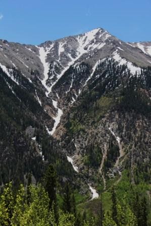
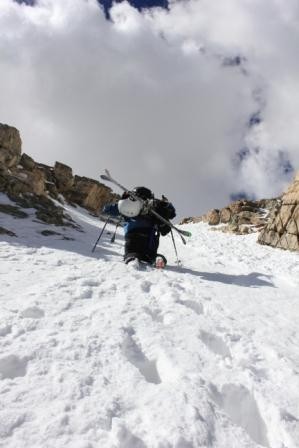
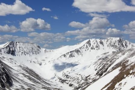
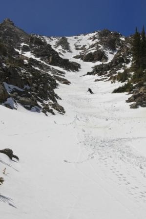
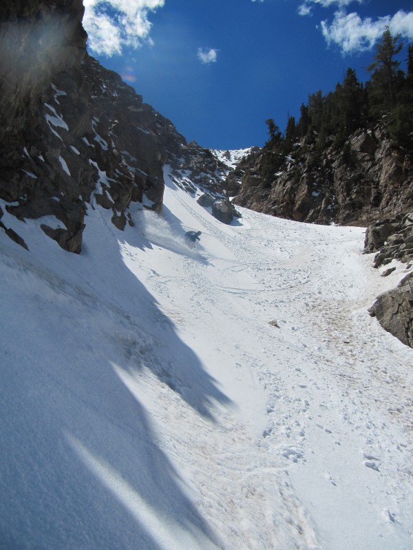
This line drops from the NE sub peak of Twin Peak B Northeast. There is a very nice line that drops from Twin Peak B NE proper, but this one seems a little more unique. With more than 3000 feet of multi aspect sustained pitch, one would think that there would be more skier and hiker traffic. The below tree line couloir adds to its appeal.
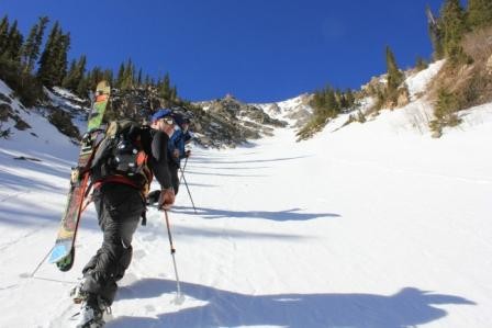
We were cruising over Freemont Pass before sunrise and enjoyed the end of the meteor shower. We hit the trail a little after 6 and worked our way up to the snow in about 25 min.
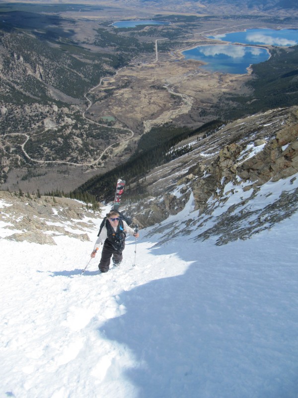
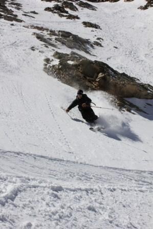
As we climbed the snow changed from spring pack to about a foot of new snow from the storms a few days prior. This was no surprise as we found ourselves in 3+ feet of snow in the Holy Cross Wilderness a few days prior. The pitch was measured in the high 40's multiple times Ervin Peak Left and Mt Baurock Right The top turns were soft. Skier-CALC
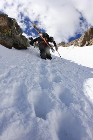
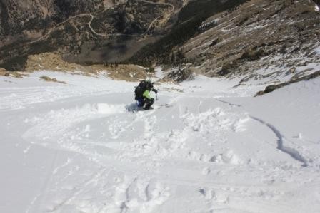
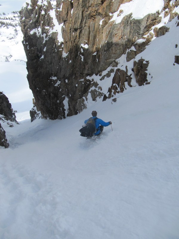
The top was softer than we would have liked but catching a line like this in perfect conditions is hard to do. Being late on the top more easterly aspect lead to perfect corn on the bottom half that faces north. Chad Zanca
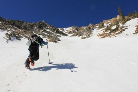
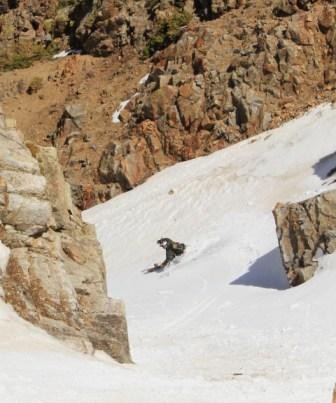
Chad getting some soft snow on the top section after the crux Chad Zanca A random Couli In the HCW two days prior
The hike out took about 20 min and we were at High Mtn pies in leadville in no time.
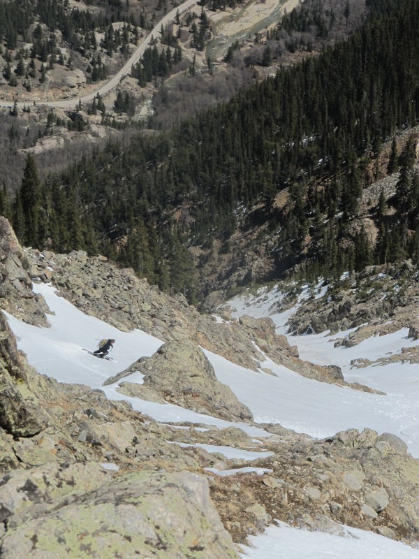
This was for sure the best descent we had all had in 2012
Thumbnails for uploaded photos (click to open slideshow):
Loving the low snow year! Everybody is killing it! This would be a classic if we didn't judge with arbitrary numbers (14,000, Centennial, BiCentennial)
KB-I was going to go into a rant on Peak Height over Quality of line conditions ect.
Rick-The roadside access is so legit on this ski!
Brian- The last pic is near missou lakes
Allthough the base is not that of last season, at least we dont have dust and resets are keeping things good on what is still in.
Attempted the line today, and got turned back @ 12,000k (right branch Y) due to rotten snow. The lower 1800 vert was VERY firm in the morning, and the lower 1000 completely sandy/dusty/rocky. After missing the turnoff, we stopped for water and to relax for a touch, missing our window to the summit. Who knows if we could have made it either way (new snow soft slabs). Regardless, what an incredible line! Can't wait to go back (perhaps next year) to get it from the top!
I saw some wet slides that had released to the ground on sat in the chute lookers left of the main chute. bummer u didnt peak out the top looked like it had a good reset sat but the lower stuff looked dirty
Caution: The information contained in this report may not be accurate and should not be the only resource used in preparation for your climb. Failure to have the necessary experience, physical conditioning, supplies or equipment can result in injury or death. 14ers.com and the author(s) of this report provide no warranties, either express or implied, that the information provided is accurate or reliable. By using the information provided, you agree to indemnify and hold harmless 14ers.com and the report author(s) with respect to any claims and demands against them, including any attorney fees and expenses. Please read the 14ers.com Safety and Disclaimer pages for more information.
Please respect private property: 14ers.com supports the rights of private landowners to determine how and by whom their land will be used. In Colorado, it is your responsibility to determine if land is private and to obtain the appropriate permission before entering the property.