Trailhead: Deer Creek Trailhead - Trailhead Info Here
15 Miles
6,000' Elevation
Peak Info
Rosalie Peak - 13,575'
"Epaulie" - 13,530'
Epaulet Mountain - 13,523' (Unranked)
Royal Mountain - 11,495'
**Note regarding pictures: Last week my camera decided to plunge into the water. Apparently, it was not a witch because it came back dead. I was able to make some use out of my Iphone camera, but a big thanks to Clay for putting up with me asking him to take pictures all day, and even allowing me to steal his camera to take photos from time to time.
Clay picked me up at my place around 5:30AM and we made the quick drive to the Deer Creek Trailhead, about 8-9 miles north of 285 just before entering Bailey. We were on the trail by 7:00AM, following another couple that left right before us. (They were off like a rocket, we wouldn't see them until near the summit of "Epaulie" later in the day.) The first portion of the Tanglewood trail is dry, minus a few areas of patchy ice. After about a mile, we passed the intersection of the Rosalie Trail. Despite having the name of the mountain we were after, this is NOT the correct trail. Be sure to stay right and continue following the Tanglewood trail.
We lost the trail for a short bit just before treeline as the snow began to deepen slightly, but by heading up towards the saddle we came back across it before too long. Near treeline, we were treated to a forest of bristle cones. Amazing trees. Once above treeline, we decided that instead of ascending directly to the saddle (where the trail led) we would head up a mellow snow slope that led a bit higher onto the ridge we were trying to gain.The snow made a nice shortcut for us and we made it to the top of the ridge without much difficulty. We decided to lighten our loads here and stashed snowshoes (which we never used all day) as well as extra water for the return trip.
After our break on the ridge, we began the ascent up the east slope of Rosalie. The slope was pleasant in the it was mostly grass covered without much talus to worry about. From the saddle to the summit was about 1500', and we arrived on top right around 11:00AM. With no worries on the weather, we decided to head on north towards "Epaulie". Before we took off, Clay took a 20 minute snooze while I chomped on an apple.

The first couple miles of the Tanglewood Trail were completely dry.

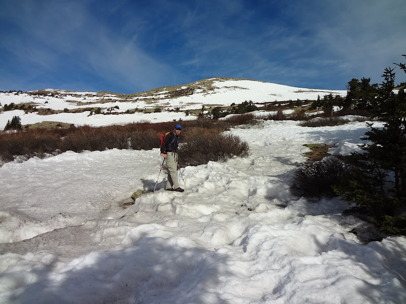
Derek on the Tanglewood Trail. The first mile was smooth trail, eventually turning rocky.

Bunny! Some type of hare...?

Views opening up to the south as we gained elevation on the trail. Around 10,500' or so the trail became difficult to follow.

Clay looking down towards our ascent path.

Shortly after finding the trail again, we broke treeline and into bristle-cone goodness.

Bristlecone.

Bristlecone.
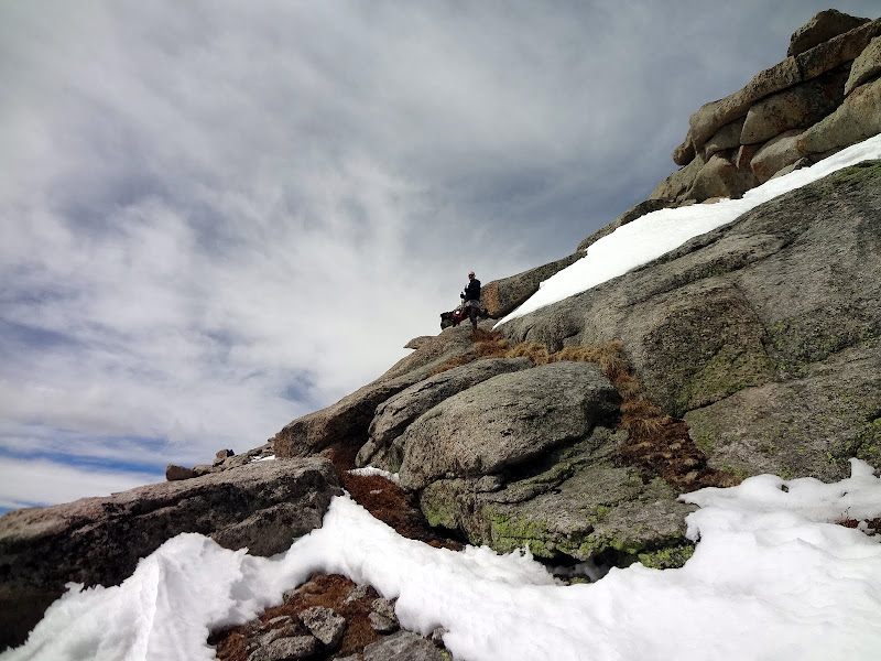
The snow increased just shy of the saddle, but it was hard enough that we avoided snowshoes.

We decided to pass on ascending to the true saddle, and instead followed the snow slope in the background which would leave us 200' or so above the saddle.

After gaining the ridge above the snow slope, we took a nice break and stashed some of our gear and water for the return trip.

The slope leading up to Rosalie was consistent but smooth. The beautiful weather made it even better.

Derek ascending the east slope of Rosalie.

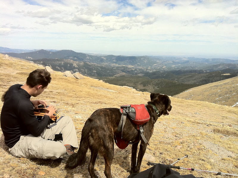
Mt. Bierstadt, Mt. Evans, and my apple.
After wrapping up our summit stay on Rosalie, we headed the one mile north to "Epaulie". Many summits of "Epaulie" actually occur from the Mount Evans Road. From the switchback parking for the Tour de Abyss route of Bierstadt and Evans, "Epaulie" (and Epaulet) are just a short stroll. From Rosalie to "Epaulie", we had to lose and then regain around 600'. The final couple hundred feet up "Epaulie" required some rock and slab hopping, but nothing harder than tough class 2. Just as we started up the slabs of "Epaulie", we met the couple from the trailhead that morning. They indicated that the views from the next mountain up (Epaulet Mountain) were fantastic. I'm not usually one for the "unranked" peak, but we figured what the heck. Since we were this close we might as well do the 1 extra mile round-trip to see the views they mentioned. We quickly tagged the summit of "Epaulie" and continued on north to Epaulet Mountain.
The views of Epaulet Mountain do NOT disappoint. By far the nicest summit we had of the day. Dramatic drop offs to the west of the summit and tremendous views of the Abyss Lake area of Mt. Bierstadt. It was definitely worth the extra distance and elevation.

"Epaulie" from near the summit of Rosalie.

"Epaulie" from the saddle with Rosalie.
Derek and Rufus on a light scramble to the summit of "Epaulie".

Clay on "Epaulie", Rosalie in the background.

Derek on the summit of Epaulet Mountain. Bierstadt, the Sawtooth and Evans in the background.

Derek and Rufus checking out the massive drop-offs near the summit of Epaulet Mountain.

Heading back to Rosalie.

Mapcheck. Crap. We DO have to reascend most of Rosalie.

Mount Evans, Warren, Rogers and the Mount Evans Road in the background.
The trip back over "Epaulie" went quick, however reascending most of Rosalie Mountain was a bit of a drag. Visually, it seems that one could wrap around the NE side of Rosalie from the saddle with "Epaulet" to gain the ridge. However, the visible ridge is NOT the same ridge that is used for the ascent. Instead, it is a second ridge in between the saddle and the ascent ridge that ends in a cliff. Therefore, it is necessary to reascend to at LEAST 13,300' in order to bypass this "fake" ridge. In fact, in hindsight it would probably be quickest just to reascend all the way back over Rosalie and not try to bypass it at all. Just make sure and glance at a map on your way back and it will make sense.
We finally arrived back to our snowshoe stash from that morning and took a long refueling break. When we had started out earlier that morning, I had indicated to Clay that I really wanted to try for Royal Mountain on the way down if given the chance. From where we sat, Royal looked so small and easy to grab on the way out. We were already at over 5,500' for the day, but we decided to head on down and see what it an ascent up the north slopes looked like. Worst case scenario, we could just bail to the west and pick up the Tanglewood Trail.
Refueling at our stash from earlier in the day, debating on whether Royal Mountain was in the cards.

Cutting across from Rosalie to Royal Mountain.
Below the saddle on the way to Royal Mountain.

Royal Mountain and the meadow below that we aimed for to begin the ascent.

Some neat clouds on the way to Royal.

One of the MANY trees uprooted that we saw below treeline during the day.
We made a diagonal angle straight towards a large willow meadow that sat at the north base of Royal Mountain. From there we figured we would be able to get a good look at an ascent path. The descent to this meadow went smoothly, however we came across dozens of uprooted trees. We would come across TONS of these through the rest of the day. Once we hit the meadow, we traversed it a little ways looking for a good place to cross. Suddenly, some movement caught my eye and I noticed a mother moose and her calf were in the willows, staring directly at us. I immediately shoved my dog down to the ground and out of sight. (Moose with young will attack dogs due to instinct.) Luckily, they headed off the other side of the meadow and out of sight. Due to the height of the willows, they probably never even saw the dog. This was the first time I had ever come across moose in the Mount Evans Wilderness, definitely wasn't expecting it. I shortened Rufus' leash for a bit until we were out of the area.
**Note to dog owners: I've heard more than once from rangers that if a moose attacks while you are with your dog, make sure to unleash your dog and run. The moose will go after the dog, and being unleashed they are better able to escape. I never would have thought of that, but its what I've been told multiple times now from the rangers. Luckily, all my moose encounters (even with calves) have been peaceful.
After that abrupt adventure (and my brief infatuation with a lovely tree in the meadow) we headed up the north slopes of Royal. Snow varied anywhere from zero to 3 feet. Being so late in the day the snow had turned to slush, therefore snowshoes wouldn't have been useful. We picked our way up slowly, finally reaching the large boulderfield that exists on the north side of Royal Mountain's summit. Rufus (my dog) had troubles on some of the large boulders, so we had to pick a way around that avoided difficulties. We finally made it up to the bristlecone covered summit for our final stop of the day. We stayed only briefly before descending along Royal's south ridge which (according to the map) would lead us straight back to the TH. I hadn't heard of anyone descending this way, but it worked out alright and we made it back to the trailhead right at 6:30PM, 11.5 hours after leaving that morning.
Great day with great company.
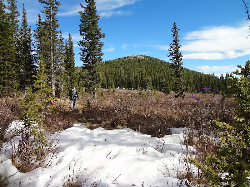
Derek and Rufus circling the meadow, oblivious to the fact the a cow moose and her calf were paralleling us to the right. (They weren't noticed at the time of this photo either.)

Mother moose and her young'n.
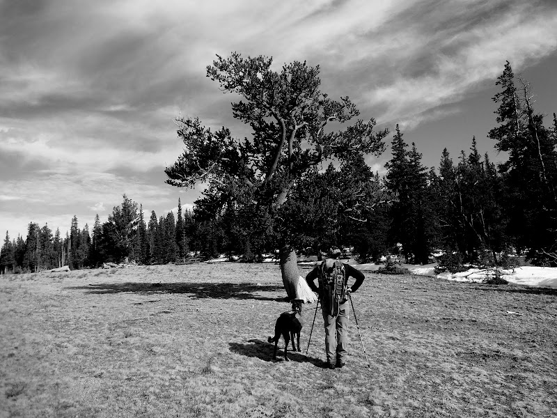
I was absolutely fascinated by this tree. Beautiful setting in this meadow area.

Rocky summit of Royal Mountain.

Bristle-coney summit of Royal Mountain.

Descending the south ridge of Royal Mountain. Great views to finish the day.
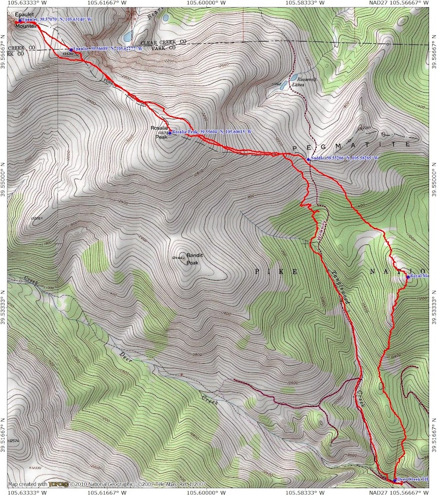
Map of the day.

Profile of the day.
My GPS Tracks on Google Maps (made from a .GPX file upload):
|


