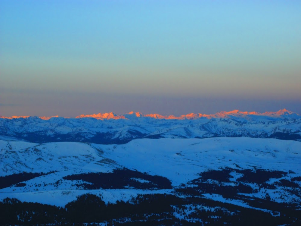
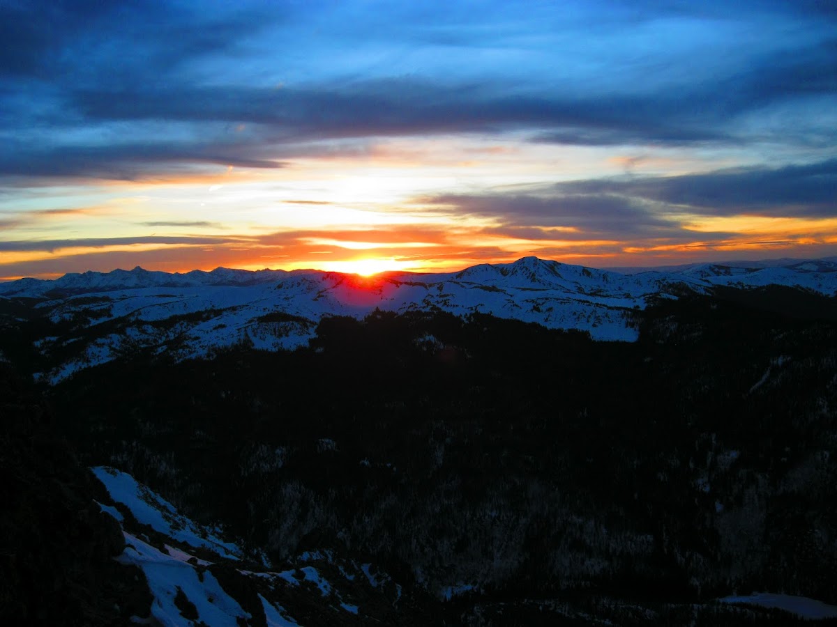
Sunrise on top of Atlantic Peak
Peaks (in order of summit):
Atlantic Peak - 13,841' (Cent-R:#87), Pacific Peak - 13,950' (Cent-R:#61), Crystal Peak - 13,852' (Cent-R:#82),
Peak 10 - 13,633' (R:#178 ), Peak 9 - 13,195' (R:#492), Peak 8 - 12,987' (R:#645),
Peak 7 - 12,665' (UnR), Peak 6 - 12,573' (UnR), Peak 5 - 12,855' (UnR),
Peak 4 - 12,866' (R:#742), Peak 3 - 12,676' (UnR), Peak 2/Tenmile Peak - 12,933' (R:#690),
Peak 1 - 12,805' (UnR), Mount Victoria - 11,785' (UnR), Mount Royal - 10,502' (UnR)
Distance: ~16.6mi
Elev Gain/Loss: 7500'/9000' (plus LOTS of small elev gain/loss on Peak 4 - 1 traverse)
Weather: Sunny w/ highs around 40F but with a VERY annoying, CONSTANT 25-35mph West crosswind that would occasionally gust to 40-45mph.
Time: 16:30 (4:45am - 9:15pm), First Summit, Atlantic Peak:7:15AM; Peak 9 - 12PM; Peak 4 - 4PM; Peak 1 - 7PM.
Technical Difficulty: Mayflower Gulch - Peak 4: Class 2, Peak 4 - Peak 1: Class 3/4 w/ significant exposure.
Technical Gear: Ice Axe (only used to cross one small snowfield below Peak 4), Microspikes (only used on Mayflower Gulch Rd), Snowshoes, Trekking Poles
Travelers: Geojed (Jed) SOLO CLIMB!
Wildlife (other than the climber  ): Fox, on descent of Mount Royal! ): Fox, on descent of Mount Royal!
Special Thanks for beta/pics: Prakash(maverick manley), Ben (benners), Elliot, Brandon (jbchalk), Sergey (strudolyubov) CharlesD's "Tenmile Traverse" page on SP
These peaks first really caught my eye and the seed was planted that developed into this amazing trip about a month ago when my brother and I were skiing at Copper Mountain. We spent most of the day skiing off the SuperBee lift and every time we rode the lift we would gaze and gawk at the Tenmile Range's amazing ridgeline starting from Drift Peak and going to Peak 9. Seeing these peaks over and over during the day repeatedly whetted my appetite to go climb them! The very next day I mapped a route starting from the Mayflower Gulch TH and going all the way to Frisco and the stats on it seemed doable in a day. A week after this ski trip I saw a TR on 14ers.com by Prakash where he climbed Atlantic Peak via the West Ridge. The awesome pictures he posted gave me an idea of the conditions in the Tenmile Range. They looked dry and would only get drier as the intervening two weeks of warm weather would work on the snow. Then very fortuitously, 3 days prior to my planned trip date, Ben posted a TR for a backcountry ski trip to Crystal Peak he did with Bill and Brian. Their pictures confirmed the very dry conditions along the Tenmile Ridge south of Crystal Peak. From my research (mostly on SP) regarding the Tenmile Traverse, I knew the crux of the route would be the traverse from Peak 4 to Peak 1. All of the obstacles along this portion can be bypassed on the West side and if there was still a lot of snow there, it wouldn't be safe to try for the Peak 4-1 traverse and I would need to bail down Peak 4's west ridge to the Copper Mtn. base. Then "lightning struck twice" and two days before my trip Elliot posted a TR where they skied the SW gully on Peak 4. He posted some tantalizingly small (500pixels) pictures of the ridge between Peak 4 and Peak 2. I immediately PM'd him for a larger pic, but he had problems uploading them and I could only go on the small pic that I had "blown up" to 400%!
I posted on the forum but got no takers (not surprising since it was on a Friday and a MONSTER of a trip) so I decided to "solo" the traverse, which was kind of liberating and very different from the last two climbs I've done where there were 12-18 people on the mountain with me at the time. This time all I had to concentrate on was myself and getting me to the end safely and in good time.
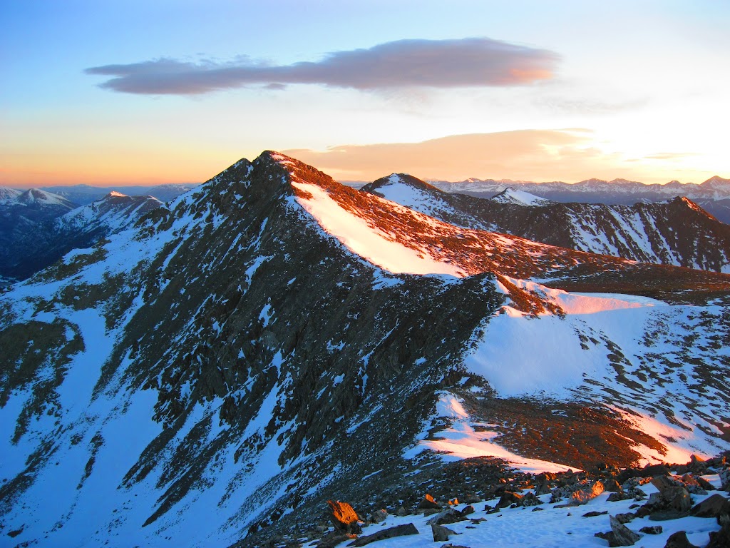
Entire Tenmile Traverse basked in peaceful alpenglow
I woke up at 2AM and left my house by 2:45AM. I arrived at the Mayflower TH around 4:15AM and packed everything up. As I went to put my Microspikes on I noticed that one of the chains on the heel portion had broken! I tried for 10min to fix it, even using my 4y.o. son's metal toy airplane to try to pry the link open more so I could put it back on to no avail. Screw it! I put them on anyways and started out on the very packed Mayflower Gulch Trail/Road. Brandon had told me that they had broke a trench a week earlier across Mayflower Gulch and to the base of Atlantic's West Ridge, but that I would still need my snowshoes. I had programmed a waypoint for where their trail split off so I wouldn't pass it in the dark and end up too far up the valley and have to backtrack. I made quick work up the road in the dark and sure enough, right where there was a break in the trees to my left a snowshoe/ski track headed down to the meadow. I checked my IPhone GPS and this was the right place. I tested the track to see if I really needed my snowshoes and on steps 3 and 4 I sunk to my crotch in the sugary snow. It was a mighty fun struggle to get back up to the road so I could put my snowshoes on!

Serene view of Quandary Peak
With snowshoes on I made quick work across the meadow and followed the main track as it went right on the other side. I was confused at first, because I thought the track should continue straight North up Pacific Creek. So I wandered around for 15min until I found that it split left again and headed up to Atlantic Peak's west ridge about 100yds to the East of where I was. Once I got to the ridge proper I took my snowshoes off and talus-hopped my way up the ridge in the dark. My first goal was to be at Atlantic's summit by sunrise (7:15AM) and in the pre-dawn light I made quick work of Atlantic's delightful ridge and summited about 5 minutes after sunrise. The pink/orange/yellow hues that graced the surrounding peaks were incredible. I quickly snapped as many pics as I could to catch the great sunrise before the light changed. The views of Quandary and Holy Cross were especially cool. The wind had been from the South when I started but by the summit of Atlantic the forecasted 25-25mph West winds had started and would torment and annoy me the rest of the day. The left side of my head would get really cold while the rest of me would be really warm. So I alternated having my hood up to protect my head and putting it down so I could cool down. I did this about 5 Billion times during the day!

Stunning Alpenglow on the Mount of The Holy Cross

Mt Elbert and Mt Massive basking in the light of dawn
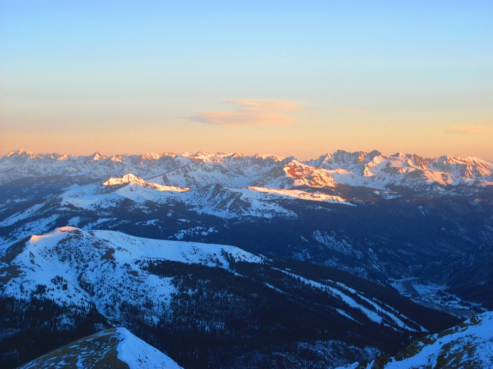
Rugged Gore Range feels the fire w/ first light just hitting Copper Mtn.

Atlantic Peak's summit cairn framed by Fletcher (L) and Drift (R) with Mount Democrat lurking in background left and La Plata and Mt Elbert peeking over Drift's shoulder right
Shortly after sunrise the sun went behind a cloud on the horizon (see sunrise pic at top of TR) all of the ranges around me went dark, EXCEPT for the Elk Range. It was still bathed in a beautiful orange glow. All 14ers in the range were visible, Castle Pk - Captiol Pk.
Entire Elk Range illuminated in the early morning light
After taking in the views and snacking/drinking for the first time since starting the climb I quickly glissaded down to the Atlantic/Pacific Saddle in about 5mins, and began my second Centennial Peak of the day. Pacific Peak.

Pacific Peak's Snowy South Ridge
This was a nice ridge that didn't have any false summits and I cruised over the low sub-summit and up the ridge to Pacific's airy summit; where I got great view back to peaks that bookend the Tenmile Range on the South and the peaks that bookend the Mosquito Range on the North.

View back to Atlantic Peak from Pacific's Summit
Still had a long way to go! Each peak I summited gave me a great view of my progress and what I still had left all through the day. 8)

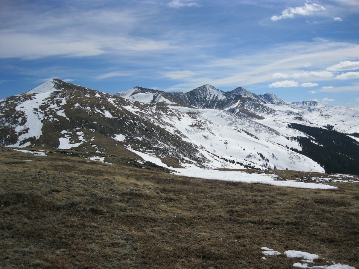
View towards Crystal Peak from Pacific's Summit. The rest of the ridge traverse past Peak 8 is visible angling left. Peak 10 is to the right of Crystal and Peak 9 is hiding behind Crystal

Pacific Tarn, the United States highest elevation lake @ 13,420' with Quandary Peak (C), Lincoln and Cameron (background Right).
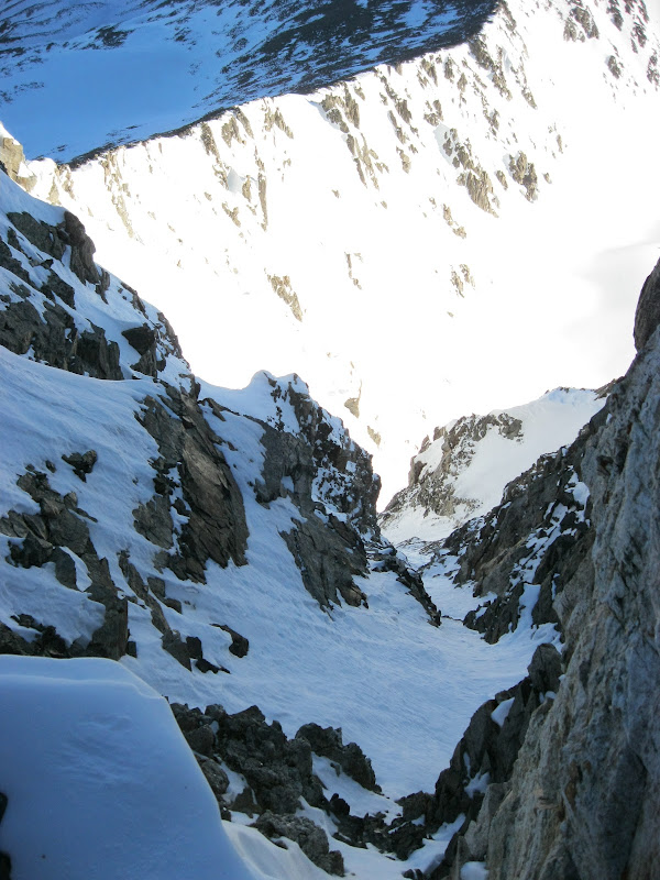
View down the Notch Couloir looking pretty spicy!
I stayed on the summit for just few minutes to take pictures and take in the views. I was easily able to cross the Class 3 "notch" on Pacific Peak and start down the North Ridge. The rocks on this ridge were fairly loose and I had to watch my step or I would take a big fall. I did fall once but my snowshoes, that were strapped to the bottom of my pack, took the brunt of the impact and prevented me from taking a hard fall on my tailbone. I kept turning around to gaze at the very snowy, mighty North Face of Pacific Peak. That Notch Couloir would be something else to climb. Apparently it gets up to 60deg in some sections! I believe it!
The rugged north face of Pacific Peak with its signature notch.
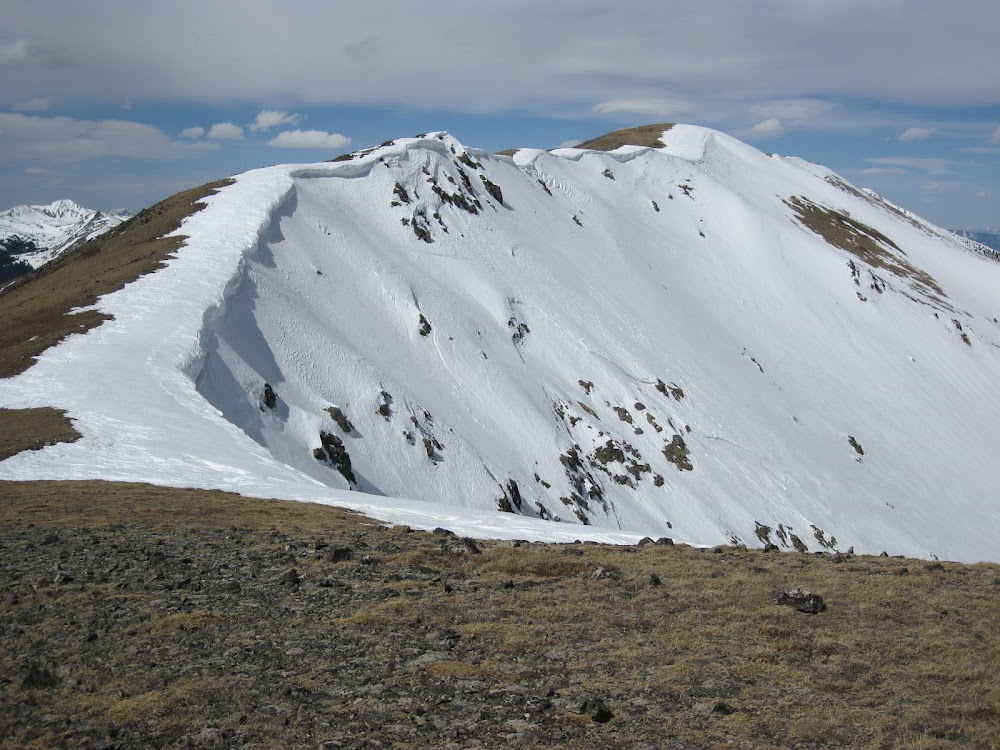
Crystal, like Pacific Peak has a small knob/sub-summit to get over before ascending the final ridge to the summit. The ridge to Father Dyer was looking fun too.
View up towards Crystal Peak from Crystal/Pacific Saddle
After I got over the small knob, the lower part of Crystal's north ridge was tundra. As I cruised along, a really cool sight stopped me in my tracks. There was this little "disk" of ice/snow that was about 4in across and was sitting like the brim of a hat on the top of a small rock, and wasn't touching the ground at all! The orange colors of the plants surrounding it added a nice contrast to the white snow/ice. So cool!!!! 8) It reminded me of a sonic boom "shockwave" cloud I've seen in pictures before.
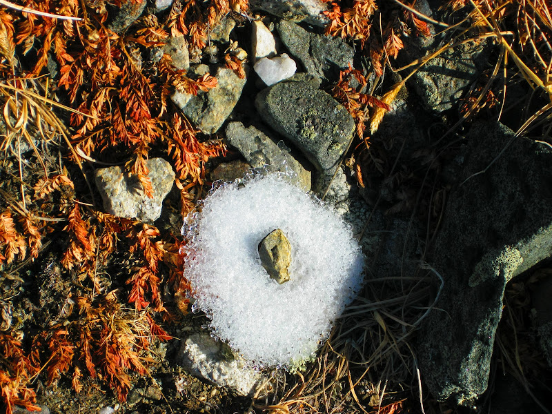
Neat little "snow disk" clinging to the crest of a small rock and hovering over the ground
It was around 10AM when I reached Crystal's summit, my third Centennial of the day, about 1:20 from Pacific's summit. The traverse from Pacific had taken a bit longer than the Atlantic-Pacific traverse (~40min). Here I stopped for 20min or so to snack and rehydrate. Thus began my ritual/strategy for the day in that I would take longer breaks on "every-other" peak and just short photo "catch my breath" breaks on the intervening peaks. I still had a LONG way to go and I had the goal to reach Peak 9 by Noon.

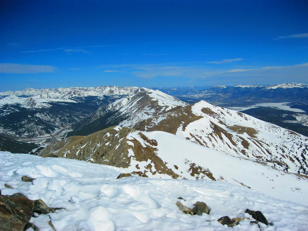
View from Crystal Peak looking towards Peak 10, Peak 9, Peak 8, Peak 7

Basin below Pacific Peak with Quandary, Lincoln, Cameron, Democrat, Fletcher, Atlantic all visible in the background
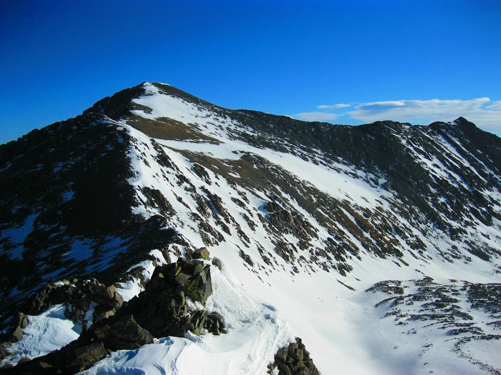
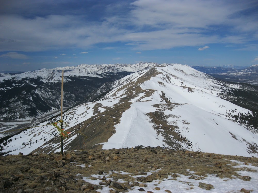
The descent down Crystal went quickly but the ascent of Peak 10's south ridge was slightly annoying. There were 2 false summits before I finally could see the true summit 100ft away from me.
Peak 9 - Peak 1 all visible.
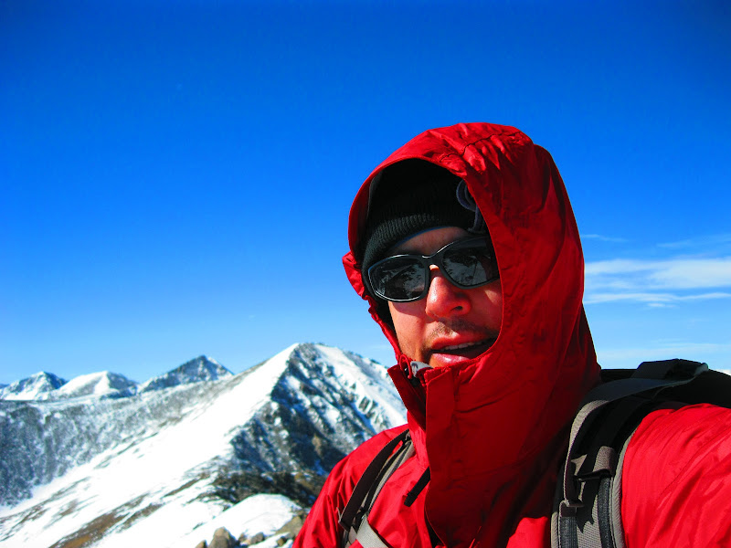
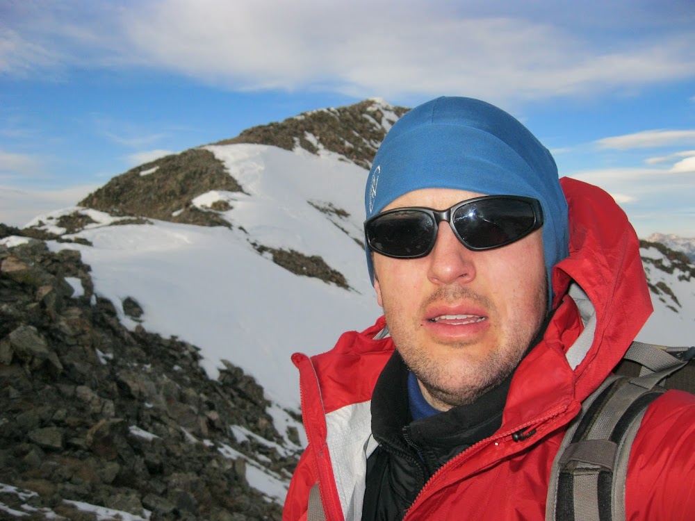
Self Portrait with Crystal, Pacific, Atlantic, Fletcher behind
I only spent 10min on the summit and began picking my way down the VERY, VERY, VERY loose talus on Peak 10's north face. The rocks moved/slid with about every step. I was hoping there was going to be a snowfield I could glissade down but no dice on that one. These loose rocks kind of reminded me of my climb of Mt Mellenthin in the La Sals. Don't even get me started on THAT horrid mountain!
I had the goal to make it to Peak 9 by Noon and I made it there with about 5min to spare. This was a "Snack Break" peak so I sat down and rested in the best wind break I could find. As I refueled a skier came hiking up the snowy east ridge of Peak 9 from the Peak 9 chair. We chatted for a second and I said "My name's Jed" he replied "My name's Bill". In the back of my mind I was thinking "Bill Middlebrook?" but I wasn't going to ask. He then said "Bill Middlebrook". Cool. 8) We talked for awhile about what my plans were for my climb and about our families, and about how I thought I had seen their tracks on Crystal Peak. He was gracious enough to take my only "action" pic of the day as I "rested" in front of Peak 10 and Crystal Peak. I said farewell and traversed/climbed the narrow section of ridge on the north ridge of Peak 9.

12PM: Bill Middlebrook took my one "action shot" of me...err... resting! Peak 10's VERY loose north face (L) and Crystal Peak (R)
Once I got down from that narrow section the real tundra trekking portion of the day began. For the next 5.33 miles to the summit of Peak 4 it's all grassy tundra that was easy to cruise along on. As I hiked up to Peak 8 I could see a constant stream of people who hiked the 50ft from the top of the chair lift and were skiing off the top. I made it there about 1:20pm and chatted with some nice folks who were preparing for their ski down. The basins and slopes up there were sadly dry but I guess they were able to link together snow patches to make it down!
View from Peak 8. Talked to some skiers up here. Still got quite a ways to go!
I sped along over the barely noticeable Peak 7 and up to the diminutive Peak 6 by 2:30PM. Here I took my last real snack/hydration break. I tried to hide as much as possible from the relentless wind behind the 3ft high summit cairn on top of Peak 6. I was still feeling pretty good and had good energy left in my legs. So I had some GU, another Orange Juice, a Snickers, the last of my Oreos, and took some more Sport Legs. I couldn't rest too long as my personal "cutoff" time for making it to Peak 4 and attempting the traverse to Peak 2/Tenmile Peak was 4pm!
Nice cornices on the ridge leading up to Peak 6.
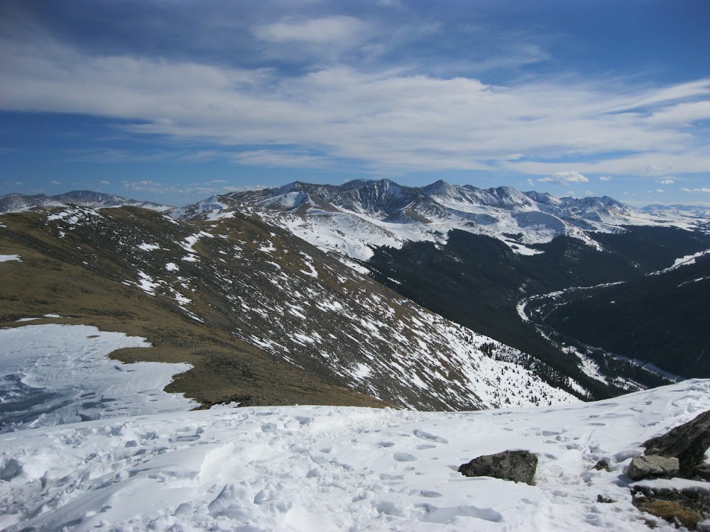
View back toward where I came from. L-R: Peak 8, Peak 9, Peak 10,Crystal Pk, Pacific Pk, Drift Pk
After finishing my snack I headed towards Peak 5, which was about a 500ft climb from the saddle with Peak 6, and you can't see the true summit until you're about 100yrds away from it.

Loooooong ridge to Peak 5!
I made it to the Peak 5 summit by about 3:35PM and I didn't even stop by the cairn as I had to make it to Peak 4 by 4PM and I only had 25mins left! I kept wondering what I would do if I was 5min late. Would I still go for the traverse to Peak 2????? Or would I obey my own personal cutoff time.........hmmmmmm......

Final Stretch to Peak 4. Gotta make it there by my 4PM cutoff time!
Fortunately, I didn't have to make that decision as I made it to Peak 4 at 3:55pm! 5 min to spare and relax! Here I got my first view of the ridge to Peak 2. Wow that looks gnarly! But one thing I was glad to see were some boot tracks heading down Peak 4's north ridge towards Peak 2! Someone else has done it!! So can I! The thought that maybe they tried and turned back kept nagging me but I kept pushing it back as I could see that their tracks were only ever going forward towards Peak 2. So they didn't turn around. I called my wife and left her a message that I was going to try for Peak 2 and that I would call again when I got there or if I turned around.

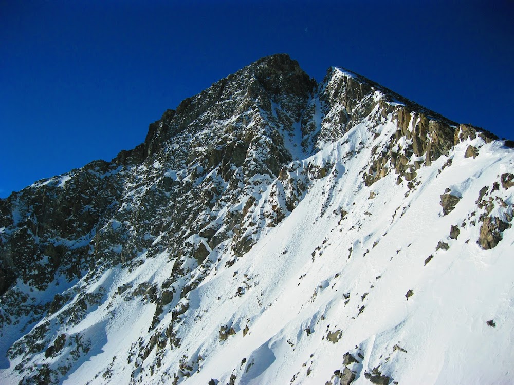
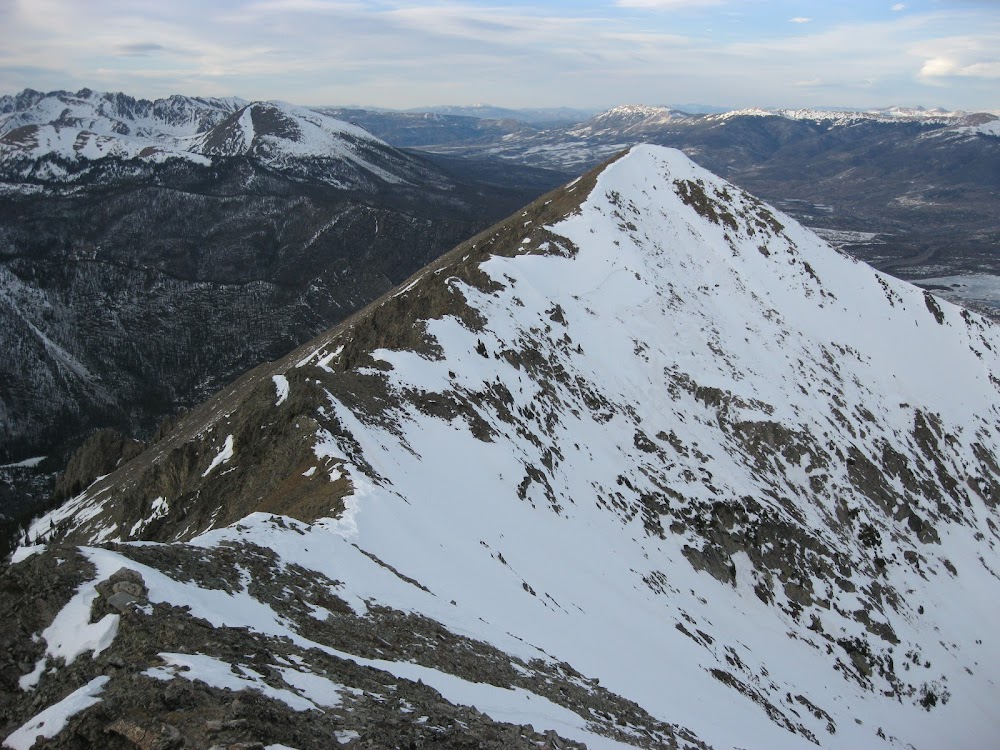
View of the gnarly Peak 4 - Peak 2 ridge. Fortunately the west side of the ridge is very dry, as the east side is unusable/unsafe due to very steep snow.
Last view back to where I've traversed from before I take the plunge and get to work on some very exciting Class 3/4 scrambling!
So I headed down the ridge sticking to the narrow "catwalk" ridge until it turned into a very steep knife edge that I didn't feel like down-climbing. I saw some steep slabs/ledges on my left that I could put together to get down below this cliffy, knife edge.

Peak 4's crazy fun North Face/Ridge. I scrambled down 2/3 of it and then descended down slabs and steps past those two small snowfields to the right of the knife edge.
Once below this section it was an easy Class 3 scramble up to Peak 3. Here I got the view of the toughest part of the traverse. I could even see the "dragon" waiting to battle with me! I tried to stick to the crest of the ridge as much as possible as it almost always was good, solid, fun, airy class 3 scrambling. Sometimes, I would have to down climb to the left to get past a notch on the ridge. I still had the 25-30mph crosswind from the West to deal with here so that amped up the excitement/challenge level here too! 8) Especially while I was on portions of the ridge that were only a couple of feet wide! Weeeeeee!

Looking from summit of Peak 3 at the relentlessly fun/challenging ridge to Peak 2. Can you spot the "dragon"?

View up towards Peak 2/Tenmile Peak from saddle with Peak 3. Getting closer to the "dragon" obstacle that is easily bypassed on the west side.
The gully to bypass the dragon was easy to spot and there were even a couple of cairns showing where the bypass began. The gully was fun, kind of reminded me of Mt. Lindsey's NW gully route, except not quite as loose.

The tail end of the "dragon". Bypass by a descending traverse to the gully on the left. You can spot the "dragon" at the top of the gully.

Looking back from the base of the gully that bypasses the "dragon"

Time to slay the Mighty Dragon!!!
I chilled for a second by the "dragon" and drank some more OJ. What I didn't know was that some of the most challenging scrambling of the whole traverse was ahead of me. This was the scrambling necessary to get over and around the several towers that make up what some people call Peak 2.5. At one point, during a bypass section, I was worried I would have to climb back up to the top of the tower and try to get over it that way. I didn't know if there was a "catwalk" ledge that would get me to another gully that would get me to the top of the last tower. So I ventured towards the gully, around a corner, and sure enough, there was a ledge about a foot wide that would take me to the gully!!!  Phew! That was close! Phew! That was close!

Looking back after the traverse of the towers of Peak 2.5

View down the gully that bypasses the last tower of Peak 2.5. The "one foot ledge" is on the bottom right. Peak 3 is barely visible above the tower on the left.
I climbed up to the top of the last tower and had to down climb one last notch and then HALLELEUJAH! Home Free to the summit of Peak 2/Tenmile Peak!!!! As I say in the caption below, when I saw this final slope there was much rejoicing, hooting & hollering!

A view I was VERY happy to see. No more obstacles to Peak 2/Tenmile Peak!!!!! There was much rejoicing, hooting & hollering!
Can you see the relief on my face?

View back at the Peak 4 - Peak 2 Ridge and the rest of the Tenmile Range.
I called my wife and let her know that I had made it! The view back across what I had just done was breathtaking. 8) I thought I was home free from the looks of the ridge to Peak 1, but it definitely held it's share of notches, snow traverses, and down climbs. All easier than what I had just done, but it wasn't a walk in the park that's for sure!
Thought I was home free to Peak 1 but it held some surprises and challenges in itself!
My notional goal to reach Peak 1 was 7PM, and again I made it there with about 5 minutes to spare!! Woo Hoo! The sun had finally come down to a gap in the clouds near the horizon and cast an INCREDIBLE golden glow over everything. One thing I also noticed that brought joy to my heart were a PLETHORA of tracks on the summit of Peak 1. This boded very well for my hike down in the dark, in the trees. A good trench/boot pack should be easy to find and follow. Yay!!!

Sunset casts Peak 2/Tenmile Peak and the rest of the Tenmile Range in a golden glow

Gap light casts a final golden flare on the Front Range to my East. Grays and Torreys lord over the landscape. You can see Peak 1's shadow too.

I DID IT!!!!! The Total Tenmile Traverse in Calendar Winter!!!! Woo Hooo!!!
I saw that the north ridge of Peak 1 still held some fun scrambling for me, but I definitely did NOT want to be doing that scrambling by headlamp in the dark, so I hurried down as fast as possible to make it to tree line/tundra before it got too dark.

Final Ridge down from Peak 1 still holds some spice until it FINALLY relents at tree line
A fiery farewell from my friend as I hurry down the ridge to reach tree line before it gets too dark.
I made it over Mount Victoria and down to tree line just as it was getting really dark. I found some snowshoe tracks in the drifts between the trees and I knew I was home free. So I put my snowshoes on in the fading twilight and turned my headlamp on. As I followed the tracks through the forest and down Peak 1's ridge my mind keep taunting/teasing me with thought of what would I do if my headlamp died! I have no idea what I would've done, since there was no moonlight at all. I would've been stuck. I did have some spare batteries for my headlamp fortunately. So I never worried too much. But.....what if?
I made it down to Mount Royal in no time at all and then headed down the VERY WELL traveled packed snow trail down to the Mount Royal TH in Frisco. I had to hurry because I needed to catch the Summit Stage back to Copper Mtn so I could hitch a ride back to my car. The Summit Stage only comes by every hour. So if I missed the 9:37pm bus I would have to wait there in the cold and dark for an hour for the 10:37pm bus! That would really suck. Fortunately though, I was making such good time that I didn't have to worry too much as I made it to the Bus Stop with 20min to spare at 9:15pm. After getting dropped off at Copper Mtn's entrance it took about 15-20min to hitch a ride back to my waiting car at the Mayflower Gulch TH. Phew!!! What a day!

Elevation Profile for the day: 16.6mi, 7500'+ elev gain, 9000'+ elev loss. 15 named peaks, 8 of them ranked, 5 13ers, 3 Centennials! What a day!
I stopped at the Ruby Tuesday in Dillon for dinner but I was still shivering and cold from the long day that I barely even ate my hamburger. I should've gotten pizza. I headed home and worked on my ½ gallon of chocolate milk and did everything I could to not fall asleep while driving.....
I finally made it home at 1:15AM. 22.5hrs after I left home. By the time my head hit the pillow I was asleep.............
As I researched this route to do it in "Calendar Winter" I could find only ONE other record on SP of anyone even attempting it, and they turned back on their way to Peak 2 from Peak 1. I'm sure others have completed it, but maybe they only did Peak 1-10 and not all the way to Atlantic? And maybe not "solo" either. It's kind of fun to at least think that I have the "first" recorded on the "internets" successful solo traverse of the Tenmile Range from Atlantic - Mt Royal. It felt great to really push myself, push my limits, and try something that maybe no one else has done before. If someone has, I would love to talk to them to compare notes and shake hands.
There's no way I would do it N-S in Winter at least. That steep climb up from Frisco would burn you out when you've just started. S-N saves you 2000' of elevation gain due to the higher TH and you get to climb 3 Centennials to boot!
Thanks for reading!
Here is a link to a picture gallery that has more pictures that I haven't shown here.
https://picasaweb.google.com/110270057888641484575/TenmileTraverseInCalendarWinter?authuser=0&feat=directlink
My GPS Tracks on Google Maps (made from a .GPX file upload):
Thumbnails for uploaded photos (click to open slideshow):
")
")
")
")
")
")
")
")
")
")
")
")
")
")
")
")
")
")
")
")
")
")
")
")
")
")
")
")
")
")
|
")
")
")
")
")
")
")
")
")
")
")
")
")
")
")
")
")
")
")
")
")
")
")
")
")
")
")
")
")
")