Download Agreement, Release, and Acknowledgement of Risk:
You (the person requesting this file download) fully understand mountain climbing ("Activity") involves risks and dangers of serious bodily injury, including permanent disability, paralysis, and death ("Risks") and you fully accept and assume all such risks and all responsibility for losses, costs, and damages you incur as a result of your participation in this Activity.
You acknowledge that information in the file you have chosen to download may not be accurate and may contain errors. You agree to assume all risks when using this information and agree to release and discharge 14ers.com, 14ers Inc. and the author(s) of such information (collectively, the "Released Parties").
You hereby discharge the Released Parties from all damages, actions, claims and liabilities of any nature, specifically including, but not limited to, damages, actions, claims and liabilities arising from or related to the negligence of the Released Parties. You further agree to indemnify, hold harmless and defend 14ers.com, 14ers Inc. and each of the other Released Parties from and against any loss, damage, liability and expense, including costs and attorney fees, incurred by 14ers.com, 14ers Inc. or any of the other Released Parties as a result of you using information provided on the 14ers.com or 14ers Inc. websites.
You have read this agreement, fully understand its terms and intend it to be a complete and unconditional release of all liability to the greatest extent allowed by law and agree that if any portion of this agreement is held to be invalid the balance, notwithstanding, shall continue in full force and effect.
By clicking "OK" you agree to these terms. If you DO NOT agree, click "Cancel"...
Mt. Muir- Mt. Whitney's lil brother, in so-called winter
Last winter's epic, record-setting snowfall is but a distant memory at this point, and mother nature has pulled an end around this winter, with the skies clear blue and the ground brown in Tahoe since Thanksgiving. Last winter was the winter that kept on giving, like an STD or an oil industry lobbyist, whereas this year the opposite is happening. While I sit here in Tahoe, absolutely incredulous to wake up every day to more of the same sunny but cold skies, my hope of winter making a fabulous comeback is dimming. I hear people in Colorado and Utah complaining about how bad the ski season is at their respective resorts and all I can do is shake my head, cuz at least you guys have some snow top to bottom to play on. We in Tahoe on the other hand have nothing. A look around to any of the peaks surrounding Tahoe and all you see is brown rock sprinkled with white here and there. Basically it looks like it would in October.
kirkwood, a few days ago
So, what to do to stave off the growing bad feelings of a forgettable winter (although admittedly conditions could change quickly around here with just one famous Tahoe dump)- go climb a 14er, that's what! So that's what I did, in the heart of winter.
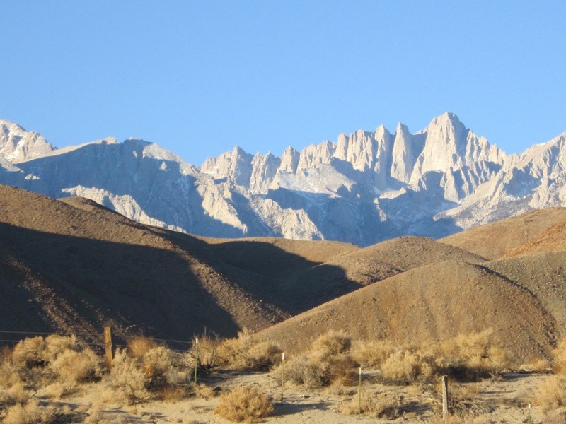
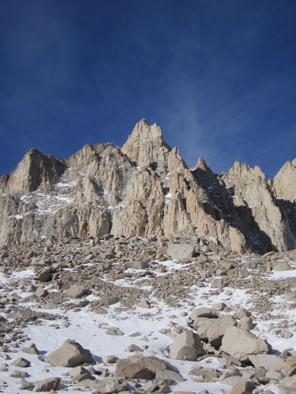
Next on my Cali 14er list was Mt. Muir, the eccentric little brother of its far more popular neighbor Mt. Whitney, which is the highest peak in the lower 49. For those unfamiliar, the Whitney skyline seen from the Owens Valley or the Alabama hills (made famous in all the Clint Eastwood cowboy flicks) is utterly jaw-dropping, with a serrated ridge of sheer spires of gleaming white granite thrusting into the dry eastern California air. Whitney is obviously king, but another of these spires also catches the eye- Muir, named after the mythical conservationist and founder of the Sierra Club. It is a great peak worthy of the person it takes its name from.
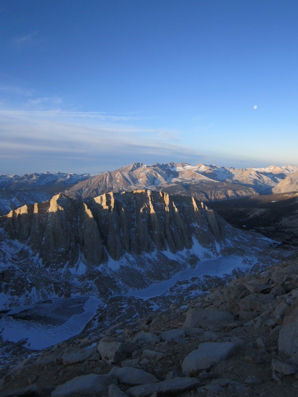
the Whitney Crest, with Mt. Muir just left of center
mt. whitney rises up above the Alabama Hills
Muir is accessed from Whitney Portal trailhead at 8,300 feet, which looms above the town of Lone Pine in the otherwise deserted Owens Valley. Because Whitney is the highest peak in the land, it is quite a popular peak, made more so by the fact that despite its fearsome east face persona, Whitney's west face is just a simple class 1 stroll via a good trail (well, not simple, as it is still a 6,200 vertical foot, 22 mile round trip endeavor). Due to the sheer masses of people looking to tag Whitney, the Forest Service has implemented a permit system to manage the all the people and their affect on the land, and getting one of these permits is a hard thing to come by. Nowadays one must reserve their spot months in advance. It can be like climbing Bierstadt on a holiday weekend in summer. Having done that, it is not the most preferred way of climbing any peak, let alone Whitney and Muir. So why not climb it in a winter where there is no snow AND no people, to enjoy the majesty of this part of the Sierra in solitude? Yes, thank you, I think I will.
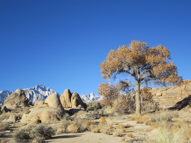
So I left Tahoe and drove the 395 highway south towards Bishop. Honestly, is there a more spectacular drive in the country than 395 alongside the eastern Sierra? Maybe the San Juan Skyway from Durango to Telluride, or Hwy 12 from Capitol Reef National Park to Bryce Canyon N.P. in Utah. Truth is, 395 passes Yosemite, Mono Lake, Sawtooth Ridge in Bridgeport, Mammoth Mountain and the broken teeth of the Minarets before dropping down to the desert floor of the Owens Valley and the peaks that put the 'high' in the High Sierra- the Palisades, Sill, Split, Williamson, White Mountain, Whitney, Muir and Langely, totaling 14 14ers visible from 395 within an hour's drive of Bishop. I stopped in Mammoth Lakes for dinner and the lack of snow covering its wide upper bowls was indeed shocking. Is this really mid-January?
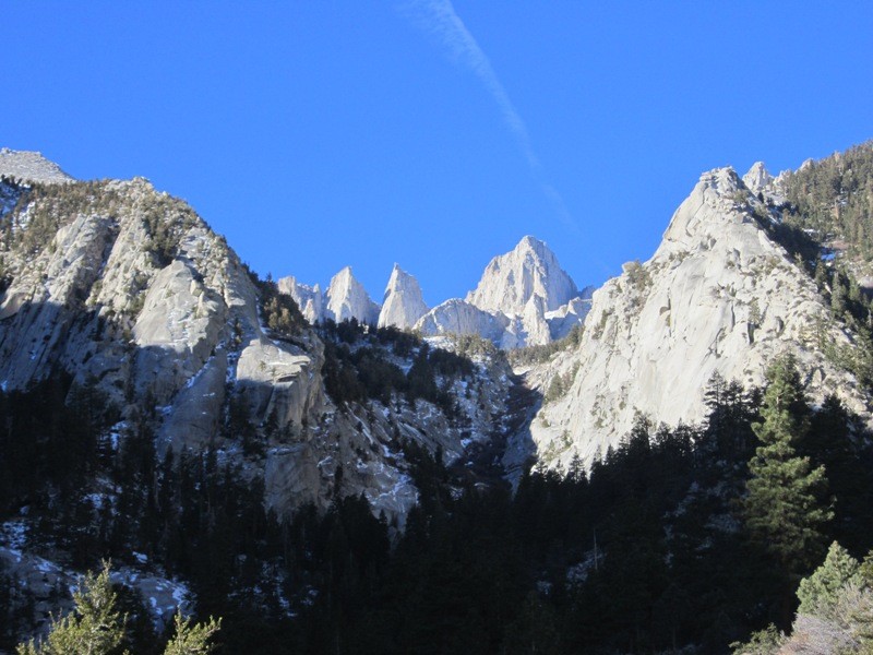
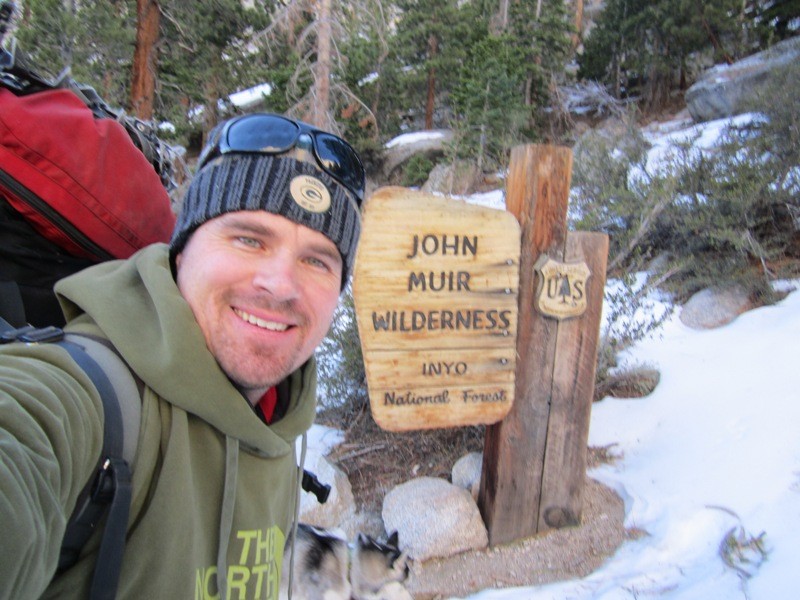
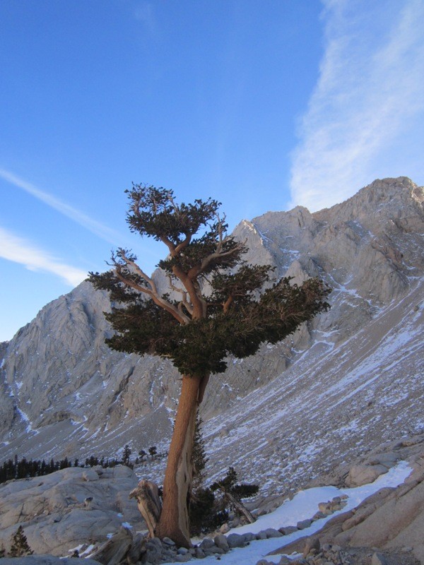
Getting to Lone Pine after dark, I threw my tent up near Manzinar, the old Japanese internment camp of World War 2, under the bright California firmament. The next morning dawned chilly and sunny...ho hum, just another such day this winter in the Sierra's. I went to the forest service office to get my backcountry permit in Lone Pine and my car was the only one in the parking lot. When I jokingly asked the ranger if there were any permits available, he gave me a quizzical look and informed me that I would be the only backcountry camper out there this night. It was a crazy thought, knowing that I would be the only person in the ever-popular Whitney Zone whereas five months from now it would be a human zoo up there. With permit in hand, I began the drive up to Whitney Portal. At the trailhead, there were just a few Forest Service vehicles there removing many downed trees from a fierce wind storm a month ago. The spires of Whitney, Keeler Needle and Day Needle loomed overhead, and it was exciting to be there. This part of the Sierra (along with the nearby Palisades) belongs in the great alpine kingdoms of North America.
Day Needle, Keeler Needle and Whitney, from the trailhead me entering the wilderness
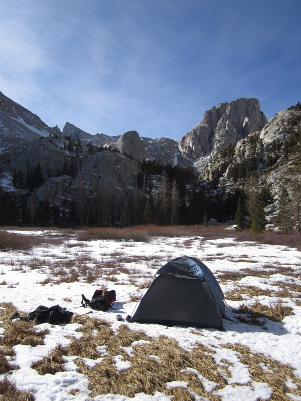
A few thousand feet later I arrived to a desolate Outpost camp. The calendar said winter, but again it might have been October. Warm days and cold nights, with only a smattering of snow here and there. I pitched my tent at 10,300 feet on the thin snow covering the willows of Bighorn Park in the sun amidst the surrounding shadows. I knew it was going to be a frigid night, and I wanted to capture as much sunlight as possible.
my tent at Outpost Camp, with Wotan's Throne overhead
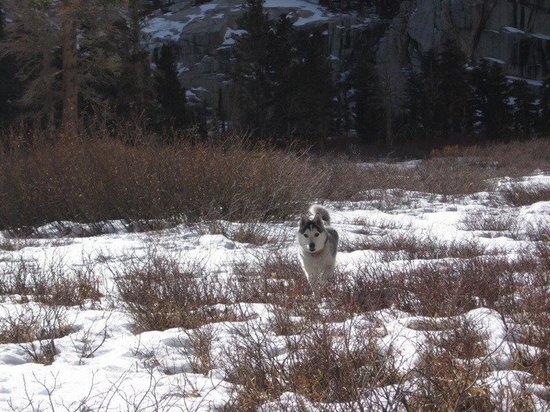
I had passed just one person on my hike up- an Irishman coming down, miserable. He told me that he had suffered through a very cold night and since he had come strait from San Francisco, he was altitude sick and thus was in no condition to climb any of the high peaks. He just wanted out of there, as fast as possible. By 4pm the water in my dog's bowl had turned to ice, and by 6pm I was curled up in my bag, shivering. Once the sun passed over the Sierra Crest, all semblance of warmth left the eastern Sierra, replaced by bone chilling cold. It turns out that my 20 degree rated sleeping bag couldn't keep out the 8 degree temperatures, and I as well suffered throughout the night. I kept drifting off to sleep thinking I was getting some good snooze time, but every check of my watch would reveal that I only dozed off for 20 or 35 minute intervals. I just wasn't getting any good sleep due to the cold. Even my husky was shivering. So at 2:30am I got up, warmed my toes with my hands and then stuffed my feet into stiff leather boots and hit the trail under the full moon.
Koya runs through the meadows
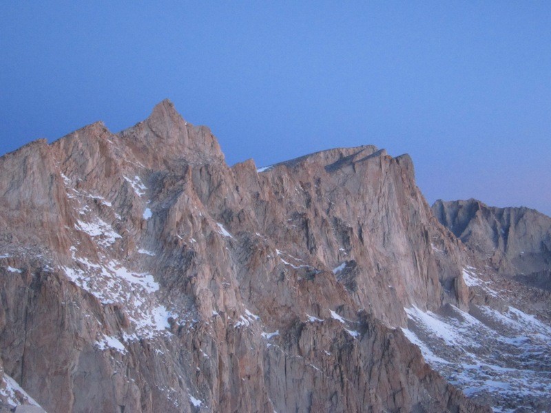
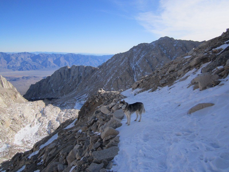
I couldn't feel my toes for awhile and wiggled them with each step. I thought I might have to turn back and get into my not-so-warm bag, but luckily I felt the sting in my toes as the warm blood rushed in. I hit the dreaded 99 switchbacks a few hours later and it was a monochrome scene in the light of the moon. Mt. Muir and Whitney's mighty east faces were right there in front of me. I was hoping the sunrise would light up the switchbacks, but I was hiking too fast and I had to negotiate the packed snow-covered switchbacks in the faint light of the moon. Finally as I reached Trail Crest at 13,600 feet, the orange glow of sunrise appeared over the many Great Basin Ranges in Nevada to the east. It was cold up there!
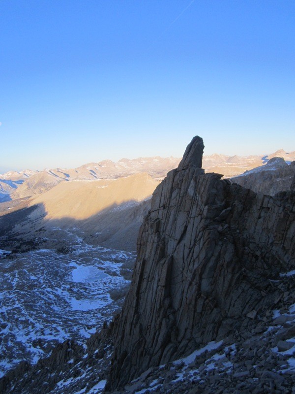
Mt. Muir (at left) at first light of day, as seen from near Trail Crest
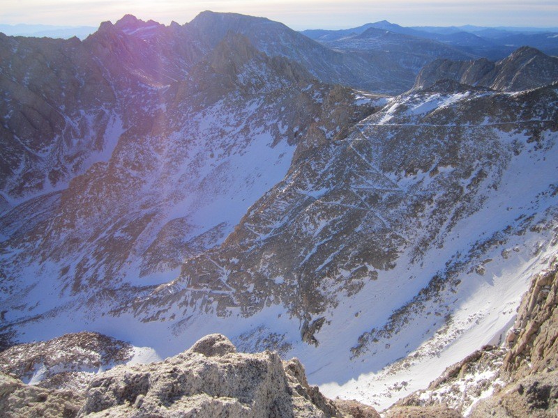
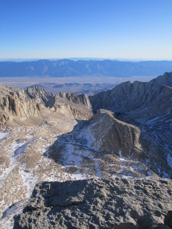
All the lakes to the west in Sequoia National Park were frozen shut, as was Consultation Lake that I had passed on my way up. The scenery up there was clichéd breath-taking. Again, I was glad to be there.
first light on the pinnacles above Hitchcock Lakes in Sequioa N.P., frozen
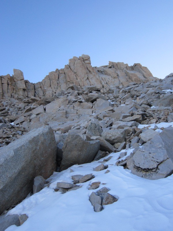
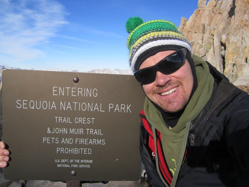
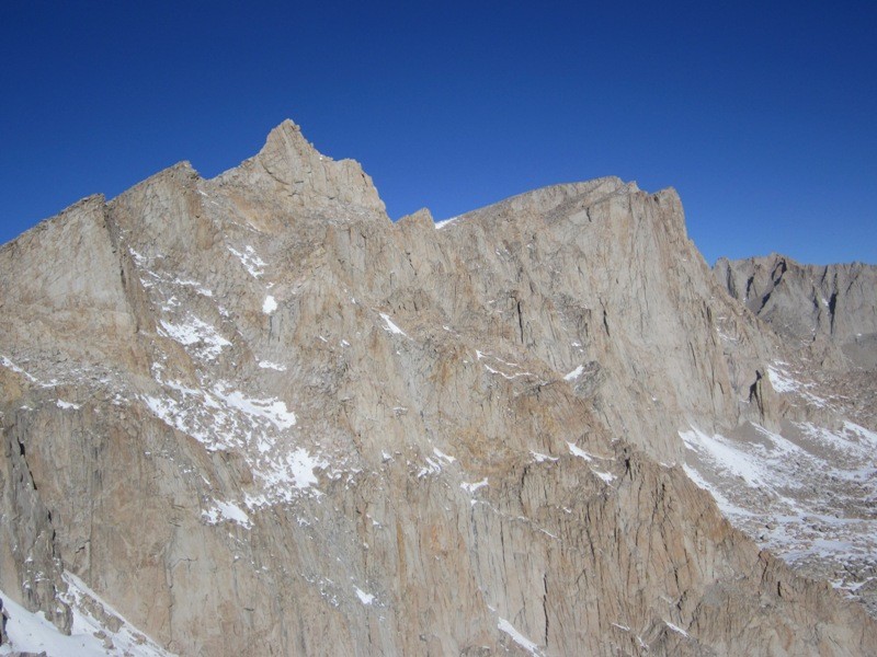
I joined the John Muir trail towards Whitney and stopped at the gully leading to the summit of Muir. Talk about a tale of two peaks. Muir's east face rises intimidatingly sheer strait up 2,000 feet in a mighty wall, whereas its west face is unspectacular and, dare I say, boring. Except for the last 50 feet, which is a class 3 headwall. Once that was scaled, Muir, at 14,015 feet, was under my boots and the views were to die for.
the summit headwall on the west face of Muir
The High Sierra's were bare and devoid of snow. No one will believe, years from now, that this was the scene up here in mid-January. It's just unbelievable, really. I was going to stroll another mile and a half to Whitney's summit (which I've climbed before), but I had a change of plans and decided to get back to camp and get down. I was not going to spend another night shivering my tail off up there. Not with a 20 degree bag. So that's what I did.
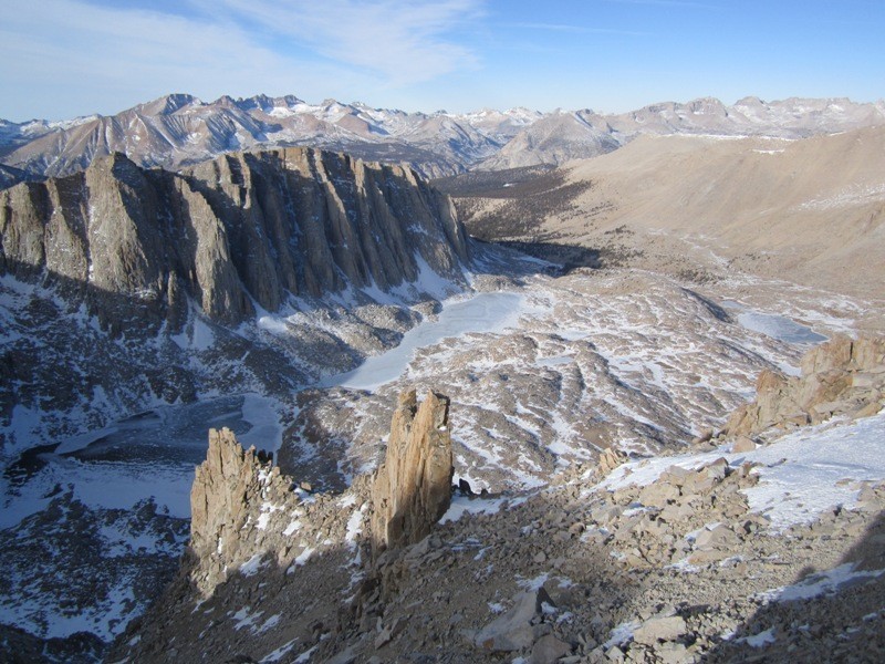
a pinnacle high above Guitar Lake in Sequioa N.P. looking to the 99 Switchbacks. Mt. Langley- 14,032 ft., is in distance, center Mt. Whitney, seen from Muir looking down to the Owens Valley and Lone Pine, 10,000 feet down, from the summit of Muir. Note the lack of snow for mid-Janu Hitchcock Lakes again yep! Mt. Muir at left, Whitney at right Koya on one of the 99 Switchbacks Mt. Muir's stunning east face
Thumbnails for uploaded photos (click to open slideshow):
Though there was no snow...it still looked like a great time. Congrats! I really want to visit Inyo...My wife and I waver between Utah and California this year from Texas. This report gets me excited and makes me lean towards this area!
Unreal. I was out that way in late June / early July last year and skied for 9 straight days. I almost don't even recognize the High Sierras without a coat of snow!
I was out in CA last week and the lack of snow was all over the news. Great climb, I wish I had more free time to take advantage too. Thanks for posting.
Caution: The information contained in this report may not be accurate and should not be the only resource used in preparation for your climb. Failure to have the necessary experience, physical conditioning, supplies or equipment can result in injury or death. 14ers.com and the author(s) of this report provide no warranties, either express or implied, that the information provided is accurate or reliable. By using the information provided, you agree to indemnify and hold harmless 14ers.com and the report author(s) with respect to any claims and demands against them, including any attorney fees and expenses. Please read the 14ers.com Safety and Disclaimer pages for more information.
Please respect private property: 14ers.com supports the rights of private landowners to determine how and by whom their land will be used. In Colorado, it is your responsibility to determine if land is private and to obtain the appropriate permission before entering the property.