Download Agreement, Release, and Acknowledgement of Risk:
You (the person requesting this file download) fully understand mountain climbing ("Activity") involves risks and dangers of serious bodily injury, including permanent disability, paralysis, and death ("Risks") and you fully accept and assume all such risks and all responsibility for losses, costs, and damages you incur as a result of your participation in this Activity.
You acknowledge that information in the file you have chosen to download may not be accurate and may contain errors. You agree to assume all risks when using this information and agree to release and discharge 14ers.com, 14ers Inc. and the author(s) of such information (collectively, the "Released Parties").
You hereby discharge the Released Parties from all damages, actions, claims and liabilities of any nature, specifically including, but not limited to, damages, actions, claims and liabilities arising from or related to the negligence of the Released Parties. You further agree to indemnify, hold harmless and defend 14ers.com, 14ers Inc. and each of the other Released Parties from and against any loss, damage, liability and expense, including costs and attorney fees, incurred by 14ers.com, 14ers Inc. or any of the other Released Parties as a result of you using information provided on the 14ers.com or 14ers Inc. websites.
You have read this agreement, fully understand its terms and intend it to be a complete and unconditional release of all liability to the greatest extent allowed by law and agree that if any portion of this agreement is held to be invalid the balance, notwithstanding, shall continue in full force and effect.
By clicking "OK" you agree to these terms. If you DO NOT agree, click "Cancel"...
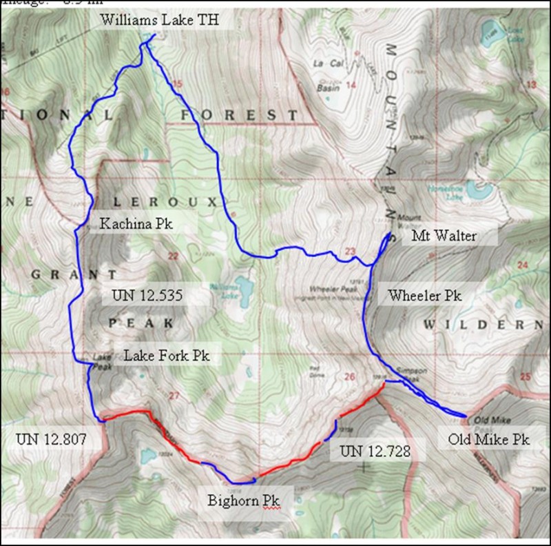
Peaks Climbed (in order):
Kachina Peak
UN 12,535
Lake Fork Peak
UN 12,807
Bighorn Peak
UN 12,728
Simpson Peak
Old Mike Peak
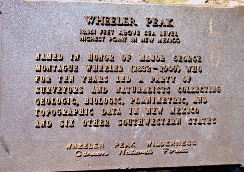
Wheeler Peak
Mount Walter
TH: Williams Lake Trailhead (south on dirt road from Taos Ski Valley)
Mileage: ~9.25 mi RT
Elevation Gain: ~5,100'
YDS: Class 2 with three short class 3 sections
Date Climbed: June 25th, 2011
Beta Credit: Strudolyubov (SP), Barry Raven
Boring Introductory Stuff
First, I apologize for the lateness of this report; however, I figured it was a rare enough route to warrant posting. In addition, it provided an opportunity to finally contribute a report void of epilepsy, rockfall, SAR, and helicopters (more boring stuff, anyways). Second, I didn't feel like messing with image size requirements so I just scaled them all down.
Upon graduation in May, I told my employer that if I didn't get field work, I would begin looking for a new job... They kindly sent me to Trinidad.
Trinidad wasn't all that bad in that I met a rather wonderful young lady. However, a quick stop at the local Wal-Mart confirmed a certain surgery reputation I took lightly. Needless to say, I was rather happy when they sent me to Red River to work on a far more interesting project. I found myself with a bit of free time at the conclusion of the project and decided to hike Wheeler Peak. Luckily, Barry Raven's post on a current thread saved me from crowded class 2 tediousness. I headed south to Taos, swung east, and found myself at the ski resort: an empty, deserted place void of even Texans. A quick bite at the highly recommended Stray Dog Cantina, a nap at the Bull of the Woods TH (No car-camping allowed up higher), and I began hiking at the pre-monsoon hour of 5:45 AM.
The Route
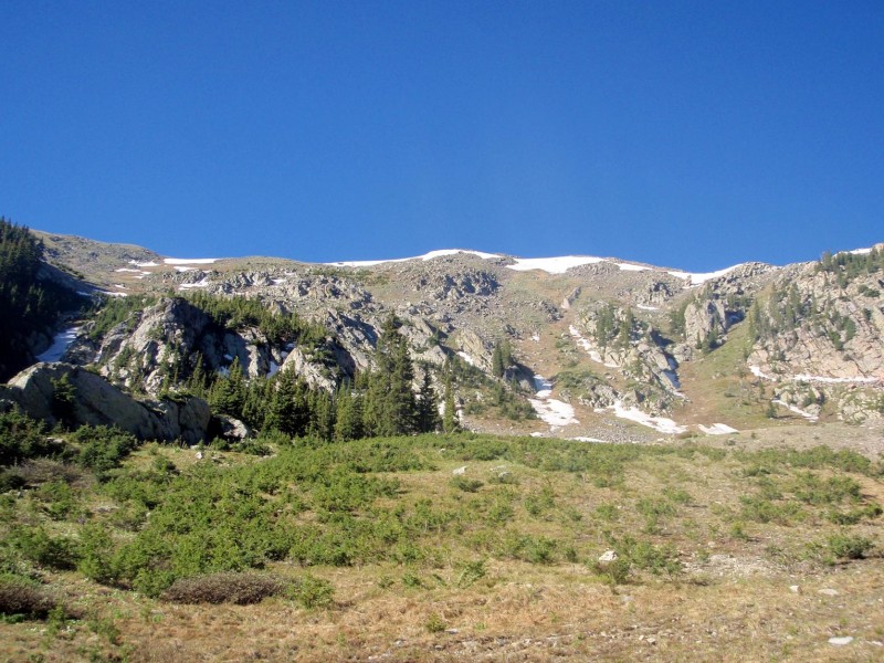
From the Williams Lake Trailhead, promptly leave the trail after the Phoenix Grill and follow a dirt road ("Lower Patton" ski run) zig-zagging beneath the Kachina Lift (#4). If you are unsure of your route, simply head straight up beneath the lift. At the top of the lift (Hunziker Bowl), you are confronted with forested steep walls split by couloirs:
Curl west around the rocky knoll center-left and head straight up the couloir ("Main Street") to Kachina's summit ridge. If you're lucky, you may come across lonely, abandoned skis - back away slowly from those dangerous creatures.
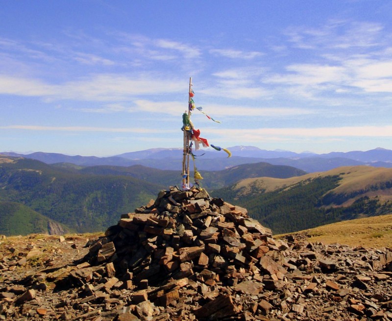
The decorative summit of Kachina awaits you shortly after gaining the ridge:
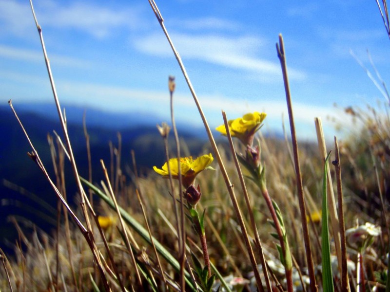
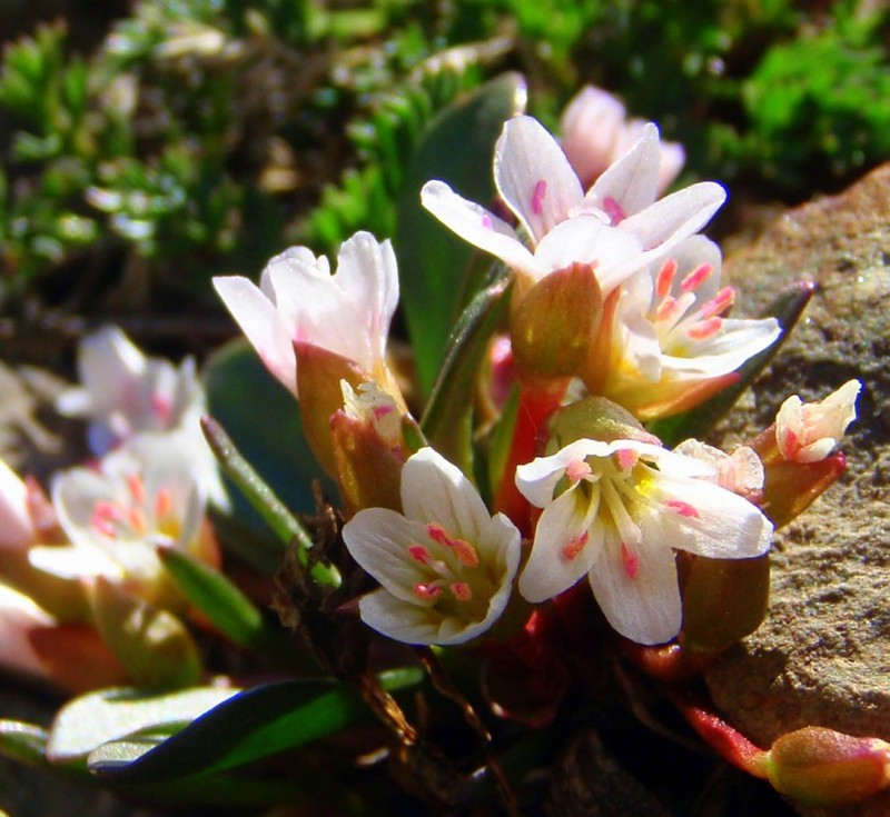
Along with a plethora of flowers reaching for the caress of summer:
From Kachina, continue south on the ridge until you reach UN 12,535's North headwall - bypass it on the flagged trail heading right/west before regaining the ridge.
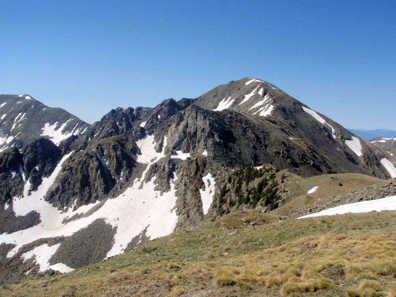
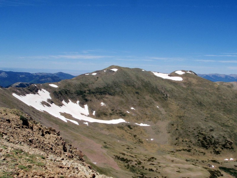
View of UN 12,535 and Lake Fork from Kachina:
A simple class 2 ridge will bring you to Lake Fork Peak, where one may become dis-heartened by the remaining distance and jagged ridge-lines laid out before them. As is common, the cruxes are easier than they appear.
Follow the ridge south to UN 12,807 and contemplate the first of three class 3 ridges. Class 2+ bypasses are available on the right, but where's the fun in that? This section, the easiest, leads to Bighorn Peak:
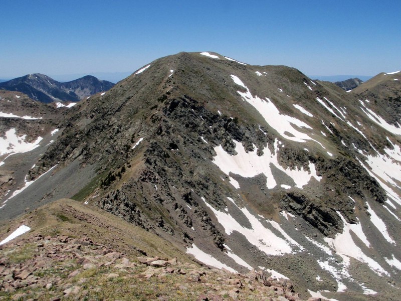
The true summit is slightly hard to determine - just hit them both. From Bighorn, gaze NE at Wheeler (left) and Old Mike (right):
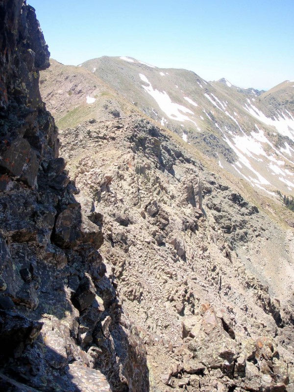
Below is looking back at the second ridge crux between Bighorn and UN 12,728. Again, the ridge itself is easy class 3 and 2+ bypasses exist on climber's right.
From UN 12,728 to Simpson peak, one is confronted by the technical crux, which also happens to be the most exposed and fun. Staying ridge proper yields interesting knife edge class 3+ options on moderate-quality rock reminiscent (although briefly) of Ellingwood Point's SW ridge. Venture to climber's left for San Juan-esque, hoodoo scrambling and good views of "y'all" type hikers gawking from the summit of Wheeler. Again, the weary may bypass on a faint trail climber's right (east).
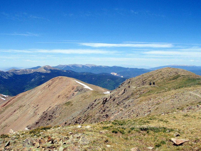
From the summit of Simpson, head east to Old Mike, where you may take a deep breath before immersing yourself in New Mexico's heavily-traveled, smaller Mt Elbert. Wheeler on left and Walter on right:
Finally, pay homage to the fierce peak guardians and claim your summits after a class 1 ridge walk:
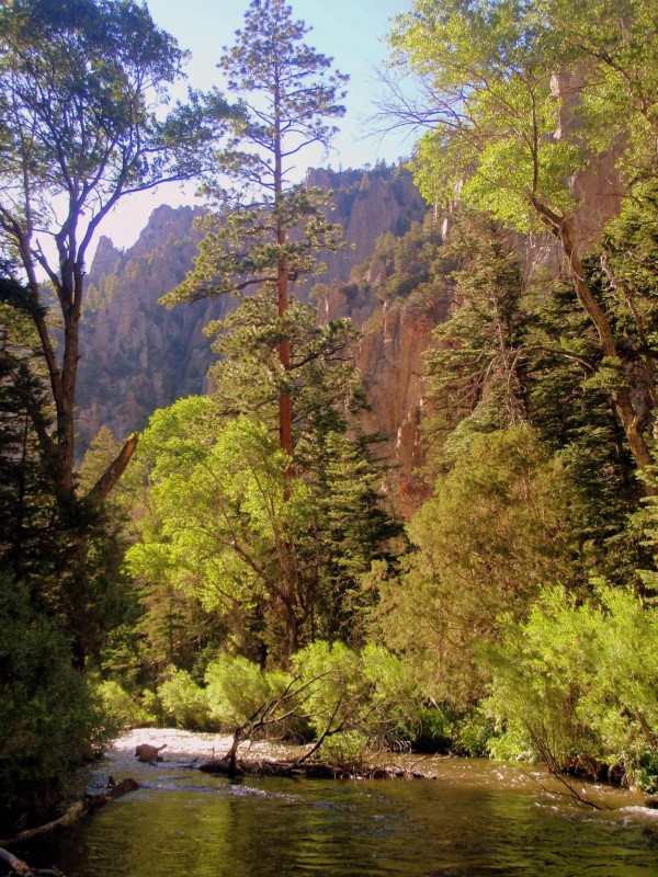
Descend the tolerable looseness west from the Wheeler-Walter saddle before rejoining the Williams Lake trail back to the trailhead. Better photographers than I may be able to take advantage of the rippling stream guiding the trail on home.
Lastly, I recommend taking the scenic route through Eagle's Nest and Cimarron back to Denver. Hope somebody finds this report helpful!
B: c2, R:c3
Thumbnails for uploaded photos (click to open slideshow):
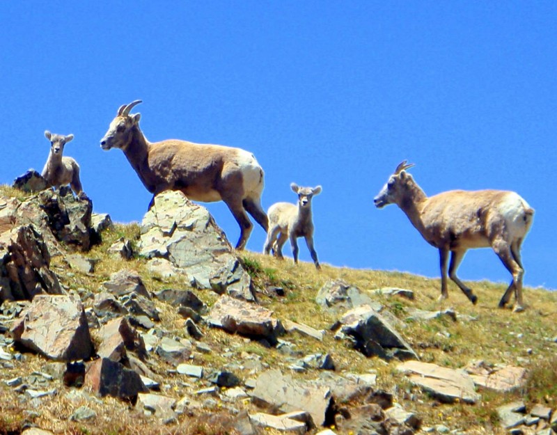
Which were more scary, the ”guardians” or the ”y'all type hikers?”
I've only been to Kachina in the winter, but Wheeler's worth hiking any time it's safe.
Thanks for a solid TR of a loop I hope to do some time.
Cool report Ryan. Don't know about you, but I was blown away by how similar NW New Mexico looks to SW CO. I would recommend Michael's Kitchen in Toas. Best damn breakfast burrito I've ever had.
Matt - definitely the guardians. The baby certainly gives off a ”don't mess” vibe.
FOTM - I'll have to check that place out! I was only able to drive through. Taos seems like a good place to explore.
Caution: The information contained in this report may not be accurate and should not be the only resource used in preparation for your climb. Failure to have the necessary experience, physical conditioning, supplies or equipment can result in injury or death. 14ers.com and the author(s) of this report provide no warranties, either express or implied, that the information provided is accurate or reliable. By using the information provided, you agree to indemnify and hold harmless 14ers.com and the report author(s) with respect to any claims and demands against them, including any attorney fees and expenses. Please read the 14ers.com Safety and Disclaimer pages for more information.
Please respect private property: 14ers.com supports the rights of private landowners to determine how and by whom their land will be used. In Colorado, it is your responsibility to determine if land is private and to obtain the appropriate permission before entering the property.