Download Agreement, Release, and Acknowledgement of Risk:
You (the person requesting this file download) fully understand mountain climbing ("Activity") involves risks and dangers of serious bodily injury, including permanent disability, paralysis, and death ("Risks") and you fully accept and assume all such risks and all responsibility for losses, costs, and damages you incur as a result of your participation in this Activity.
You acknowledge that information in the file you have chosen to download may not be accurate and may contain errors. You agree to assume all risks when using this information and agree to release and discharge 14ers.com, 14ers Inc. and the author(s) of such information (collectively, the "Released Parties").
You hereby discharge the Released Parties from all damages, actions, claims and liabilities of any nature, specifically including, but not limited to, damages, actions, claims and liabilities arising from or related to the negligence of the Released Parties. You further agree to indemnify, hold harmless and defend 14ers.com, 14ers Inc. and each of the other Released Parties from and against any loss, damage, liability and expense, including costs and attorney fees, incurred by 14ers.com, 14ers Inc. or any of the other Released Parties as a result of you using information provided on the 14ers.com or 14ers Inc. websites.
You have read this agreement, fully understand its terms and intend it to be a complete and unconditional release of all liability to the greatest extent allowed by law and agree that if any portion of this agreement is held to be invalid the balance, notwithstanding, shall continue in full force and effect.
By clicking "OK" you agree to these terms. If you DO NOT agree, click "Cancel"...
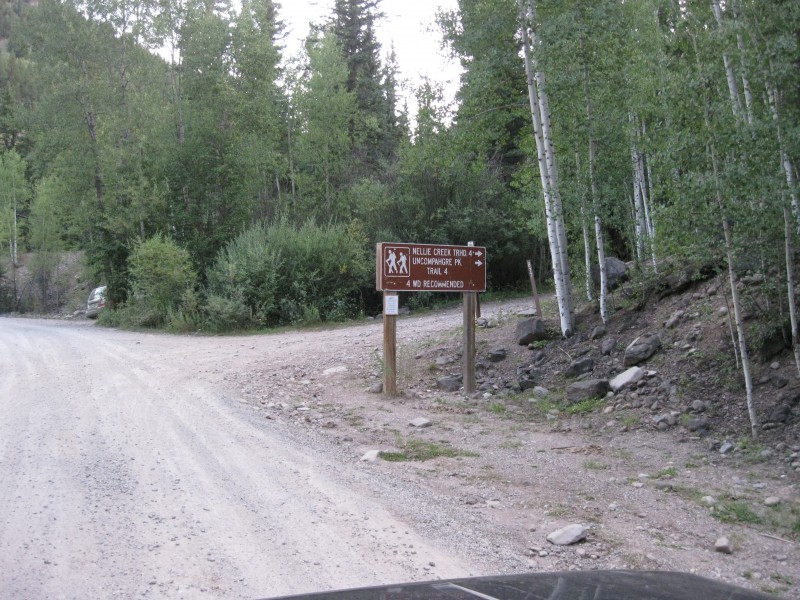
The agenda for Day 2 in the San Juans was to climb Uncompahgre Peak. I have to admit I saw this peak was class 2, so I briefly reviewed the route and put little effort into learning what it entailed. It seemed straightforward enough. The first challenge which I was already partially prepared for was called Nellie Creek Road. 4 miles, 2 creek crossings, 2000 ft of narrow, rough 4WD road. We have a 1998 Jeep Cherokee that handles this terrain fine, but I still don't like it. All in all, the Jeep handled it fine, but I can't help but continuously thinking: What if I break down? What if another car comes around the corner of one these steep, narrow sections? No problems, but still, for me I would rather climb and descend "the Staircase" of Wetterhorn 100 times than drive on that road. I'm just saying, it's not my cup of tea.
This Sign Just Makes Me Nervous
Nonetheless, we made it to Nellie Creek Trailhead by 7:30 and set out on our next 14er adventure. Uncompahgre Peak.
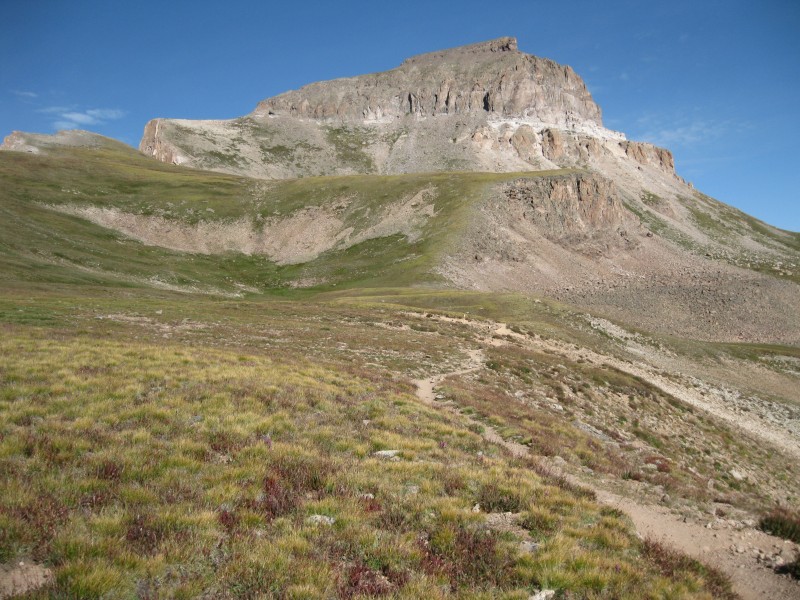
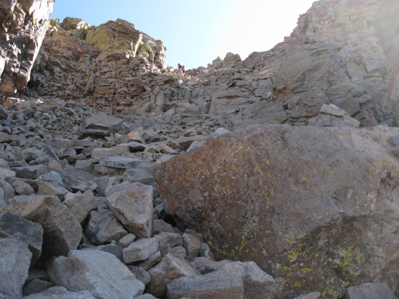
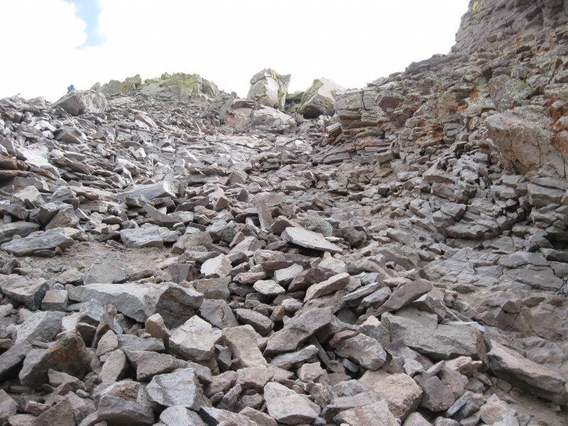
Not far into the hike on Nellie Creek, Uncompahgre soon comes into view. It looks like a fortress with cliffs on every side. I kept asking myself how this trail could take us to the summit without encountering those cliffs. As we soon found out, it really doesn't. You just take the easiest route through the cliffs. This was where I completely underestimated this mountain.
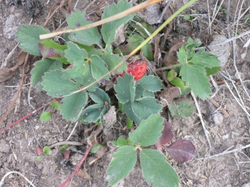
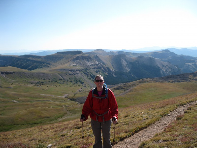
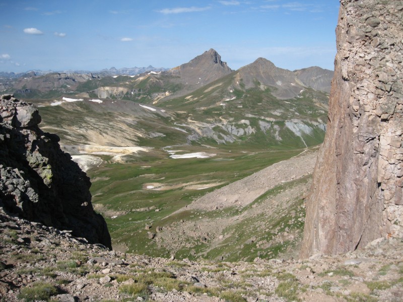
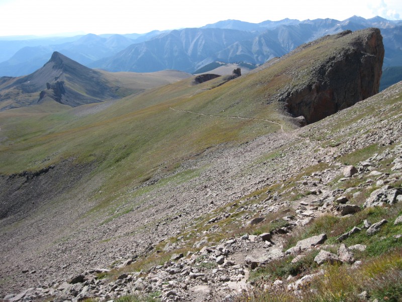
First Peak At Uncompahgre Wild Strawberries A Fortress of Cliffs Karren Excited About This Climb Wetterhorn and Matterhorn from Above the West Facing Cliffs The Trail Above the West Facing Cliffs
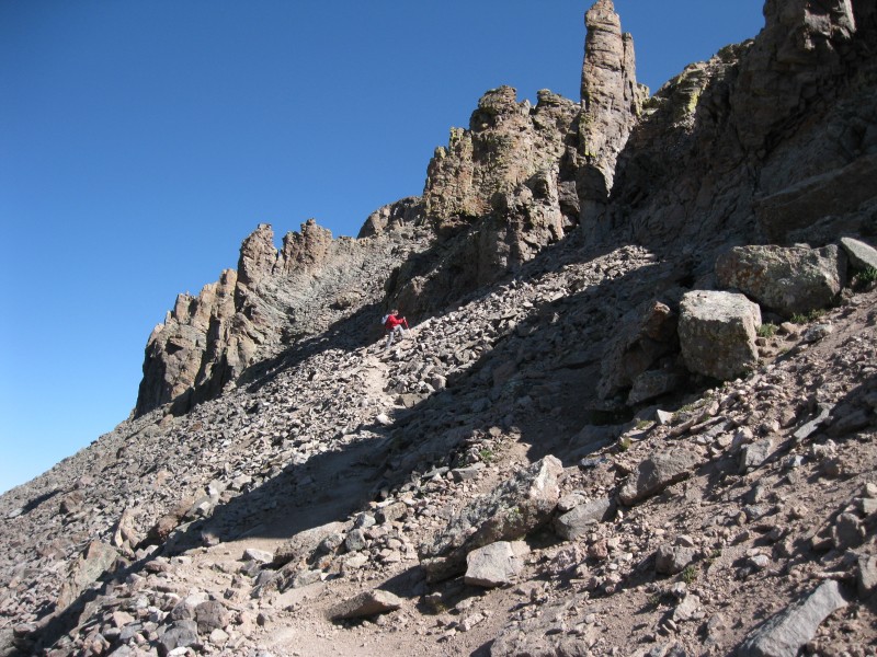
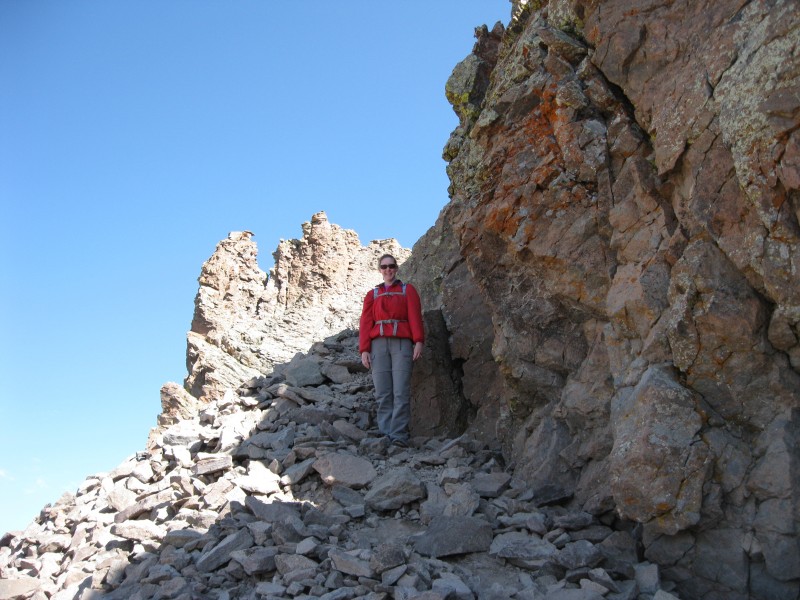
If you've read my previous reports, you know that my wife and my hiking partner, Karren, has been faced with Class 3 terrain twice and had decided that she didn't like it. Uncompahgre was supposed to be the easier class 2 hike that we could summit together. As it turns out, after you have climbed an easy trail above the cliffs on the west and then the south, you turn north to skirt the cliffs above on the southeast face. There are two routes up this. One is very steep, but the rock looks more stable. One is less steep (but still steep), but the rock is looser. After doing the second option, I would agree that the difficulty did not exceed difficult class 2. However, after taking a wrong path through some very loose rock, Karren quickly got scared and decided to bail on this peak also. She was pretty upset about not summiting Uncompahgre. I really blame myself for not studying the route better and taking her up the easiest, safest route. There's nothing I can do about that now.
Um...This Isn't Looking Easy That's Steep But Karren's Still Positive This Route Isn't Easy Either
I walked Karren down to a place where she could rest and quickly finished the ascent and got back down to her before we headed out.
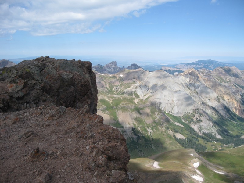
The Summit Is Within Sight Precipice and Dunsinane From the Summit Wetterhorn From the Summit Another Great View From the Summit Me on the Summit Did This Rock Just Fall Out of the Air
After a long drive down Nellie Creek Road, we headed back to Lake City and feasted at the SmoQue BBQ shack. Not the best BBQ I've ever had, but pretty good after a long day's hike. Add a few Coronas and fried okra and it soon became my Lake City favorite. We spent the last night at the Matterhorn Motel and headed back to C Springs Monday morning.
In summary, I loved our trip to the San Juans. I feel bad that Karren did not summit either peak, but we both had a great time. I expect that next time we make it back here for Redcloud, Sunshine, and Handies, she'll do just fine. In the meantime, I'm looking for a climbing partner to ascend the class 3 and eventually class 4 14ers. I'll also be looking for some adventures up class 3 13ers or other summits. I'm loving the climbing at this point .
Thumbnails for uploaded photos (click to open slideshow):
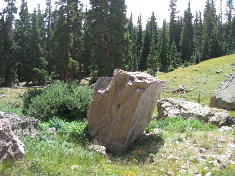
yeah it probably did fall out of the air. When I hiked it I ran into a guy who seemed fairly intelligent and said that it was an older volcano which is why you have the volcanic rock on that trail (swish cheese rock formations) and the weird half of earth looking shots like pic 7. If it is right or not, it made sense to me at the time.
I think we saw you two on the trail. I was up there with my 9-yr-old daughter on Sunday. Great road, isn't it? One of the worst approach roads I've been on so far. Glad you made it. Joe
Joe, I love to see kids getting out on these trails. Hope you guys had a great day. What a beautiful peak this one was. It almost made up for the road :wink: .
Caution: The information contained in this report may not be accurate and should not be the only resource used in preparation for your climb. Failure to have the necessary experience, physical conditioning, supplies or equipment can result in injury or death. 14ers.com and the author(s) of this report provide no warranties, either express or implied, that the information provided is accurate or reliable. By using the information provided, you agree to indemnify and hold harmless 14ers.com and the report author(s) with respect to any claims and demands against them, including any attorney fees and expenses. Please read the 14ers.com Safety and Disclaimer pages for more information.
Please respect private property: 14ers.com supports the rights of private landowners to determine how and by whom their land will be used. In Colorado, it is your responsibility to determine if land is private and to obtain the appropriate permission before entering the property.