| Report Type | Full |
| Peak(s) |
Mt. Sill - 14153 |
| Date Posted | 09/03/2011 |
| Date Climbed | 08/31/2011 |
| Author | hansolo35 |
| A Cali 14er |
|---|
|
Before I started going to Burning Man over Labor Day in 2006, it was a tradition of mine to go climb lofty peaks across the western U.S. over this holiday. It's a tradition that came to an end with Burning Man, but for one year I resurrected the tradition and went off this past week to climb another tall and mighty peak. I have climbed thirteen 14ers this summer, all in Colorado, and this week I went to climb another, this one in California. The objective was Mt. Sill, at 14,153 feet, the 6th highest peak in California. Sill is a mighty square block of granite towering above the jagged Palisade Crest, and it forms the southern guard tower of the magnificent North Palisade circuit of peaks whose great cirque cups the Sierra Nevada's largest glacier- the Palisade. This spectrum of wonderment is encompassed within the John Muir Wilderness, sandwiched betweenYosemite National Park to the north and Kings Canyon and Sequoia National Parks to the southwest. This part of the Sierra Nevada Range is truly a spectacular gem and should be included amongst the great alpine regions in America, similar in scale and scope to the Tetons and Rainier. Mt. Sill towers a whopping 10,000 feet over the town of Big Pine, its access point, and as is the case with all of California's 14ers, the vertical relief from trailhead to summit is long and hard, more so than Colorado's 14ers. For an ascent of Sill, you are looking at 6,400 vertical feet of elevation gain over 10 miles.  The trail starts at Glacier Lodge at 7,800 feet and passes through some of the best scenery that the Sierra has to offer. After five miles of traversing across hot barren slopes filled with sagebrush and cactus, the trail enters the alpine zone at First Lake at 10,000 feet. First Lake is one of seven lakes that sit in the large basin near the head of Big Pine Creek, with the towering pinnacles and flying buttresses of Temple Crag looming large on the lake's southern shore. In fact, Temple Crag presides over Second and Third lakes as well, and to see it is exasperating. As its name implies, Temple Crag is a place of sacred beauty and to be here in this spiritual place leaves you feeling humbled. 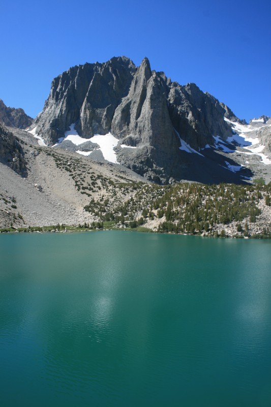 I made camp at the outlet of Third Lake and spent the rest of the day relaxing, mentally preparing myself for the big day that I knew loomed ahead tomorrow. When the sun went down it grew very dark out with no moon, which made the stars brilliant but the sounds of the forest were scary. I was paranoid about bears, as I had forgot to pack a rope to hang my food, and I didn't sleep very well. The following morning dawned and I was on the trail by 7am, up towards Sam Mack Meadows and the heights beyond. I got to the meadows after an hour and 1,000 vertical feet of altitude gain and when I got there, it was one of the prettiest alpine scenes that I've ever seen. A shallow river ran straight thru the green grass, sprinkled with boulders, boxed in by granite walls with towering 14,000 foot peaks stabbing the sky. It was marvelous! If I hadn't been here to climb a mountain, I would've just sat down on the grass and wiled away the day here in this mountain paradise. But I churned my way up the granite walls headed towards the Palisade Glacier moraine, which served as the launching point to Sill.  When I got there, a commanding sight presented itself, one that left my mouth agape. North Palisade sprung from the large glacier at its base up to 14,242 feet in a sheer rise, with several steep snow couloirs rising up either on its face or on the ridges surrounding it. One of these, the U Couloir, provides the standard approach to North Palisade. To the north of North Palisade rose two spires- the beautifully named Starlight and Thunderbolt Peaks, two more 14ers crowning the cirque. All three of these 14ers hold mandatory class 5 technical standard routes to attain their true summits. 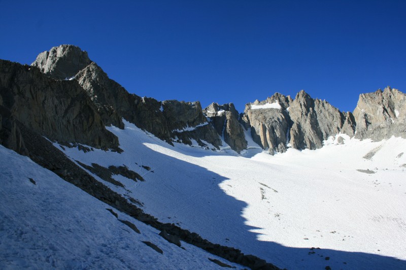 Anchoring the southern end of this breath-taking panorama was Sill itself, its blocky summit looking impenetrable but for two lines- the classic Swiss Arete and the aptly-named L Couloir, which was my route of choice. The Arete is rated 5.7 as it ascends Sills east ridge, while the L is an L-shaped body of snow rising underneath the arête. 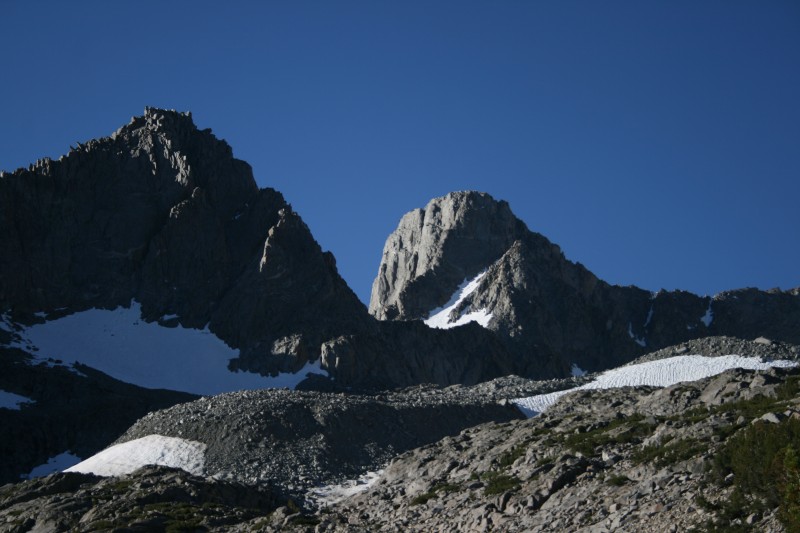 I strapped on crampons, pulled out my axe and made my way out onto the glacier where I ascended the still frozen surface up to the base of Sill. I had to take my spikes off and climb up a class 3 loose headwall to attain Glacier Notch at the base of the L Couloir. Back went on the crampons as I pounded my way up the 45 degree snow chute. When it ended, I was facing the crux of the climb- a very exposed class 4 climb up solid granite to gain the northern summit ridge. This was a true no-fall zone, similar to Capitol's knife-edge but more sheer. A fall would send you rolling down 1,500 vertical feet strait down to the glacier below. Fortunately the rock was solid with bomber holds and one had to put the airy exposure below out of mind as you made your way up. 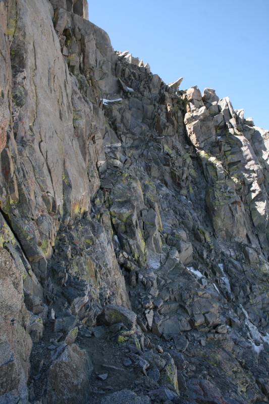 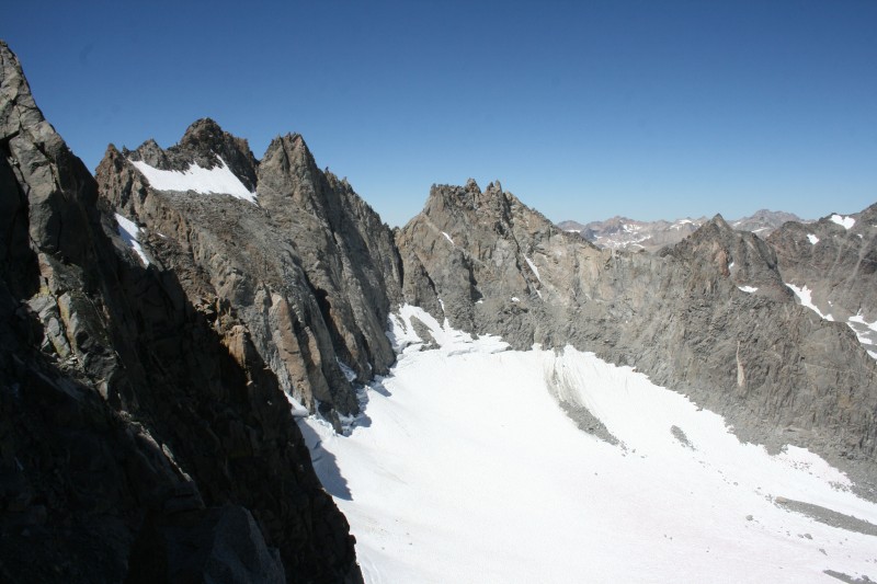 Once at the top of the ridge, the route-finding begins, as you have to navigate up thru cliffs and sheer slabs. Somewhere thru here lies a class 3 route, but I was unable to locate it and instead had to do more class 4 stem moves up chimneys before I finally attained the summit at noon. 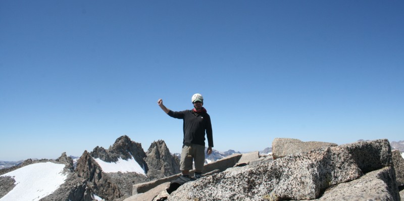 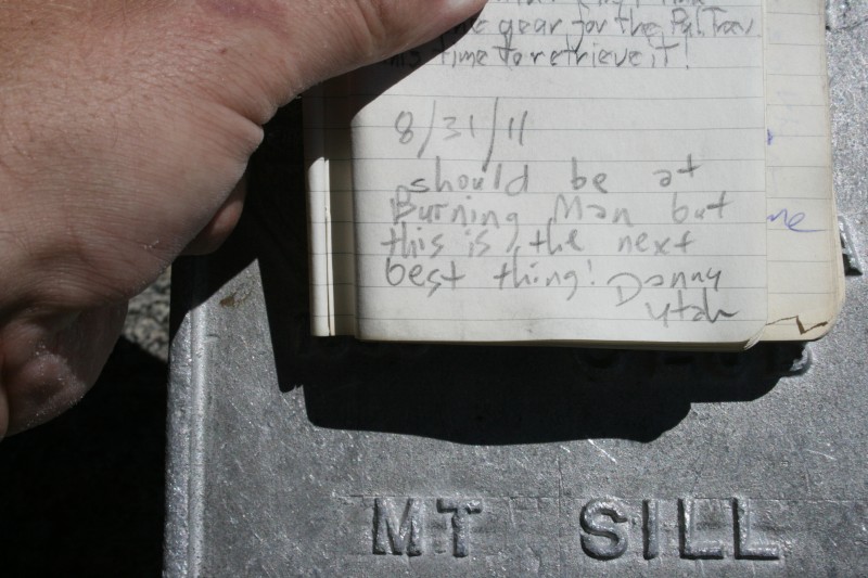 To be up there is to feel like a hawk soaring on the thermals. All of the southern Sierra could be seen from this airy perch, including Mt. Whitney, highest in the land. The town of Big Pine lay far below in the sweltering 100 degree heat of the Owens Valley, which is one of the deepest valleys in world, being walled in by 14,000 foot peaks on both sides with 10,000 vertical feet relief. Indeed, White Mountain Peak- 14,246 feet sat as a stodgy pile in the White Mountains on the other side of the valley. The jagged Palisade Crest ran north and south, and the views from Sill's summit are some of the best that I've ever beheld. 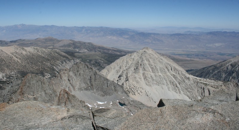 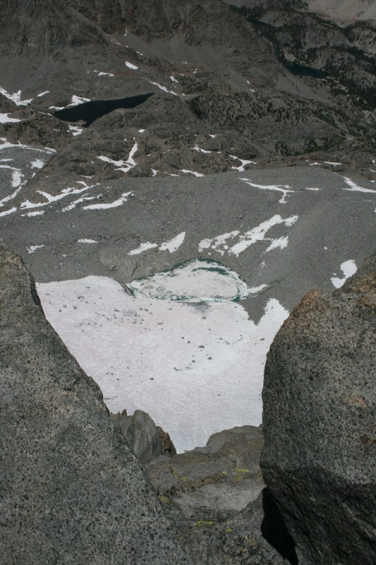 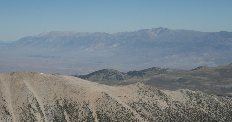 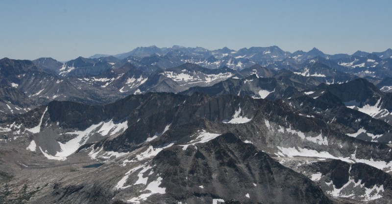 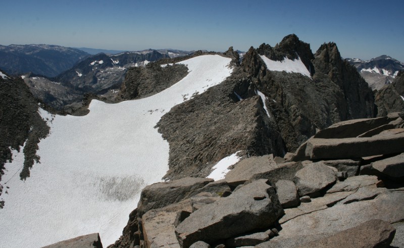 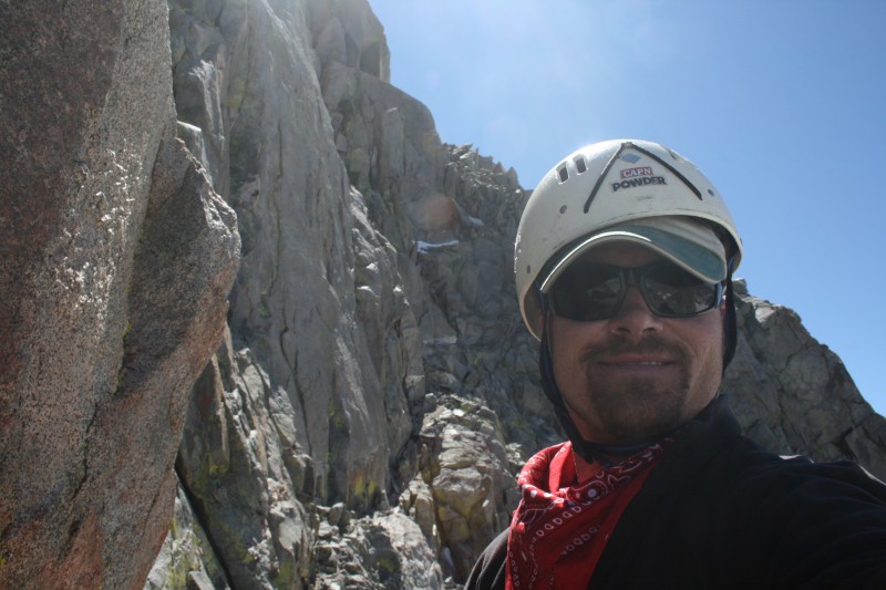 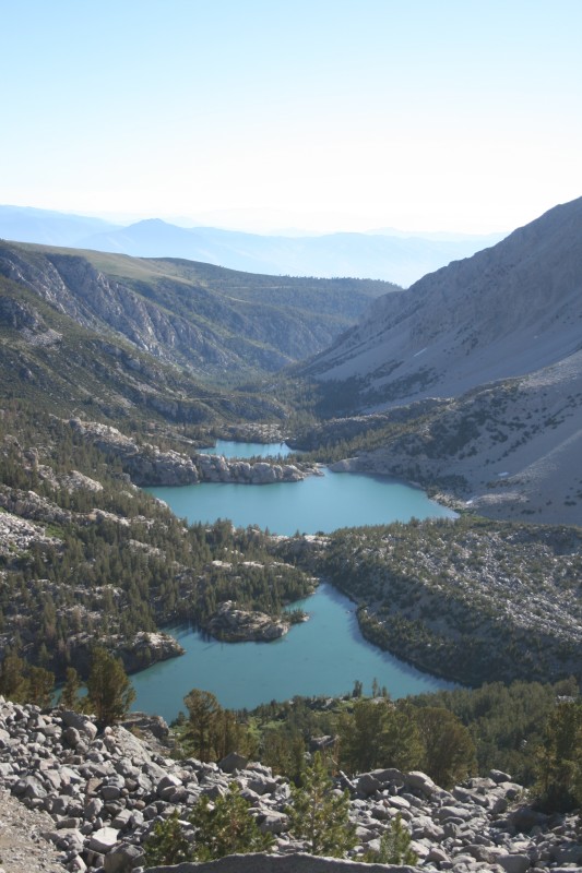 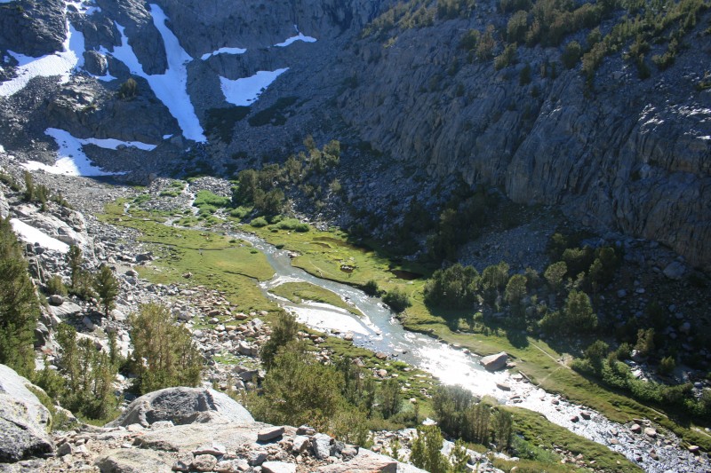  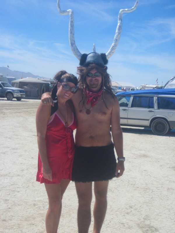 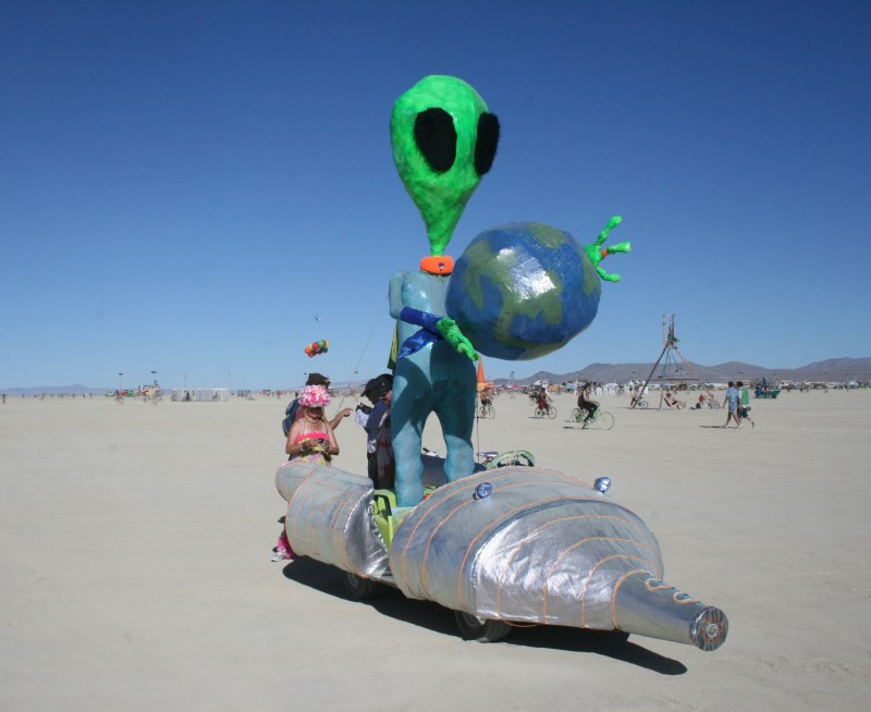 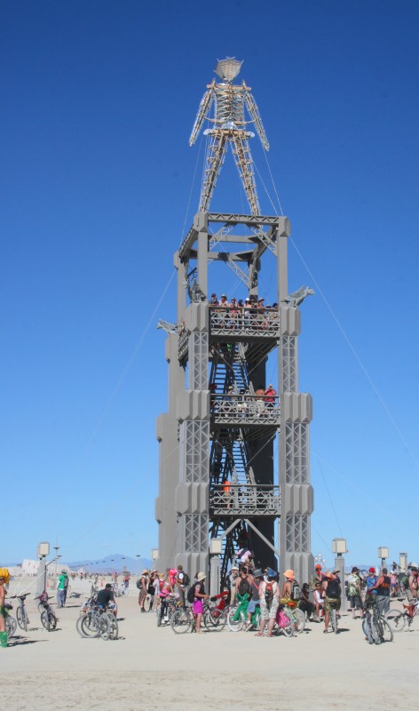 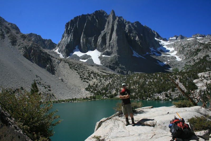 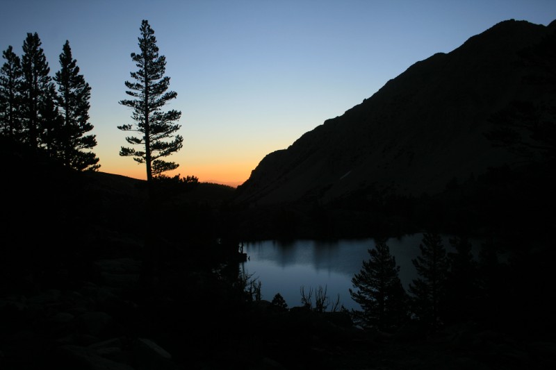 Thumbnails for uploaded photos (click to open slideshow):
|
| Comments or Questions | |||
|---|---|---|---|
|
Caution: The information contained in this report may not be accurate and should not be the only resource used in preparation for your climb. Failure to have the necessary experience, physical conditioning, supplies or equipment can result in injury or death. 14ers.com and the author(s) of this report provide no warranties, either express or implied, that the information provided is accurate or reliable. By using the information provided, you agree to indemnify and hold harmless 14ers.com and the report author(s) with respect to any claims and demands against them, including any attorney fees and expenses. Please read the 14ers.com Safety and Disclaimer pages for more information.
Please respect private property: 14ers.com supports the rights of private landowners to determine how and by whom their land will be used. In Colorado, it is your responsibility to determine if land is private and to obtain the appropriate permission before entering the property.


