| Report Type | Full |
| Peak(s) |
Mt. Sherman - 14,043 feet White Ridge - 13,698 feet |
| Date Posted | 09/01/2011 |
| Modified | 08/25/2015 |
| Date Climbed | 08/06/2011 |
| Author | HikerGuy |
| Sherman Solitude - East Ridge from Thompson Park |
|---|
Sherman Solitude - East Ridge from Thompson ParkEvery 14er is special, either especially beautiful and/or challenging, or especially forgettable. If the latter, I like to find an alternative route that makes it less forgettable. Outside of winter, Sherman can be forgettable. Extremely crowded, not much elevation gain, extremely crowded, and windy. Except for the last issue, this route solves these problems and provides a wonderful hike above the crowds with elk as your only climbing companions. I hiked this solo, but it was a weekend camping trip with my wife and the dogs. So this was a camping trip first with a 14er hike added, keeps everybody happy! I drove out not knowing if we would find a suitable site along the forest road out of Thompson Park. I am going to try and describe the camping options at this trailhead as best as possible. While this website has an incredible wealth of route beta, I find it difficult to find information on dispersed camping options near trailheads. If you frequently camp prior to hiking, this information can be just as important when choosing a trailhead/route. From Fairplay, drive just over a mile south on U.S. 285 and turn right onto County Road 18 (aka 4 Mile Creek Rd). About a mile down the road, you can continue straight on 4 Mile Creek Rd or turn right and follow directions to Thompson Park through the adjacent neighborhood. I recommend going through the neighborhood as it is shorter/smoother and eliminates FR 18.2B, which is bit narrow and rough. We drove up the tougher way looking for potential camping sites along the way and drove out the easier route. The route through the neighborhood is very will signed. The turn off for FR 18.2B is on the right in a clearing just past the Horseshoe Campground. It is signed with one of those brown plastic strip markers, hard to see. The road crosses the clearing and turns sharply to the right up a ridge. There are two camping sites on FR 18.2B between the Horseshoe Campground and the intersection of FR 18.2B an FR 423, which is marked as the trailhead in Roach's 2nd edition 14er book. Both of these sites are on/near the apex of the road. The site on the east side of the road looked very appealing, with views to the East, but we wanted to get as close as possible. FYI, I was driving a 2011 Hyundai Santa Fe. It was about as much road as I wanted to handle (new vehicle), but mainly because of the crappy low-profile highway tires. I'm a bit conservative, so it was probably not as bad as I recollect. 4WDs, Subarus, 2WD trucks, and SUVs with decent clearance should have no problem. I would not take a 2WD car up this road. Turn left at the junction of FR 18.2B and FR 423. For those with a large group or 2WD vehicles, there is a nice campsite in Thompson Park proper, closer to the intersection vs. exit from neighborhood. As we drove up FR 423 towards the Sacramento ghost town, we grew increasingly concerned we would not find a suitable camping site. I don't believe we passed any worthy/practical sites before we found the site we settled on. The image below includes the coordinates of our camp. The site was located along the road, but was perfect. Large, level, nice grassy area, established fire ring, and plenty of supplemental firewood. After stopping here, I walked further up the road and saw one/two other sites, but not nearly as good and the road became progressively worse and narrow.  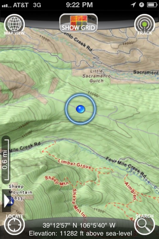 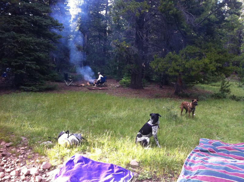 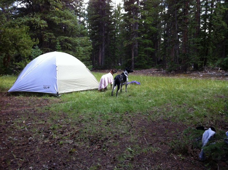 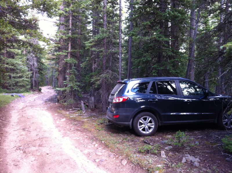 I got a later start than expected. The dogs were up and out of the tent every hour during the night, something they ate I guess. I started out around 8 AM, bluebird day. The first portion of the hike is along the 4WD road. If you have Roach's 2nd edition book, the route he describes is no longer valid as it crosses private property. You must continue straight up the main 4wd road versus turning right towards the old Sacramento town site and over Point 12,032. Leave the road once you clear the stream on the right and head towards White Ridge. No route finding issues at all except weaving around the low scrub pines and willows before heading up the ridge. Rather than describe the straightforward route, I added captions to photos taken along the hike. Enjoy! 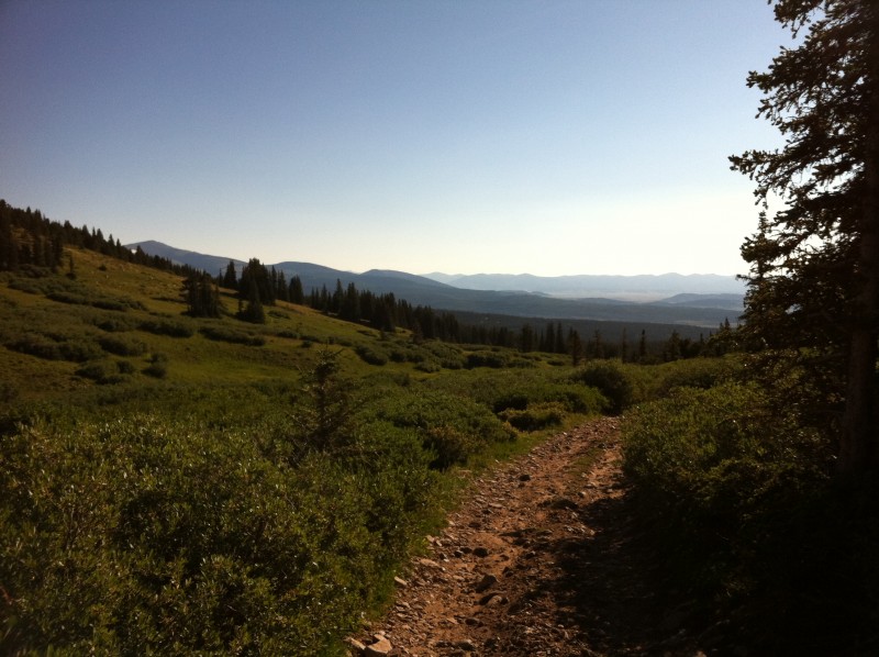 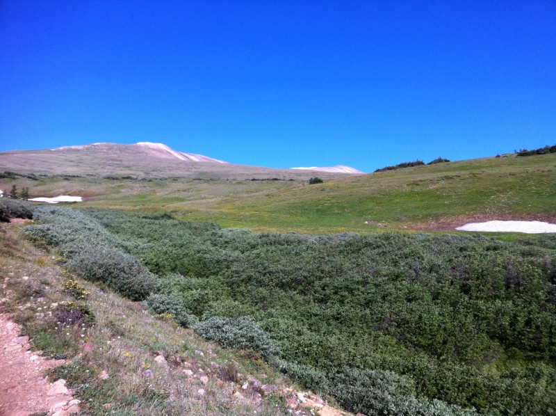 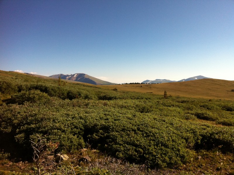  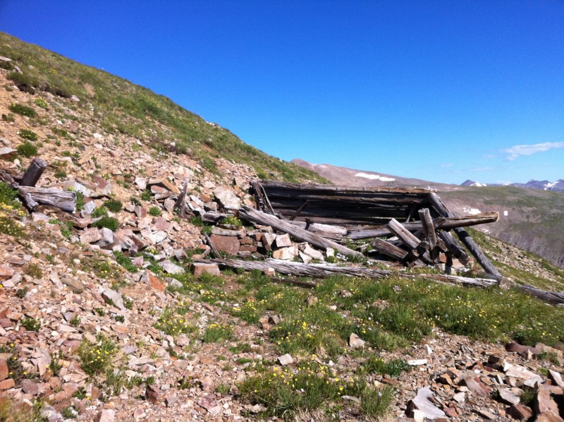 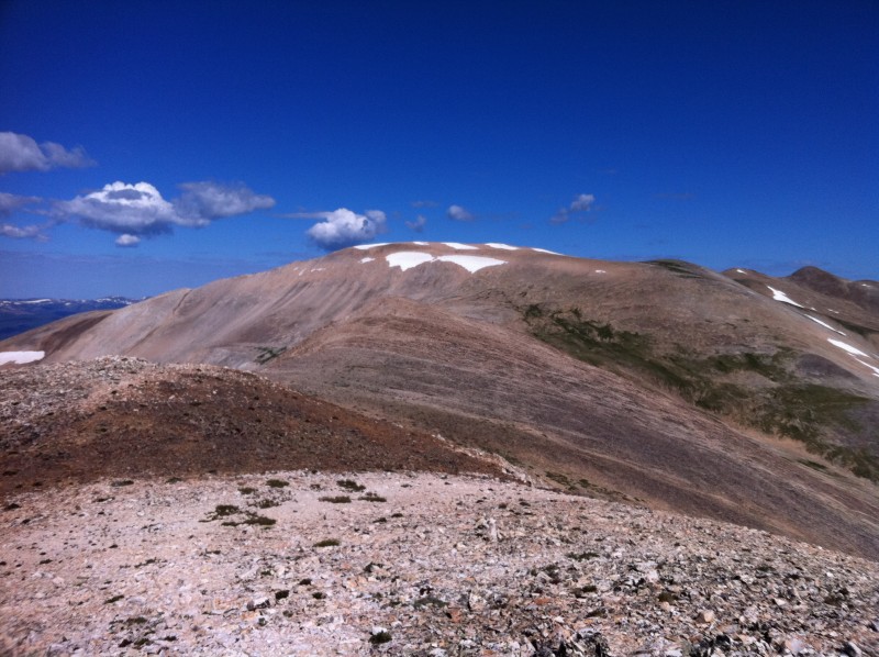   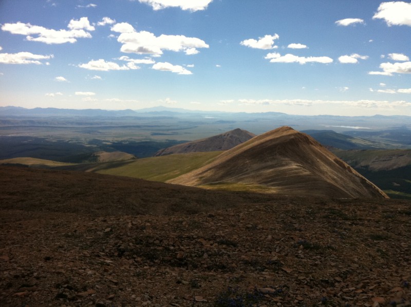 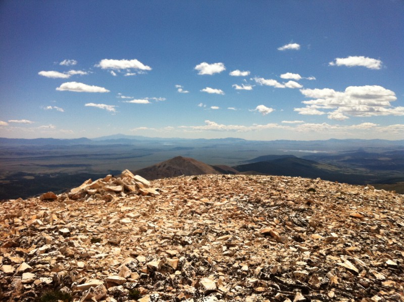 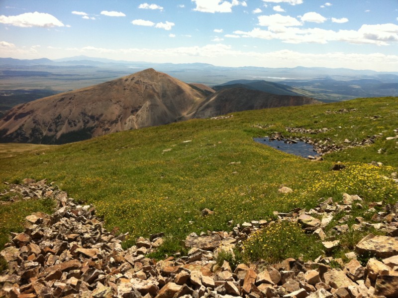  I wouldn't have seen a soul on this hike until the summit, except for passing two couples in the saddle between White Ridge and Sherman. They were also trying to escape the sea of humanity atop Sherman. It took me 3 hours up and 2 hours down. This was a great hike and even better campsite. Only two hikers and about a half dozen ATVs passed by us during our 2-night, 3-day stay. No other vehicles. And if you are the type that needs to be connected while feeling like you are in the middle of nowhere, we had exceptional 3G service (AT&T). Thumbnails for uploaded photos (click to open slideshow):
|
| Comments or Questions | |||||||||
|---|---|---|---|---|---|---|---|---|---|
|
Caution: The information contained in this report may not be accurate and should not be the only resource used in preparation for your climb. Failure to have the necessary experience, physical conditioning, supplies or equipment can result in injury or death. 14ers.com and the author(s) of this report provide no warranties, either express or implied, that the information provided is accurate or reliable. By using the information provided, you agree to indemnify and hold harmless 14ers.com and the report author(s) with respect to any claims and demands against them, including any attorney fees and expenses. Please read the 14ers.com Safety and Disclaimer pages for more information.
Please respect private property: 14ers.com supports the rights of private landowners to determine how and by whom their land will be used. In Colorado, it is your responsibility to determine if land is private and to obtain the appropriate permission before entering the property.


