Download Agreement, Release, and Acknowledgement of Risk:
You (the person requesting this file download) fully understand mountain climbing ("Activity") involves risks and dangers of serious bodily injury, including permanent disability, paralysis, and death ("Risks") and you fully accept and assume all such risks and all responsibility for losses, costs, and damages you incur as a result of your participation in this Activity.
You acknowledge that information in the file you have chosen to download may not be accurate and may contain errors. You agree to assume all risks when using this information and agree to release and discharge 14ers.com, 14ers Inc. and the author(s) of such information (collectively, the "Released Parties").
You hereby discharge the Released Parties from all damages, actions, claims and liabilities of any nature, specifically including, but not limited to, damages, actions, claims and liabilities arising from or related to the negligence of the Released Parties. You further agree to indemnify, hold harmless and defend 14ers.com, 14ers Inc. and each of the other Released Parties from and against any loss, damage, liability and expense, including costs and attorney fees, incurred by 14ers.com, 14ers Inc. or any of the other Released Parties as a result of you using information provided on the 14ers.com or 14ers Inc. websites.
You have read this agreement, fully understand its terms and intend it to be a complete and unconditional release of all liability to the greatest extent allowed by law and agree that if any portion of this agreement is held to be invalid the balance, notwithstanding, shall continue in full force and effect.
By clicking "OK" you agree to these terms. If you DO NOT agree, click "Cancel"...
Route: Campbell Creek up (no trail), Grizzly Gulch down
Mileage: 8
Elevation Gain: 3,717'
Partner: Solo
Having been 0.25 miles away from 13,795 on my last trip up Grizzly Gulch and Handies a few years ago, I wanted to find a way to the summit of this one. The nasty steep scree route that I ascended last time was not going to happen. I would go down it, just not up. With Campbell Creek Peak just down the ridge, I was wondering if I could string these two together and possibly add in Whitecross Mountain along the way (another I missed in my Tour de'Handies).
Only Furthermore had a TR for these two, and mentions the ridge proper went to class 5. I was undeterred, I would find a way. Even if it meant dropping some elevation to do it. So with a few days planned in the San Juans, I head up the road to Grizzly Gulch to check out my options.
Once at the trailhead, there are only 3 other solo vehicles in attendance, not bad for a Wed night. First part of the decision tree on this one is to bushwhack on the west of the stream or to walk the road and cross the stream. I decide to drive down and test out the stream crossing options. Next to the open gulch that I was going to ascend was a non-marsh or chasm stream section. It was deep and running fast, so I removed the leg sections of my pants and started to wade across. At the deepest and fastest running part of the stream it was difficult to keep my balance. The water was to my mid thigh! I got across, but it wasn't pretty. After recrossing, I marked it with a stick for the morning.
Back at the trailhead I readied myself for the next day and went over my options. Walking the road and crossing the stream would be the fastest option. I would have to strip to my skivvies to cross the stream (the pants I was going to wear do not have a zip off option), as otherwise I would be soaked. But I would risk a watery death if I slipped in the night on the crossing. The bushwhack didn't look too bad, only a few places of difficulty. But it would take a lot more time to find my way in the dark. I went back and forth between both options for a while.
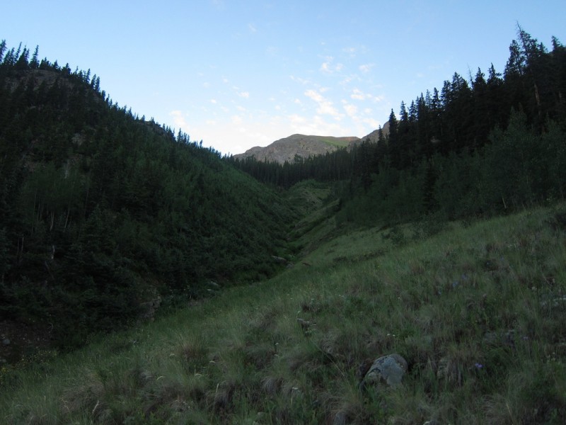
In the morning, I chose the bushwack. Of course, I forgot that I would also have to cross Grizzly Gulch creek too. Darn, forgot about this one. I had to remove my freshly put on boots to cross with my sandals. Just wide and deep enough to not risk soaked boots for the next 4 days of hiking. I also went from 100% clean to rather filthy 10 minutes into my vacation as I swam through dirty willows. Oh well, I was going to be dirty eventually! From there I followed a path of least resistance as I stayed as high above the stream below as I could. I found quite a few game trails that were quite useful.
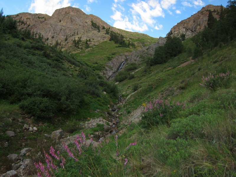
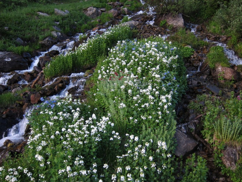
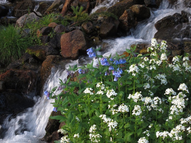
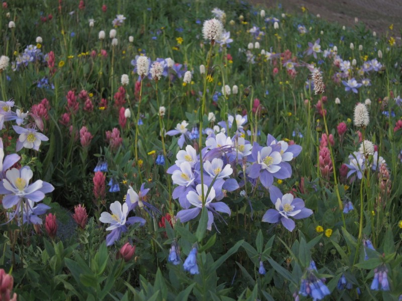
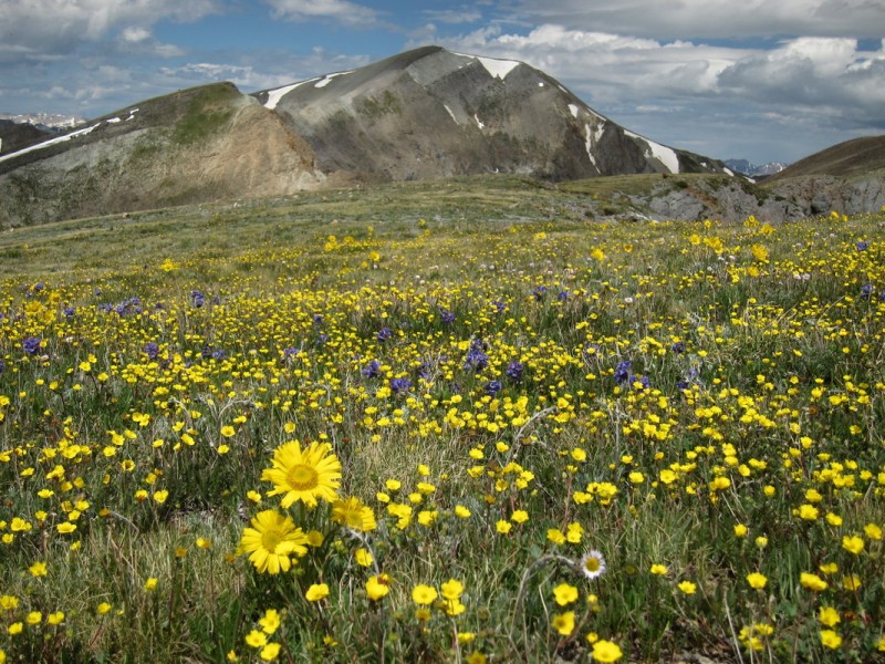
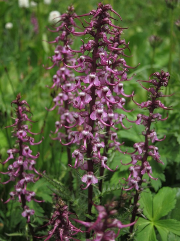
Once at Campbell Creek (north branch), the sun was brightening things up quickly. An hour had passed since I started, and I was later than planned. Walking the stream up went pretty quickly, as all the undergrowth was missing. I found another game trail as I cut through some woods over to the main stream. Here I found two dilapidated cabins. Further up the stream I ran into even more wildflowers than below.
Start of Campbell Creek Middle Campbell Creek Stream crossing Playing in the water
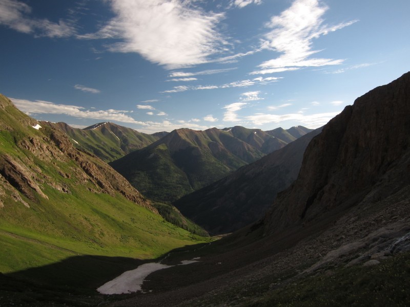
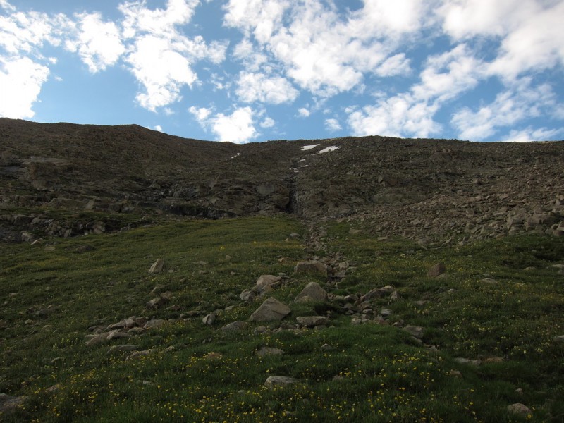
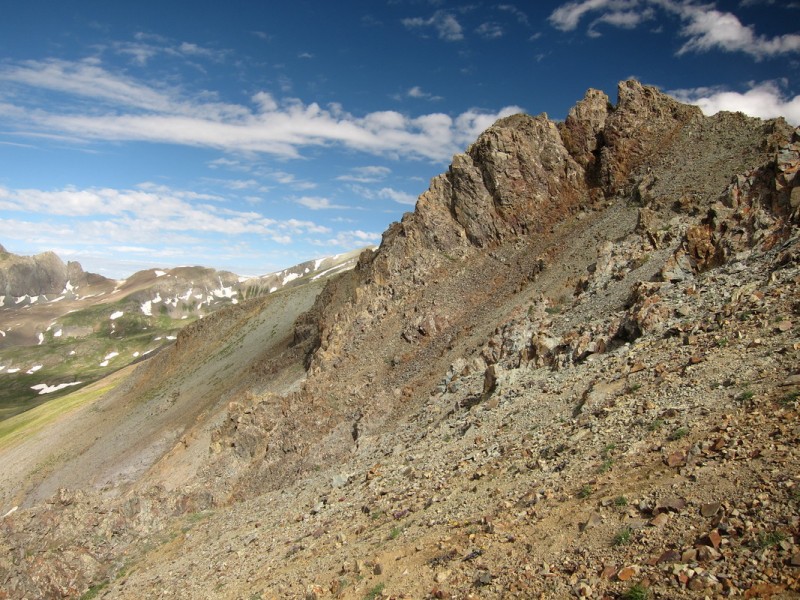
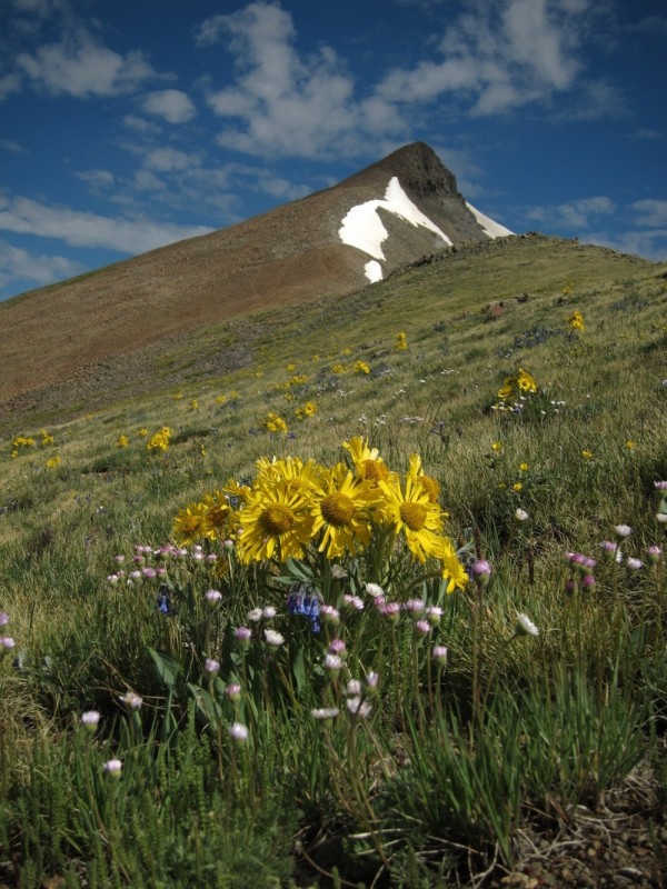
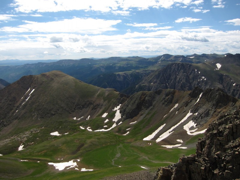
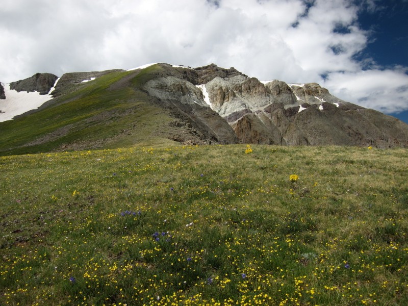
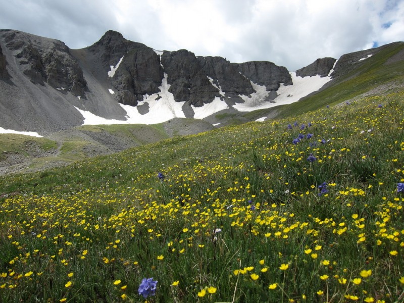
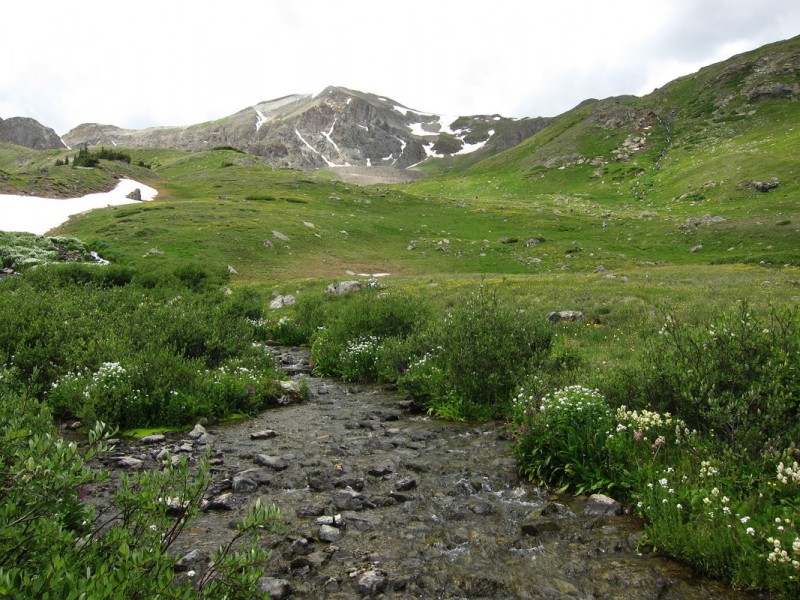
Once in the upper basin I was presented with a plethora of lush flowers to take some photos of, as I reoriented myself. From here I had to travel far enough up into the valley to find a non-cliff to go up the north face of Campbell. It reminds me a lot of the west face route up Columbia, but without the thousands of feet turning it into a complete scree mess. Nearing the top of the slope, I found some more game trail tracks to follow up to the ridge proper. I was only a short distance from the summit, so I overshot a little to the east, but not too bad.
North Face of Campbell - Reminds me of west face of Columbia Carson group - That's for Saturday
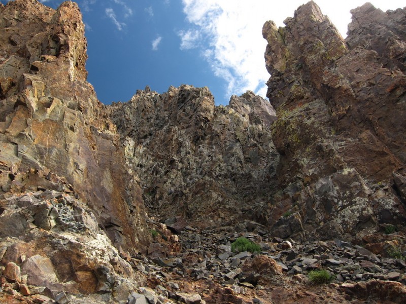
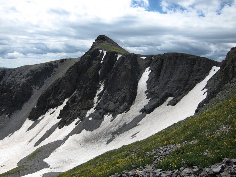
Took only a short break on the summit, as it had taken a lot longer to get to than planned. I saw what I thought were two humans near the ridge difficulties, and I thought it would be nice to get some beta on the crossing. But after making the quick walk over, I found that they must have been of the four footed variety.
As I had been following a variety of game trails all day, I thought I may as well continue. The game trail skirted the ridge rocks to the south and on a fairly steep talus/scree slope. But it seemed that many animals had used this path, and therefore it was pretty concave. I stayed relatively close to the rock walls as I traversed across, following animal tracks all along the way.
Looking back on Campbell Creek Peak Looking at the start of the ridge difficulties The lower traverse Looking up at the ridge difficulties My trail
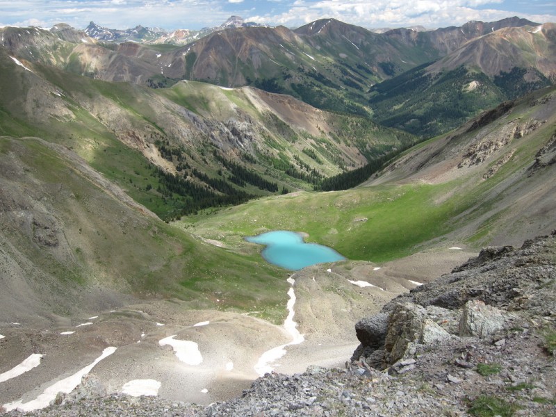
Once on the other side, I didn't think the work-around was all that tough. Hmmm smart animals, silly humans? From here it was a simple stroll over to 13,795.
13,674 & Half Peak 13,795 Looking back on Campbell Creek Peak and traverse
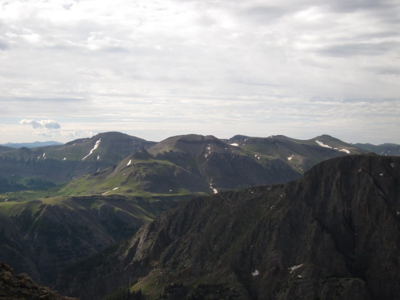
I relished the summit for a little while, as it is one that takes a bit more work to get to. I could see a bunch of tiny human forms on the summit of Handies. The current cloud development would also prevent a summit of Whitecross Mountain this day. I would have more than enough time to descend to the trail head, just not with another summit. So after a time, I descended the familiar slope down to the scree slope from hell. Though this time, it was a ton of fun to scree ski it!
Flowery Handies 13,795 from start of descent Ahh the familiar turquoise rubber ducky! 13,795 Whitecross!!! For another day, again
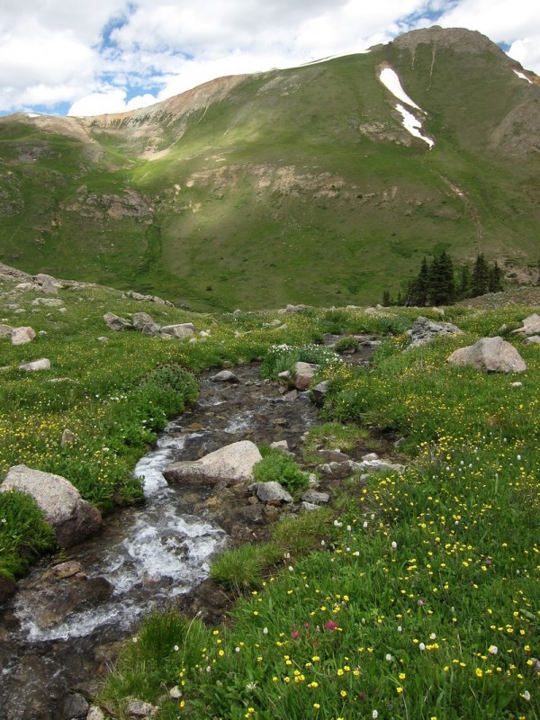
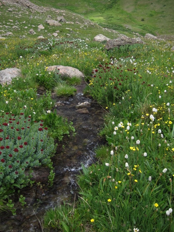
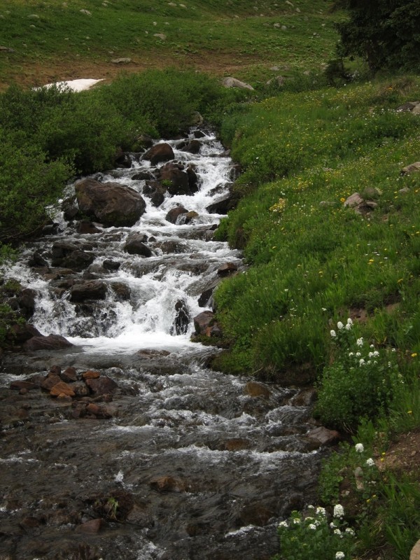
Back down in Grizzly Gulch, I could take my time an enjoy the flowers. There was only one other group near by, the only other people I had seen all day.
Handies from Grizzly Gulch I like this flower Did I mention, I like this flower? So nice to have a human trail to follow! A pretty stream Another pretty purple flower
2 out of 3 ain't bad! I'll be back for Whitecross some other time.
Thanks for the report, bergsteigen. Many of the peaks from your three day Lake City siege are on my list for late summer/early fall so I am looking forward to the other writeups. It seems like the San Juans hold a lifetime of climbing options. Now, if I could only find a job down there, I'd be all set.
This was a fun little loop to do, and rather quiet. A siege is about the only way I can justify the drive to the San Juans! I probably should start working on planning the next one :D
Papillon - I noticed your name on the summit register of Bent & Carson peaks. The remainder are fun!
I see you're on a 13er kick also - let's hit up a bunch this summer! I enjoyed reading this. And the flower photos are gorgeous. When can you get out again?
One of my favorite Lake City peaks 8/10/2015 12:37pm
I lived in Lake City for five years and UN 13,454 (evidently called Campbell Creek Peak) is on my short list of favorites, but I have another good route recommend for you to try. We just visited last weekend and I climbed it a second time, this time linking it to UN 13,795 (also my second time up it).
Campell Creek is a good way to climb these peaks (can’t go wrong there), but I climb it from Cataract Gulch up the East Ridge. It starts out with a bit of bushwacking, then the cliffs on either side come in close, you go up through the "chute" and onto a prominent ridge with great views – well below treeline still. The ridge gets down to 15 feet wide in a place or two and there’s some very minor scrambling, then the ridge opens up into the summit cone and you push on to the top through steep grass and rocks (again, minor scrambling).
Good peak, no matter how you get there. Probably won’t ever see anyone else on it.
Caution: The information contained in this report may not be accurate and should not be the only resource used in preparation for your climb. Failure to have the necessary experience, physical conditioning, supplies or equipment can result in injury or death. 14ers.com and the author(s) of this report provide no warranties, either express or implied, that the information provided is accurate or reliable. By using the information provided, you agree to indemnify and hold harmless 14ers.com and the report author(s) with respect to any claims and demands against them, including any attorney fees and expenses. Please read the 14ers.com Safety and Disclaimer pages for more information.
Please respect private property: 14ers.com supports the rights of private landowners to determine how and by whom their land will be used. In Colorado, it is your responsibility to determine if land is private and to obtain the appropriate permission before entering the property.


 Start of Campbell Creek")
 Middle Campbell Creek")
 Stream crossing")
 Playing in the water")
")
")
")
 North Face of Campbell - Reminds me of west face of Columbia")
 Carson group - That's for Saturday")
 Looking back on Campbell Creek Peak")
 Looking at the start of the ridge difficulties")
 The lower traverse")
 Looking up at the ridge difficulties")
 My trail")
 13,674 & Half Peak")
 13,795")
 Looking back on Campbell Creek Peak and traverse")
 Flowery Handies")
 13,795 from start of descent")
 Ahh the familiar turquoise rubber ducky!")
")
 13,795")
 Whitecross!!! For another day, again")
")
 Handies from Grizzly Gulch")
 I like this flower")
 Did I mention, I like this flower?")
 So nice to have a human trail to follow!")
 A pretty stream")
 Another pretty purple flower")


