Download Agreement, Release, and Acknowledgement of Risk:
You (the person requesting this file download) fully understand mountain climbing ("Activity") involves risks and dangers of serious bodily injury, including permanent disability, paralysis, and death ("Risks") and you fully accept and assume all such risks and all responsibility for losses, costs, and damages you incur as a result of your participation in this Activity.
You acknowledge that information in the file you have chosen to download may not be accurate and may contain errors. You agree to assume all risks when using this information and agree to release and discharge 14ers.com, 14ers Inc. and the author(s) of such information (collectively, the "Released Parties").
You hereby discharge the Released Parties from all damages, actions, claims and liabilities of any nature, specifically including, but not limited to, damages, actions, claims and liabilities arising from or related to the negligence of the Released Parties. You further agree to indemnify, hold harmless and defend 14ers.com, 14ers Inc. and each of the other Released Parties from and against any loss, damage, liability and expense, including costs and attorney fees, incurred by 14ers.com, 14ers Inc. or any of the other Released Parties as a result of you using information provided on the 14ers.com or 14ers Inc. websites.
You have read this agreement, fully understand its terms and intend it to be a complete and unconditional release of all liability to the greatest extent allowed by law and agree that if any portion of this agreement is held to be invalid the balance, notwithstanding, shall continue in full force and effect.
By clicking "OK" you agree to these terms. If you DO NOT agree, click "Cancel"...
Routes: Queens Way Couloir (Apache), West Chimney (Navajo), Airplane Gully (Descent off Niwot Ridge)
Mileage: 10
Elevation Gain: 3,479'
Tour d'Navajo group: Darrin (kansas) & me
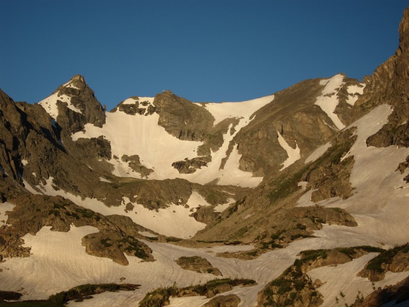
A peaceful morning
The Indian Peaks Wilderness has always held a certain fascination with me. Such incredible beauty, so close to where I live. Just have to jump through the various hoops to get there, as there are only a couple access points, and all are popular. So in the post-14er finishing world of what looks good this weekend, the IPW floated to the top. Plus the late snow season may afford just one more easy snow climb.
So before some were home from a night out on the town, we made our way up lefthand canyon to Brainard Lake. The light from the just past full moon illuminated the road, that I have so frequently skied. Along the way, our early arrival startled a bull moose with a fairly large rack as he quickly left the roadway to search out the marshlands around the small lakes. It had been awhile since I've seen a moose this close, after I left Alaska. A rare treat here in Colorado.
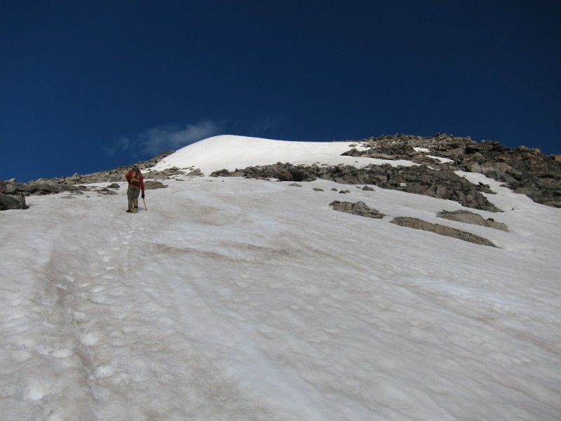
Having arrived a bit behind schedule, we quickly got ready and pounded up the mostly flat trail past Long Lake and up to Lake Isabelle. Snow still occurs in random patches all along the lower trail, but becomes mostly continuous when you reach the bench up to Lake Isabelle. Thousands of feet have pounded the lower snow into a solid trail, so snowshoes are not needed. Even after the Lake, the snow remained firm enough to walk on without any trouble.
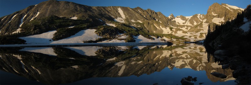
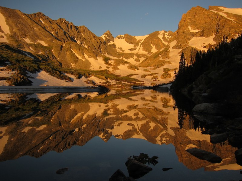
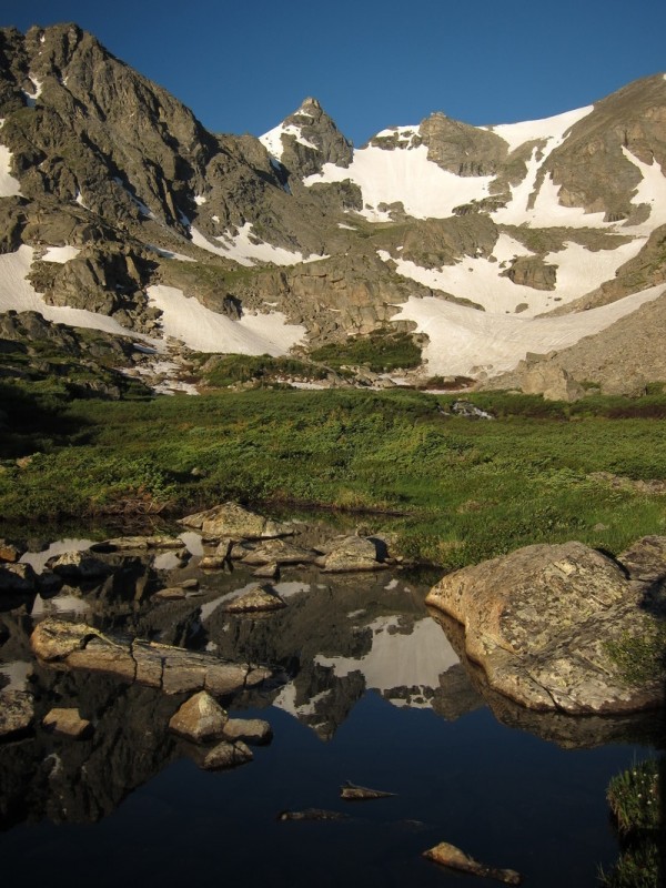
The views improved with almost every step along Lake Isabelle, until they culminated in some amazingly still reflections.
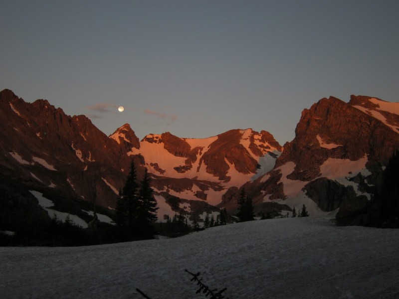
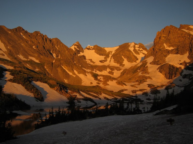
Alpenglow and Moonset
Capturing the moons craters above Navajo Morning reflections A peaceful morning
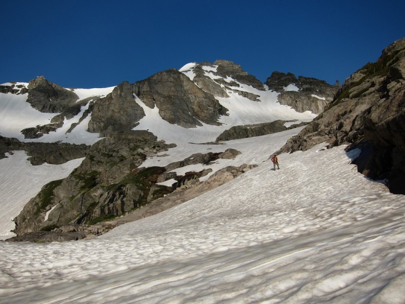
Once beyond the lake, and photography 101 was over, we made quick work of getting up into the upper basin. Along the way, we past by the only group we would see up close all day. There were 3 other groups, but we were spaced just right, and on different routes with different goals, that we felt perfectly alone in our own paradise.
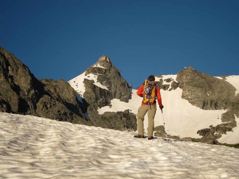
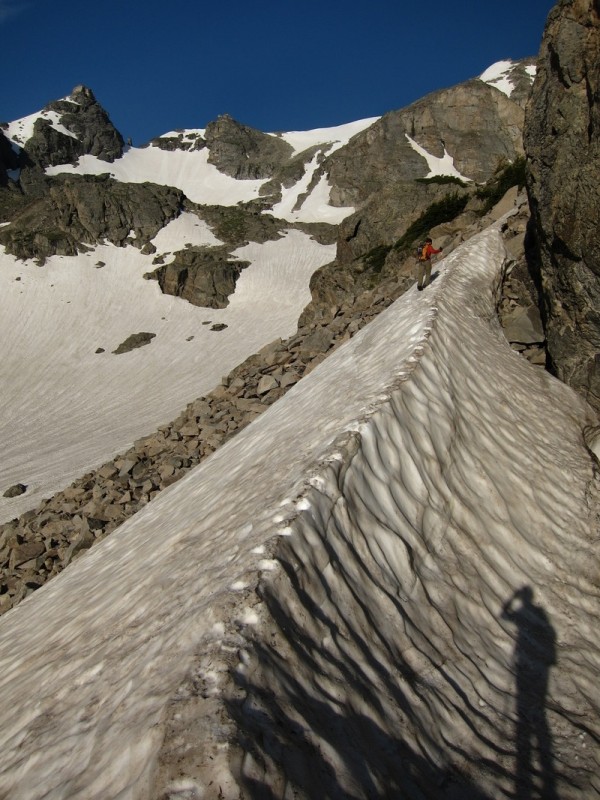
The route so far was a series of benches with flat areas in between, so a perfect balance for me to go quickly, as there was always a spot to rest from the exertions of the last elevation gain. The higher we went, the better we could pick our snow route up. It wasn't fully continuous, but fairly so. We had decided to choose between the Apache Couloir and Queens Way once we got higher in the basin. Both were continuous, but Queens Way looked to go closer to the summit, and would allow for less back-tracking on the ridge. So we chose the slightly less traveled route.
Quite a bit of snow in the basin Darrin contemplating Navajo Another pool reflection Navajo Apache
Photo Credit: Darrin
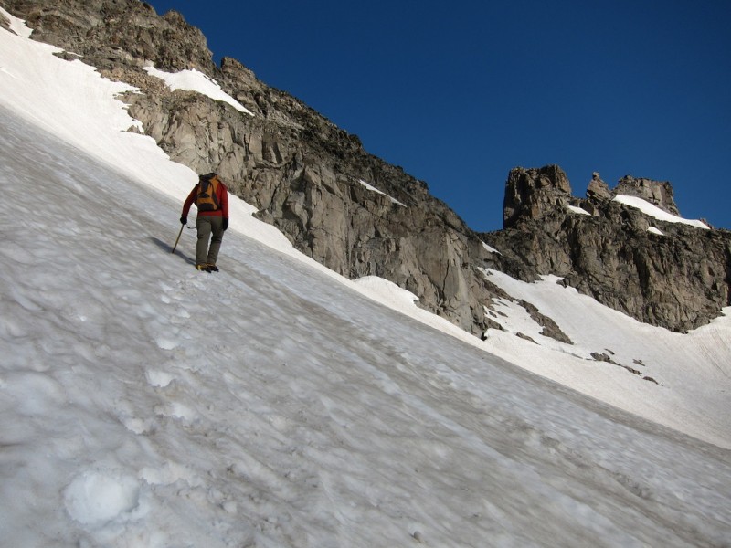
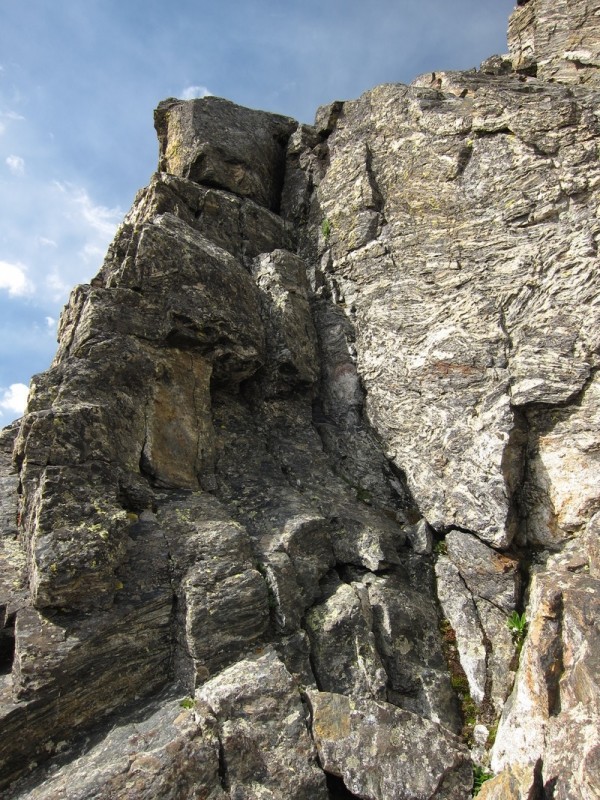
Once on Queens Way, we made short work of the couloir. The snow was soft, but the buckets were holding. Near the top, or by any rocks, the snow was no longer supportive and some post-holing occurred. Unfortunately so, that instead of following the snow to the left (south), we jumped onto the rocky ridge above at the end of the couloir. The rocky ridge goes, but in a few places it is rather narrow with large blocks. We could have saved 30min by following the snow closer to the summit probably.
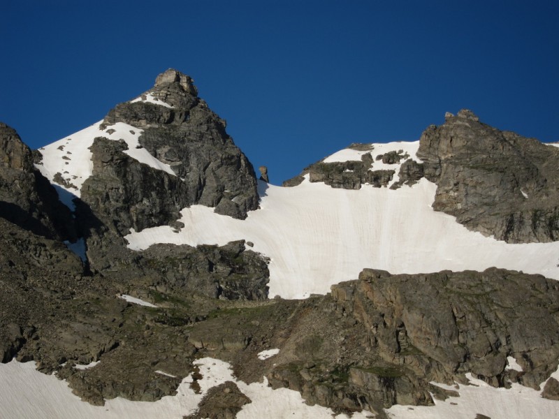
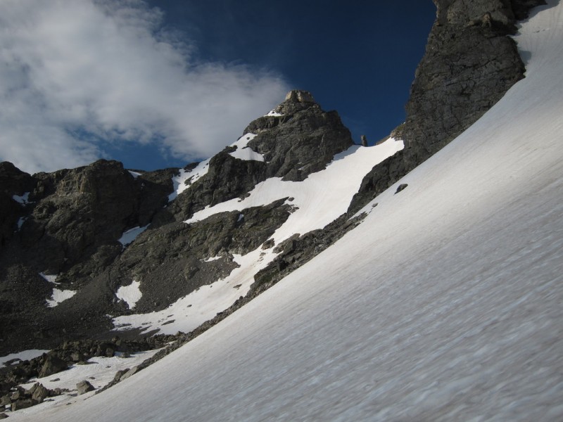
Approaching Queens Way, with the 3 Chessmen behind Starting up Queens Way
Photo Credit: Darrin Nearing the summit
Nearing the top of Queens Way Rock Wall to summit
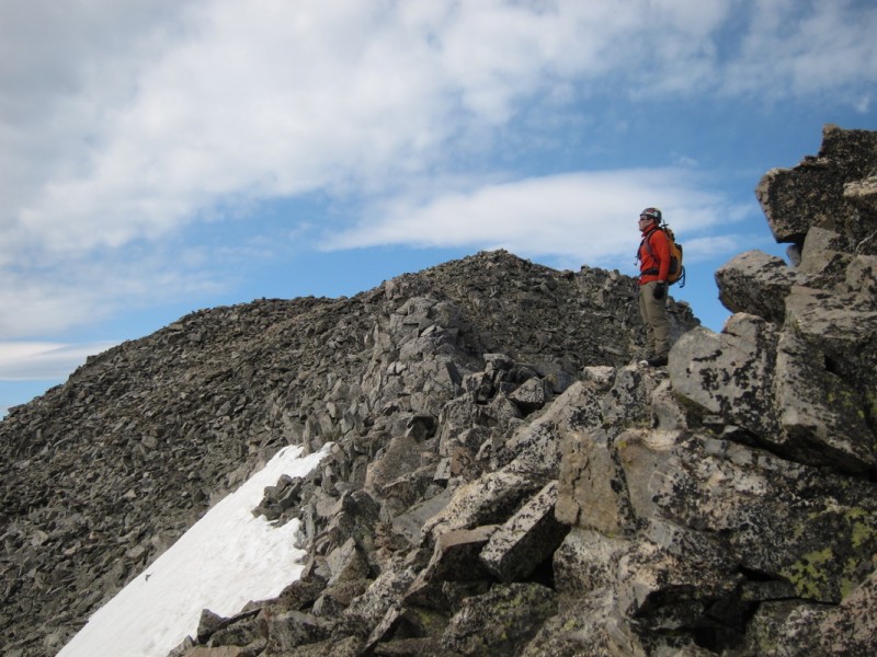
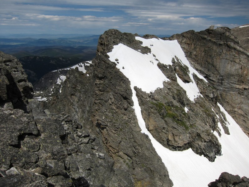
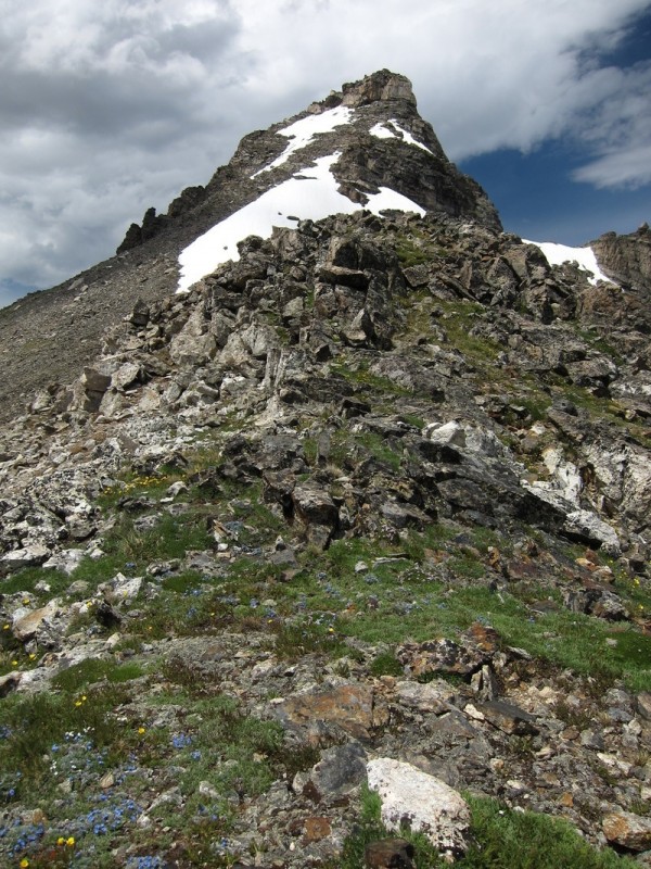
We didn't spend much time on the summit, as Apache was the warm up to the real prize of the day: Navajo. The ridge was easy class 2 until we started the descent to the saddle. Here there was some periodic class 3 mixed in with one class 4 section. All solid rock, so we didn't find it that bad at all.
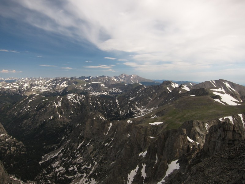
Northern IPW and RMNP
Looking back on Apache - Photo Credit: Darrin Approaching Navajo
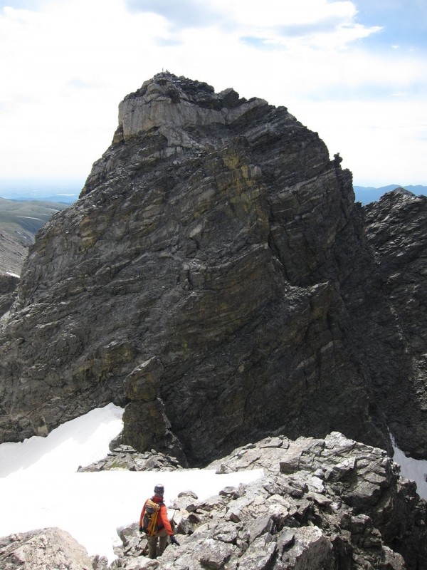
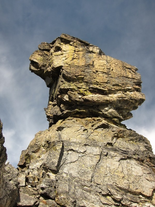
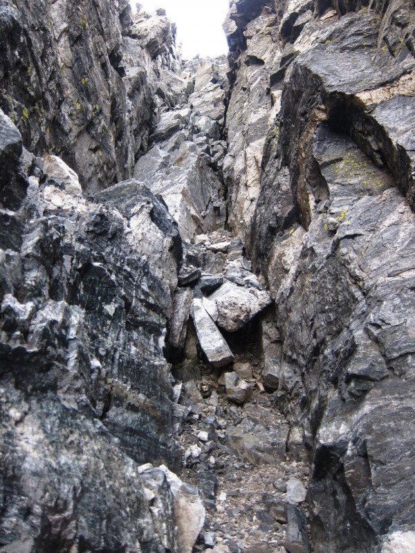
Down climbing the ridge crux - Photo Credit: Darrin The class 4 crux on ridge traverse. Isn't it gneiss? Dickers Peck. What animal(s) do you see?
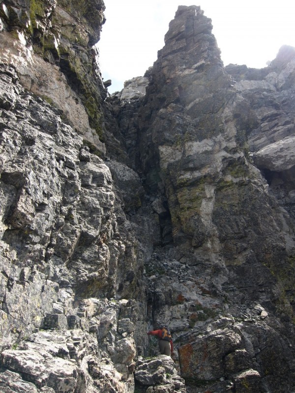
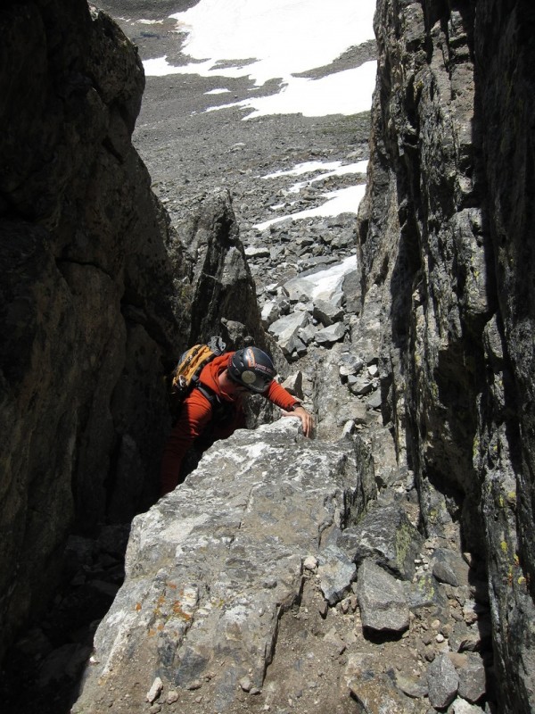
Once we passed around Dickers Peck, there was an obvious ramp to follow to get to the west chimney route on Navajo. We had gotten some timely beta from a friend on Friday, that this chimney should be climbed solo or one at a time. There is no place to hide from any rock fall that may occur. Once we got up close, we concur! I waited behind the chock-stone at the bottom, while Darrin went up to the top of the relatively short chimney. Or at least short if you like class 4. I found an old nut firmly placed below the chock-stone.
Once I got into the chimney I found the rock to be solid, with some loose pebbles and small rocks on most surfaces. It was a fun class 4 chimney, though I was glad to be going up, not down it. The exposure is strong in this area.
The west chimney Darrin ascending the chimney Solid rock in chimney, just lots of loose rocks on top
Ouch, that looks steep - Photo Credit: Darrin
Once above the chimney, we traversed over to the prominent ridge to the south and then followed the ridge proper to the summit.
The ridge from Apache Darrin reaching the top of Navajo Arikaree and North Arapaho...ridges look gnarly
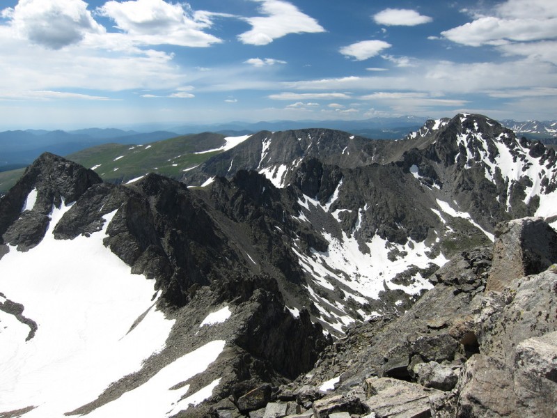
We spent a little longer enjoying this summit, as the views are incredible. The forbidden fruit just to the south, the glaciated basins surrounding us, and the long continental divide snaking through along rugged ridge lines.
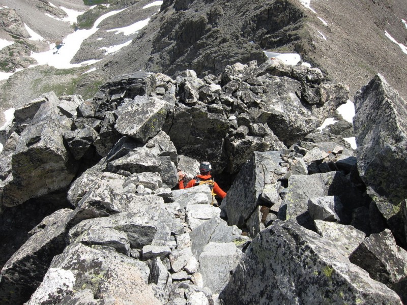
The chimney to the east on Navajo has been worn smooth by thousands of hands and feet, as the standard route up Navajo is this way. The chimney is a solid class 3, but the exposure is minimal.
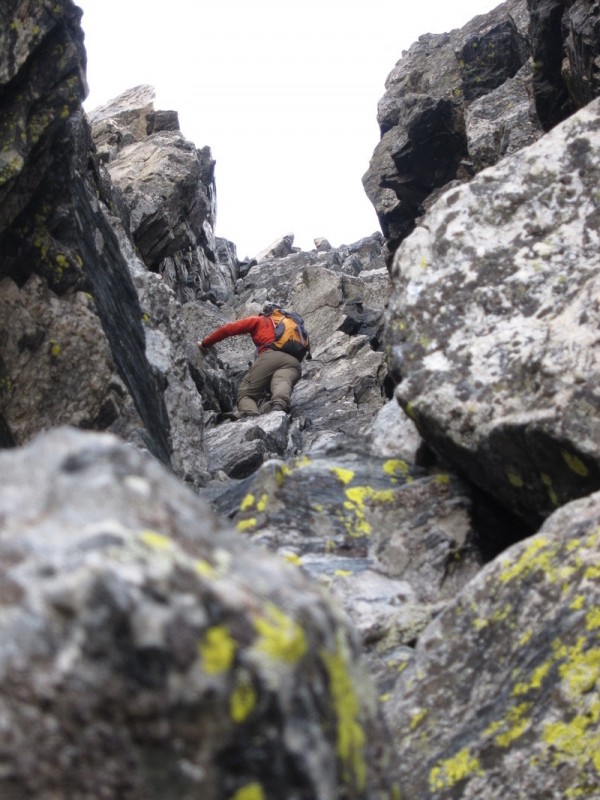
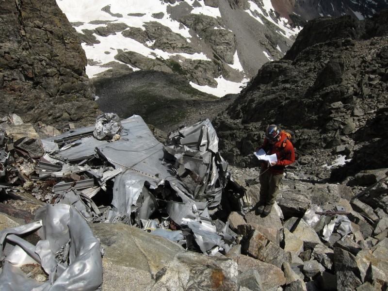
Down on the ridge, the rock and scree is inconsistent and slows progress. Once in the Airplane Gully, this inconsistent nasty talus scree only worsens. Not sure why the Airplane Gully is considered "classic". I can only imagine it may be for the historical value of the 1948 plane wreckage which is a constant all along the gully and into the basin below it.
Descending the chimney on the Niwot Ridge side of Navajo Darrin in east chimney
It must be class 3, I'm facing out! - Photo Credit: Darrin Navajo from above Airplane Gully Darrin checking out the 1948 airplane wreckage
With the strong monsoon we have been seeing lately, it was nice to have a day of almost normal summer weather. Though clouds did chase us out of the basin from above, it didn't stop a torrent of foot traffic up to the lakes from below. As with any IPW adventure, it ends with plans for an immediate return.
My GPS Tracks on Google Maps (made from a .GPX file upload):
Matt - I added the "better" Moon photo. It is hard to get the moon to not look like a glowing orb!
Snowgirl - There was a duo of skiers behind us on the route (small dots at base of couloir). If you want to hump skis up 2+ miles back and forth, the snow is still good enough to ski in my book!
I did this in reverse last fall. Going down the chimney definitely made the rock feel much less trustworthy! Gotta get back up there for the Peck. This was the motivation I needed! Great photos and nice report.
But I did ski St Mary's today. Yes Eric, we need to get out and ski next season! I bet we can twist Darrin's arm on a few ;)
49ersRule - For Navajo only via Airplane Gully you shouldn't ”need” an axe. The snow that you do cross is mostly harmless if you stick to the higher trail on the north side of the basin.
Thanks for posting. Any need for the ice ax on the Navajo side or was it mostly clear?
Caution: The information contained in this report may not be accurate and should not be the only resource used in preparation for your climb. Failure to have the necessary experience, physical conditioning, supplies or equipment can result in injury or death. 14ers.com and the author(s) of this report provide no warranties, either express or implied, that the information provided is accurate or reliable. By using the information provided, you agree to indemnify and hold harmless 14ers.com and the report author(s) with respect to any claims and demands against them, including any attorney fees and expenses. Please read the 14ers.com Safety and Disclaimer pages for more information.
Please respect private property: 14ers.com supports the rights of private landowners to determine how and by whom their land will be used. In Colorado, it is your responsibility to determine if land is private and to obtain the appropriate permission before entering the property.