Summary: ~31 miles, ~9,200 ft vertical, 3 days, 2 peaks and we got to ski from 13,100 ft in winter, which is always a treat.
01.17.15
Approach: Henson Creek road (winter closure just past Nellie's creek)
Mileage: 6.7 miles
Vertical: ~1,600 ft
Time: ~ 4.5 hours
Participants: Matt, Mark, Jamie (shanahan96) and Natalie (SnowAlien)
After late arrival and not getting a good night of sleep at the Raven's Rest hostel in Lake city, we had a pretty late start. We drove up to the TH, geared up and started skinning (in Jamie's case - snowshoeing) around 10am in perfect blue bird weather. The last storm from 3 days earlier deposited about a foot of snow in the San Juans, but it's been sunny and dry since then. We were hoping for (but not expecting) a snowmobile track and it appeared, which made for a very efficient skinning. Jamie took off, while myself, Matt and his brother Mark enjoyed a leisury skin to Matterhorn Creek turnoff.
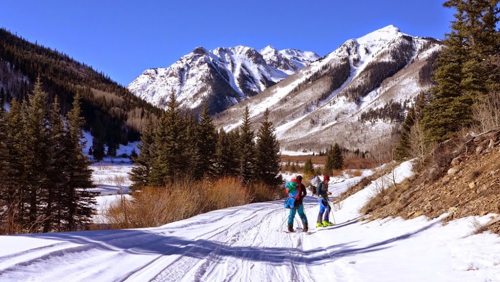
Skinning up Henson Creek road

Catching up to Jamie at Matterhorn creek turnoff
There we caught up to Jamie who was happy to see snowmobile tracks continue to Matterhorn Creek. At some point in the next 2 miles Jamie was finally forced to throw on the snowshoes.

Snowshoes go on soon after this
The last 0.6 miles felt pretty steep with heavy packs, so we were glad to arrive at our intended campsite just below the upper summer TH shortly after 2pm. A snowmobile track continued, but it was older and more faint, and at some point we lost it. Still, it was a huge help.

Another mile to go before the camp
After setting up the camp Jamie went to investigate how far the snowmobile track goes, while myself, Matt and Mark got busy with camp duties. We only had one fast stove between 4 of us (and 2 slow stoves), so the snow melting process took a while. With temps around 20F, the fuel kept freezing and the water production was slowing to a halt. Nothing like a refresher on winter camping on the first winter trip of the season! Finally we got our meals cooked, water melted and boiled, and retired to our tents ready for challenges of the next day.

01.18.15
Approach: from campsite at 10,800 ft
Mileage: 8.1 miles
Vertical: 3,300 ft
Time: 9.5 hours (6.30am to 4pm)
Max speed: 24 mph
Participants: Matt, Mark, Jamie and Natalie
Everybody was ready to go at 6.30am. Jamie went about another mile the afternoon before, but stopped short of the avalanche terrain as he was solo. We made a fairly good time to the bottom of the avy slope and decided to circumvent the wind loaded gullies as far low and closest to the creek as possible. Jamie insisted on breaking trail to make sure it would hold his weight in the afternoon. That section definitely got our hearts pumping in the morning.

Once in the trees, Matt took over the skin track duties and we topped out at the tree line in good time.
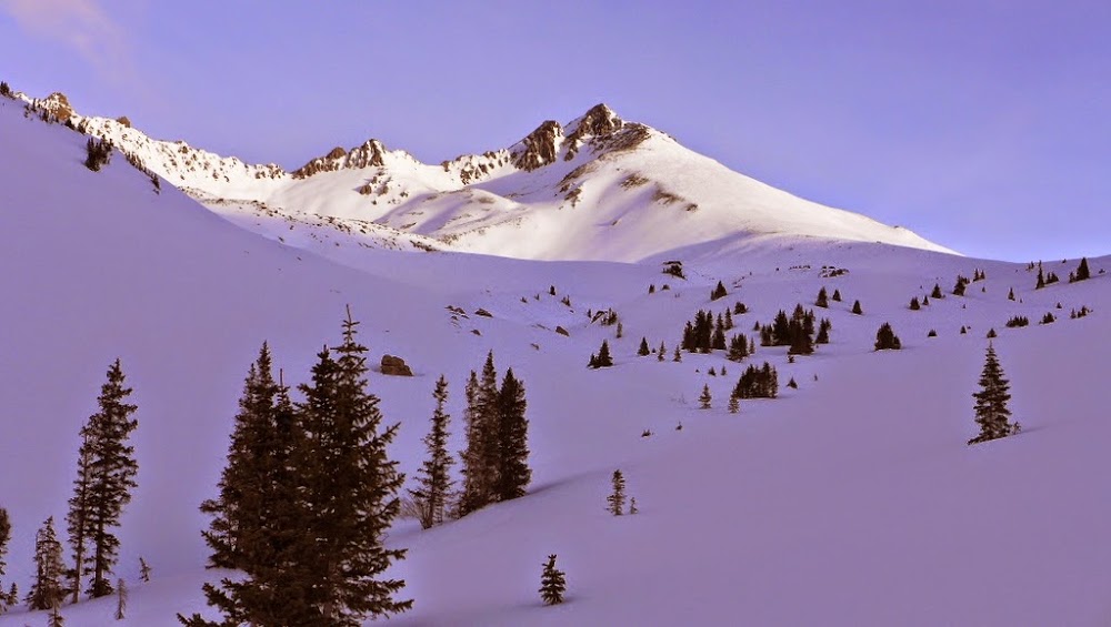
Good morning, Matterhorn!
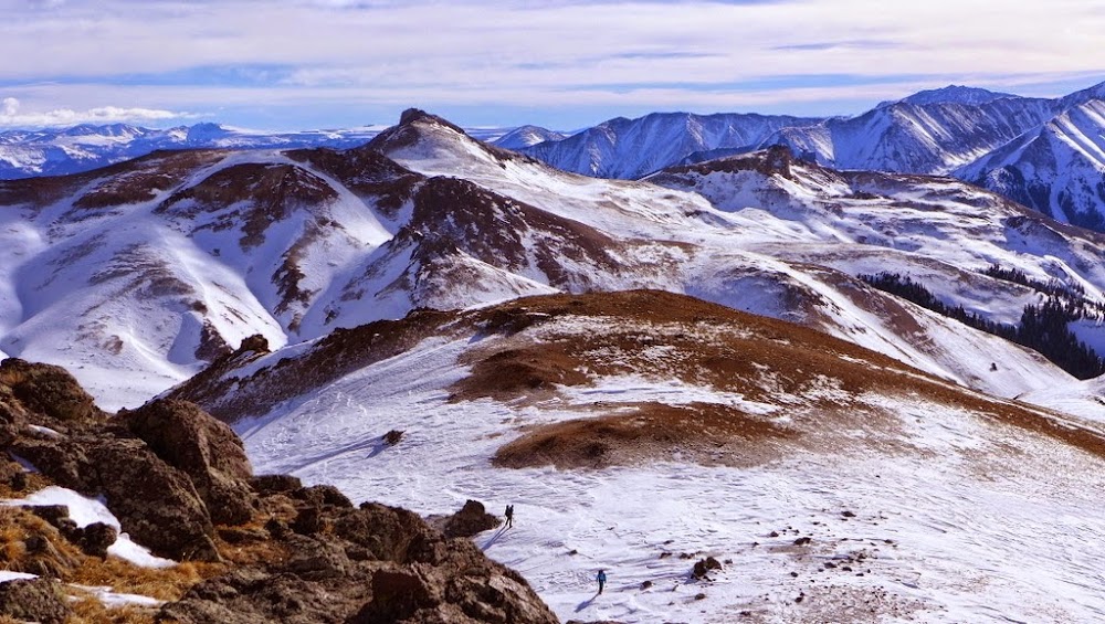
I then took over and lead the group across the basin to the upper headwall. I think Jamie postholed a few times on snowshoes, but the snow felt supportive and fairly consolidated, so we all managed to stay afloat.
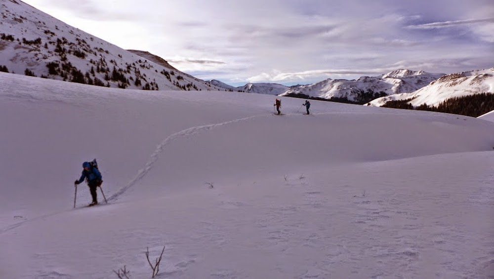

Getting closer
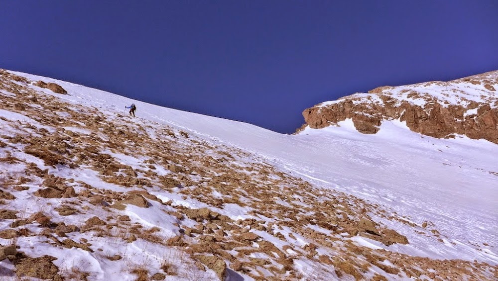
Once in the higher basin, winds really picked up and one 30-40 mph gust even knocked me over. Thankfully, it was a flat spot. Matt took the lead again and skinned to the saddle at 13.1k.


Nearing the 13.1k saddle
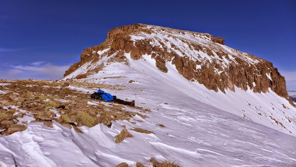
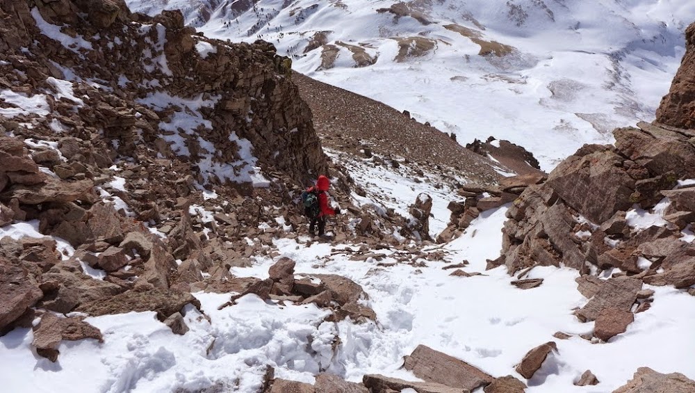
We followed suit, but got out the whippets/ice axes just in case. The angle was about 25 degrees. We stashed our floatation devices at the saddle (skis, splitboard and snowshoes), put crampons on and started kicking steps on fairly supportive and consolidated snow on the ridge. We were trying to make good time, as Mark and Matt had a turnaround time of 12pm as they had other commitments that evening.
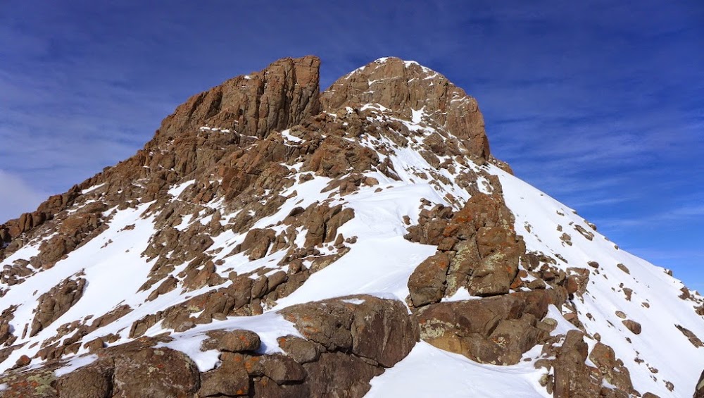
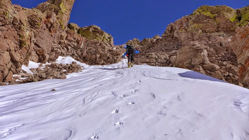
Scrambling atop the ridge in gloves, ski boots and crampons added a bit of a challenge. Unfortunately, by 11.50am we only reached 13.7k point on the ridge, so Matt and Mark had to turn around due to the timing. Jamie led the way to the summit and did some efficient route finding and step kicking.

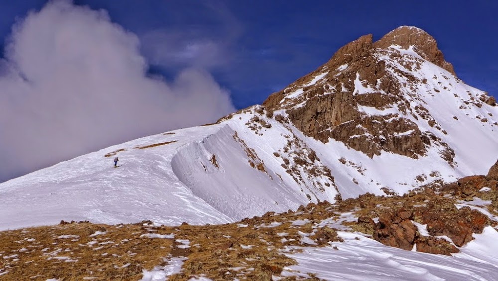
Nearing the prow

The ramp

Jamie on the ledges

Uncompahgre from the summit

Coxcomb & Redcliff
We topped out around 12.40pm and were able to watch Matt and Mark skiing/snowboarding down the saddle into the lower basin.
Matt and Mark skiing

Natalie on the descent


Jamie downclimbs
I was slightly nervous about the exciting Class 3 downclimb in ski boots (not that Jamie had it any better in Koflachs), but eventually the terrain relented. We slowly got back to our ski/snowshoe stash and after gearing up it was finally time to ski.


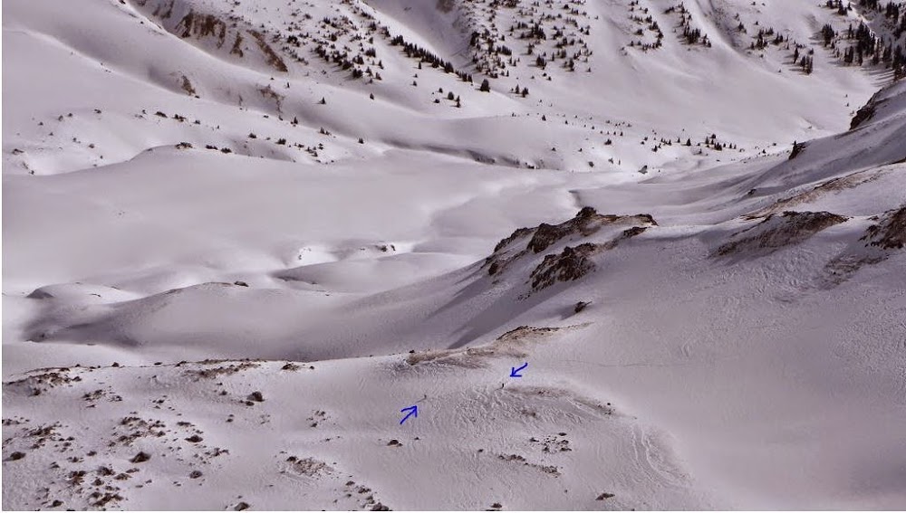
I started skiing from 13k saddle around 3pm, while Jamie did a running descent on snowshoes.


Practice turns in the Matterhorn basin - maybe there will be more of them in Spring?
After making sure Jamie made it past the avy slope safely, I was back at the camp by 4pm, with Jamie appearing 5 minutes later. With just 2 people at the camp, snow melting chore went quicker and I was retired at the tent and resting by 6pm.
01.19.15
Approach: from campsite at 10,800 ft
Mileage: 16.3 miles
Vertical: 4,300 ft ascent; 5,700 ft descent
Max speed: 19 mph
Time: 13 hours (10 hours for Uncompahgre, 1 hour to pack up camp and 2 hours for the deproach)
Participants: Jamie and Natalie
After another cold night in camp, Jamie and I were not feeling particularly strong on the 3rd day, but decided to tough it out, since snow conditions and the weather window appeared to hold nicely. We were almost out of fuel though and had to institute some water rationing (e.g. we didn't cook hot breakfast that morning). We hit the already too familiar trail at 6am. By the time we reached the treeline like some 1.5 hours later I confessed that I wasn't feeling that great (a lingering cold from the week before was rearing its head again). Jamie also wasn't feeling 100% either, but we decided to push to Broken Hill pass and evaluate the conditions there. Thankfully, snow was again supportive and Jamie didn't posthole too much, while I stayed afloat on skis. After checking the topo map, we decided to stay a bit further and higher from the cross-loaded slopes of Matterhorn.

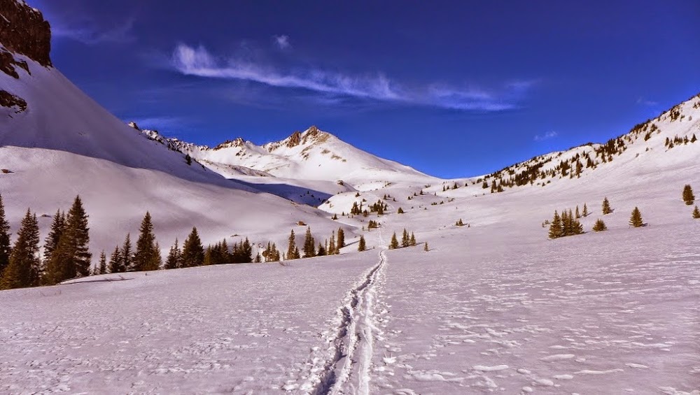
Approaching Broken Hill pass in the morning

Matterhorn
After topping out on the pass in fairly good time, we decided to continue, since the next section was downhill anyway.
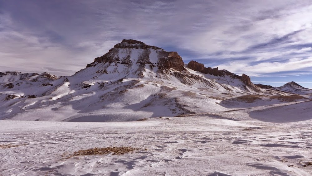
Our objective

We were debating the Big U approach for some time in the last couple of days and finally settled on the snowfield with rocks leading up to the notch. We parked our floatation devices (skis and snowshoes) lower in the basin and switched to crampons. I studied the CAIC report before leaving on the trip and the SW aspect in San Juans was the only aspect with no reported (natural or human-triggered) slab avalanches. That gave us some confidence to at least start going up the snowfield and test the conditions. We found snow very well consolidated, almost spring-like.

Our ascent line

Mellow section

We alternated kick-stepping duties and although the ascent line turned out to be a bit steeper than we were expecting, the snow felt stable, perfectly cramponable and fully supported our weight. We topped out on the standard route of Uncompahgre around 11.30am. The next section of potential concern on the upper slopes, which we couldn't see from Matterhorn creek basin, granted us a safe passage.
Heading up to the top of the ridge
Earlier in the morning, Jamie set a turnaround time of 12.30pm, and after topping out on the ridge we finally felt that the winter summit was within reach.
Jamie is resting before the final summit push. I wonder where he got this idea from?
Kicking final steps

Wetterhorn
After some friendly banter (should we turn around now?), we reached the summit at 12.45pm. The weather was holding up, but we could see the snow front slowly moving closer.

Starting the descent
For the descent line, we picked a dry rib leading directly into the basin, which turned out to be a great choice. There was only a small rock band with a few Class 3-4 moves that we had to downclimb, but the rest was pretty straightforward.

Our descent line

Short section of Class 3-4 downclimb
Jamie turned on the afterburners and charged towards our floatation stash, which we reached at 2.30pm. We got back to the pass with very minimal post-holing, but traversing under several gullies with some avalanche potential made me uneasy.


Heading over BH pass as weather is moving in

Curtain falls on a great adventure. Light snow starts falling as we pack up the camp and leave, finishing the ski/hike out in the dark.
I finally took the skins off at the top of the pass at 3pm and was back at the camp at 4pm. Jamie showed up only few minutes later. We packed the camp in light snow and started down by 5pm, Jamie about 10 minutes ahead of me. With a couple flat sections, I could barely catch him at Capitol City! Then my luck ran out and I hit a flat, almost uphill section for about a mile and Jamie passed me on snowshoes. Eventually I managed to push myself with poles and skate ski down to the car which we reached just before 7pm, again within minutes of each other. Overall, a very good trip in good conditions, although my head cold definitely got worse.
My GPS Tracks on Google Maps (made from a .GPX file upload):
|


