| Report Type | Full |
| Peak(s) |
Grays Peak - 14,275 feet Torreys Peak - 14,272 feet |
| Date Posted | 08/24/2009 |
| Modified | 09/09/2013 |
| Date Climbed | 07/16/2009 |
| Author | Jessie_s Dad |
| Grays Peak - plus Torreys |
|---|
On Monday, we climbed Mt. Bierstadt. The day started out with beautiful weather, we started early and planned to be off the summit by noon, but storms arrived around 11:15, ending our day early. Our plan was to climb Grays Peak on Wednesday. We had seen Grays in the distance from Bierstadt and were looking forward to a great day.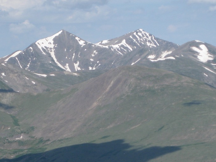 The forecast for Wednesday was again the same with storms likely after noon. With a cold front moving in the forecast for Thursday was better, only 10% chance of rain, so we re-scheduled our climb for Thursday. On Wednesday the forecast was revised... to 0% CHANCE OF RAIN FOR THURSDAY ! Six of us were staying in Fraser and another 2 in Frisco, so we planned to meet near the trailhead at 6:30 am Thursday. We got up early and the temp was 38 degrees. We drove from Fraser to reach the Grays Peak trailhead, using Exit 221 at Bakerville on Interstate 70. We went over I-70 and stopped at the parking lot right by the exit. We left one car there and then continued on Forest Road 189. 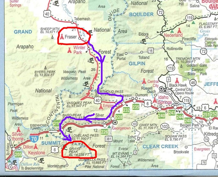 We heard that the road to the TH would be one of our challenges for the day, but knew that if we could navigate past the "rut" near the beginning, we would make it all right. 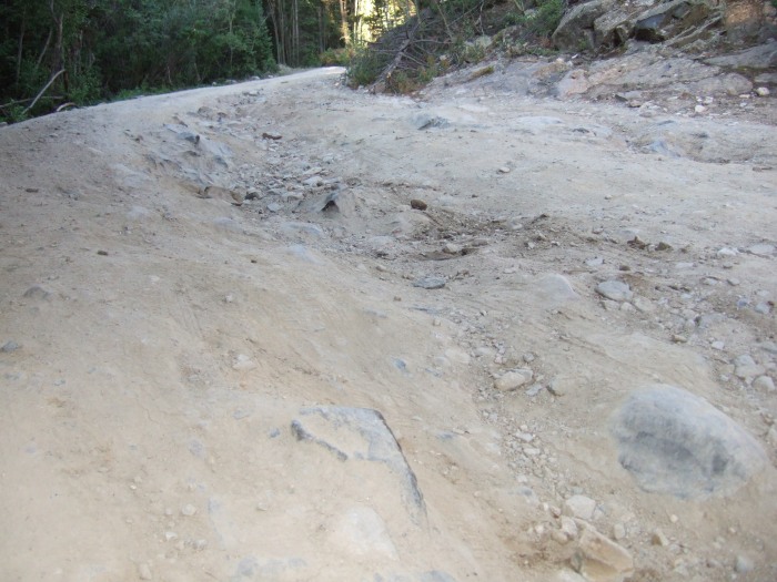 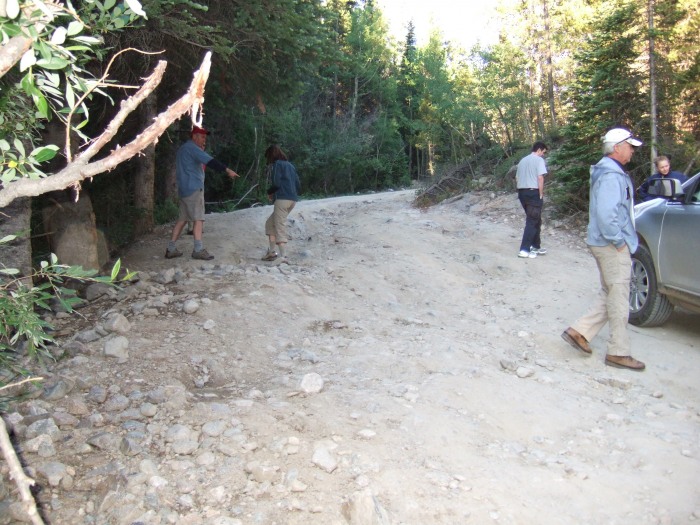 It is about 4 miles to the trailhead. The "rut" is about 1/2 mile from the start. With our Ford Edge we had no problems with the "rut". Six of us piled in, and started to the TH, with the remaining 2 of our group to start walking until we returned to pick them up. Further up the road, the road was rough but OK 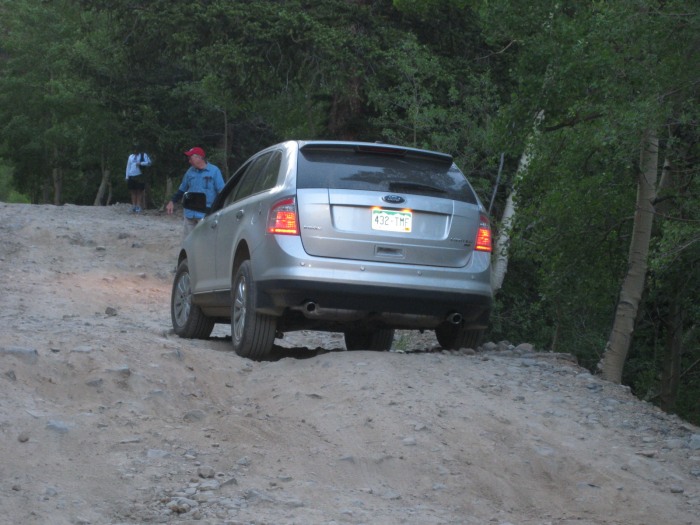 We stopped to pick-up 1 more hiker (Joe from Florida) and gave him a ride. We returned for the rest of our group, plus 2 more, and made it to the TH by 7:30. There were several other large SUV's etc. who made the trip WITHOUT stopping to give anyone a ride, even though they had plenty of empty room. Please, people, extend a little common courtesy and give people a ride if you have room. We crossed the large bridge that spans the stream in Stevens Gulch and followed the well-defined Grays trail up the hill into Stevens Gulch. We were still in the shadows with the sun hitting the tops of the surrounding peaks. 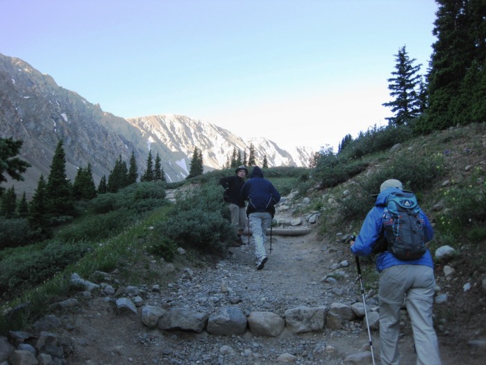 Grays Peak soon came into view. 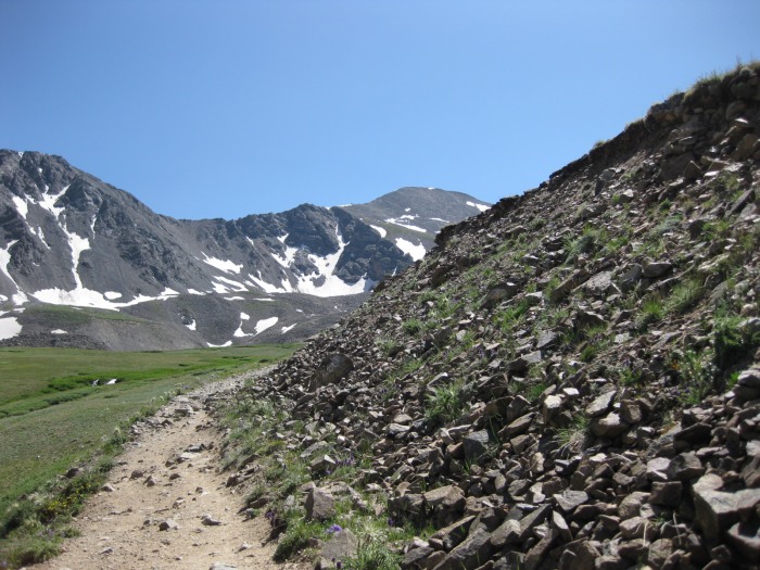 The trail climbed constantly from the start, as compared with Bierstadt where we went down for a while before climbing, but the trail was well marked and easy to follow. 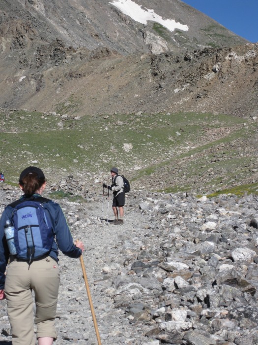 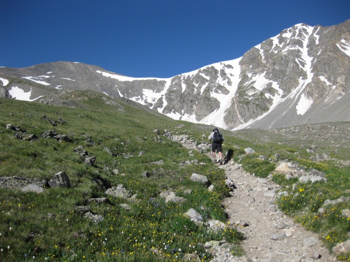 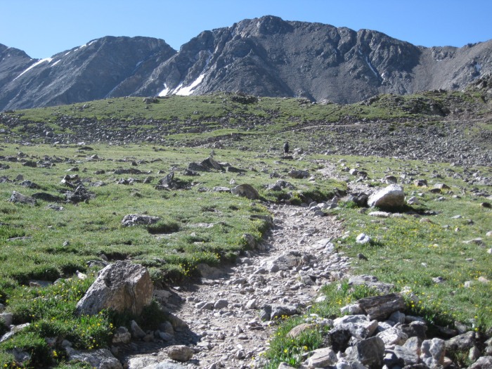 Our group was spread out by this time, everyone moving at their own pace. Mr. Smith was hiking with Mom_to_Jess and myself at this point, as we were taking the lead. The wind was really blowing and we had to hold onto our caps to keep them from blowing away. It is going to be chilly on top when we get there. Looking ahead we could see the rock tower we read about in the route description. 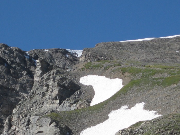 There were ptarmigan among the rocks, and mountain goats around the tower, and there were wildflowers everywhere. 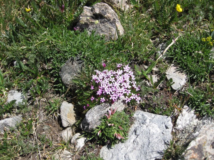 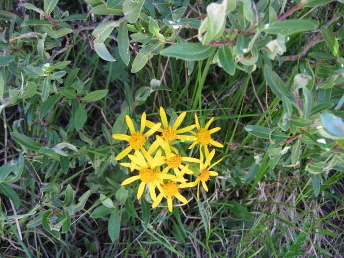 At this point the trail was pretty rocky, a lot of fun. 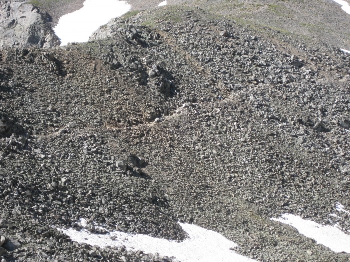 We continued to climb, stopping to catch our breath at the switchbacks. 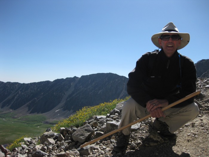 The views back down into Stevens Gulch were spectacular. 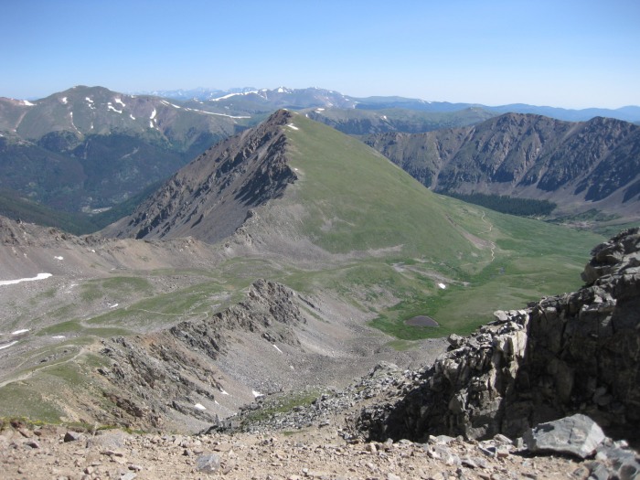 You could see most of the trail we had travelled. And we had a great view of Torreys Peak to our right. 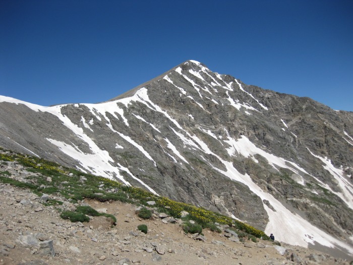 Mom_to_Jess and I are getting close to the summit now.. 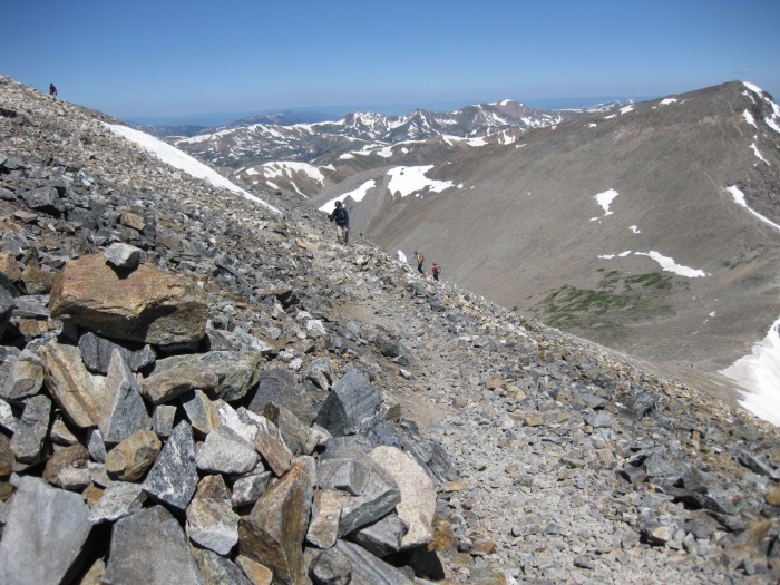 As we summitted, we were greeted with spectacular views to the west of the Sawatch range, Mt of the Holy Cross was clearly visible.. 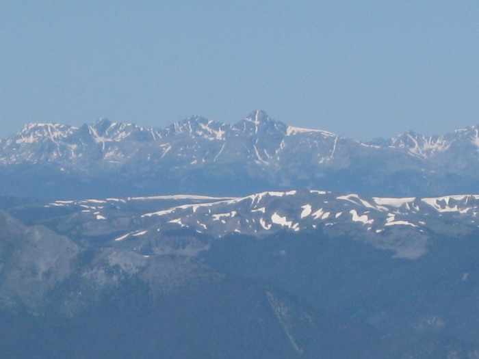 We found it to be very emotional reaching the top. We took our obligatory Summit Shot.. 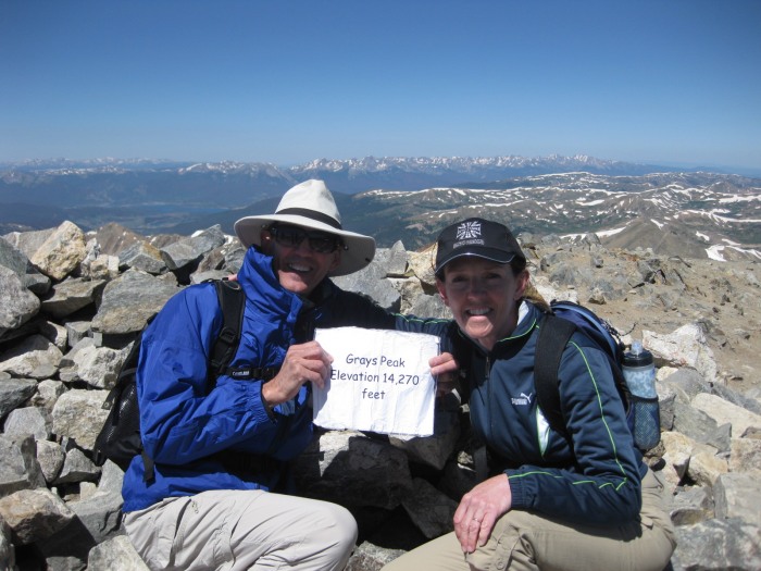 and waited as th rest of our group made it to the top. 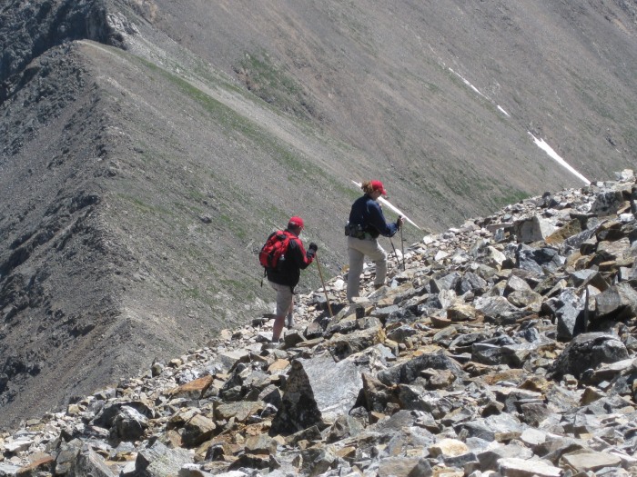 We enjoyed lunch together on the summit. What a gorgeous Day ! 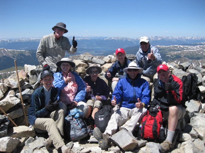 After 30 minutes on the summit, our group started to descend. With the forecast so good, and feeling in good shape, Mr. Smith and I decided to try Torreys, 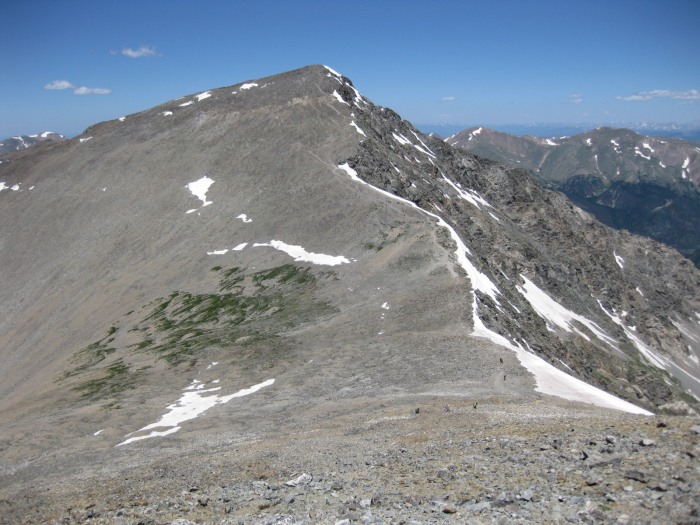 and meet everyone else back down at the TH. The descent from Grays was steep, but the footing was good and we were not in a rush. 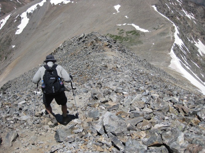 In 15 minutes we were at the saddle and looked up at the trail ahead, 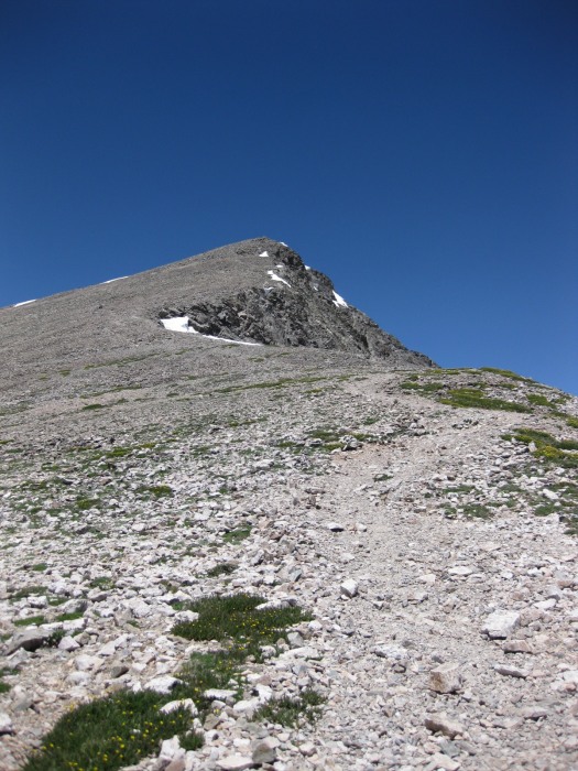 a bit steeper than the trail up to Grays. 50 minutes after leaving Grays, Mr Smith and I arrived at the top of Torreys 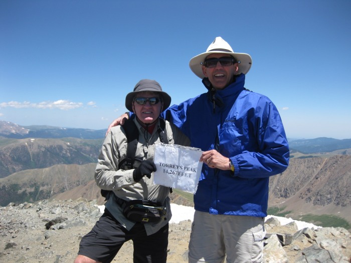 We had the summit to ourselves for 15 minutes, before being joined by a party of 3 more hikers. We took a look back at Grays 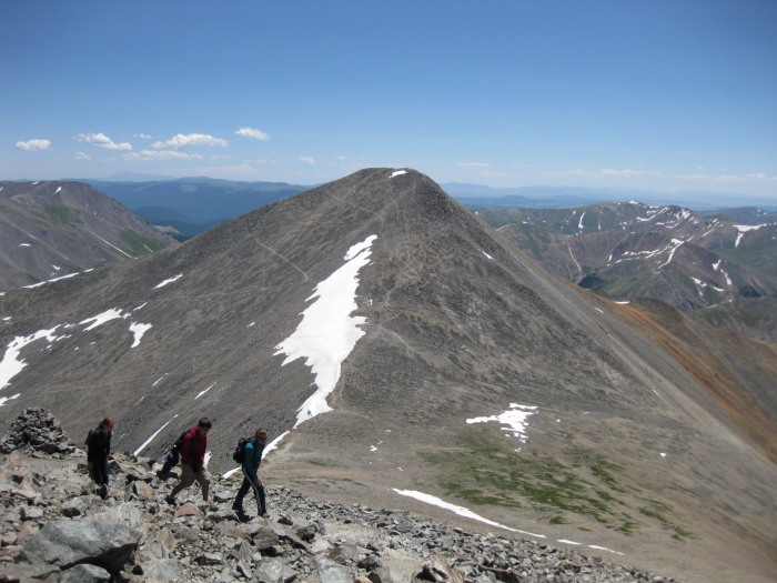 and took another look at Mt of the Holy Cross 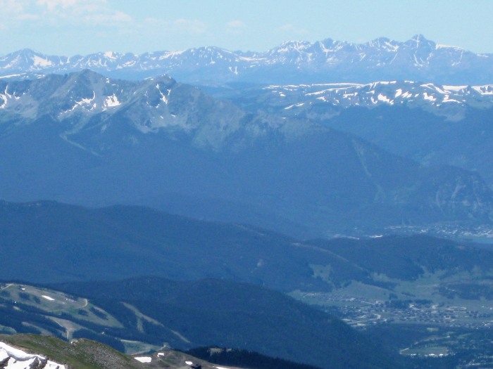 After 15 minutes, we started our descent with the other hikers. Once on the saddle, we picked a route across the snowfield, 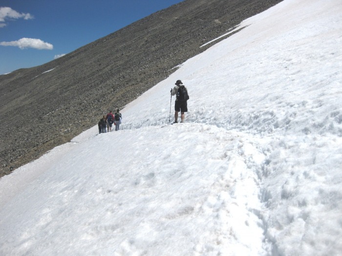 starting from the trail sign, until we re-joined the Grays Peak trail again. Mrs. Smith and Mom_to_Jess were waiting for us a little further down and we hiked the rest of the way back together, passing some beautiful shallow alpine pools 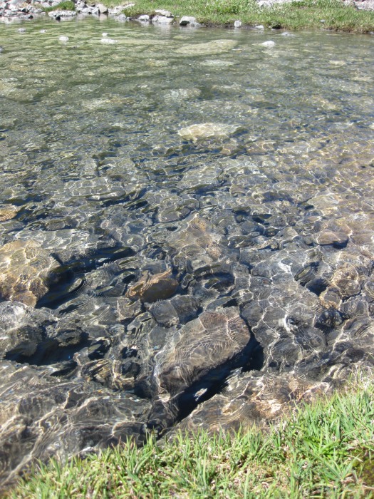 along the way. The sun stayed with us all day, the wind never became much of an issue, it was strong at the beginning and on the summit, but otherwise we stayed somewhat sheltered from its effects. We decided to all pile in to our Ford Edge for the ride back down Stevens Gulch Road, with two in the wayback, 1 standing through the sunroof as a spotter, and made it down with no incident. We topped offthe day with a dip in the Hot Tub back in Frisco with the Smiths, a relaxing end to an awesome day, made even better by being able to enjoy it with good friends. Thumbnails for uploaded photos (click to open slideshow):
|
| Comments or Questions |
|---|
|
|
Caution: The information contained in this report may not be accurate and should not be the only resource used in preparation for your climb. Failure to have the necessary experience, physical conditioning, supplies or equipment can result in injury or death. 14ers.com and the author(s) of this report provide no warranties, either express or implied, that the information provided is accurate or reliable. By using the information provided, you agree to indemnify and hold harmless 14ers.com and the report author(s) with respect to any claims and demands against them, including any attorney fees and expenses. Please read the 14ers.com Safety and Disclaimer pages for more information.
Please respect private property: 14ers.com supports the rights of private landowners to determine how and by whom their land will be used. In Colorado, it is your responsibility to determine if land is private and to obtain the appropriate permission before entering the property.

