Download Agreement, Release, and Acknowledgement of Risk:
You (the person requesting this file download) fully understand mountain climbing ("Activity") involves risks and dangers of serious bodily injury, including permanent disability, paralysis, and death ("Risks") and you fully accept and assume all such risks and all responsibility for losses, costs, and damages you incur as a result of your participation in this Activity.
You acknowledge that information in the file you have chosen to download may not be accurate and may contain errors. You agree to assume all risks when using this information and agree to release and discharge 14ers.com, 14ers Inc. and the author(s) of such information (collectively, the "Released Parties").
You hereby discharge the Released Parties from all damages, actions, claims and liabilities of any nature, specifically including, but not limited to, damages, actions, claims and liabilities arising from or related to the negligence of the Released Parties. You further agree to indemnify, hold harmless and defend 14ers.com, 14ers Inc. and each of the other Released Parties from and against any loss, damage, liability and expense, including costs and attorney fees, incurred by 14ers.com, 14ers Inc. or any of the other Released Parties as a result of you using information provided on the 14ers.com or 14ers Inc. websites.
You have read this agreement, fully understand its terms and intend it to be a complete and unconditional release of all liability to the greatest extent allowed by law and agree that if any portion of this agreement is held to be invalid the balance, notwithstanding, shall continue in full force and effect.
By clicking "OK" you agree to these terms. If you DO NOT agree, click "Cancel"...
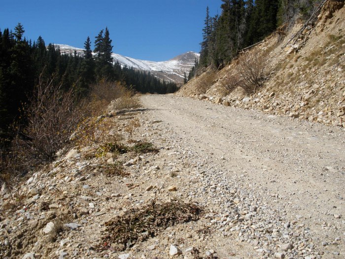
I parked at the Leavick townsite which is unmarked and is roughly 10.5 miles from the US285/CR-18 junction. I could've driven another mile or so farther but I figured the extra distance wouldn't hurt, what with this being a relatively short hike anyway. About a half mile up the road, I got my first glimpse of Mt. Sheridan, a 13er that shares the southwest ride with Mt. Sherman but wasn't on the agenda for the day.
First view of Mt. Sheridan
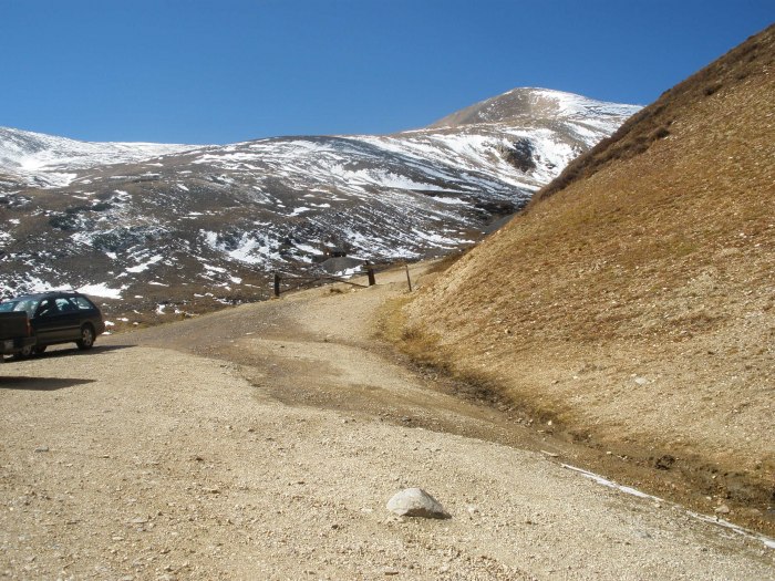
The 4WD road closure gate which marks the Fourmile Creek TH is another 1.5 miles down the road.
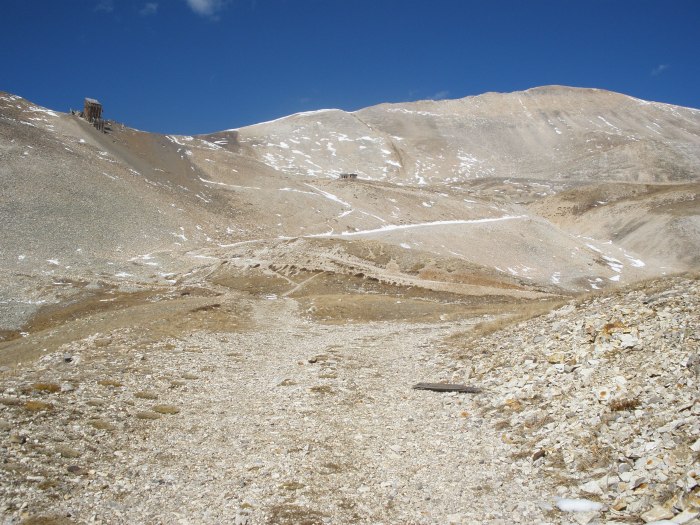
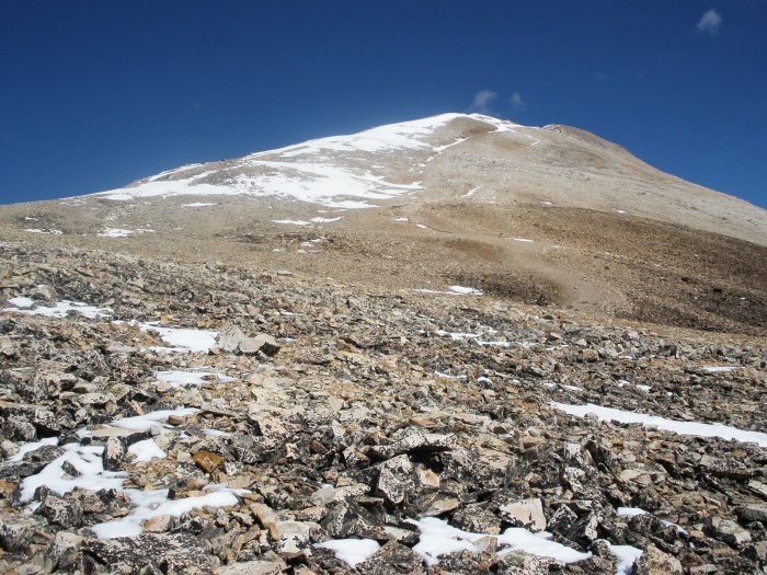
The Fourmile Creek trail is somewhat unique in that it lacks the densely wooded portion that's typical on most 14er trails starting below treeline. The early part of the trail is broad and open as it meanders through the mine buildings. Shortly into the hike, Mt. Sherman came into view exposing the trail winding up to Hilltop mine and the traverse over its long southwest ridge.
Early look at the route and peak
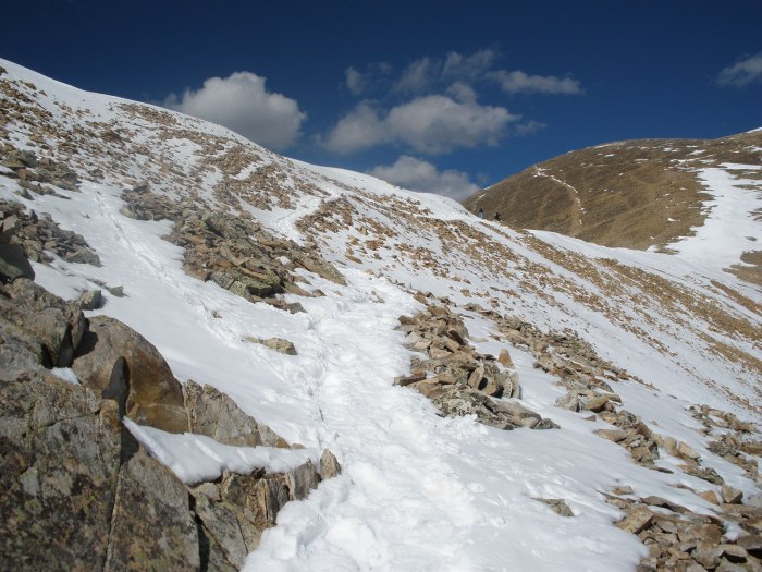
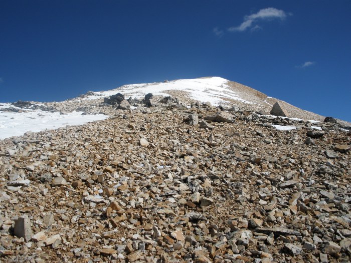
The appearance was a little misleading as there was snow on the trail that quickly increased with elevation; thankfully, it was well packed and traction wasn't an issue for the most part. Wind, however, did make its chilling presence felt as I climbed up to the ledge west of Hilltop mine which leads up to the saddle between Mt. Sheridan and Mt. Sherman.
Ledge leading to the saddle
Snow-packed ledge
Saddle and ridge route
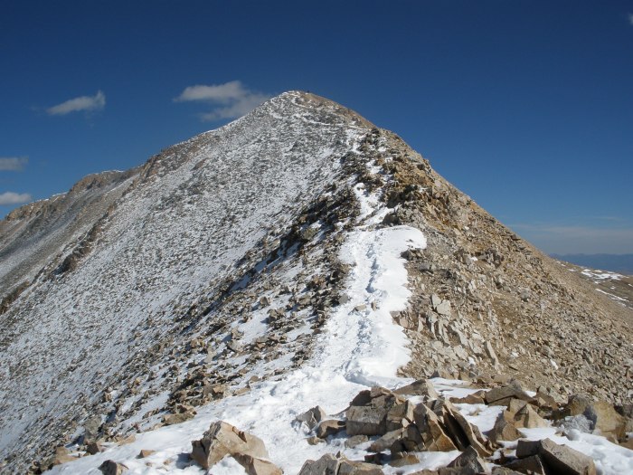
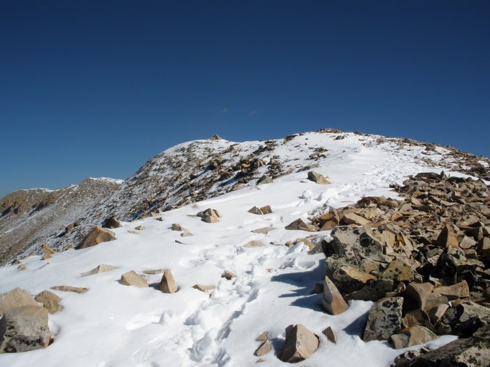
The hike from the saddle traverses the wind-scoured ridge that leads up to two false summits.
False Summit 1
False Summit 2
The true summit is another ¼ mile from the last pretender and is the penultimate hump in the picture below.
Final pitch to the gentle summit
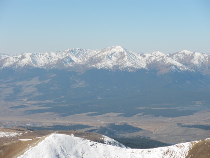
Once on the top, I was rewarded with spectacular views of the Sawatch range. Here you can see Mt. Elbert, Colorado's highest, in all her majesty.
View of Mt. Elbert
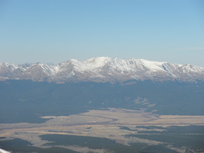
...and the awesome five-summited Mt. Massive.
View of Mt. Massive
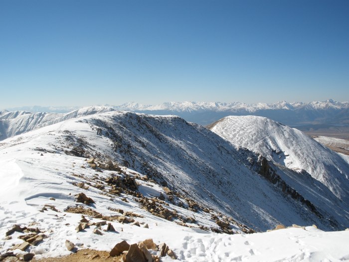
Here is a view over the South ridge gracing the top of Mt. Sheridan while the Sawatch range fills the background.
Summit View to the South
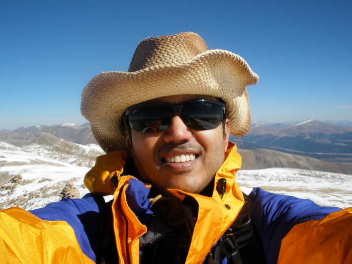
Here is a shot of yours truly; what appears to be a "Come to Papa" look was my attempt at an ear-to-ear grin but evidently, everything is muted at high altitude! Twin-summited Gemini Peak is visible in the background to the left.
It was not until I was well on my descent that it dawned on me that this hike marked the 13th anniversary of my previous ascent of Mt. Sherman. Today's was a solo venture but in 1997 I had hiked this peak with an amazing woman that I soon started dating and to whom I am now happily married. I will eternally be grateful to Colorado and her magnificent mountains for these incredible memories!
Thumbnails for uploaded photos (click to open slideshow):
Looks like a great hike. I hiked Mt. Sherman back in June from the Iowa Gulch TH. I agree the views from the top are worth suffering through a relatively less-than-scenic hike up. Minor correction, Image #10 is actually a view of Mt. Elbert, Colorado's highest! I do think you can barely see the summit of Princeton further to the south however.
zoriloco, indeed it was a great day; may not be much more left in the season for fair-weather hikers like me. Sounds like you guys had a blast too!
globreal, thanks! :)
Caution: The information contained in this report may not be accurate and should not be the only resource used in preparation for your climb. Failure to have the necessary experience, physical conditioning, supplies or equipment can result in injury or death. 14ers.com and the author(s) of this report provide no warranties, either express or implied, that the information provided is accurate or reliable. By using the information provided, you agree to indemnify and hold harmless 14ers.com and the report author(s) with respect to any claims and demands against them, including any attorney fees and expenses. Please read the 14ers.com Safety and Disclaimer pages for more information.
Please respect private property: 14ers.com supports the rights of private landowners to determine how and by whom their land will be used. In Colorado, it is your responsibility to determine if land is private and to obtain the appropriate permission before entering the property.

 First view of Mt. Sheridan")
")
 Early look at the route and peak")
 Ledge leading to the saddle")
 Snow-packed ledge")
 Saddle and ridge route")
 False Summit 1")
 False Summit 2")
 Final pitch to the gentle summit")
 View of Mt. Elbert")
 Summit View to the South")
")
 View of Mt. Massive")


