Download Agreement, Release, and Acknowledgement of Risk:
You (the person requesting this file download) fully understand mountain climbing ("Activity") involves risks and dangers of serious bodily injury, including permanent disability, paralysis, and death ("Risks") and you fully accept and assume all such risks and all responsibility for losses, costs, and damages you incur as a result of your participation in this Activity.
You acknowledge that information in the file you have chosen to download may not be accurate and may contain errors. You agree to assume all risks when using this information and agree to release and discharge 14ers.com, 14ers Inc. and the author(s) of such information (collectively, the "Released Parties").
You hereby discharge the Released Parties from all damages, actions, claims and liabilities of any nature, specifically including, but not limited to, damages, actions, claims and liabilities arising from or related to the negligence of the Released Parties. You further agree to indemnify, hold harmless and defend 14ers.com, 14ers Inc. and each of the other Released Parties from and against any loss, damage, liability and expense, including costs and attorney fees, incurred by 14ers.com, 14ers Inc. or any of the other Released Parties as a result of you using information provided on the 14ers.com or 14ers Inc. websites.
You have read this agreement, fully understand its terms and intend it to be a complete and unconditional release of all liability to the greatest extent allowed by law and agree that if any portion of this agreement is held to be invalid the balance, notwithstanding, shall continue in full force and effect.
By clicking "OK" you agree to these terms. If you DO NOT agree, click "Cancel"...
Starting Point: 1 mile past Leavick townsite on CR-18 (11,500')
RT Distance: 11.1 miles
Elevation Gain/Loss: 4,660 feet
Correct title should read: Sherman Quartet AKA How to Turn an "Easy" Fourteener Hike into a Challenging Workout
Arbitrary guidelines to make a 14er hike a more difficult:
1. Start the hike below the standard trailhead adding more distance and elevation gain to the trip.
2. Add a few of the neighboring high 13er peaks to the agenda. Not only does this add more elevation gain/loss, the addition occurs at higher elevations and often requires the re-summit of at least one peak, preferably the highest.
3. Lose a vital piece of equipment, say, camera, and spend precious time at high altitude searching for it.
4. Get off trail on the descent or take a route not heading to the trailhead. This is admittedly difficult to do with a GPS device on hand, but as you'll see some of us manage just fine!
Mt. Sherman was the 'collateral" peak for my hike today as my goal was to summit its neighboring 13ers, Gemini to its north and Sheridan to the southwest. Roach labels this combo "the big one" in the Sherman group. Also on the cards possibly was Dyer Mountain northwest of Gemini but I knew this would be tough option although it would clearly take guideline 2 a step further. I started my hike just over a mile and some 500 vertical feet short of the Fourmile creek trailhead for no good reason other than to follow arbitrary guideline 1; I knew my car would've made it just fine up to the gate so that definitely wasn't it.
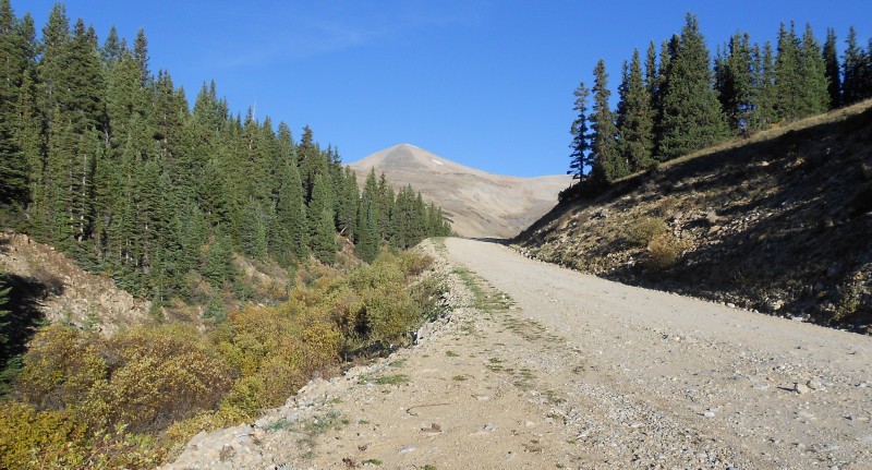
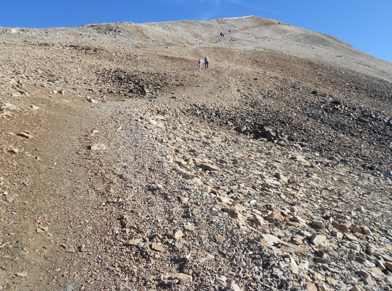
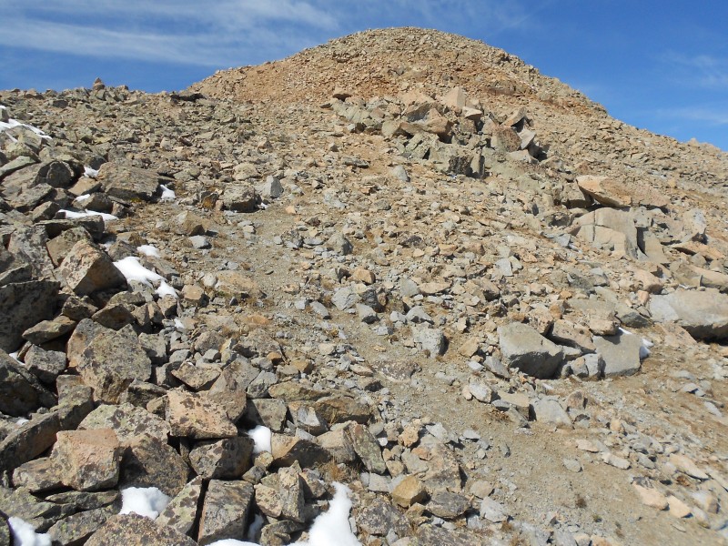
Starting point
I documented my 2nd hike of Sherman from two years ago so I won't dwell on the details of this part of the trail which is clearly very popular and rather easy to follow to Sherman's summit. If anything, I found that there were too many equivalent trail options which made things a little confusing but all roads do eventually lead to Rome, I mean Sherman!
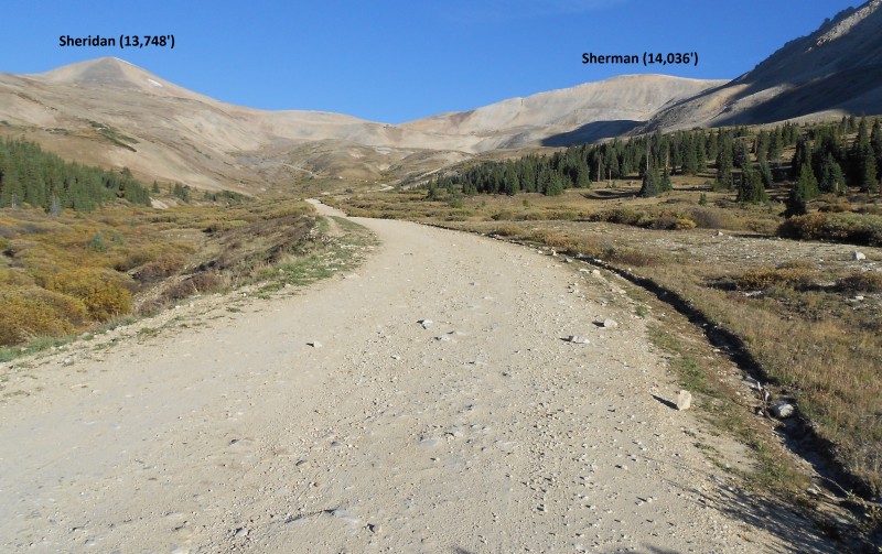
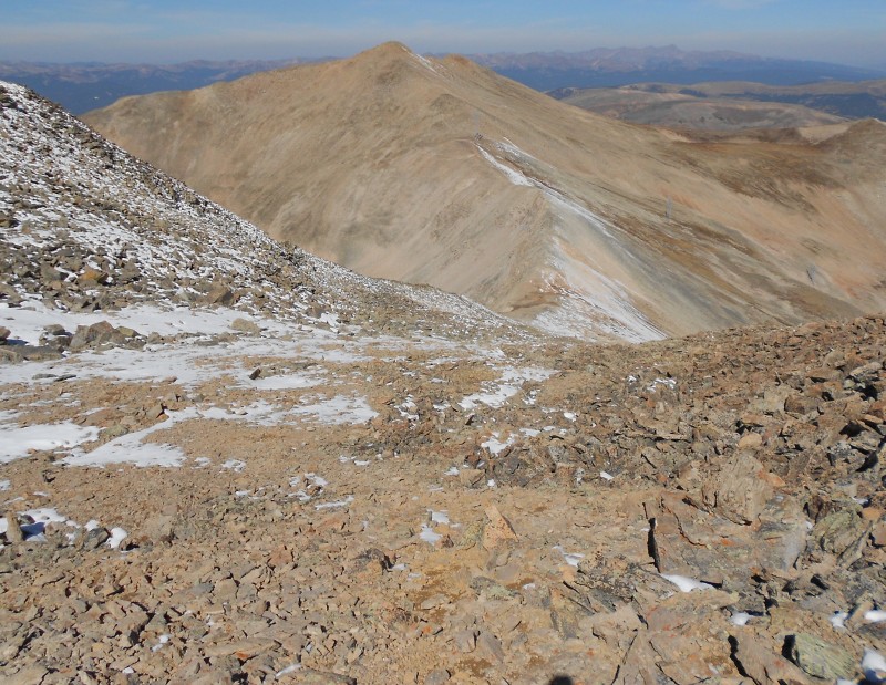
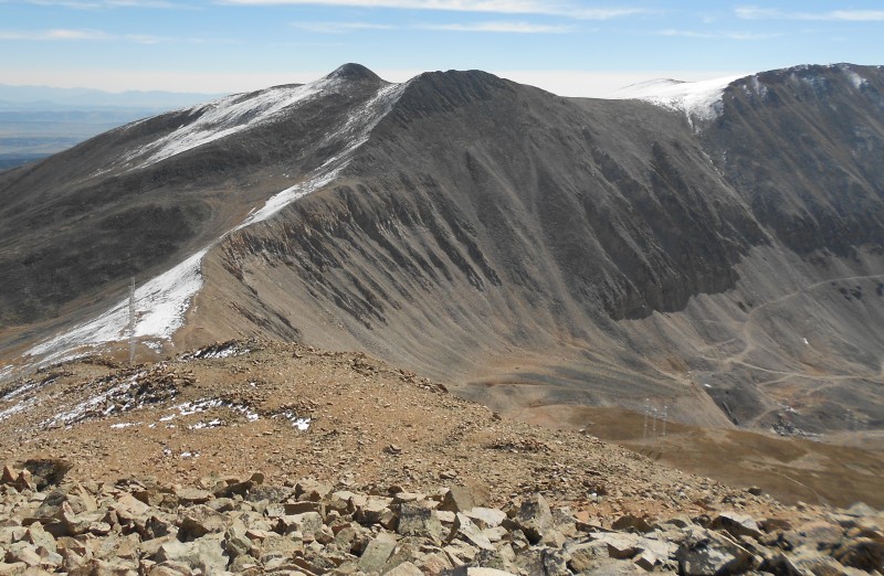
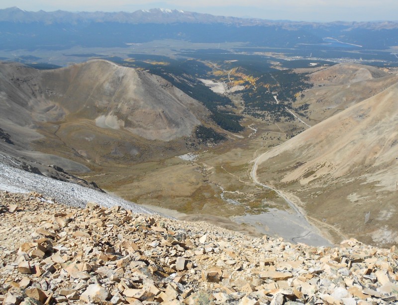
Sherman and Sheridan
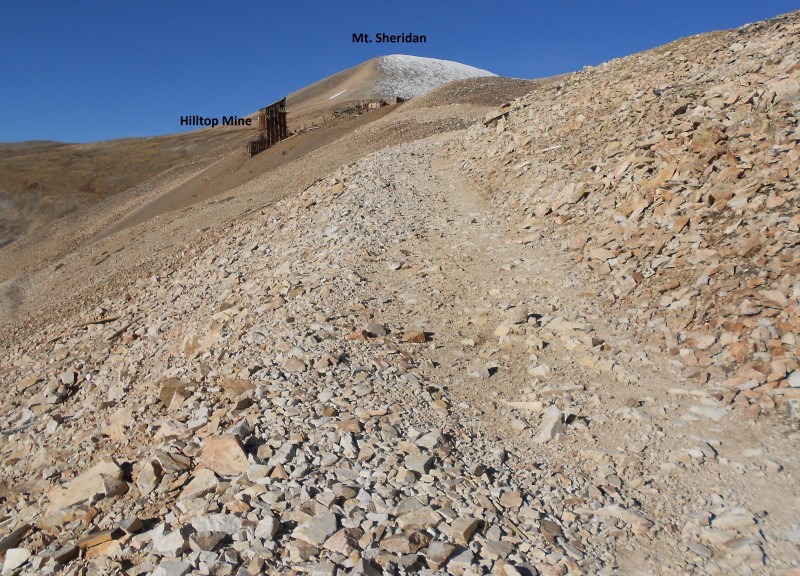
The trail itself is rather unremarkable, passing the Dauntless and Hilltop Mines en route to the saddle with Sheridan at 13,150'.
Sheridan
When I got to the saddle, the views to the west were gorgeous and the winds which had been sporadic until then picked up to a subdued but steady roar.
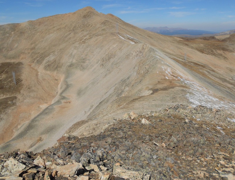
Sherman-Sheridan Saddle
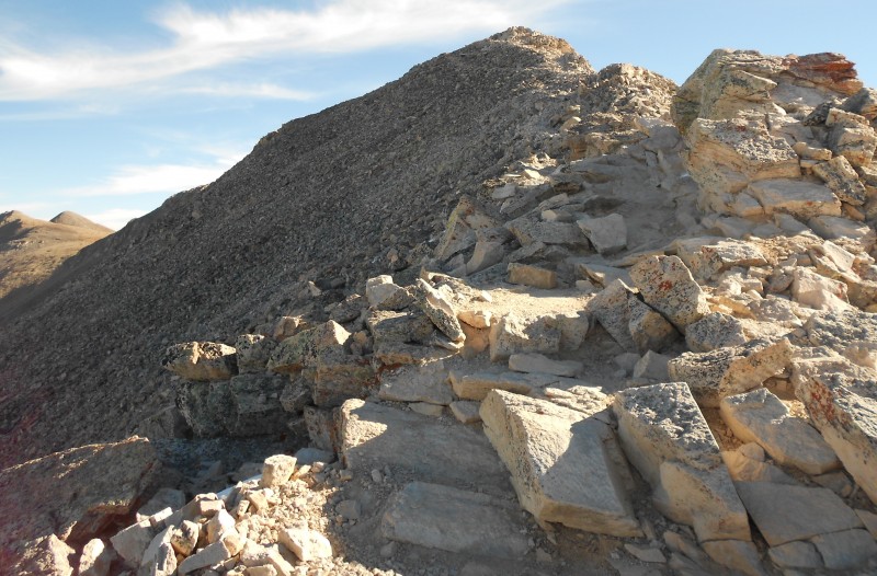
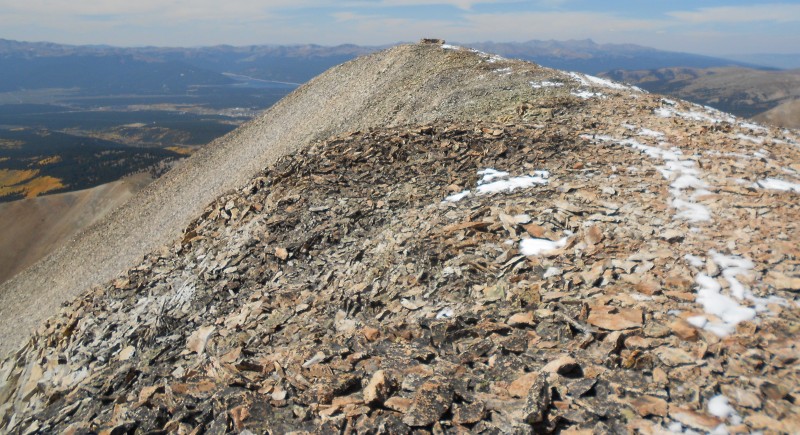
The ridge route to the summit of Sherman was well marked and I remembered the false summits that one had to endure as the trail weaves to either side of the narrow ridge.
Ridge to Sherman
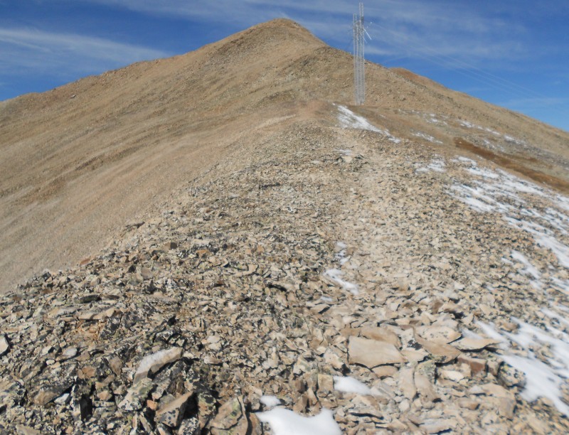
The popularity of Sherman not to mention its reputation as an easy 14er was definitely in evidence today as there were hikers galore in every section of the trail.
Ridge trail
Navigating the narrow ridge
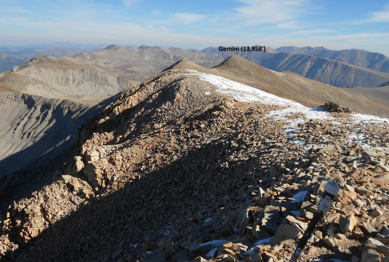
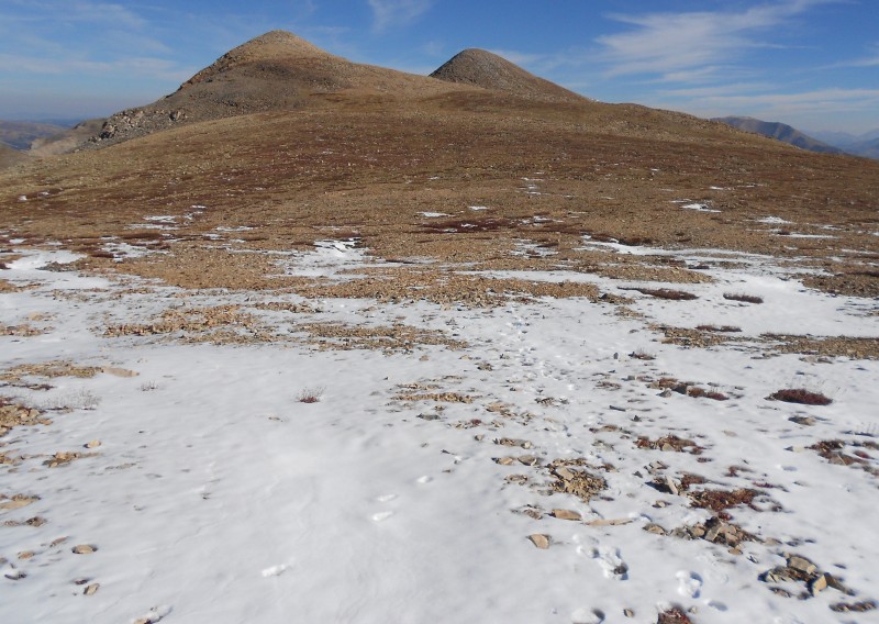
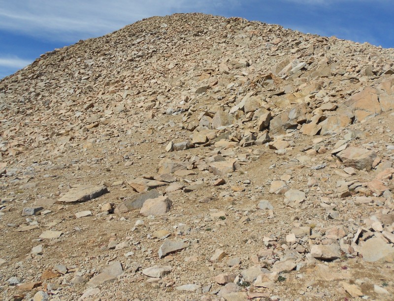
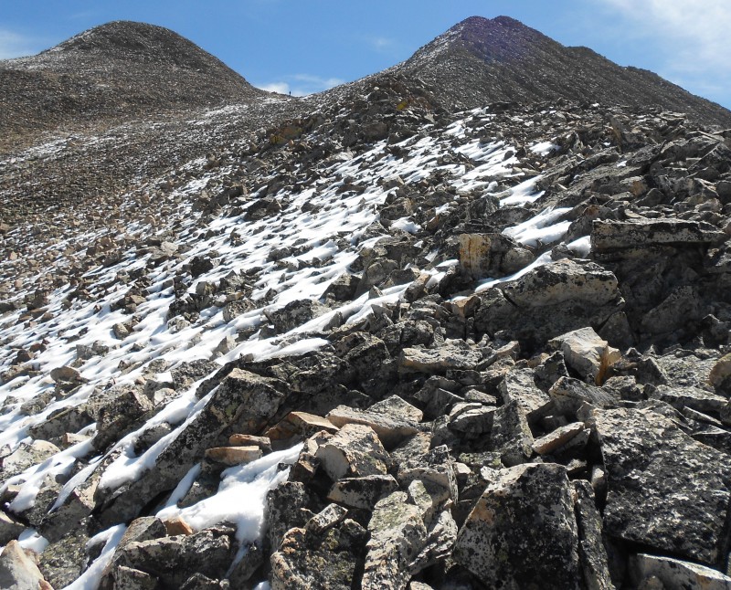
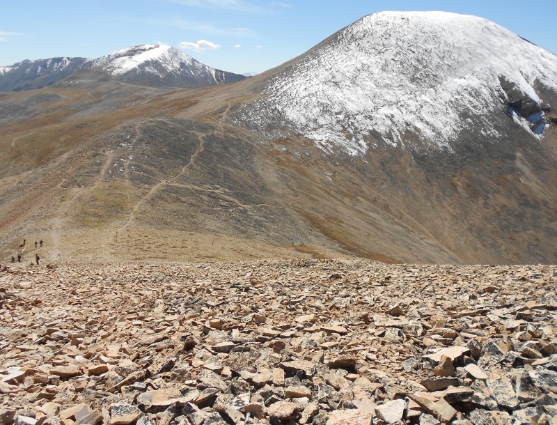
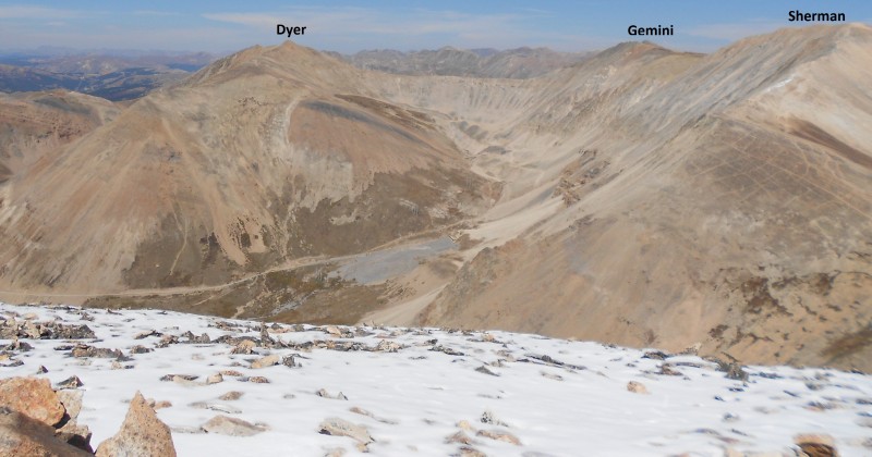
An hour and 30 minutes after leaving my car, I was at Sherman's summit but I didn't linger long for there was plenty of more work to do and the tough sections of the hike still lay head. I glanced at the twin-humped Gemini peak to the north and set out along the ridge.
Atop Sherman Looking North to Gemini
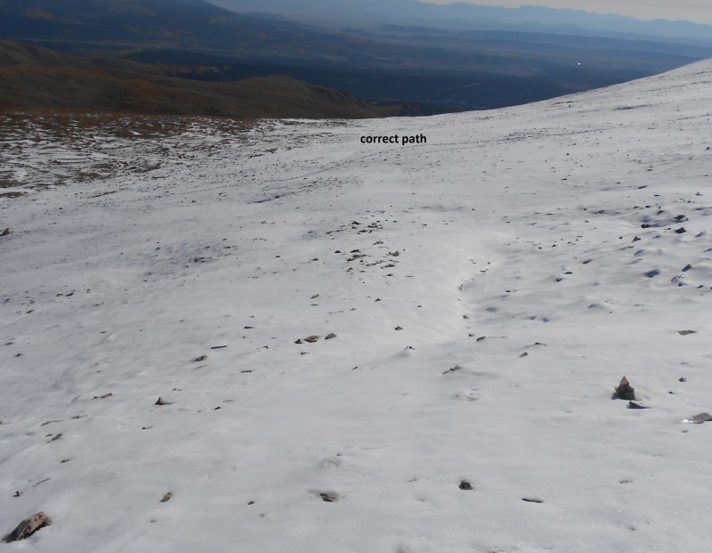
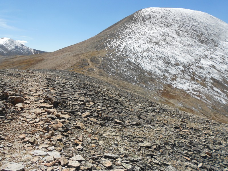
What I didn't immediately realize was that the ridge doesn't exactly connect and that I needed to veer east of the ridge to find the easiest path to the northeast of the two peaks which is the true summit. I hadn't encountered much snow until then but that was about to change. I traversed down the ridge for a bit and then picked up the tracks in the snow defining the best path.
Sherman's snowy north face
Once I was on the saddle, the snow disappeared and so did the tracks I'd followed so I took a direct approach to the northeast hump sans trail.
On the broad saddle to Gemini
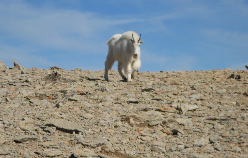
As I crossed the boulder field and approached the base of Gemini's hump, the guardian of Gemini sprung from the face to the west and caught me completely by surprise!
Whoa!
I was still taking pictures of this beauty when I realized that he was steadily taking steps toward me.
Should I run now?
I hurriedly shoved the camera in my pocket (or so I thought), grabbed my hiking pole and retreated to let him know that I meant no threat. He took a couple of more steps in my direction before deciding that I was every bit as innocuous as I looked and veered off to the right. It was not until I'd reached the base of the hump that I checked my pockets confirming that my camera was no longer in my possession! I started retracing my path and replaying my moves leading to the sighting of the goat; for the first ten minutes, I used my GPS to trace my path but to no avail. Realizing that I was paying more attention to the device instead of scouring the area, I switched tactics and ten minutes later found the camera, thus observing arbitrary guideline 3 without serious repercussions!
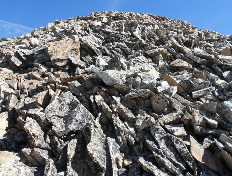
The hike up Gemini's rocky hump was an enjoyable scramble, albeit a little trickier on the way down.
Gemini's rocky face
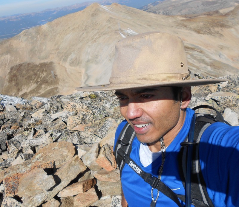
Gemini's summit had a population of exactly one. In dire contrast to Sherman's crowded summit seen in this picture with the Sawatch peaks in the horizon.
Party on Sherman
I took my photo with Dyer Mountain in the backdrop to the northwest and at this point I was still undecided on whether I would add this traverse to the agenda.
Dyer Mountain
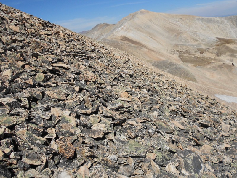
When I got off Gemini I still wasn't sure. I eyed the narrow ridge route and then it flashed before my eyes: last night's dream (or should it be, nightmare?) where I was precariously navigating this very ridge. The only difference was the entire slope had been filled with snow in my dream; indeed, reality had turned out in my favor so I decided to take the plunge; after all, I could always skip Sheridan on the last leg if I didn't feel up to it.
Ridge trail to Dyer
The ridge in fact looks narrower than it really is, and the correct route stays close to it since the drops-offs on either side are loose and steep. I started down a stable rock gully that soon connected to the ridge.
Navigating the narrow ridge
Indeed this traverse was much worse in my dream! The trail bypasses the first couple of rocky humps to the right before descending to the saddle.
On the saddle
The ridge climbing up to Dyer is thankfully not as narrow and the trail now stays to the left of the next hump as it weaves its way to the summit.
Skirting this hump on the left
Final pitch to Dyer
The next shot shows the ridge route from Dyer's summit block. Mt. Sherman's summit is visible to the far right.
Looking back toward Gemini
I had encountered not a soul on the last traverse or on Dyer's summit for that matter. I was pretty stoked having made my third high summit for the day but didn't spend long on Dyer's summit. I still wanted a shot at Sheridan if at all possible so I started my journey back. I was about half way up the ridge when I spotted a hiker on Gemini's saddle.
Hiker on Gemini's saddle
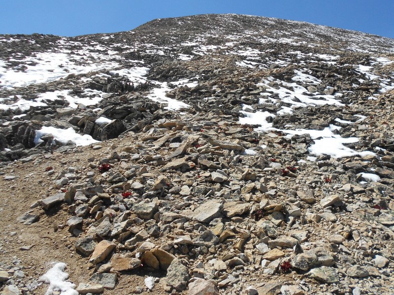
This was a group so Gemini Peak would have a few more vistors for the day after all! Forty minutes after leaving Dyer, I was on Sherman's north ridge making my way back to the summit. The snow tracks on Sherman's north face show the route that stays off the ridge as well as paw prints joining in from the ridge, belonging to some genius who shall go unnamed!
Return to Sherman's summit
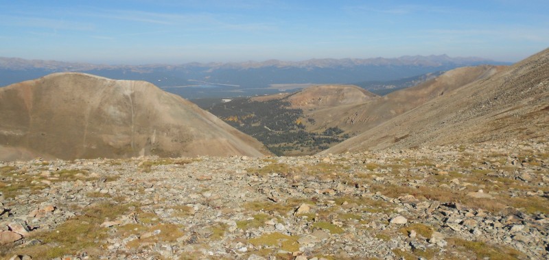
Atop Sherman for the second time today, I briefly enjoyed the views of the valley to the west and the majestic Sawatch range in the distance.
Views to the west
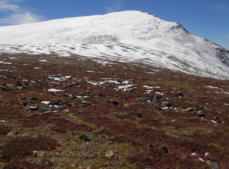
But today, there will be no rest for the weary! I started heading down the saddle toward Sheridan hoping that I had enough left in the tank for the final peak. As I made my way down the ridge keeping my eye on Sheridan for the most part, there appeared to be multiple trails heading up her northeast face before they disappeared under the snow cover.
Eyeing Sheridan
There were still hikers making their way up to Sherman's summit and many others on their way down, but once I got to the saddle I realized that my ascent up to Sheridan will again be a solo one. Such is the relative popularity of Colorado's 14ers while the multitudes of peaks that just miss that designation wallow in solitude! Would it be different if we used the metric system?
On the saddle with Sheridan
My goal was to find the most direct path up the summit but there turned out to be a faint trail that I was able to follow for the most part without much drama.
Route up Sheridan
Sheridan Summit
My summit shot from Sheridan captures the other three peaks that I visited today.
The Trio from Sheridan
I sat in the rock shelter atop Sheridan, away from the hum of the crowds, the winds strangely muted compared to the relentless thrashing on Sherman's summit. I could finally say, "It's all downhill from here"! But the drama would continue for a bit longer as I was about to observe arbitrary guideline number 4! As my GPS route marker will attest, I started the descent from Sheridan and promptly took the wrong trail (yes, there is another!); this path heads south and descends rapidly so within minutes I was a few hundred feet off the summit.
Off trail!
When I finally took stock of my bearings and checked against the GPS, I knew I either had to climb back to the top or engage in some side hilling to get back to the correct trail. I chose the latter and this turned out to be a veritable scree adventure as I tried to skirt across the face while still descending what quickly became a loose rocky slope. And just in case you're wondering - NO, this is not the fastest way down or the most pleasant! I slid down most of this rock face for a good 30 minutes before joining the main trail, thankfully unscathed. Some 7 hours and 45 minutes after I'd started on this saga I was back in my car and it felt great but it sure didn't feel like an "easy" fourteener!
My GPS Tracks on Google Maps (made from a .GPX file upload):
I did Sherman and Gemini on 8/17 (cut it short due to weather concerns that never materialized)-It's amazing the solitude you feel in that basin below Sherman and on Gemini, isn't it? This ”boring 14er” has been one of my favorite hikes!
Indeed, Sherman is under appreciated and even maligned in the community for that reason. This trip definitely opened my eyes to the beauty of the area that I'd completely missed until now! :)
...and very helpful to me! I climbed Sherman and Sheridan 19 years ago. I'm headed back this wknd to Sherman for my daughter's finisher, and would like to tuck in Gemini and Dyer. Your nice pics help to fill in the (large) gaps in my memory so I'll know what to expect. (Plus convincing me that Gemini is too rough for running shoes!) Congrats on getting all four of your targets.
Glad to hear that my TR jogged your memories from nearly two decades ago! Congrats on completing the 14ers and hope you and your daughter have a blast on her finisher. :)
Caution: The information contained in this report may not be accurate and should not be the only resource used in preparation for your climb. Failure to have the necessary experience, physical conditioning, supplies or equipment can result in injury or death. 14ers.com and the author(s) of this report provide no warranties, either express or implied, that the information provided is accurate or reliable. By using the information provided, you agree to indemnify and hold harmless 14ers.com and the report author(s) with respect to any claims and demands against them, including any attorney fees and expenses. Please read the 14ers.com Safety and Disclaimer pages for more information.
Please respect private property: 14ers.com supports the rights of private landowners to determine how and by whom their land will be used. In Colorado, it is your responsibility to determine if land is private and to obtain the appropriate permission before entering the property.