Download Agreement, Release, and Acknowledgement of Risk:
You (the person requesting this file download) fully understand mountain climbing ("Activity") involves risks and dangers of serious bodily injury, including permanent disability, paralysis, and death ("Risks") and you fully accept and assume all such risks and all responsibility for losses, costs, and damages you incur as a result of your participation in this Activity.
You acknowledge that information in the file you have chosen to download may not be accurate and may contain errors. You agree to assume all risks when using this information and agree to release and discharge 14ers.com, 14ers Inc. and the author(s) of such information (collectively, the "Released Parties").
You hereby discharge the Released Parties from all damages, actions, claims and liabilities of any nature, specifically including, but not limited to, damages, actions, claims and liabilities arising from or related to the negligence of the Released Parties. You further agree to indemnify, hold harmless and defend 14ers.com, 14ers Inc. and each of the other Released Parties from and against any loss, damage, liability and expense, including costs and attorney fees, incurred by 14ers.com, 14ers Inc. or any of the other Released Parties as a result of you using information provided on the 14ers.com or 14ers Inc. websites.
You have read this agreement, fully understand its terms and intend it to be a complete and unconditional release of all liability to the greatest extent allowed by law and agree that if any portion of this agreement is held to be invalid the balance, notwithstanding, shall continue in full force and effect.
By clicking "OK" you agree to these terms. If you DO NOT agree, click "Cancel"...
Wilson Peak via the Rock of Ages/Silver Pick Approach, Southwest Ridge
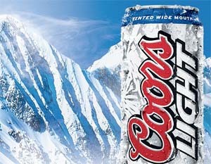
Most people have seen Wilson Peak before, though they probably didn't realize it; it's on every can of Coors and displayed in the background of every ad!
Of course, us astute mountaineers knew this
Anyone getting thirsty?
This was my second attempt on Wilson Peak. I originally was planning on hiking in on Monday (9/3), setting up camp around 12,000ft and going for the summit aiming to be there at sunrise.
The Wolverine
The below area near the remains of the stone cabin was where a wolverine was allegedly recently seen. On reaching the area, I sat on a rock in the talus for a while watching quietly - camera ready in hand, waiting for one to come out. Unfortunately, I never saw one, though did see several dark marmots cavorting about in the area. Neat place to hang out though.
I hiked up to that grassy area, near where I was planning on pitching my tent, I discovered that of the water sources there, one was essentially dried up with a bit of cloudy mud sluggishly moving along the ground and the other stream was stained white, emanating from an old mine... neither looked like good options with which to fill my bottles up.
Since there didn't appear to be any potable water around and due to my expecting to treat some here, I only carried about a liter with me. As this was not enough for cooking, to last the night and for the climb in the next day, I decided to pack out and hike back to the car and do it as a one day climb in the morning. I was hoping that by sitting somewhere out of site, quietly in a tent might give me a chance to see the wolverine, without disturbing it...oh well, another day.
To Scott and Julie whom I met at the parking lot and who gave me a ride the last mile down that road, thank you again. Hope you guys made the summit the next day! I saw your truck there, but must have missed you on the way down.
The Climb
As the last member of the Wilson Group, rumor had it that this was the least difficult of the three so I figured I'd head out solo and enjoy a late summer day up in the Silver Pick Basin.
While this was easier in general than Mount Wilson and El Diente, the last portion of this peak was pretty tough, not a walk up by any means, but was a fun day with virtually nobody on the mountain that day.
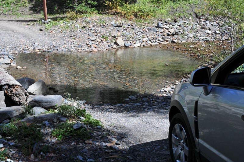
Happily, Silver Pick Road was quite manageable in the car and even the creek was no major obstacle, though I imagine in Spring/early summer swollen with snowmelt it could be difficult to cross.
The forecast seemed solid, so getting started about an hour before sunrise seemed a good time to start.
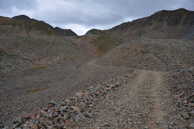
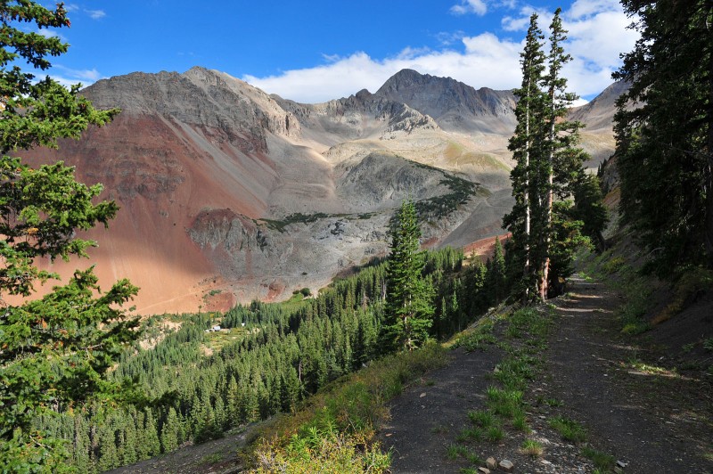
The hike from the trailhead to the saddle was pretty uneventful. You first hike on a trail, which morphs into a road carved from gravel and talus up into the basin, where the
road eventually blends into a rocky trail heading up towards the saddle at 13,000ft.
The road becomes a bit monotonous and seems never ending, until you turn off onto the steeper trail.
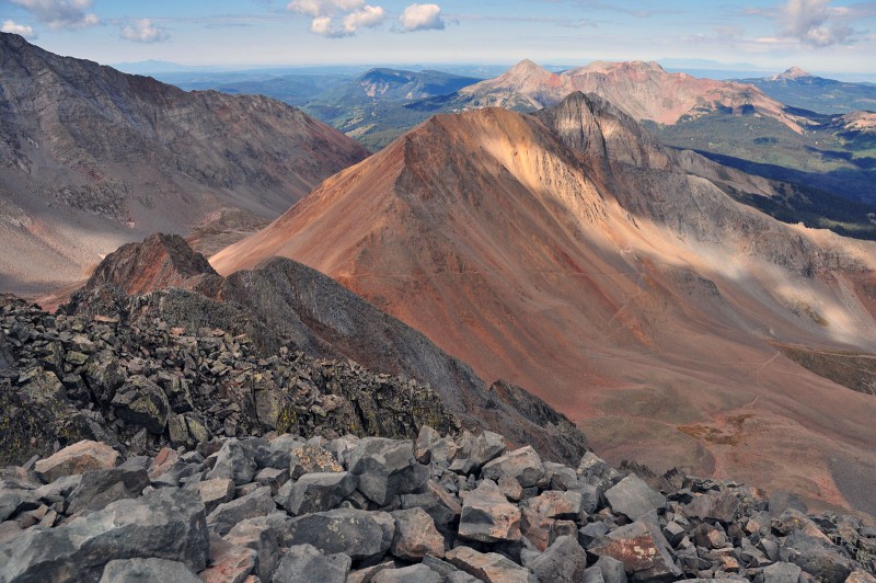
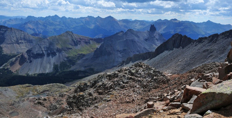
Along the road/route up, you are treated to grand views of the San Juans with stunning contrasts of colors of reds, blues and greens as if I were walking into my wallpaper on my flat screen.
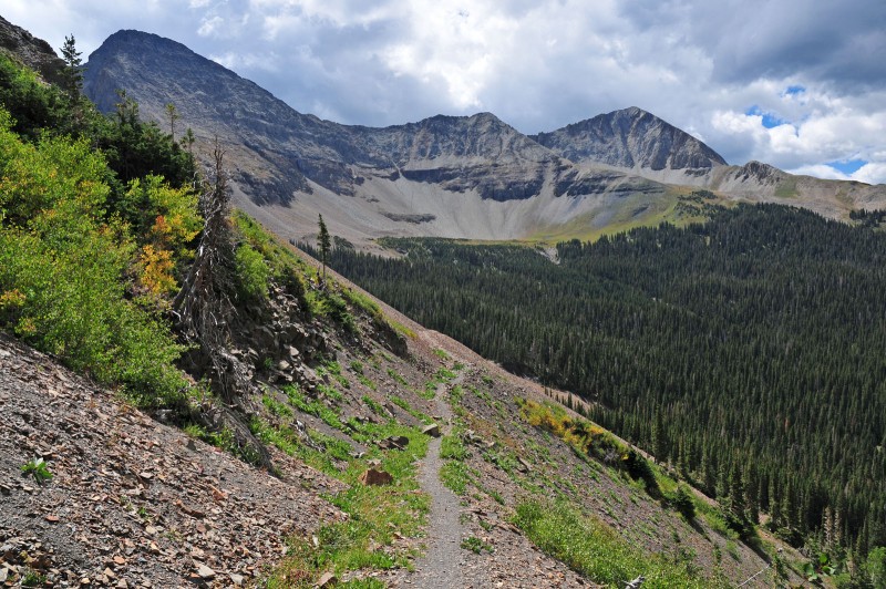
Looking back from roughly 11,500ft at a spot where the talus road enters a patch of forest briefly.
The talus road continues high up before turning west off up the slopes towards the saddle on a trail.
For those of you who enjoy talus, you'll love this area. It reminded me of the city of Bedrock where Fred and Wilma live. I expected to see Dino run out any minute from behind the remnants of that stone cabin. I imagine a modern day Flintstones could be filmed here.
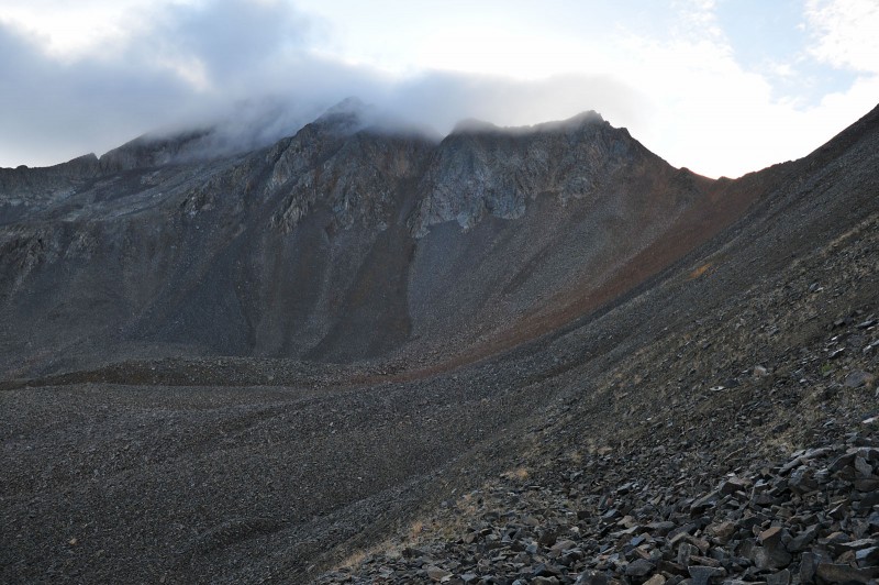
In the early morning, clouds covered the summit of Wilson Peak and its subpeaks. I was hoping this would burn off after the sun came up. Luckily, by the time I reached the saddle, they did.
Before getting to the saddle you can see the nicely defined western face of the Wilson Peak, draped in scree and talus. From a distance, these terrain features give the mountain its characteristically shapely appearance. I took this shot on the way down-note the clear skies.
Once the Saddle is reached, you see what appears to be the remaining route, but this is the ridge to another small sub-summit of sorts and then to Gladstone peak to the South. The summit of Wilson Peak is not yet visible.
This is really an awesome area with great views and makes for a nice rest spot before and after climbing up the Peak.
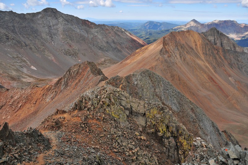
The photo shows the long ridge to Gladstone Peak. Mount Wilson is just off to the right of this photo. Wilson Peak is off the far left not visible in the image. There is also a small cabin at the bottom of the basin, think its an old mining cabin.
Both El Diente and Mount Wilson can be clearly seen here, with them and their connecting ridgeline framing the southern border of the Navajo basin in front of you
El Diente: hard to imagine we stood on top of this two days ago.
Mount Wilson (Were you one of those three people standing on the summit on Sept 4??)
After reaching the saddle between Gladstone and Wilson Peak, you can see the remaining route and roughly 800ft of climbing left. The rocks were a bit wet from the morning - after moving left on the steeper terrain, the slipperiness caused me to backtrack and descend instead the 100ft or so then cut over to the route up the Peak. The descent here is loose and steep.
Making my way across the terrain here, looking back in a stunning view, you can see the route from the saddle with Gladstone Peak to the left.
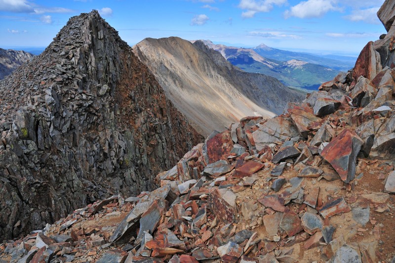
The terrain here is spectacular with ridges and points with several 13ers and 14ers surrounding you.
A closer look at the route, looking back at the Gladstone-Wilson Peak saddle and ridgeline. Mt Wilson is in the middle. The route up Wilson Peak cuts across this from the far right in the photo to the middle of the ridge which is the spot where I climbed back up to the Gladstone-Wilson Peak saddle before descending back down to ROA TH.
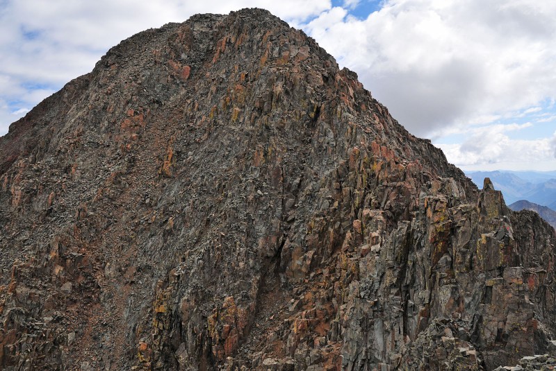
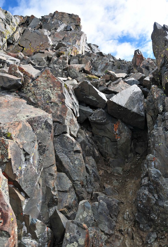
Near the top at about 100 feet from the summit a false summit appears. It feels like the summit, until you get up and see the actual summit looming in front of you.
In the photo below, looking back, you can see a climber coming along the ridge. He is the black dot just left of center, about to enter the scree/talus slopes (click photo to enlarge). He unfortunately didn't summit today due to a broken hand! Good work though for even attempting to continue on with this with only one hand to climb!
Once on top of the false summit, you need to downclimb to its base where you pick up the final route to the real summit.
This downclimb is on pretty good class 3 rock as is the remaining climb up, but does require care as this is a no-fall zone. The option to go lower and then ascend the gulley looks miserable and while probably less exposed, I prefer rock to gulleys so I stuck with the steeper, but more solid option.
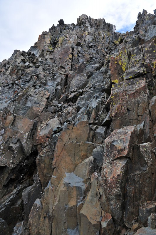
As viewed from the false summit, looking at the climbing left to do to get to the top. I'd take the crack just right of center and angle my way up.
A closer look at the diagonal crack leading to the summit
Care needs to be taken here. While not as exposed as the final Crux to the top of Mount Wilson, there are spots here where a fall will result in a real bad day or worse with some long drops. This is also not a place to turn an ankle.
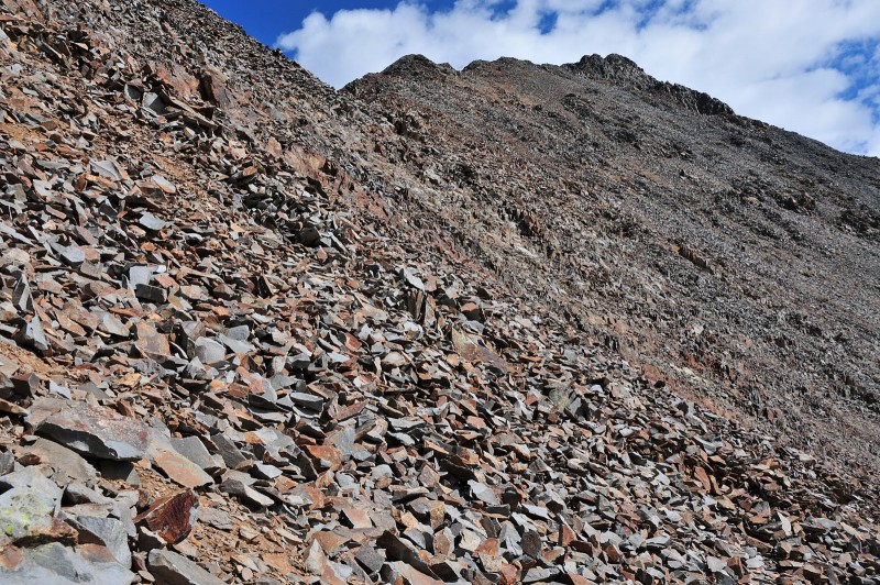
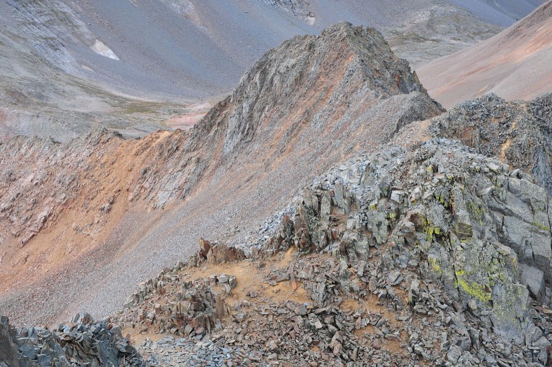
Closeup of the terrain
Looking back you can see the route up the Rock of Ages "Trail" through the Silver Pick Basin
from a couple of different angles.
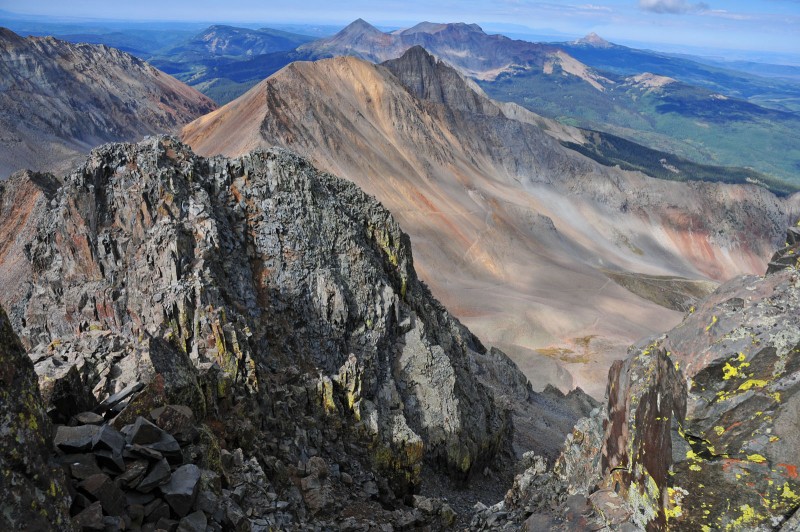
After some focused climbing, I got to the summit where I was greeted with awesome views of the Silver Pick and Navajo Basins and surrounding peaks and the San Juans. I had the summit to myself.
Another view of Mount Wilson and the connecting ridge to El Diente
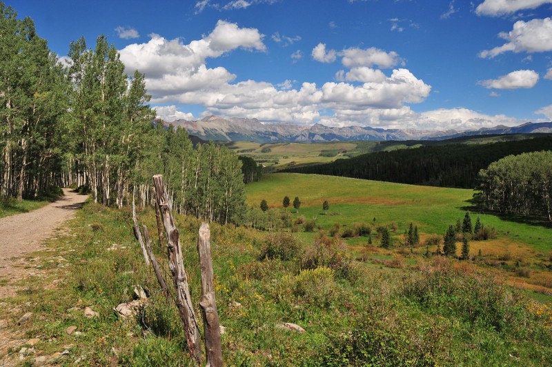
On the way back, I could see that the aspens were trying their best to start turning and you have a great view of the San Juans and meadows and flat land below.
Disclaimer: this is not an advertisement nor recommendation for Coors. Simply recognizing the connection. Drinking and climbing may be hazardous to your health .
Note: Coors image source: Coors website.
Thumbnails for uploaded photos (click to open slideshow):
Another fun fact - Coors donated a significant amount of money to the Trust for Public Lands so TFPL could purchased the private mining claims that blocked public access to Wilson Peak via ROA until 2008.
Nice report. Excellent photos. I really like the composition and colors in #16 and #30. I'm hoping someone gets a photo of that wolverine sometime. Too bad it wasn't you.
Great photos and narrative. I'm amazed at the quality of some of the TR's, certainly including this one. I'm such a clod with such things, I can really appreciate when someone takes the time, as you did, to produce such a quality product :)
Just beautiful colors. Anyone thirsty? :? Not even thinking about it with that selection ... maybe if you'd put up a picture of a Modus. :wink: But, then again, it wouldn't tie into your trip report now, would it. :lol: Thanks for posting. Happy trails! :D
Congrats on knocking the San Miguels (or commonly referred to as the Wilsons)...
Enjoyed the El Diente - Wilson day with the group.
Wilson Peak is the ultimate ”Mullet” Mountain... Long down below with and short and subby with a little business up top...
Hey Jim, funny, when you mentioned mullet I was thinking the fish-we use them for bait for stripers! I was able to get the three peaks in the Wilson Group as above, Crestone Needle and Lindsey. Was a good week!
Not a wolverine (sadly), but saw this guy in the Silver Pick basin. He was moving way too fast for me to take a clear shot of him.
Edited: I think it was a coyote. He was moving uphill so fast! I was hoping to see a wolverine too.
Caution: The information contained in this report may not be accurate and should not be the only resource used in preparation for your climb. Failure to have the necessary experience, physical conditioning, supplies or equipment can result in injury or death. 14ers.com and the author(s) of this report provide no warranties, either express or implied, that the information provided is accurate or reliable. By using the information provided, you agree to indemnify and hold harmless 14ers.com and the report author(s) with respect to any claims and demands against them, including any attorney fees and expenses. Please read the 14ers.com Safety and Disclaimer pages for more information.
Please respect private property: 14ers.com supports the rights of private landowners to determine how and by whom their land will be used. In Colorado, it is your responsibility to determine if land is private and to obtain the appropriate permission before entering the property.


")
")
")
")
")
")
")
")
")
")
")
")
")
")
")
")
")
")
")
")
")
")
")
")
")
")
")
")
")
")