Download Agreement, Release, and Acknowledgement of Risk:
You (the person requesting this file download) fully understand mountain climbing ("Activity") involves risks and dangers of serious bodily injury, including permanent disability, paralysis, and death ("Risks") and you fully accept and assume all such risks and all responsibility for losses, costs, and damages you incur as a result of your participation in this Activity.
You acknowledge that information in the file you have chosen to download may not be accurate and may contain errors. You agree to assume all risks when using this information and agree to release and discharge 14ers.com, 14ers Inc. and the author(s) of such information (collectively, the "Released Parties").
You hereby discharge the Released Parties from all damages, actions, claims and liabilities of any nature, specifically including, but not limited to, damages, actions, claims and liabilities arising from or related to the negligence of the Released Parties. You further agree to indemnify, hold harmless and defend 14ers.com, 14ers Inc. and each of the other Released Parties from and against any loss, damage, liability and expense, including costs and attorney fees, incurred by 14ers.com, 14ers Inc. or any of the other Released Parties as a result of you using information provided on the 14ers.com or 14ers Inc. websites.
You have read this agreement, fully understand its terms and intend it to be a complete and unconditional release of all liability to the greatest extent allowed by law and agree that if any portion of this agreement is held to be invalid the balance, notwithstanding, shall continue in full force and effect.
By clicking "OK" you agree to these terms. If you DO NOT agree, click "Cancel"...
This report is the second half of the trip that involves the portion of the Elk range 14ers. To read the start of this trip with the San Juan half please click here
This report is the Elks half continuing on the 6 day journey to grab 8 14ers.
Stats
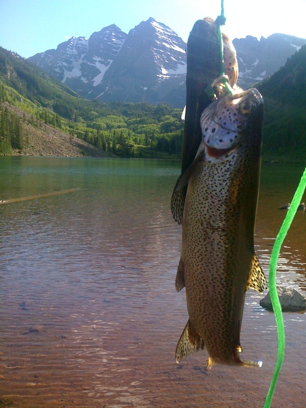
Dates:6/9 to 6/17 8 14ers: Sneffels, El Diente, Mt. Wilson, Wilson Peak, Conundrum, Castle, Pyramid, Snowmass Total Mileage: 63 Miles Total Elevation Gain: 46K feet GreatTraverses: Diente to Wilson 4th of 4. Partners: 3 # of peaks solo: 1 # of fish caught: 10 # of lake jumps: 1
Part 2: The Elks
(h2)Day 4: Conundrum Peak (14,060') and Castle Peak (14,265')(/h2) Route: Castle Creek Trailhead 4wd to 11,000' (a ways below the Pearl Pass turnoff) and hike to ascend Conundrum Couloir and traverse across the ridge/saddle to Castle and down the Northwest Ridge route on Castle back to Castle Creek. Mileage: ~9 Miles Elevation Gain: ~3,500' Partners: (url:http://www.14ers.com/forum/memberlist.php?mode=viewprofile&u=6103)KansasHiker Note: Any pictures with the date in the bottom right corner are courtesy of KansasHiker. Start:5 AM Finish 1 PM
If you have read any of my older trip reports, you would know that my vehicle of choice for 14er travel as well as get to work on a daily basis has been my 1970 red VW Bus, Pabst. I recently picked up a Toyota Tacoma with a topper since I have that little one on the way. I still have the bus but it is for sale so I didn't want to haul it around the state on this trip. Anyhow, my new little toy is what allowed me to shave a few miles throughout the week for accessing places I haven't been able to before.
I awoke at 3:45 am in the back of the truck to a surprisingly cold night. Usually, I just use a tiny blanket but I found myself shivering most of the night in my 30 deg bag with the blanket over that. I guess I should have used the 0 deg down but didn't feel like getting out. Maybe tomorrow night if I feel like it I will get it out to use. I started the morning with some hydrogen peroxide on my monstrous blisters and doing my daily prep and dressing before getting dressed and getting my approach shoes on. After making my coffee and loading back up the truck, we were driving up Castle Creek road by 04:30AM in the dark. A few years ago around the same time in June, I found myself hiking from the very bottom here, the first river crossing was so deep, it was impassable to vehicles and the second river crossing before pearl pass, the bridge was completely washed out. Since I already hiked this from the bottom once, and I was only back to get Conundrum since the Avy conditions made me uncomfortable to continue on from Castle that time, I did not feel guilty driving a ways. I wanted to play with my truck anyhow and enjoy the fact that I made a smart decision last time to not take the risk and live to climb another day. That said, I was still determined to not cheat. By 4:55 we found a nice spot at a sharp turn at about 11,050 not too far below the pearl pass turnoff. By 05:00 AM, we were on our way with plans to climb Conundrum Couloir first, ridge run to Castle and take the standard route down Castle.
In what seemed like no time at all, we were approaching 12,800' where the road traditionally ends and even the elite 4X4 cheaters have to start using their own legs. The red line is our approximate path up and the green is down.
The remainder of my trip report can be found in grave detail located on my blog HERE
See you at the top!
Thumbnails for uploaded photos (click to open slideshow):
Nice accomplishment in just 6 days! Especially with cracked, bleeding heels. I have some big heel blisters that won't seem to go away either but I keep hiking. :)
Oh, btw, by your own numbers it's 26,400' of elevation gain and 64 miles of hiking. :?:
Thanks for pointing out that my number's don't add up djkest. Please note that the summary miles and gain at the beginning of the report are the true numbers right off of my GPS. When I was on the trail, my GPS was on and actually it died a couple of times so I went more than what it is reading and what I am claiming. The numbers for each peak are only estimates as I didn't write down the differences while I was out there.
Truly great trip report, that's a remarkable week. I'm going out next week for a few days to snag a few but nothing like this. Congrats on being so close and on the baby.
So did you use your ice axe going around that snow cornice? Just curious since I'm planning to do Pyramid on Sunday. Not sure if I need to bring it or bring microspikes.
Definitely don't need the axe or microspikes over the cornice. On the far left side, I think we took 1 maybe 2 steps in the snow to get past.
Caution: The information contained in this report may not be accurate and should not be the only resource used in preparation for your climb. Failure to have the necessary experience, physical conditioning, supplies or equipment can result in injury or death. 14ers.com and the author(s) of this report provide no warranties, either express or implied, that the information provided is accurate or reliable. By using the information provided, you agree to indemnify and hold harmless 14ers.com and the report author(s) with respect to any claims and demands against them, including any attorney fees and expenses. Please read the 14ers.com Safety and Disclaimer pages for more information.
Please respect private property: 14ers.com supports the rights of private landowners to determine how and by whom their land will be used. In Colorado, it is your responsibility to determine if land is private and to obtain the appropriate permission before entering the property.
")
")
")
")
")
")
")
")
")
")
")
")
")
")
")
")
")
")
")
")
")
")
")
")
")
")
")
")
")