Download Agreement, Release, and Acknowledgement of Risk:
You (the person requesting this file download) fully understand mountain climbing ("Activity") involves risks and dangers of serious bodily injury, including permanent disability, paralysis, and death ("Risks") and you fully accept and assume all such risks and all responsibility for losses, costs, and damages you incur as a result of your participation in this Activity.
You acknowledge that information in the file you have chosen to download may not be accurate and may contain errors. You agree to assume all risks when using this information and agree to release and discharge 14ers.com, 14ers Inc. and the author(s) of such information (collectively, the "Released Parties").
You hereby discharge the Released Parties from all damages, actions, claims and liabilities of any nature, specifically including, but not limited to, damages, actions, claims and liabilities arising from or related to the negligence of the Released Parties. You further agree to indemnify, hold harmless and defend 14ers.com, 14ers Inc. and each of the other Released Parties from and against any loss, damage, liability and expense, including costs and attorney fees, incurred by 14ers.com, 14ers Inc. or any of the other Released Parties as a result of you using information provided on the 14ers.com or 14ers Inc. websites.
You have read this agreement, fully understand its terms and intend it to be a complete and unconditional release of all liability to the greatest extent allowed by law and agree that if any portion of this agreement is held to be invalid the balance, notwithstanding, shall continue in full force and effect.
By clicking "OK" you agree to these terms. If you DO NOT agree, click "Cancel"...
The plan: to enjoy our day off and go on a nice - relatively easy - climb. We were going to snowshoe/climb/ski as far as we comfortably could, and just enjoy the day. A disconcerting sign of things to come was on the drive in ... the car was getting blown all over the road on I-70 with the massive gusts of wind ...
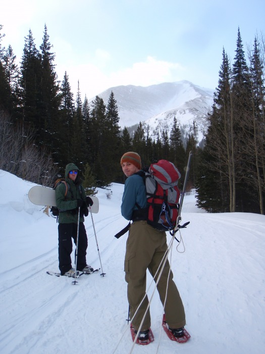
We parked just off I-70 and departed at about 7:15am and began the easy and really enjoyable snowshoe up Steven's Gulch road.
Snowshoeing the road up, with Josh's ski hauling contraption Snowshoeing the road up
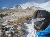
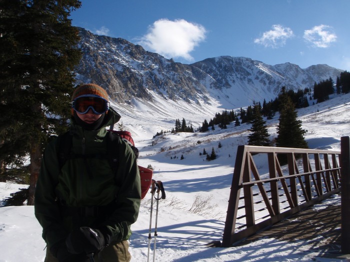
We carried our skis (no skins ) up to the end of the road and the start of the trail. Based on other trip reports/weather reports/pictures, we didn't think there'd be enough good low avalanche risk snow up top, so we stowed our skis under the bridge at the end of the road, and left our ski boots in trash bags with the skis.
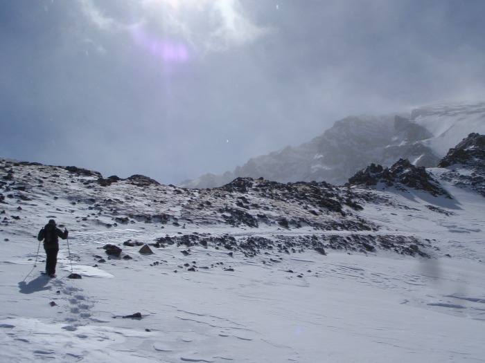
Once we got above the trees, the wind really started to pick up. It was anywhere from 5 mph to 40 mph with some substantially larger gusts mixed in. The forecasted weather for the day was 27mph avg with 40+ gusts, so seemed pretty spot on.
Start of the trail Start of the trail
The higher we got, the colder and the windier, of course.
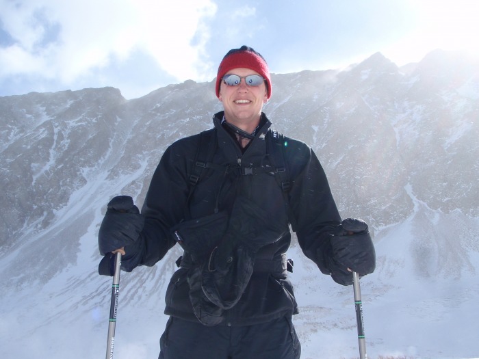
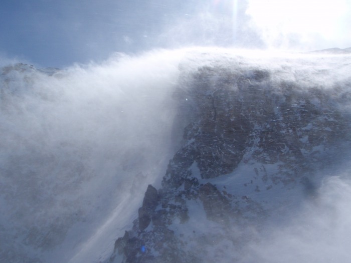
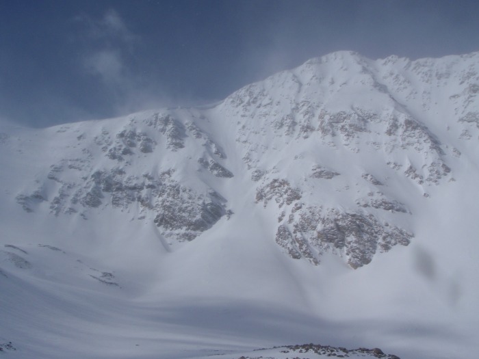
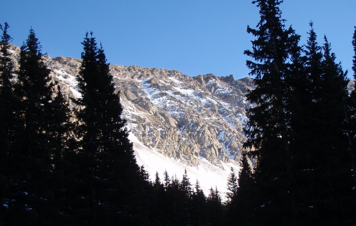
The pic below gives a pretty good example of what we saw and felt as we got higher. The temperature was -1 to -3 or so (thermometer was kind of cheap), and the gusting wind made things pretty awful.
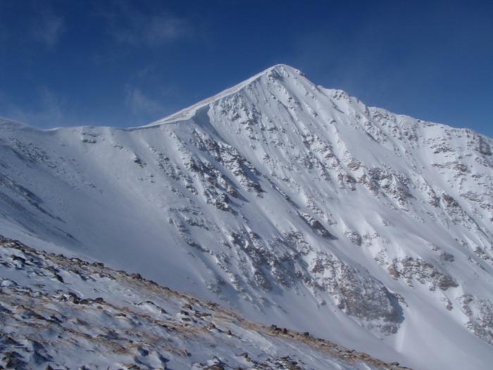
Looks a little cold, right? A look at Torrey's Another look at Torrey's
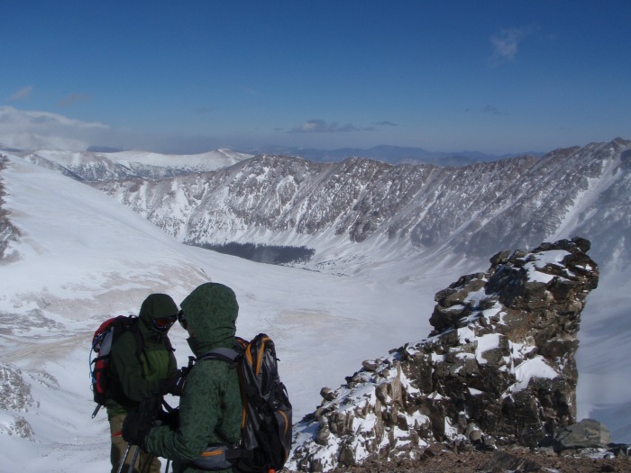
We made it to a little bit above 14000 feet (at ~1:30pm), and I started questioning how good of an idea it was to continue. My toes on my left foot were pretty numb, and the fingers on my right hand were very numb and I just couldn't get them to warm up unless I balled my fist up in my mit and didn't use my pole, which messed with my balance. At this point we were more or less trailblazing going straight up, so the poles for balance and support were absolutely essential. Plus the biting cold hitting every square cm of exposed skin burned a bit. I decided to turn back down, and it quickly became a group decision. Gray's and Torrey's would both be there if we decided to try again another time!
Once we started down, it seemed like the wind got lower and the temperature got higher, but we were still pretty happy with the decision, as painful as it is to turn back when you're only 100 feet vertical from the top
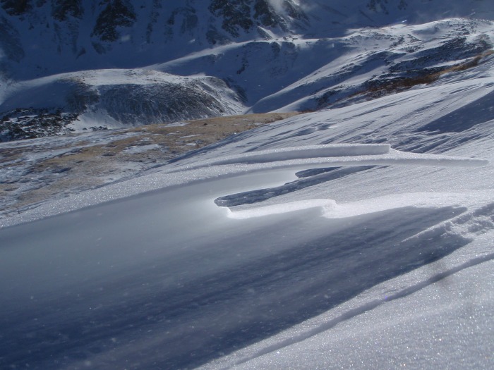
Once we got closer to treeline with the gusting wind, there were some pretty neat ice formations.
We have no pictures of the struggle, but it took a solid 10 extremely painful minutes to get our ski boots on. They were absolutely frozen solid. Once they were on though, skiing the last 3 miles down turned out to be absolutely perfect. We finished 3 feet from the car.
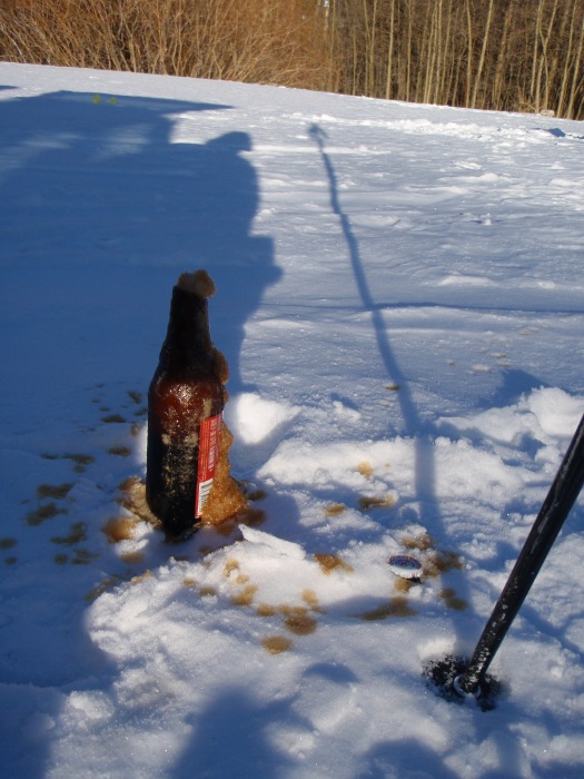
For every 14er we do, we have to bring a celebatory beer along ... well, we didn't get to drink it at the summit like we had hoped, so once we made it down to the car, we decided to partake. It turns out that a bottle of beer in sub-zero temperatures, opened with an ice axe makes a big delicious mess.
Our reward for the night was a stop at Beau Jo's in Idaho Springs for a 3 lb pizza!
I still have a darkish splotch on my cheek where I got a touch of frostbite (on my right earlobe too), but it will heal just fine. I'm just glad we got down when we did!
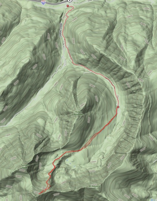
The topo map from the trip is below (the battery died about halfway back, so the path displayed ends a little prematurely). I think we ended up going ~14 miles or so, though I don't have an exact number. In hindsight it's still pretty painful to be so close to the summit and not get there, but overall I'm pretty happy with the decision. Another 15 minutes for the last 100 feet could have made things a heck of a lot worse for us. Now I get to take my fingers and toes to another mountain!
Thumbnails for uploaded photos (click to open slideshow):
Party foul! But maybe since a 14er was involved the referees might let it slide. Nice report, good pics! I'll have to try Beau Jo's next time I'm in Idaho Springs. I normally like Tommyknocker's.
Nice work, awesome story, and great pics... also a great lesson by example... sometimes it's just not worth the risk!
Caution: The information contained in this report may not be accurate and should not be the only resource used in preparation for your climb. Failure to have the necessary experience, physical conditioning, supplies or equipment can result in injury or death. 14ers.com and the author(s) of this report provide no warranties, either express or implied, that the information provided is accurate or reliable. By using the information provided, you agree to indemnify and hold harmless 14ers.com and the report author(s) with respect to any claims and demands against them, including any attorney fees and expenses. Please read the 14ers.com Safety and Disclaimer pages for more information.
Please respect private property: 14ers.com supports the rights of private landowners to determine how and by whom their land will be used. In Colorado, it is your responsibility to determine if land is private and to obtain the appropriate permission before entering the property.


 Snowshoeing the road up, with Josh's ski hauling contraption")
 Snowshoeing the road up")
 Start of the trail")
 Start of the trail")
")
 Looks a little cold, right?")
")
 A look at Torrey's")
")
")
")
")
")
")
 Another look at Torrey's")