Download Agreement, Release, and Acknowledgement of Risk:
You (the person requesting this file download) fully understand mountain climbing ("Activity") involves risks and dangers of serious bodily injury, including permanent disability, paralysis, and death ("Risks") and you fully accept and assume all such risks and all responsibility for losses, costs, and damages you incur as a result of your participation in this Activity.
You acknowledge that information in the file you have chosen to download may not be accurate and may contain errors. You agree to assume all risks when using this information and agree to release and discharge 14ers.com, 14ers Inc. and the author(s) of such information (collectively, the "Released Parties").
You hereby discharge the Released Parties from all damages, actions, claims and liabilities of any nature, specifically including, but not limited to, damages, actions, claims and liabilities arising from or related to the negligence of the Released Parties. You further agree to indemnify, hold harmless and defend 14ers.com, 14ers Inc. and each of the other Released Parties from and against any loss, damage, liability and expense, including costs and attorney fees, incurred by 14ers.com, 14ers Inc. or any of the other Released Parties as a result of you using information provided on the 14ers.com or 14ers Inc. websites.
You have read this agreement, fully understand its terms and intend it to be a complete and unconditional release of all liability to the greatest extent allowed by law and agree that if any portion of this agreement is held to be invalid the balance, notwithstanding, shall continue in full force and effect.
By clicking "OK" you agree to these terms. If you DO NOT agree, click "Cancel"...
Route: Pahlone Pk via Monarch Crest and south ridge Distance: ~14.7 miles Vertical: ~2,500 ft Time: 6.5 hours Who: Yikes, Annabelle Ferocious When: Sunday, October 23, 2011 Weather: 25ish at the start, 40ish at the end; blue skies
After cranking through seven 14ers in a 2 week period late August, I took some time off from the mountains. Maybe a little too much time. Gotta' keep the feet moving or the peaks are going to be rough this winter. So should I try to get some decent elevation gain or keep it flatter and crank out some miles? Just didn't feel the motivation to jump on the mountain stair master, so let's get some miles on those dusty boots.
The skyline west of Salida presents a fair share of interesting objectives. At some point in the hopefully not too distant future, I have a goal to get to the top of those taunting peaks. Just to the right of mighty chief Ouray (13,971) lies wife Chipeta (13,472) and daughter Pahlone (12,667). A quick measure on Google Earth shows Chipeta to be 17 miles RT and Pahlone to be about 13 miles RT. 17 miles might be pushing it with the dog, so we settle on Pahlone.
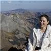
25 quick minutes up to Monarch pass. Sometimes it's nice not having to push the 4wd button and bounce your way up miles of riverbed. Only car in the parking lot; not too many mountain bikers up on the Crest this time of year. A little chilly in the shade, just some practice for the much colder starts coming up this winter. Annie, aka Annabelle Ferocious, aka Dogger Dog was ready to go, pulling at the leash trying to get to some wonderful smell. Wish she would wait until I had my boots on at least. Annie is a small dog but she's pulled me up a few 14ers, including Shavano and Wetterhorn. Annie - ready to hike
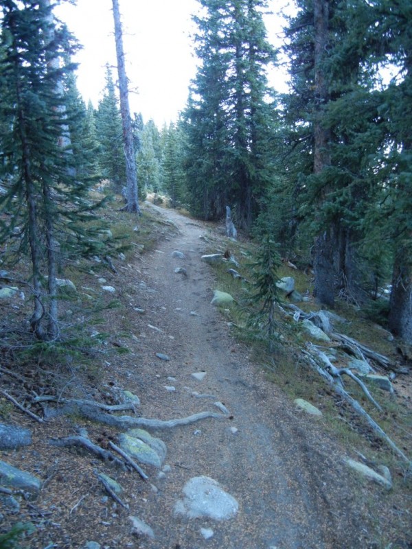
The first 5 miles are on the Monarch Crest single track. Smooth as a baby's bottom; not that I would know. Monarch Crest trail
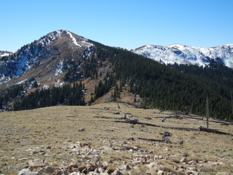
The miles go by pretty quickly and quietly with only two trail runners zipping by. We leave the trail at the S. Fooses Creek turnoff and start the bushwhacking. A short side-slope leads to a small grouping of trees. There isn't any sign of trail from this point forward, but the trees are fairly open and don't present any problems. About 6 inches of snow lies on the ground in the trees. We stay on the highpoint of the ridge; navigation difficulties are non-existent. Ridge to Pahlone Open ridge
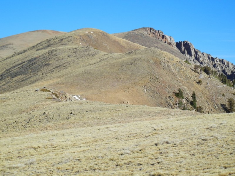
After 10 minutes in the trees, the route reaches a saddle and opens up for the remaining distant to the summit. It's about 1.75 miles and 1,000' elevation gain from the saddle to Pahlone. It doesn't look very far, but with too much time on the couch, it takes a little longer than I would prefer. The ridge drops off to S. Fooses Creek on the left and Green Creek on the right. The slopes are pretty easy travel, not much in the way of talus until the last 100 feet or so. Annie does a decent job in talus, but I carry her the last 100 feet just to make things a little easier on her. Rocky Summit
At the summit, there was a little surprise - some cliffs off the back side; didn't see those from Salida. Just thought this peak was a gentle bump off the divide. We can see town from the top. Quick call home to give the all clear and 5 minutes later we are heading back down the slopes. Back to the Crest
The minor elevation gain getting back to the Crest from the saddle feels like more than it really is. Another reminder that I need to keep up the hiking. Annie asks - Why are we just sitting here?
The last five miles drag on but we eventually reach the car and point downhill towards town. Annabelle is quickly asleep in the passenger seat. Turns out the hike was closer to 15 miles (oops, sorry Annie), but she was a champ and pulled the entire way. I think I was more tired than she was.
So what's next? Chipeta? Mt White? Might have to save those for next summer.
Thumbnails for uploaded photos (click to open slideshow):
Hello - I was going to geology field camp that year and took off on a Saturday with a flat-landers intent of getting to Mount Ouray from the Crest. Oh, well, not enough time, but the view from Pahlone was great. Turned back to the pass before the sun went down. Didn't get my first 13er till the following year, and first 14er two years later so Pahlone is a personal high point landmark for me. Thanks for Annie too!
Caution: The information contained in this report may not be accurate and should not be the only resource used in preparation for your climb. Failure to have the necessary experience, physical conditioning, supplies or equipment can result in injury or death. 14ers.com and the author(s) of this report provide no warranties, either express or implied, that the information provided is accurate or reliable. By using the information provided, you agree to indemnify and hold harmless 14ers.com and the report author(s) with respect to any claims and demands against them, including any attorney fees and expenses. Please read the 14ers.com Safety and Disclaimer pages for more information.
Please respect private property: 14ers.com supports the rights of private landowners to determine how and by whom their land will be used. In Colorado, it is your responsibility to determine if land is private and to obtain the appropriate permission before entering the property.


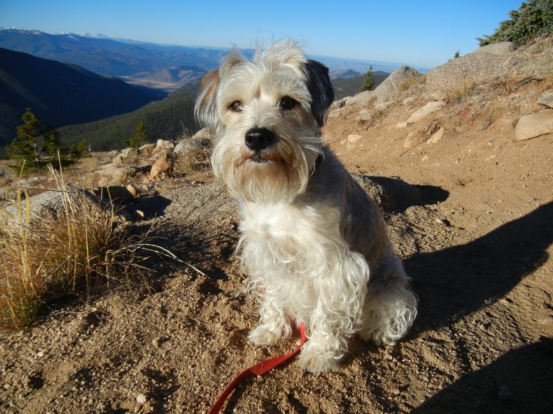
 Annie - ready to hike")
 Monarch Crest trail")
 Ridge to Pahlone")
 Open ridge")
 Rocky Summit")
 Back to the Crest")
 Annie asks - Why are we just sitting here?")