| Report Type | Full |
| Peak(s) |
Mt. Bierstadt - 14,066 feet |
| Date Posted | 07/22/2009 |
| Modified | 08/05/2013 |
| Date Climbed | 07/13/2009 |
| Author | Jessie_s Dad |
| Standard Route - Guanella Pass |
|---|
Our group of flatlanders arrived on Friday to join Mom_to_Jess and myself (we arrived on Wednesday to get a few more days to acclimate). We had a group of 8 staying in Fraser, another 2 in Frisco, and a pair from Georgetown (plus 3 dogs) for our hike on Monday. We knew that the route would be busy on the weekend so we scheduled for a weekday. On Sunday afternoon four of us drove to the trailhead to check out the construction on Guanella Pass. 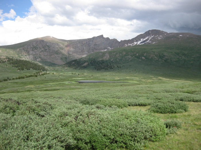 We were struck by the awesome beauty of the view from the parking lot with the sinking sun hitting the western slopes. I had been worried that some of our group was not that excited about climbing a 14-er, but the scenery eliminated my concerns. I knew everyone would be glad they came. We left Fraser at 5 am, and made it to the TH by 7, after hooking up with the rest of our group in Georgetown. The drive through the construction area was uneventful. The temperature was in the 40's, with beautiful clear sunny skies. Forecast was for chance of T-storms, more likely in the afternoon. 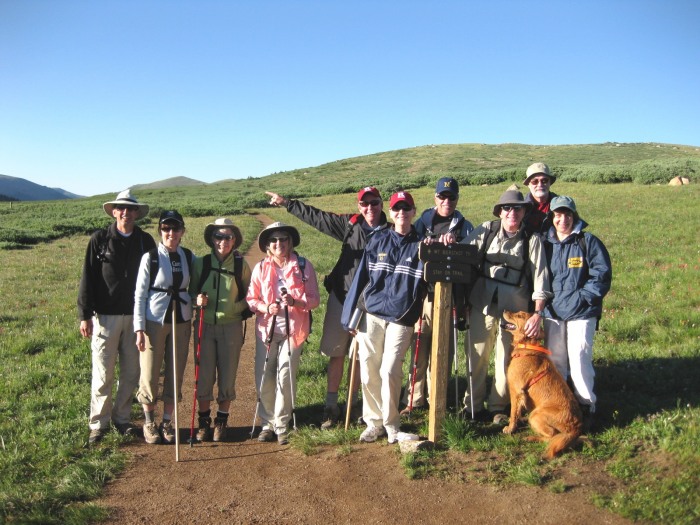 The boardwalk through the willows had some ice on it but the going was great to Gomer Creek. 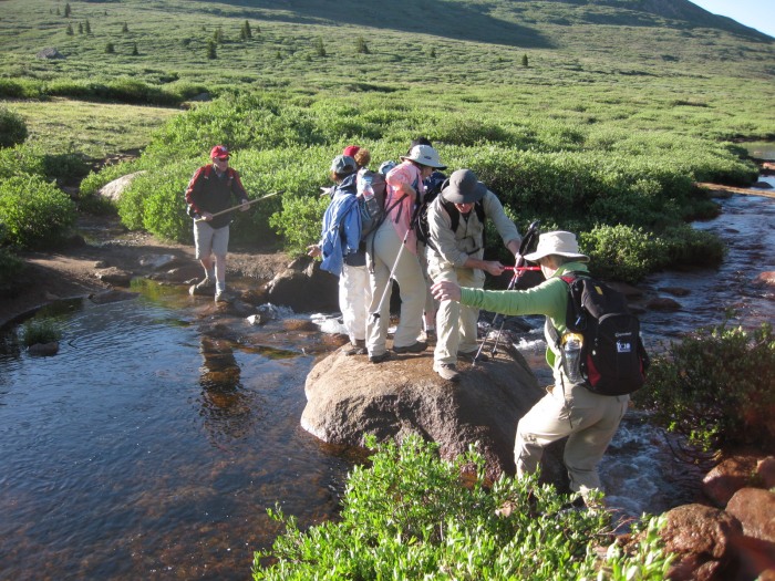 At Gomer Creek, one of our party slipped crossing the stream, ending up on her back in the middle of the creek. Not hurt (except for her pride), but what a way to start the day. Another option to cross was a bridge slightly downstream from these rocks, made with 2 logs. This was Ok to use if you have trekking poles, but tricky otherwise. Jessie's Mom and I went upstream to cross I reached out to lend her a hand crossing, only to be pulled into the middle of the stream, getting wet up to my knees. Oh well, I'll just put on my extra pair of dry socks. Having spent only about a year planning this trip, I had forgotten to pack a pair of dry socks, so I stopped, emptied my shoes of excess water, wrung out my socks as best I could, and put everything back on. Thank goodness I did have wool socks, and my liner socks also helped make the rest of the climb comfortable. After an hour, Matt checked his GPS to find out we had gained 10 ft from our starting place at the TH. There were several groups on the trail, but everyone was spread out enough so we never felt crowded. 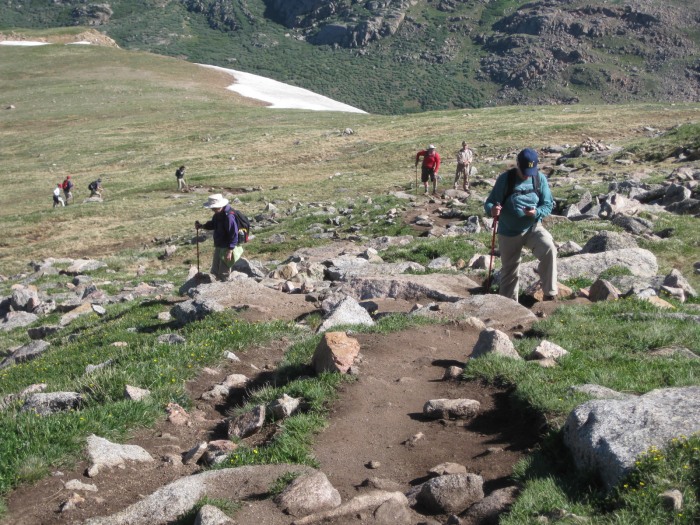 At 12,000 ft, Oreo Dave started to feel nauseous, and had to return to the TH. He eventually returned to Georgetown to recuperate until we could join up again with him later. The trail was in good shape, with some wet spots. The hardest part was the steep section between 13,000 and 13,300 ft, but after that we got a second wind, and did not have any problems. We saw lots of wildflowers along the trail, all the way to the top. 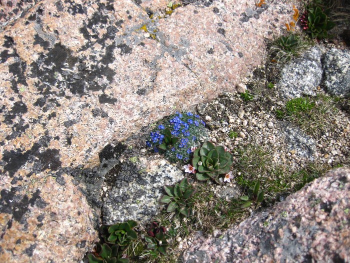 Our plan was to summit by noon (the entire group), eat lunch, and then descend. 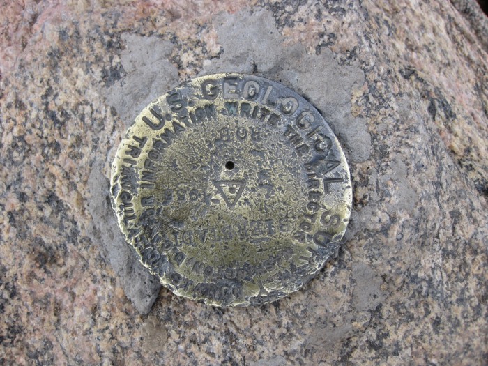 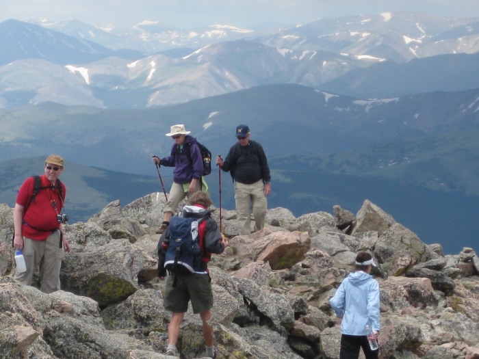 The views were spectacular in all directions. 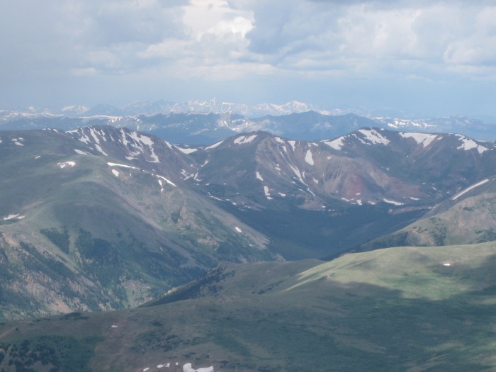 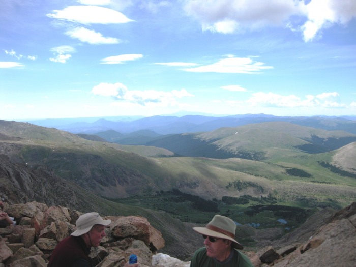 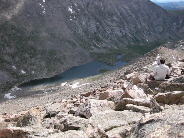 We signed the register, took some photos, and started to eat lunch while we waited for the rest of our group to summit. At 11:15 storm clouds (along with thunder) started to roll in, and we started to head down. 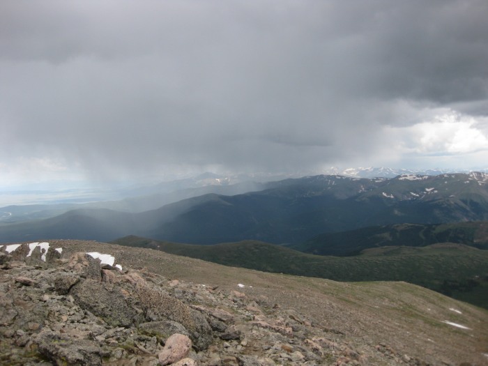 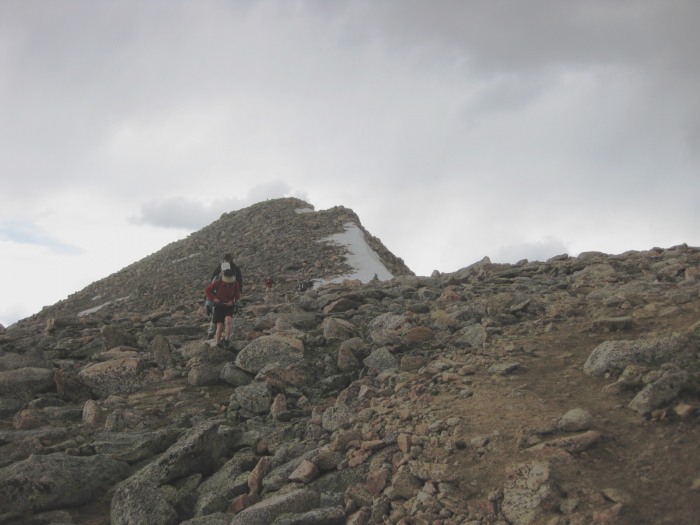 Mom_to_Jess, Bense, Rufus, and Mrs Smith has made it to the snowfield at the top of the ridge and had climbed within 200 ft of the summit, but common sense prevailed and they headed back too. Another 20 minutes reprieve and our whole group (less Oreo Dave) would have summitted. 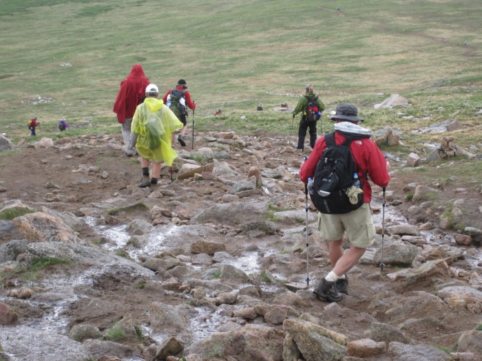 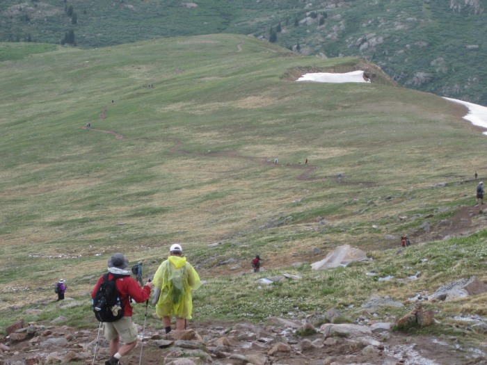 We encountered some sleet (some called it hail, but the stones were very small), then a break until we were halfway down. At that point it started to rain and get colder. By the time we got back to the parking lot (1:20 pm), we were all chilled and wet, but safe. No problem with Gomer Creek on our return. The construction area was closed until 3 pm, so we hung out, dried out, warmed up, and caught up with friends we hadn't seen for a while. 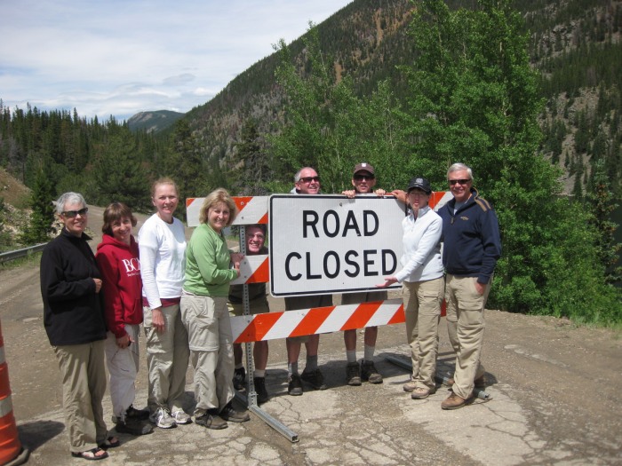 The sun came out again and warmed back into the 60's. We had a great time (even with the rain). I think for a group of flatlanders, with only a couple of days to acclimatize, the results were great. Everyone was well hydrated (inside as well as outside), so no adverse effects of altitude (except Oreo Dave). I think this really helped. Next we are planning Grays Peak for Wednesday, before we head back home.  Thumbnails for uploaded photos (click to open slideshow):
|
| Comments or Questions |
|---|
|
|
Caution: The information contained in this report may not be accurate and should not be the only resource used in preparation for your climb. Failure to have the necessary experience, physical conditioning, supplies or equipment can result in injury or death. 14ers.com and the author(s) of this report provide no warranties, either express or implied, that the information provided is accurate or reliable. By using the information provided, you agree to indemnify and hold harmless 14ers.com and the report author(s) with respect to any claims and demands against them, including any attorney fees and expenses. Please read the 14ers.com Safety and Disclaimer pages for more information.
Please respect private property: 14ers.com supports the rights of private landowners to determine how and by whom their land will be used. In Colorado, it is your responsibility to determine if land is private and to obtain the appropriate permission before entering the property.

