Square Top Mountain A - 13,794'
Argentine Peak - 13,738'
Mount Wilcox - 13,408'
Otter Mountain - 12,766'
Mileage - 11.0 miles
Elevation Gain - 4,000'
Trailhead - Guanella Pass - Upper Lot
Route - Squaretop: West Slope, Argentine: South Ridge, Wilcox: West Ridge, Otter: West Slopes
Solo
And so it goes...
Sadly, this month (June) will officially be my final month as a Colorado resident. Changes in life and family have made it necessary to head eastward. It's upsetting knowing that I won't have any more "spur of the moment" mountain trips like I have had in the past 7 years, and going forward I will have to place a lot more time and effort into the planning. Looking towards the bright side, since my mountain travels will all require air travel, maybe I can put more of an effort into checking out other mountain ranges around the country.
Regardless, it has been a fun run here in Colorado and I have no doubts that I will truly miss it.
Back to the beginning...
The west Guanella Pass mountains were definitely not the first mountains I ever climbed. I had already clicked off a number of 14ers before I ever headed there. However, it is this group that I credit for starting me down the "lower peak" path that I would maintain throughout my years in Colorado. The seclusion I felt among these peaks many years ago would fuel my mountain desire for more than just summits, but for exploration. From my first trip up these mountains, the excitement of rarely traveled peaks continued to grow and there was no turning back. Obviously, the glory factor isn't always there when asked on a Monday at work "Did you climb a 14er?" and I have to respond with "No, but I climbed an unnamed 10er covered in trees!". But, that is where I found my mountain love, and to this day I credit those fun little mountains to the west of Guanella as starting me down that path.
I figured it would be fitting for me to take one more trip over these peaks before I headed out. To "go back to the beginning", if you will. With plenty of time on my hands (wife and baby are already out east) I decided to head up Saturday afternoon and watch the sunset from Guanella Pass. After an intimate evening involving just me, the sunset and a Subway sandwich, I drove a couple miles north of the pass to set up a bivy for the night.
Revisiting the old friends...
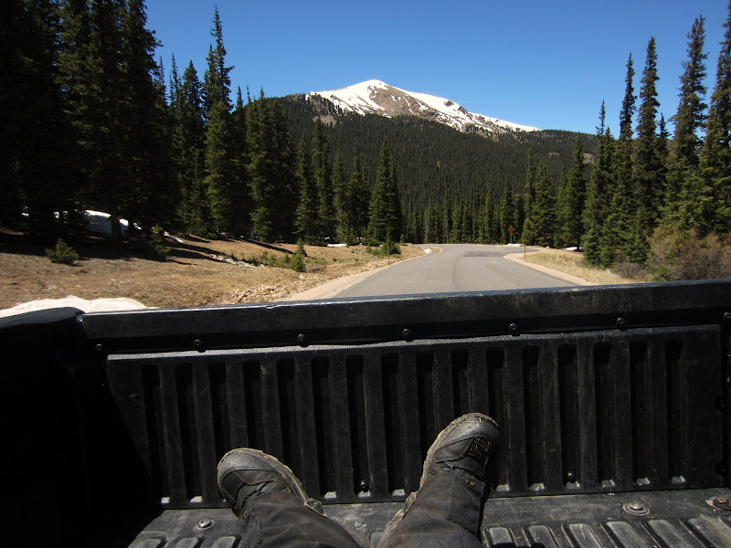
I woke up Sunday morning around 4:30, then proceeded to hit snooze for about an hour. Oops. By the time I finally rolled up to the TH, the sun was already covering the tops of the peaks. For some unknown reason (I blame it on the whirlwind of moving and boxes) I happened to forget my sunscreen at home. I cruised the Beirstadt parking lot and found some guys who were nice enough to hit me up with some. (Thanks guys!) I then headed up to the upper lot and started onto the trail at 6:15. Right off the bat, I could tell that a winter of LCW and IPW peaks had left me under acclimated for the higher mountains. I followed the Square Top Lakes trail for a mile or so as it made its way southwest in the general direction of Square Top Mountain. Right before the trail turns to the upper lake, I branched off towards the large, mellow slopes above. The slopes don't seem too steep, but the elevation sure seems to click away quickly. About 2 hours after leaving the TH, I was at the large, open summit.
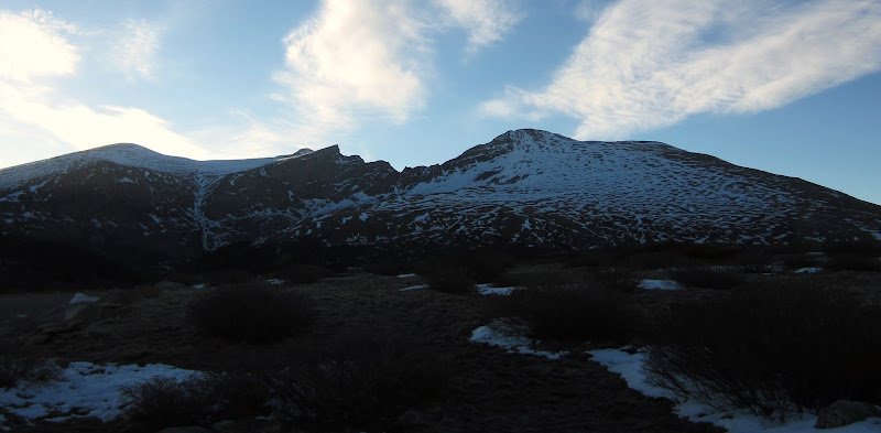
Early morning shadows across the road on Bierstadt.
Square Top from along the first portion of trail.

Lower Square Top Lake.

Near where I left the trail and headed up towards the slope on the left.

Final 600' to the summit of Square Top.

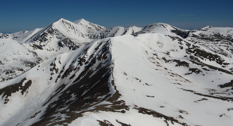
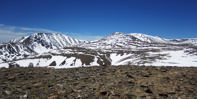
Views to the NW from the summit. (Grays, Torreys, Argentine, Edwards.)
From the west end of the large summit, I dropped to the north towards the saddle of Squaretop and Argentine. There were some loose blocks to deal with, but I was able to find patches of snow that made for some nice glissades. The south ridge of Argentine was much snowier than I was expecting. As I slowly worked my way up, I had to use caution to maintain a good distance from a cornice on the left and the snow slopes off the right. There were a few tracks, and also some ski/snowboard lines along the ridge...likely left by KansasBoarder judging from his Trip Report. Once beyond this snowy portion of the ridge, I topped out on the second lower summit. The lower and higher summits are divided by some large power lines and a little work building. I stopped to see how the building had handled the winter (not well...filled with snow...) and finished the ascent to the true summit of Argentine.
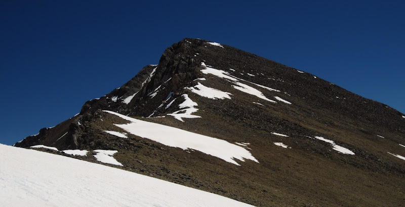
Close look at the ascent ridge I was headed for on Argentine.

Naylor Lake from the saddle of Squaretop and Argentine.

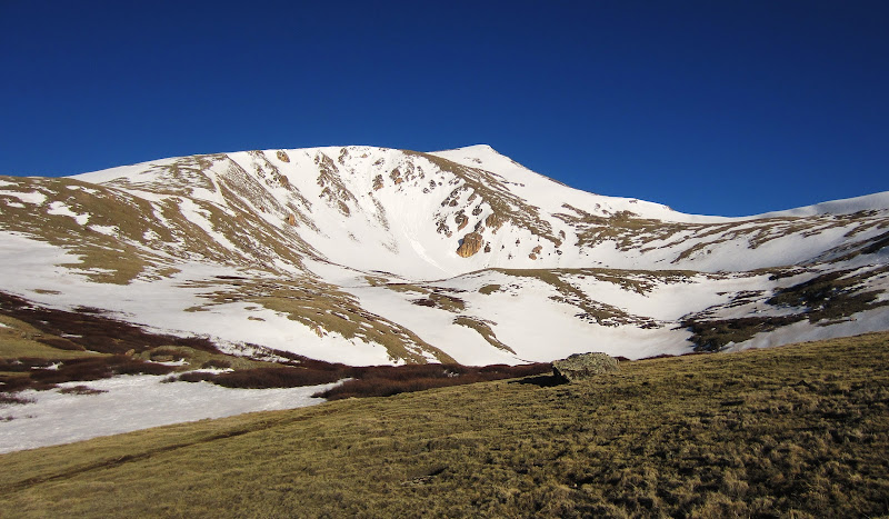
Wilcox wearing a hat.

Headed up Argentine.

The shack between the two Argentine summits.

Wilcox from the summit of Argentine.
The descent from Argentine to the Wilcox saddle was tons of fun as I was able to glissade most of the way. The ascent from the saddle up to Wilcox was stiff, however I was able to spot a light trail through the talus that I don't recall seeing before. Nice! The summit of Wilcox was the first summit of the day that actually seemed warm. With the lack of a brisk wind (finally) I chilled out on the summit for a long stay. To the east were wonderful views of the Mount Evans Wilderness area, which I finally finished this past year. To the south I could just make out the northern end on the Lost Creek Wilderness, which sadly appears that within which I will be leaving 4 unfinished peaks. To the north stood many of the fun "I70" peaks...Bard, Parnassus, Citadel, etc. It felt good to take it all in one last time from the same spot as 7 years ago.

Looking back at my descent from Argentine, near the saddle with Wilcox.
Mount Wilcox.

Terrain up to Mount Wilcox.

Summit of Wilcox.

Seven LONG years ago.

2013. Older and balder.
After a long break, I decided to maintain an eastward heading instead of dropping back down to Naylor Lake. Otter Mountain was about 1.5 miles away, and somehow I had never gotten around to visiting its rounded summit. The terrain in between Wilcox and Otter was neat, almost like a prairie in the sky. There were mini water traps scattering the landscape, adding to the uniqueness. The ascent up Otter was straightforward, just a large round bump needing about 350' vertical to summit. The summit provided a pleasant percepective of the Guanella Pass road far below. From the summit, I headed southward towards a slight ridge that I could see on the topo map. It looked steep, but direct. And it was steep, and direct. It was steep enough in parts that I had to use trees to prevent from tumbling down the mountain. Before long, I popped out onto the Guanella Pass road, right near the winter closure gate. Now, in the winter I have no issue hoofing the final miles up to the pass. However, I was hot and didn't feel like walking the road in warm conditions. I stuck out my thumb and caught a ride back to my truck without issue. I know. I'm lazy. 8)

Otter Mountain, far in the distance.

Terrain on the way to Otter.

Clear, grassy slope to Otter.
The days trek from the summit of Otter.

Beirstadt and the Guanella Pass Road from the ridge descent of Otter Mountain.

Trees along the descent.
Looking back up at Otter during my hitchhike back to Guanella Pass.

Final map of the day.
Ta-ta for now...
And so it ends. I've loved my time here in Colorado, and will cherish all the memories of climbing its peaks. I've made lots of new friends and climbing partners, none of whom I will soon forget. I'll still be around the site, seeing who is going where and climbing what. I'll probably still even contribute to the trip reports, seeing as I will probably be out here for work/visits a few times a year. (You can't escape the Lost Creek Wilderness Trip Reports that easy;) ) Thanks for the good times...
Happy trails, safe travels, and keep heading up.
--Derek Freed
|