Download Agreement, Release, and Acknowledgement of Risk:
You (the person requesting this file download) fully understand mountain climbing ("Activity") involves risks and dangers of serious bodily injury, including permanent disability, paralysis, and death ("Risks") and you fully accept and assume all such risks and all responsibility for losses, costs, and damages you incur as a result of your participation in this Activity.
You acknowledge that information in the file you have chosen to download may not be accurate and may contain errors. You agree to assume all risks when using this information and agree to release and discharge 14ers.com, 14ers Inc. and the author(s) of such information (collectively, the "Released Parties").
You hereby discharge the Released Parties from all damages, actions, claims and liabilities of any nature, specifically including, but not limited to, damages, actions, claims and liabilities arising from or related to the negligence of the Released Parties. You further agree to indemnify, hold harmless and defend 14ers.com, 14ers Inc. and each of the other Released Parties from and against any loss, damage, liability and expense, including costs and attorney fees, incurred by 14ers.com, 14ers Inc. or any of the other Released Parties as a result of you using information provided on the 14ers.com or 14ers Inc. websites.
You have read this agreement, fully understand its terms and intend it to be a complete and unconditional release of all liability to the greatest extent allowed by law and agree that if any portion of this agreement is held to be invalid the balance, notwithstanding, shall continue in full force and effect.
By clicking "OK" you agree to these terms. If you DO NOT agree, click "Cancel"...
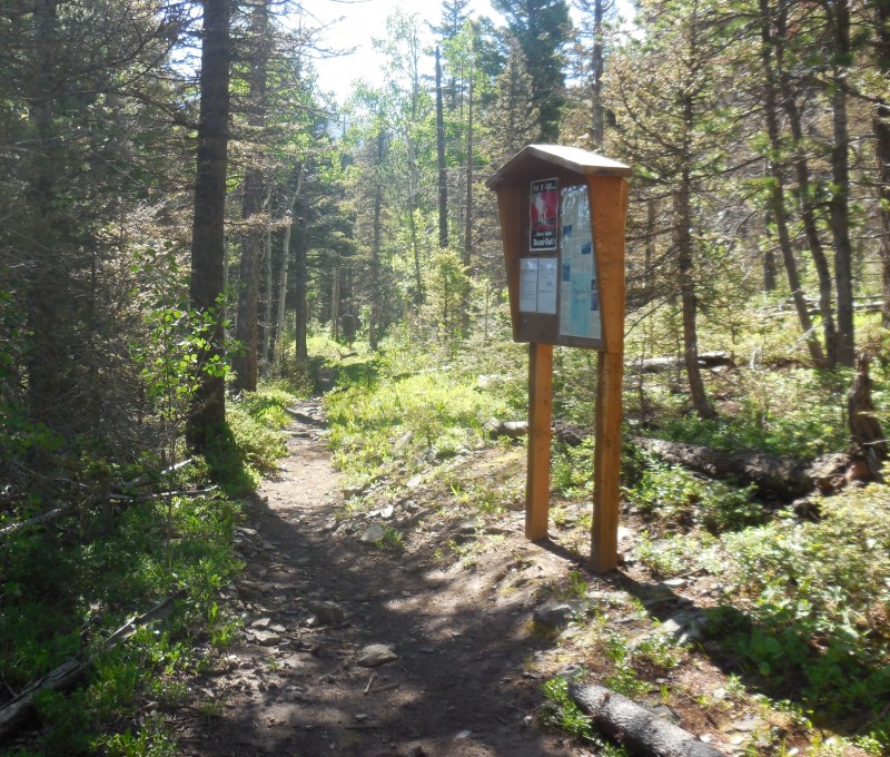
Starting Point: Wahatoya Trailhead, Elevation: ~9,800'
Peak Climbed: West Spanish Peak (13,626')
Route: East Ridge
RT Distance: ~9.3 miles
Elevation Gain/Loss: ~4,250 feet (per Google Maps)
Group: Solo
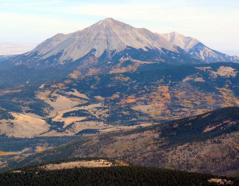
West Spanish Peak has been on my radar since 1997 when, on a southbound trip to climb Sandia Crest, I found myself fascinated by the majesty and prominence of the Spanish Peaks. Last season, in my foray into the southern Sangres, I got my fill of this magnificent peak.
West Spanish in All Her Glory!
I vowed to come back the very next week to hike both Spanish Peaks from the same trailhead, an epic undertaking by any measure, but life got in the way and Trinchera proved to be the last big hike of the season.
Both Spanish Peaks can be climbed from the Wahatoya trailhead which is the starting point for the standard approach to the lesser of the two, East Spanish Peak (12,683'). West Spanish Peak (13,626') is typically climbed from Cordova Pass (11,248') as a direct ascent of the southwest ridge. Studying the top maps, it was clear that ascending the lower northeast ridge and then the long east ridge would give the hiker a much better appreciation of the glory of this peak. But have there been any documented climbs of West Spanish Peak from Wahatoya trailhead? I couldn't find any evidence of such with the exception of a climber.org report from 1999 by a Gary Swing. In my research on this route, I came across a forum discussion from 2008 involving the late, great Steve Gladbach; by his own account, Steve had climbed East Spanish Peak from this trailhead no fewer than eight times, but not the West peak. Settled then - I knew what my approach was going to be.
Wahatoya Trailhead
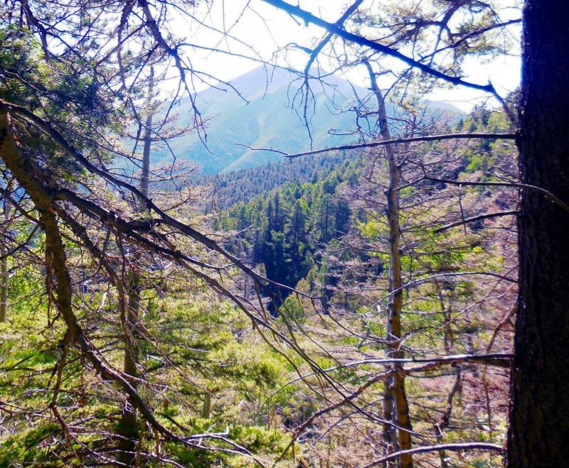
The Wahatoya trail is narrow but ascends gently all the way to the saddle between the two peaks. Given my lazy 9:15 a.m. start and the likelihood of afternoon thunderstorms, I took advantage of the easy ascent by running most of this section. Views of East Spanish opened up shortly into the trail.
East Spanish Peak
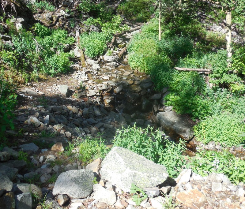
The woods were green and lush thanks to the recent wet weather. The water flow in the creek was good but the first creek crossing posed no problems.
First creek crossing
Narrow trail
Right around 10,000', the trail passes over a rock field en route to the second creek crossing.
Looking back at the boulder field
Second creek crossing
I had studied the map and knew that I would have to leave the comfort of the trail shortly before the saddle to ascend the lower northeast ridge which would then provide access to the long east ridge of West Spanish. I found the perfect spot to do this around 10,600'.
Time to lave the trail
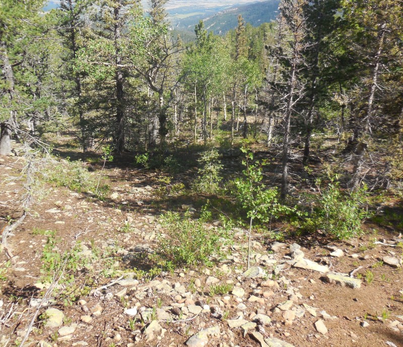
The woods in this spot were not dense enough to require any bushwhacking so I just weaved between the trees as I made my way up the hillside.
Climbing the hillside
Navigating through the pines
Looking down the lower slope
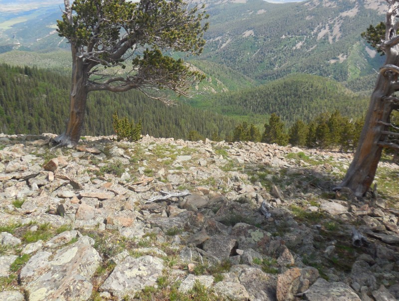
As I approached treeline at 11,400', the terrain transition from soft moss-laden clay into rocks.
Approaching treeline
Looking back down the slope
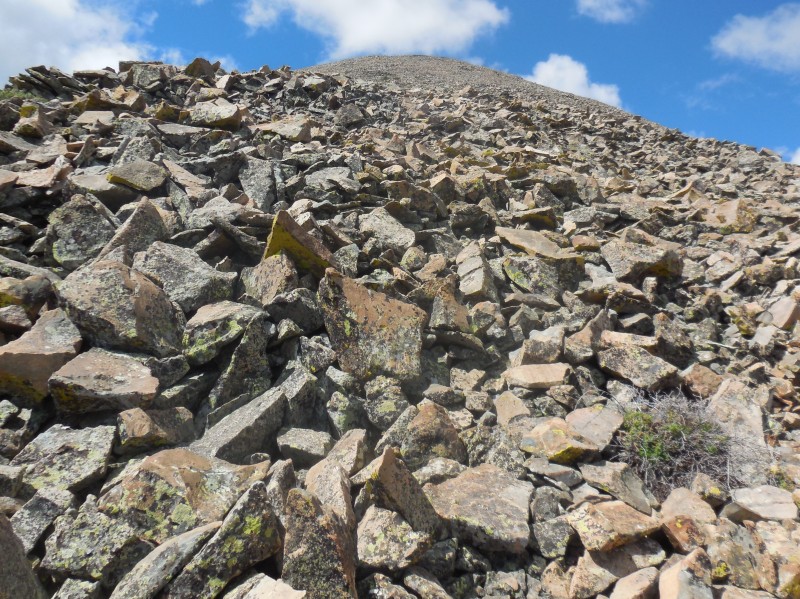
Breaking out of the trees, I was greeted by a steep talus slope leading to a point just above 12,200' on the northeast ridge.
Aiming for the next station on the NW slope
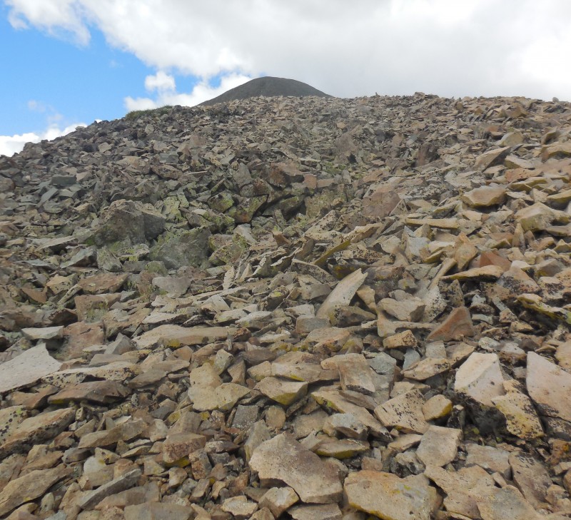
The next two thousand vertical feet are on tippy talus but I didn't as much as put one foot wrong on this terrain during the ascent. The descent, however, was a different story. The view down this rocky terrain captures the steepness of this pitch.
That's steep!
The wind was now blowing steadily as I slogged up this pitch, mindful of the rocks that moved under each step.
Tippy talus
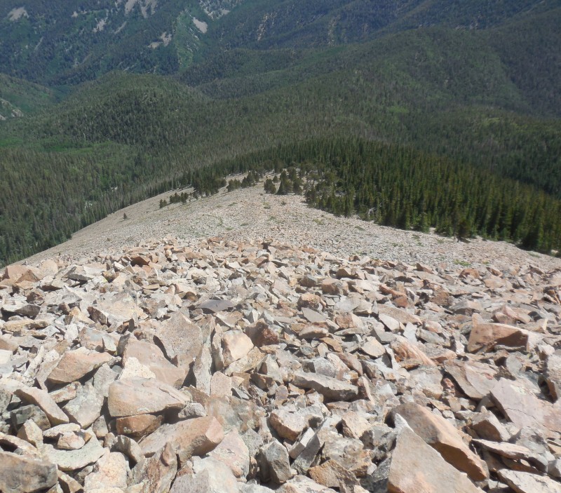
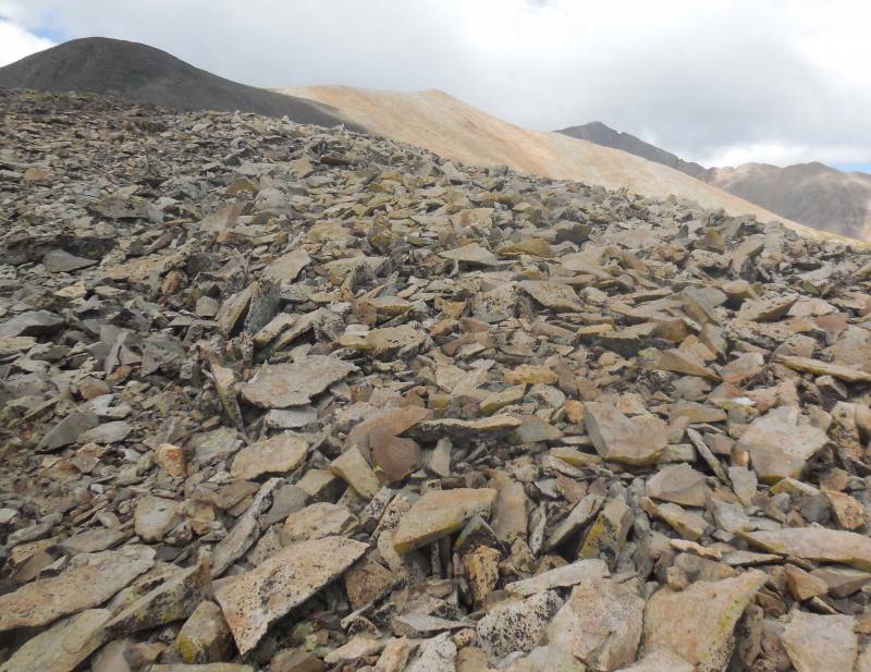
The northeast ridge is deceptively steep as it scales over two thousand vertical feet in around 1.25 miles! The high point on this ridge is around 12,800' and comes into view momentarily.
Next point to aim for
Then I got my first glimpse of the long east ridge that would eventually connect to the summit of West Spanish even though the true summit would not be visible until much later.
Reaching the east ridge
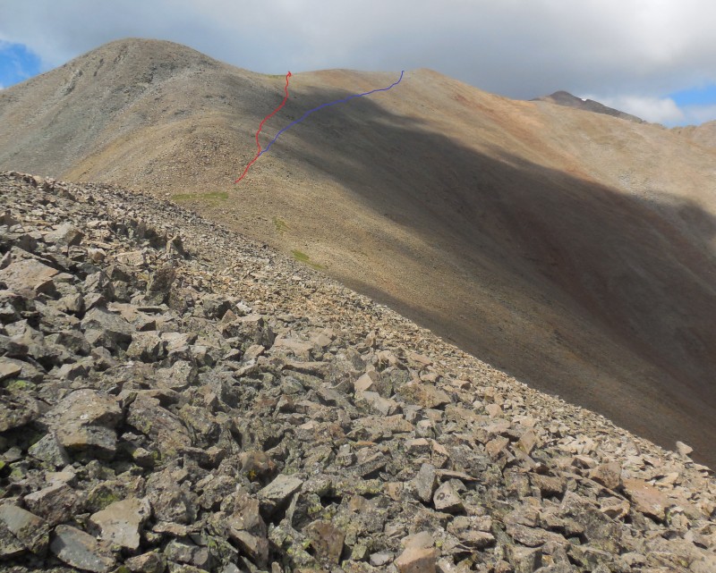
I realized that I could skirt below the next bump on the ridge and the route I took is shown in red in the next shot. Conceivably, one could stay lower and regain the ridge farther ahead but that slope harbors loose scree so I decided against that choice (in blue).
My route in red
As I grunted up this section, the view of East Spanish behind me was definitely worth a few looks.
Looking back at East Spanish
There is no trail on any section of this route so I took the path of least resistance across the talus, trying to minimize unnecessary elevation gain while staying on the more stable rocks. Easier said than done!
Finding the path of least resistance
I aimed for and gained the ridge at the grassy saddle from where I could survey the east ridge to the summit.
Aiming for the grassy saddle
From this vantage, the best route appeared to be along the ridge, staying just below to climber's left.
Surveying the east ridge
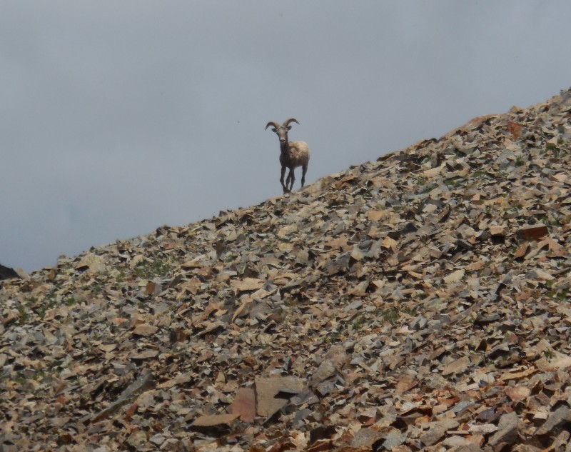
As I gazed up the ridge, mentally mapping my path to the next station, I saw something looking straight at me. Obviously, he had spotted me even before I did and was wondering what I was.
Hey there!
Denizen of high ridges
He stood his ground as I approached while keeping my eye on him the whole time. Satisfied that I posed no threat, he causally bounded up the rocky ridge and disappeared.
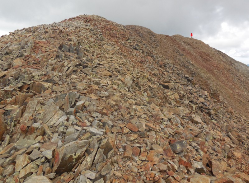
The next shot shows what appears to be the true summit; the east ridge is also broken in a couple of sections which I figured might make the traverse more interesting.
East ridge route
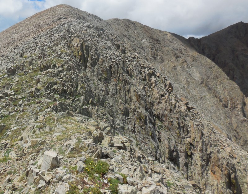
The broken sections on the ridge were such that there was no choice but to skirt them on the left.
Roughness on the ridge
More broken sections
The last notch on the east ridge en route to the top was no different.
One more notch on the ridge
The final pitch to the summit was an easy walk on broken talus.
Starting the final ascent
Final pitch to summit
I knew the views from the top would be nothing to write home about today due to the cloudy weather. The long line of southern Sangre De Cristo peaks were merely silhouettes surrounded by murky skies.
Murky skies
Clouds over Sangres
Is that Culebra?
The next shot looks down at the Wet Mountains - a sub range of the Sangre De Cristo, a beautiful range where I spent many a weekend this past spring climbing many memorable high points.
Wet Mountains
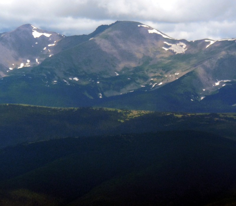
The views of the northern Sangres were disappointing due to the foggy air and the cloud cover over the high peaks. Looking up, I realized that those very clouds were heading in my direction so I decided to abandon my lofty perch.
On my descent I stayed closer to the ridge proper to see if the crest offered any opportunities for down climbing the more rugged sections. The few that existed flirted dangerously close to the steep cliffs on the north face. Perhaps the Bighorn sheep may have been more at home on these cliffs...
Atop the ridge crest
Gazing down one of these steep gullies, I caught a raven in mid-flight.
Raven in mid-flight
The cloud cover thickened, but a speedy retreat, however, was simply not on the cards. The descent down the lower part of the east ridge and the northeast ridge proved to be largely an exercise in balancing while maintaining downhill progress; nearly every rock I stepped on moved no matter the size, and some behaved like skateboards. No surprise then that the traverse from 13,000' to treeline took longer on my descent; I was just relieved once I reached the trees, knowing that the worst was behind me and I could cover the remaining section down to the trail at a more respectable pace.
Just as I got below treeline, I heard the first rumble in the skies - a gentle reminder that I was overstaying my welcome. Any ambition I might have had of making an attempt at East Spanish was summarily dispatched at that point. I would have to be content with one Spanish Peak today. Content? Color me elated!
Did I really climb that?
My GPS Tracks on Google Maps (made from a .GPX file upload):
I do enjoy your reports. I did East SP from Wahatoya and enjoyed it a lot. I thought that was tougher than doing West from Cordova. Is there a faint trail in Pic #20?
Great work an a route that I had seen no documentation on either.
I like your adventurous style, thanks for the TR! I will have to try it from that side some day with my own variation in mind! I don't think it is an easy task no matter how you slice it to get both. Wow, such a big mountain and undertaking!
Brian: Well said!
Jay: There is definitely a path in the rocks across that slope in Pic #20 that helped the traverse.
MtnHub: You're due for some mountain adventures yourself - hope to read about them soon!
krazykat: Car to car was 6:45.
boudreaux: I'd still like to do the Spanish combo but yes, that'll be a big day - probably ~14 miles RT and ~6,400' elevation gain/loss.
I love that area and have been down that trail many times, never seeing anyone on it as opposed to the mob at Cordova. Beautiful, remote area. We did East Peak but never West from this side...that is one long talus slog you did. Super job!
Great report, I enjoyed it. Looks like a heck of a long ridge hike. I plan on taking my middle daughter up there next month to bag West Spanish from it's standard route and probably a Rito Alto/Hermit/Eureka combo the day before or after that.
Caution: The information contained in this report may not be accurate and should not be the only resource used in preparation for your climb. Failure to have the necessary experience, physical conditioning, supplies or equipment can result in injury or death. 14ers.com and the author(s) of this report provide no warranties, either express or implied, that the information provided is accurate or reliable. By using the information provided, you agree to indemnify and hold harmless 14ers.com and the report author(s) with respect to any claims and demands against them, including any attorney fees and expenses. Please read the 14ers.com Safety and Disclaimer pages for more information.
Please respect private property: 14ers.com supports the rights of private landowners to determine how and by whom their land will be used. In Colorado, it is your responsibility to determine if land is private and to obtain the appropriate permission before entering the property.


 Wahatoya Trailhead")
 East Spanish Peak")
 First creek crossing")
 Narrow trail")
 Looking back at the boulder field")
 Second creek crossing")
 Time to lave the trail")
 Climbing the hillside")
 Navigating through the pines")
 Looking down the lower slope")
 Approaching treeline")
 Looking back down the slope")
 Aiming for the next station on the NW slope")
 That's steep!")
 Tippy talus")
 Next point to aim for")
 Reaching the east ridge")
 My route in red")
 Looking back at East Spanish")
 Finding the path of least resistance")
 Aiming for the grassy saddle")
 Surveying the east ridge")
 Hey there!")
 Denizen of high ridges")
 East ridge route")
 Roughness on the ridge")
 More broken sections")
 One more notch on the ridge")
 Starting the final ascent")
 Final pitch to summit")
 Murky skies")
 Clouds over Sangres")
 Is that Culebra?")
 Wet Mountains")
 Raven in mid-flight")
 Did I really climb that?")
 West Spanish in All Her Glory!")
 Atop the ridge crest")


