Download Agreement, Release, and Acknowledgement of Risk:
You (the person requesting this file download) fully understand mountain climbing ("Activity") involves risks and dangers of serious bodily injury, including permanent disability, paralysis, and death ("Risks") and you fully accept and assume all such risks and all responsibility for losses, costs, and damages you incur as a result of your participation in this Activity.
You acknowledge that information in the file you have chosen to download may not be accurate and may contain errors. You agree to assume all risks when using this information and agree to release and discharge 14ers.com, 14ers Inc. and the author(s) of such information (collectively, the "Released Parties").
You hereby discharge the Released Parties from all damages, actions, claims and liabilities of any nature, specifically including, but not limited to, damages, actions, claims and liabilities arising from or related to the negligence of the Released Parties. You further agree to indemnify, hold harmless and defend 14ers.com, 14ers Inc. and each of the other Released Parties from and against any loss, damage, liability and expense, including costs and attorney fees, incurred by 14ers.com, 14ers Inc. or any of the other Released Parties as a result of you using information provided on the 14ers.com or 14ers Inc. websites.
You have read this agreement, fully understand its terms and intend it to be a complete and unconditional release of all liability to the greatest extent allowed by law and agree that if any portion of this agreement is held to be invalid the balance, notwithstanding, shall continue in full force and effect.
By clicking "OK" you agree to these terms. If you DO NOT agree, click "Cancel"...
I've not posted to this site before but figured that since I value the trip reports of others for intel before a climb, it would be good karma to post one as well.
My wife Brooke, my dog Aspen, and I left Denver on Thursday 4/2 at around 2:30- about :45 later than we wanted to... stupid work, always getting in the way of fun. Our plan was to climb Blanca and Ellingwood on Friday and then drive to the Lilly Lake Trailhead to camp and climb Lindsey on Saturday. We arrived to Lake Como Road at 6:30 after suffering through about :30 of traffic at exit 52 on I-25. There is construction that closes 25 SB and routes everyone through this exit and through the town of Walensburg. Good for Walensburg. Bad for us.
This road is not 5.5 miles as it states in the directions on this site... at least not from where we measured it. From the turn off, off of 160 its about 7.5 miles. Now, this wouldn't ordinarily be a big deal, but when you are carrying a fairly cumbersome pack (including all of your wife's gear), hiking up hill, and planning on climbing a couple mountains early the next day, the unexpected extra 2 miles are a kick in the stomach. In any even, we drive in on the road about 3 miles and start hiking. After about an hour an a half we see 2 folks on their way down who inform us we have another 2.5-3hrs to go... huh... okay. We grunt out the miles and arrive at Lake Como at around 10:45, quickly set up our tent in the closest spot we see and attempt to get some sleep, which is a lot harder than it sounds at 11,000' with the wind gusting hard, and a loudly snoring 80 lbs labrador.
No pictures up to this point yet as the camera was packed away and we weren't stopping to find it until we got to the lake...
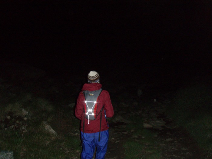
4:30 AM wake up the next morning to set off on our climb. As we were getting ourselves together I commented to my wife that there weren't any stars in the sky, which I thought was strange... shrugging off the lack of stars, we begin our hike along Lake Como.
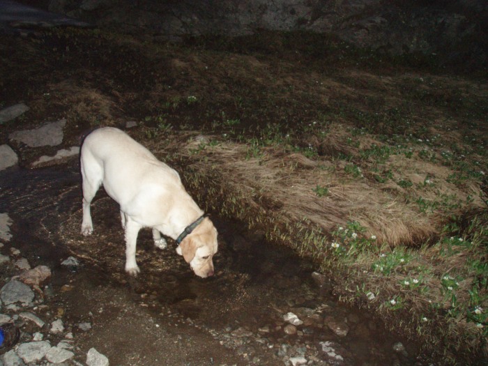
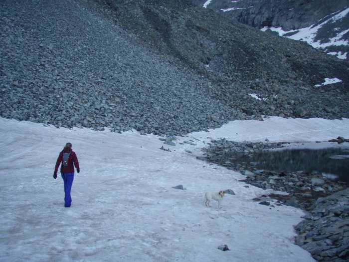
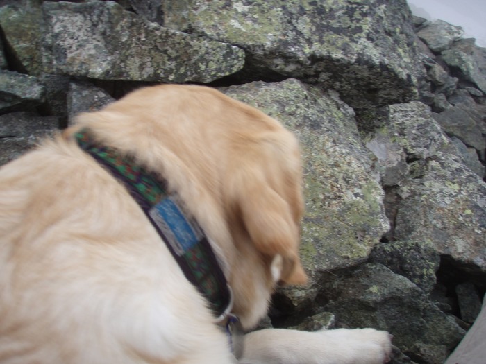
Here's Aspen getting an early drink... she'll need all the energy she can find.
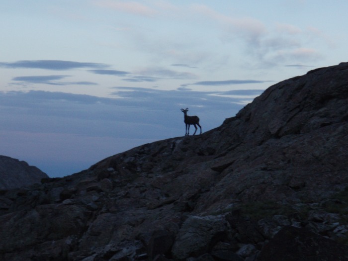
Sun rise with a mountain goat.
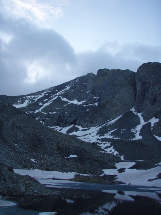
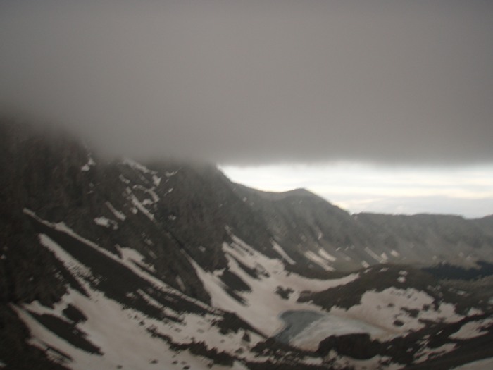
As dawn breaks we see that there are some clouds in the sky, but nothing too threatening. Here is a look at the approach.
And a look at back to the valley.
We are making our way toward the waterfall and there is still quite a bit of snow on the ground and some of the lakes are almost fully frozen.
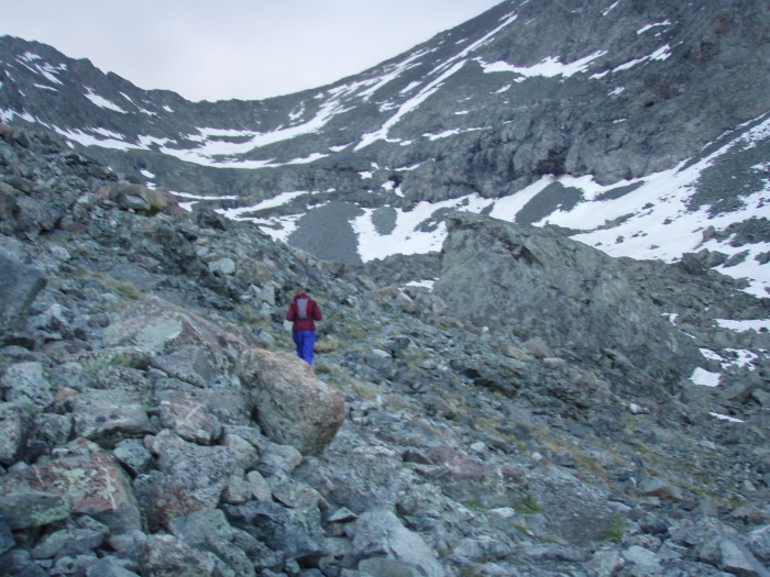
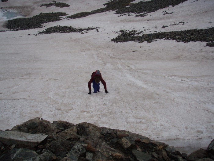
The ledges were definitely a slight challenge and Aspen was having a very hard time. She couldn't make all the moves and I had to lift her several times. Maybe we didn't find the best route up, but there were several instances where we were doing some class 3 climbing.
The approach to the ledges and the ledges
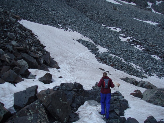
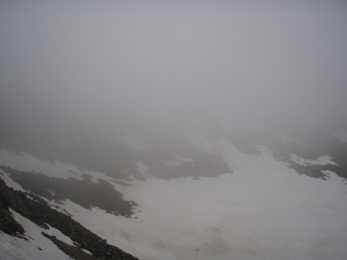
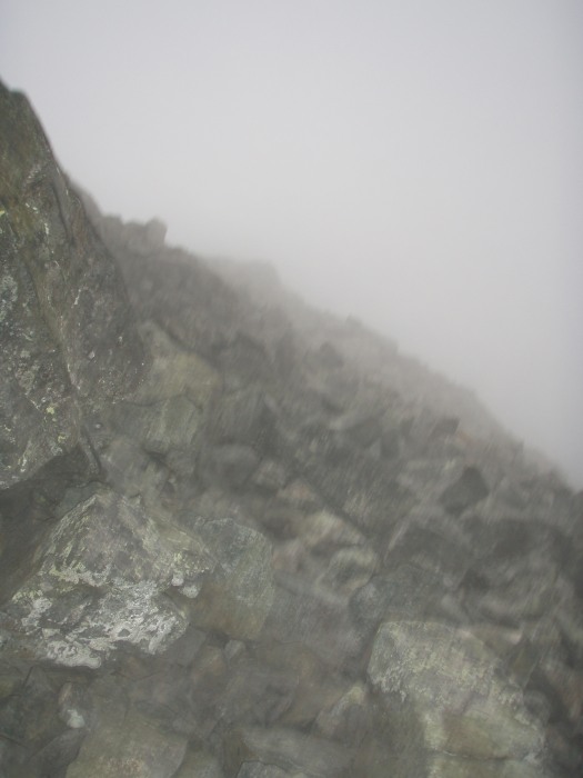
After getting up the ledges we made what I think was our first mistake. We headed off to the left toward Ellingwood as this was the peak we were planning on summitting first. There was so much snow on the ground and we followed some tracks... I'm not sure if this was the way to Ellingwood or not, and at this point we were getting socked in by some serious cloud cover and visibility was deteriorating rapidly.
We couldn't see anything above us and could not find any resemblance of a trail. Luckily we saw to other climbers coming up the ledges and go off to the right toward Blanca. We decided to alter our plans and do Blanca first. We headed back down to the top of the ledges and then began the ascent up a thinly cairned trail. Aspen was struggling a lot at this point and her paws were starting to get a bit torn up. We had ruffwear booties for her but they were not staying on well and she was not as confident in them so we packed them away. We finally made it up to the ridge for what we thought was the final ascent to Blanca.
At this point Aspen refuses to go any further. We decide that my wife was going to go ahead first while I stayed with the dog- her summitting was a lot more important as her goal is to finish all of the mountains (she has 21 under her belt as opposed to my 5...) and we figured that once she came back, I would then make a go of it. Not so much. Visibility was horrendous, here is our view or lack there of:
.
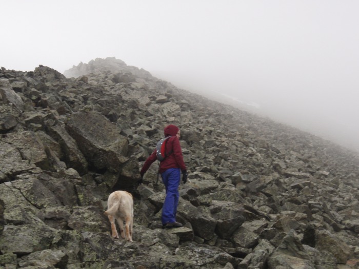
Aspen and I holding down the fort, er, ridge while Brooke treks on:
Brooke comes back about 15 minutes later and says she isn't sure if she summitted. After talking with a few other climbers back down at the lake, it appears she came within 30 yards of the summit, but due to the lack of visibility and overall sketchiness of being there alone, she turned back... I'm very impressed and proud she made it as far as she did. Here is her coming back down... yes, she really is in there somewhere, but it didn't show in the pic:
We decide not to do Ellingwood for two reasons: 1) the weather seems to be getting worse and 2) I have no idea where the trail is. I could not find the mine that the route discusses and couldn't even see the mountain.
Unfortunately we decide to call it a day and head down. Of course it begins to rain. Here is a wet, bummed wife:
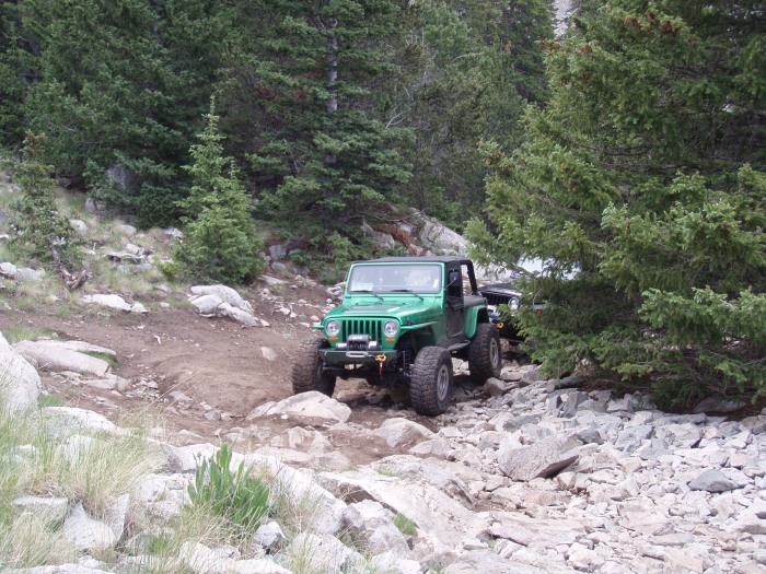
Our weekend plans call for us to now drive to the Lilly Lake Trailhead for an attempt at Lindsey. We decide that we'll come back next year on the 4th of July and redo Blanca, hit Ellingwood and throw in Little Bear for good measure... Sounds like a good plan, but that does mean we'll have to tackle Lake Como Road again. Here is a pic of a few Jeeps at JAWS 84.5 or whatever number obstacle that road throws out there...
Coming down was as bad, if not worse, than coming up... it was hot and Aspen was crying and limping the whole way down. Not only did we not summit, we broke our dog.
Although disappointing, it was a learning experience (don't bring Aspen on anything above a class 1) and it was a good scouting mission for next year.
Now we look forward to celebrating our independence on top of Lindsey the next day... trip report will come soon... hope this is helpful for someone.
Thumbnails for uploaded photos (click to open slideshow):
I‘m pretty sure we ran into you at the lake and creek crossing. Me and my friend had the orange and blue helmets on and prob looked pretty bummed too. We had the same issues with weather and such on Little Bear. I feel your pain with going up the Lake Como road again. Nice report!
Jamie, I do remember... I believe Aspen barked at you when you guys were coming back and we were breaking camp? guarding our tent as a vicious lab...
Caution: The information contained in this report may not be accurate and should not be the only resource used in preparation for your climb. Failure to have the necessary experience, physical conditioning, supplies or equipment can result in injury or death. 14ers.com and the author(s) of this report provide no warranties, either express or implied, that the information provided is accurate or reliable. By using the information provided, you agree to indemnify and hold harmless 14ers.com and the report author(s) with respect to any claims and demands against them, including any attorney fees and expenses. Please read the 14ers.com Safety and Disclaimer pages for more information.
Please respect private property: 14ers.com supports the rights of private landowners to determine how and by whom their land will be used. In Colorado, it is your responsibility to determine if land is private and to obtain the appropriate permission before entering the property.


")
")
")
")
")
")
")
")
")
")
")
")
")
")
")
")
")
")
")