Download Agreement, Release, and Acknowledgement of Risk:
You (the person requesting this file download) fully understand mountain climbing ("Activity") involves risks and dangers of serious bodily injury, including permanent disability, paralysis, and death ("Risks") and you fully accept and assume all such risks and all responsibility for losses, costs, and damages you incur as a result of your participation in this Activity.
You acknowledge that information in the file you have chosen to download may not be accurate and may contain errors. You agree to assume all risks when using this information and agree to release and discharge 14ers.com, 14ers Inc. and the author(s) of such information (collectively, the "Released Parties").
You hereby discharge the Released Parties from all damages, actions, claims and liabilities of any nature, specifically including, but not limited to, damages, actions, claims and liabilities arising from or related to the negligence of the Released Parties. You further agree to indemnify, hold harmless and defend 14ers.com, 14ers Inc. and each of the other Released Parties from and against any loss, damage, liability and expense, including costs and attorney fees, incurred by 14ers.com, 14ers Inc. or any of the other Released Parties as a result of you using information provided on the 14ers.com or 14ers Inc. websites.
You have read this agreement, fully understand its terms and intend it to be a complete and unconditional release of all liability to the greatest extent allowed by law and agree that if any portion of this agreement is held to be invalid the balance, notwithstanding, shall continue in full force and effect.
By clicking "OK" you agree to these terms. If you DO NOT agree, click "Cancel"...
Mt. Columbia (14073) March 22, 2008 Route: SE Ridge Round Trip: 15 miles Elevation Gain: 4400 ft. Hikers: KirkT, Shad, and Tracy
After taking a break from hiking since November, I have been itching to get out into the wilderness for awhile. I have been wanting to get back to climbing the 14er's that were on my list so I could inch closer to my finishing goal later this year. Shad and I had been planning on climbing somewhere on Good Friday with a tentative trip planned for the San Juans. As the date drew closer, we decided on Columbia based on its location and "ease" of avalanche free route. We decided to take the same route USA Keller did last year up the SE ridge. So the plan was set. Weather forecasted cloudy, 40% chance of snow and windy with gusts to 40 mph. Yep.... exactly why I can't wait for the Spring/Summer climbing season.
After touching base with Tracy earlier in the week, we met up and took off to Buena Vista around 4:15am. There was not a cloud in the sky the whole way and we made excellent time. We arrived at the Cottonwood Road around 6am. It had snowed the day before about 3 inches so we started up the road very slowly. After about 5 minutes, Tracy's 4-Runner bottomed out on the deep snow and we were stuck. We comtemplated on starting our hike or digging it out.. So we started digging. Shad and I used our ice axes and after about 45 minutes we finally were free. We backed back down the road aways and parked and geared up. The temp was around 30 degrees and the elevation was 8600ft. UGH!! This was going to be a very long hike indeed.
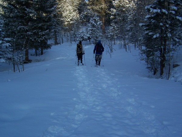
We put our snowshoes on and started up the Cottonwood Road to where the Colorado Trail crossed and we would meet up with the SE Ridge trail. The hike to the Colorado trail junction was 2.7 miles. This was going to add roughly another 5 miles to an anticipated 10 mile trip!! It took us right at 1 hour to reach the Colorado Trail junction. The time was now 8:15.
Shad and Tracy hiking up the Road.
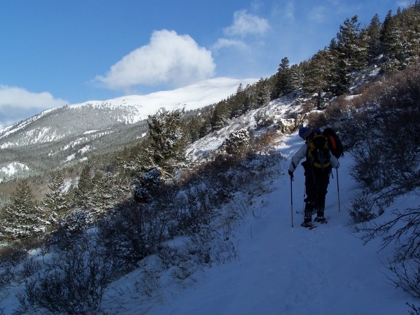
We proceeded up the Colorado trail past the two large switchbacks and started up the SE Ridge.
Shad and Tracy heading up Colorado trail with Columbia in distance.
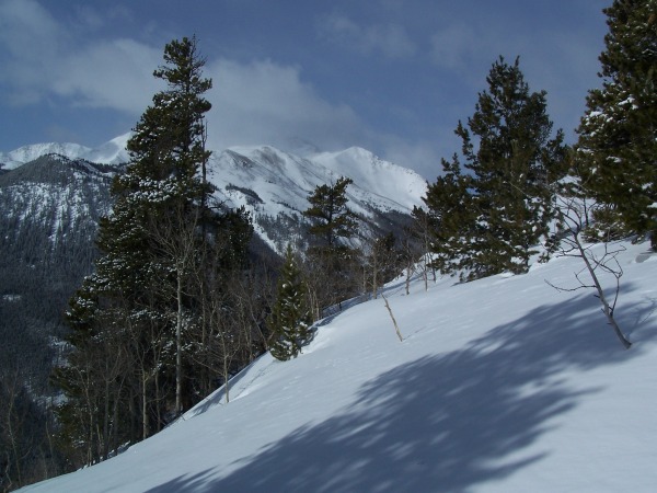
Mt. Princeton in Alpenglow with fresh snow.
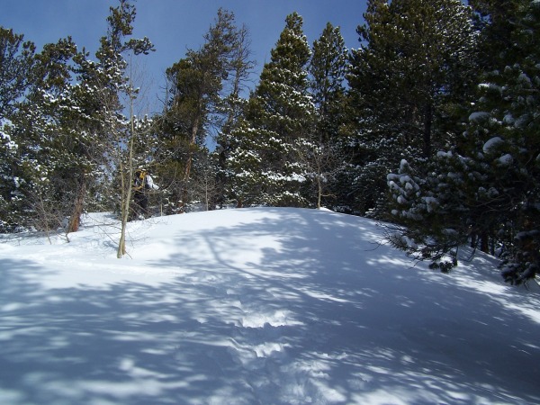
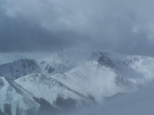
We started heading up the SE ridge trail breaking knee deep snow the entire way. Shad led the entire way trailbreaking. The snow was anywhere from 4 to 12 inches of fresh powder the entire way through tree line. This was bringing back memories of Elbert last year without the frigid temps. The wind could be heard above the trees. Viewing Yale across the valley it was obvious that the wind was pretty fierce above 12000 ft. as the snow could be seen blowing all over that mountain. It almost looked like fog but it was obvious that it was snow being blown around. The sky was clear to partly cloudy. The temperature in treeline was somewhere in the mid 30's and we were all shedding layers.
First shots of Mt. Yale
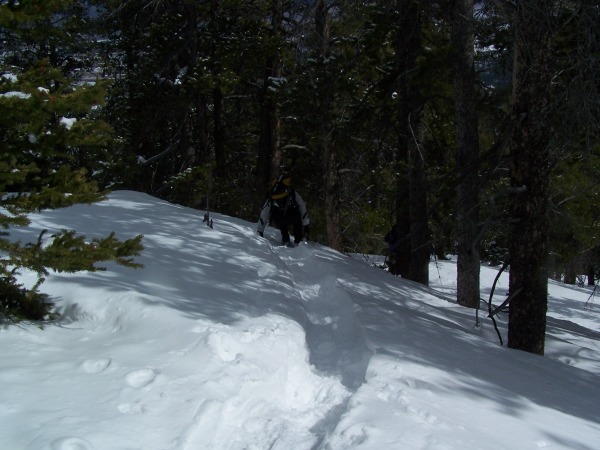
Tracy a few yards ahead in the heavy treeline snow.
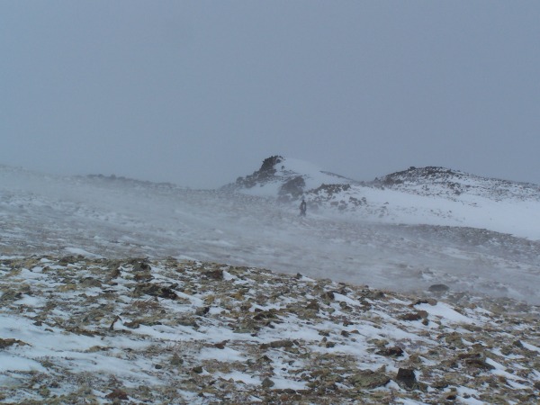
We continued the neverending slog through knee deep snow and finally made it to treeline around Noon. The wind had really started to blow now and the layers were beginning to be replaced. We continued on with an into your face 40mph+ steady wind with occassional gusts much higher. The wind was creating white-out conditions all over and ground blizzards. It was extremely difficult going up hill in those conditions. The long slog through treeline and the extremely strong winds up high were really taking it out on me.
Tracy up ahead around 12500ft. in a ground blizzard!!
We decided to continue on a little further and see how far we could go. Shad had set a 1pm turnaround time. It was already that time! We continued up to 12800ft. At this point... we had been hiking 6 hours, covered 7+ miles and had about 1 mile left to summit and it was almost 2 pm. We decided to stop and call it a day. The wind was a sustained 40+ mph with higher gusts. We could barely make out the summit at certain points but it was usually hard to see because of the blowing snow. It would of taken a minimum 1 hour or more to summit at this point. The decision to turn back was a wise one. "Reluctantly," we started our way back down... ever looking for a place to shelter from the wind. It was no use.... she would not stop.
Mt. Yale through a ground blizzard.
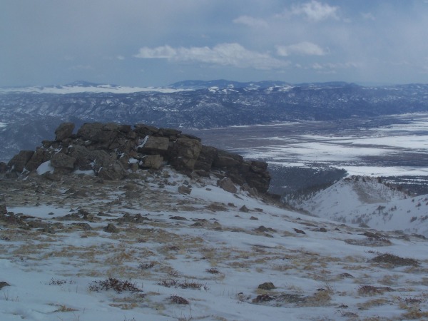
Buena Vista from 12500ft.
We eventually made it back to treeline where the wind was again sheltered by the trees. The slog back through the trees was again relentless.. There were places that our trail was almost totally covered up by the wind! We stopped along the way and refueled and took a well needed break.
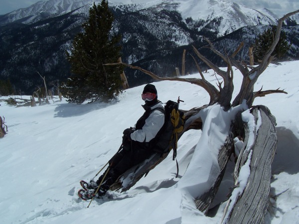
Tracy ... taking it easy.
Tracy in the deep snow slogging back down.
The trek back through the trees was pretty uneventful, but man was it a long way down in these conditions. We arrived back at the truck at 5 pm. It had taken us almost 7 hours to reach 12800ft. and 3 hours to return back to the truck at 8600ft. This was the first 14'er I had personally attempted and failed to summit. As Tracy and Shad both pointed out.... we had hiked almost 15 miles, gained almost 4400ft in 10 hours with heavy snow conditions and relentless wind. I guess that's ok with me. It was a great day to be back in the mountains with good friends. It really gets me excited about the Spring and Summer hiking season. After the snow melts I'll go back and do Harvard and then traverse over and finish up on Columbia.
Thanks for reading! 8)
Thumbnails for uploaded photos (click to open slideshow):
Wow! Looks like you had some fun. I would be happy to go back with you and summit that bad boy anytime. We miss you in the crew. Let‘s hook up soon for a hike.
That is a long ridge from the CT. You'll enjoy it more when you go back in better conditions. Glad you were able to give it a go. 15 miles and 4400‘ counts as a good day in anyone‘s book.
Great report on the conditions, Kirk. I remember last March when sdkeil and I did it, we were so tired that we had to take a short nap below Point 13,298. The north side of Yale looks pretty snow-loaded. At least you got some elevation in. I'll be happy to go back with you for that traverse!
Sorry you guys didn‘t have more time, but that is an ambitious route in those conditions. At least you got your 2008 legs warm, and it‘s only gonna get better from here! (If you don‘t think about all the snow that April will bring to the high country)... :roll:
Caution: The information contained in this report may not be accurate and should not be the only resource used in preparation for your climb. Failure to have the necessary experience, physical conditioning, supplies or equipment can result in injury or death. 14ers.com and the author(s) of this report provide no warranties, either express or implied, that the information provided is accurate or reliable. By using the information provided, you agree to indemnify and hold harmless 14ers.com and the report author(s) with respect to any claims and demands against them, including any attorney fees and expenses. Please read the 14ers.com Safety and Disclaimer pages for more information.
Please respect private property: 14ers.com supports the rights of private landowners to determine how and by whom their land will be used. In Colorado, it is your responsibility to determine if land is private and to obtain the appropriate permission before entering the property.