| Report Type | Full |
| Peak(s) |
Wetterhorn Peak - 14,021 feet Uncompahgre Peak - 14,318 feet |
| Date Posted | 07/20/2014 |
| Modified | 07/22/2014 |
| Date Climbed | 07/20/2014 |
| Author | claybonnyman |
| Wetterhorn>Uncompaghre combination |
|---|
|
I wanted to do a trip report because I have some different opinions than I've seen expressed frequently in other reports. First, be aware that the last .6 mile from the Matterhorn Creek TH to the Matterhorn Creek 4WD TH is, indeed, quite rough and steep. If you have a 4WD with decent clearance, it will be no problem, but I might hesitate even with a smallish SUV like a RAV4 or something like that. I drove down to Lake City from Niwot on a Saturday afternoon to avoid traffic (ha; still got stuck for about an hour for road work on Colo. 93 to Golden) and arrived at the 4WD TH just at dark. There were several other vehicles there, but I was fortunate to be able to squeeze between two. Having looked over the (relatively few) Wetterhorn-Uncompaghre trip reports and climb times, and comparing my times on other peaks with those of people who posted about U/W (or W/U, as the case may be), I decided I didn't need a killer early start. The weather reports had been changing all week, but when I looked last at the Lake City Cafe around 8 p.m., thunderstorms weren't predicted to roll in until 3-5 p.m. and I was sure I'd be down before then. 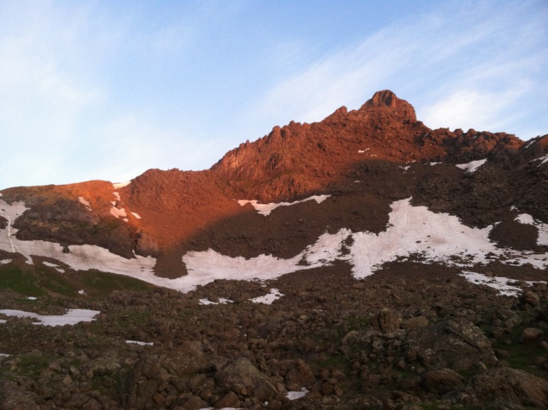 I got up at 4 a.m., made coffee and oatmeal, organized my stuff and headed out at 5:05 a.m. A few people had passed by with headlights and were ahead of me on the trail. The weather was chilly, but not windy. Still, I went for maximum flexibility and donned Columbia convertible pants and a water/windproof CoCoNa running jacket, fully expecting to ditch both once I got warmed up and the sun rose. The trail starts immediately uphill and if you leave in the dark, you definitely want a decent headlamp, as there are many rocks and roots on which to stumble. By the time I reached the split between the Wetterhorn and Uncompaghre trails, there was plenty of light and the sun had touched the summit of Wetterhorn. First callout: I have seen a number of people report that finding the trail to Wetterhorn is confusing. I couldn't disagree more. The first part of the trail is so clear you can do it in the dark, no problem. At .75 miles/11,200 feet be sure to head right and uphill on switchbacks, rather than continuing along the creek " this, to me, is the only conceivable place you could really go wrong. Once you are in the Matterhorn/Wetterhorn basin, you'll come to a split in the trail, which clearly indicates " in case you don't recognize the beautiful, toothy peak to your left " the way to Wetterhorn. I have to say, Wetterhorn is one of those engaging peaks " short, sweet and steep " that I really enjoy. Climbing up through the basin toward the peak goes extremely fast. It was great to watch the sunlight spread from the peak and finally start warming my back. Callout two: Some posters also have indicated they found route-finding slightly tricky once above the "yellow soil" at around 13,000 feet, but again I disagree. It's pretty intuitive, so long as you understand you are heading toward the prominent Prow up and to your left. There are cairns, but I think if you've taken a good look at any photos on 14ers.com or read Roach, you'll have no problem. The final pitch was really fun and not very hard. The hand/footholds are quite solid, for the most part, so the picking " you do have to do a bit of picking " is easy. It had taken me just 1:45 from the 4WD TH to the summit and, having passed 8-10 people, I was the first up. There was not the slightest breath of breeze and the air felt warm. There, 3 miles away as the crow flies, was Uncompaghre, but at this point I was feeling cocky, even though I still had 15+ miles to go. 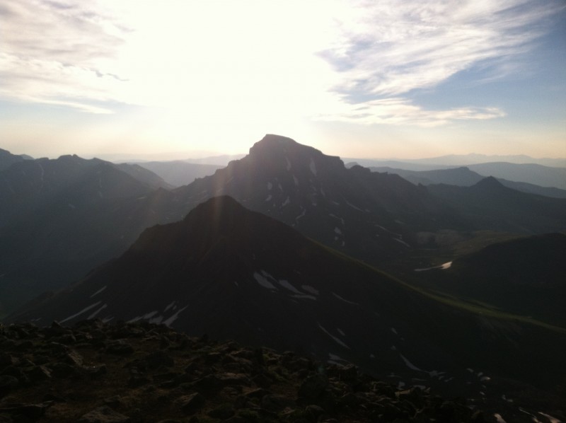 I took great care downclimbing the final pitch. I do not have any fear of heights, really, but vestigial exposure fear from a climbing incident at age 12 forced me to haul out the "Litany Against Fear" from Frank Herbert's "Dune": "I must not fear. Fear is the mind-killer. Fear is the little-death that brings total obliteration. I will face my fear. I will permit it to pass over me and through me. And when it has gone past I will turn the inner eye to see its path. Where the fear has gone there will be nothing. Only I will remain." Actually, I just mumbled the first few words and I was fine. But for sure, you wouldn't want to take a tumble here; it's a long way down (though this photo doesn't do it justice). 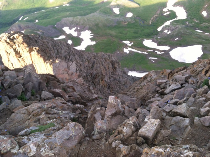 Not far below the final pitch, I came across a group, four people and two dogs, I'd passed on the way up. They were feeling a little stressed: One guy had peeled off with his dog and headed north, toward the east face/ridge of the mountain, which as far as I can tell is notably more difficult than the route we were on (Class 4). They had another dog with them and one young woman asked about taking him up the final pitch. Callout three: Dogs have obviously made it to the top of Wetterhorn " RIP Diente " but I would strongly advise against it (as even the Forest Service sign advises at the trailhead). Dogs would probably be fine clawing up the final pitch, but coming down ... no thanks. Most dogs can sense exposure and might well be reluctant to downclimb. If they were, "braking" on claws is not so reliable. And you, the human, wouldn't want to have to manage getting your pal down. A fall for either of you would very likely prove fatal or at least result in serious injury. This group decided they would take turns going up to the summit and wait with the dog below the final pitch. No idea what happened to the other guy/dog. Fast forward to the basin. I reached the fork and headed up FT 233 toward Uncompaghre (not visible from here, though Matterhorn looms nicely) almost exactly 3 hours into my day. The climb up to the saddle below Matterhorn, 12,380, is nice and gentle, good for jogging/running if you are into that kind of thing. From the saddle, there is a good, long stretch of single-track that rolls and contours around the south side of the basin. This is pretty easy stuff, but the slightest twinge of anticipation was beginning to tickle my cockiness: When I finally began to climb in earnest toward the SW ridge of Uncompaghre, I'd really only come 8 miles and I could see how this might be ... tiresome on the way back. But I was not about to make the (apparently) oft-made mistake of "shortcutting" up the west face. In winter/spring/early summer snow, this is apparently a viable route. But when dry, it's a long, unstable scree slope, no fun for ankles and terrible for the mountain itself. (I stupidly followed mumble-mumble's advice that the scree slope from the saddle between Redcloud-Sunshine was viable, to my great regret and further wounding of the mountain.) Getting up to the summit of Uncompaghre was very straightforward and pretty steep, as you gain some 2,000 feet in less than 2 and a half miles, with little switchbacking. By the time I hit the (very) brief Class 2 bit on the west side, I was eager to hit the top, but there was still perhaps 3/4 a mile to go. I was on top right at 10:30 a.m., 5:25 into the hike (including top time on Wetterhorn). Again, the weather was fantastic, though a breeze had blown up and I could see clouds beginning to form off to the west. I didn't dare creep too close to the northeast-facing cliffs, but did peer over; it is an impressive drop. Amazing that it's so easy to get up here via another route.  Again, if you are into that sort of thing, once off the top, you can run/jog almost all the way back down into the basin, with the exception of the crumbly, slide-y Class 2 bit. Just for grins, I looked off the west side and was very glad I added the extra 5 miles or so of going around to the SW ridge. As I suspected, by the time I was down in the basin, I was feeling less inspired, though still fine. Others have described the slog back to the Matterhorn saddle as discouraging, and I understand. But I had already accepted that this was part of the route, and in the end, it really wasn't bad at all. If anything, the climb was less taxing than the long downhill run from the summit to the basin. I was just over 13 miles and 7 hours into the hike, climbing back toward the saddle, when the clouds had pretty much covered the sky. They didn't look like they were planning to wait until 3 p.m. to start storming. Once I hit the saddle, I jogged and walked 2+ miles back down to the trailhead. I arrived " as did the rain, lightning and thunder " right at 12:45. 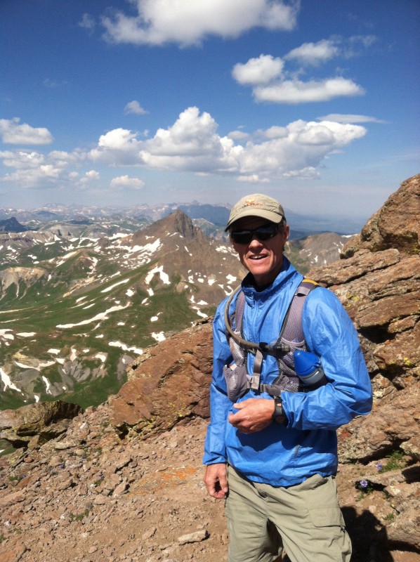 Total time: 7:40; minus top time, 7:10. Callout four: I am most grateful for the responses to my forum post about whether to do Wetterhorn or Uncompaghre first from the Matterhorn Creek TH. First, there didn't appear to be anyone else on the trail who was attempting both peaks on this day. The Wetterhorn folk were all doing an up-down " and what a fantastic, fast, fun little trip that would be " and all the Uncompaghre people except for one pair came up Nellie Creek. I kept my options open and didn't decide until I was standing at the fork in the trail between W/U. I went with Wetterhorn because: 1) I was excited to get up and experience the Class 3 stuff, which sounded like fun; 2) On the theory that Wetterhorn offered more, shall we say, "variety," I wanted to make sure I summited there if I were only going to reach the top of one; 3) Most important, given the exposure on Wetterhorn, I wanted to be as fresh and unfatigued as possible. I think I made the right decision, though either way obviously works. I think my point 3) is especially crucial. It's a long haul over to Uncompaghre and back, and I can well imagine that I would have been feeling pretty tired by the time I hit the Class 3 on Wetterhorn. Overall, this is absolutely one of my favorite days climbing 14ers to date. It offers a little bit of everything: 17.5 miles, close to 6,800 feet of elevation gain, some fun, not-too-daunting Class 3 scrambling, and (for me), plenty of opportunity to pick up the pace by jogging/running. The area is spectacularly beautiful, and being able to see the respective peaks from each summit is a wow experience. Final thoughts: Do your dog and yourself a favor and don't try to take him/her to the summit of Wetterhorn (Uncompaghre is no big deal). Yes, you can do it, but I don't think it's going to be pleasant for either of you, and presumably he/she doesn't really care. "Normal" 14er climbers should have no trouble with either peak, though I'd stick with the standard routes. Doing each peak separately would entail more overall effort/distance/climbing, but clearly be less taxing. Wetterhorn is wham-bam-summit-man, and like Yale or Bierstadt, its swift ascent is invigorating. Uncompaghre is evidently quite simple and easy from the upper Nellie Creek 4WD TH. The combo is indeed a long haul. Some posters have suggested that only the "superfit" or "ultrafit" attempt it. I would say yes, you should be very fit, but more important, I think, is doing your best to climb on a day when storms are expected to hold off until late day at the earliest. I am reasonably fit and I like to go "fast" (though the fastest recorded times for this combo on 14ers.com are an astonishing 5 and a 1/2 hours; that's how long it took me to summit Wetterhorn and Uncompaghre before I started back down). Yet I'm also 52, and while I was certainly tired by the time I finished, this incredible day didn't kill me. The next day I felt a little sore, mostly quads and glutes, but nothing more. Thumbnails for uploaded photos (click to open slideshow):
|
| Comments or Questions | ||||||||||||
|---|---|---|---|---|---|---|---|---|---|---|---|---|
|
Caution: The information contained in this report may not be accurate and should not be the only resource used in preparation for your climb. Failure to have the necessary experience, physical conditioning, supplies or equipment can result in injury or death. 14ers.com and the author(s) of this report provide no warranties, either express or implied, that the information provided is accurate or reliable. By using the information provided, you agree to indemnify and hold harmless 14ers.com and the report author(s) with respect to any claims and demands against them, including any attorney fees and expenses. Please read the 14ers.com Safety and Disclaimer pages for more information.
Please respect private property: 14ers.com supports the rights of private landowners to determine how and by whom their land will be used. In Colorado, it is your responsibility to determine if land is private and to obtain the appropriate permission before entering the property.


