
Log In 
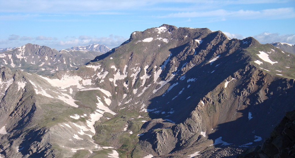
The 3rd highest peak in Colorado is located in the Collegiate Peaks Wilderness of the San Isabel National Forest, just northwest of the town of Buena Vista. Unlike Mounts Princeton, Antero, Yale and Columbia, Harvard isn't as visible from paved roads as you drive through the Arkansas River Valley. If you want to see Harvard in all its grandeur, you'll have to drive to the trailhead and hike to the peak. Climbing Mt. Harvard via its standard and easiest route involves backpacking into Horn Fork Basin from the North Cottonwood Creek Trailhead. The trail ascends almost all the way to the summit, but you’ll need to scramble through rocky terrain near the top.
Elevation 14,424' (LiDAR)
Prev Elevation 14,420'
CO 14er Rank 3 of 53
Range Sawatch
Forest San Isabel
County Chaffee
Towns Granite, Buena Vista, Leadville
Mt. Harvard

Other 14ers in Group

Peak Mount Columbia

Photos

360 Pano
360° Summit Pano
pic1
pic2 pic3 pic4 pic5 pic6 pic7 pic8 pic9
pic10
pic11 pic12 pic13
pic14 pic15 pic16 pic17 pic18 pic19 pic20 pic21 pic22 pic23 pic24 pic25 pic26 pic27
pic28
pic29 pic30 pic31 pic32
pic33
pic34 pic35 pic36 pic37 pic38 pic39

Climbing Routes

route
Mt. Harvard - South Slopes Standard Route
Difficulty: Class 2
Total Elevation Gain: 4,600'
Round-trip Distance: 13.75 mi
Exposure: Moderate
Rockfall Potential: Moderate
Route-Finding: Moderate
Commitment: Moderate
route
Mt. Columbia - West Slopes Standard Route
Difficulty: Class 2
Total Elevation Gain: 4,250'
Round-trip Distance: 12 mi
Exposure: Moderate
Rockfall Potential: Considerable
Route-Finding: Moderate
Commitment: Moderate
route
Combo: Harvard and Columbia Traverse
Difficulty: Class 2
Total Elevation Gain: 6,100'
Round-trip Distance: 15 mi
Exposure: Moderate
Rockfall Potential: Considerable
Route-Finding: High
Commitment: High
route
Mt. Columbia - Southeast Ridge
Difficulty: Class 2
Total Elevation Gain: 4,800'
Round-trip Distance: 11.25 mi
Exposure: Moderate
Rockfall Potential: Moderate
Route-Finding: Considerable
Commitment: Moderate
route  _
Mt. Harvard - South Face
Difficulty: Class 2  Moderate Snow
Total Elevation Gain: 4,600'
Round-trip Distance: 13.75 mi
Exposure: Moderate
Rockfall Potential: Moderate
Route-Finding: Considerable
Commitment: Considerable
route  _
Mt. Columbia - Southwest Couloir
Difficulty: Class 2  Moderate Snow
Total Elevation Gain: 4,800'
Round-trip Distance: 13.5 mi
Exposure: Moderate
Rockfall Potential: Moderate
Route-Finding: Considerable
Commitment: Moderate

Map

Human Verification Required

Trip Reports

  8 Recent Reports Peaks Climbed Added
  Columbia to Harvard Traverse
By: taylormac8
Added: 9/4/2025
Mt. Columbia
Mt. Harvard
9/3/2025 9/4/2025 3  10
  Columbia to Harvard Direct traverse
By: LAW1234
Added: 8/4/2025
Mt. Columbia
Mt. Harvard
8/4/2025 8/4/2025 8  37
  Harvard & Columbia
By: Winter Parker
Added: 7/29/2025
Mt. Harvard
Mt. Columbia
7/28/2025 7/29/2025 3  4
  Harvard Columbia Traverse
By: maraki
Added: 7/7/2025
Mt. Harvard
Mt. Columbia
7/6/2025 7/7/2025 5  6
  Holy Nolans FKT Google Map Included GPX file available for download
By: SpeedWalker
Added: 10/9/2024
Mt. Shavano
Mt. Princeton
Mt. Yale
Mt. Harvard
Mt. Belford
Huron Peak
La Plata Peak
Mt. Elbert
Mt. Massive
Mt. of the Holy Cross
10/5/2024 10/9/2024 47  26
  Better Remembrances of Things Past
By: HikesInGeologicTime
Added: 8/26/2024
Mt. Belford
Mt. Oxford
Missouri Mountain
Mt. Yale
Mt. of the Holy Cross
Mt. Harvard
Mt. Columbia
9/2/2017 8/26/2024 4  18
  Harvard Columbia Ridge Direct Traverse
By: daway8
Added: 8/24/2024
Mt. Harvard
Mt. Columbia
8/3/2024 8/24/2024 10  8
  Nolans 14 thru hike (aka slowlans heavy)
By: vermontster
Added: 8/20/2024
Mt. Shavano
Tabeguache Peak
Mt. Antero
Mt. Princeton
Mt. Yale
Mt. Columbia
Mt. Harvard
Mt. Oxford
Mt. Belford
Missouri Mountain
8/15/2024 8/20/2024 14  13
View All 206 Trip Reports

Frequently Asked Questions about Mt. Harvard

Can I hike Mount Harvard and Mount Columbia together?

Yes, Mount Harvard and Mount Columbia share the exact same standard trailhead (North Cottonwood) and are very frequently climbed together. Elite or high-endurance hikers often choose to bag both summits in a single, massive 15-mile day via a combination traverse route. Alternatively, many climbers backpack into the Horn Fork Basin to set up a base camp, allowing them to summit Mount Harvard on day one and tackle Mount Columbia on the subsequent day.

What is the terrain like on the final climb to Mount Harvard's summit?

While the lower miles are spent on a smooth, well-defined dirt trail through the woods, the final push up the standard South Ridge turns into rugged, rocky Class 2 terrain. The very last 50 feet below the true summit block requires some basic, hands-on movement across large, solid granite boulders. It is a highly enjoyable finish, but hikers must watch their footing and maintain focus, as the boulder block features minor exposure.

Is Mount Harvard good for beginner 14er hikers?

Mount Harvard is the fourth-highest peak in Colorado, and while its standard South Ridge route is a non-technical Class 2 hike, it is not recommended for absolute beginners. The trek requires a long round-trip distance and a demanding 4,600 feet of vertical elevation gain. It demands excellent stamina, strong cardiovascular physical conditioning, and solid pacing skills to safely navigate the long alpine approach.

How do I get to the standard Harvard/Columbia trailhead?

The standard access point is the North Cottonwood Trailhead located just outside of Buena Vista. The dirt road leading to the trailhead is generally well-maintained and accessible to most standard 2WD passenger cars and low-clearance vehicles during the summer. However, parking spaces in the main lot are limited and fill up rapidly on weekend mornings, so arriving early or choosing a weekday hike is highly recommended.

Additional Mt. Harvard History

Name History 1
Climbing History 0
Mining 0
Geology 0
More Information 0
  View All