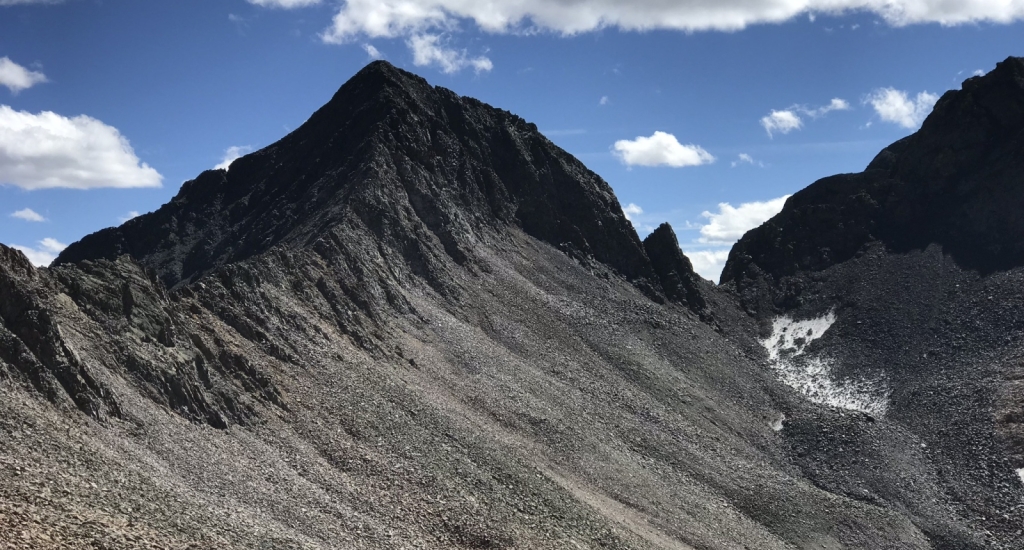
Gladstone Peak
Southwest RidgeDifficulty Class 5
Risk FactorsExposure: High
Rockfall: High
Route-Finding: Considerable
Commitment: High
Rockfall: High
Route-Finding: Considerable
Commitment: High
TrailheadRock of Ages
Start10,350 feet
Summit13,923 feet
Total Gain4,500 feet
RT Length11 miles
AuthorBquinn89
Last UpdatedMay 2023
Trailhead
From Ridgway, leave U.S. 550 and take Colorado 62 toward Telluride. Drive over Dallas Divide, down to Placerville and turn left onto Colorado 145. Drive 6.7 miles and turn right onto the Silver Pick road (dirt). From here, it's 8.5 miles to the trailhead. Drive 4 miles to an intersection and turn right onto "59 H" which is also Forest Road 622. Continue 2.3 miles, turn right onto FR 645 and continue 2.2 miles to the Rock of Ages trailhead, near 10,350'. Notes: After 1 mile on the FR 645 road, you must cross the stream in Big Bear Creek which usually isn't too bad by mid-July. Also, there are some designated camp sites along this road.
Route
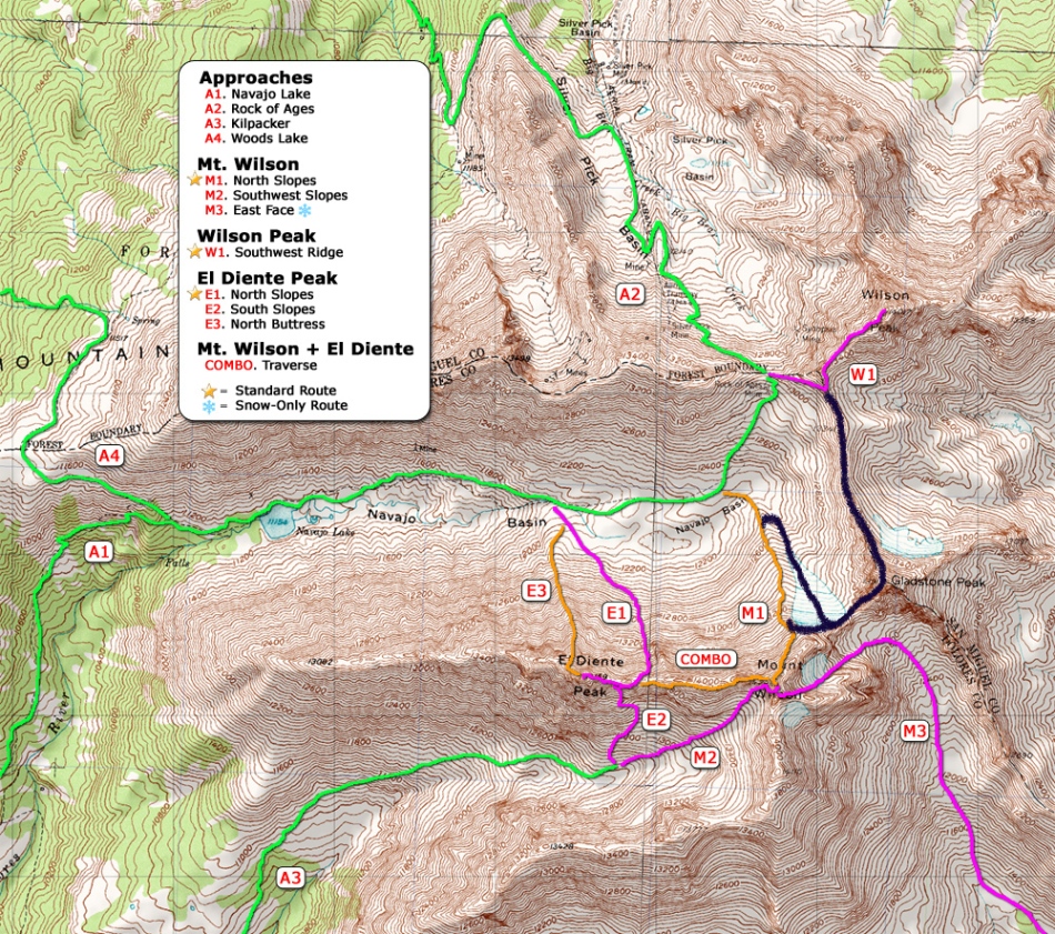
A great picture of the whole route is found on the main Gladstone Peak page, the left ridge in the photo. This route has the potential to increase the value of a Wilson group combo by sticking to the ridge through a previously not recorded section of terrain. Follow description on Mt Wilson North Slopes via Rock of Ages Approach to the upper (east) end of Navajo Basin.
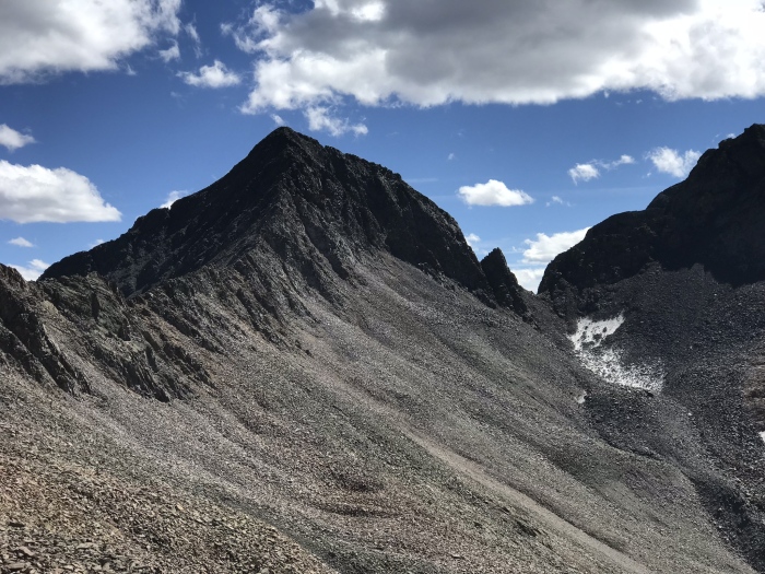
Photo 5 shows the ascent on the right and the descent to the left/foreground from the Rock of Ages saddle. The Mt Wilson/Gladstone saddle in the center of the photo is the start of the difficulties of the route. The notch left of that is where you will encounter the large headwall in photo 2.
From Navajo Basin, follow the beginning of the Mt Wilson North Slopes route until around 13000 ft begin contouring east to the Mt Wilson/Gladstone saddle @~13,200 feet. I did this in September 2018, and there was minimal snowfield, but earlier season one could take the glacier directly from Navajo Basin to the saddle.
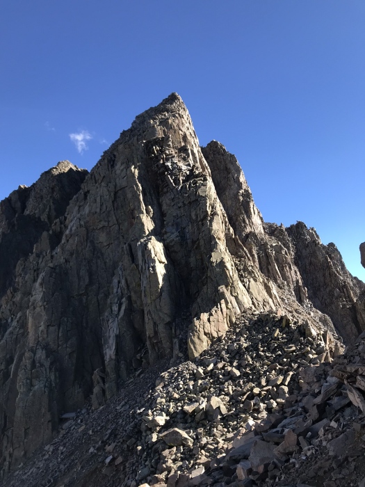
1 shows the first difficulty that may be climbed head on ~5.5-5.7 or dodged to the south.
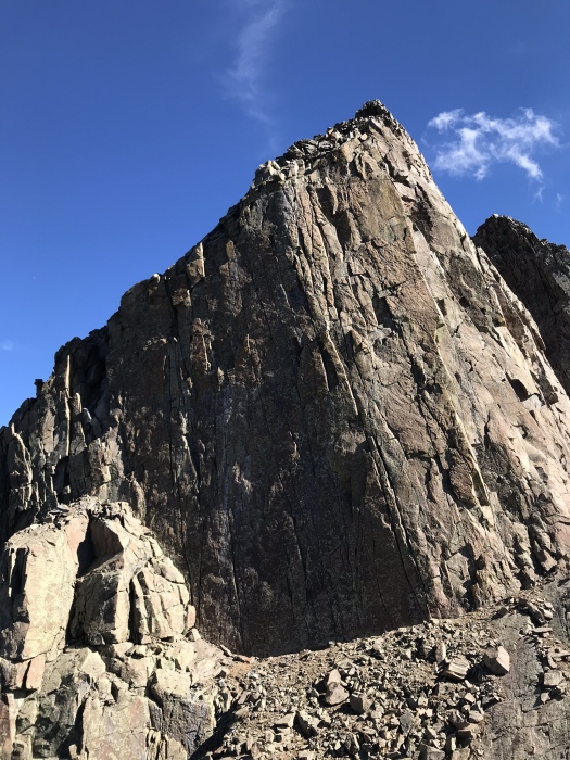
Regain the ridge at this prominent buttress: 2. There are many appealing 5.10 and harder appearing routes up this, but I soloed the far left side through a chimney at ~5.5. Head back southeast through steep terrain to regain the proper ridge at the top of the headwall.
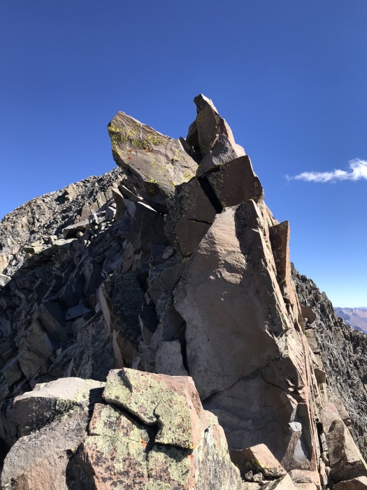
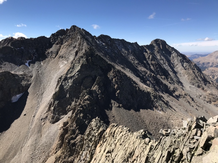
Continue delicately through several more teeter-totter boulder problems and large amount of narrow ridge with extremely loose talus through the remaining portion of the ridge 3.
Looking back on the narrow ridge and Mt Wilson from near the summit: 4.
Descend the North Ridge of Gladstone back to the Rock of Ages Saddle.
Photo 5 shows the ascent on the right and the descent to the left/foreground from the Rock of Ages saddle. The Mt Wilson/Gladstone saddle in the center of the photo is the start of the difficulties of the route. The notch left of that is where you will encounter the large headwall in photo 2.
From Navajo Basin, follow the beginning of the Mt Wilson North Slopes route until around 13000 ft begin contouring east to the Mt Wilson/Gladstone saddle @~13,200 feet. I did this in September 2018, and there was minimal snowfield, but earlier season one could take the glacier directly from Navajo Basin to the saddle.
1 shows the first difficulty that may be climbed head on ~5.5-5.7 or dodged to the south.
Regain the ridge at this prominent buttress: 2. There are many appealing 5.10 and harder appearing routes up this, but I soloed the far left side through a chimney at ~5.5. Head back southeast through steep terrain to regain the proper ridge at the top of the headwall.
Continue delicately through several more teeter-totter boulder problems and large amount of narrow ridge with extremely loose talus through the remaining portion of the ridge 3.
Looking back on the narrow ridge and Mt Wilson from near the summit: 4.
Descend the North Ridge of Gladstone back to the Rock of Ages Saddle.
Notes
None
 |
Caution: The information contained in this route may not be accurate and should not be the only resource used in preparation for your climb. Failure to have the necessary experience, physical conditioning, supplies or equipment can result in injury or death. 14ers.com and the author(s) of this route provide no warranties, either express or implied, that the information provided is accurate or reliable. By using the information provided, you agree to indemnify and hold harmless 14ers.com and the route author(s) with respect to any claims and demands against them, including any attorney fees and expenses. Please read the 14ers.com Safety and Disclaimer pages for more information.