Twin Peaks B Saddle Descent after Rinker Peak
Difficulty Class 2
TrailheadWillis Gulch
Start9,275 feet
Summit13,341 feet
Total Gain4,917 feet
RT Length12.75 miles
Authorgeojed
Last UpdatedJul 2019

Trailhead
15 miles south of Leadville, turn west onto CO 82 (Independence Pass road) and drive approximately 8.5 miles on CO 82 to reach the signed Willis Gulch trailhead on the left.
Route
This is an alternate descent route from Twin Peaks if you decide to climb them after doing Rinker Peak via the South Slopes Route on the Rinker Peak South Slopes Route Page.
The two descent routes from Twin Peaks B most people have taken are:
1. After getting both of the Twin Peak summits, go back along the ridge to the saddle between Rinker Peak and Twin Peaks and descend the slope you came up Rinker.
2. After getting both Twin Peak Summits, keep descending the NE ridge of Twin Peaks all the way down to where the NE ridge intersects the Willis Gulch Trail ~1mi from the TH. Common adjectives used in the TR's where they descended this NE ridge are "suck", "draining", "tiring", "ankle roll" "felt like it took forever" and "loose".
The route described here is much more pleasant alternative to the two mentioned above. It allows you to descend ~1800' down to the Willis Gulch trail very quickly (it took me 30-35min) and you'll be on very steep, yet soft and surprisingly solid grassy tundra 90% of the way, which saves your knees and ankles. You can even scout this route out by studying the drainage as you're coming up the Willis Gulch Trail towards Rinker and take a picture of this route for future reference. When I took this route I made it back to where the NE ridge hits the Willis Gulch trail in about 1:30-1:45. Other TR's mentioned it took them at least 2hrs to make it down the NE Ridge route.
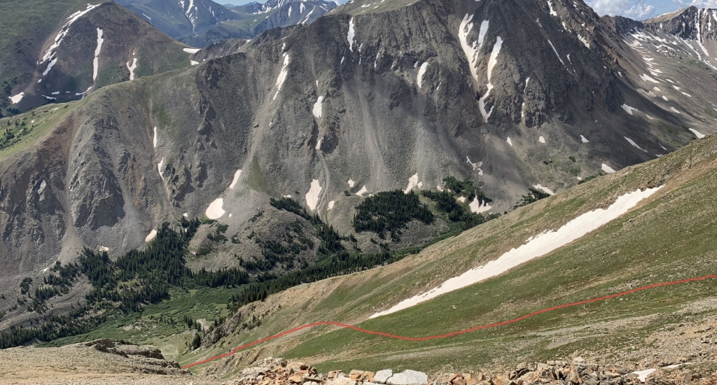
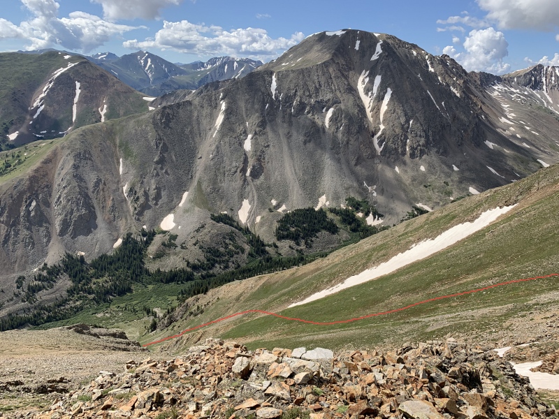
The route is pretty simple really. After reaching the summit of Twin Peaks B NE you go back 0.1mi all the way to the true saddle between Twin Peaks B and Twin Peaks B NE. Then you begin your descent down into Willis Gulch via the drainage to the southeast following the tundra as best as you can. You can see most of the descent route as you are returning to the saddle.
1
You'll want to stay towards the right side of the drainage pretty much the entire way down until you reach the tundra/talus cone at the bottom. Avoid the middle of the drainage as it turns into a very rocky gully. I don't think it cliffs out but better to just avoid it.
2
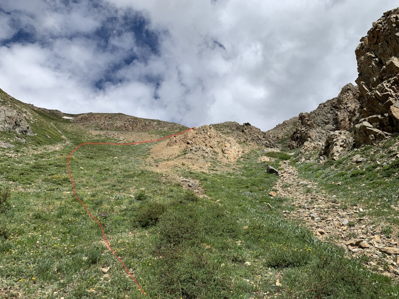
You will have to weave your way easily through a couple "cliffy" sections as seen in the picture below.
3
About 2/3 of the way down you'll come to the narrowest section of the drainage (~100' wide still). Once through the constriction, you'll reach the top of the tundra/talus cone. Now follow the left/east edge of it until you reach the pine forest.
4
Pick your way through the pleasant forest for 200' until you reach the Willis Gulch Trail. Follow that trail back to the TH.
Another side benefit of this route is that you almost completely avoid going back through the willows you went through on your way up the Willis Gulch trail towards Rinker.
Notes
Definitely recommend you have trekking poles while doing this descent. It is soft tundra but it is also VERY steep, steeper than the South Slopes Route you used to come up Rinker. Poles will allow you descend more confidently while providing some protection if you slip on the grass.
If there is some snow on this slope it will make the grass very slippery, microspikes would help with traction. It is south facing so it will dry/melt out quicker. You can always survey this route's conditions on your way up and make a decision then whether you want to use this route to descend.
Definitely AVOID this route in full on Winter conditions due to possible avalanche danger.
 |
Caution: The information contained in this route may not be accurate and should not be the only resource used in preparation for your climb. Failure to have the necessary experience, physical conditioning, supplies or equipment can result in injury or death. 14ers.com and the author(s) of this route provide no warranties, either express or implied, that the information provided is accurate or reliable. By using the information provided, you agree to indemnify and hold harmless 14ers.com and the route author(s) with respect to any claims and demands against them, including any attorney fees and expenses. Please read the 14ers.com Safety and Disclaimer pages for more information.


