Gladstone Peak
North RidgeDifficulty Class 4
TrailheadRock of Ages
Start10,350 feet
Summit13,923 feet
Total Gain4,100 ft
RT Length11.25 mi
AuthorBillMiddlebrook
Last UpdatedAug 2014
Trailhead
From Ridgway, leave U.S. 550 and take Colorado 62 toward Telluride. Drive over Dallas Divide, down to Placerville and turn left onto Colorado 145. Drive 6.7 miles and turn right onto the Silver Pick road (dirt). From here, it's 8.5 miles to the trailhead. Drive 4 miles to an intersection and turn right onto "59 H" which is also Forest Road 622. Continue 2.3 miles, turn right onto FR 645 and continue 2.2 miles to the Rock of Ages trailhead, near 10,350'. Notes: After 1 mile on the FR 645 road, you must cross the stream in Big Bear Creek which usually isn't too bad by mid-July. Also, there are some designated camp sites along this road.
Route
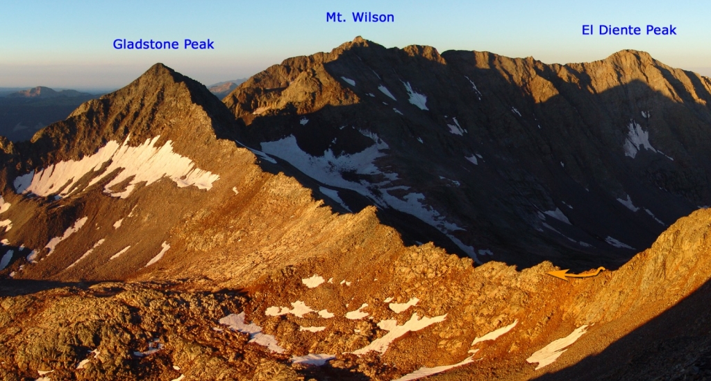
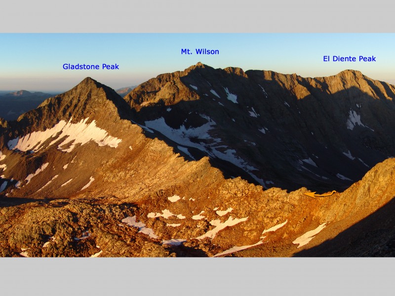
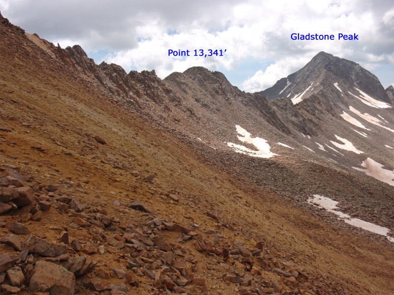
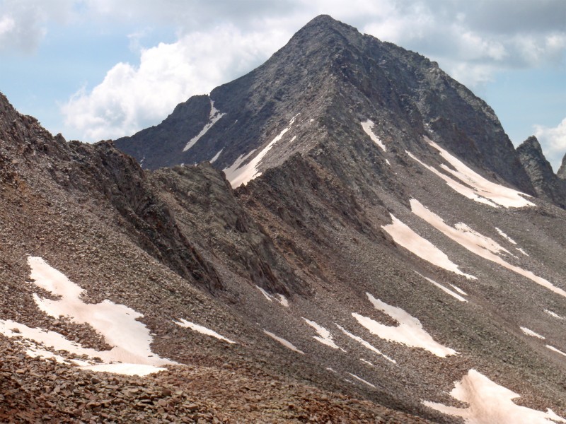
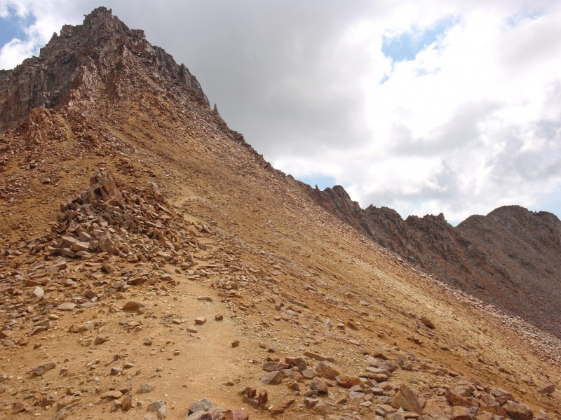
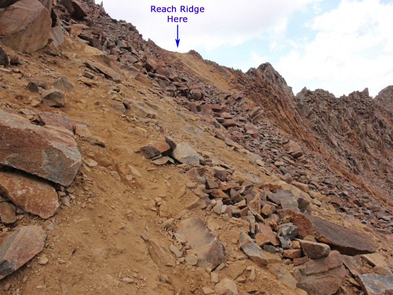
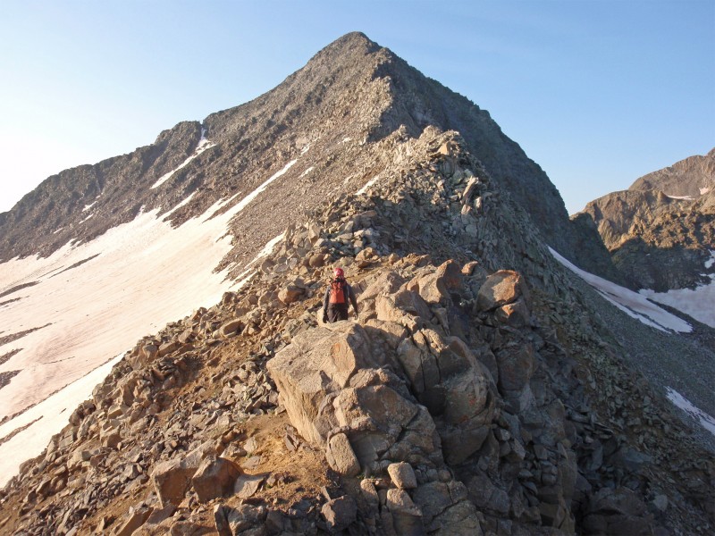
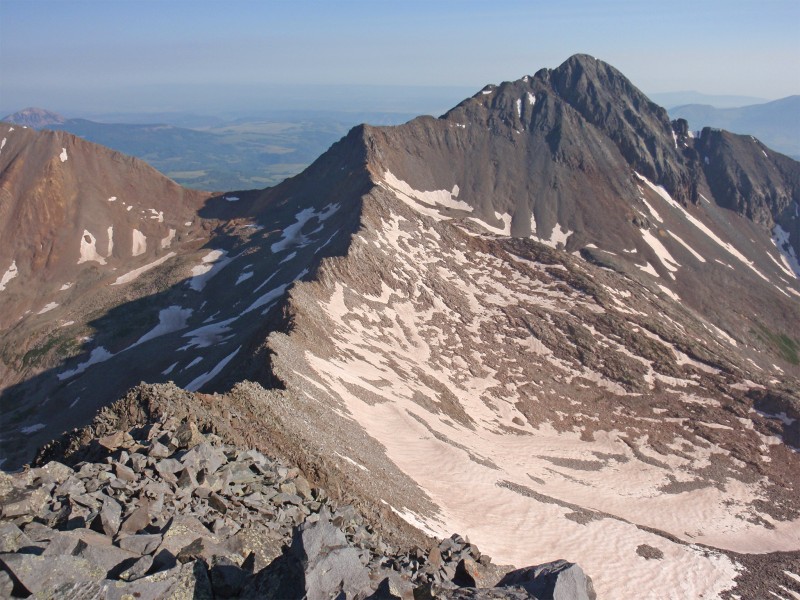
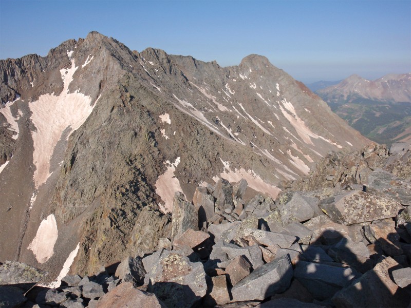
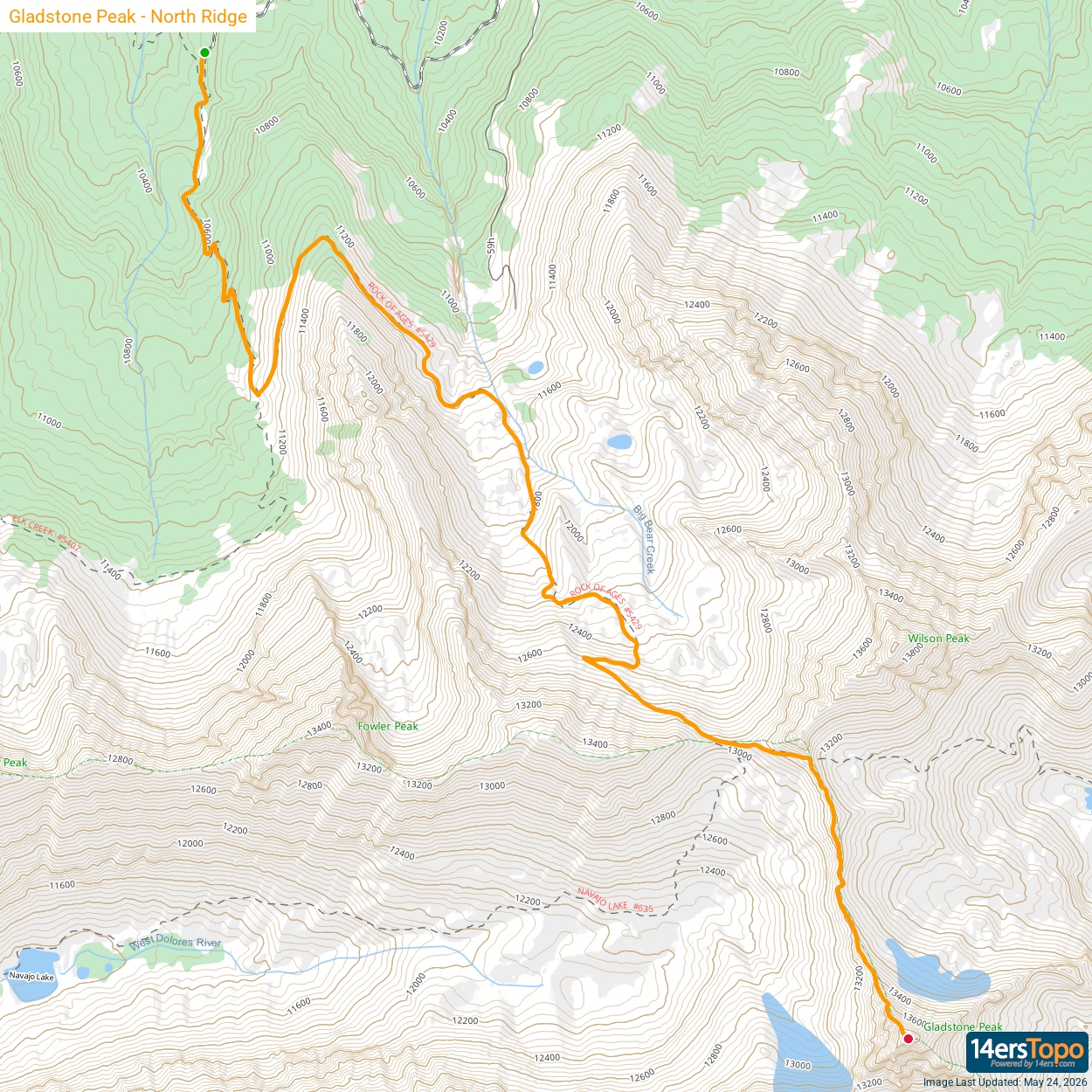
Taken from 14er Wilson Peak, 1 is a look at Gladstone's north ridge route. Follow the Rock of Ages Approach or Navajo Basin Approach to reach the Rock of Ages saddle, at 13,000'. From here you'll have an excellent view of Gladstone's north ridge - 2 and 3. On the saddle, locate the standard trail for 14er Wilson Peak ( 4) and follow it east across a rugged slope ( 5) to reach the Wilson side of the long ridge between Wilson Peak and Gladstone Peak - 6.
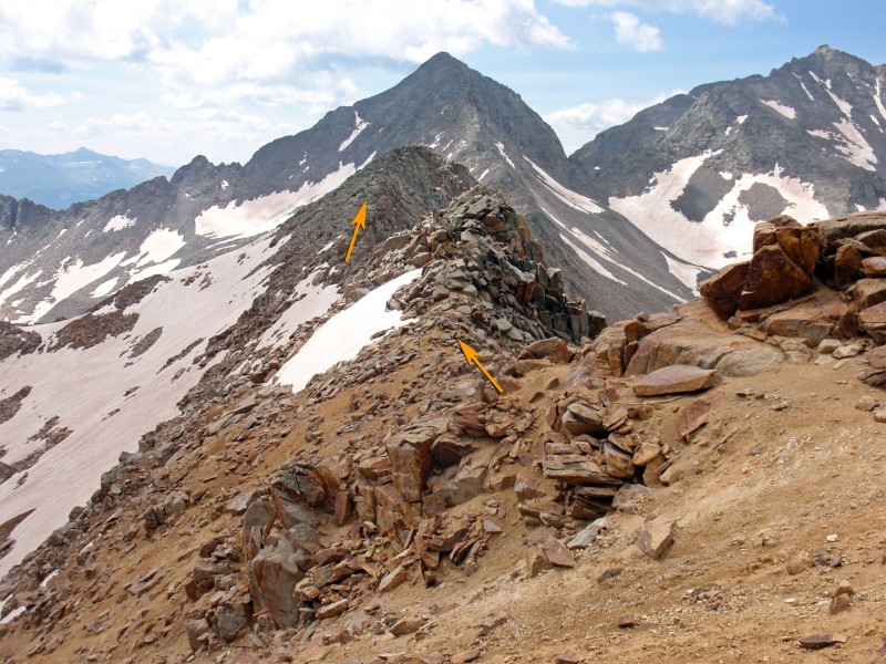
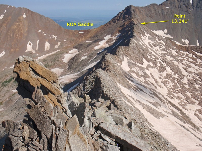
Turn south and begin hiking/scrambling along the ridge crest. The first 0.25 mile is fairly straightforward and the difficulty can be kept at Class 3, with most rock outcroppings being passed on the left - 7. 8 looks back at the initial stretch of ridge. After 0.25 mile, you'll reach the north side of Point 13,341' - 9. The rock deteriorates in this area and doesn't get much better on the remaining route. Ascend Point 13,341' to get a view of the remaining route - 10.
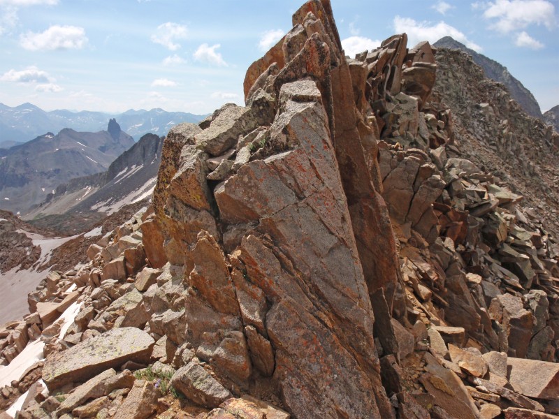
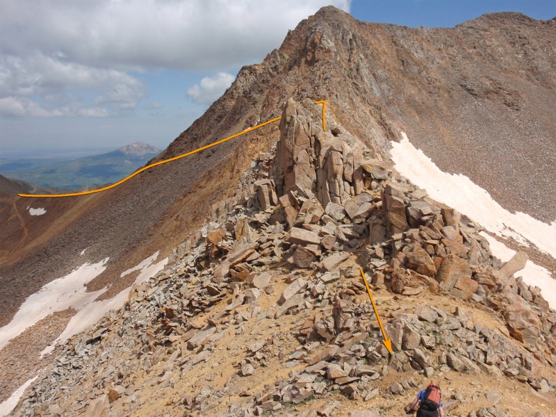
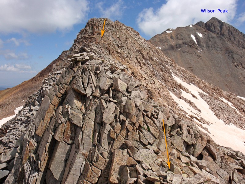
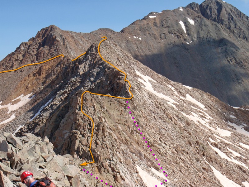
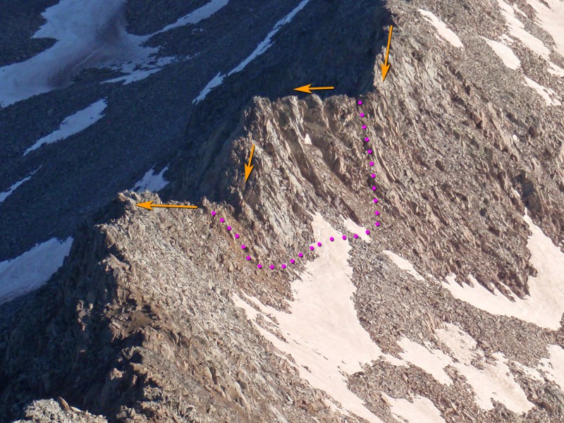
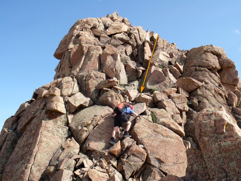
The remaining route is more dangerous and includes a lot of scrambling on loose rock. Descend south from Point 13,341' ( 11) and continue along the ridge crest - 12. Approx. 0.2 mile after Point 13,341' and before reaching the lowest point on the ridge, you'll reach the crux of the north ridge - 13. It's difficult to see as you approach but it's a small point along the ridge which requires Class 4 climbing, including a steep downclimb on the other side. Here are the coordinates of this point: 37.85113 N, 107.98755 W. 14 and 15 show the crux from the other side and 16 is the descent on the south side of the point. If you climb to the top of the point and can't find a comfortable way to descend the other side, backtrack a bit and descend left (Class 3) to bypass the point on the east side of the ridge before regaining the ridge in a notch on the south side of the point. This Class 3 option is drawn in pink on 14 and 15. Due to loose rock on the side of the ridge, descending this far away from the ridge crest is not a great idea on most of the route but it's certainly an alternative to the Class 4 climb over this point.
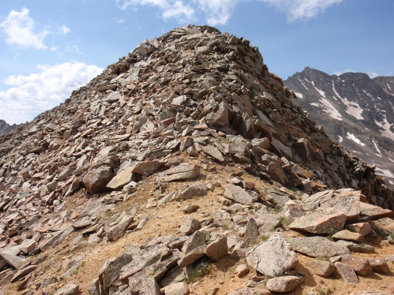
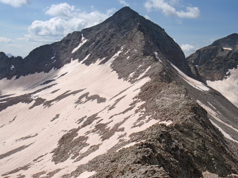
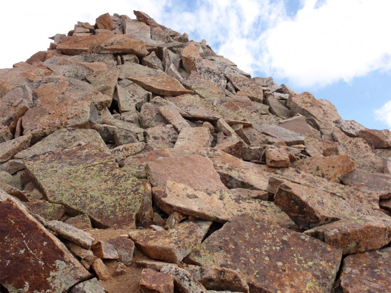
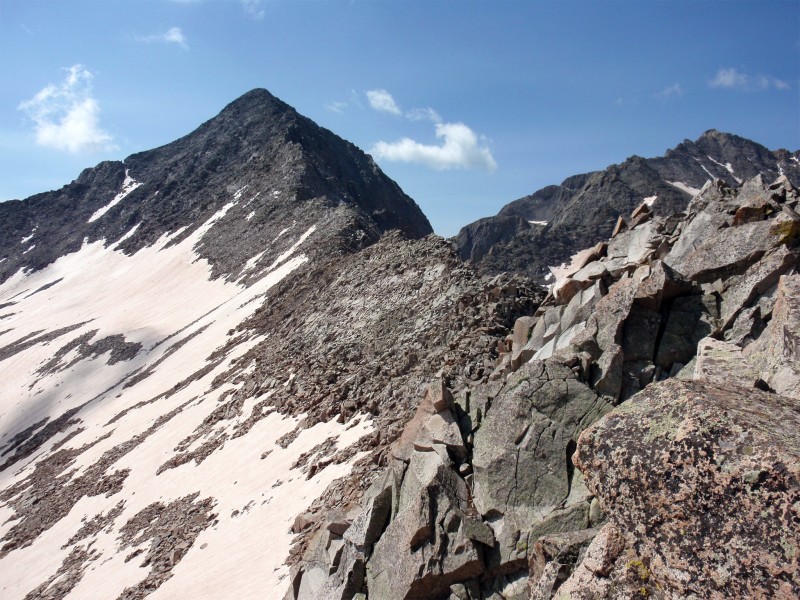
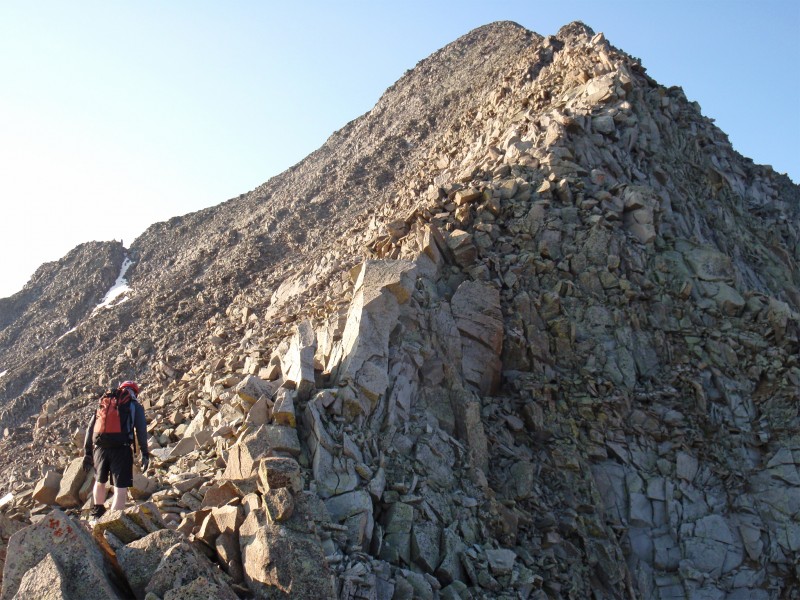
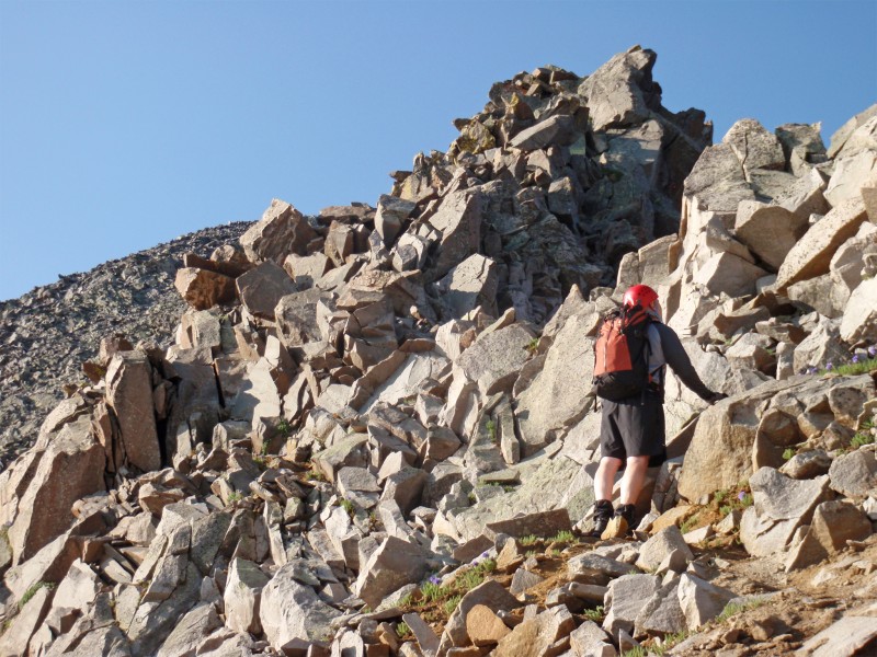
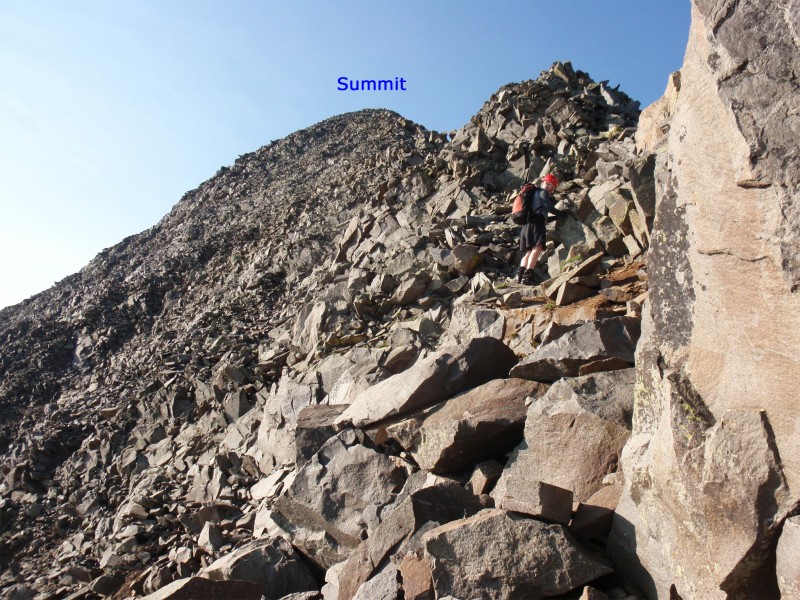
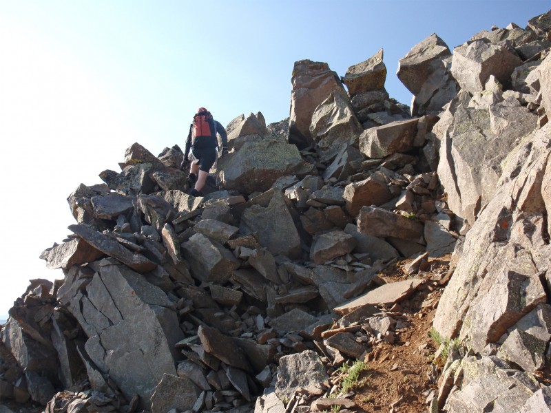
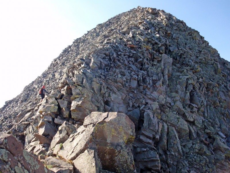
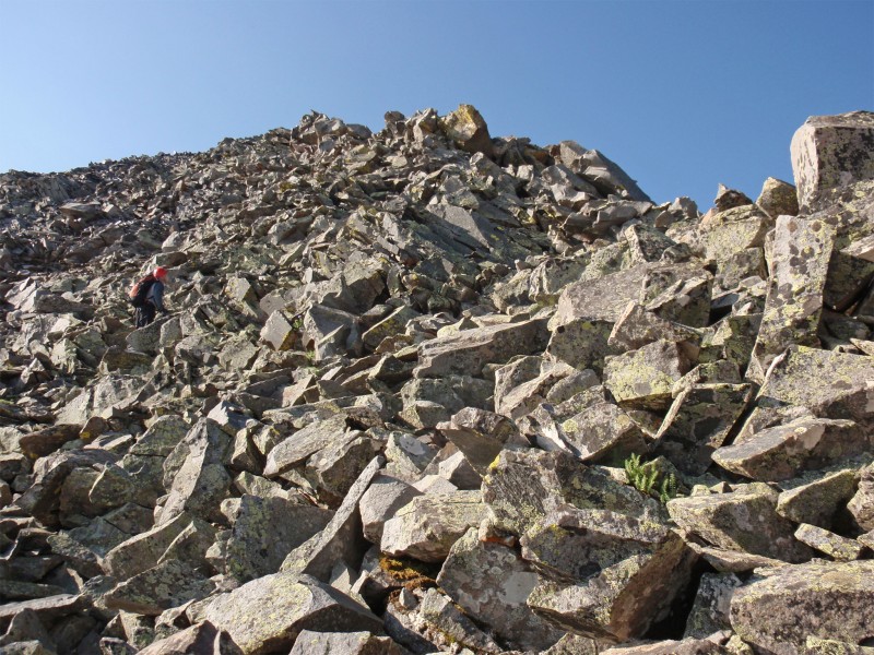
Continue over another small point to reach an easy section of the ridge before the route steepens - 17. Beyond this area, the route gets even more serious as the risk of moving rocks increases. Carefully scramble along the ridge crest - 18 and 19. Above 13,400', the route-finding may take a bit more time as you zigzag up through large, stacked rocks - 20, 21 and 22. Above 13,800', the summit becomes more obvious - 23. Continue along the ridge ( 24) to reach the top - 25 and 26.
Turn south and begin hiking/scrambling along the ridge crest. The first 0.25 mile is fairly straightforward and the difficulty can be kept at Class 3, with most rock outcroppings being passed on the left - 7. 8 looks back at the initial stretch of ridge. After 0.25 mile, you'll reach the north side of Point 13,341' - 9. The rock deteriorates in this area and doesn't get much better on the remaining route. Ascend Point 13,341' to get a view of the remaining route - 10.
The remaining route is more dangerous and includes a lot of scrambling on loose rock. Descend south from Point 13,341' ( 11) and continue along the ridge crest - 12. Approx. 0.2 mile after Point 13,341' and before reaching the lowest point on the ridge, you'll reach the crux of the north ridge - 13. It's difficult to see as you approach but it's a small point along the ridge which requires Class 4 climbing, including a steep downclimb on the other side. Here are the coordinates of this point: 37.85113 N, 107.98755 W. 14 and 15 show the crux from the other side and 16 is the descent on the south side of the point. If you climb to the top of the point and can't find a comfortable way to descend the other side, backtrack a bit and descend left (Class 3) to bypass the point on the east side of the ridge before regaining the ridge in a notch on the south side of the point. This Class 3 option is drawn in pink on 14 and 15. Due to loose rock on the side of the ridge, descending this far away from the ridge crest is not a great idea on most of the route but it's certainly an alternative to the Class 4 climb over this point.
Continue over another small point to reach an easy section of the ridge before the route steepens - 17. Beyond this area, the route gets even more serious as the risk of moving rocks increases. Carefully scramble along the ridge crest - 18 and 19. Above 13,400', the route-finding may take a bit more time as you zigzag up through large, stacked rocks - 20, 21 and 22. Above 13,800', the summit becomes more obvious - 23. Continue along the ridge ( 24) to reach the top - 25 and 26.
Notes
Once you're on the north ridge, it's almost always safest to stay on or near the ridge crest. If you descend away from the crest, you'll quickly find loose, dangerous rock.
 |
Caution: The information contained in this route may not be accurate and should not be the only resource used in preparation for your climb. Failure to have the necessary experience, physical conditioning, supplies or equipment can result in injury or death. 14ers.com and the author(s) of this route provide no warranties, either express or implied, that the information provided is accurate or reliable. By using the information provided, you agree to indemnify and hold harmless 14ers.com and the route author(s) with respect to any claims and demands against them, including any attorney fees and expenses. Please read the 14ers.com Safety and Disclaimer pages for more information.