Pingree Park approach
Peaks Included: Rowe Peak, Rowe Mountain
Difficulty Class 3
Risk FactorsExposure:
Rockfall: Moderate
Route-Finding:
Commitment:
Rockfall: Moderate
Route-Finding:
Commitment:
TrailheadEmmaline Lake
Start9,060 feet
Summit13,390 feet
Total Gain6,100 feet
RT Length19 miles
Authorkrishcane
Last UpdatedJul 2013
Trailhead
From Ft. Collins, take CR-38E to Masonville.
From points south of Ft. Collins, take 287 to Hwy. 34 west. About six miles west of 287 on Hwy. 34, turn right onto Buckhorn Rd., also known as CO-27. There is a sign that says Masonville pointing the way.
Once at the main intersection in Masonville, head west (which means go straight if you came from Ft. Collins, or turn left if you came up via CO-27).
Go about 10 miles until you see the sign for Pennock Pass indicating a dirt road on the left (this is CR-44H and also Buckhorn Rd.). Take CR-44H approximately 18 miles over the top of the pass and down the other side until you run into CR-63E and the sign for Pingree Park.
Turn left on CR-63E and continue up this road about 3 miles until you see the sign for Tom Bennett Campground and FR-145 on the right side of the road. Turn right onto this road. The campground is immediate - go about a quarter mile up the hill and around the corner to find the Emmaline Lake Trailhead sign on the left.
Up until now, it's all easily accessible 2WD road.
You can park here if you don't have good 4WD, or you can continue on up to 0.5 miles if you can clear 12 to 18 inch tall rocks in the single-track road. There are two places to park or turn around along the way once you commit to it. If you go the whole half mile, the road terminates at a gate with room to park a few cars and turn around.
From points south of Ft. Collins, take 287 to Hwy. 34 west. About six miles west of 287 on Hwy. 34, turn right onto Buckhorn Rd., also known as CO-27. There is a sign that says Masonville pointing the way.
Once at the main intersection in Masonville, head west (which means go straight if you came from Ft. Collins, or turn left if you came up via CO-27).
Go about 10 miles until you see the sign for Pennock Pass indicating a dirt road on the left (this is CR-44H and also Buckhorn Rd.). Take CR-44H approximately 18 miles over the top of the pass and down the other side until you run into CR-63E and the sign for Pingree Park.
Turn left on CR-63E and continue up this road about 3 miles until you see the sign for Tom Bennett Campground and FR-145 on the right side of the road. Turn right onto this road. The campground is immediate - go about a quarter mile up the hill and around the corner to find the Emmaline Lake Trailhead sign on the left.
Up until now, it's all easily accessible 2WD road.
You can park here if you don't have good 4WD, or you can continue on up to 0.5 miles if you can clear 12 to 18 inch tall rocks in the single-track road. There are two places to park or turn around along the way once you commit to it. If you go the whole half mile, the road terminates at a gate with room to park a few cars and turn around.
Route
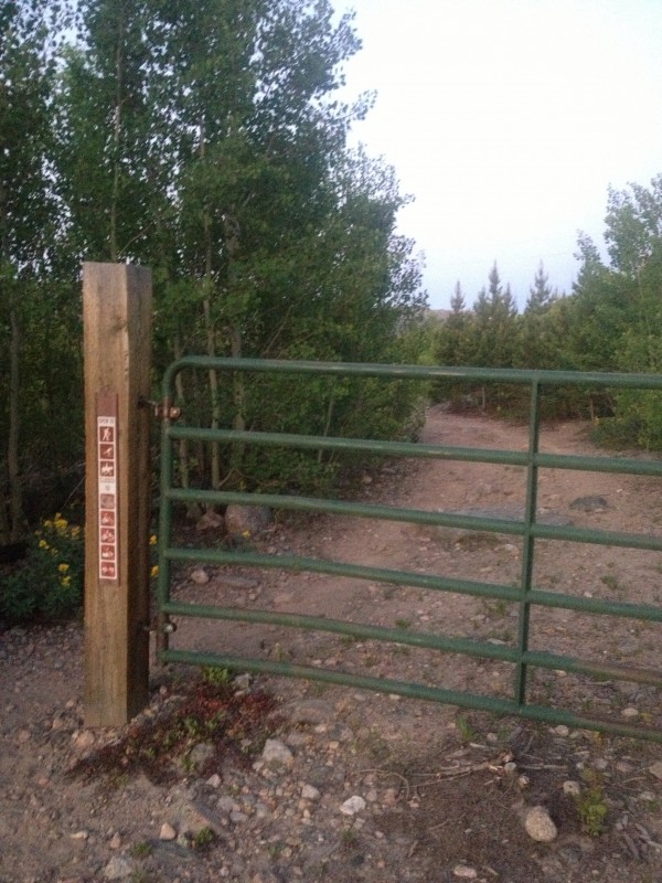
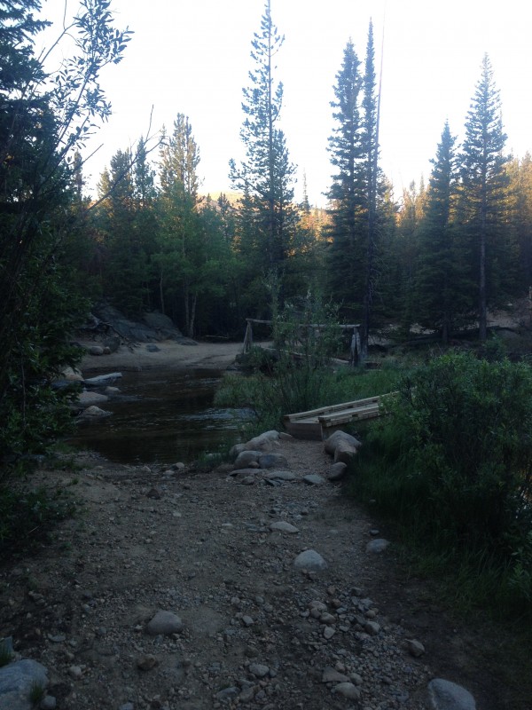
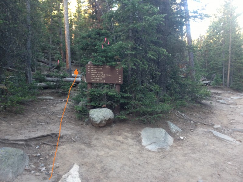
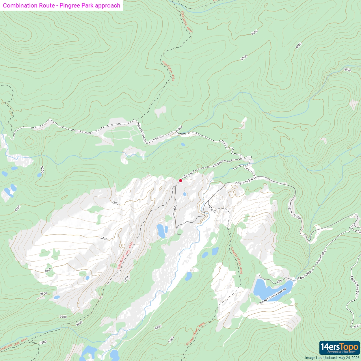
From the Emmaline Lake Trailhead at the end of the half mile 4WD access road, pass the gate ( 2) and continue down the dirt road, gaining a few hundred feet through aspen groves for the first mile. At 1.6 miles from the gate, cross a river ( 3) and continue on to the Mummy Pass Trail turnoff just before 2 miles ( 4) at 9500 feet.
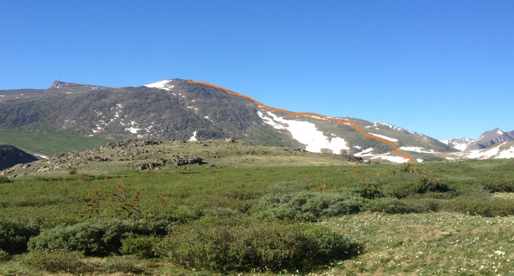
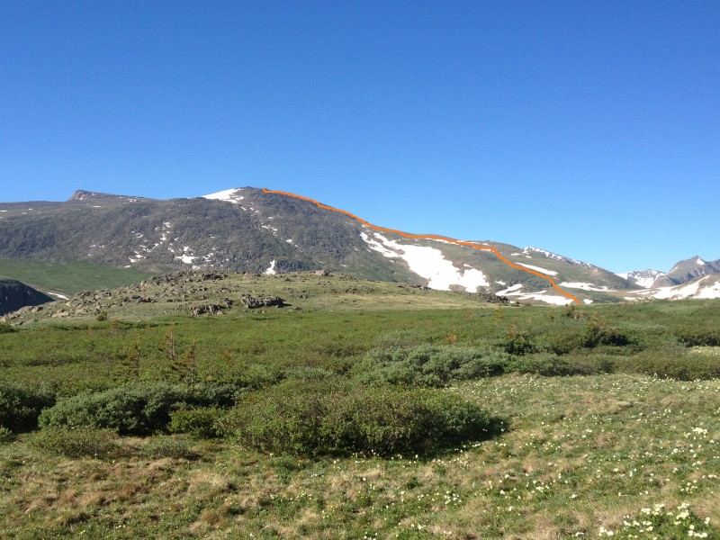
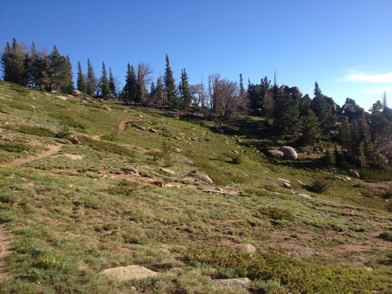
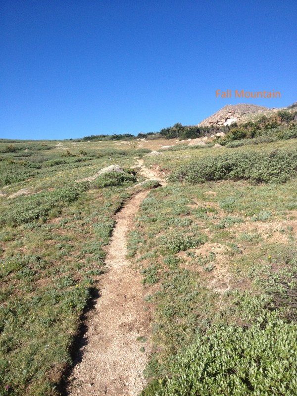
The trail ascends gradually through woods over the next several miles, breaking out of treeline near 11,000 feet and 4.5 miles ( 5). Cairns begin near treeline and continue periodically during the ascent to Mummy Pass. At around 5.7 miles, Fall Mountain comes into view to the west while approaching the high point of the pass ( 6) and Rowe Mountain comes into view to the southwest, revealing the route to the summit ( 1). Take a moment to study Rowe Mountain and the valleys leading to the western slope.
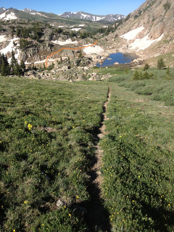
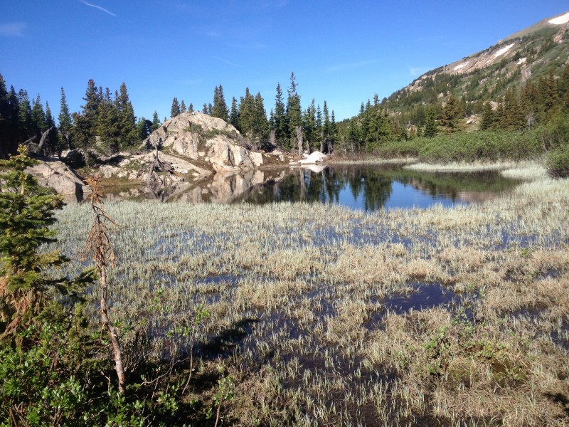
Cross over the flat meadows of Mummy Pass at 11,450 feet and drop down the west side of the pass toward a small lake ( 7). Move through tall bushes on either side of the trail and pass to the left (south) of the small lake, using cairns to guide ( 8). Continue half a mile to a landmark pond on the other side of the pass ( 9), at 6.7 miles and 11,200 feet.
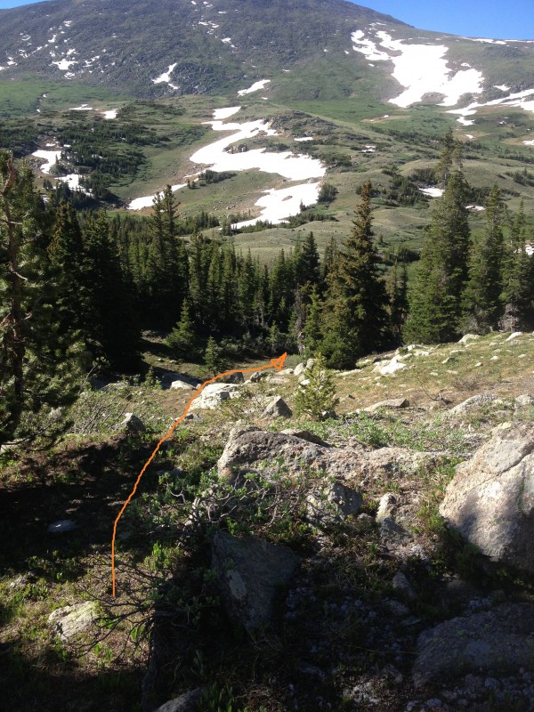
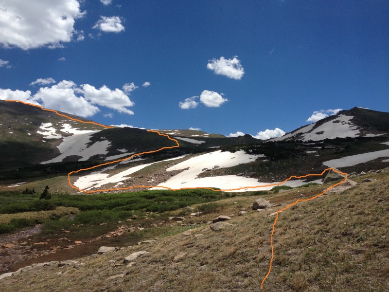
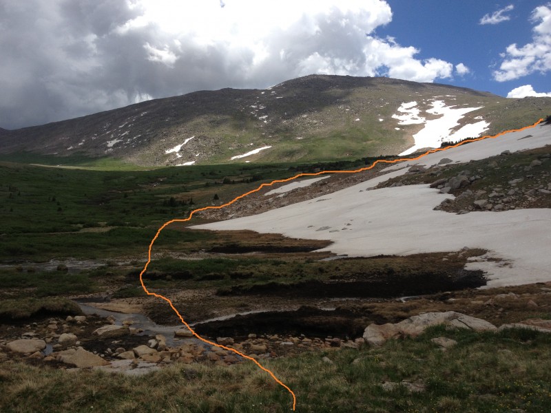
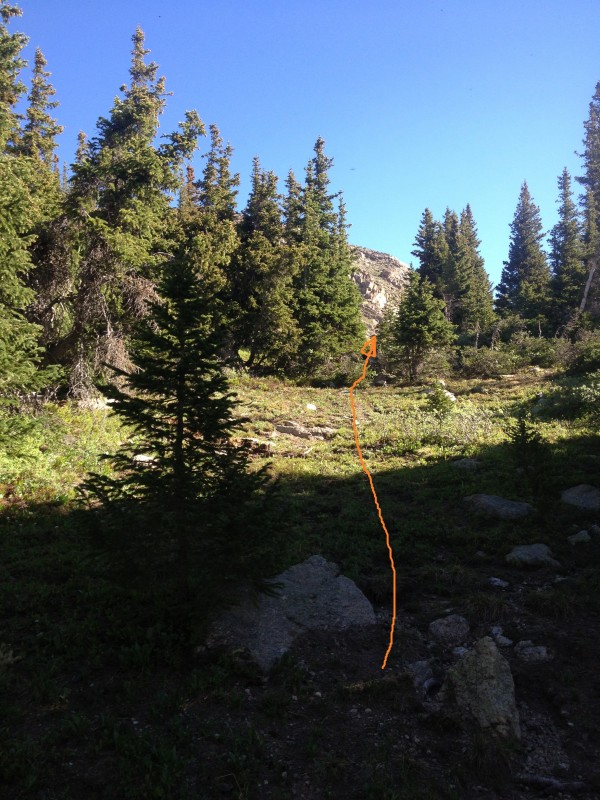
Take a drainage south through light woods, leaving the Mummy Pass Trail ( 10), and find the river just south of the pass. Turn west again and follow the river west to its origin at the base of Rowe Mountain ( 11), stepping over various small tributaries on the way. 12 is taken at about 7.2 miles, closer to the point of crossing the source of the river ( 13). The point of following the river west is to avoid the dense shrubbery growing due north of Rowe Mountain.
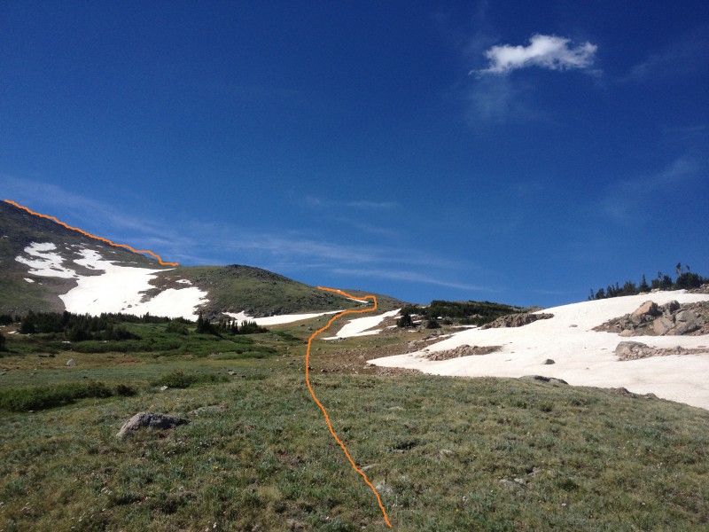
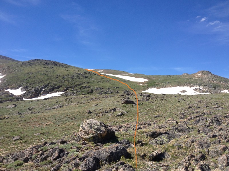
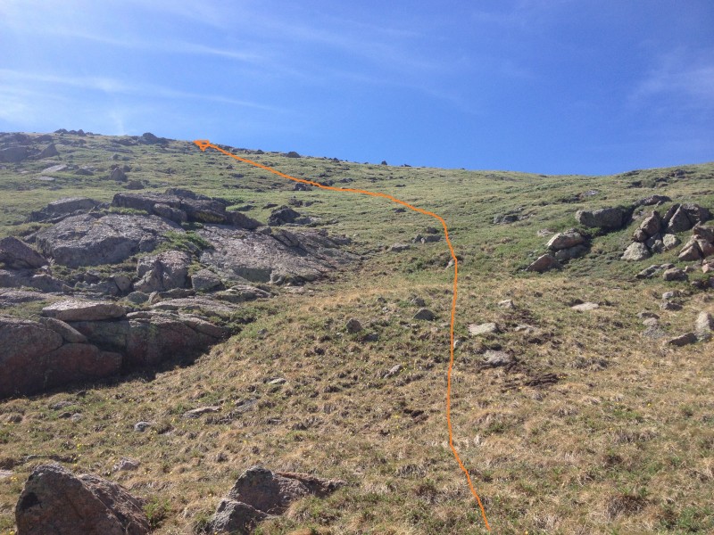
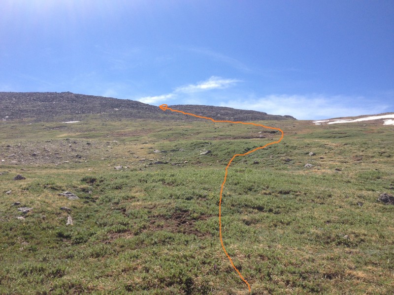
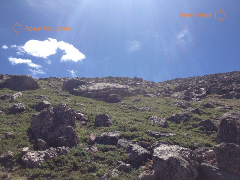
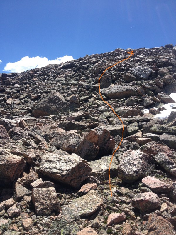
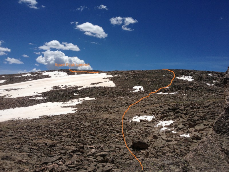
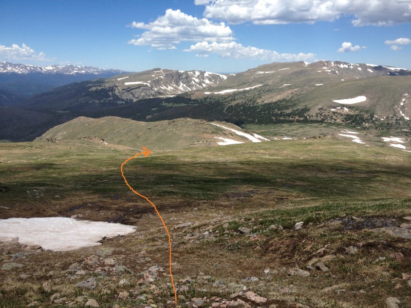
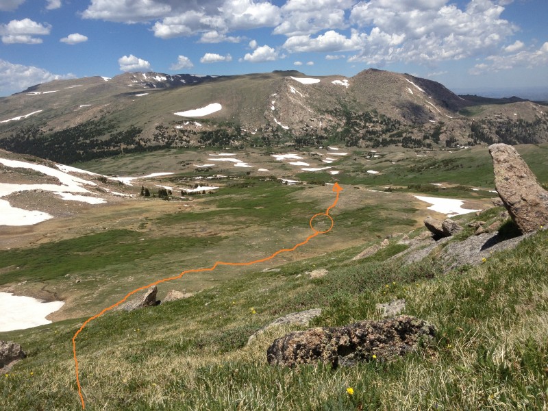
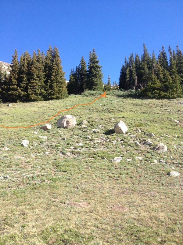
Once across the river at 7.5 miles and 11,200, the rest of the route to the summit region is clear ( 14). 15 and 16 show the tundra ascent. 17 shows the route to the saddle between Rowe Mountain to the northeast and Rowe Peak to the southeast. Reach the saddle at 9.4 miles and 13,000 feet ( 18).
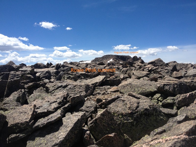
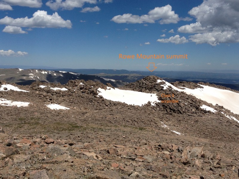
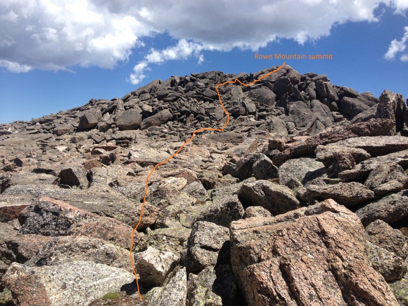
Head southeast up the slope toward the summit of Rowe Peak ( 19). The terrain stays Class 2 all the way to the rounded summit ( 20) at 10 miles and 13,420 feet. Sign the rarely signed register and then head due north to pick up Rowe Mountain's summit on the return trip. From just above the saddle between Rowe Mountain and Rowe Peak it is easy to tell Rowe Mountain's true summit from the nearby sub-summits ( 21). The most direct route is to descend slightly into the saddle at 13,100 and then ascend 85 feet of Class 3 scrambling to the summit. 22 looks back on Rowe Peak from the saddle and shows the route taken down to the base of the Rowe Mountain summit scramble.
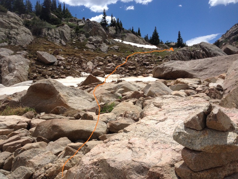
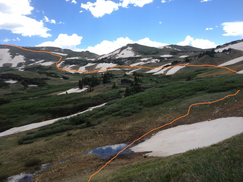
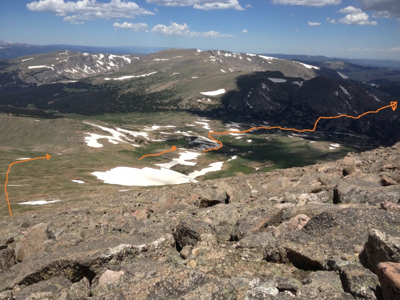
After attaining the Rowe Mountain summit at around 10.5 miles, head northwest off the summit across difficult Class 2 rock ( 23) to get back to the western part of the saddle. Observe the route back to Mummy Pass from this vantage point ( 24). Be sure to take the correct drainage on descent ( 25) and use marker rocks ( 26) to navigate down to the river source.
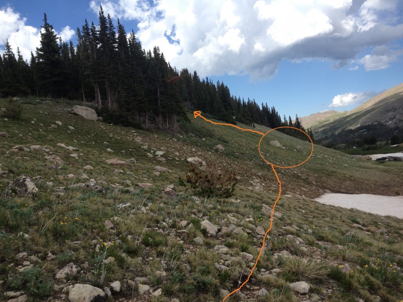
Cross the river source area and head east. At around 13 miles total, look for marker rocks ( 27) to select the right point to ascend. 29 is another and more distinct view of the same rocks, from directly below them by the river. Ascend the drainage ( 28) to return to the Mummy Pass Trail near the pond, and take the Mummy Pass trail back to the trailhead.
The trail ascends gradually through woods over the next several miles, breaking out of treeline near 11,000 feet and 4.5 miles ( 5). Cairns begin near treeline and continue periodically during the ascent to Mummy Pass. At around 5.7 miles, Fall Mountain comes into view to the west while approaching the high point of the pass ( 6) and Rowe Mountain comes into view to the southwest, revealing the route to the summit ( 1). Take a moment to study Rowe Mountain and the valleys leading to the western slope.
Cross over the flat meadows of Mummy Pass at 11,450 feet and drop down the west side of the pass toward a small lake ( 7). Move through tall bushes on either side of the trail and pass to the left (south) of the small lake, using cairns to guide ( 8). Continue half a mile to a landmark pond on the other side of the pass ( 9), at 6.7 miles and 11,200 feet.
Take a drainage south through light woods, leaving the Mummy Pass Trail ( 10), and find the river just south of the pass. Turn west again and follow the river west to its origin at the base of Rowe Mountain ( 11), stepping over various small tributaries on the way. 12 is taken at about 7.2 miles, closer to the point of crossing the source of the river ( 13). The point of following the river west is to avoid the dense shrubbery growing due north of Rowe Mountain.
Once across the river at 7.5 miles and 11,200, the rest of the route to the summit region is clear ( 14). 15 and 16 show the tundra ascent. 17 shows the route to the saddle between Rowe Mountain to the northeast and Rowe Peak to the southeast. Reach the saddle at 9.4 miles and 13,000 feet ( 18).
Head southeast up the slope toward the summit of Rowe Peak ( 19). The terrain stays Class 2 all the way to the rounded summit ( 20) at 10 miles and 13,420 feet. Sign the rarely signed register and then head due north to pick up Rowe Mountain's summit on the return trip. From just above the saddle between Rowe Mountain and Rowe Peak it is easy to tell Rowe Mountain's true summit from the nearby sub-summits ( 21). The most direct route is to descend slightly into the saddle at 13,100 and then ascend 85 feet of Class 3 scrambling to the summit. 22 looks back on Rowe Peak from the saddle and shows the route taken down to the base of the Rowe Mountain summit scramble.
After attaining the Rowe Mountain summit at around 10.5 miles, head northwest off the summit across difficult Class 2 rock ( 23) to get back to the western part of the saddle. Observe the route back to Mummy Pass from this vantage point ( 24). Be sure to take the correct drainage on descent ( 25) and use marker rocks ( 26) to navigate down to the river source.
Cross the river source area and head east. At around 13 miles total, look for marker rocks ( 27) to select the right point to ascend. 29 is another and more distinct view of the same rocks, from directly below them by the river. Ascend the drainage ( 28) to return to the Mummy Pass Trail near the pond, and take the Mummy Pass trail back to the trailhead.
Notes
None
 |
Caution: The information contained in this route may not be accurate and should not be the only resource used in preparation for your climb. Failure to have the necessary experience, physical conditioning, supplies or equipment can result in injury or death. 14ers.com and the author(s) of this route provide no warranties, either express or implied, that the information provided is accurate or reliable. By using the information provided, you agree to indemnify and hold harmless 14ers.com and the route author(s) with respect to any claims and demands against them, including any attorney fees and expenses. Please read the 14ers.com Safety and Disclaimer pages for more information.