Rito Alto Peak
South RidgeDifficulty Class 2
TrailheadHermit Pass Road
Start11,000 feet
Summit13,801 feet
Total Gain2,900 feet
RT Length9 miles
AuthorBillMiddlebrook
Last UpdatedMay 2023

Trailhead
From the intersection of Colorado Highways 96 and 69 in Westcliffe, drive south on CO 69 for 0.3 mile and turn right (west) onto Hermit Road (County Road 160). Drive 6.0 miles to a fork in the road. Stay left on Hermit Road which quickly becomes rough 2WD. Approx. 1.25 miles after the fork, the road turns to 4WD. Reach the Rainbow Trail 2 miles up from the fork and the Hermit Pass Trail (goes to Hermit Lake, on left) at approx. 6 miles. The road is very rough now and continues an additional 3 miles to reach Hermit Pass (a total of approx. 9 miles from the low, 2WD fork in the road). Below 11,400', there are lots of pull-offs and dispersed camp spots along the road.
Route
The Hermit Road requires 4WD above 9,100' and requires some slow driving with good-clearance. There are several large pull-offs and camp spots along the road, including an excellent spot on the left, near 10,960'.
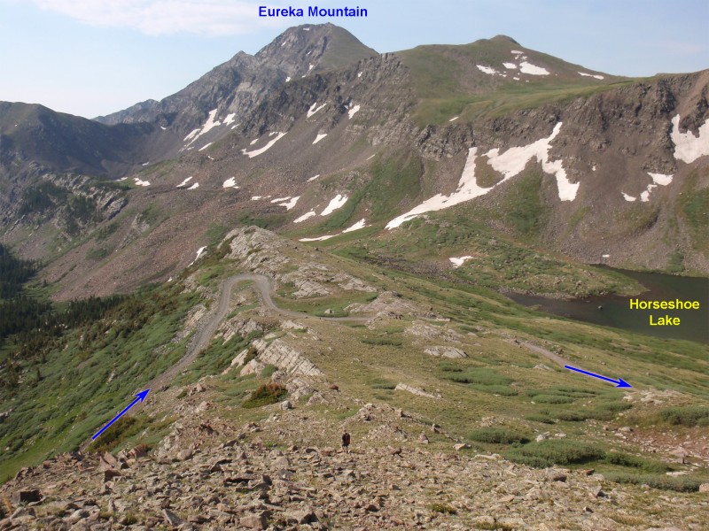
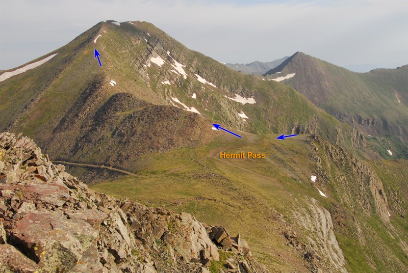
From your parking spot, hike up the Hermit Road. Pass the trail to Hermit Lake (left) near 11,400' and exit the trees near 11,900'. Zig zag north up a broad slope to reach an overlook with beautiful views of Horseshoe Lake and Eureka Mountain - 1. Continue on the road ( 2) for another mile to reach Hermit Pass, near 13,000' - 3.
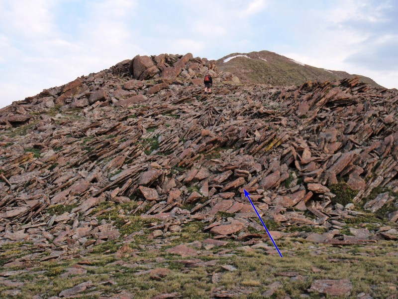
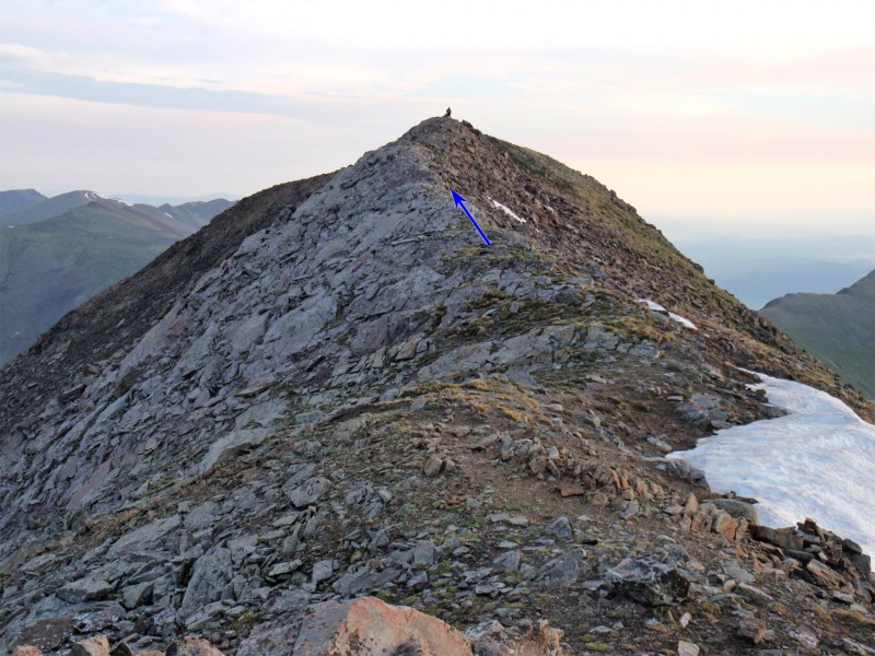
Rito Alto's south ridge is up to your right (northwest) - 4 and 5. From the pass, leave the road and begin hiking up the south ridge - 6. You won't find much of a trail on the remaining route there isn't much route-finding - stay on or near the ridge crest - 7, 8, 9 and 10. Above 13,600' you'll reach the summit ridge ( 11 and 12) where you can see the true summit, approx. 0.1 mile to the north. Taken from the summit, 13 looks back along the south ridge.
Notes
None
 |
Caution: The information contained in this route may not be accurate and should not be the only resource used in preparation for your climb. Failure to have the necessary experience, physical conditioning, supplies or equipment can result in injury or death. 14ers.com and the author(s) of this route provide no warranties, either express or implied, that the information provided is accurate or reliable. By using the information provided, you agree to indemnify and hold harmless 14ers.com and the route author(s) with respect to any claims and demands against them, including any attorney fees and expenses. Please read the 14ers.com Safety and Disclaimer pages for more information.


