Log In 
Difficulty
 Difficult Class 2 
Risk Factors
ExposureModerate
RockfallConsiderable
Route-FindingConsiderable
CommitmentModerate
Trailhead
Argentine Pass 11,050 feet
Summit
13,278 feet
Elevation Gain
2,250 ft
Length Round-TripRT
4.6 mi
Peak Conditions
Downloads
Photo
Show More
Route Last Updated: May 2023

Trailhead

This trailhead is used to access both Argentine Pass and Horseshoe Basin. Take U.S. 6 to the west end of Keystone. If you are driving east on U.S. 6, take the exit for Montezuma Road before U.S. 6 begins its climb to Loveland Pass. If you are driving west (from Loveland Pass), turn left into the River Run area of the Keystone Ski Resort. Take another quick left and drive a bit to get to the Montezuma Road.

Drive ~4.3 miles on the Montezuma road and turn left on the 260 (dirt) road. There is a large parking area at the start of this road. From the parking area, drive 4.5 miles along Peru Creek to the Argentine Pass trailhead at 11,050', just below the Shoe Basin Mine. The road is gated beyond the trailhead.

Route Description

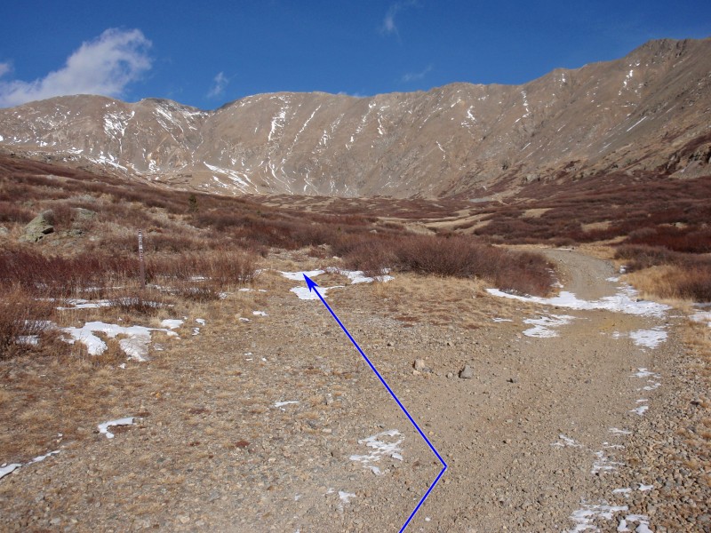
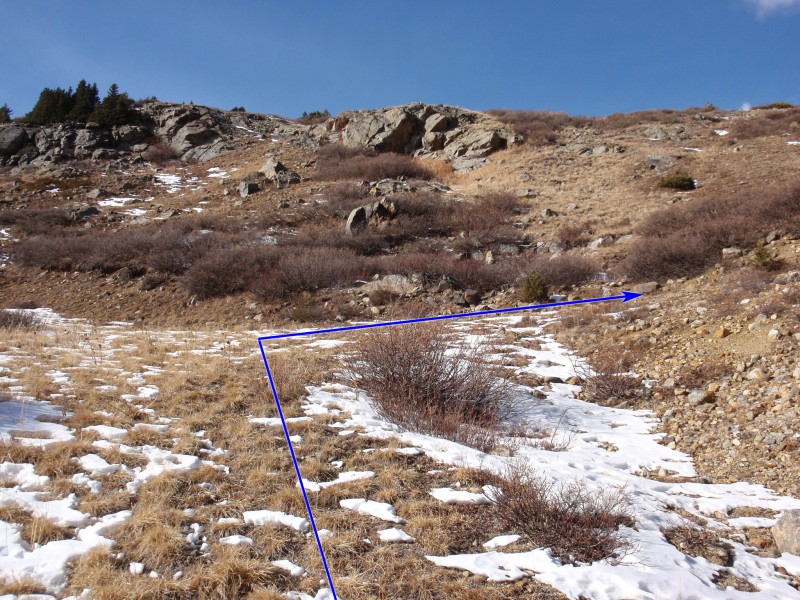
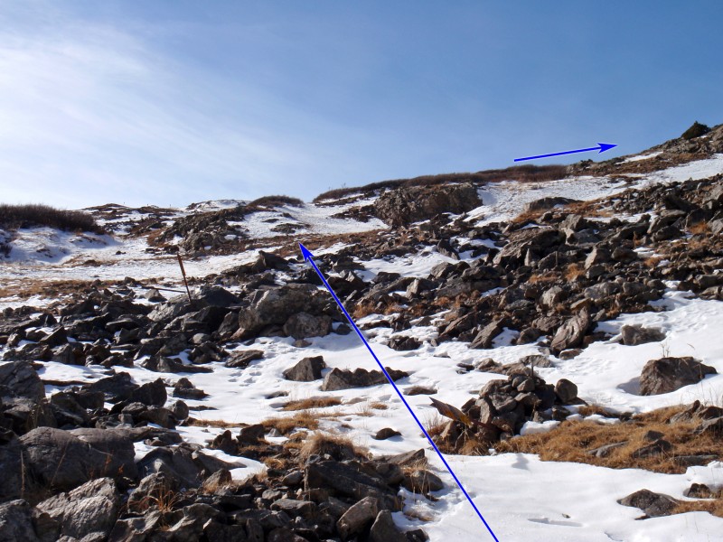
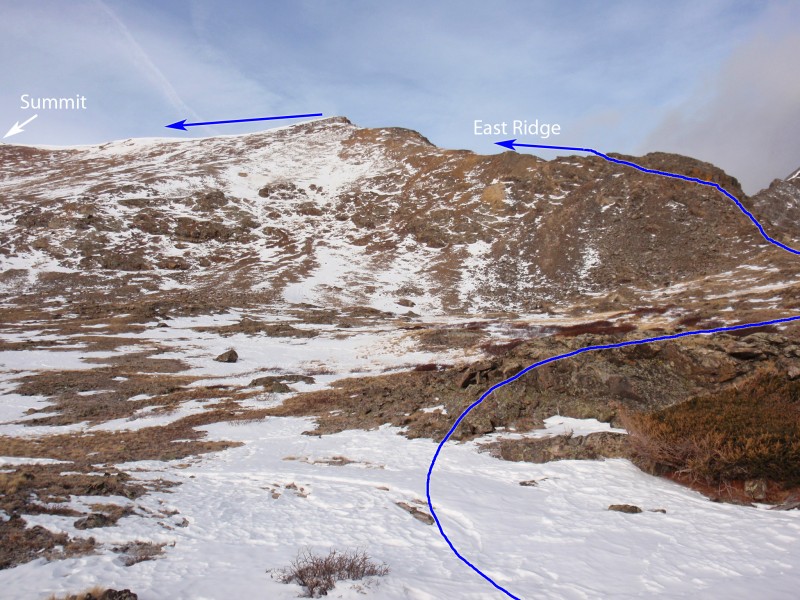
From the parking area, walk northeast a short distance up the road and pass the gate, near the Shoe Basin mine -  1. Continue 0.5 mile and turn left on an old mining road at 11,350' -  2. Follow this road for another 0.5 mile to reach a small junction, near 11,700' -  3. Turn right and continue west ( 4) to reach a small mine area at 11,800' -  5. Here, cliffs block easy gain to the east ridge, so turn left and ascend southwest ( 6) for over 0.1 mile. Once you're near 12,000' ( 7), turn right (north) and hike to gain the crest of the east ridge, near 12,300' -  8.

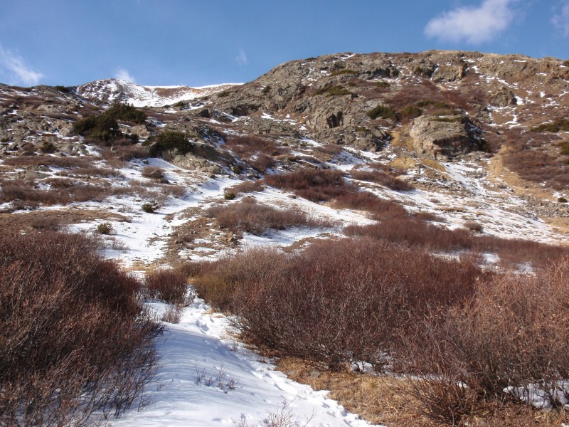
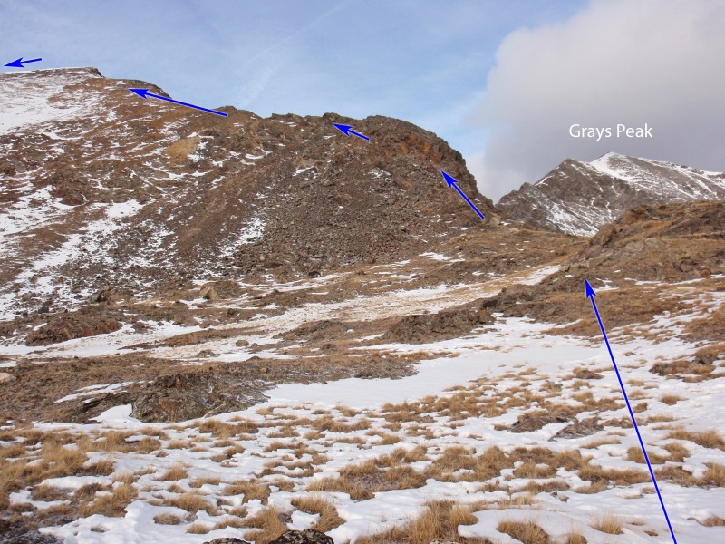
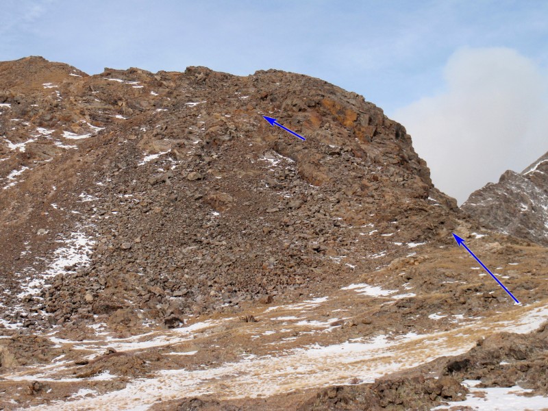
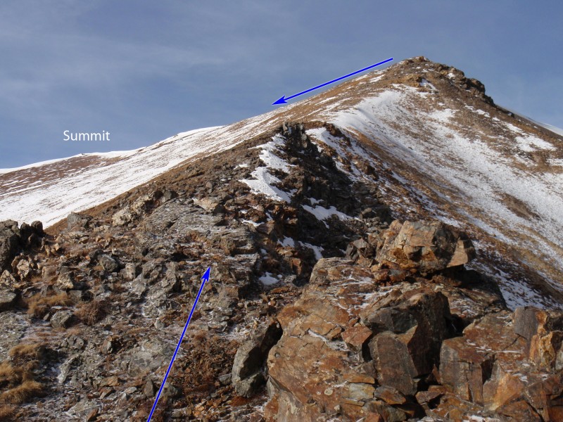
The first major bump on the ridge looks gnarly, but it's fairly easy to keep the difficulty at Class 2. Continue to the base of this bump ( 9) and start climbing. After a short distance, you'll encounter the crux area which contains some large talus and cliffs -  10. Locate an easy way left under the cliffs ( 11) and continue up to the left as you work your way around some small ledges and over loose rock -  12. With careful route-finding you can keep the difficulty at Class 2 and regain the ridge crest in short time -  13.

Continue west up the east ridge ( 14 and  15) to reach the top of ridge where you can see the summit, to the southwest -  16 and  17. Walk 0.3 mile ( 18) to reach the top -  19.

Maps

JPG Image
Static Map JPG
Interactive Map & 3D Flythrough
Human Verification Required

Photos

#1#2#3#4#5#6#7#8#9#10#11#12#13#14#15#16#17#18#19

Weather

Caution: The information contained in this route may not be accurate and should not be the only resource used in preparation for your climb. Failure to have the necessary experience, physical conditioning, supplies or equipment can result in injury or death. 14ers.com and the author(s) of this route provide no warranties, either express or implied, that the information provided is accurate or reliable. By using the information provided, you agree to indemnify and hold harmless 14ers.com and the route author(s) with respect to any claims and demands against them, including any attorney fees and expenses. Please read the 14ers.com Safety and Disclaimer pages for more information.

Copyright: Route information, text, risk factors, maps, GPX files, charts, photos, 14ers.com-created map imagery, flythroughs, and other content provided in this route description are copyrighted by 14ers.com and may not be copied, reproduced, republished, distributed, modified, or used to create derivative works without prior written permission.

Please respect private property: 14ers.com supports the rights of private landowners to determine how and by whom their land will be used. In Colorado, it is your responsibility to determine if land is private and to obtain the appropriate permission before entering the property.

Heading to a 14er soon? Don't forget the 14ers.com mobile app.
Google Play     Apple App Store