Download Agreement, Release, and Acknowledgement of Risk:
You (the person requesting this file download) fully understand mountain climbing ("Activity") involves risks and dangers of serious bodily injury, including permanent disability, paralysis, and death ("Risks") and you fully accept and assume all such risks and all responsibility for losses, costs, and damages you incur as a result of your participation in this Activity.
You acknowledge that information in the file you have chosen to download may not be accurate and may contain errors. You agree to assume all risks when using this information and agree to release and discharge 14ers.com, 14ers Inc. and the author(s) of such information (collectively, the "Released Parties").
You hereby discharge the Released Parties from all damages, actions, claims and liabilities of any nature, specifically including, but not limited to, damages, actions, claims and liabilities arising from or related to the negligence of the Released Parties. You further agree to indemnify, hold harmless and defend 14ers.com, 14ers Inc. and each of the other Released Parties from and against any loss, damage, liability and expense, including costs and attorney fees, incurred by 14ers.com, 14ers Inc. or any of the other Released Parties as a result of you using information provided on the 14ers.com or 14ers Inc. websites.
You have read this agreement, fully understand its terms and intend it to be a complete and unconditional release of all liability to the greatest extent allowed by law and agree that if any portion of this agreement is held to be invalid the balance, notwithstanding, shall continue in full force and effect.
By clicking "OK" you agree to these terms. If you DO NOT agree, click "Cancel"...
Route: South slopes of 13,811' (accessed from E. Fork of Bent Creek) to E. ridge of 13,832' Distance: ~11mi. RT (round trip) Elevation Gain: ~5100' Time to Complete: 12hrs (~1hr. on summit of 13,811' and 2hrs. of Hellacious post-holing on descent)
Gear: daypack w/Essentials, ice axe (but didn't break it out) & maybe I should have brought snowshoes (?)
Resources Used For Trip Planning: NOAA forecast, TOPO! software, Roachs' 13er guidebook, winter trip report by Ken Nolan (on 14erWorld)
Foreword
With an anticipated lull at work, I started to monitor peak conditions and weather hoping for a window of opportunity for a trip to the San Juans. I was hoping to go climb Pigeon & Turret, but timing thus far has not worked out well for a long & safe enough window for me to attempt them. Therefore, I set my sights on other centennial goals.
These two 13ers reside in the Lake City area, most notably next to the 14ers Redcloud and Sunshine. I made the drive down to Lake City on Monday afternoon, without a definite plan as to which approach I would use. My options were from the Williams Creek TH (trailhead), or from directly south of 13,811, starting near the Mill Creek campground. The latter starts near the bathroom that is just east of Mill Creek, and it's the approach that I used.
On Monday evening, after locating the approach for my hike, I went to the Mill Creek campground and settled in for the night. I left my camp & truck at the campground, which is currently available for use, and started my hike from there on Tuesday morning at 7am-ish.
The Hike
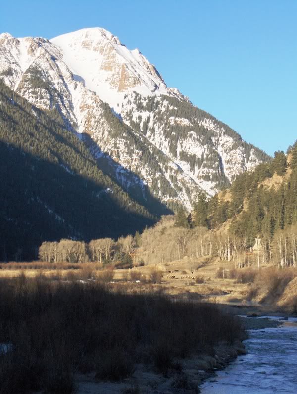
The sun rises on 13,299' and the elk below...
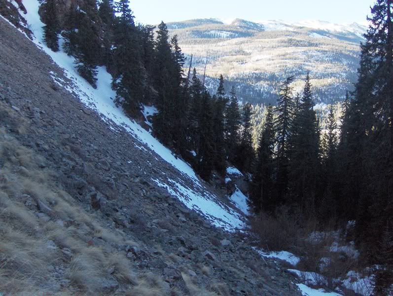
I walked down the road from camp, and at the meadow on the north side of the road, cut up and followed the drainage until it became too restricted. I should have gone further east on my approach and just gained the ridge lower instead of heading into the drainage. But I did not!
At the first opportunity to cut up to the east to get above Bent Creek, I did so. This move placed me on the south running ridge that I wanted. This ridge will deliver me to Pt 12,483'.
Goodbye to Bent Creek below...
Once on the ridge, the bushwack became easier, and was mostly devoid of snow until about 10,600'. From there, it was continuous firm snow with an occasional posthole.
(Note: seeing the dry southern exposed slopes from the road the day before, and from a report by Anna stating she didn't feel the need for snowshoes on her recent hike of Sunshine & Redcloud, I decided to leave my snowshoes behind as well. Good idea?)
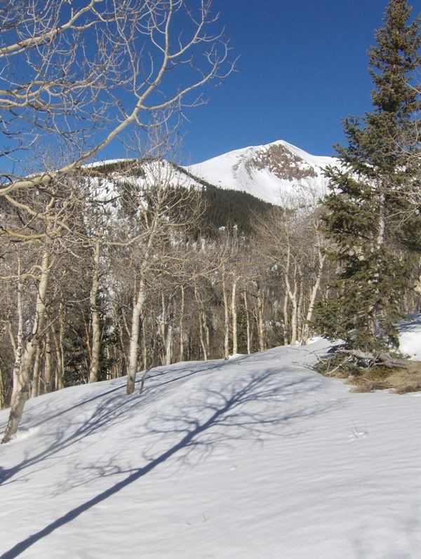
Aspen reaching for Sunshine...
I broke treeline at about 9:40am, and stopped for a while to take in the views. Today was going to be a beautiful day!!
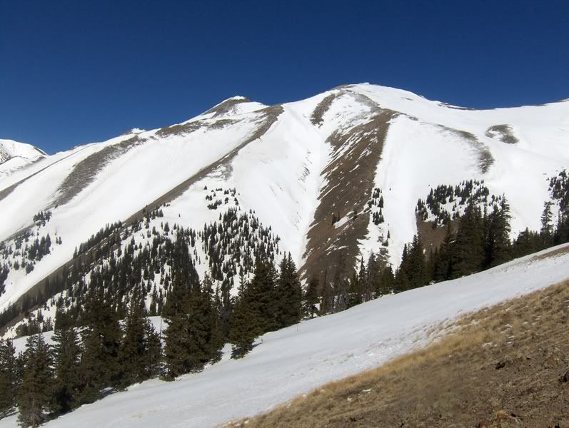
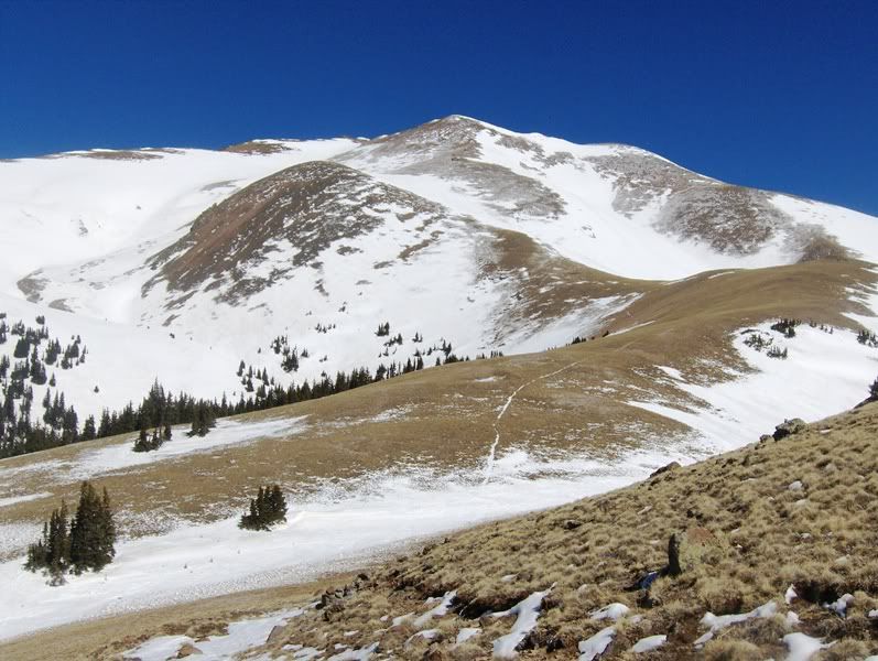
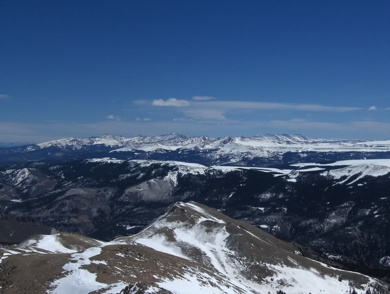
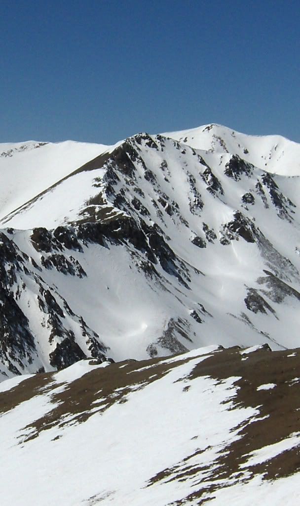
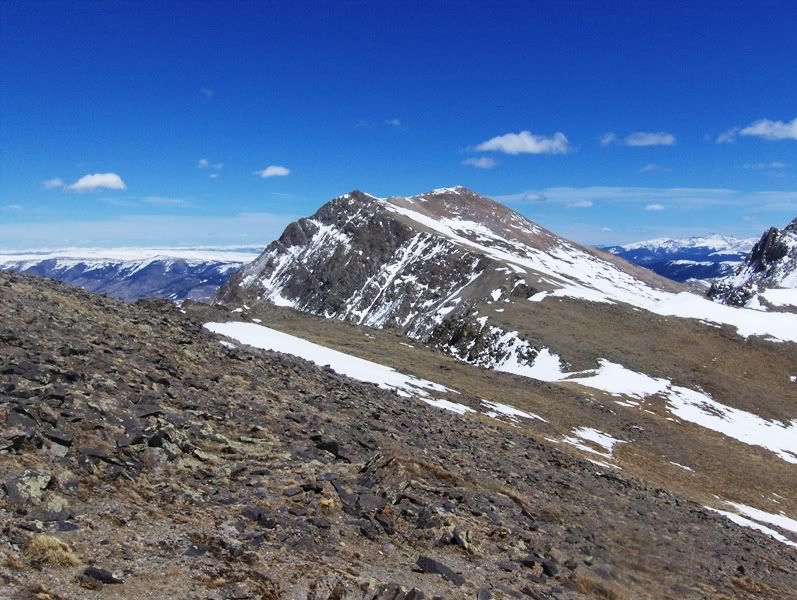
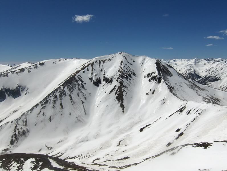
S. slopes & ridges of Pt. 13,832' (left of center) and unranked 13,632'...
First goal of day, 13,811'...
In the above picture, I took the windblown sub-ridge in the center to gain the south talus slopes of 13,811'.
The higher I went, the more I felt the effects of lack of training. The last time I was above 12,000' was at the end of February when I hiked Mt. Evans (14,264') and I've only been to ~12,000' a couple of times since. Luckily today the weather was awesome, with light but cool winds. However, the higher I went, the more I thought Pt 13,832' looked farrrr away.
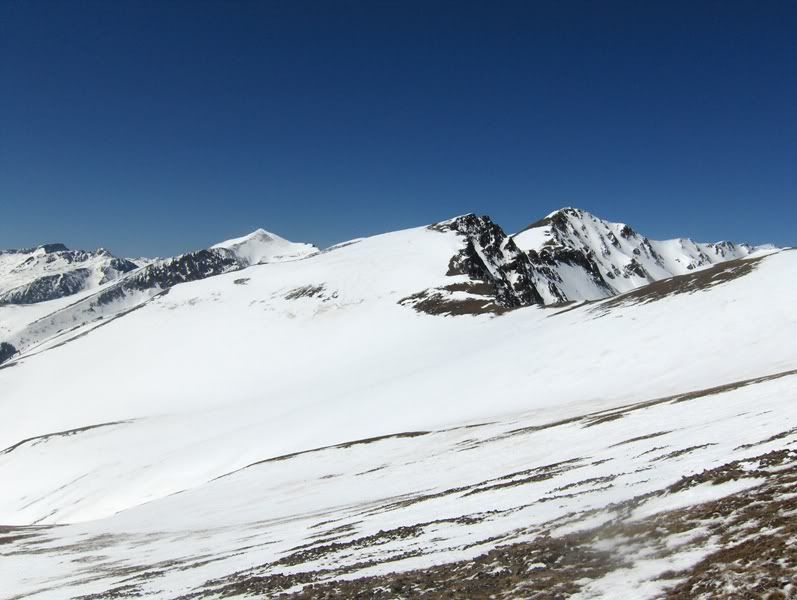
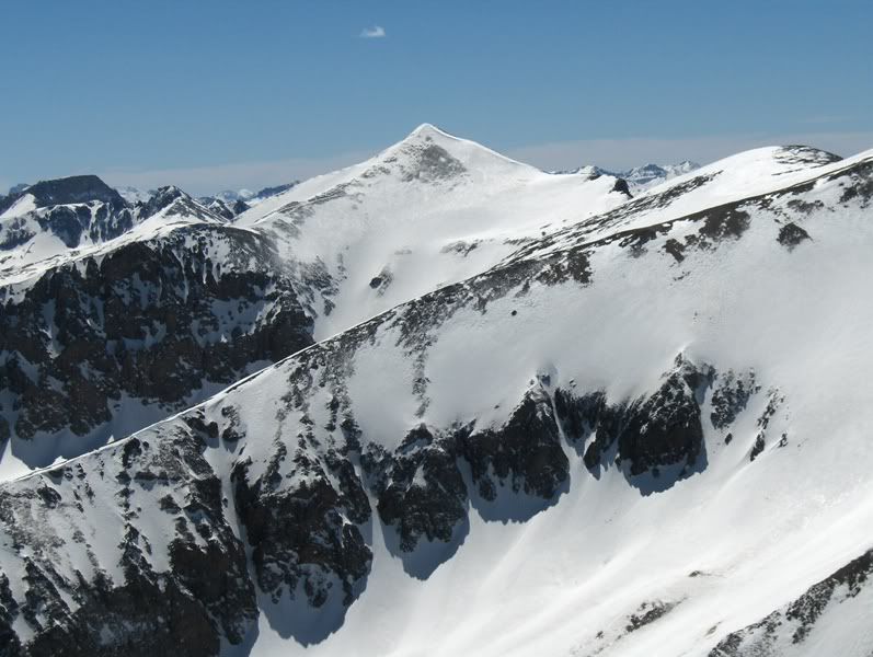
13,832' is the summit right of center, and a little over a mile away...
"Well, I don't want to think about that right now. What's to the south anyway?
Ahhh....look at those beauties!!"
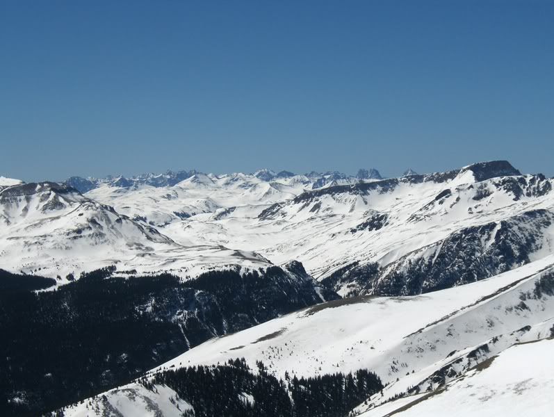
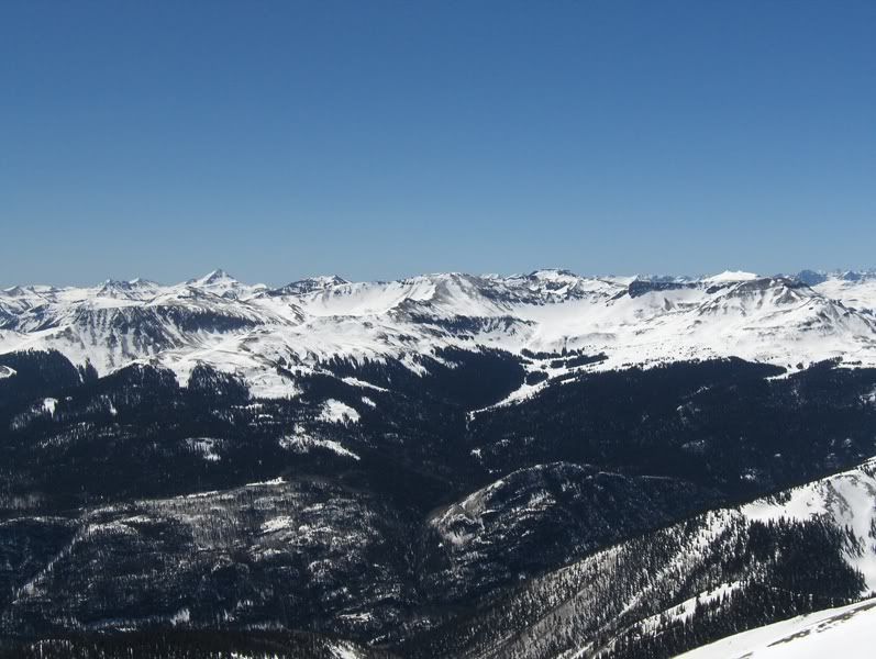
The Weminuche greats in the distance, Half Peak (13,841') on the right...
11:40am finds me on the summit of 13,811' and the views to the North offer the first Point prize...
The Rest of the Aspects
East...
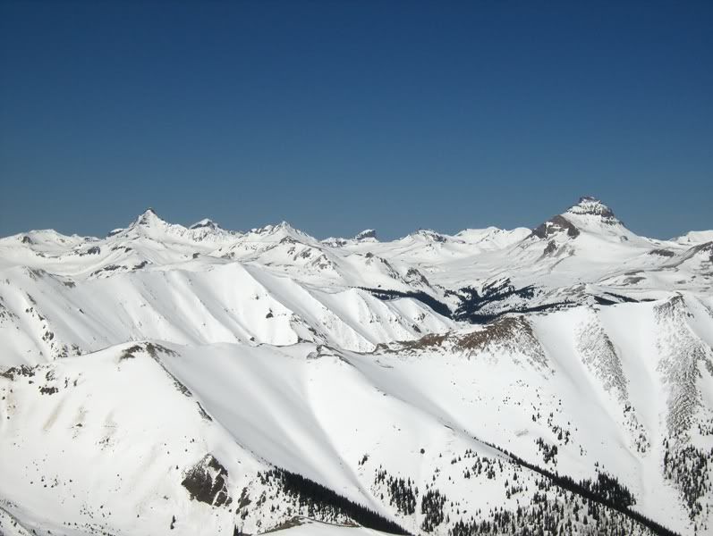
South...
West...
On my way up here, I was thinking about the traverse over to 13,832' and how far away it looked, and how out of shape I felt, and, well, every excuse I could come up with Not to go over there came to mind. Including the hour of the day, the solar radiation and how it might be affecting the snowpack on the aspects I would be on late in the day, and the postholing I was looking forward to on my descent.
So I went to the sub-summit of 13,811' and sat there for a bit longer and enjoyed the views some more. After all, why hurry?
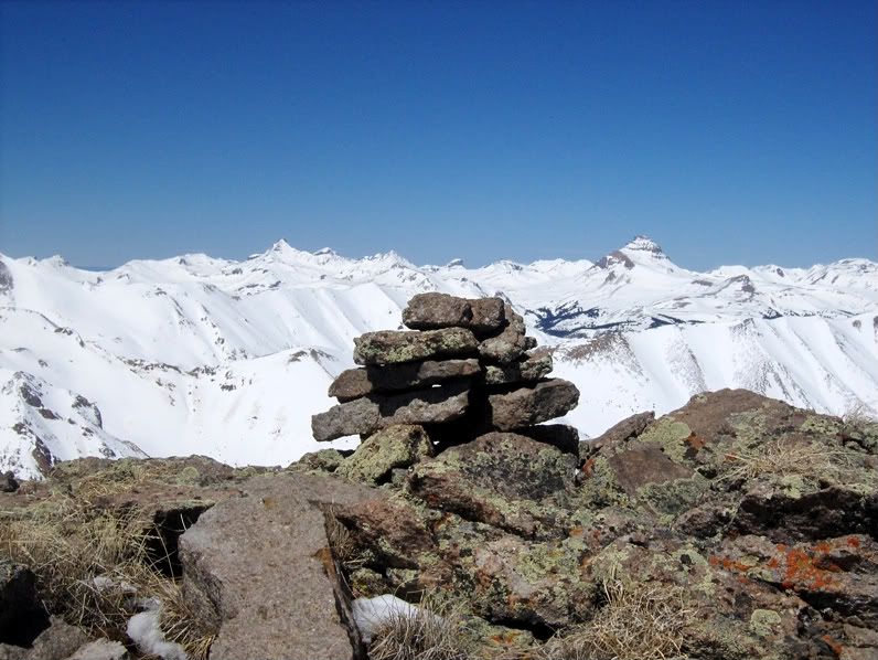
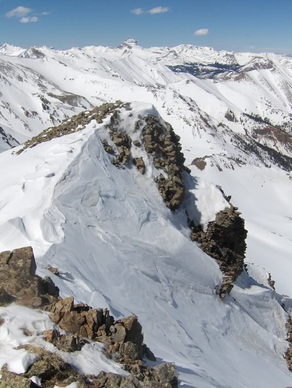
Pile of Rocks on sub-summit...
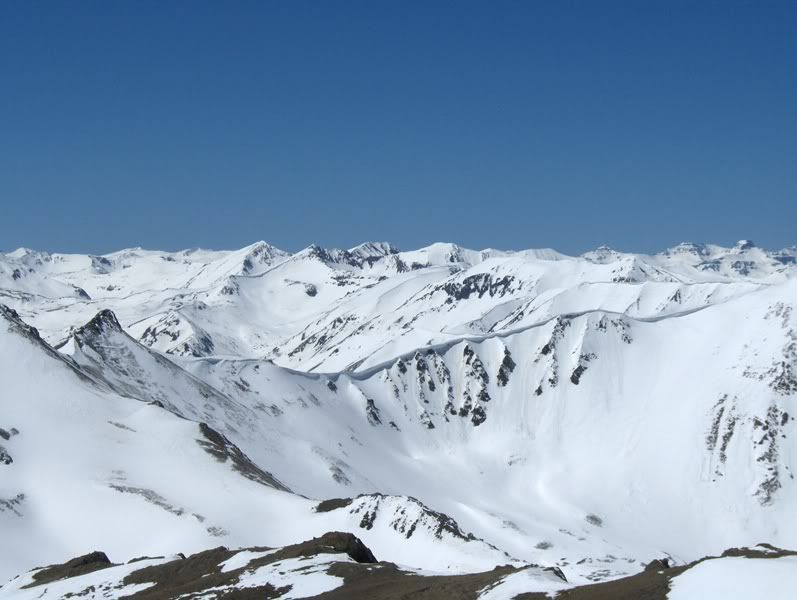
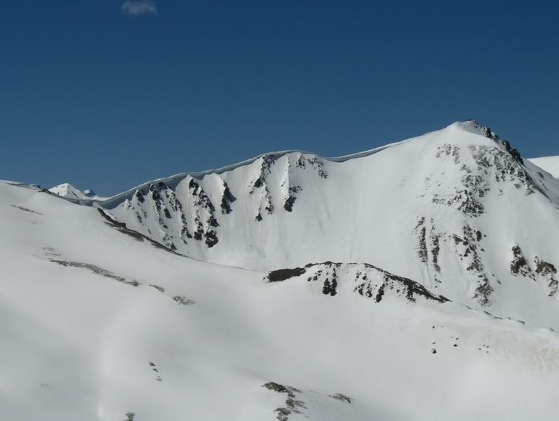
North face of 13,832' and some fun looking lines to the top...
I liked the looks of the N face of 13,832' and thought it could make for a nice snow climb, but the approach could be problematic. Tuck that thought away for another day though.
"It's getting late, you've been up here for almost an hour."
"I'm not going to 13,832' now anyway. My mind is made up. I'm sitting my ass right here and I'm going to stare off to the Weminuche and dream a little!"
"Sigh....but I'm here. It's right there! "
"But you'll come back, you know you will."
"Yeah, you're right. There's a bunch more peaks around here I want to hike!"
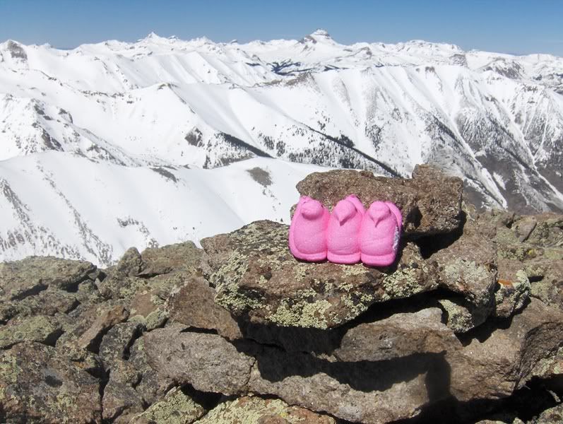
That was almost the conversation that was going on inside my hypoxic peabrain. But then I ate a Pop Tart, and chased it with some Peeps.
"It's right there. You can do it!"
"Ok, let's go."
I left the sub-summit at 1:20pm.
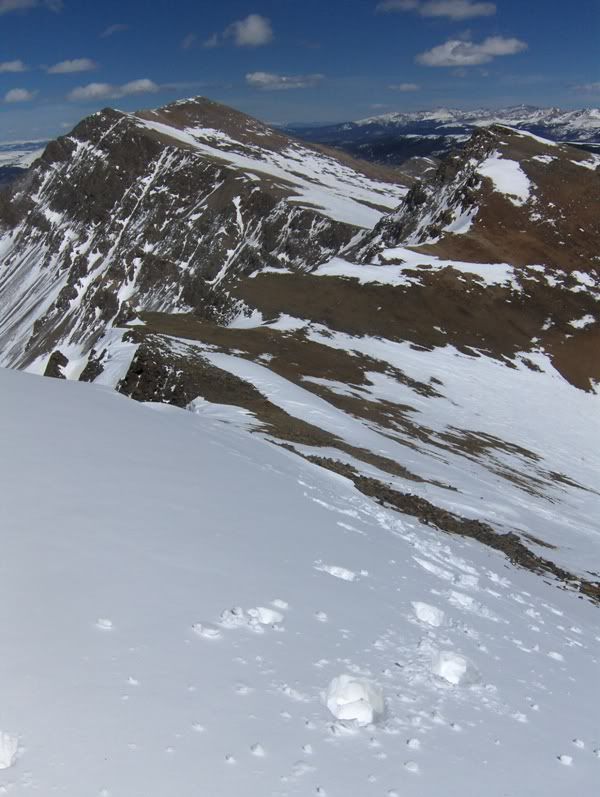
The connecting ridgeline to 13,832'...
While I was sitting on top with my brain debating to go/no go, I did realize that the ridge leading up to the tops of 13,632' and 13,832' had room on the N side to avoid snow if it was too steep to be on softening snow that late. I also noticed I wasn't seeing signs of point releases or roller-balls anywhere, so I thought I should at least check it out.
Making Waves...
A look back at 13,811'...
13,632' and Uncompahgre through the notch...
The snow leading up and around 13,632' and to 13,832' was firmer than I expected, so I think the winds must have kept it cool. Either way, getting over there wasn't nearly as bad as I led myself to believe.
Making tracks...
Summit of 13,832' at 2:15-ish.
And it's all Sunshine...
Redcloud Peak (14,034')
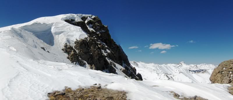
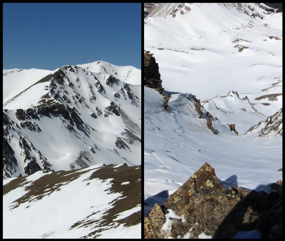
Left photo is N face of 13,832'; Right photo is looking down couloir...
Exit of couloir on N face of 13,832'...
The last person to sign the register was a guy from Colorado Springs, and it was in September of 2010. I signed my name, took a few more pictures, and left. I was really looking forward to my descent below treeline!! (Well, not really, but I knew what to expect.)
Hellacious Trench Building
I'm not exactly sure what time it was, but I believe it was around 4pm-ish when I reached treeline. It would take me close to 2 hours to go no more than a mile of descent. I did not take pictures. I want to forget about this section. I do have bruises on my legs now though, and that will serve as memory for the next few days.
I'm 6' tall, and probably weigh about 210. I had snow to mid-thigh for most of the time. Occasionally I would cool off my, well, you may guess how much deeper I could have gone. It was frustrating, but I plodded along, thinking what it could be like if I had brought my snowshoes. I don't think it would have been much different, given the time of day, and condition of the snow.
But you see, I have to do something stupid at least once, no, probably twice (more like 3 or 4) times a year. This will count as one of those stupid moments. Was it worth it? Hmm....my softshell pants were wet through from the knee down, the insides of my boots were soaked, I ran out of water (although I was swimming in it), yet I still think it was worth it!!
Sigh....earning those Points towards the end of the Centennial list, stories & memories that make the list that much more special down the road.
Thanks for reading,
Darin
Approximate Route: blue = ascent, red = deviation on descent
Thumbnails for uploaded photos (click to open slideshow):
I did that on the 4th of July last year. Looks like even more fun with snow. Congrats on getting it done. When are you doing Pigeon and Turret? I want to get down there this summer and do those two if you don't get them earlier.
Re: Mike, the photos are linked to photobucket, so you should tell your boss to allow your work computer to view them. At least that is my guess. No snowshoes, sigh...I know. sorry to disappoint you. Still not sure if they would have done much good though.
Re: ”degree” Barry, I hope to finish this summer, I have 10 left in the Top 100 (7 in the SJ's, 2 in Sangres, 1 in Front Range; 2 of the 10 are 14ers, the rest cent' 13ers).
Re: John, I hoping to go in for Pigeon & Turret next week if conditions & weather look good.
Nice report, Darin. I possess the sweet tooth of all sweet tooths but draw the line with the peeps. Thanks for posting non-standard route beta. I too have a lot of work to finish before the ”semester” ends in December. Maybe we'll end up in the same ”class” or two this summer. Take it easy...
Greg, I'm still dreaming!! Maybe I'll let you know how the dream went/goes after next week. Maybe. If I do go, I'll probably have a lot more conversations going on inside my head!
Great photos, they really show conditions in the area well! Now you're getting me all excited for spring ski season, some nice looking routes off the ”backsides” of Redcloud and PT 13832. Might have to check those out
Solid effort on that trip D. Way to persevere through the mind games. But no snowshoes...what were you thinking? I'm so disappointed in you.
I'm sure your pictures are nice...if I could see them. Still getting the red X images on all your reports on my work computer.
Caution: The information contained in this report may not be accurate and should not be the only resource used in preparation for your climb. Failure to have the necessary experience, physical conditioning, supplies or equipment can result in injury or death. 14ers.com and the author(s) of this report provide no warranties, either express or implied, that the information provided is accurate or reliable. By using the information provided, you agree to indemnify and hold harmless 14ers.com and the report author(s) with respect to any claims and demands against them, including any attorney fees and expenses. Please read the 14ers.com Safety and Disclaimer pages for more information.
Please respect private property: 14ers.com supports the rights of private landowners to determine how and by whom their land will be used. In Colorado, it is your responsibility to determine if land is private and to obtain the appropriate permission before entering the property.


")


