Download Agreement, Release, and Acknowledgement of Risk:
You (the person requesting this file download) fully understand mountain climbing ("Activity") involves risks and dangers of serious bodily injury, including permanent disability, paralysis, and death ("Risks") and you fully accept and assume all such risks and all responsibility for losses, costs, and damages you incur as a result of your participation in this Activity.
You acknowledge that information in the file you have chosen to download may not be accurate and may contain errors. You agree to assume all risks when using this information and agree to release and discharge 14ers.com, 14ers Inc. and the author(s) of such information (collectively, the "Released Parties").
You hereby discharge the Released Parties from all damages, actions, claims and liabilities of any nature, specifically including, but not limited to, damages, actions, claims and liabilities arising from or related to the negligence of the Released Parties. You further agree to indemnify, hold harmless and defend 14ers.com, 14ers Inc. and each of the other Released Parties from and against any loss, damage, liability and expense, including costs and attorney fees, incurred by 14ers.com, 14ers Inc. or any of the other Released Parties as a result of you using information provided on the 14ers.com or 14ers Inc. websites.
You have read this agreement, fully understand its terms and intend it to be a complete and unconditional release of all liability to the greatest extent allowed by law and agree that if any portion of this agreement is held to be invalid the balance, notwithstanding, shall continue in full force and effect.
By clicking "OK" you agree to these terms. If you DO NOT agree, click "Cancel"...
Maladies, Grids and Gusts - Silverheels in December
Mount Silverheels
13,822' Feet (96th highest in CO)
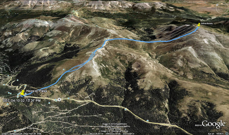
Trailhead: Hoosier Pass
December 4th, 2010
Approximately 8.3 Miles Roundtrip
Approximately 3,400 Feet Elevation
Derek and Chris
Just a fair warning: This report is a bit different from my usual trip reports. Whereas in most of my trip reports I try to focus mainly on logistics and stats of a hike/climb, this one is more of a personal report. Hope you don't mind...but if you do, you can always skip on ahead.
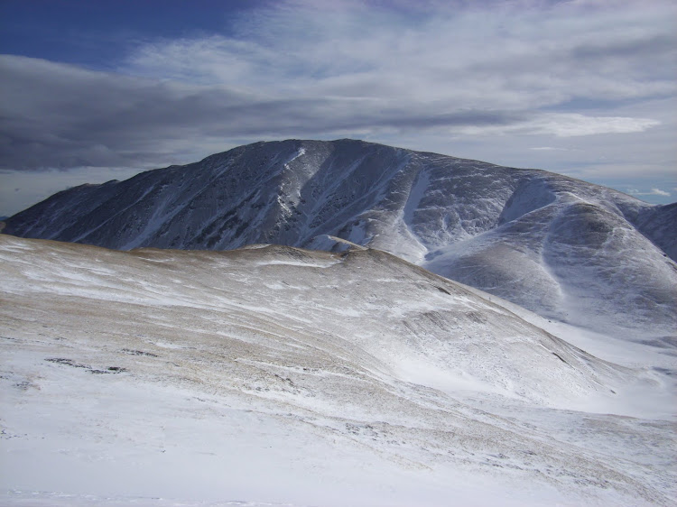
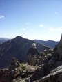
Mount Silverheels seen from North Star Mountain in April of 2010.
Maladies
One year ago this fall, I was diagnosed with cancer. Obviously, this came as a bit of a shock for me. Besides the fact that I was only 26, I had also never known anyone in my family to EVER have it. In other words, it was not something that I had ever thought or worried about. Nevertheless, it was there.
It started innocent enough. I had been on a great trip out with Greenhouseguy on Father Dyer, Crystal and Peak 10 earlier in the day. A matter of hours later, I was in the hospital getting my appendix out. Amazing how quickly an appendix can make a departure! Everything went quick and easy, and I was out of there the next day. Unfortunately, later tests revealed that the appendicitis had been caused by a tumor instead of the normal grunge that makes up a clogged appendix. The doctors decided that they wanted to go back in and "remove and reroute" some additional areas that they felt may have been affected. All of this was just a bit unbelievable to me. I couldn't recall the last time I had ever called in sick or even taken a Tylenol, now this?
I had to wait until the previous surgery to heal before they could proceed, so I was able to hit the mountains a couple more times, although at a much slower pace than normal. I enjoyed some Puma Hill prowling with Greenhouseguy as well as the first "14ers.com Winter Welcomer" with many here at this site. All the while, I had the nagging thoughts that depending on outcomes, they may be my last hills for a long, long while.
Finally, on November 9th, 2009 I had my surgery. Unfortunately, the time between the surgery and when I would find out the results was three days. Three LONG days. Three days of nothing but thinking. Finally, on the morning of the fourth day I received the news I had been hoping for. During one of my question sessions with one of the surgeons (why they choose 4:30AM to talk to patients, I have no idea...) she calmly mentioned that all tests had come back clear. After she left the room, I was so excited that I wanted to tell my mom, sister...at least SOMEONE the news, but it was so early I didn't want to wake anyone up. So to pass the time until morning, I decided to make up a mountaineering goal for the next year.
Grids
2010 was originally going to be just another year, however now 2010 had a different feel to it. It was a year that could have turned out very different, and I didn't want to forget that. Among the normal life things that I decided needed to happen (such as getting engaged and buying a house, both of which I ended up doing) I also wanted to do something fun mountain related. At first, I planned to (finally) finish the 14ers during the next year. The longer I thought about this option, the more I decided that sticking to the 14,000' marker wouldn't mean that much to me, as some of my favorite mountain trips are below the trees. I wanted something I would enjoy throughout the year, and not limit me in any way. I also wanted something that would allow me to see more of what Colorado had to offer, and not just the high alpine areas. That's when I decided on a one year elevation based grid. (Not to be confused with the crazy 14er grid some are following. ) Right there in my hospital bed, I decided on some "guidelines" I would give myself for my grid project:
1. I would attempt to summit a minimum of 10 ranked mountains for each elevation range. (Starting at 6ers on up to 14ers, 90 peaks total.) This would allow me to check out many different "zones" in the CO mountains.
2. If I repeated any peak during the year, I would only count it once on the grid. So each grid point would have to be unique to the year. (In other words, no repeating Green Mountain to fill the 6ers )
So there it was. My mountaineering goal for the 2010. Not the most difficult of goals by some standards, but for someone who just an hour ago wasn't sure that he would be climbing ANYTHING over the next year, it felt right.
The final one and a half months of 2009 were full of recovery and rest. (Not to mention another surgery and another one week stay in the hospital due to a surgical infection.) Near the end of December (don't tell my doctors) I decided to get out and see how the legs felt. I ended up hiking Green Mt, Dinosaur Ridge, and Mount Morrison over the last couple weeks of 2009, and I felt great. I was ready for 2010.
Gusts
2010 absolutely flew by. I really didn't have to focus on my "grid" very much because the peaks that I ended up climbing started to fill it up without me even thinking about it. By the time fall of 2010 arrived, I started to put a bit of effort into choosing a final peak. I wanted to finish on a peak that I had my sights on for a while, and I also wanted it to be a higher peak. As the only high grid spot still open was for a 13er, the choice for Mount Silverheels became obvious.
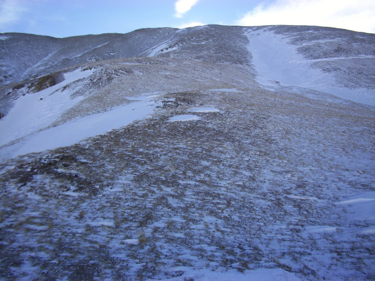
Mount Silverheels is located just to the southeast of Hoosier Pass. As high peaks go, it is quite popular for winter summits. By following the route from Hoosier Pass TH, almost all avalanche terrain can be avoided. As safe as it is in winter, the mountain makes up for in notoriously high winds throughout the year. In fact, I couldn't recall any trip reports where high winds or bad weather was not mentioned.
Although I was looking forward to hiking Silverheels, I almost had to delay it another week. The night before the hike, I discovered that I had forgotten about previous plans involving a holiday party with my girlfriend's workplace. By the time the party was over and I finally got to bed, it was almost 2:30AM. I was expecting to wake up to my alarm at 5:00AM and call my partner for the day and cancel. When 5:00AM came however, I decided that I may as well give it a shot. I would really hate to cancel on someone because of my own "late night".
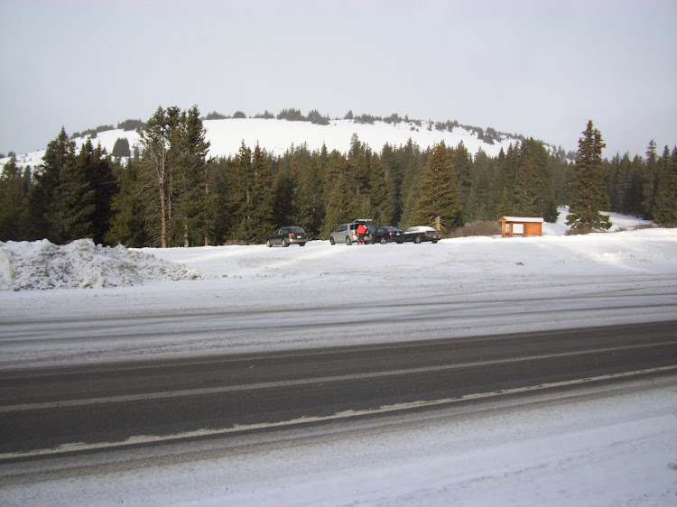
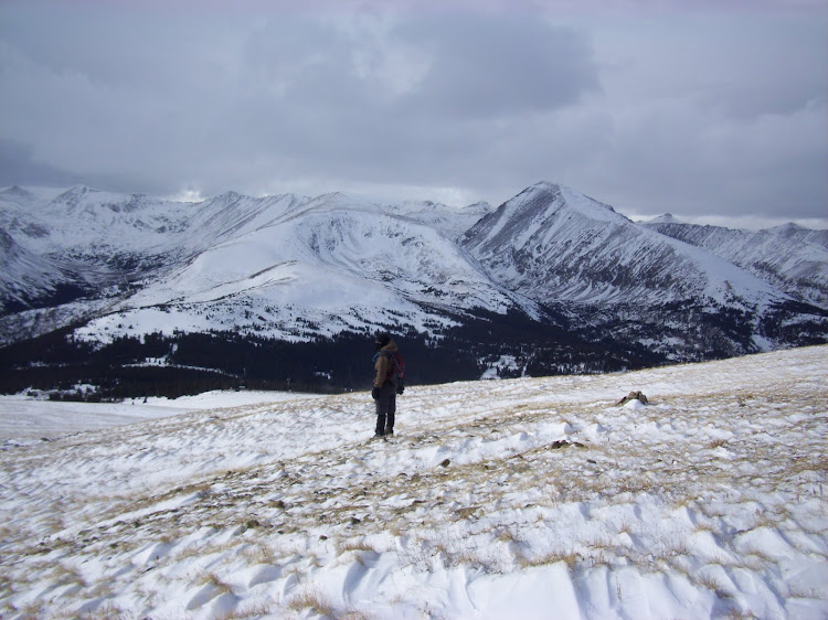
Looking back at Hoosier Pass parking area after crossing HWY 9.
I pulled into the Hoosier Pass parking area just after 7:30AM. Although in a tired and groggy daze, I was excited to get going. Chris had arrived separately because I had plans I needed to attend to in Colorado Springs after the hike. By the time my slow butt got geared up to start, it was around 8:00AM. The temperature was a decent 28 degrees at the trailhead, but there was a steady snow falling and we could tell that the higher elevations were already getting nailed with winds.
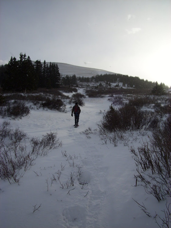
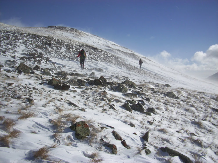
After crossing HWY 9, we immediately threw on our snowshoes. The snow wasn't horribly deep, but there was no packed trail to follow and it made the going much easier. After a couple hundred yards through the trees, we emerged into the willow patches that guard the ascent towards Hoosier Ridge. We found a nice path through these willows and started up the first hillside leading to the ridge. Around this time, two other hikers caught up with us. Our group of 2 expanded to a group of 4. We all decided to remove snowshoes at the top of the first hill near a prominent cairn. Expecting the worst in terms of weather, I also took a waypoint of the cache to be sure that we could find them on the way down.
Chris making his way through the willows.
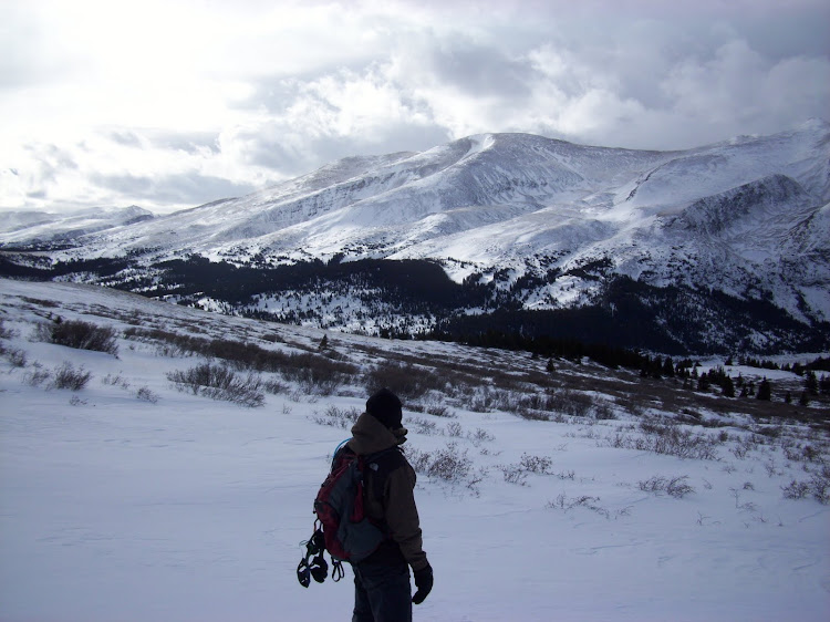
Looking back towards Hoosier Pass just after passing treeline.
The four of us ascending towards the ominous weather above.
Chris admiring our first view of Mount Silverheels.
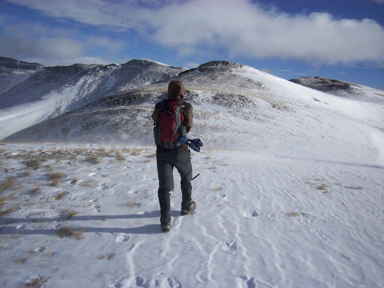
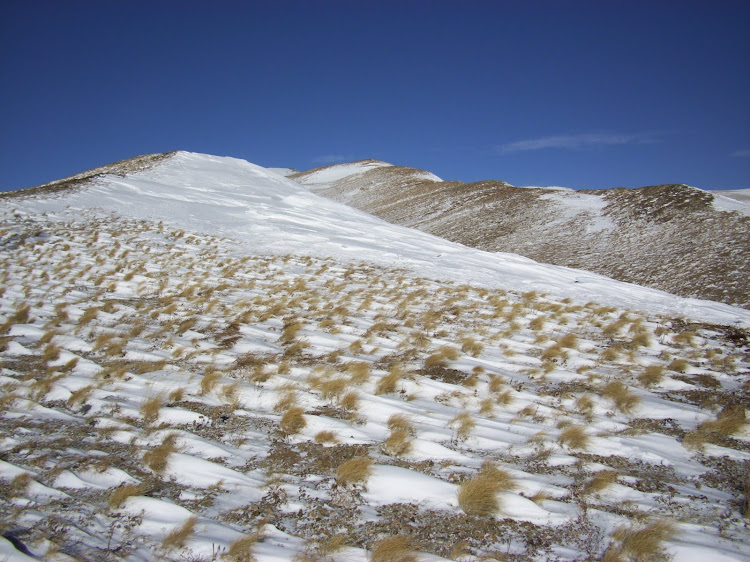
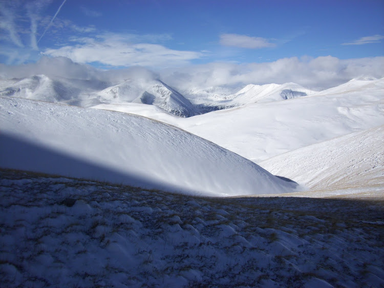
From the snowshoe cache, we continued on the gradual ups and downs of the ridge heading east. Eventually, the massive lump that is Mount Silverheels appeared to our right. Clouds were guarding the summit, and the presence of wind was clearly evident. After around the third bump on the ridge, we finally reached a point where we could see the "power-line saddle". It is towards this saddle that one must descend in order to reach the northern base of Mount Silverheels. During times of high snow volumes and avalanche conditions, its best to continue further east to the next high point where you are directly north of the saddle. The conditions allowed us to drop a bit sooner and head for the saddle in a diagonal path. This saved us time and elevation.
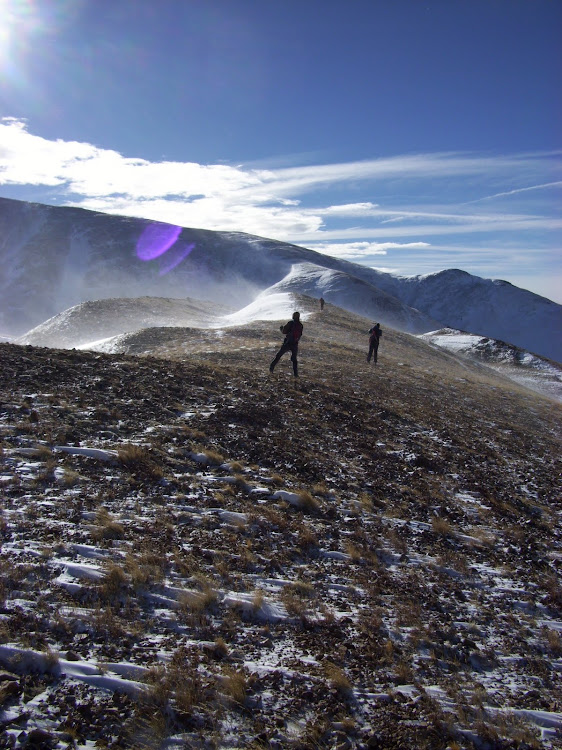
Once we reached the ridge leading south towards Silverheels, the winds really began to pick up. Everyone had a slightly diagonal stance to brace against the wind, and speaking to each other was quite difficult given the noise. As we neared the power lines that pass over the saddle, the other 2 hikers decided to turn back due to time restraints. It was nice to meet both of them! It was now down to just Chris and I again.
Following the ridge eastward.
We left the ridge and turned south (right) just prior to the next high point in this photo.
Silverheels looking larger and larger as we get closer.
Bracing against the winds while headed towards the "power line saddle".
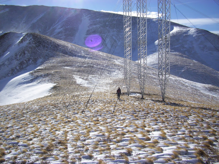
Chris looking small next to the massive power lines on the saddle.
Looking back North from where we descended. Photo taken near the power line towers.
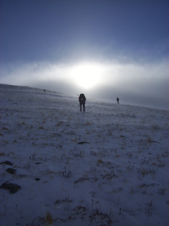
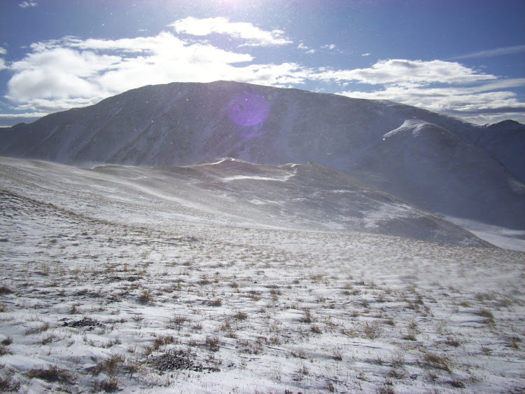
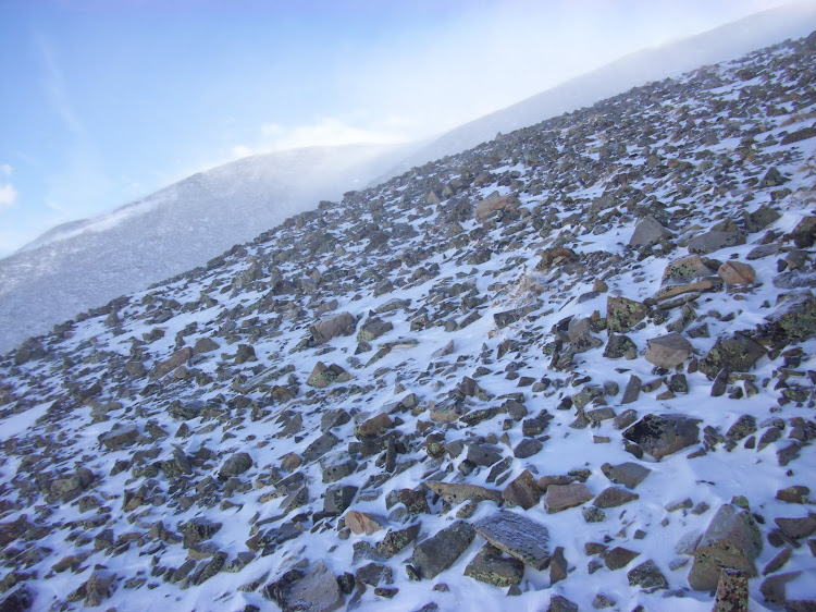
We reached the low point of the ridge just past the power lines, and we were greeted by the final 1200' or so slope up to the summit of Silverheels. Chris took up the lead, and we slowly picked our way up. At some points we were able to find bits of trail, other times we just headed straight up. The rocks were frozen in place enough that footing wasn't too much of an issue. I had my spikes with me, but I decided not to use them. (They probably would have been beneficial, but I didn't feel like taking the time to put them on.)
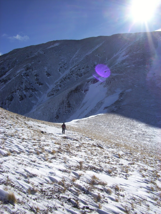
Chris began to hit his afterburners and pulled ahead of me. We saw a VERY large bighorn ram on the slope. I used the universal "check out that huge ram on your left" hand signal to make sure he saw it. (By now the winds were too strong to communicate by voice.) Up and up the slope we continued, Chris still moving much faster than me. Eventually, his figure disappeared into the swirling snow and winds above me. Besides for the winds, the weather was still decent so we weren't worried about separating a bit this close to the summit. I took a short break to add a layer under my shell. This turned out to be quite an exciting break, as putting on a layer with the wind threatening to blow your coat to the next county makes for a difficult layering process. After finally relayering, I came across the bighorn tracks from the ram we noticed earlier. It appeared that he had headed directly for the summit, so I just followed his route. After another 20 minutes or so, I popped out on the summit ridge and could finally see most of the remaining route.
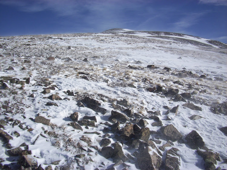
Fantastic views to the west.
Almost ready to start our final ascent.
Up and up we go.
My eyes are constantly drawn to the west.
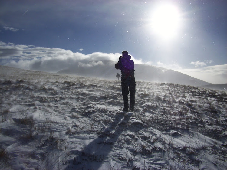
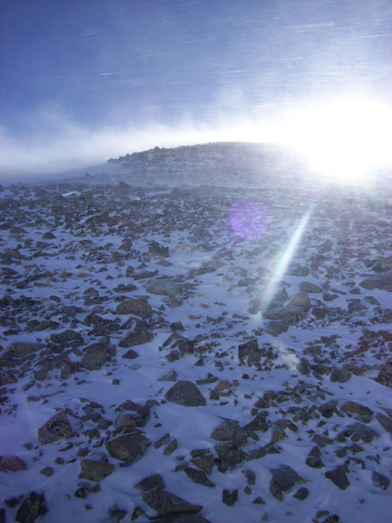
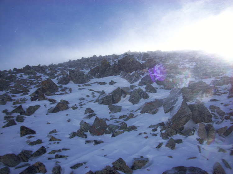
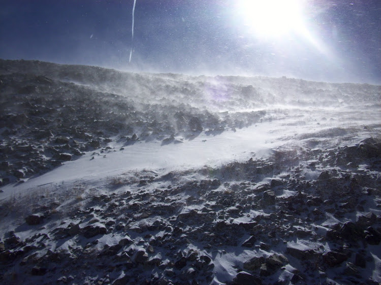
The winds are really starting to put up a fight.
Summit of Silverheels seen from the ridge we ascended.
Wind.
And more wind.
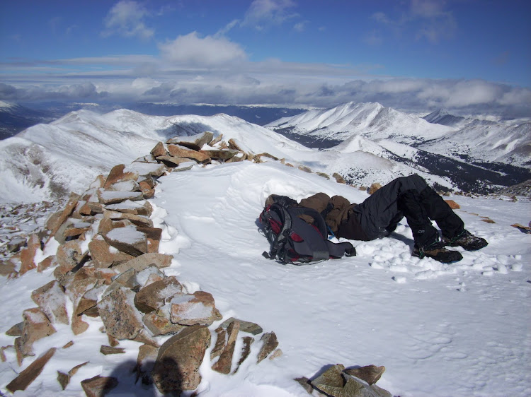
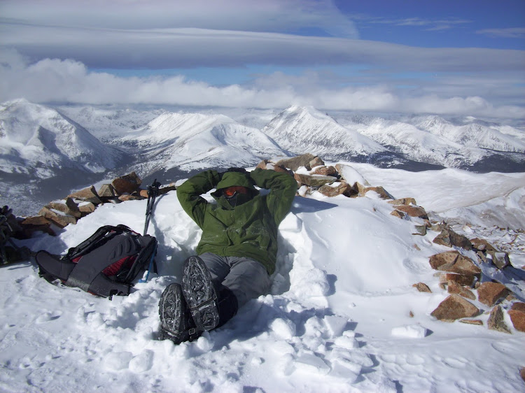
The winds on the summit ridge were still quite bad, but not as terrible as they had been a bit lower on the mountain. I picked up Chris's footprints in the snow and headed east the final .35 miles to the true summit. On my arrival, I found Chris lounging in the snow filled windbreak. From the car to the summit had taken me around 3.5 hours, and Chris had been on the summit for almost a half and hour when I arrived.
I had originally planned to bring along a bottle of Bell's Two Hearted Ale to enjoy on the summit to celebrate a goal achieved, but I ended up leaving it in the car. That was probably a good idea, because it probably would have put me to sleep. (My lack of sleep from the previous night was really starting to wear me down...) We stayed on the summit for only a few minutes after I arrived. There were some clouds gathering to our west that looked to be carrying a good amount of precipitation, and snow mixed with the wind that we were experiencing was not a good combination.
The final .35 miles to the summit.
Chris taking a break while waiting for me to summit.
A quick moment of relaxation.
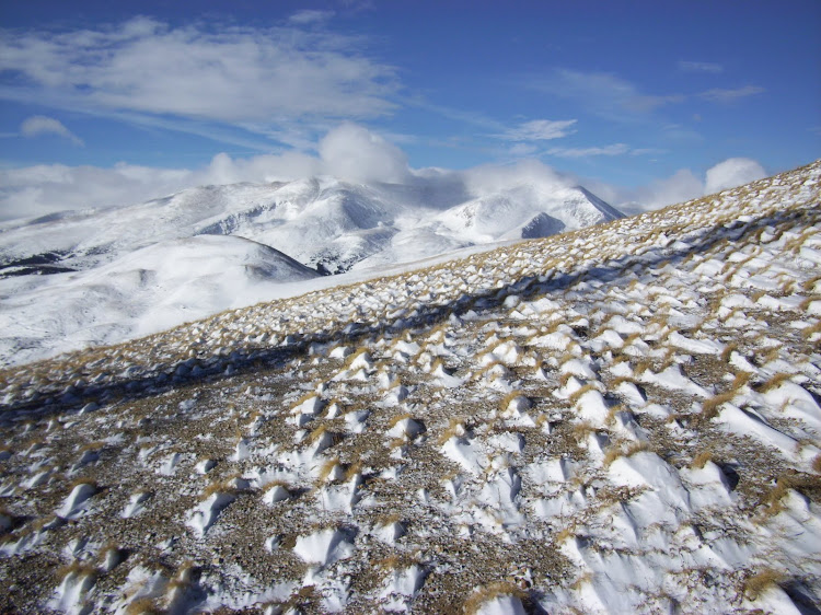
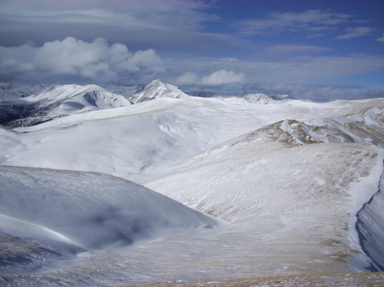
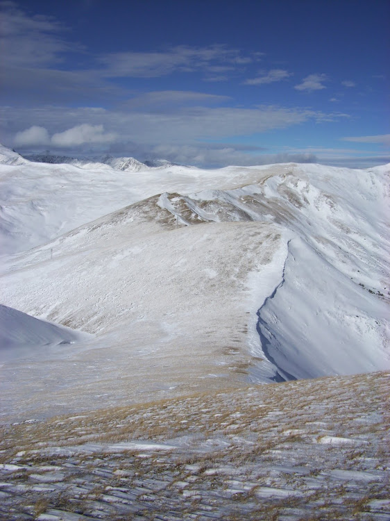
Looking back at most of our route from the summit.
The ups and downs awaiting our return.
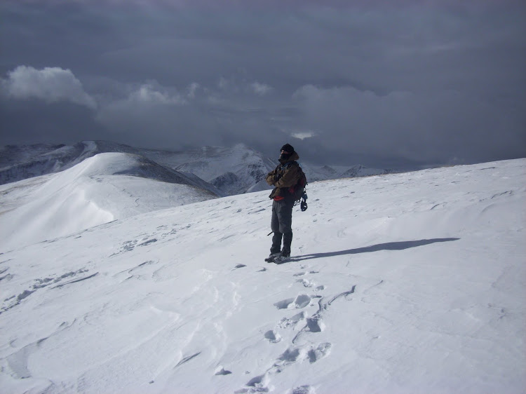
We followed the same route down that we had ascended. Once back at the power line saddle, the winds became absolutely fierce. We were now walking into the wind a bit, and every step felt about 3 times harder than in should have. As we began to ascend over the final bumps towards the ridge back to Hoosier Pass, my energy plummeted. I was moving pretty slowly, and even when I stopped to take breaks I was losing energy from the effort it took just to stand up. Eventually, we ascended back to the main ridge that would lead us out. The wind here relented quite a bit, and we were able to move much easier. Even though Chris was able to move quite a bit faster than me, we kept together just in case the weather took a bad turn. Luckily, the clouds that we saw building to the west never seemed to move.
Threatening clouds to the west while Chris looks on.
A final look at Silverheels.
North Star and Quandary watching over our descent.
Back to the willows.
We made it back to our snowshoe cache and continued the final mile to the pass. We knew that we no longer needed to hurry, so we took our time back down through the trees. We returned to our cars a little over 6 hours after leaving that morning. Even though my energy and speed was bad right from the beginning, we made better time than I had originally planned on.
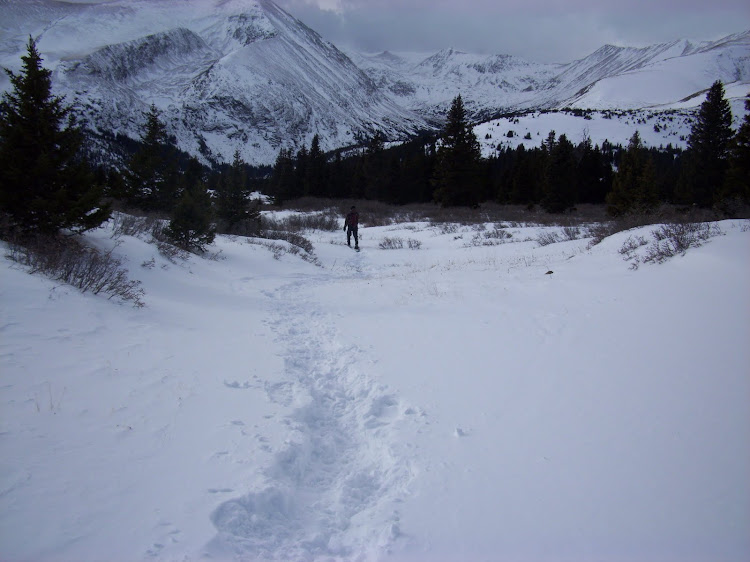
Following the path back to Hoosier Pass.
Final Googleearth track from our day.
So it was done. 11 months after I started and on the 111th ranked summit of 2010 I had reached the goal that I had planned while laying in a hospital bed. Silverheels did its best to make it a rough day, but I'm glad that it decided to allow us the ascent. The year was great (although still not over) and it really allowed me to appreciate a lot of what Colorado has to offer. From the 6ers in Poudre Canyon to 14ers in the San Juans, I enjoyed every bit of it. The year taught me that you can't plan for everything, so enjoy the things you can plan for.
Just to finish up, I thought I would list my favorites from each elevation range from the year:
6er: UN 6954 Tremendous views for a sixer. Definitely one I would like to repeat. (Careful regarding access...) 7er: Aiquelle de Greyrock a VERY fun class 4 route to the summit. 8er: Elephant Butte One of those "we have no information on the peak but we'll try it anyway" type of climbs. Turned out to be a really fun trip. 9er: Sugarloaf (near Tarryall Reservoir) Any addict of the LCW would love the views from this peak. 10er: Lost Platte PeakThis was my first difficult hike after surgery, and the first hike that I felt like I was really good to go. 11er:UN 11270 (Retirement Range)Great aspens all over the summit, a great fall hike. 12er: Bison PeakEveryone has to do this peak at LEAST once. 13er: North Star MountainOne heckuva a fun ridge when there is snow. 14er: HumboldtWeird, huh? I just enjoyed it because I never saw another person the entire day, which is pretty rare for a 14er.
Cheers
--Derek
My GPS Tracks on Google Maps (made from a .GPX file upload):
Congratulations again, Derek. That really is quite an unbelievable year. I'm glad I could climb a few with you. So next year are you going to do 5ers thru 15ers?
”Near the end of December (don‘t tell my doctors) I decided to get out and see how the legs felt...”
Classic! : )
Derek, I really enjoyed the TR. Hearing your story was moving. But more than that, it's wonderful to see you're alive, well, and climbing! Thanks so much for sharing your story and your joy of climbing.
for sharing your journey with us. Can't imagine getting the news of ”cancer.” But then to be out climbing like you did afterwards. That's quite a feat.
Greenhouseguy told me your story when I climbed with him in Arizona over Thanksgiving. Amazing!
I pray you have many, many more climbs, peaks, and summits in the years to come.
It was great hiking some of the peaks with you. It was amazing to watch you recover from your surgeries. I'm still with you every inch of the way, even though I've been taken out of the game for a while. What can you do in 2011 to top this?
Thanks for the nice comments everyone... 12/8/2010 2:16am
Life can change quick, and I plan to enjoy every bit that I can. Which in my case involves mountains.
Todd-Its been excellent hitting the hills with you this year. I plan on many, many more summits with you. Like next week? Jim- Thanks, we'll have to get out this winter since I was a bit limited last winter! Sen- You would enjoy it. I'd be interested in doing it again from the south if you're interested. Matt- The grid was fun. Ironically, the hardest section was the 6ers. Access issues, ”silent” climbing, etc.. Britt- Thanks for the kind words. Maybe we can get together in the hills sometime. Dr No- Yes...yes it does. Hopefully my days of ”kicking its ass” are over.. Otina- You've had quite the year too. I'm glad I could join you on your finisher. Del Sur- Thanks, hopefully I won't be writing too many more ”post-cancer” reports... Brian- To top this in 2011? I'm just going to enjoy the year. Try for a lot more overnight multi-peak days. And hopefully spend more time in the Sangre's. I'm sure you'd be willing to join, right? El Chup- Chris and I were talking on the way down about how you guys probably could have made it within your time limit, I think the skirting of highpoints really minimized our gain/time. Randal- Thanks! Glad you enjoyed it..
It was nice meeting you guys up there Saturday. I wish we could of finished the route off with you guys. My friend thought it was going to take too long but it sounds like you didn't have to lose that much elevation and we could of done it pretty fast. Wow what a windy day it was. Love your pics and hope to see you on the hills again! Great story to!
Caution: The information contained in this report may not be accurate and should not be the only resource used in preparation for your climb. Failure to have the necessary experience, physical conditioning, supplies or equipment can result in injury or death. 14ers.com and the author(s) of this report provide no warranties, either express or implied, that the information provided is accurate or reliable. By using the information provided, you agree to indemnify and hold harmless 14ers.com and the report author(s) with respect to any claims and demands against them, including any attorney fees and expenses. Please read the 14ers.com Safety and Disclaimer pages for more information.
Please respect private property: 14ers.com supports the rights of private landowners to determine how and by whom their land will be used. In Colorado, it is your responsibility to determine if land is private and to obtain the appropriate permission before entering the property.