| Peak(s): |
La Plata Peak - 14,344 feet "East La Plata" - 14,186 feet |
| Date Posted: | 09/30/2010 |
| Date Climbed: | 09/28/2010 |
| Author: | mikemalick |
| Peak(s): |
La Plata Peak - 14,344 feet "East La Plata" - 14,186 feet |
| Date Posted: | 09/30/2010 |
| Date Climbed: | 09/28/2010 |
| Author: | mikemalick |
| East La Plata fun |
|---|
|
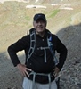
Summary ==================== Route: La Plata Peak - Standard Northwest Ridge with cross over to East La Plata. Start: 6:07 AM La Plata Peak Summit: 9:50 AM East La Plata Summit: 10:16 AM Depart East La Plata: 11 AM Return to La Plata Peak Summit: 11:25 AM Depart La Plata Peak Summit: 11:36 AM Arrive back at car: 2 PM Total Time: 7 hours 53 minutes Distance: Approx 8.95 miles Elevation Gain: 4,760' ==================== Official 14er #20...La Plata Peak with bonus East La Plata. I must say the trip over to and back from East La Plata was the highlight. Definitely came away saying to myself I'd be back next year to do Ellingwood Ridge. Thought I'd start with lessons learned. Lesson 1: When you are hiking in the dark, you can't see! Yes, I know...a newsflash I am sure. Even with a headlamp...just not as good as with the sun up. So when hiking a dirt road knowing you have to cut off into the woods after about 1/4 mile, don't pick that point to look down while walking and start adjusting items on your pack lest you enjoy walking right past the turnoff and continuing on for another 1/4 mile. Oh well. Ended up passing a car on the side of the dirt road where I suspect some folks were sleeping and they left their very large dog outside to enjoy the fresh air. He also enjoyed barking at me. As I continued on I kept thinking...what if that car was blocking the sign leading into the forest? I decided to finally turn around as it was obvious I went much farther than it should have been. Doing an about-face, my headlamp hit upon my stalker...that very same dog! Not only did I get an official escort back to the car parked on the side of the road, but clear to the wilderness sign-in post and then up the trail another 100 feet. Thought I'd have company all the way up! Lesson 2: Weak batteries in a Garmin etrex Vista Cx will lead to very, very baaaaad tracking. Fortunately this didn't happen until I was over halfway back down the mountain. I knew something was up when I took a peek at the GPS and it stated my trip odometer was 235 miles! The thought of that kind of speed was very appealing and I already started planning taking a long weekend and thru-hiking the entire Colorado Trail. Alas it was not meant to be. A fresh pair of batteries and I was back to being a mere mortal. It took quite some time to clean up that hosed portion of the gpx file. Lesson 3: Don't wait more than a day to review hike pics and post. Otherwise all those rock outcroppings start to look the same and figuring out which exact route I took in photos gets to be worse than a statistics final exam. Here we go. Route overview and profile. My car was the only one in the parking area when I set off a little after 6 AM.   Got my first good views of La Plata Peak well up the La Plata Gulch.  Taken on descent, but this is looking up the series of switchbacks from 11,360' to 11,800' once you leave the gulch.  Ascent pic heading up switchbacks looking generally southward up La Plata Gulch at Sayres Peak.  On ridge approx 12,720' looking up to true summit and East La Plata on left. You lose sight of the true summit a number of times from here on out till a little before you actually arrive up top.  13,280' view back down. The 6x6 block (mentioned in Bill's route description) is somewhat centered far below with the trail being pretty distinctive. You gain the ridge on the right in this shot.  Same spot looking north-northeast to start of Ellingwood Ridge. Beyond that you can see Bull Hill center left, Mt Elbert behind that a little to right and Mt Massive beyond all those to left.  Same spot but looking further up Ellingwood Ridge with Rinker Peak rising up in the background.  Pretty much snow free to this point. This snow field started around 13,600' but was easily avoided sticking to trail that stayed to the right.  Up around 14,000' with a subpeak coming into view. You end up turning to the left shortly missing that subpeak for the final push up to the summit.  Just shy of the summit. Looking north with CO82 heading up over Independence Pass to left, some 13ers centered, Casco Peak center right, Mt Massive background to right of that with Bull Hill on right edge and Mt Elbert just off shot to right.  Summit of La Plata Peak looking towards East La Plata. Looks pretty tame from here. Rinker Peak centered and Mount Hope to right. Keep points 1, 2 and 3 in mind. You will most likely need to click the pic to enlarge in order to see the detail.  Further along connecting ridge at point 2. Keep in mind points 4 and 5.  Same spot as before, but looking back up to La Plata Peak. Notice point 1.  Standing at previously mentioned point 3 where the ridge gets a bit more interesting.  Standing at point 5 looking at point 4 right in front of me. Hard to tell with the shadows, but there is a gap in the middle of this mound that I came through. Behind me here is a downclimb I did not want to do so ended up bypassing it by heading down to left from here and hooking again to the left/east.  Standing at point 4 looking to point 5. You can't see the dropoff from here. From this pic, I bypassed that by skirting off to picture's right side. I ended up climbing up that section on the return trip. Wasn't comfy with the downclimbing thought.  Looking up that downclimb I didn't do. I'm guessing it was 20'-25' feet. So much easier climbing up. Is that why cats are always getting stuck up in trees?? You can see in red the route I took climbing up this face on the return trip.  Just below the East La Plata summit looking back the way I came.  Looking generally sowtheast from East La Plata where you can see Crystal Lake, ridgeline heading up to Rinker Peak off pic left, Mount Hope center left and in the distant central background (I think) Pecks Peak, Missouri Mountain, Mount Belford, Mount Oxford and Waverly Mountain. Hard to tell which is which.  My favorite shot of the day, East La Plata looking out along the sweeping Ellingwood Ridge with Bull Hill, South Elbert, Mount Elbert and Mount Massive in the background. May have to return next year to tackle Ellingwood.  Further out on East La Plata looking back at the ridge up to La Plata Peak. Point 5 is shown.  Zoomed in on point 5 that I'll be climbing up shortly. I'm guessing it was in the class 4 area.  To prove I was really there.  Well on the way back to La Plata Peak. Skirted this rock tower on a left-side ledge.  Past rock tower seeing what is next. Lots of paths to head up.  Some guys up from Aspen were nice enough to snap some pics. Mount Massive is just to the right of my left shoulder. Mount Elbert is to the right of that.  Another summit shot with the Pecks, Waverly, Missouri, Belford and Oxford group behind me.  Bridge on the dirt road over North Fork Lake Creek and La Plata Peak in background.  It has been a great past few weeks being able to get out once a week from the Front Range out to Sawatch. May have to stick to stuff closer to home for the remainder of the season. Enjoy! Thumbnails for uploaded photos (click to open slideshow):  Route taken. Same route up as down")
 Route profile")
 First good views of La Plata")
 Switchbacks")
 13,738' Sayres Peak")
")
")
")
")
")
")
")
")
")
")
")
")
")
")
")
")
")
")
")
")
")
")
")
")
")
|
| Comments or Questions | |||||||||
|---|---|---|---|---|---|---|---|---|---|
|
Caution: The information contained in this report may not be accurate and should not be the only resource used in preparation for your climb. Failure to have the necessary experience, physical conditioning, supplies or equipment can result in injury or death. 14ers.com and the author(s) of this report provide no warranties, either express or implied, that the information provided is accurate or reliable. By using the information provided, you agree to indemnify and hold harmless 14ers.com and the report author(s) with respect to any claims and demands against them, including any attorney fees and expenses. Please read the 14ers.com Safety and Disclaimer pages for more information.