| Peak(s): |
Mt. Bross - 14,178 feet Mt. Lincoln - 14,293 feet Mt. Cameron - 14,248 feet Mt. Democrat - 14,154 feet |
| Date Posted: | 08/19/2010 |
| Modified: | 08/24/2010 |
| Date Climbed: | 08/04/2010 |
| Author: | nomadelmundo |
| Peak(s): |
Mt. Bross - 14,178 feet Mt. Lincoln - 14,293 feet Mt. Cameron - 14,248 feet Mt. Democrat - 14,154 feet |
| Date Posted: | 08/19/2010 |
| Modified: | 08/24/2010 |
| Date Climbed: | 08/04/2010 |
| Author: | nomadelmundo |
| The Mosquito 4 - (combo reversed) |
|---|
|
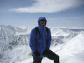
I have been following the road closure since the start of this summer. 14er "Gator" noted that this first week of August, there won't be any closures, so I took the opportunity and headed out to conquer most of the Mosquitos with one road trip (I hate driving, especially when alone.) After the Lindsey fiasco with my buddy from Texas last month, where I did not properly load the GPS points on my Garmin, I made sure this time they were pre-loaded properly. Apparently I have not figured out how to load up more than one set of route points on my Garmin MAP76. I packed my usual 2L water, pistachios, fruity candy snacks and set my alarm for 330AM. I was out on the road by 4AM with Max and did not wake up the babies. I reached small town of Alma still asleep, and like the Bill's direction said; saw a very small road sign that points Kite Lake and took a left turn (as you are heading north towards Brackenridge). Just a few yards from the main town road, I was on dirt and saw the sign.  But there weren't any road blockage or gates signs saying potential road closure, so I am thank "Gator" being right and proceed. The road was really not terrible at all, except few potholes (>100) that sneak on you. I am too slow to dodge going 30 MPH but 4Runner took the abuse without complaint. After some elevation gain from Alma (10,000 feet) to ~12,000 feet, the road was streaming with recent precipitation.  I am the 4th car parked just before the entrance to the paid parking lot ~ 50 yards ahead ($3 per day). I save the $ (gets me 1 gallon of fuel) and walk. I am now geared and start at the TH ~ 645AM. In the main parking lot, to my surprise, there must have been over 20 cars already parked there, but I did not see anyone on the trails, maybe they were super fast. It has just started still dawning. I decide to take the reverse route, as I have read from many reports that the scree coming down from Mt Bross is ridiculously tough on the knees and many advised going up the scree would be easier option. So I did, and I find myself the only one doing it backwards, well... other than my husky buddy Max.  A hour into the hike after crawling up the worse part of the loose rocks on the scree, the morning clouds shifts into the ridge line, covering much of the other 3 peaks and finally I find myself walking in the clouds.  The dirt and rocks are orange red as you approach the summit of Mt Bross and many abandoned mines are still present. I can't imagine how people use to come all the way up here to mine, mining what I wondered? I do not go and find out.  Summited Mt. Bross ~ 830AM, clouds still prevent the sun from shining through. I don't hear thunder I pray there won't be lightning!  Mt Bross summit is a big plateau, no real peaks to appreciate quite frankly ugly. After taking some photos, headed towards Mt Lincoln. There is a wide 4WD road track to the right side of the trail... so that's how the miners must have gained access up to the top and who owns this road these days?  While walking across the saddle between Mt Bross and Mt Cameron, some mixed sleet, rain, snow cleanse by face. I had to take out my fleece hat. We quickly passe 4 hikers heading the opposite direction towards Mt Bross... I presume they had already finished the other 3? Pretty amazing seeing how it is not even 9AM yet. Sun starts to peak through and you can feel whisper of God.  We now approach Mt Lincoln, and Max frequently stops to wait for me as the ascent is slightly steep.  The trail is easy to follow and the view gets better...  and better...  and better...  We make summit of Mt. Lincoln ~930AM. I spend almost 20 minutes taking photos and shedding off layers, by now the sun feels warm and toasty.  ") Mt. Lincoln's summit views were beautiful. Can anyone name this lake pictured below ( as you look towards north)?  Now we head towards Mt. Cameron, (not recognized as a 14er peak because the elevation change is less < 400 feet between the its saddle shared with Mt. Lincoln.) I now also see several group hikers happily descending Mt Cameron towards Lincoln. 2 young laddies were giggling ecstatically.  Going up Mt. Cameron was chill, no defined path but you can just do a straight rapid incline. I look back and see the others have made it to the peak of Mt Lincoln as I summit Mt Cameron ~ 10AM.  I meet a seasoned hiker up lubricating sunscreen at the summit of Mt. Cameron, which is a big flat area that you can build a shopping mall on. He offers to take some obligatory summit photos for me. Now my camera also is sunscreen-ed.  We didn't linger much on Mt. Cameron, and starts heading down towards Mt. Democrat. More hikers appear and Max watches on.   The loose rocks going down Mt Cameron quickly becomes boring and I feel small pity for people ascending, especially if they had just came down from Mt Democrat. I am careful not to send any flying rocks towards their melons.  After the saddle between Mt Cameron and Mt Democrat, there's only one way to go and it is up. Rocks are loose but much easier than going up Mt. Bross. Trail is also well defined but eventually I stopped looking up and counting the switchbacks, because it seemed endless.  In the valley just below the summit of Mt. Democrat, some glacier still remains. Max finds himself in heaven.   We make to summit of Mt. Democrat after few more switchbacks ~1130AM. 2 high school students in their track jumpers take few photos for me and Max.  We rapidly descend and reach the saddle again ~ 12PM. My goal is make it back to the car by 1pm to get home before the traffic and cook for the family.   I start running and soon fall for the first time on my hiney... I take a moment to rest. I underestimate the distance to the TH. I can see the cars and Kite Lake, but can't seem to get closer fast enough. By now it's almost 1pm, yet I still greet several groups of hikers just starting out on the trail in cheerful spirits... I wish them luck but in my mind thinking they are crazy especially as the afternoon dark clouds sneaks in.  I arrive at my 4Runner ~ 130PM and make it home for dinner. Great day in the Mosquito range and just doubled my 14er #s in 1 day. PS. If anyone who lives along the Front Ranges especially near Colorado Springs / Castle Rock area and share similar ambition of completing all the 14ers and want to share a ride / overnight trip to conquer some of the Elks and San Juans, PM me! Thumbnails for uploaded photos (click to open slideshow): ")
")
")
")
")
")
")
")
")
")
")
")
")
")
")
")
")
")
")
")
")
")
")
")
")
")
")
")
|
| Comments or Questions | |||||||||
|---|---|---|---|---|---|---|---|---|---|
|
Caution: The information contained in this report may not be accurate and should not be the only resource used in preparation for your climb. Failure to have the necessary experience, physical conditioning, supplies or equipment can result in injury or death. 14ers.com and the author(s) of this report provide no warranties, either express or implied, that the information provided is accurate or reliable. By using the information provided, you agree to indemnify and hold harmless 14ers.com and the report author(s) with respect to any claims and demands against them, including any attorney fees and expenses. Please read the 14ers.com Safety and Disclaimer pages for more information.