Download Agreement, Release, and Acknowledgement of Risk:
You (the person requesting this file download) fully understand mountain climbing ("Activity") involves risks and dangers of serious bodily injury, including permanent disability, paralysis, and death ("Risks") and you fully accept and assume all such risks and all responsibility for losses, costs, and damages you incur as a result of your participation in this Activity.
You acknowledge that information in the file you have chosen to download may not be accurate and may contain errors. You agree to assume all risks when using this information and agree to release and discharge 14ers.com, 14ers Inc. and the author(s) of such information (collectively, the "Released Parties").
You hereby discharge the Released Parties from all damages, actions, claims and liabilities of any nature, specifically including, but not limited to, damages, actions, claims and liabilities arising from or related to the negligence of the Released Parties. You further agree to indemnify, hold harmless and defend 14ers.com, 14ers Inc. and each of the other Released Parties from and against any loss, damage, liability and expense, including costs and attorney fees, incurred by 14ers.com, 14ers Inc. or any of the other Released Parties as a result of you using information provided on the 14ers.com or 14ers Inc. websites.
You have read this agreement, fully understand its terms and intend it to be a complete and unconditional release of all liability to the greatest extent allowed by law and agree that if any portion of this agreement is held to be invalid the balance, notwithstanding, shall continue in full force and effect.
By clicking "OK" you agree to these terms. If you DO NOT agree, click "Cancel"...
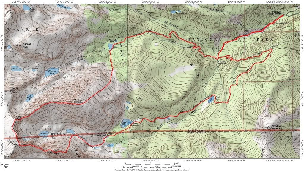
19.8 miles RT, 7500' gain, 12 hours
From Wild Basin TH (8,500 ft), Rocky Mountain National Park
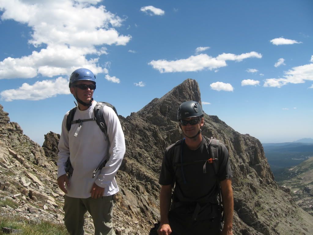
Partners: Mike and John
The weather forecast finally cooperated for a long ridge run in RMNP. John needed these three peaks as he closes in on his Boulder County completion. While I've climbed Ogalalla before I still needed to do Copeland and Elk Tooth. Mike was game for a weekend in the Park and drove up from Avon to join us. It was time for another long adventure in Wild Basin.
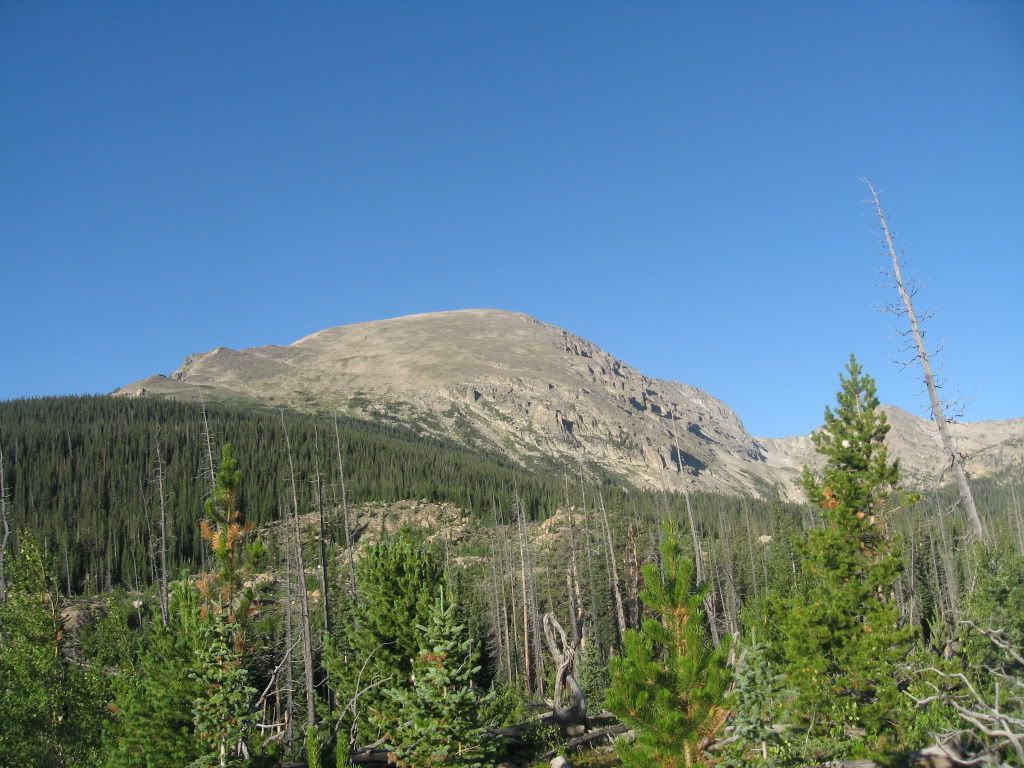
Copeland Mountain NE slopes:
John and I met up with Mike about 6:00 a.m. at the Wild Basin trailhead. This was a free entry day for the national parks but there was still plenty of parking at this hour. Though I'm sure it was to be a crazy busy day in lower Wild Basin we never saw another person until near Finch Lake ten hours later. Solitude can still be found far from the trailheads in this area. The excellent trail system allowed us to cover the five miles to Ouzel Lake in a couple of hours. This 10,000 ft. lake is another one of countless alpine beauties in the Park and a worthy destination in and of itself. We followed a faint trail around to the SW side of the lake and began the bushwhack from there.
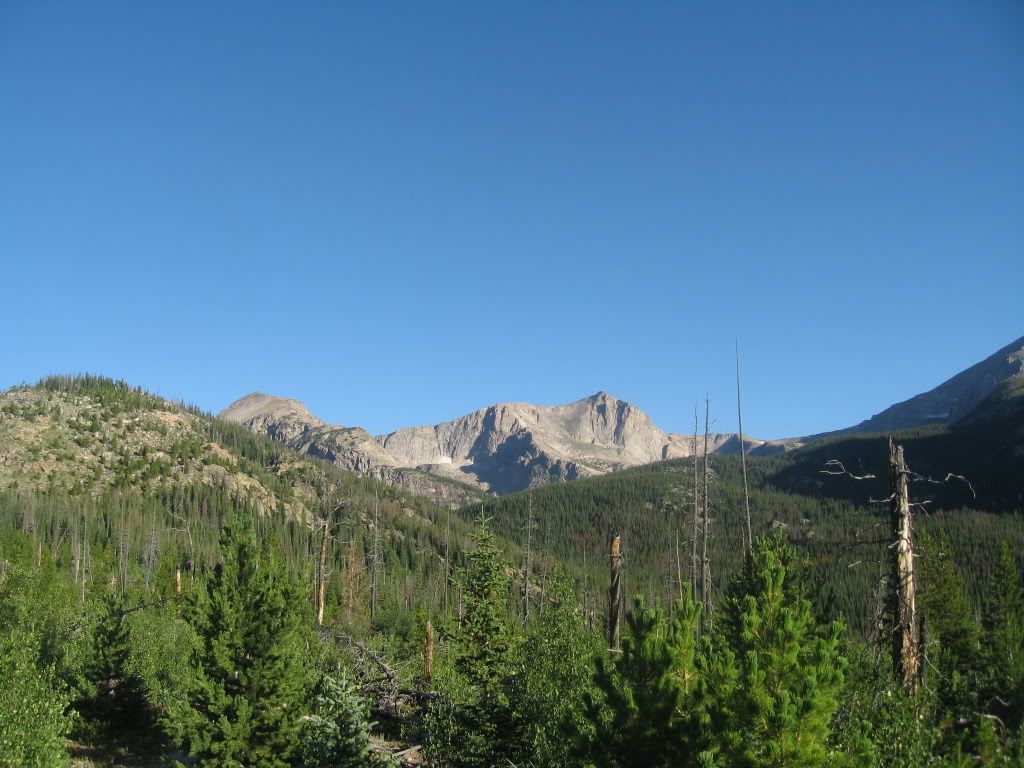
Mount Alice from the trail:
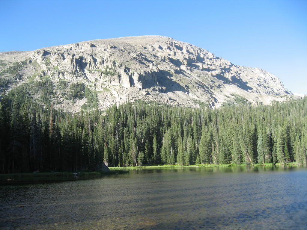
Ouzel Lake below Copeland Mountain:
There was still a lot of work remaining to gain the summit of Copeland Mountain, over 3,000 feet of gain in less than two miles from Ouzel Lake. The bushwhacking in the trees wasn't too bad from where we started up. At treeline we continued up the immense NE slopes across mixed grass and plenty of talus. The summit seemed to never appear until the last few hundred feet due to the rounded nature of the peak. John and Mike soundly beat me to the top as I may have still been feeling the effects of the East-West Partner traverse in the Gore range yesterday. It was great to reach the summit and enjoy the spectacular views of the area. We could plainly see the rest of our day laid out in front of us. Let the ridge run begin!
Ogalalla Peak above Cony Lake:
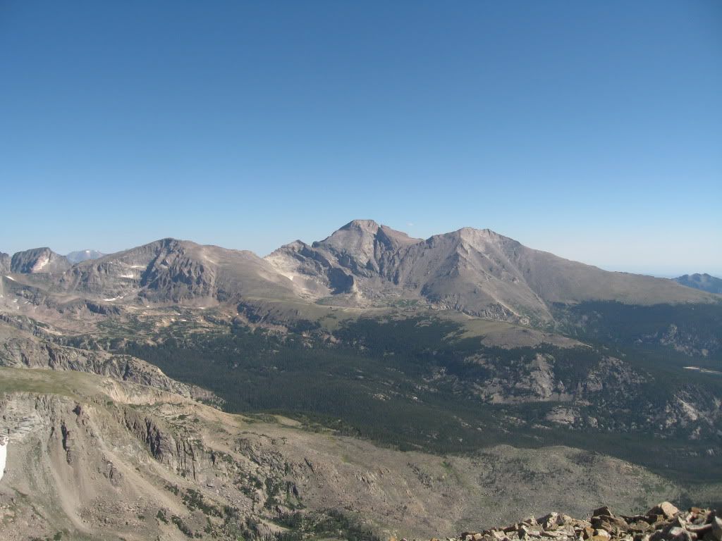
Boulder County giants: McHenrys, Chiefs Head, Pagoda, Longs, Meeker (L to R)
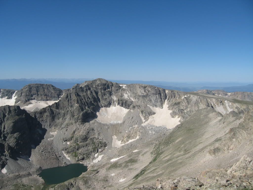
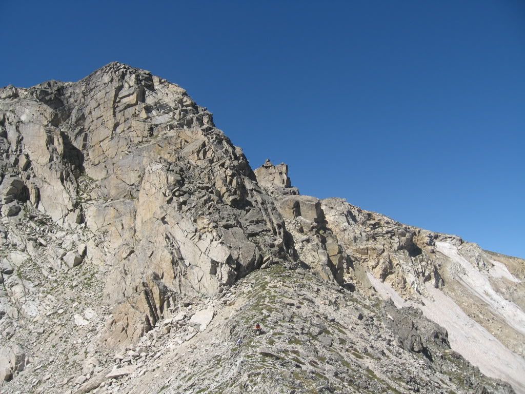
The west ridge of Copeland to the continental divide is quite an undertaking and seldom traveled. We stayed on or near the ridge for the first half of the traverse. A nice ramp led up the south side of the first big tower along the way. When another large ugly tower appeared we traversed left and south of it and wrapped around to Cony Pass. At Cony Pass the headwall of the divide rears up and looks quite improbable. But a short walk to the right brought us to the third class gully and ledge system that goes pretty well right up to the divide. Helmets are essential and great care must be taken here to avoid sending rockfall onto your partners. Once through these difficulties we popped out on the windy divide and finished the short tundra walk to the summit of Ogalalla, the southernmost 13er in the Park. I think it was about noon at this point, but still hardly a cloud in sight.
Cony Pass and the headwall to the continental divide:
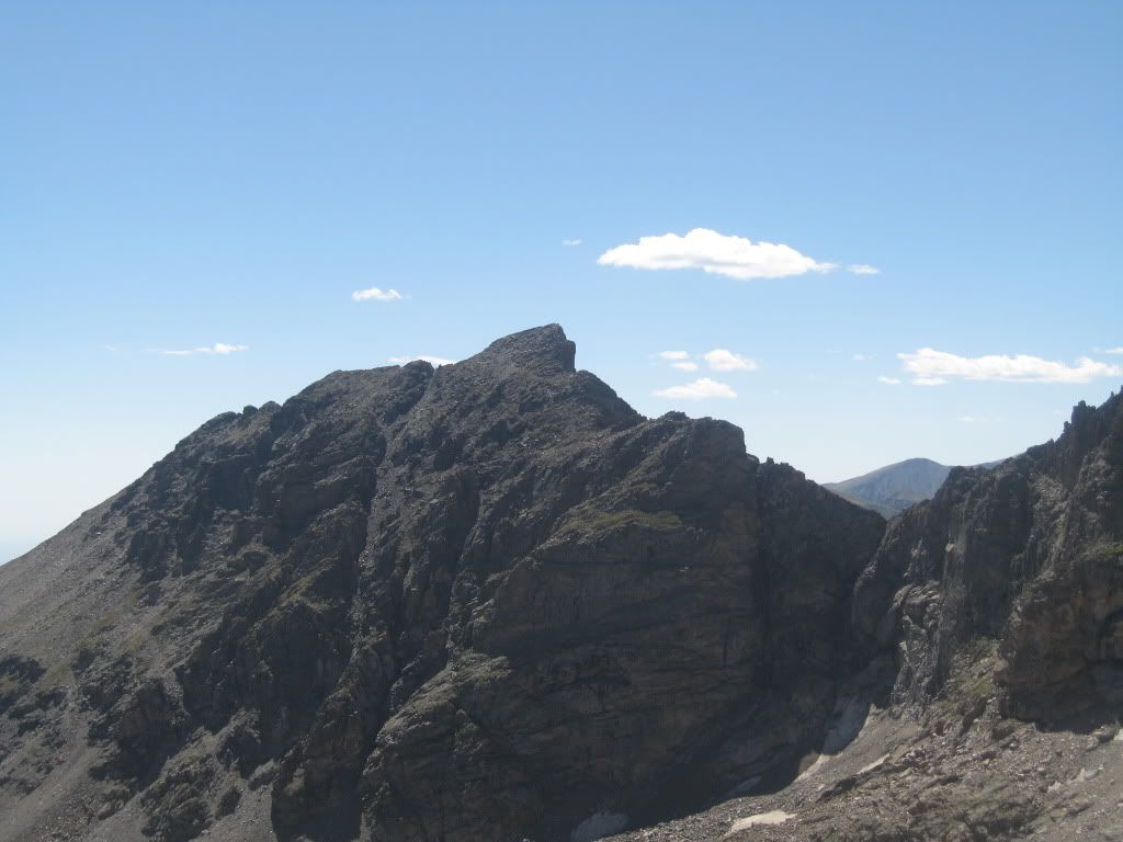
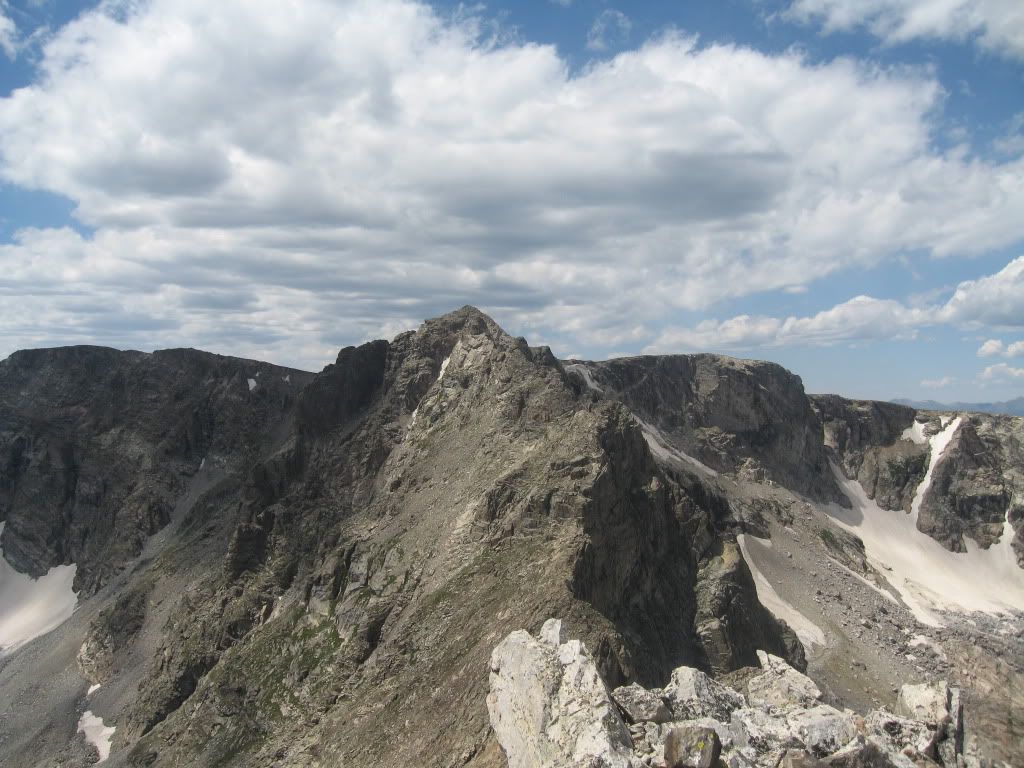
Elk Tooth:
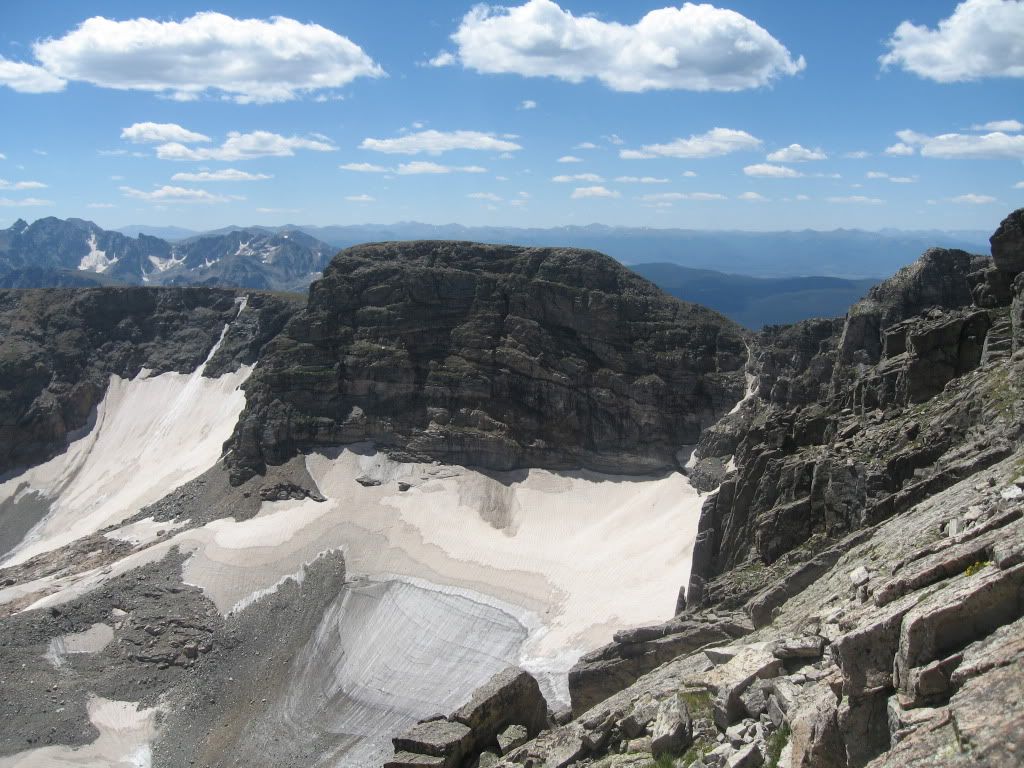
The traverse down from Ogalalla to the Elk Tooth saddle was the best part of the day for me. There wasn't anything terribly hard or dangerous and the rock was solid. We stayed high on the ridge most of the way but eventually had to bypass a huge cliff to the south. After the saddle the terrain changes to something more rotten. The St. Vrain glacier did a mighty carving job on this peak back in the day. John and I traversed east below and Mike took the high road to a prominent gully where we met up in a tiny saddle. This was the crux of the whole traverse, but was still mainly class 3. After that we wrapped around onto the north side where the rock was better. A short climb up the airy ridge had huge exposure on the south side. We were soon on the third and final summit of the day. We could see our entire route around the Cony Lake basin from here. We had covered some major ground but were far from finished.
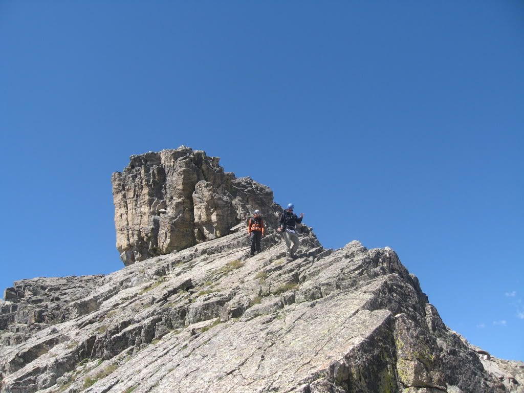
John and Mike on the ridge just below Ogalalla summit:
John and me below Elk Tooth:
"Ooh La La!" above the St. Vrain glacier:
Ogalalla from Elk Tooth:
From the summit of Elk Tooth we continued down the east ridge over one small tower and then left the ridge to the north before the next tower. It was a steep descent on loose talus almost all the way down to Hutcheson Lake. This was the least pleasant part of the day. Once down at the lake we worked our way down the basin past beautiful small lakes, creeks full of fish, and wild country. These remote areas of the Park are most enjoyable to me, far from the crowds of Longs Peak, Glacier Gorge, and Trail Ridge road. We found a hint of a trail that headed down towards larger Pear Lake. Here the real trail begins. We hiked two miles and took a break on the shores of Finch Lake. This lake is shallow with no inlet or outlet and was therefore relatively warm. Of course I had to take a five minute swim, which felt amazing and an almost comfortable water temperature.
Finch Lake:
We flew down the remaining five miles to the Wild Basin trailhead. We chose the fork that goes over to Calypso Cascade instead of taking the Finch Lake trail all the way out. This was a good choice. Wild raspberries were abundant in the old 1978 fire burn zone and I feasted on many of those. We began to see more and more people (and horse manure) but no bear this time. At 6:00 p.m. we finished the 20-mile hike after 12 long hours out. The next day I would return to the Park with the family and rejoin Mike for 12er "Trail Ridge" and 11er Tombstone Ridge along Trail Ridge Road. Mike had the strength to climb Lily Mountain later that evening, way to go Mike. Best wishes to John as he'll complete the 87 ranked peaks of Boulder County on his next hike. I'll get there later this year, 13 more to go for me now. Another great day in Wild Basin!
Thanks for posting Steve, and thanks for inviting me along. I don't know if I really had the strength to climb Lily after this, but I did it anyway Great seeing you this weekend and great taking advantage of two days in the Park, a rare treat for a central mountains guy like me!
Nice work. And thanks for the fine TR, Steve. I have a goal to finish the ranked 13ers in the IPW by year end, and Ogalalla is one of the peaks (wish I had the time to finish the 12ers too, but that will be next year). I haven't yet done the research on Ogalalla routes, but your TR sure provides a headstart. Looks like the traverse to Elk Tooth shouldn't be missed. Thanks for posting the enjoyable report. And congratulations to John. Never met the man, but his soon-to-be-realized goal is one that I share.
Caution: The information contained in this report may not be accurate and should not be the only resource used in preparation for your climb. Failure to have the necessary experience, physical conditioning, supplies or equipment can result in injury or death. 14ers.com and the author(s) of this report provide no warranties, either express or implied, that the information provided is accurate or reliable. By using the information provided, you agree to indemnify and hold harmless 14ers.com and the report author(s) with respect to any claims and demands against them, including any attorney fees and expenses. Please read the 14ers.com Safety and Disclaimer pages for more information.
Please respect private property: 14ers.com supports the rights of private landowners to determine how and by whom their land will be used. In Colorado, it is your responsibility to determine if land is private and to obtain the appropriate permission before entering the property.