Download Agreement, Release, and Acknowledgement of Risk:
You (the person requesting this file download) fully understand mountain climbing ("Activity") involves risks and dangers of serious bodily injury, including permanent disability, paralysis, and death ("Risks") and you fully accept and assume all such risks and all responsibility for losses, costs, and damages you incur as a result of your participation in this Activity.
You acknowledge that information in the file you have chosen to download may not be accurate and may contain errors. You agree to assume all risks when using this information and agree to release and discharge 14ers.com, 14ers Inc. and the author(s) of such information (collectively, the "Released Parties").
You hereby discharge the Released Parties from all damages, actions, claims and liabilities of any nature, specifically including, but not limited to, damages, actions, claims and liabilities arising from or related to the negligence of the Released Parties. You further agree to indemnify, hold harmless and defend 14ers.com, 14ers Inc. and each of the other Released Parties from and against any loss, damage, liability and expense, including costs and attorney fees, incurred by 14ers.com, 14ers Inc. or any of the other Released Parties as a result of you using information provided on the 14ers.com or 14ers Inc. websites.
You have read this agreement, fully understand its terms and intend it to be a complete and unconditional release of all liability to the greatest extent allowed by law and agree that if any portion of this agreement is held to be invalid the balance, notwithstanding, shall continue in full force and effect.
By clicking "OK" you agree to these terms. If you DO NOT agree, click "Cancel"...
I was fortunate to get an invitation to hike Maroon on Sunday with a very solid group of hikers, including Eric (lostsheep5) on his finisher.
We car camped at the trailhead on Saturday night, set the alarm for 1:20 am and hit the trail just about 2am. We were to meet half of the group at Crater Lake at approximately 3am. I think we were a bit early, but we all left Crater Lake around 3am. After that, I didn't want to look at my watch until sunrise.
We got to the bent tree, and past it turned right onto the Maroon trail. The route description is correct to say that the first bit right after the turnoff is steep and indicative. I think that at least half of us were groaning at that 20 foot pitch. For the next hour or two, it was a solid grind to get up that slope. I could sense some exposure at times, but thankfully the darkness kept me in relative bliss.
I had heard of a left and a right trail. I don't recall ever seeing a junction, but we got onto the left trail. There was one spot where we all were a bit lost; perhaps that is where we got onto the left trail. Not having doen the normal route, I imagine that the left route is a pretty good option, because it traverses more, and puts you on a rib. Once on the rib, the trail was more solid, and not so steep. I can't picture exactly where the trail is, but the following shows the approximate area of the left route (orange), approximate area of the standard route (yellow), and about where the cross over is (blue).
So once on the left rib, the trail improved and we grouped up again and reached the ridge right around sunrise. This shot looks down from very near the ridge, you can see the rib we are on. If you notice the point off to the right, I believe we were on that as well, so I think we are about as far south as you could be without dropping into a basin area.
Taking the left route puts you on the ridge one hump to the south of the saddle in the route description. Our "saddle" was only about 10 feet wide. We swapped gear, snacked, and then started our way over the hump, into the true saddle, and perused our remaining route. This shot is from our saddle looking at the backside of the hump to get to the route saddle.
And over the hump, in the route saddle and preparing to get back on route
Steve Gladbach mentioned that in the dark with headlamps, I looked like a motion capture guy with all my reflective bits. Paul snapped this shot that captures the effect. At least the others won't lose me in the dark.
From the saddle to over near the first chimney, the route is mostly just traversing semi steep, semi loose terrain. It was nice to have the sun starting to brighten up the back side.
The chimney was fun scrambling. It is pretty steep, but many handholds/footholds. I believe this shot was taken (by Paul) above the chimney at one of the traverse areas. Mostly the path is clear, wide enough, with handholds in good places when necessary.
Eric, about to round one of the many ribs. One of the few problems we had on the route is that with a group of 6, we occasionally were strung out across several gullies and ribs. The middle folks were the anchors keeping the leader and laggers in sight. We all did each of these three jobs at times.
Rounding a corner, we got our look at the two gully options. We opted to traverse low and take the second (left) gully up. There is a better shot coming up in the report (on the descent) showing the low traverse into the second gully.
This is taken at near the exit of the second gully. This was the only spot on the whole trip where we questioned the route (on the way down). You have to continue down into the narrow steep area if looking for the low traverse exit.
Since this rock formation looked like a good landmark, we tried it as our gully exit, and it worked. I suspect you could have exited higher, but this is at least easy to recognize.
Shortly, we made it into the broad, shallow, loose gully. I stayed on the left edge (ascending), but the trail went up the middle. This was maybe the loosest area on the whole hike, but it didn't take long to get to the top.
From the top of the gully, looking down on the team, and showing one of the exit options on the ledge to the right of the photo. This was a bit spicy, but plenty of solid holds.
Up to this point, it seems that the route was mostly obvious. After this point, it seemed there were more options. I described it to another hiker that there were trails and cairns everywhere, and any wrong choices typically led to class 3+ or 4 or so terrain. About 75% of the time, I was comfortable the whole way, knowing that some of the paths I chose were probably harder than on route. Only about 25% of the time did I backtrack, but when I did, there was always an easy option that I missed. There is a lot of scrambling up, traversing, crossing ribs, etc. This is one of the spots.
There was plenty more route above the broad, shallow gully than I expected. Ultimately, the ledges and traverses put you close enough to the ridge to just go for it. That could be with 150' of climbing or 20' of climbing, but eventually I got sick of the slope and just went up. From the ridge, the rest of the way to the summit was easy.
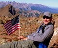
We arrived at the summit at about 8am, and spent about 1.5 hours celebrating Eric's finisher, relaxing and enjoying the great weather.
After that we started down. The route options were much easier to spot from above, and it was easier to see the easy ways at the points where the upclimbing was tougher. One of the steeper areas coming off of the ridgeline.
Back in the broad gully, heading down. Here is where we met the first other climbers we had seen all day. We were careful not to send rocks down.
And the traverse out of the broad gully (on the left partially in the shadow) back to a rib. Passing other climbers heading up.
And an interesting shot somewhere on the traversing. You can see the trail we were on right next to the rock, another one about 5 feet below, and then two options to clear the rib. Easy to see from above, but this was a good example of the route options, and the 10-15' of scrambling to move from one route to another.
And back into the second gully, this shot is taken from the bottom exit, looking back up at the steep narrow area.
And looking back from the traverse out. The second gully is in the shadow on the left. Britt is just exiting, John is about to enter the shadow again, Steve is just in the shadow and Paul is about halfway across the shadow to me. Note the rock formation behind John and you can compare that to photo 9 and see what the route looks like with no people as reference.
Another traverse on the way down. To me it looks like the same photo area as shot #8 if you look at the rock formation just above Eric in #8. One nice thing about a group of 6 is that some lucky photos have good depth perception with folks strung out.
Steve coming down the chimney
And just below the chimney traversing back out
One of Pauls photos showing yours truly coming back across yet another traverse area.
And back to the route saddle, and over the hump down into the left (south) saddle. This is the crew coming off of the hump.
Taken about the same area as photo #2, showing the rib on the way down. As loose as this was, it is about the most solid ground on the slope.
Still working down the rib on the southern part of the "left" route
One of the cliffy areas on the slope, this is one of the spots where you can sense the exposure in the dark.
Near the bottom looking back up. Ultimately, the left trail goes at least to the rib/ridge on the left side of the photo, looking up.
Once we got back to the bottom of the valley, we rested a bit and headed down. We took a lot of breaks the whole trip, including packing up camp at Crater Lake. This made the trip a 12 hr total for us. Probably with at least 2 - 3 hours of break built in.
Aside from the east slope to the ridge, the route is a blast. Probably one of the most complicated route finding 14ers I have done, but a great balance of challenge and fun on the backside. It was great having the experienced group, and several sets of eyes looking at the route. If I could get transported to and from the saddle, I could repeat this route often. It is a shame that the 2800' of suck will likely keep me off this route for a while, because the last bit was FUN.
Thanks for reading, and thanks to the strong crew: Britt, Eric, John, Paul, and Steve for letting me join you and congratulations to Eric on his finisher.
Thumbnails for uploaded photos (click to open slideshow):
I went with a climber who had climbed the bells 3 times. He took us left to gain the ridge. From what he was saying it was much easier and made little impression to me since it was done in the dark and we descended N Maroon
You did an excellent job of taking us through the route as much as is practical. Having a solid group like that certainly makes climbing that peak safer and more enjoyable as it did on our climb the previous day with Eric on Pyramid.
Very impressive report and loved the photos. I note that you live in Houston and are close to finishing all 54. Being a Houston area resident as well I find that very impressive. Enjoyed your Whetterhorn report as well as it is on our calendar for this September.
Your photos are great and I agree, having that many people in the group does add depth and perspective to the pictures. Really like the silhouette of Eric on the ridge. Thanks for posting. Happy trails!
thanks for putting up the trip report. What a great day to be out. The weather was perfect, the crew was awesome to climb with, and to celebrate with Eric...priceless!
And you added the trip report to boot. It doesn't get any better than this. Thanks to each and all of you.
I really enjoyed reading your report and the pics were great. We made it to the ridge but turned back due to time of day. I'll be trying again next year.
Thanks for putting this one up, I plan to have one up in the next week or two. Football and school are getting heavy...Great to meet you and I hope to climb with you again
Caution: The information contained in this report may not be accurate and should not be the only resource used in preparation for your climb. Failure to have the necessary experience, physical conditioning, supplies or equipment can result in injury or death. 14ers.com and the author(s) of this report provide no warranties, either express or implied, that the information provided is accurate or reliable. By using the information provided, you agree to indemnify and hold harmless 14ers.com and the report author(s) with respect to any claims and demands against them, including any attorney fees and expenses. Please read the 14ers.com Safety and Disclaimer pages for more information.
Please respect private property: 14ers.com supports the rights of private landowners to determine how and by whom their land will be used. In Colorado, it is your responsibility to determine if land is private and to obtain the appropriate permission before entering the property.


")
")
")
")
")
")
")
")
")
")
")
")
")
")
")
")
")
")
")
")
")
")
")
")
")
")
")
")
")
")