| Peak(s): |
Grays Peak - 14,275 feet Mt. Edwards - 13,860 feet Argentine Peak - 13,743 feet Ruby Mountain - 13,278 feet |
| Date Posted: | 08/23/2009 |
| Modified: | 07/24/2018 |
| Date Climbed: | 08/23/2009 |
| Author: | d_baker |
| Peak(s): |
Grays Peak - 14,275 feet Mt. Edwards - 13,860 feet Argentine Peak - 13,743 feet Ruby Mountain - 13,278 feet |
| Date Posted: | 08/23/2009 |
| Modified: | 07/24/2018 |
| Date Climbed: | 08/23/2009 |
| Author: | d_baker |
| Ruby to Grays to Edwards to Argentine to bed |
|---|
|
August 23, 2009 Ruby Mountain (13,277') Grays Peak (14,270') Mount Edwards (13,850') Argentine Peak (13,738') Front Range Hikers: Sam Campbell and Darin Baker Approach: Horseshoe Basin (starting at the Shoe Basin Mine) Route(s): E ridge of Ruby, S ridge of Grays, W ridge of Edwards, N ridge of Argentine Distance: ~9 miles RT (roundtrip) Elevation Gain: ~4950' Time to Complete: 8.5 hrs Gear: Daypack w/Essentials, helmet Resources used for Trip Planning: summitpost.org (see Ruby Mountain page), Roach's 14er book for trailhead directions, a map, and some route information (on Grays south ridge) provided in a trip report by Kevin Baker Foreword Mount Edwards sits at #83 in the top 100 highest in Colorado, and Edwards has been on my "to do list" for a while. I considered a possible winter attempt, but I prefer my winter suffering to come in the form of "getting pumped" on vertical ice, and of course freezing my a$$ off at the belay. Another thought I had was a snow climb in late spring, via the Edwardian couloir. Spring came, but an opportunity to climb the couloir didn't happen. Now summer is waning, and I've been to the San Juan's four times, the Elks twice, and the southern Sangre's once. I think I need a weekend closer to home. Edwards is still on my list. But I wanted an interesting way to hike it. A trip report by Kevin Baker from a couple of weeks ago gave me an idea. Kevin did a tour starting from Stevens Gulch, and on his tour he came down the south ridge of Grays so he could summit Ruby. He said the ridge turned out to be a nice scramble. Hmm. I could go up Ruby Mountain first, then get a nice scramble up the south ridge to Grays, and from there, finally get over to Edwards. And then maybe add Argentine Peak. Sounds like a good plan to me! Now to find a partner. Sam, a regular and reliable climbing partner of mine, was looking for something to do, and he's usually game for a nice high peak workout. Problem solved, partner found. We left my house in Manitou around 5pm on Saturday, to make the drive up Peru Creek to Horseshoe Basin for a car camp. We found the gate closed and locked just above the Shoe Basin Mine, so we parked in the lot there and camped. The Tour We set our alarms for 5am and were going up the road by 5:30am. The temperature was probably in the mid-40's already. Using a route description for Ruby Mountain found on summitpost, we started looking for the east ridge to ascend. 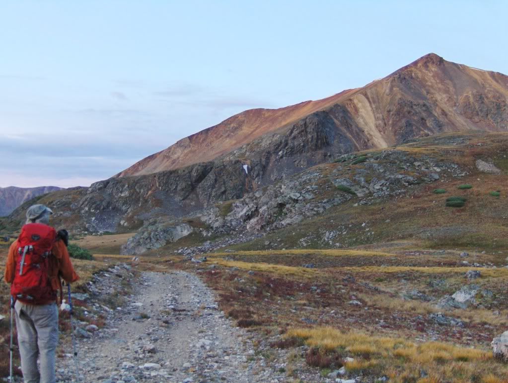 Looking at the east ridge of Ruby Mountain. We went to the far left on the grassy benches and ascended from there. Once it came into view, we decided to stay on the south side of the ridge, more or less staying on the SE face as we headed up toward the summit ridge. We were sweating in no time as this was a steep grassy grunt to gain the ridge! 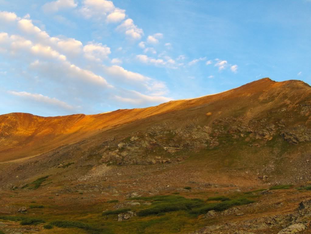 Looking up at the face we ascended. We stayed right of center and went up the grass in between the rocks. The summit is to the left in this picture. We hit the ridge (just south of the false summit) at 7:15am and five minutes later we were on our first summit of the day. We then looked to our next objective, the south ridge of Grays Peak. 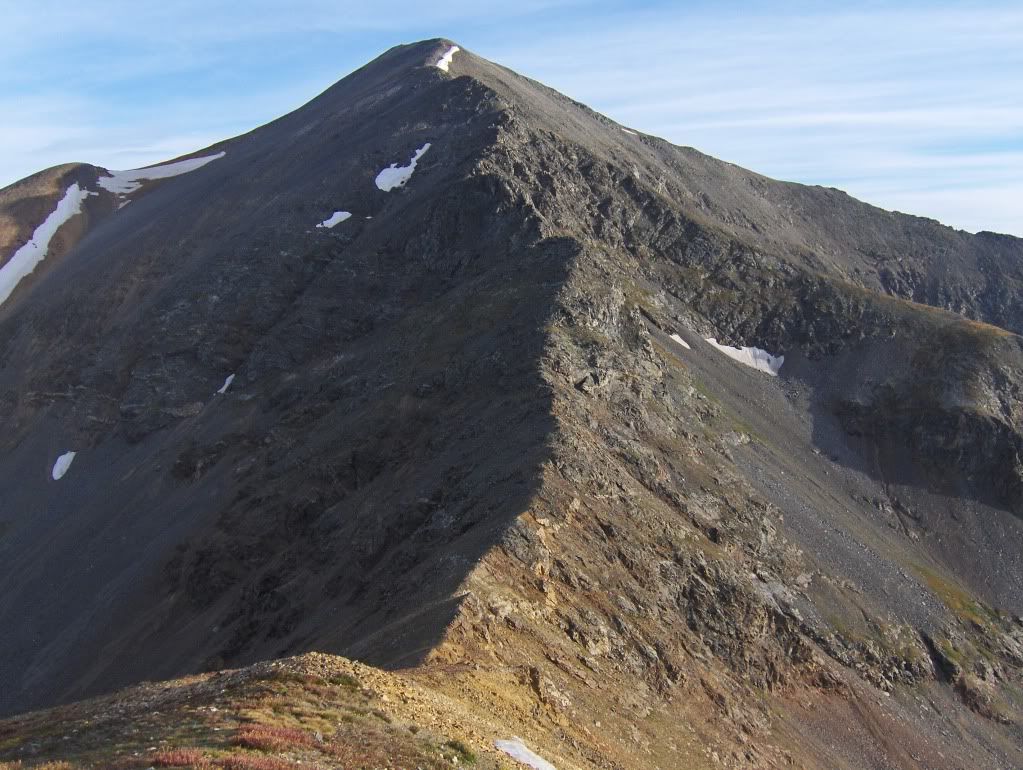 View of south ridge on Grays, as seen from Ruby Mountain. We left Ruby's summit and headed north to the saddle between the two peaks. Once at the saddle, we took a 10 minute break to fuel up, apply sunscreen, and put our helmets on. Then it was go time! 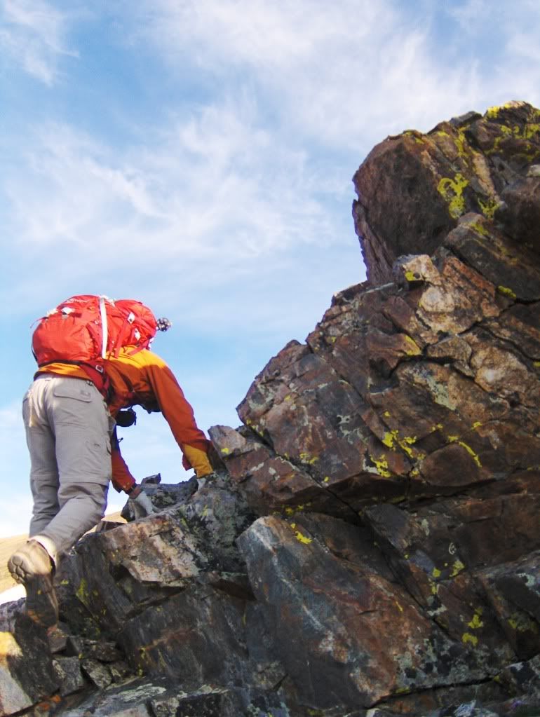 Sam on some early and good scrambling along the ridge. Starting out, we stayed on the crest of the ridge, until we came to the first big headwall along the ridge. 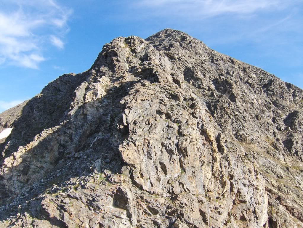 First headwall along the ridge (center of picture). We bypassed this first obstacle using ramps on the west side (left) of the ridge. We passed one gully, went beyond a rib, and then used the next gully to head back up to the ridge. 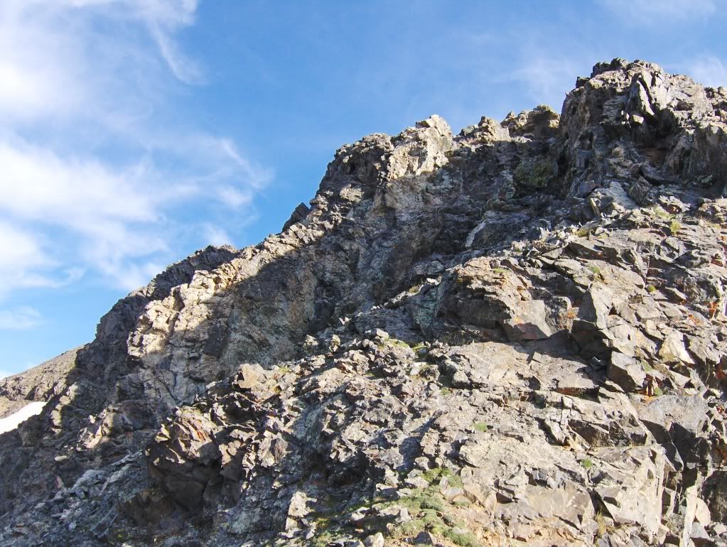 We went up this section, going to the notch that's right of center. Going up the gully wasn't a big deal because it was mostly grass ramps mixed in with a few scrambling moves on good rock. To get back onto the ridge, we did a short class 4 section, but only because we wanted to. There was a class 3 ramp below it that avoided the move. Here's Sam making the class 4 move... 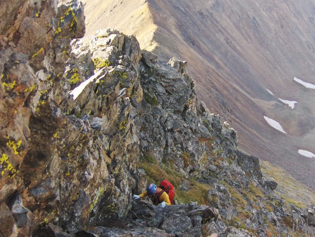 Once back onto the ridge, we stayed on the crest, or sometimes staying just to the east (right) side. We came upon a notch that was easily down climbed facing out, and from there went up a gully that is left of the center of the ridge. This gully led us back up to the ridge and eventually to another notch. At the notch, we could see viable options to the west and east sides. The east side looked more inviting to me, because I could see a possible way back to the ridge by going up a shallow dihedral. To get to the dihedral, we first had to go along the east side on a ledge system. 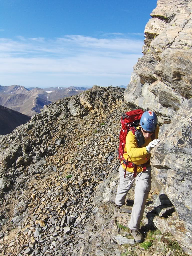 Sam coming across the narrow ledge system on the east side of the ridge. Once beyond the ten foot long ledge, we came to ledges that led us up to the base of a gully that would lead us up to the dihedral. 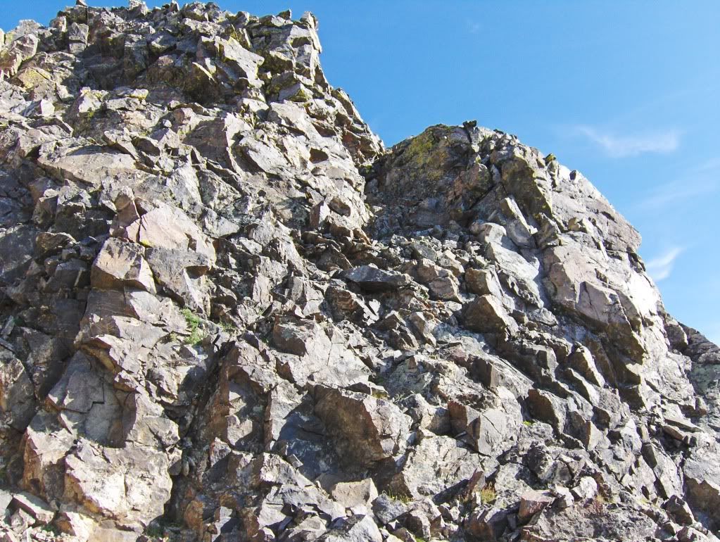 Looking up the gully leading to the dihedral. Sam making the entrance moves to the gully.... 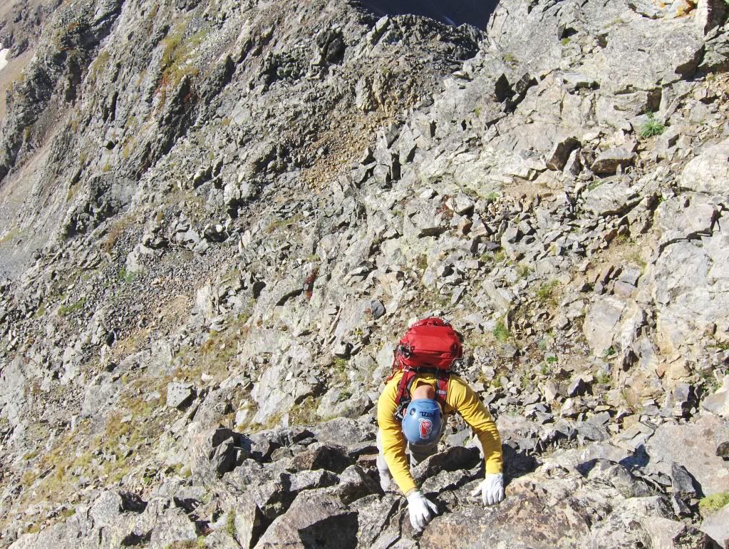 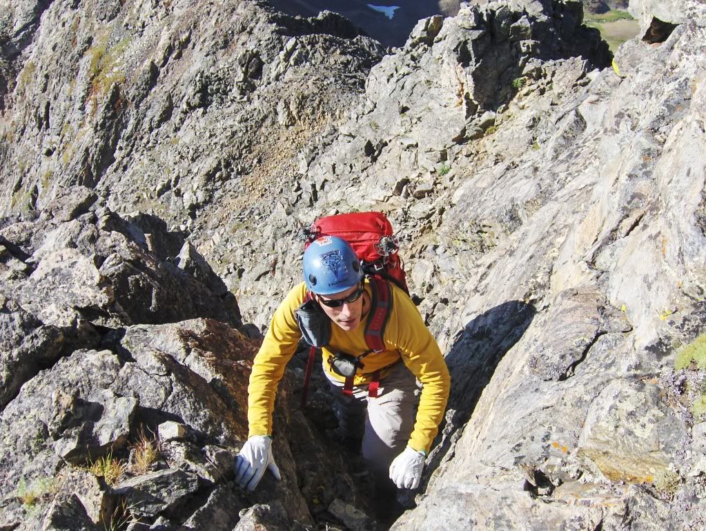 And here's Sam coming through the dihedral. From the top of the dihedral, there're a few more class three moves, and then it's a walk to the summit of Grays Peak. (Note: The scrambling sections along the ridge took us over an hour to complete.) Also above the dihedral move is where the SE (southeast) ridge route connects. 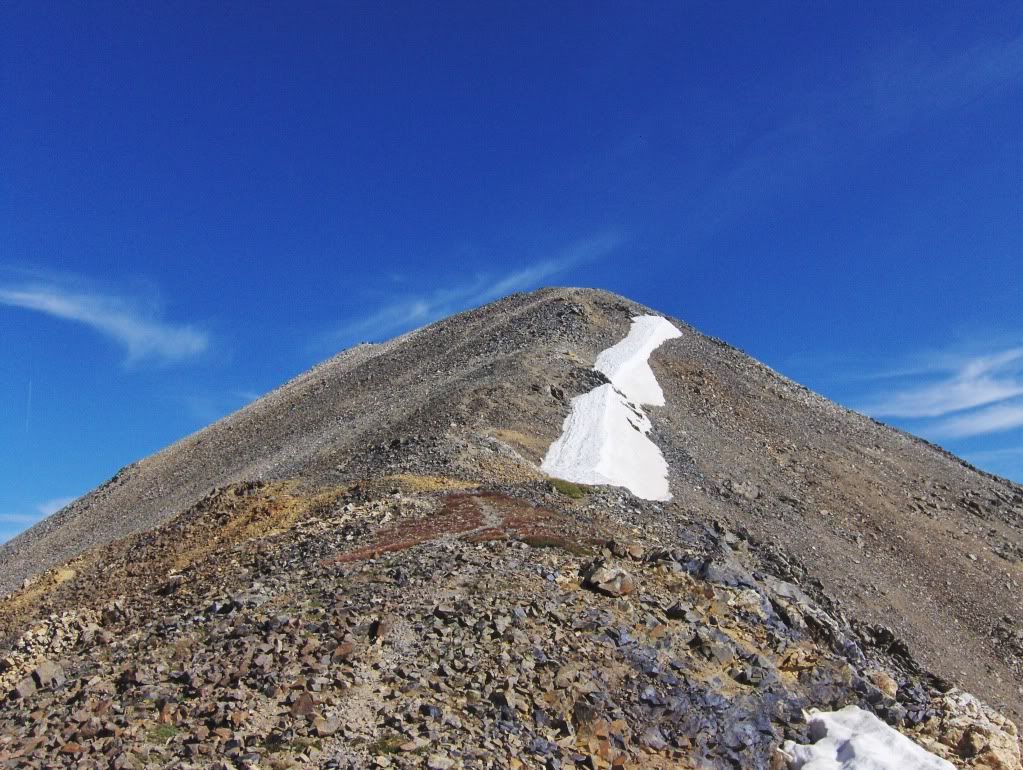 Final portion of the south ridge on Grays. The summit is to the left. We reached the summit of Grays at 9:30. After a short break, we headed down the ("standard") north slopes route for a couple of switchbacks before heading east across the talus for our approach to Mount Edwards. I was actually surprised with the west ridge of Edwards. I think it's a nice class 2+ rock hopping ridge, but with a few up's and down's along the way. It was also nice to have solitude once again. We were on the summit of Mount Edwards at 10:55. 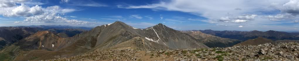 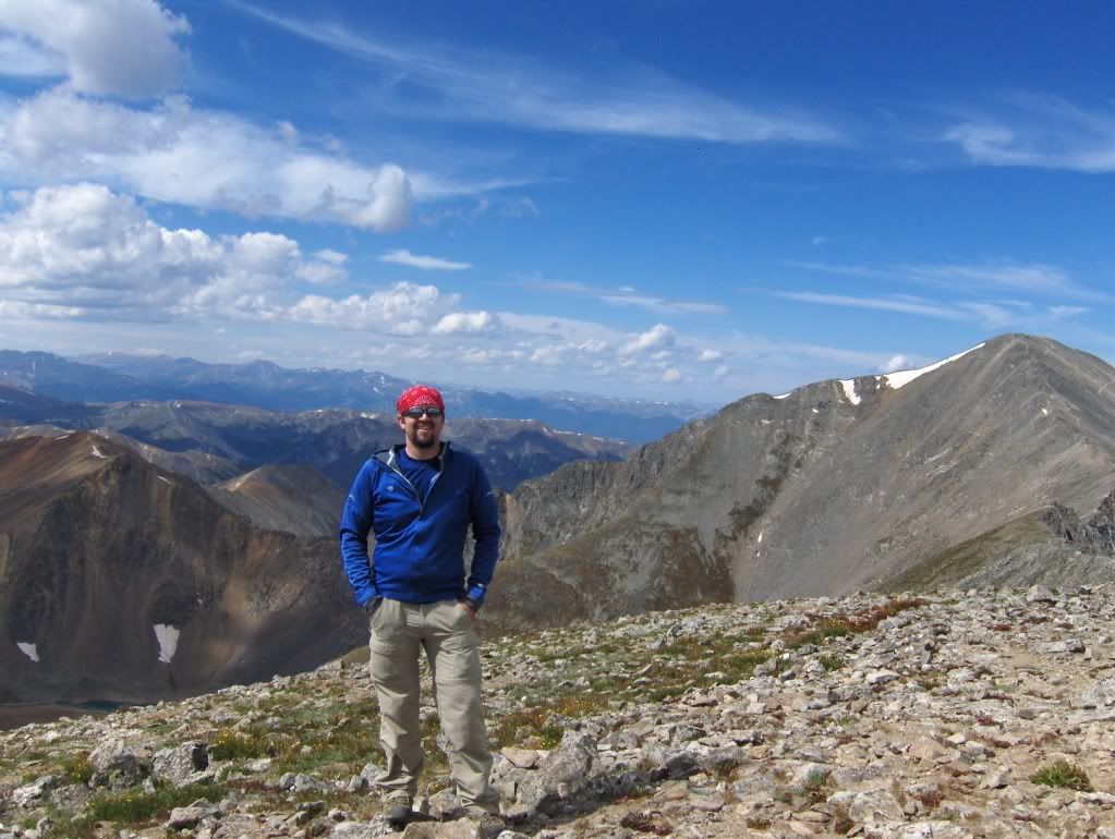 Me on the summit of Mount Edwards. Grays Peak is to the right (in the picture). This made me laugh... 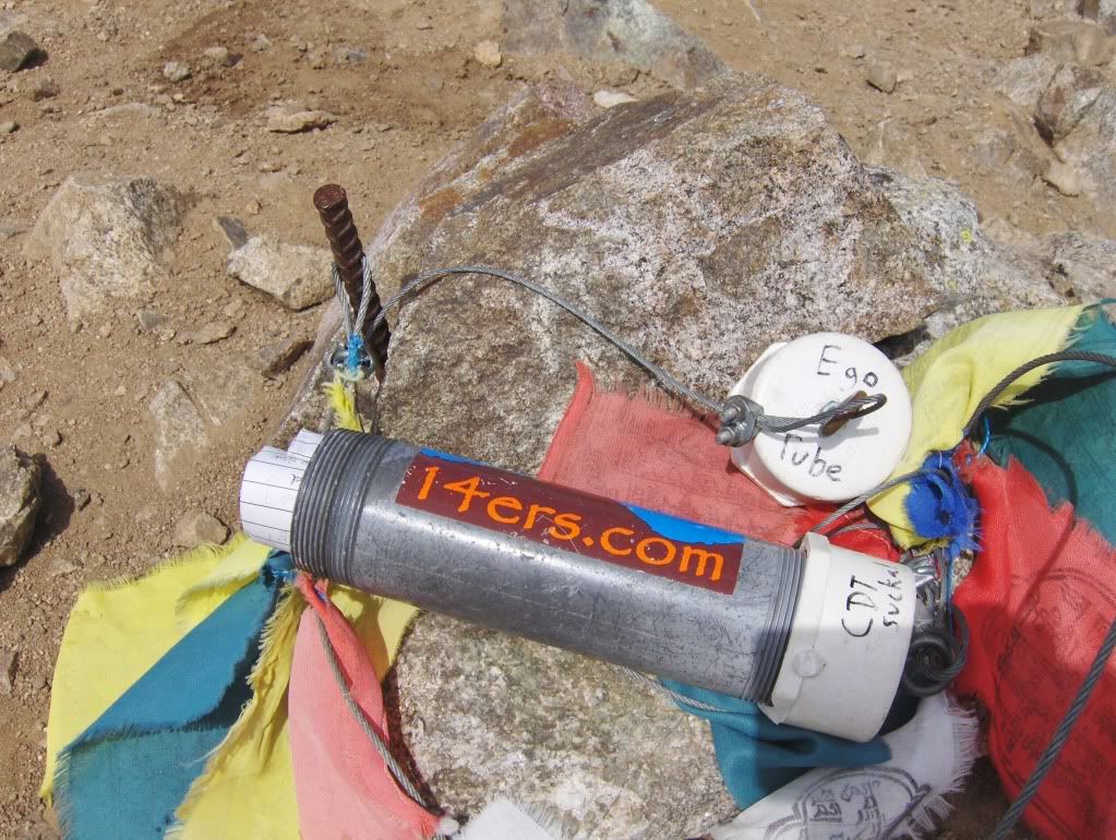 Look at the cap. I fed my ego by signing the register! We left Edwards by 11:20, only to be slowed by traffic while en route to Argentine Peak... 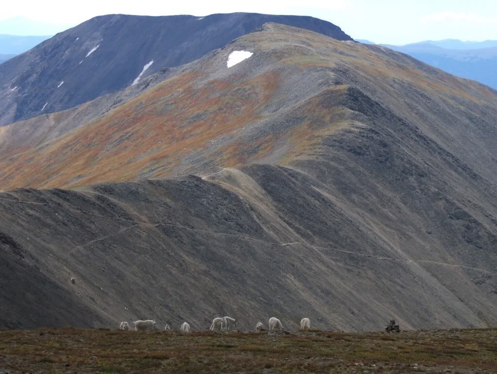 Goats (foreground) Argentine Peak, and Square Top Mountain (in the distance). 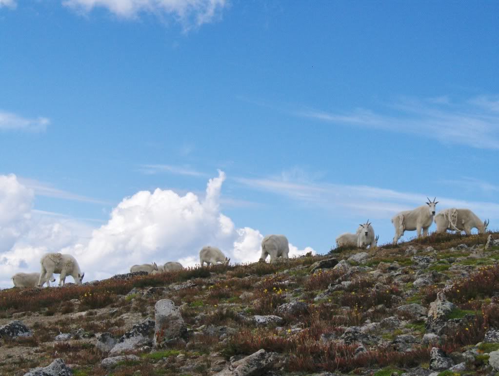 "What are you looking at?" Can anyone else see the cloud in the center that looks like a demon child (face up)? The bushy hair is to the left, then to the right is the forehead, nose and eye, and he's spewing something out of his mouth. Maybe it's just me... The ridge walk to Argentine was long and a little tiring. While on our way over, I took this picture of the south ridge on Grays... 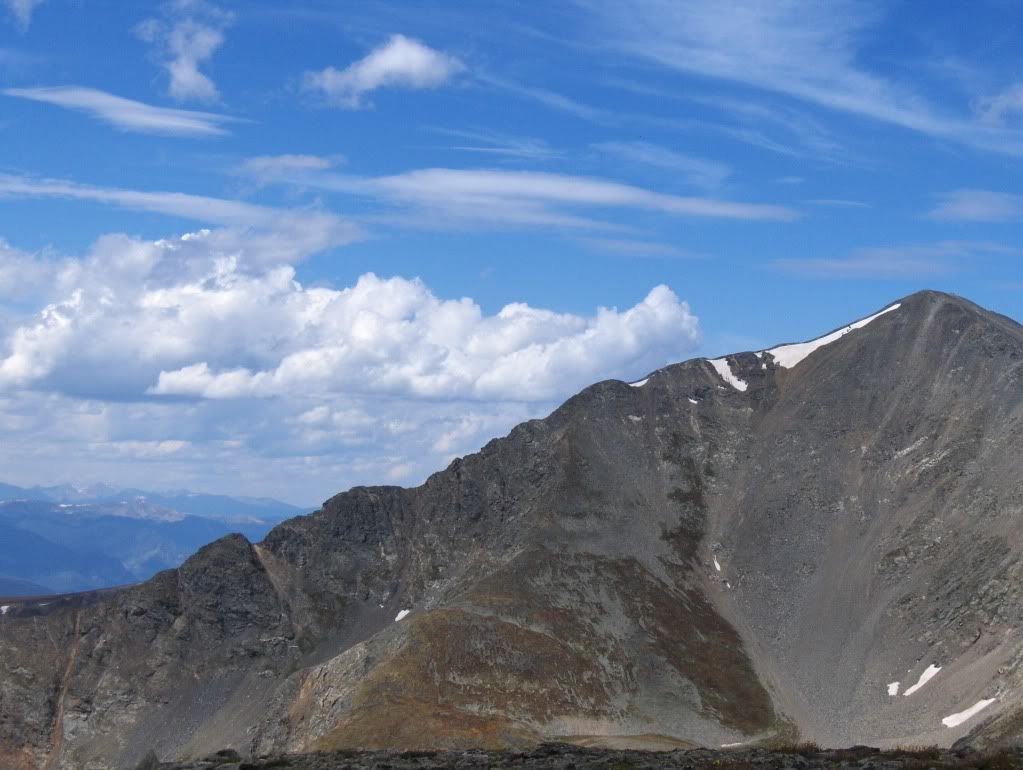 We finally arrived at the summit of Argentine Peak (our fourth and final peak of the day) at 12:35pm. 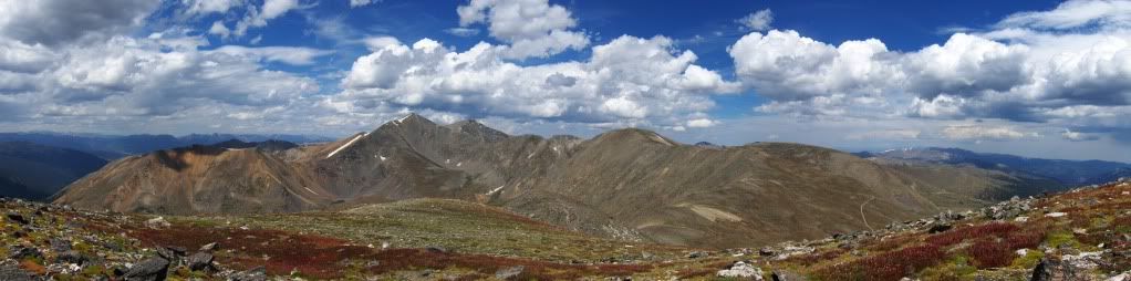 A pan of our whole traverse. We didn't stay on the summit long, maybe 3 minutes, before starting off for the worst part of the day; we took a direct line west off of the summit. Steep. My problematic right ITB and knee were not happy with me at this point. Once at the bottom of the slope, we were able to connect with the Argentine Pass trail, which we took back to the road and finally back to the truck at 2pm. Phew! Hindsight & Personal Notes I wanted an interesting way to hike/climb Edwards, and I got it! This was a cool and fun tour. As Kevin mentioned in his report (in regards to the south ridge of Grays), this route is a nice alternative to the "norm" for this popular 14er, and I agree. If someone were to climb this route only (on Grays), it would be easy to descend the SE ridge route that Roach describes in his book. Getting on the route would likely be the worst part, because you would need to ascend the gully of scree/dirt/crap that reaches the saddle between Grays and Ruby. Regardless, this is a great line up a popular 14er that probably doesn't see much traffic. Sam and I were able to stay on the ridge almost the entire time, mostly due to teamwork with route finding and support. The rock is good, in fact not once did we knock anything off. Not to say that there's not any loose rock, and care still needs to be taken. Thanks for reading, Darin 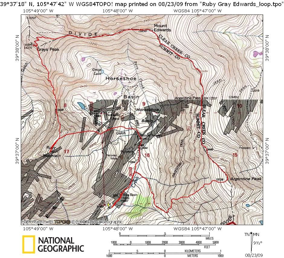 The map above is our approximate tour/route. |
| Comments or Questions | ||||||||||||
|---|---|---|---|---|---|---|---|---|---|---|---|---|
|
Caution: The information contained in this report may not be accurate and should not be the only resource used in preparation for your climb. Failure to have the necessary experience, physical conditioning, supplies or equipment can result in injury or death. 14ers.com and the author(s) of this report provide no warranties, either express or implied, that the information provided is accurate or reliable. By using the information provided, you agree to indemnify and hold harmless 14ers.com and the report author(s) with respect to any claims and demands against them, including any attorney fees and expenses. Please read the 14ers.com Safety and Disclaimer pages for more information.


