Download Agreement, Release, and Acknowledgement of Risk:
You (the person requesting this file download) fully understand mountain climbing ("Activity") involves risks and dangers of serious bodily injury, including permanent disability, paralysis, and death ("Risks") and you fully accept and assume all such risks and all responsibility for losses, costs, and damages you incur as a result of your participation in this Activity.
You acknowledge that information in the file you have chosen to download may not be accurate and may contain errors. You agree to assume all risks when using this information and agree to release and discharge 14ers.com, 14ers Inc. and the author(s) of such information (collectively, the "Released Parties").
You hereby discharge the Released Parties from all damages, actions, claims and liabilities of any nature, specifically including, but not limited to, damages, actions, claims and liabilities arising from or related to the negligence of the Released Parties. You further agree to indemnify, hold harmless and defend 14ers.com, 14ers Inc. and each of the other Released Parties from and against any loss, damage, liability and expense, including costs and attorney fees, incurred by 14ers.com, 14ers Inc. or any of the other Released Parties as a result of you using information provided on the 14ers.com or 14ers Inc. websites.
You have read this agreement, fully understand its terms and intend it to be a complete and unconditional release of all liability to the greatest extent allowed by law and agree that if any portion of this agreement is held to be invalid the balance, notwithstanding, shall continue in full force and effect.
By clicking "OK" you agree to these terms. If you DO NOT agree, click "Cancel"...
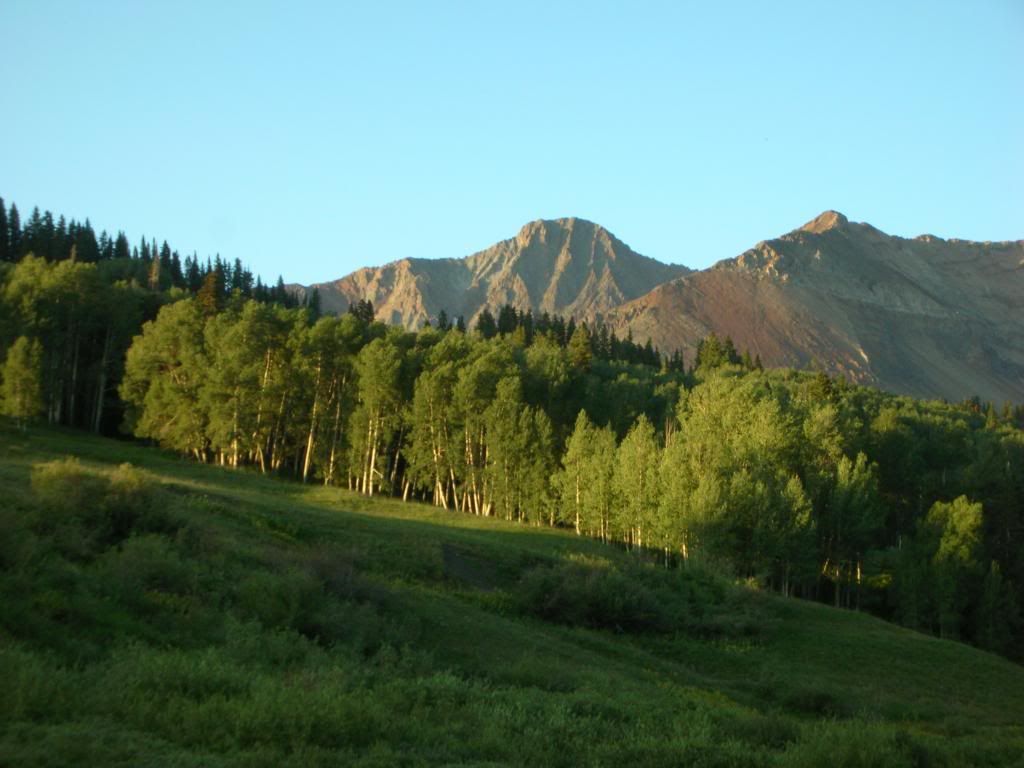
Crew: Me and Ben (Benners) Stats: DAY 1 Sneffels - 6.5 miles, 3000 feet
DAY 2 Wilson Group - 22 miles, approx 8000 vertical, 16.5 hours from Kilpacker
There was a time when I had no interest in finishing the fourteeners. I had hiked a lot in high school and college, and after finishing all the class 1-2 fourteeners relatively close to the metro area I didn't even consider attempting the harder ones. For one thing, most were far from Denver and I had heard terrifying tales of having to walk across razor sharp ridgelines with certain death awaiting any mistake. But 3 years ago Benners made me climb Pyramid. Yes, MADE me. He simply wouldn't take no for an answer, and since that day I have had an almost insatiable appetite for climbing all of our state's high peaks.
Considering Benners and I have climbed half of the fourteeners together, I wanted to finish with him, but we didn't have a lot of options. Because of my job and Ben's school schedule, we had only one weekend that we could both swing the trip. We had four days to snag Sneffels and the Wilson group (including two days of driving), so everything would have to proceed smoothly for the trip to be a success. We left Denver early Thursday morning and enjoyed the drive via 285/50 until we arrived at the Amphitheatre Campground just south of Ouray. My wife and baby boy Owen were also joining us for some camping and we settled in to the site and grilled hot dogs and corn on the grill. After some good grub we turned in with alarms set for 4:00am.
Day 1- Sneffels:
Upon starting hiking at 5:00am from the lower trailhead at Yankee Boy Basin, we made the unpleasant discovery that it was freezing outside. It would continue to be both windy and very cold throughout the day, but we took our minds off of the issue by discussing Einstein's theory of relativity and its implications on our faith in God (yes, seriously...apparently we are nerds). Ben is reading a book called "The Elegant Universe" and wanted to talk physics. I was enjoying the conversation and it made the time fly by until eventually our discussion was forced back to the task at hand; we decided to give the SW ridge a try, and we made pretty decent time to Blue Lakes Pass:
Beginning the SW ridge:
We don't have many pictures from Sneffels at all because it was so cold and the wind was blowing so hard. Except for the winter, I don't remember ever experiencing such strong winds, and they unnerved me towards the top where the ridge became narrow and the exposure more severe. I even back-tracked a short section to go below the ridge crest because I was terrified of being knocked off by the 40-60 mph winds. Ben didn't seem to be bothered with it though, and we continued to the summit without any further problem.
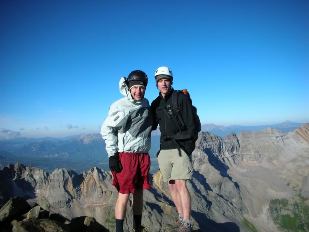
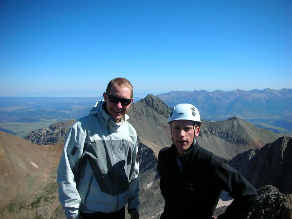
Ben and I looking miserable on the summit:
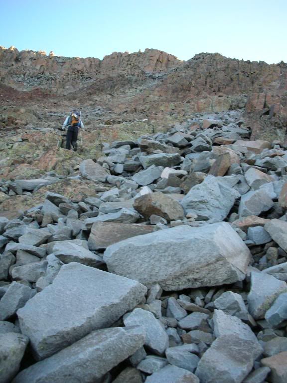
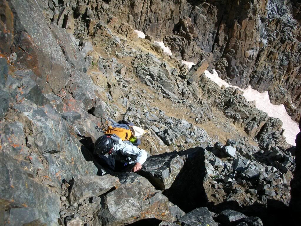
We decided to descend the standard route and found a small patch of snow that could be barely bypassed on our left hand side. I had heard horrible things about this gulley, but found it much more pleasant than some others that I have climbed, namely Lindsey's standard route. Still, the bottom of the gulley held some very large rocks that were shockingly loose and appeared to be very dangerous. I later learned that the day after we climbed Sneffels there was a vast amount of rock fall in this couloir (with injuries), so be extremely careful, and wear a helmet. The lower part of the standard route is incredibly loose ball bearings, but Ben and I had fun trying to surf down as fast as possible, because the wind was making things miserable, even throwing small pebbles into our eyes. Before we knew it, we had returned to the basin. We drove back to the campsite for lunch and threw around the baseball and Frisbee, went into town, made dinner, and tried to catch some sleep for day 2.
Day 2- Wilson Group:
To be honest, the Wilsons have always made me really nervous. Especially concerning and poignant is the TR of an attempted El-Diente-Mt Wilson traverse by DeTour. Thinking about their horrific day had kept me up the night before (though my general inability to sleep while camping contributed). Still, I was thrilled at the prospect of finishing, even if it would be a grueling day. No matter how you slice it, our plans for that day were big; Beginning from Kilpacker TH, the plan was to summit El Diente from the south, traverse to Mt Wilson, descend the standard route into the Navajo Basin, climb Wilson Peak and then return via Navajo Basin until a small spur trail hooked us back up with the Kilpacker trail. In total, 22.5 miles and just under 8000 vertical as far as we could piece together (information on combinations from Kilpacker is slim).
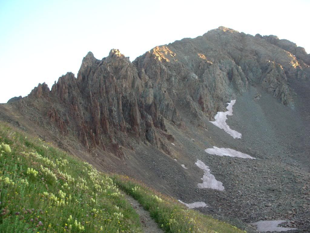
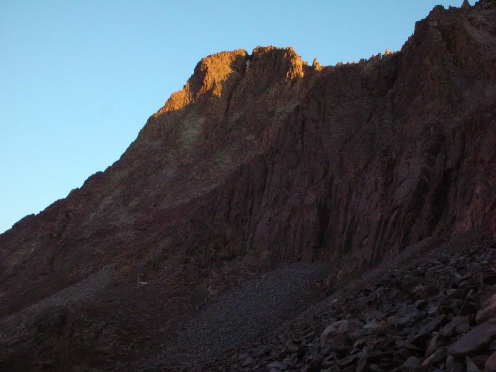
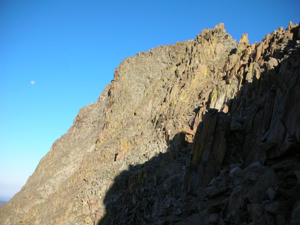
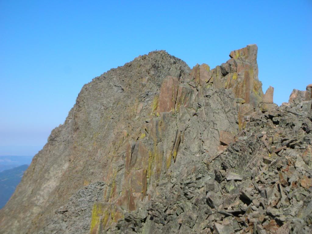
We awoke at 12:15am, and left the camp site in Ouray by 12:45. At 3:00am we started hiking in. Neither of us was feeling well, and the norm for us while climbing in the dark is to discuss the strength of our desire to still be asleep. This was especially true for me today. I did not feel strong, and it was cold and windy like the day before on Sneffels. This feeling always wears off when the sun starts to rise, so the hard part is just to push through the psychological barrier and remember how much I love to climb mountains. This would be a great day. We had a 5 minute issue finding the trail that traverses the "dinner plate" scree section into the Kilpacker Basin, but we resolved it quickly and before we knew it found ourselves looking up at the massive orange tooth just as the sun was rising:
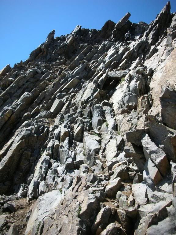
The premise of the route is simple, follow the basin until you reach an obvious (if you study the route) ascending traverse to the west under the summit. From there the route climbs up toward the base of the organ pipes, where it joins the North Slopes route. We found it to be well cairned except for the turn from the basin towards the west, but we might have just lost the trail for a few minutes. Ben and I agreed that the line the route takes is intuitive, and really the only logical one. Just make sure you climb far enough east in the basin before you make your ascending traverse back west. This avoids the cliff bands near the bottom of El Diente's south face.
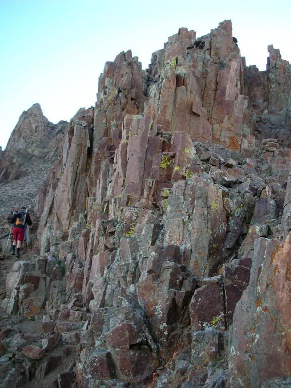
Making our way up the face:
El Diente and the Moon:
El Diente's reputation is horribly loose rock and sketchy exposed climbing, but I found this route to be a lot of fun, and even delightfully solid as we got closer to the Organ Pipes. I was having a great time and my nervous feelings were long gone by the time we reached the last north facing gulley near the top. A bit of scrambling and we were standing on the summit of Colorado's westernmost 14er. The time was 7:45am.
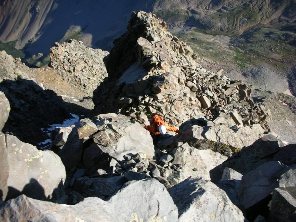
Ben climbing the last pitch:
I signed the register and we snapped a couple of photos before taking a nice long break to enjoy the views and refuel. The weather was perfectly clear and beautiful. The traverse was definitely a go:
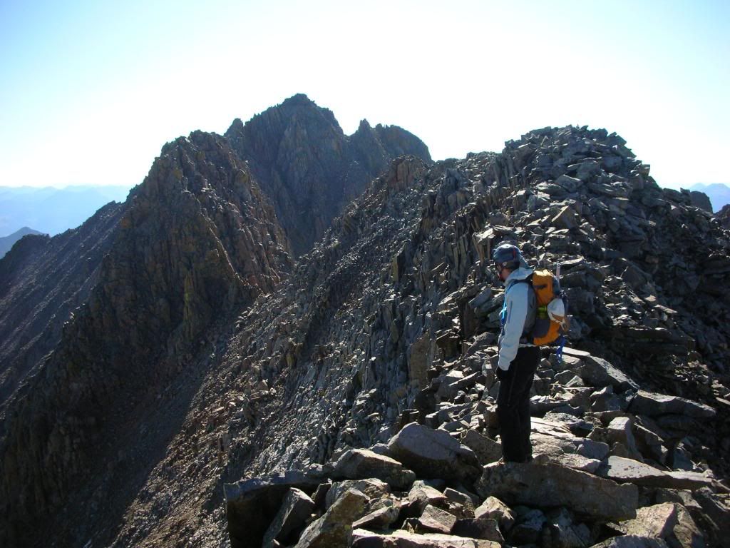
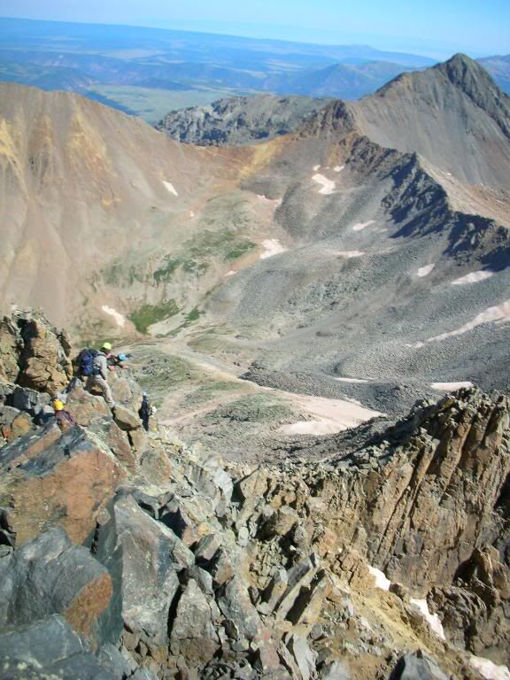
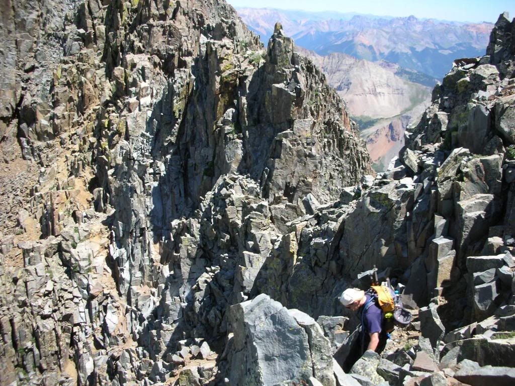
At 8:30am we left El Diente's summit and retraced our ascent route to the base of the Organ Pipes until we reached the turnoff for the North Slopes descent. Our next step was to cross the Gendarmes that block easy passage to the ridge crest. We were undecided as to whether we would take the high or low ground, but ended up staying high. This afforded us the opportunity to make some exposed, but otherwise low risk traversing moves, and I was enjoying the climbing immensely. I recommend the higher route unless you are concerned about the difficulty, but if you have 3rd class experience I would say you will be fine. Eventually the cliffs above us began to relent and a short climb brought us to the ridge crest where we continued for most of the remainder of the traverse.
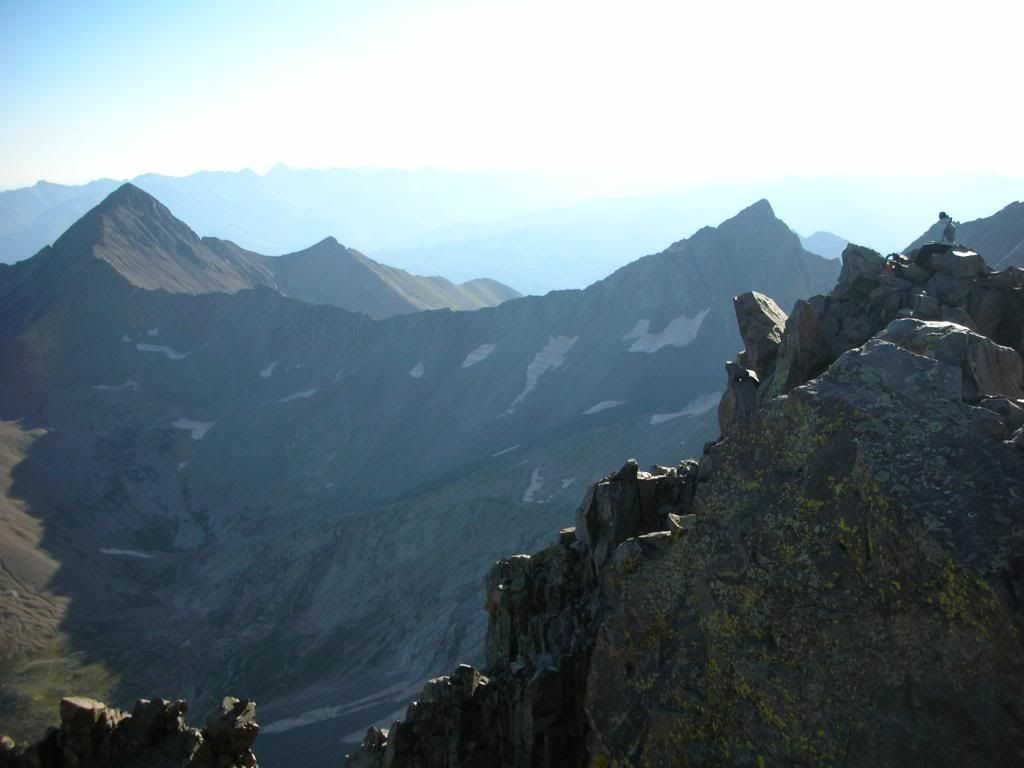
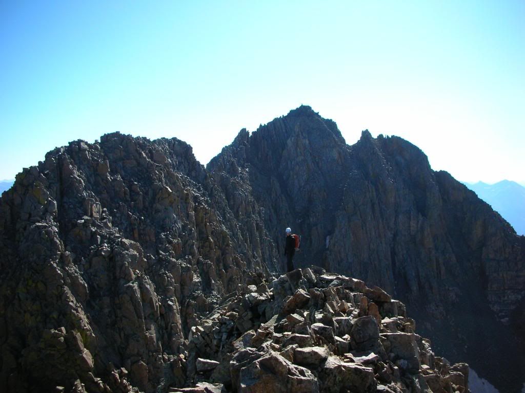
Looking back toward El Diente with a climber on the summit:
And towards Mt. Wilson:
On the way Ben recounted a 20 hour round trip adventure from camp at Navajo Lake several years ago where he and Marmotman summited these three peaks in what equates to the most sketchy snow conditions imaginable (). When we reached the portion that Bill rates as the crux, I was expecting a much worse pitch then we found.
Several reports have mentioned not being able to locate a class 3 line, but on this day there was one very well cairned. It possibly flirted with class 4, but the rock was solid. If anything, the line back to the ridge crest was a bit complex. Roach calls it sinuous so I suppose it depends on what route you take.
Ben just before the crux with Mt Wilson in view:
Nearing the top of the pitch:
After some exposure on the narrow section of ridge, we dropped below to the left (north) and around to the gulley that finally joins you to the NE ridge route of Mt Wilson. We took a look at the ridge crux, and for whatever reason decided to climb the face directly under the summit, only gaining the ridge upon reaching the true high point. This was a bit loose and difficult, but we made it at 10:15am for a traverse time of 1 hour 45 minutes. This is definitely a classic traverse and I loved every moment of it.
The final pitch on the face:
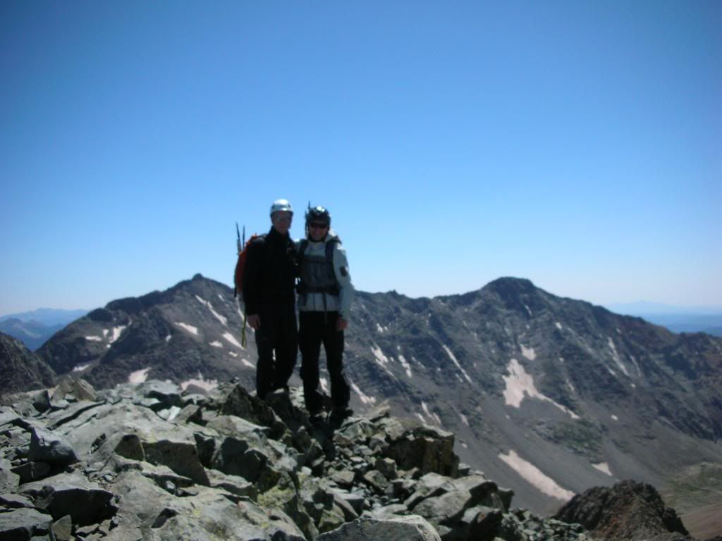
Summit shot with Wilson Peak in the background:
We met a group of four on the summit that had summited Long's Peak the previous day. We joked around with them for a bit, particularly lauding their logistics in climbing the two mountains that are almost the furthest away from each other on consecutive days (they had a good reason of course, but we just thought it was funny).
The group down climbing the more traditional line:
We returned the same way we ascended and agreed this was the hairiest climbing of the day:
The NE ridge of Mt Wilson was the loosest rock of the day, and it seemed that every single one of the six of us descending(we were just behind the group from the summit) knocked something loose during the descent. Ben and I kept commenting that the descending traverse is really the only safe option, since climbing one of the gullies (sans snow) would be suicide due to rock fall from other parties.
We decided to take the bottom portion of the Gladstone glacier to reach the valley to give our feet a little break from the impact, then connected to the trail up Wilson Peak for my last fourteener. We were both tired from the first half of the day and I think I moved particularly slow as we gained the saddle and traversed toward the false peak. Still, we saw a few other climbers near the summit and they appeared surprisingly close, so we neglected to take any breaks. I think Ben was more excited for me then I was for myself at this point.
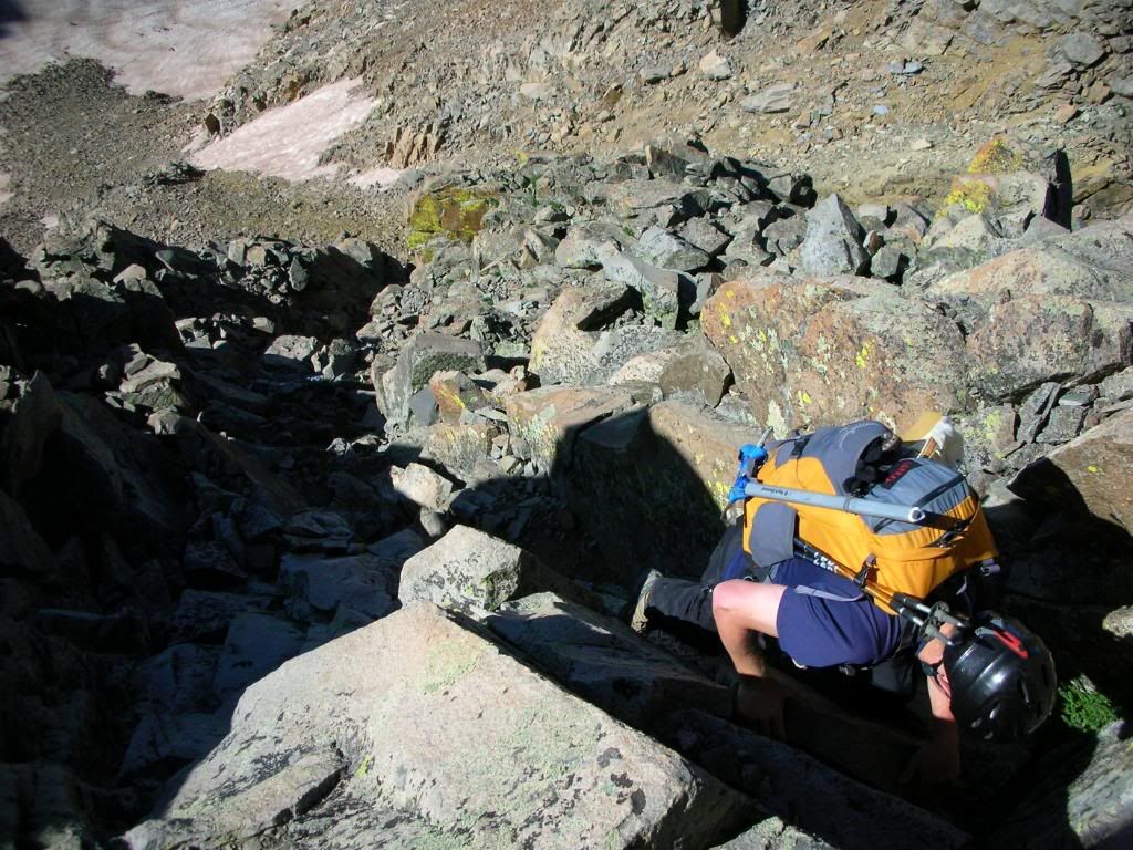
We reached the false summit and I began to descend the slope to the final pitch towards the summit. At this point my mind reverted back to Benners and Marmotman's climb with sketchy snow conditions, and I cannot imagine the guts/insanity it took to do this section of the climb on a wall of ice.
The downclimb right before the crux:
The climb up the crux was quick and the summit appeared. VICTORY! Feels so good to be done. I have to thank everyone that I have climbed with and the contributions and information that I received from 14ers.com members. I also could not have finished without my wife's incredible patience with me. Also...a big thanks to Benners for climbing so many (and all of the hard ones) with me. THANKS!
Summit Pics:
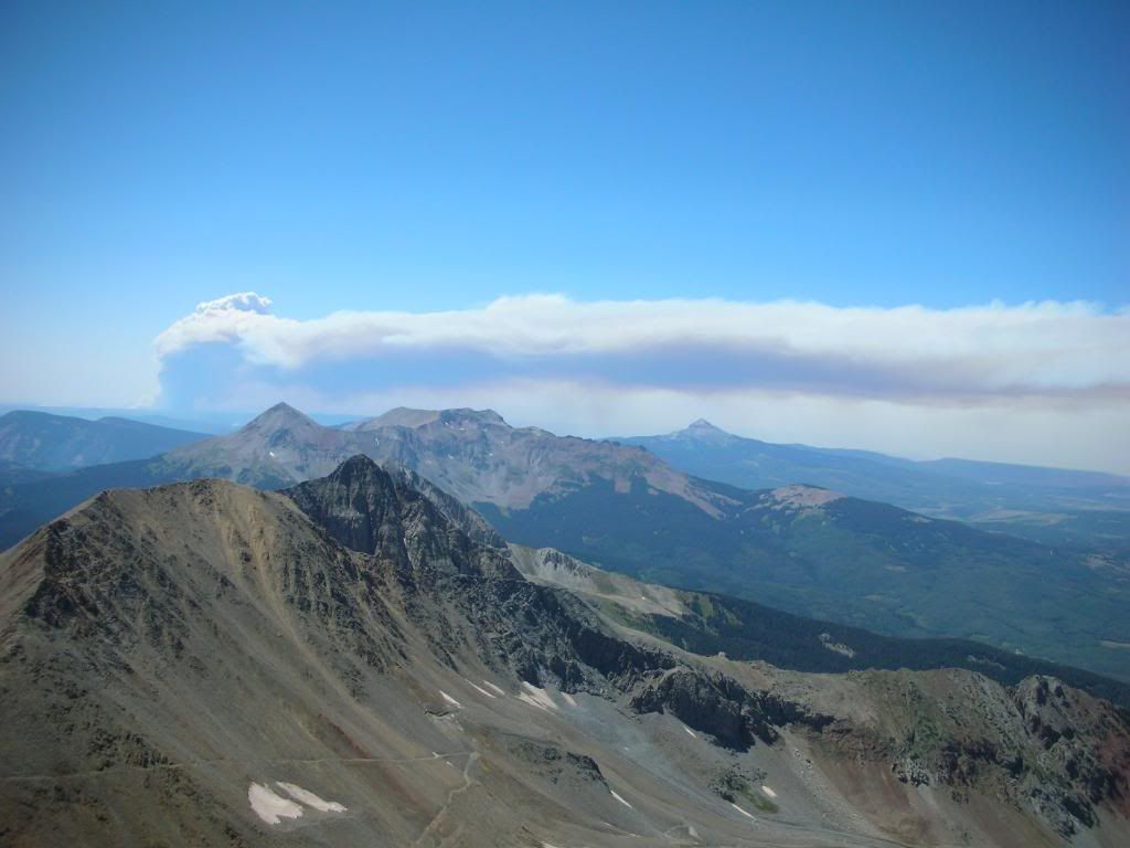
Huge fire to the west:
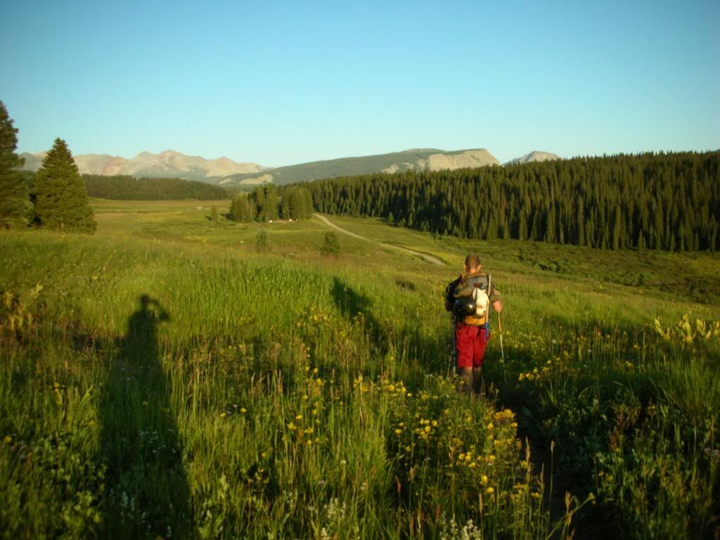
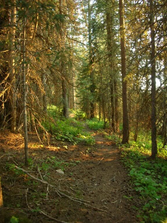
The way down was very long, but we didn't care because the Basin was absolutely gorgeous. The trail from Navajo Basin to Kilpacker had incredible scenery and we felt like we were walking through the forrest in Lord of the Rings. We each switched from our approach shoes in the basin and while Ben had tennies, I hiked out the last 4 miles or so in my rainbow sandals. We made it back to the car at 7:30pm for a round trip of 16.5 hours.
A welcome site:
We thanked the Lord for safety and for the beauty He had created as we packed up. It was an incredible day and an unforgettable way to finish. Thanks for reading!
That is one heckuva day trip on the Wilson Group! Every part of that trifecta is impressive - the overall mileage, the vertical, the multiple exposed peaks on loose rock, you name it. That‘s what I‘d call a strong finish I hope my account of our stupidity on the traverse didn‘t cost you too much sleep. Your experience shows how this is a great route for people who are properly prepared and know what they‘re doing. Hopefully we will fit that definition next time we set foot on the Wilson Group.
DeTour - I really appreciated your account, and though it made me a little nervous I think that as a whole it helped us to be better prepared for this trip. Your report was very well written, and conveyed an important message well. Thanks!
Hook Em- Love that area and a good peak to finish on. LOTR pic:
have compared some of my travels to scenes from Lord of the Rings. The Ship‘s Prow w/ fog cover looked like the entrance to the Mines of Moria and Marten Peak deep in the IPW resembled a scene too. That ski off Evans with the clouds was kind of eerie too....
Ok, enough of me sounding like a LOTR geek, nice job finishing Jon, hell of a weekend in the San Juans.
Thanks for a great report! Lots of helpful info here for those looking to do the Wilson group. Enjoyed it quite a bit.
Caution: The information contained in this report may not be accurate and should not be the only resource used in preparation for your climb. Failure to have the necessary experience, physical conditioning, supplies or equipment can result in injury or death. 14ers.com and the author(s) of this report provide no warranties, either express or implied, that the information provided is accurate or reliable. By using the information provided, you agree to indemnify and hold harmless 14ers.com and the report author(s) with respect to any claims and demands against them, including any attorney fees and expenses. Please read the 14ers.com Safety and Disclaimer pages for more information.
Please respect private property: 14ers.com supports the rights of private landowners to determine how and by whom their land will be used. In Colorado, it is your responsibility to determine if land is private and to obtain the appropriate permission before entering the property.