Download Agreement, Release, and Acknowledgement of Risk:
You (the person requesting this file download) fully understand mountain climbing ("Activity") involves risks and dangers of serious bodily injury, including permanent disability, paralysis, and death ("Risks") and you fully accept and assume all such risks and all responsibility for losses, costs, and damages you incur as a result of your participation in this Activity.
You acknowledge that information in the file you have chosen to download may not be accurate and may contain errors. You agree to assume all risks when using this information and agree to release and discharge 14ers.com, 14ers Inc. and the author(s) of such information (collectively, the "Released Parties").
You hereby discharge the Released Parties from all damages, actions, claims and liabilities of any nature, specifically including, but not limited to, damages, actions, claims and liabilities arising from or related to the negligence of the Released Parties. You further agree to indemnify, hold harmless and defend 14ers.com, 14ers Inc. and each of the other Released Parties from and against any loss, damage, liability and expense, including costs and attorney fees, incurred by 14ers.com, 14ers Inc. or any of the other Released Parties as a result of you using information provided on the 14ers.com or 14ers Inc. websites.
You have read this agreement, fully understand its terms and intend it to be a complete and unconditional release of all liability to the greatest extent allowed by law and agree that if any portion of this agreement is held to be invalid the balance, notwithstanding, shall continue in full force and effect.
By clicking "OK" you agree to these terms. If you DO NOT agree, click "Cancel"...
Route: Red Couloir
Distance Traveled: 8.0 miles
Elevation Gain: 4,600 feet
Participants: stevevets689, Tweak
First, a quick synopsis of the trip report I never wrote:
In the summer of 2008, from July 14th to August 12th, I was in South Colony Lakes Basin working with a group called Earth Corps under direction of the Rocky Mountain Field Institute. We spent most of the time working high on Broken Hand Pass, building walls to prevent further erosion of the alpine environment in that area. We also studied, had discussions, presentations, and an exam in order to earn 4 college credits, but that's another story. We ALSO hiked Humboldt Peak early in our stay (July 16th), and Crestone Needle towards the end (August 10th), via a variation which took us east of the eastern gully, closer to the ridge crest. Both climbs went very well, and left me with Crestone Needle as my favorite 14er. We also made a trip over the pass to the base of Crestone Peak, and witnessed a body recovery in the process. Because of all the climbs up Broken Hand Pass, we gained over 30,000 feet in that 30 days. On one of those days, my friend Josh came down the pass. He and a friend had tried to climb Crestone Needle but turned back due to bad visibility.
Josh (14ers.com alias "Tweak") had mentioned he wanted to go back to the Crestones so he could have another chance at the Needle, so when the time was right I asked if we could do the Peak first. Then we decided we might try for the traverse, but at least I would finish off the Crestone Group of 14ers first thing. If we didn't do the traverse we would try for the Needle the next day.
Returning to the South Colony area was a very surreal feeling. I had spent so much time there the past summer, and all the memories seemed to flood back at once. We drove in Josh's jeep up to the upper trailhead and parked in the first parking lot, taking the Northern trail from there. This trail leaves directly from the first parking lot and heads straight for the lakes instead of looping up the valley first. Once the upper part of the road closes, I think this trail will be promoted more. The condition is very good and the distance is shorter. The key, however, is not to miss the turnoff for the Crestones shortly after hiking through an open meadow/boulderfield or else you will head for Humboldt. We ran into the 2009 Earth Corps camp and I arranged to camp nearby. We hit the hay by 9:30.
Not quite six hours later, my alarm went off. We were out of camp by 4:00. We crossed the creek and hiked up the trail, joined with the other trail, then hiked up to the turnoff marked "Crestone Needle Standard Route" and turned left. Every step of the pass seemed to still be ingrained in my memory from the preceding summer. Periodically I would recognize little projects that I helped work on as we switchbacked our way up the steep trail. We made it all the way passed the snowfields (which were a little slick in the morning) before I turned my headlamp off. Finally we climbed our way up through the rocks and up the last bit of trail to the top of the pass.
Humboldt Peak in the pre-dawn light
It was gradually getting lighter, so Josh and I agreed to hike down the other side of the pass before taking a break to filter more water. We made it down relatively quickly and passed by Cottonwood Lake before stopping by the stream. I looked around. The last time I was in that spot, I saw a military helicopter land in order to allow a team of rescuers heft a blue body bag into the chopper before it took off again, flying low enough over us to almost knock us over. Snapping back to the present, I reminded myself of the consequences of messing up in the wrong spot in this treacherous place.
Looking back at Broken Hand Peak over Cottonwood Lake
Starting up the trail to the Red Couloir
Moving on, we hiked up the trail towards Crestone Peak. I constantly surveyed the terrain above us in case we were to try for the traverse. This trail, also built by Earth Corps crews (though not mine) brings you around the initial slabs of the Peak before dropping you in the lower part of the Red Couloir. By this time we had been leapfrogging another group of climbers and they led the way up the Couloir. There are a couple simple route finding challenges initially but everything is basic class 3 if not steep class 2. I kept my eyes open for cairns on the right side leading away for the traverse and eventually spotted them after going around a couple snowfields. Things were going well and it was about 7:30 by the time we decided to climb the last snowfield instead of looking for a way around it.
Beginning of the Couloir
Steep hiking in the lower Couloir
Basic climbing
This is the second snowfield, which we went around
Looking up the last snowfield, which we climbed
Going up the snow was a little hairy. We had our axes but weren't getting a lot of bite into the very firm snow, and neither of us brought crampons. For the most part, the tread of our boots was enough to get a purchase but every now and then I didn't like the footing so I would chop steps using the adz of my ax (that's the scoopy part). At last we arrived at the base of the rocks and put our axes away.
Looking down the snowfield after climbing it
The upper, steep part of the Couloir where things really start getting loose
From there, the most important job seemed to be avoiding the rocks that were flying down the gully as a result of so many climbers who had passed us by that point. We witnessed some very close calls with others but none near us and no one got hurt from what we could see. Still, I was very glad to be wearing a helmet. We worked our way up the most solid rocks we could find to try to avoid sending any missiles down ourselves and arrived at the 14,180 saddle between the Peak's nearly twin summits. I would like to call this Crestone Pass, as one could drop down the Northwest Couloir on the other side.
"Crestone Pass" with some climbers on it
Climbers headed for the summit
Looking down the Northwest Couloir. Looks like there is still some steep snow to contend with, and a lot of rubble
The final scramble to the summit, which I took right on the ridge crest
The scrambling up to the summit from there was very basic and we arrived on top around 10:00. I knew I was already too tired for the traverse so we spent a good deal of time on top. I really enjoyed the actual highpoint with the big drop off right behind it. Other climbers came and went but we had the summit to ourselves for around fifteen minutes. At last I had finished the 14ers of this group above my hometown, and I looked around at my other accomplishments. Kit Carson Avenue seemed mostly clear of snow. The Needle, as always, looked sharp. Humboldt was out of view, behind the Peak's eastern summit. All that is left for me to finish the peaks that are within Colorado's Top 100 in this particular area is to climb Columbia Point, which I intend to get on top of before the end of the summer.
Challenger Point, Kit Carson Peak, and Columbia Point from left to right
Blanca Group and the Great Sand Dunes
The North Buttress. A class 4 route takes you to the top of this, down this side and across to the saddle
Crestone Needle. The traverse finds its way up the left side to the summit
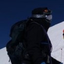
Just two climberz
It was nearing 11:00 when we started down. The gully looked longer than it had earlier in the morning and we got our concentration up in order to keep the rockfall low. One note about a group we saw heading up, and I hate to offend anyone, but they were using what seemed to me to be a fairly pointless system. The person in front had a climbing rope tied around his waist with a bowline knot. The other three people in the group were not tied in... they were holding onto the rope with their hands! I thought through what would happen if any particular person fell in this system and couldn't come up with any logical reasoning behind it. One thing I did see, though, is that dragging the rope up the gully could pose a rockfall hazard. They went up the east side of the gully; we went down the west side.
Flower (insert name here)
The snow was a lot softer on the way down and the steps had vastly improved, but we still cut over about halfway down the snowfield and went around it on rocks. Then it was just a long, tedious process to finish descending the gully and get back to Cottonwood Lake. We were already exhausted but knew we still had to hike back over Broken Hand Pass. Josh filtered some water while I ate some jerky and, almost begrudgingly, we headed back up.
The entire Red Couloir
The traverse runs across this face, from the Peak on the left to the Needle on the right
It was one of those times when I would pick a spot somewhere on the trail ahead of me to hike to before stopping and catching my breath before moving on to another target, but after a while I started to pick up a rhythm and take less breaks. In less time than I anticipated we were on top of the pass, but it was already around 3:00. For old times' sake I moved one rock with the Earth Corps team and then we continued our descent to camp, where we arrived at 4:30.
Looking down the west side of the pass, slowly making our way up
Snowfields on the east side of the pass
Earth Corps 2009 coming down the pass back to camp
Sleep. Food. Water. More sleep. My alarm went off at 4:15 the next morning...
"Josh, how do ya feel?"
"Tired. And sore."
"Me too."
So much for climbing the Needle, sorry buddy. We woke up again after 8:00, lounged around for a little bit and then packed up. Josh might return this summer to get the Needle, but I bet that the next time I return it's going to be a much longer hike thanks to the road closure. And ya know, I don't mind. Maybe there'll be less people.
To see more photos from this climb, please visit my online album at:
Thumbnails for uploaded photos (click to open slideshow):
Did you get a decent look into the couloir on the Needle? Was it easy getting up Broken Hand Pass without crampons? I‘m heading up Tuesday and very curious about what effect snow will have.
Great report and great pictures!
James, I did take a look up the Needle and it looks mostly clear of snow. Going up the pass without crampons was fine. Having an ax will make you more comfortable crossing the snowfields on the pass since it is a little slick, but the steps have been kicked in fairly well.
Thanks for the beta on the cottonwood approach. We spoke briefly in the 2wd parking lot yesterday. Rockfall in the gully equals no fun. There were several late and helmetless climbers we encountered on the descent which kind of blew me away.
Wow. It‘s amazing how much snow can melt in one week. After traversing from the needle to the peak, we couldn‘t even exit at the bottom of the red couloir safely. .
James- I agree with the axe on broken hand. There is literally no snow on the needle couloir as of last weekend. We made it to the top snow free. (It‘s south facing) Just make sure you switch from the east couloir to the west as roach describes about half way up unless you want to do some class 4. The switch is cairned if you watch for it.
Just missed you guys by a couple of peaks, we were on Marble Mtn for the SP Summer Gathering on Saturday! Sounds like you had a great climb, congrats on finishing the ”hometown” 14ers!
Caution: The information contained in this report may not be accurate and should not be the only resource used in preparation for your climb. Failure to have the necessary experience, physical conditioning, supplies or equipment can result in injury or death. 14ers.com and the author(s) of this report provide no warranties, either express or implied, that the information provided is accurate or reliable. By using the information provided, you agree to indemnify and hold harmless 14ers.com and the report author(s) with respect to any claims and demands against them, including any attorney fees and expenses. Please read the 14ers.com Safety and Disclaimer pages for more information.
Please respect private property: 14ers.com supports the rights of private landowners to determine how and by whom their land will be used. In Colorado, it is your responsibility to determine if land is private and to obtain the appropriate permission before entering the property.


")
")
")
")
")
")
")
")
")
")
")
")
")
")
")
")
")
")
")
")
")
")
")
")
")