Download Agreement, Release, and Acknowledgement of Risk:
You (the person requesting this file download) fully understand mountain climbing ("Activity") involves risks and dangers of serious bodily injury, including permanent disability, paralysis, and death ("Risks") and you fully accept and assume all such risks and all responsibility for losses, costs, and damages you incur as a result of your participation in this Activity.
You acknowledge that information in the file you have chosen to download may not be accurate and may contain errors. You agree to assume all risks when using this information and agree to release and discharge 14ers.com, 14ers Inc. and the author(s) of such information (collectively, the "Released Parties").
You hereby discharge the Released Parties from all damages, actions, claims and liabilities of any nature, specifically including, but not limited to, damages, actions, claims and liabilities arising from or related to the negligence of the Released Parties. You further agree to indemnify, hold harmless and defend 14ers.com, 14ers Inc. and each of the other Released Parties from and against any loss, damage, liability and expense, including costs and attorney fees, incurred by 14ers.com, 14ers Inc. or any of the other Released Parties as a result of you using information provided on the 14ers.com or 14ers Inc. websites.
You have read this agreement, fully understand its terms and intend it to be a complete and unconditional release of all liability to the greatest extent allowed by law and agree that if any portion of this agreement is held to be invalid the balance, notwithstanding, shall continue in full force and effect.
By clicking "OK" you agree to these terms. If you DO NOT agree, click "Cancel"...
2nd time‘s a charm on Shavano/Tabeguache (East slopes)
After my failed attempt to summit Tabeguache after summitting Mt. Shavano last year I was heart broken, and this week would be pay back. I can't stand the feeling of having unfinished business, and this combo was unfinished. (All pictures were taken on the way down)
I left my truck at 530am and was greeted with warm temps, and blue skies. I didn't even have to wear my shell today! The summer trail is free and clear of snow, and if you happen to see any snow you can walk about a foot out of your way and avoid it. I find the Colorado trail portion of this hike beautiful as you wind through aspen groves and a smooth packed trail. And the cows are a nice compliment as well.
(Doesn't this remind you of another 14er?)
But after you see this sign and make the commitment to hike Shav/Tab the trail goes from smooth dirt, to something that looks like a dried out rubble filled river bed.
After following a good climbers trail to around 10,800 you come to a river crossing, and this is where I had a slight issue. This photo is almost the same as Bill's photo #10 on his Shavano east slopes route trail description, except for now there is a bridge crossing, and a large number of fallen trees that obscure the obvious trail, so I ended up going climbers right, to follow another obvious trail which is a campers trail to nowhere, when I should've gone climbers left over the fallen trees. The only reason I mention this is that all the people I ran into today had a route finding issue with this particular section of trail, which of course with some patience it is easily solved.
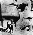
Above what I believe is the Angel's right arm (the only remaining arm)
looking back at the summer trail.
Looking towards Salida from around 13,000ft, a lone hiker readies himself for the remainder of his descent.
Looking up at Shavano's summit from near the top of the Angel's arm. Also notice the ascending hikers on the summit cone, this gives you a good perspective of how large it is.
Looking down at the saddle from below the summit
This picture was taken on the highest snow field near the summit of Shavano (this can be seen in the 2nd picture above)
Once I summited Shavano I was on a mission, I wasn't really even excited to have climbed -yet again- Colorado's 17th highest. I wanted to get the mountain that had eluded me in 2008. The weather was questionable but I thought I had a chance. MY legs were still feeling fresh and quick so I made the dash.
It only took me about 15-20 minutes to get near the saddle between Shavano and Tabeguache.
But the climb up Tabeguache took a little longer, maybe 30 mins and my legs weren't feeling so "fresh" afterwards
But in the end I got my mountain, here I am representin'. No shameful plugs here!
The long, arduous return to Shavano waits for me. But will the weather?
The weather did end up holding and actually looked more threatening then it really was. And the climb up the ridge wasn't as bad as I thought it would be.
A 14er.com user took this picture for me, Thank you! (I'm sorry I didn't get your name)
My descent was easy as I glissaded from the tip of the Angel's arm down to the bottom, and a quick bushwhack through the drainage led me right to the trail which shaved off quite a bit of time and energy! I made it back to my truck by 1'oclock.
This trip was long overdue and I am very happy to finally have pulled this thorn out of my side, with 3 more Sawatch mountains to go I am very excited to see what the rest of the summer has in store for me, as for all the people I met on this hike thank you very much!
Thumbnails for uploaded photos (click to open slideshow):
Feels good to have another loose end tied up. It was perfect weather up there all day today. Thanks again! 8) (BTW, the Angel isn‘t looking too healthy this season....)
Thanks for the great condition update, Jason! Tabeguache is a loose end for me too from last year, and I‘ve just been waiting for that post-holey Shav/Tab saddle to melt out. I‘ll have to get out there ASAP!
Caution: The information contained in this report may not be accurate and should not be the only resource used in preparation for your climb. Failure to have the necessary experience, physical conditioning, supplies or equipment can result in injury or death. 14ers.com and the author(s) of this report provide no warranties, either express or implied, that the information provided is accurate or reliable. By using the information provided, you agree to indemnify and hold harmless 14ers.com and the report author(s) with respect to any claims and demands against them, including any attorney fees and expenses. Please read the 14ers.com Safety and Disclaimer pages for more information.
Please respect private property: 14ers.com supports the rights of private landowners to determine how and by whom their land will be used. In Colorado, it is your responsibility to determine if land is private and to obtain the appropriate permission before entering the property.


")
")
")
")
")
")
")
")
")
")
")
")
")
")
")
")
")