Download Agreement, Release, and Acknowledgement of Risk:
You (the person requesting this file download) fully understand mountain climbing ("Activity") involves risks and dangers of serious bodily injury, including permanent disability, paralysis, and death ("Risks") and you fully accept and assume all such risks and all responsibility for losses, costs, and damages you incur as a result of your participation in this Activity.
You acknowledge that information in the file you have chosen to download may not be accurate and may contain errors. You agree to assume all risks when using this information and agree to release and discharge 14ers.com, 14ers Inc. and the author(s) of such information (collectively, the "Released Parties").
You hereby discharge the Released Parties from all damages, actions, claims and liabilities of any nature, specifically including, but not limited to, damages, actions, claims and liabilities arising from or related to the negligence of the Released Parties. You further agree to indemnify, hold harmless and defend 14ers.com, 14ers Inc. and each of the other Released Parties from and against any loss, damage, liability and expense, including costs and attorney fees, incurred by 14ers.com, 14ers Inc. or any of the other Released Parties as a result of you using information provided on the 14ers.com or 14ers Inc. websites.
You have read this agreement, fully understand its terms and intend it to be a complete and unconditional release of all liability to the greatest extent allowed by law and agree that if any portion of this agreement is held to be invalid the balance, notwithstanding, shall continue in full force and effect.
By clicking "OK" you agree to these terms. If you DO NOT agree, click "Cancel"...
The weather forecast was so good yesterday, that I couldn't resist going back to the Sawatch and try to bag another 14er. My original plan was to do Belford and Oxford, but I ended up only making it up to Belford due to several factors:
1.) a late 8 AM start
2.) forgetting to bring sunscreen/chapstick
3.) a cell-phone that seemed to change its mind on the time of day
At any rate, it was a fun time just going up Belford. I had the whole mountain to myself on this day, and according to the register at the trailhead and the summit, I was the first person to be hiking in the area in over a week. It's a pretty easy peak, but since up-to-date trail conditions are so up-in-the-air this time of year, I'm sticking with the lighter hikes. The road to the Missouri Gulch TH was completely free of snow, as was the parking area. I didn't have a problem at all with my passenger car:
I crossed over the bridge and started up the switchbacks through the forest. The trail maintains a pretty good upwards grade throughout. The majority of the trail is covered with only a couple of inches of packed snow, though there are still plenty of patches of dirt. Here's a section of trail towards the beginning for a general idea:
After about a mile of hiking up through the forest, I saw the log bridge over the creek to my left. There is not any sort of sign indicating a trail intersection, but the bridge isn't easy to miss. The log bridge over the creek seemed like it was ready to collapse under my weight, so I opted to cross the creek over the sturdier log dam that was just a few feet downstream from the bridge. As soon as I got to the other side of the creek, the trail became more snow-covered:
More switchbacks through the snowy forest, and I arrived at the ruined cabin.
Shortly after the cabin, I emerged above treeline and continued upwards, still not seeing the actual peak. Eventually I saw what looked like a few trails leading off to the left, but I am glad I stuck with the main trail because the point where you split off to start Belford's main ascent is clearly marked with a sign:
A little more climbing and I arrived at a rocky gulch where I could look up and catch my first glimpse of Belford. The view of the main peak would quickly disappear however, and would be replaced with a series of false summits until the very end.
After crossing the gulch, the main ascent up the west face began. The first bit of the trail is a series of stone steps. Then it turns into tight switchbacks that whip up the ridge. On the main ascent, the trail is almost entirely covered in mostly hard-packed ice and deeper snow, so the going was pretty slow. The trail switchbacks started to often lead fairly close to the precipitous edge of the gulch on the north edge of the ridge, so I was glad that I had my stablicers for extra traction. In fact, I think this portion of the trail would be very challenging for some one wearing only hiking boots without any sort of extra traction. There are several areas where one slip can send you down a very bad fall.
This is one of the very few spots of the trail where the snow was powdery enough to make footprints in, but it gives you an idea of the coverage:
After a long time of slogging up and across the hard snow, I arrived at a remarkably snow-free saddle and looked up to see the last false summit of Belford:
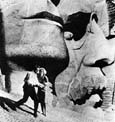
Up and over and there was the rocky summit just a few hundred feet away. A few summit shots:
The view over to Mt. Oxford:
To the south towards Elks Pass:
Looking back towards the final saddle:
The sky was completely clear and though it was cold, the wind gusts only got up to maybe 10 MPH. Considering the season, it was a darn nice day. I could clearly see the cross on the Mount of the Holy Cross to the north.
Like I said, I originally wanted to do Oxford too, but the days are simply getting too short now. The sun got about halfway done with rising, and then started to set. I had overestimated my pace too, as the snow was slowing me down quite a bit. Oxford might have been doable if I had gotten an earlier start and gone up the first couple of miles with a headlamp. The hike back down was uneventful, though the snow did soften up a bit better. There's still not enough snow around to get any good glissades in. I got back to the trailhead a little after 3 PM. (By the way, I found a knit hat on the trail. Anyone lose one in this area? Tell me the color, and I can mail it out to you.)
All in all, it was a good time. Belford is a pretty easygoing peak, with some good vertical gain and some great rewarding views. 8)
Thumbnails for uploaded photos (click to open slideshow):
Oh yes, I still have the junky camera, so you can still see some UFO‘s in the pictures above. Maybe that explains the odd fluctuations of time on my cell phone clock....
This was 14er #19 for me, so I‘m very tempted to try to get one more in and end the season on a nice round 20. We‘ll see if the winter continues to be delayed though!
Caution: The information contained in this report may not be accurate and should not be the only resource used in preparation for your climb. Failure to have the necessary experience, physical conditioning, supplies or equipment can result in injury or death. 14ers.com and the author(s) of this report provide no warranties, either express or implied, that the information provided is accurate or reliable. By using the information provided, you agree to indemnify and hold harmless 14ers.com and the report author(s) with respect to any claims and demands against them, including any attorney fees and expenses. Please read the 14ers.com Safety and Disclaimer pages for more information.
Please respect private property: 14ers.com supports the rights of private landowners to determine how and by whom their land will be used. In Colorado, it is your responsibility to determine if land is private and to obtain the appropriate permission before entering the property.


")
")
")
")
")
")
")
")
")
")
")