Download Agreement, Release, and Acknowledgement of Risk:
You (the person requesting this file download) fully understand mountain climbing ("Activity") involves risks and dangers of serious bodily injury, including permanent disability, paralysis, and death ("Risks") and you fully accept and assume all such risks and all responsibility for losses, costs, and damages you incur as a result of your participation in this Activity.
You acknowledge that information in the file you have chosen to download may not be accurate and may contain errors. You agree to assume all risks when using this information and agree to release and discharge 14ers.com, 14ers Inc. and the author(s) of such information (collectively, the "Released Parties").
You hereby discharge the Released Parties from all damages, actions, claims and liabilities of any nature, specifically including, but not limited to, damages, actions, claims and liabilities arising from or related to the negligence of the Released Parties. You further agree to indemnify, hold harmless and defend 14ers.com, 14ers Inc. and each of the other Released Parties from and against any loss, damage, liability and expense, including costs and attorney fees, incurred by 14ers.com, 14ers Inc. or any of the other Released Parties as a result of you using information provided on the 14ers.com or 14ers Inc. websites.
You have read this agreement, fully understand its terms and intend it to be a complete and unconditional release of all liability to the greatest extent allowed by law and agree that if any portion of this agreement is held to be invalid the balance, notwithstanding, shall continue in full force and effect.
By clicking "OK" you agree to these terms. If you DO NOT agree, click "Cancel"...
I have been taking advantage of the late winter to try and tackle a few more 14ers before the deep snow sets in. Since the days are now getting shorter, with almost complete darkness setting in at around 5:00 PM, I decided to focus on a route with a shorter horizontal distance and decided on doing the 7 mile Southwest Slopes Route on Mt. Yale. Even though Roach‘s book says that no matter the route, this peak will "test your legs", the 4, 300 ft. vertical gain seemed doable.
I drove up to the Denny Creek Trailhead right when it was light enough to not need to pull out my headlamp at 7:00 AM. One other solo hiker pulled into the lot just as I did, and I was the first one to start up the trail. There was about 4 inches of snow on the ground, which I guessed was from last Thursday night. It was pretty walkable though, and I had gaiters and stabilicers on my boots which made the going fine. At the registry box, I noticed that 2 groups of 2 had gone up to the peak and back the day before, so I felt that I had some pretty reliable tracks that I could follow through the snow-covered trail. The trail intersection near the junction of Denny and Delaney Creek is clearly marked with a sign, so it was easy to take the right fork about a mile in and continue on.
One of two stream crossings below treeline:
The trail maintained a steady ascent and after a while I finally broke out of the treeline to this view:
At this point, two other solo hikers caught up to me as I tried to decide what to do. The foot tracks seemed to disappear, and there was no obvious trail in sight. Eventually, we all decided to climb up the steep west-facing slope to the right in the picture above. One of the other hikers was able to charge up at a very fast pace, while I and the other hiker made our way up slowly and carefully. The slope was mostly a combination of loose talus and scree with some patches of snow, and was quite steep; definitely harder than a class 2 route.
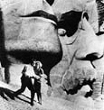
A picture of the slope:
At the top of the ridge, the two of us decided to join forces and figure out the best route to take. We were obviously off of the main trail, and the peak itself was still mostly obscured in heavy cloud cover. We ended up climbing further of the ridge (north) and then noticed a snow-filled gulley off to our right near a small patch of trees. We hiked alongside the gulley until we found ourselves up on top of another ridge that thankfully also had a well-travelled trail running across it.
The trail at the upper ridge:
The trail was fairly obscured in a lot of places by powdery snowdrifts that were about a foot deep in places. We lost it a few times, but were always able to find it once again a little further up. We also started to notice the tracks of the fast hiker who went up ahead of us, which was a reassuring sign. Eventually, the clouds finally burned off enough for the peak of Mt. Yale to come into clear view:
The trail switchbacked up the saddle shown on climber‘s left, but the snowdrifts remained frequent and the going was pretty slow. About halfway up the big slope up to the saddle, we met the fast-hiker coming down, who let us know that he was going to try taking a different route back down (which we had already decided on ourselves. Going back down that steep rockslide? No thanks! ). We continued up to the broad saddle and I was surprised how calm the winds were. The last bit of rocky summit ridge up from the saddle was completely coated in crystallized snow and looked really neat, much like Superman‘s Fortress of Solitude:
After taking a quick break on the saddle, we decided it would be easiest to ditch our packs and scramble up the final bit. This ended up being a great strategy, and we were at the summit in less than 20 minutes. And now, here are some summit shots:
Mitch coming up the last bit of summit ridge:
Other collegiates to the south:
Afternoon clouds getting ready to sink back down:
Me doing my official summit shot:
Looking east towards Buena Vista and the Arkansas Valley:
As you can see, we summited at the perfect time to get some truly striking views of the Southern Sawatch during a very unique time of the season. I am so glad that I had given it a go at doing another 14er so late in the season. We really could not have hoped for better weather. Summit time was about 12:30 PM.
We made our way back down to the saddle to retrieve our packs (thank goodness the marmots are in hibernation mode) and decided to try and follow the trail we had found back down, which we were assuming was the main trail back to Denny Creek.
About halfway down the main slope from the saddle, we met a group of three heading up. We warned them that they would probably be doing part of their return hike in the dark and they said that they had headlamps and were fine with that and continued on up. At about 2:00 PM, we had pretty much made it all the way down the main slope and looked up to see the group we had passed appear to reach the summit, so that was cool that they made it. We then ran into a pair of young girls on their way up the main slope. They had very minimal gear and no headlamps, so we made sure to tell them that they had nowhere near enough time to make it up and out until well after dark. They fortunately agreed and turned around and hiked back down ahead of us at a faster pace and we eventually lost sight of them.
It seemed like the fast solo hiker and the two girls both ended up bushwhacking their way down into the Delaney Creek Gulch and hooking back up with the main trail below treeline. We decided to make an effort to keep with the actual trail and try to find out where we had taken the wrong turn coming up. We did a good job of following the trail down through the trees, though the snowdrifts were still a foot deep in many places. We eventually managed to follow it back down to the main trail and realized that we were just baaaarely off when we had taken our wrong turn. So basically, when you get to this point on the trail:
You have gone just a few steps slightly too far. Turn around, go a few yards back into the trees and look to the east. You should see a faint suggestion of the main trail (albeit, snow-covered) winding up through the trees on a much gentler slope. When we had come up this way in the morning, there were no tracks at all going up this portion of the trail, but you should be able to see ours coming down if you make it up there before the next big snow. We also tried laying some branches across the "wrong turn" and made a few shoddy cairns as feeble attempts to steer people the right way. But, if you feel like an adventure, you can still take the hard way up that we had done!
At any rate, another snowfall or two, as this hike will become even more difficult, so I‘m very glad I got this one in. As the days are only getting shorter, I‘d say a headlamp is mandatory for this hike from now on. I didn‘t need to use my mountaineering axe, and the snow was still patchy and shallow enough not to make snowshoes worthwhile. Hope you enjoyed this report!
Thumbnails for uploaded photos (click to open slideshow):
By the way, sorry about the blotchy quality of the photos. Those are not UFO‘s hovering around in the sky. My camera is old and has some annoying particles floating around inside of it somewhere.
Good TR - Especially for the first 11/9/2008 6:09pm
I did Yale three weeks ago and it looks like conditions have deteriorated a little, but not too bad. When I went, the snow was south towards Princeton but Yale was fairly clear. Even though it is easily accessible, Yale is a summit to be earned. Good report and nice pictures.
Hey man. . .great trip report! I can‘t think of a single thing I would add, only that it was a PERFECT day on Yale. A little sketchy route-finding aside, that was a great day on a great mountain!
I‘ll share my photos as soon as I unpack my camera. It was a long flight home on Monday!
Glad you made it back to PA in one piece. You‘ll have to let me know how your hike up Mt. Sherman went the following day. Have fun recovering!
Caution: The information contained in this report may not be accurate and should not be the only resource used in preparation for your climb. Failure to have the necessary experience, physical conditioning, supplies or equipment can result in injury or death. 14ers.com and the author(s) of this report provide no warranties, either express or implied, that the information provided is accurate or reliable. By using the information provided, you agree to indemnify and hold harmless 14ers.com and the report author(s) with respect to any claims and demands against them, including any attorney fees and expenses. Please read the 14ers.com Safety and Disclaimer pages for more information.
Please respect private property: 14ers.com supports the rights of private landowners to determine how and by whom their land will be used. In Colorado, it is your responsibility to determine if land is private and to obtain the appropriate permission before entering the property.


")
")
")
")
")
")
")
")
")
")
")