Download Agreement, Release, and Acknowledgement of Risk:
You (the person requesting this file download) fully understand mountain climbing ("Activity") involves risks and dangers of serious bodily injury, including permanent disability, paralysis, and death ("Risks") and you fully accept and assume all such risks and all responsibility for losses, costs, and damages you incur as a result of your participation in this Activity.
You acknowledge that information in the file you have chosen to download may not be accurate and may contain errors. You agree to assume all risks when using this information and agree to release and discharge 14ers.com, 14ers Inc. and the author(s) of such information (collectively, the "Released Parties").
You hereby discharge the Released Parties from all damages, actions, claims and liabilities of any nature, specifically including, but not limited to, damages, actions, claims and liabilities arising from or related to the negligence of the Released Parties. You further agree to indemnify, hold harmless and defend 14ers.com, 14ers Inc. and each of the other Released Parties from and against any loss, damage, liability and expense, including costs and attorney fees, incurred by 14ers.com, 14ers Inc. or any of the other Released Parties as a result of you using information provided on the 14ers.com or 14ers Inc. websites.
You have read this agreement, fully understand its terms and intend it to be a complete and unconditional release of all liability to the greatest extent allowed by law and agree that if any portion of this agreement is held to be invalid the balance, notwithstanding, shall continue in full force and effect.
By clicking "OK" you agree to these terms. If you DO NOT agree, click "Cancel"...
Ascent: East Slope, diverting snow fields and rounding up over an unnamed 13er
Decent: Glissade down both Tab. and the Angel.
Round trip: 11 hours with long summits
Conditions: Beautiful skies, light wind, encountered snow around tree line, but could get around
Equipment: no need for snow shoes or crampons this route.
We're the couple that was confusedly thought to be lost. We did let people know our trip plans, but there was a misunderstanding at Rick's work, thus the post "Has anyone seen the Kanes?" Sorry to alarm those that were looking on.
We camped just a ways past the Blank Cabin TH in a very serene spot under the Aspens. Next to the Colorado Trail we encountered many short and long distance travelers. It still felt very remote and was the perfect spot. Camping here inspires us to someday hike the Colorado Trail, perhaps after accomplishing the goal of all 54 fourteeners. After setting up camp Friday and enjoying some R&R we prepared for our first 14ers of the season.
We got going around 7ish, enjoying a little later start (since there were no storms to worry about).
We ran into a gal, Renae that was hiking solo. After crisscrossing each other through the early part of the hike, we decided to all hike together at the Angel junction, staying on the eastern slope path.
We did hit snow fields that were impassable just under tree line, but we bypassed this by hiking back down below the snow and around, forging our own path. This left us to shoot straight up and threw us off a little. We ended up following this speedy chick up an unnamed 13er (which in some ways was shorter but by far steeper and through many, many boulders).
Somehow we were wishful this was Shavano's summit but of course we still had to climb the last stretch of steep slope to get to Shavano's summit. We came across Big Horn Sheep and a Mountain Goat just a few hundred feet below summit. This helped push us up the peak.
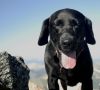
There were several hikers and dogs on summit enjoying the gorgeous skies and views.
There was nearly no wind at this point. We hung out for awhile chatting with some folks from Iowa and then headed over to Tab.
The descent over went quickly. We skirted to the left of the snowfields when gaining the summit. Although pooped, we kept plowing on and enjoyed a � hour to ourselves on summit. We glissaded down Tab. without ice axes.
The return to Shavano was unexciting; we were ready to be done.
We came across another group that was going to ski down the Angel. We had already decided to glissade down ourselves. A couple of the gals used snow shovels to glissade which gave us a good path. The 1600 foot glissade was a thrill!
We bushwhacked and roamed our way back to the Eastern trail. The last mile or so seemed to put us in a trance. The long day was grueling but well worth the adventure. We enjoyed some cold ones back at camp and slept oh so good! It feels great to be hiking the peaks again. The remainder of our camp trip consisted of short walks along the Colorado Trail and leisurely mountain biking. Well, that is until Rick decided to ride out of the area on our way out by bike. Since most of 252, 250, 140 are down hill he gained speeds of 52 MPH and caught air over the cow grids. Yikes, I thought hiking was risky
Thumbnails for uploaded photos (click to open slideshow):
Looks like a great weekend and a wonderful way to spend your 3 anniversary. Glad to hear you weren‘t really missing! I love the glissade pictures. Where to next?
Caution: The information contained in this report may not be accurate and should not be the only resource used in preparation for your climb. Failure to have the necessary experience, physical conditioning, supplies or equipment can result in injury or death. 14ers.com and the author(s) of this report provide no warranties, either express or implied, that the information provided is accurate or reliable. By using the information provided, you agree to indemnify and hold harmless 14ers.com and the report author(s) with respect to any claims and demands against them, including any attorney fees and expenses. Please read the 14ers.com Safety and Disclaimer pages for more information.
Please respect private property: 14ers.com supports the rights of private landowners to determine how and by whom their land will be used. In Colorado, it is your responsibility to determine if land is private and to obtain the appropriate permission before entering the property.


")
")
")
")
")
")
")
")
")
")