Download Agreement, Release, and Acknowledgement of Risk:
You (the person requesting this file download) fully understand mountain climbing ("Activity") involves risks and dangers of serious bodily injury, including permanent disability, paralysis, and death ("Risks") and you fully accept and assume all such risks and all responsibility for losses, costs, and damages you incur as a result of your participation in this Activity.
You acknowledge that information in the file you have chosen to download may not be accurate and may contain errors. You agree to assume all risks when using this information and agree to release and discharge 14ers.com, 14ers Inc. and the author(s) of such information (collectively, the "Released Parties").
You hereby discharge the Released Parties from all damages, actions, claims and liabilities of any nature, specifically including, but not limited to, damages, actions, claims and liabilities arising from or related to the negligence of the Released Parties. You further agree to indemnify, hold harmless and defend 14ers.com, 14ers Inc. and each of the other Released Parties from and against any loss, damage, liability and expense, including costs and attorney fees, incurred by 14ers.com, 14ers Inc. or any of the other Released Parties as a result of you using information provided on the 14ers.com or 14ers Inc. websites.
You have read this agreement, fully understand its terms and intend it to be a complete and unconditional release of all liability to the greatest extent allowed by law and agree that if any portion of this agreement is held to be invalid the balance, notwithstanding, shall continue in full force and effect.
By clicking "OK" you agree to these terms. If you DO NOT agree, click "Cancel"...
Just hours before going to bed, Jen and I decided to climb Torreys Peak from Loveland Pass the following day. We've already climbed Torreys a few times from Stevens Gulch (standard route and Kelso Ridge), so we thought it would be fun to get it from the other side. We also thought it would be good exercise. It sure was.
At 5:50 a.m. we parked by the rock stairs on Loveland Pass, gathered our stuff and headed up the well-worn path to Point 12,915.
The sun was well on its way up into the sky at this time, and a few people had just enjoyed the show atop Point 12,915.
I've climbed along this ridge many times, but it finally dawned on me that our entire route would trace the Continental Divide - and one of the highest portions of the Divide, no less. In addition, our nearly 10-mile route would all be well above 12,000 feet in elevation.
We descended Point 12,915 and pushed on healthily toward Cupid (13,117'). As we came up on Cupid's broad summit, the trail became faint. We saw a few cairns and continued on. We were just below Cupid's true summit and high point, which was a couple hundred feet to our left. As we descended, we easily regained a single-track trail, which was slightly down and to our right.
As we climbed down Cupid's south side, we came across the rock mound. Snow lingered over part of the trail on the east side of the rocks. We easily traversed between the snow and to the left of the rock mound. Then we climbed down (east) a bit, across 20 feet of snow, and then we were back on dry trail.
After climbing up and over some easy, solid rocks, we gained Point 12,936. Then, after an easy downclimb to the saddle before Grizzly Peak, the theater's curtains opened and the climb began to show its toughness.
In the beginning, Grizzly Peak's northwest ridge was steep and loose. Your typical dirt/gravel/scree sort of stuff. But roughly halfway up, when the route moves over to the ridge's high point, things became much easier, as it was on solid rock.
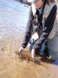
Jen on the "solid" part of Grizzly's ridge:
At 8 a.m. we made Grizzly's summit, and we had it all to ourselves. It was our second time on this fine summit.
Looking over toward Torreys Peak was intimidating. Even though skies were clear and clean, Jen was concerned about possible thunderstorms. It was a good concern, though. Getting caught up there wouldn't be fun. Getting back is long and grueling; it's not just running "down" a mountain. Escape is possible, into one of the many valleys below, but you may have to descend some sketchy scree, and it would put you far away from Loveland Pass. In short, on this climb, you could find yourself on an epic journey/adventure rather easily.
But back to the intimidating thing: Torreys appeared to be very far away ... and really high. Probably because it was.
From Grizzly, we descended via the high point of the ridge. The ridge was easy Class 2, but there were some steep drop-offs to the left. Had he been with us, our friend Ryan would've so eloquently put it, "Death to the left." As long as you don't trip you'd be fine. I rarely used my hands at all.
As we got lower and lower on the ridge, we started to near some lingering snow. This is where we decided to go down the rocky talus rather than keep to the ridge. It wasn't a bad decision, as the scree slope was pretty solid. Most of the rocks were "locked in," and only a few slipped or shifted with our weight. We aimed northeast, to the highpoint on the broad, grassy saddle.
Perspectives and angles were skewed somewhat. Some route descriptions say to stay high, along the ridge, as it angles northeast then southeast, but I thought it was just as good to angle more eastward, and kind of cut off a little. You don't lose much more elevation and the downclimbing was just as easy.
We had a nice view of a frozen, hanging lake (doesn't seem to be named on the map I'm looking at; it was just south of Grizzly Peak's summit) and the expansive Chihuahua Gulch.
From the huge saddle, I looked up at Torreys. It was intimidating. Like the ridge up to Belford, it just went on and on. At 12,950 feet, the grass ended and the scree began. There were multiple trails ascending Torreys west ridge. All were steep and slippery.
A close-up view of the gravel/scree on Torreys west ridge:
At times, it was the one-step-up-and-slide-back-half-a-step sort of stuff. We followed a shallow gully (with water running underneath) that was 50 to 100 yards away from the north edge of the ridge.
Looking back at our route from Torreys‘ summit:
Man, it just kept going up. 1,600 feet or so, I think. We just kept going for the high point, which was a mound of rock at about 13,960'. After skirting to the right around that pile, the trail completely mellowed out and became more level. Just a few hundred feet and a quarter mile or so to the top.
After hopping up to the ridge's high point, things got easier. Within no time we were enjoying the cozy summit with about a thousand other people. It was just after 10 a.m.
Ed Viestur's says the summit is only halfway. This is truly one of those climbs where the summit is only halfway. Nearly five miles and thousands of feet of vertical gain still remained ahead of us, so we only spent about 10 minutes on the summit.
At 11:40 we were back up Grizzly Peak. Fatigue was hitting me, and I was scrounging for food in my pack.
As we hiked back up Cupid, I found myself hitting a wall of exhaustion. Out of food, I think I was experiencing a calorie low and I was bonking hard. We ate everything we brought, which rarely happens. I kept pushing on like a soldier. Jen was slighly sluggish earlier in the day, but she caught some sort of fourth wind and was all happy go lucky. I wanted to punch her.
At 1:30 p.m. we made it back down to Loveland Pass. The ride was over just in time, as I was exhausted and hungry as all hell. The salt rings on my hat said it all. I needed to be replenished with fluids and salt.
No "flat" on that climb. It was all UP and DOWN, ALL DAY ... and all well above 12,000 feet in elevation.
As we drove down Hwy 6 I felt a huge "runner's high"/exercise buzz. It was like I was on LSD. Everything was muffled and in slow motion. And then I yawned, cracking open my ears and awakening my consciousness.
Moments later, we were sitting at the bar at Beau Jo's in Idaho Springs, chomping on a 3-pound Mountain Pie and drinking fat beers out of mason jars. In between gulps I hacked up mountain resin from my burned lungs. It was a good day.
Here's a "rough" profile of our journey to Torreys. Keep in mind, it's not perfect, and I was drinking when I made this so don't hold me to it. But it should give you a rough idea of the route.
Thumbnails for uploaded photos (click to open slideshow):
I tried that same route a few years ago. The weather started building over Grizzly when I was about 400 vert under the summit of Torreys. I decided to bail out down Chihuahua Gulch and you're right, it then becomes epic.
Love that scree on Torreys too, 3 steps forward, 2 steps back.
Cool trip though and one I want to try again some day.
I like the elevation profile...adds a nice touch. Looks like you had a fun
Caution: The information contained in this report may not be accurate and should not be the only resource used in preparation for your climb. Failure to have the necessary experience, physical conditioning, supplies or equipment can result in injury or death. 14ers.com and the author(s) of this report provide no warranties, either express or implied, that the information provided is accurate or reliable. By using the information provided, you agree to indemnify and hold harmless 14ers.com and the report author(s) with respect to any claims and demands against them, including any attorney fees and expenses. Please read the 14ers.com Safety and Disclaimer pages for more information.
Please respect private property: 14ers.com supports the rights of private landowners to determine how and by whom their land will be used. In Colorado, it is your responsibility to determine if land is private and to obtain the appropriate permission before entering the property.